
REPORT ON THE ASCENT OF INDEX PEAK (2595 m) VIA THE SOUTHEAST RIDGE ROUTE, CATEGORY 2A, BY THE TRAINING DEPARTMENT OF AK "POLYTECHNIC" ON AUGUST 6, 2018 Leader: N.N. Bakharev, Coach: V.A. Molodozhen St. Petersburg 2018
1. Ascent Details
| №№ | 1. General Information | |
|---|---|---|
| 1.1 | Full name, sports rank of the leader | Bakharev N.N. – 3rd sports rank |
| 1.2 | Full name, sports rank of the participants | Fineeva A.A. – 3rd sports rank, Sadovsky S.V. – 3rd sports rank, Duplak A.K. – 3rd sports rank, Lymanyuk A.Yu. – 3rd sports rank, Molodozhen V.A. – Master of Sports |
| 1.3 | Full name of the coach | Molodozhen V.A. |
| 1.4 | Organization | AK "Polytechnic" |
| 2. Characteristics of the Ascent Object | ||
| 2.1 | Region | France, Haute-Savoie, Chamonix valley, Aiguilles Rouges |
| 2.2 | Valley | Éboulement du Rouge |
| 2.3 | Section number according to the 2013 classification table | 10.3 |
| 2.4 | Name and height of the peak | L'Index. Height 2595 m. |
| 2.5 | Geographical coordinates of the peak (latitude/longitude), GPS coordinates | 45.96839° N / 6.86654° E |
| 3. Route Characteristics | ||
| 3.1 | Route name | Route via the Southeast Ridge |
| 3.2 | Proposed category of difficulty | 2A |
| 3.3 | Degree of route development | Well-developed |
| 3.4 | Nature of the route terrain | Rocky |
| 3.5 | Elevation gain of the route (according to altimeter or GPS data) | Elevation of the campsite – 1035 m; Elevation at the base of the rocky ascent – 2505 m; Peak elevation – 2595 m; Elevation gain from campsite to peak – 1560 m; Elevation gain from the base of the rocky ascent to the peak – 90 m. |
| 3.6 | Route length (in meters) | Distance from campsite to the base of the rocky ascent (approach length) – about 5 km, possibly using a cable car; Distance from the base of the rocky ascent – 130 m; Descent from the peak to the base of the rocky ascent – 300 m; Total length of the rocky section – 130 m; Total route length including approach and return to campsite – 5130 m |
| 3.7 | Technical elements of the route (total length of sections of varying difficulty with indication of terrain type: ice-snow, rocky) | 3+/4- difficulty grade, rocks – 25 m; 3 difficulty grade, rocks – 65 m; 3- difficulty grade, rocks – 40 m; |
| 3.8 | Descent from the peak | Rappelling from the peak to the NE towards Col de L'Index – 45 m, then descent via simple climbing to the pass – 50 m, descent to the cable car via a scree slope |
| 3.9 | Additional route characteristics | - |
| 4. Characteristics of the Team's Actions | ||
| 4.1 | Time of movement (team's walking hours, in hours and days) | 6 hours |
| 4.2 | Overnight stays | Campsite |
| 4.3 | Departure from overnight stays | 07:30, August 6, 2018 |
| 4.4 | Departure for the route | 09:00, August 6, 2018 |
| 4.6 | Arrival at the peak | 10:00, August 6, 2018 |
| 4.7 | Descent from the route | 11:00, August 6, 2018 |
| 4.8 | Return to overnight stays | 13:30, August 6, 2018 |
| 5. Person Responsible for the Report | ||
| 5.1 | Bakharev Nikolai Nikolaevich | mrkoliaska@gmail.com |
2. Description of the Ascent
1. Characteristics of the Ascent Object
1.1 General Photo of the Peak
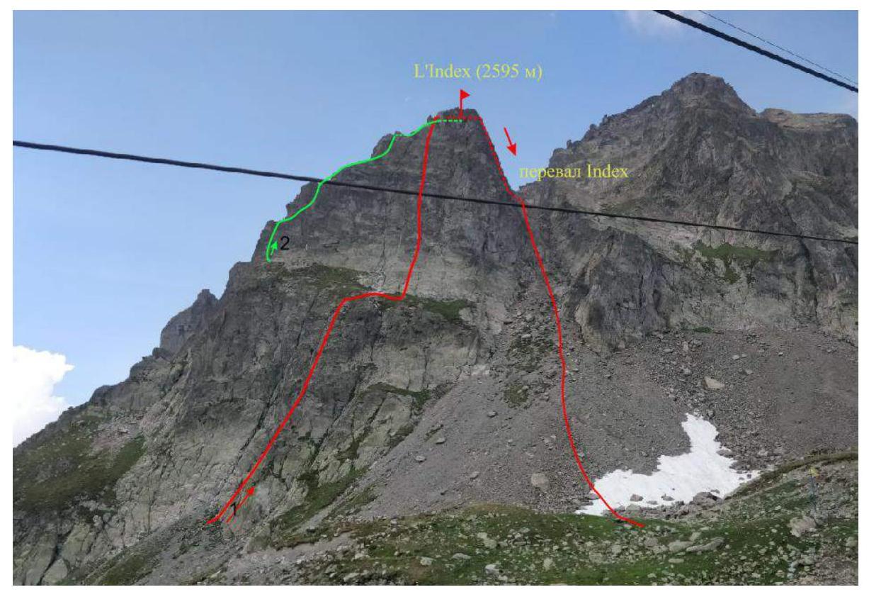
Date of photo – July 29, 2018. Location – Index cable car, France, Chamonix, view of Col de L'Index and the eastern slope of L'Index peak.
Routes:
- Bruna-Perru route via the eastern ridge, category 3A.
- Route via the Southeast Ridge, category 2A.
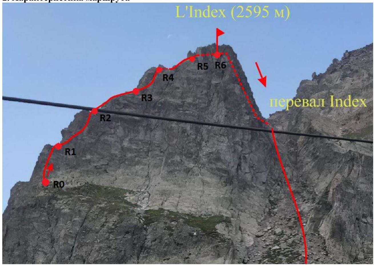
1.2 Photo of the Route Profile
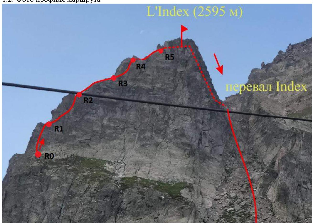
Date of photo – July 29, 2018. Location – Index cable car, France, Chamonix, view of Col de L'Index and the eastern slope of L'Index peak.
1.3 Photopanorama of the Area
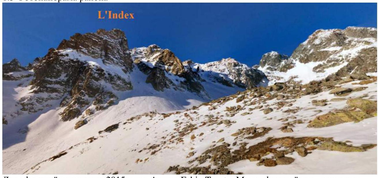
Date of photo – January 2015. Author: Fabio Tosato. Location – Index cable car, France, Chamonix, view of Col de L'Index and the eastern slope of L'Index peak.
1.4 Map of the Area
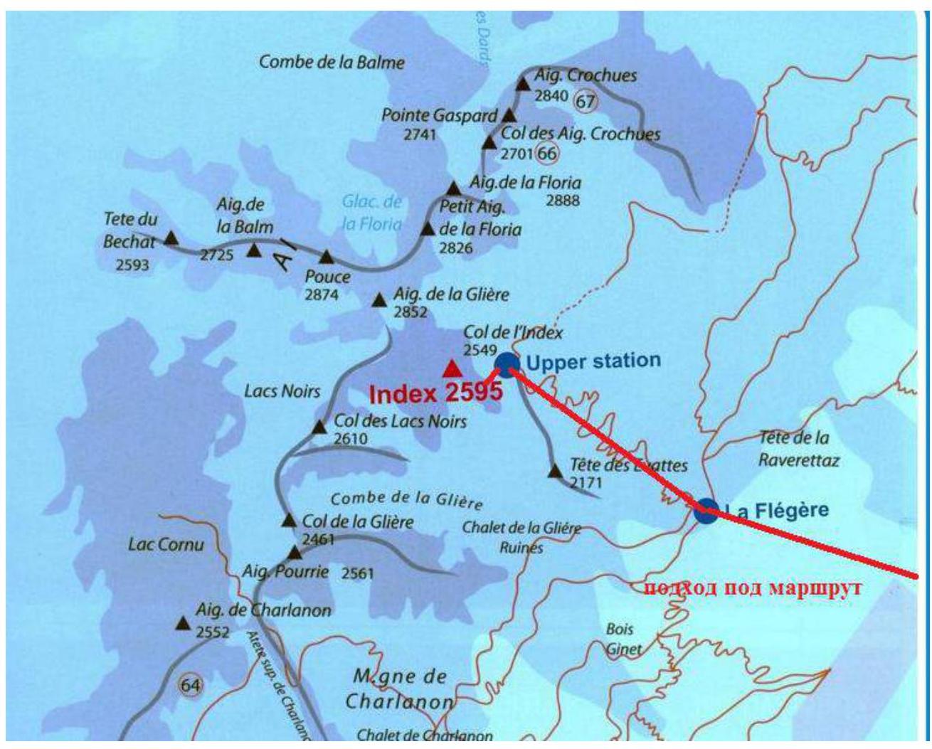
The area where the peak is located is in the Chamonix valley (Haute-Savoie, France) in the region known as Aiguilles Rouges, north of Chamonix. The route and approach are completed in one day. From the campsite, it is necessary to reach the Flégère cable car, the second section of which goes to L'Index peak. To start the route, follow the cable car or the ski slope nearby. The distance to the start of the route is about 5 km. The walking time is 3 hours. It is also possible to use the cable car (operation starts at 8:00, it is advisable to buy tickets in advance). In this case, the ascent time is 20 minutes. From the cable car, ascend to a wide grassy ledge and move right to the ridge. The start is under a large boulder.
2. Route Characteristics
| Section № | Terrain Type | Difficulty Grade | Length | Type and Number of Pitons |
|---|---|---|---|---|
| R0–R1 | Rocks | 3+/4- | 25 m | 7–10 medium-sized stoppers. Old pitons are present. |
| R1–R2 | Rocks | 3 | 30 m | 5–10 medium-sized stoppers. |
| R2–R3 | Rocks | 3- | 25 m | 5 medium-sized stoppers, slings for belaying on the ridge. |
| R3–R4 | Rocks | 3 | 15 m | 3–4 medium-sized stoppers. Two old pitons are present on the section. |
| R4–R5 | Rocks | 3 | 20 m | 3–4 medium-sized stoppers. |
| R5–R6 | Rocks | 3- | 15 m | 2 medium-sized stoppers. Slings on the summit. |
| Descent from the route | Rocks | 250 m | Several established rappel stations |
3. Characteristics of the Team's Actions
| Section № | Description | Photo № |
|---|---|---|
| R0–R1 | The route starts under a large boulder, which is climbed on the right, then move left for a few meters. Continue upwards for about 15 m along the corner. Old pitons are present, which can be used for belaying. Difficulty grade 3+/4–. | 1, 2 |
| R1–R2 | Traverse right for 3 m, then move right and upwards along another corner. At point R2, reach the ridge where a belay station can be set up using slings. Difficulty grade 3. | 2, 3 |
| R2–R3 | Move forward along the ridge, staying on its right part. There are many places to set up belay stations on the ridge. Difficulty grade 3–. | 4 |
| R3–R4 | Traverse 5 m to the right. Climb the wall to the tower. Difficulty grade 4+. Alternatively, traverse 10 m to the right instead of 5 m and climb the wall at this point. In this case, difficulty grade 3. | 5 |
| R4–R5 | Bypass the tower on the left, descending 2 m. Continue moving along the ridge, stopping under a small pre-summit tower. Difficulty grade 3. | |
| R5–R6 | Climbing grade 3– to reach the ridge – 15 m. Then traverse to the summit – 5 m. The summit is a narrow ridge. It is convenient to use slings for belaying on large outcrops at this section. | |
| Descent from the route | Traverse along the ridge 10 m to the right, descend 5 m to a ledge and traverse 10 m to the rappel stations. Two rappel options are possible. The optimal one is towards Col de L'Index on the ridge – 45 m. The main difficulty is to reach a point from which it is possible to continue moving via simple climbing with one rope (see photo 7, which shows the most successful descent point). After that, descend via simple rock climbing to the pass and continue moving along the scree slope to the cable car. | 6–8 |
Along with the Bruna-Perru route, this is one of the most popular routes to L'Index peak. The route is well-developed, with old pitons and stoppers present. It is recommended to bring: – two sets of medium-sized stoppers for belaying; – large slings, which will be useful on the ridge.
Navigation on the route is straightforward. Due to the route's popularity, it is recommended to start before 8:00, as most people ascend via the cable car. If using the cable car, it is advisable to buy tickets in advance to catch the first cabin. The path to the route is clearly visible. The route is not prone to rockfall. The proposed grade of the route is 2A.
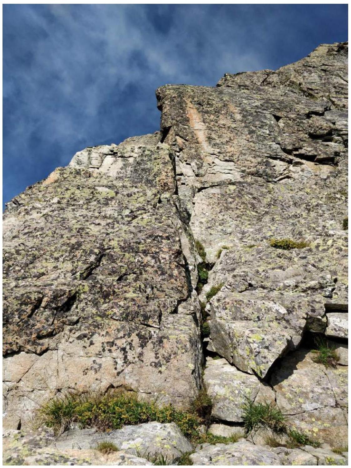
Photo 1. View from point R0. Start under a large boulder, which is climbed on the right.
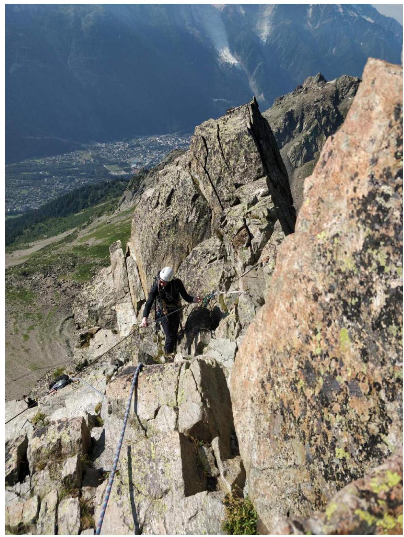
Photo 2. View of point R1 on section R1–R2.
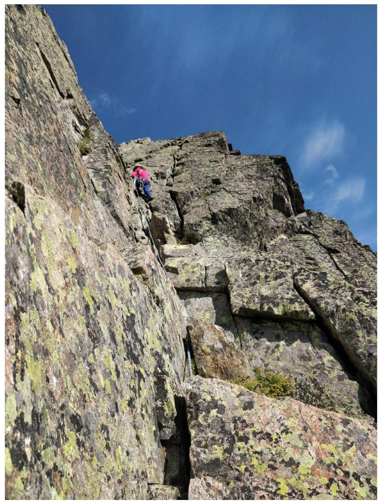
Photo 3. Inner corner on section R1–R2.
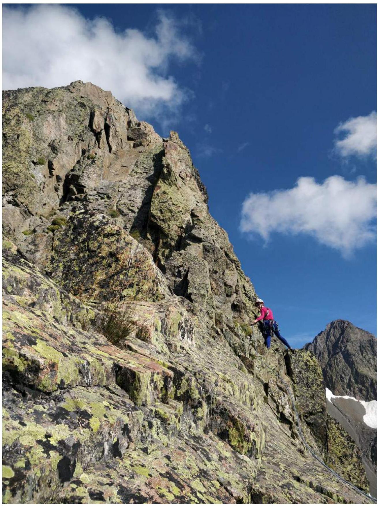
Photo 4. End of section R2–R3.

Photo 5. Traverse before the ascent on section R3–R4.
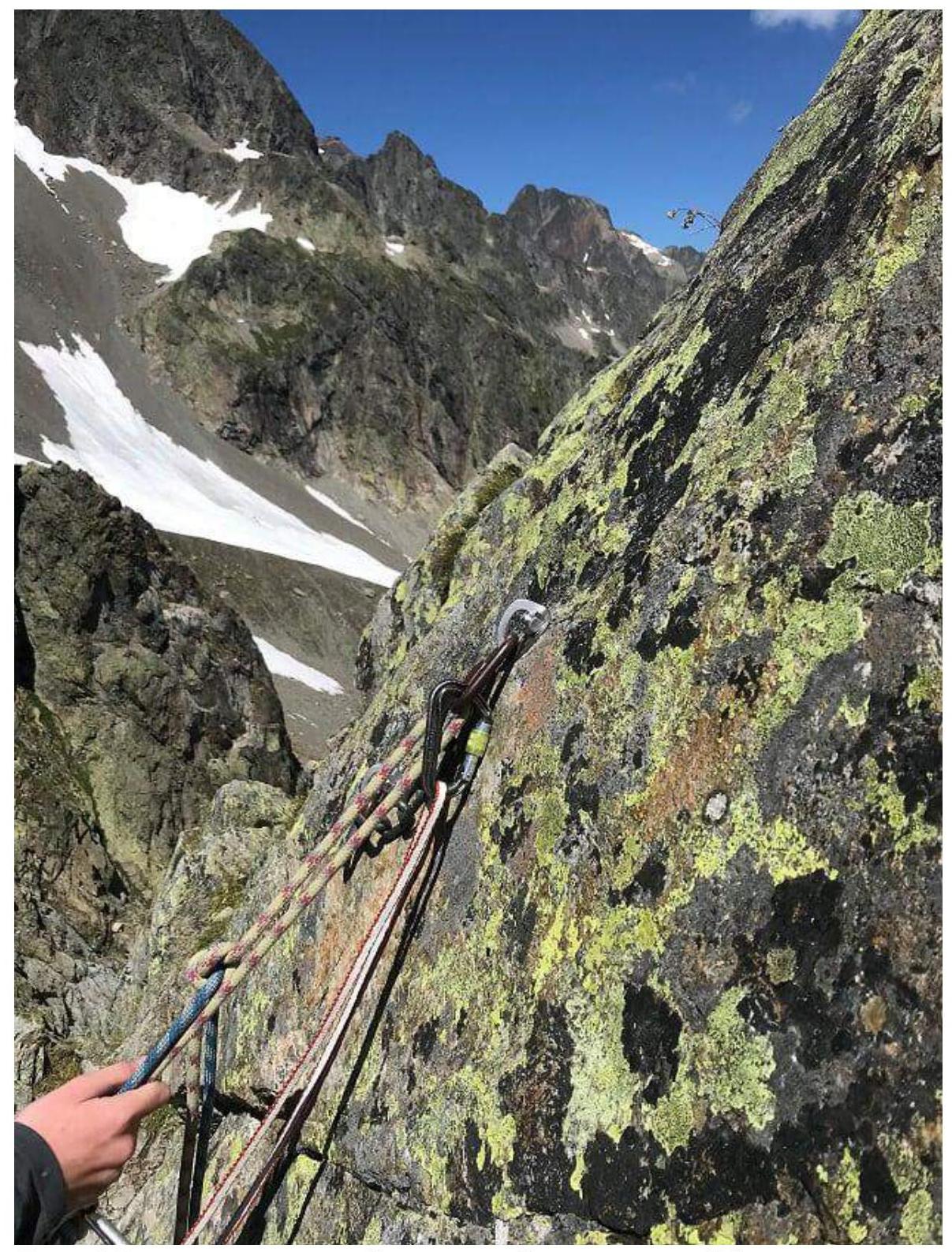
Photo 6. View from the ledge near one of the stations around point R8.

Photo 7. Rappelling towards Col de L'Index.
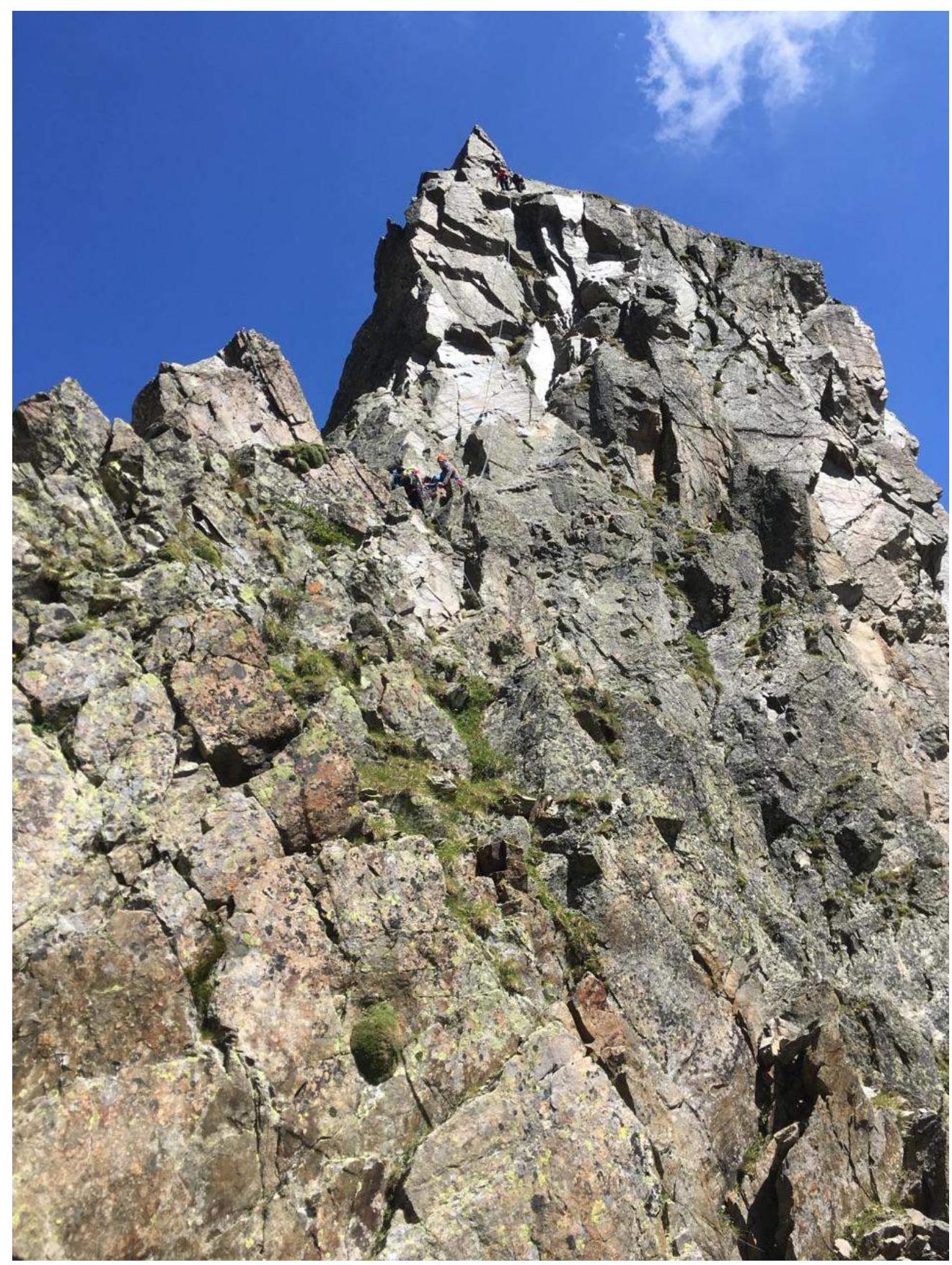
Photo 8. Alternative rappel option (to the northwest). People are standing on the intermediate and upper stations.
Comments
Sign in to leave a comment