Report
On the ascent of Wetterhorn peak (Alps, Switzerland) via the SW slope and SE ridge ("Classic") 2B category of complexity by the team of Demchenko Moscow CSKA on August 4, 2019
I. Climbing Report
| № | 1. General Information | |
|---|---|---|
| 1.1 | Full name, sports rank of the leader | Yurkin A. V., Master of Sports, instructor 2nd category |
| 1.2 | Full name, sports rank of participants | Kashirskaya A., badge holder; Felitsin I., badge holder |
| 1.3 | Full name of the coach | Yurkin A. V. |
| 1.4 | Organization | Demchenko Moscow CSKA |
| 2. Characteristics of the Climbing Object | ||
| 2.1 | Region | Switzerland, Bernese Alps |
| 2.2 | Valley | |
| 2.3 | Number according to the 2013 classification table | 10.3 |
| 2.4 | Name and height of the peak | Wetterhorn 3701 m |
| 2.5 | Geographic coordinates of the peak (latitude/longitude), GPS coordinates | 46.63861°N / 8.11528°E |
| 3. Characteristics of the Route | ||
| 3.1 | Name of the route | Via SW slope and SE ridge ("Classic") |
| 3.2 | Proposed category of complexity | 2B |
| 3.3 | Degree of route development | First ascent on August 31, 1844 by Melchior Bannholzer and Johann Jaun. |
| 3.4 | Nature of the route terrain | Combined |
| 3.5 | Height difference of the route (according to altimeter or GPS data) | Directly on the route 800 m. Total ascent from the hut on the day of the climb 1380 m |
| 3.6 | Length of the route (in meters) | 1400 m |
| 3.7 | Technical elements of the route (total length of sections of different complexity categories with terrain type indication (ice-snow, rock)) | I category ice/rock/combination — ___ m. II category ice/rock/combination — 1250 m. III category ice/rock/combination — 200 m. IV category ice/rock/combination — ___ m. Movement on a closed glacier — 400 m |
| 3.8 | Descent from the peak | Via the ascent route |
| 3.9 | Additional route characteristics | Water is present on the route |
| 4. Characteristics of the Team's Actions | ||
| :--: | :--: | :--: |
| 4.1 | Time in motion (team's walking hours, in hours and days) | 6 hours up, 4 hours down to the hut |
| 4.2 | Overnight stays | Gleckstein hut, 2317 m |
| 4.3 | Start of the route | 05:30 on August 4, 2019 |
| 4.4 | Reaching the peak | 11:30 on August 4, 2019 |
| 4.5 | Return to the base camp | 15:30 at the hut on August 4, 2019 |
| 5. Responsible for the Report | ||
| 5.1 | Full name, e-mail | Yurkin A. B., S2_aleks@mail.ru |
II. Climbing Description
1. Characteristics of the Climbing Object
1.1. General photo of the peak.
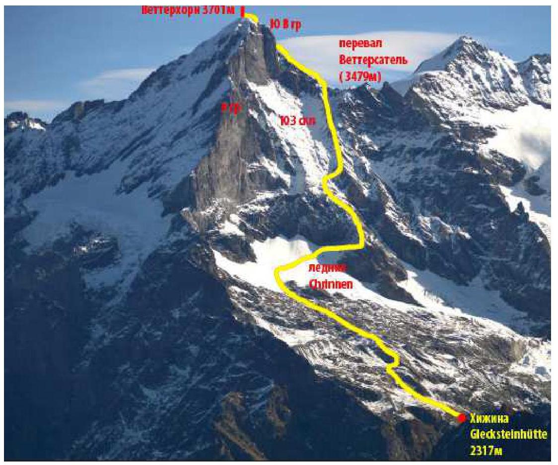
1.2. Photo of the route profile (upper part)
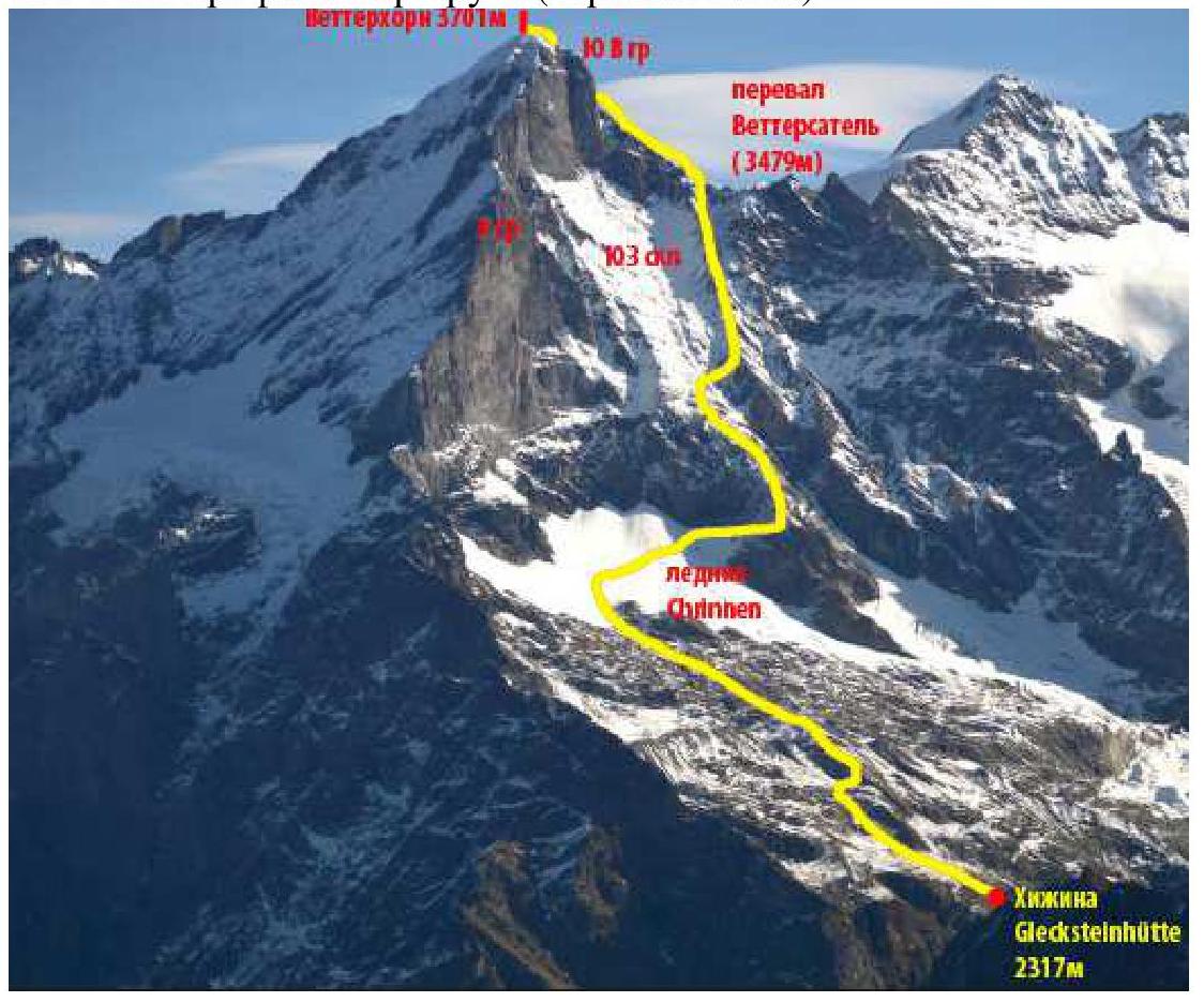
1.3. Photopanorama of the area
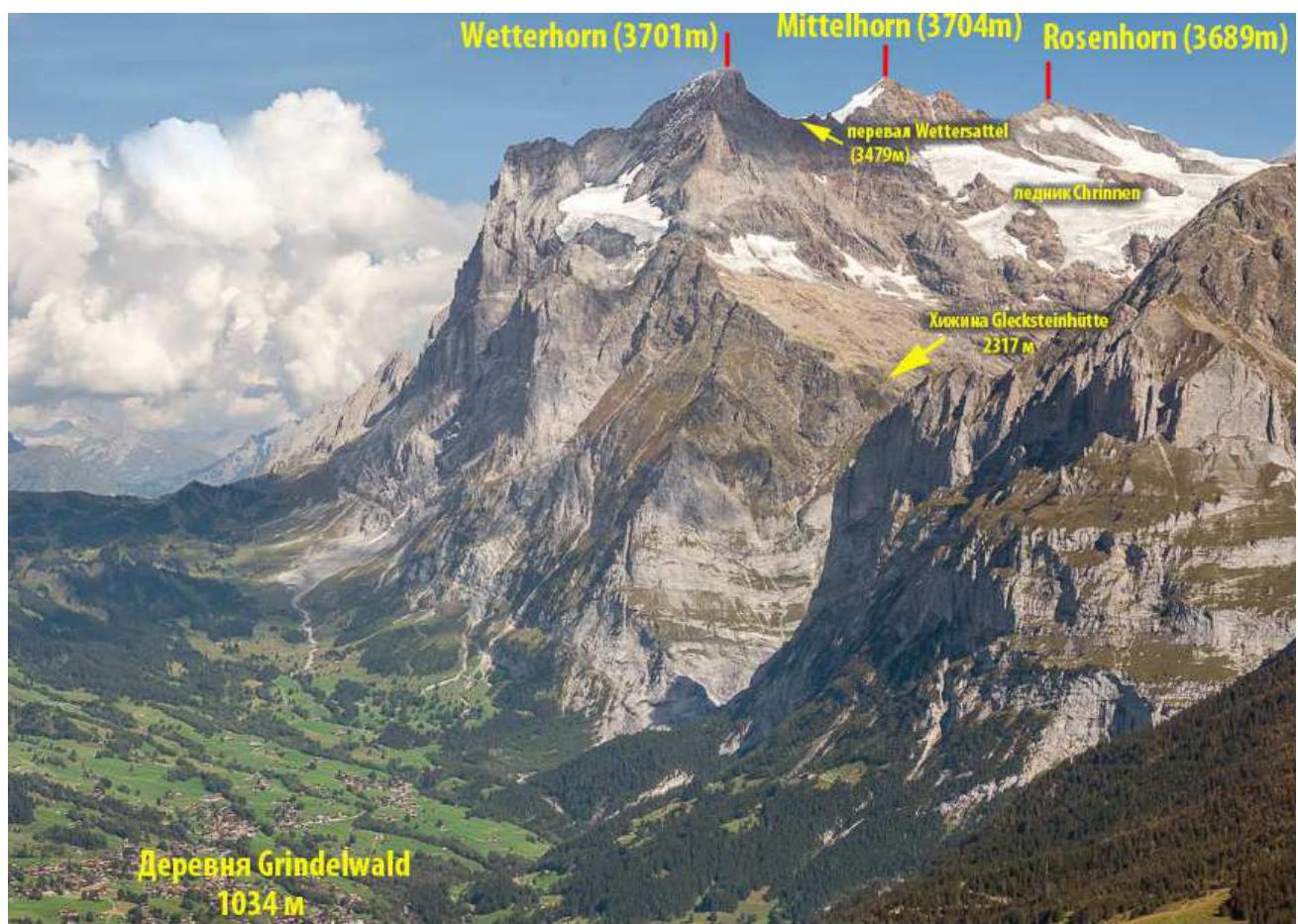
1.4. Map-scheme of the area
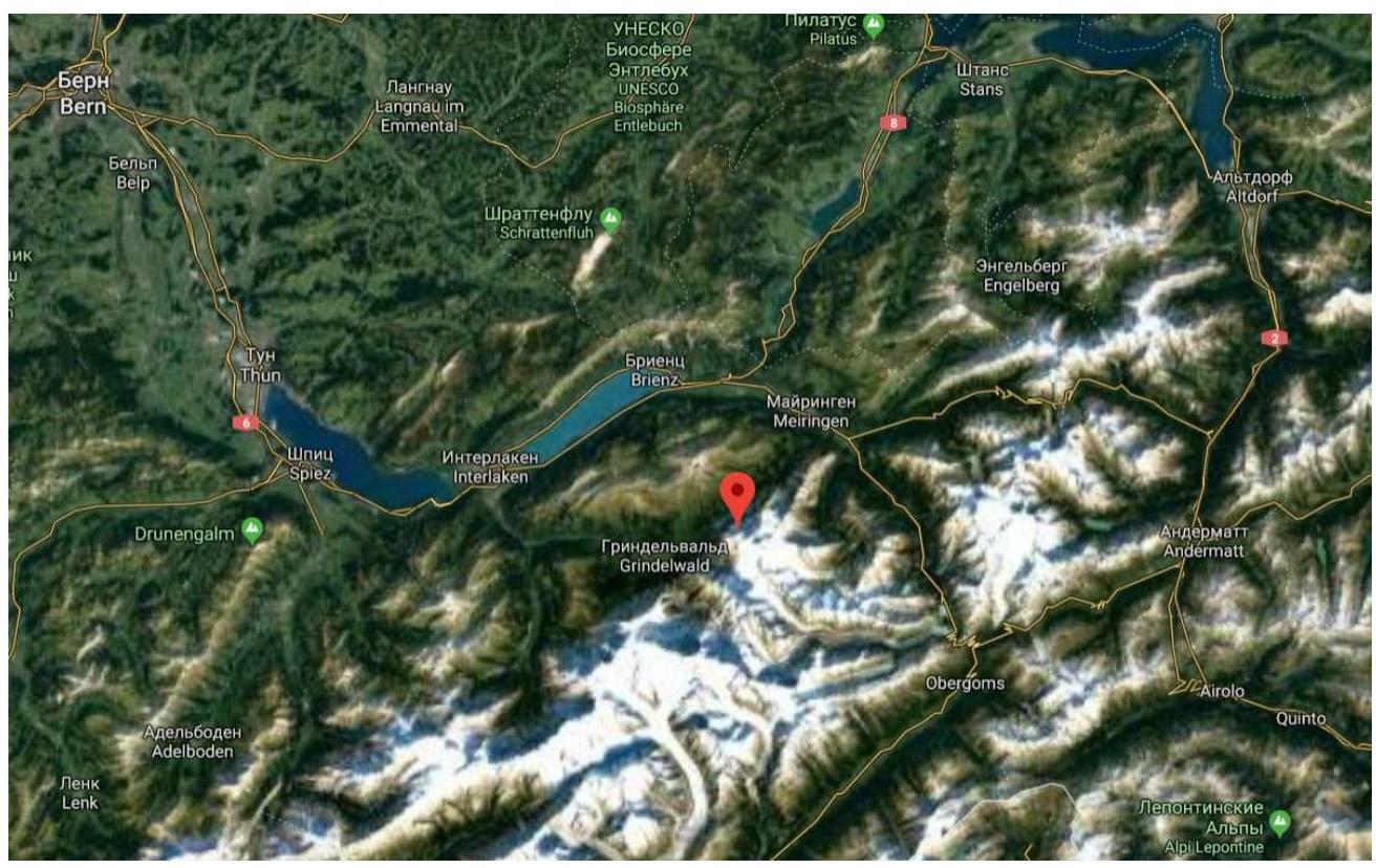
Approach Description
The starting point for the approach to the route is the village of Grindelwald. From there, take public transport or a personal vehicle to Oberer Gletshten (20 minutes by bus). From the large parking lot, follow the marked trail (initially a road) towards the mountain. The starting point is marked by a large red booth — a remnant of an old cable car (a landmark). Pass through the forest zone and begin the ascent to the rocky part of the approach. The trail is well-equipped and frequently visited as many tourists and climbers head towards Wetterhorn. Reach the initial bivouac — Glecksteinhutte (2317 m). The hut is serviced during the summer. The approach takes 3 hours
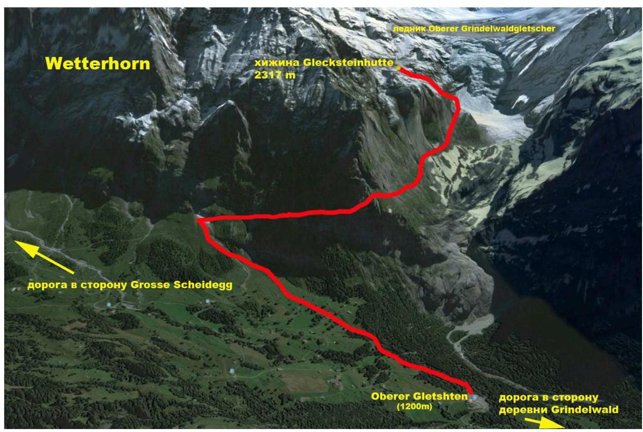
Approach to the hut
2. Characteristics of the Route
2.1. Technical photograph of the route
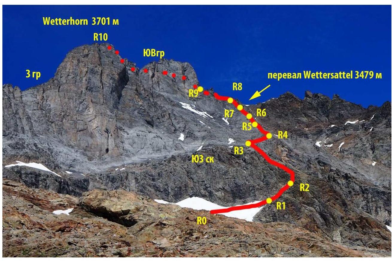
2.2. Section numbers on the technical photograph should correspond to the section numbers in paragraph 2.3.
2.3. Technical characteristics of the route sections
| Section № | Terrain type | Complexity category | Length, m | Type and number of pitons |
|---|---|---|---|---|
| R0–R1 | Snow - ice | 2 | 400 | Belay via ice axes |
| R1–R2 | Rocks | 2 | 50 | Simultaneous movement, belay on ledges |
| R2–R3 | Rocks | 2 | 300 | Simultaneous movement, belay on ledges |
| R3–R4 | Rocks | 2 | 50 | Alternating movement, belay via bolts |
| R4–R5 | Rocks | 2 | 100 | Simultaneous movement, belay on outcrops and metal pins |
| R5–R6 | Rocks | 3 | 50 | Alternating movement, belay via bolts, pins, 2 cams |
| R6–R7 | Rocks | 3 | 150 | Alternating movement, belay on outcrops, 5 cams, 2 slings |
| R7–R8 | Rocks | 2 | 50 | Simultaneous movement, belay on outcrops |
| R8–R9 | Rocks-snow | 2 | 100 | Simultaneous movement, belay on outcrops, on snow (20 m) alternating, |
| R9–R10 | Rocks | 2+ | 200 | Alternating movement, belay on outcrops and metal pins |
3. Characteristics of the Team's Actions
3.1. Brief description of the route passage.
From the hut, move along the trail upwards towards the glacier. The trail is marked (recommended to check the trail marking color at the hut's information board beforehand). The trail initially goes along a grassy-stony slope, gradually transitioning to moraine and then to "ram's foreheads". There is no marking on the "ram's foreheads" — move upwards towards the glacier. Reach the ice. Put on crampons and climbing gear. 1 hour
| Section № | Description | Photo № |
|---|---|---|
| R0–R1 | From the flat part of the glacier, move upwards to the right towards a characteristic ridge. Attention to crevasses! Snow-ice 2 400 m 45° | |
| R1–R2 | Transition from ice to rocks (carefully – randkluft). There are small platforms where crampons can be removed. Then move upwards to the right onto a flat ridge (cairns). Rocks 2 50 m 45° | |
| R2–R3 | Move simultaneously along the flat ridge. Rocks in the form of inclined slabs, sometimes ridge. Move upwards. As the steepness increases, move to the right – watch for the transition to the right (neighboring ridge). Between the ridges, there is a small canyon in the upper part, tapering to nothing. The transition landmark to the neighboring ridge is metal pins at the edges of the canyon. 2 300 m 40° | |
| R3–R4 | Cross the canyon to the right ridge. There are bolts and pins. 2 50 m 45° | |
| R4–R5 | Move upwards along the destroyed ridge until a sharp ascent. 2 100 m 45° | |
| R5–R6 | From the station on a good platform before the ascent. Belay via bolts, pins, and own points. 3 50 m 60° | |
| R6–R7 | Further movement along a narrow ridge. Sometimes the width is 0.5 m. Passages on the left and right of the ridge. 3 150 m 60° | |
| R7–R8 | In the upper part of the ridge-slope to the right, climb into a large crevice that leads to the SE ridge above the Wettersattel pass between Wetterhorn and Mittelhorn. 2 50 m 40° | |
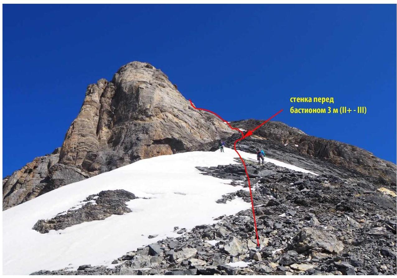
| R8–R9 | To the left upwards along the broad SE ridge. Sometimes snow-ice. Approach the bastion. Before the bastion, there will be a small wall 3 m, climbed by scrambling through a crevice in the center of the wall. At the top, there is a metal pin. 2 100 m 45° | |
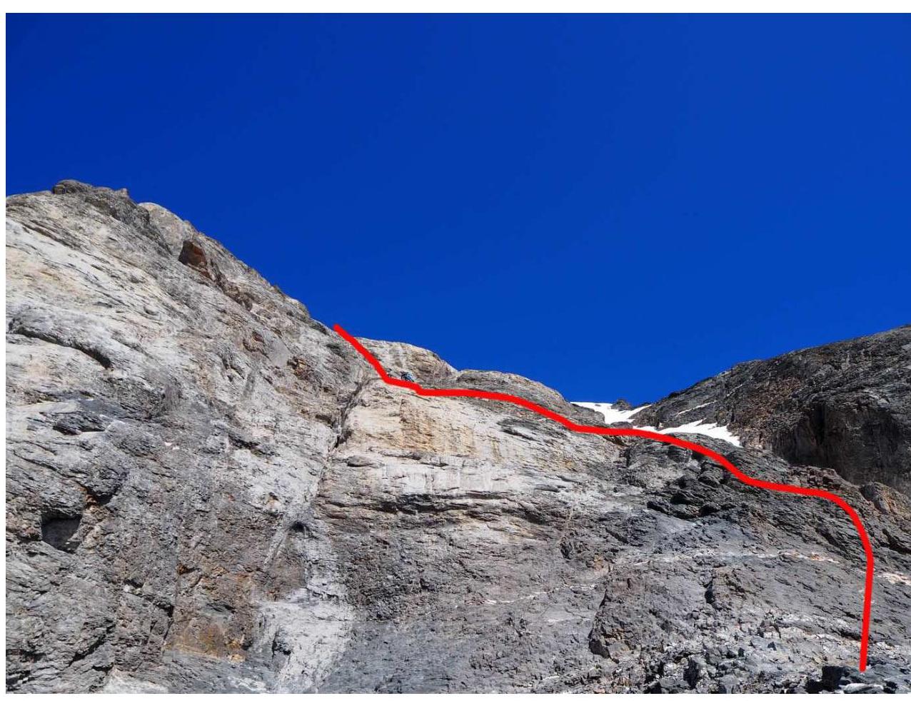
| R9–R10 | Movement along the bastion rocks. Simple scrambling if the rocks are dry. Inclined slabs with few holds. Overhangs are bypassed on ledges. Attention on the ledges to loose stones that can be dislodged by a rope. Belay via metal pins. The exit to the peak at the top is possible from both the right and left sides. The peak is an elongated flat area about 15 meters long. 2+ 200 m 60° |
3.2. Photo of the team on the peak near the control cairn.
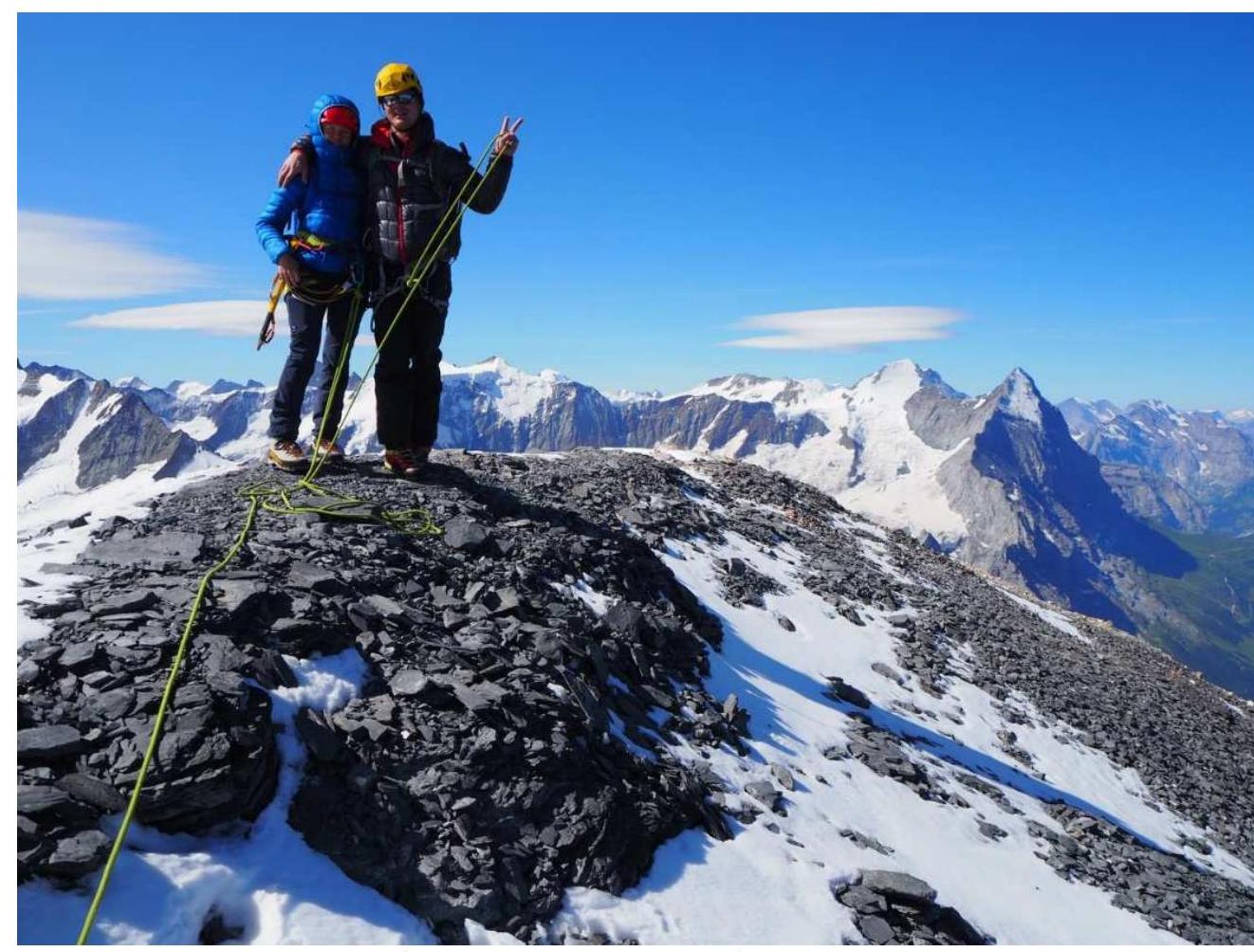
Photo on the peak (Eiger and Mönch visible in the background on the right)
3.3. Assessment of the route's safety.
The route is relatively safe. The unpleasant part is crossing the canyon on the SE slope. Stones may fall from possible climbers on the right ridge leading to the Wettersattel pass.
On the peak bastion, the rocks are very poor; use metal pins; between them are steep faces and ledges that, when dry, are climbed by scrambling from pin to pin (interval between them 20–25 m). If the rocks are snowy or wet, intermediate belays will be challenging. (Bring anchors).
Cell phone coverage is reliable throughout the route.
Descent is via the ascent route; after the "ram's foreheads" of the glacier, there is trail marking.
The route can be compared to a long, sturdy 2B on the Caucasus or a simple 3A. According to the European classification (French-Italian), the route is rated as PD.
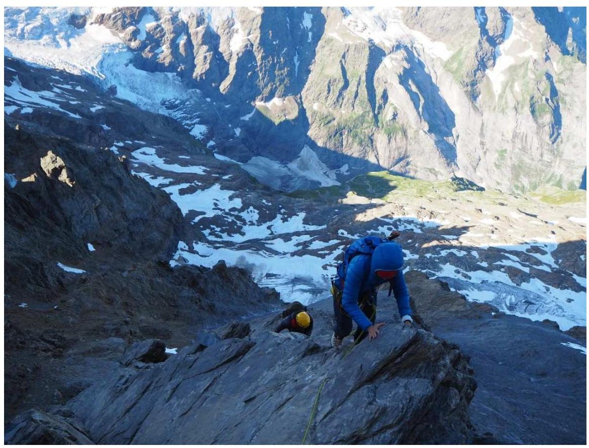
Photo report

Section R0–R1, glacier approach
Upper part of section R5–R6
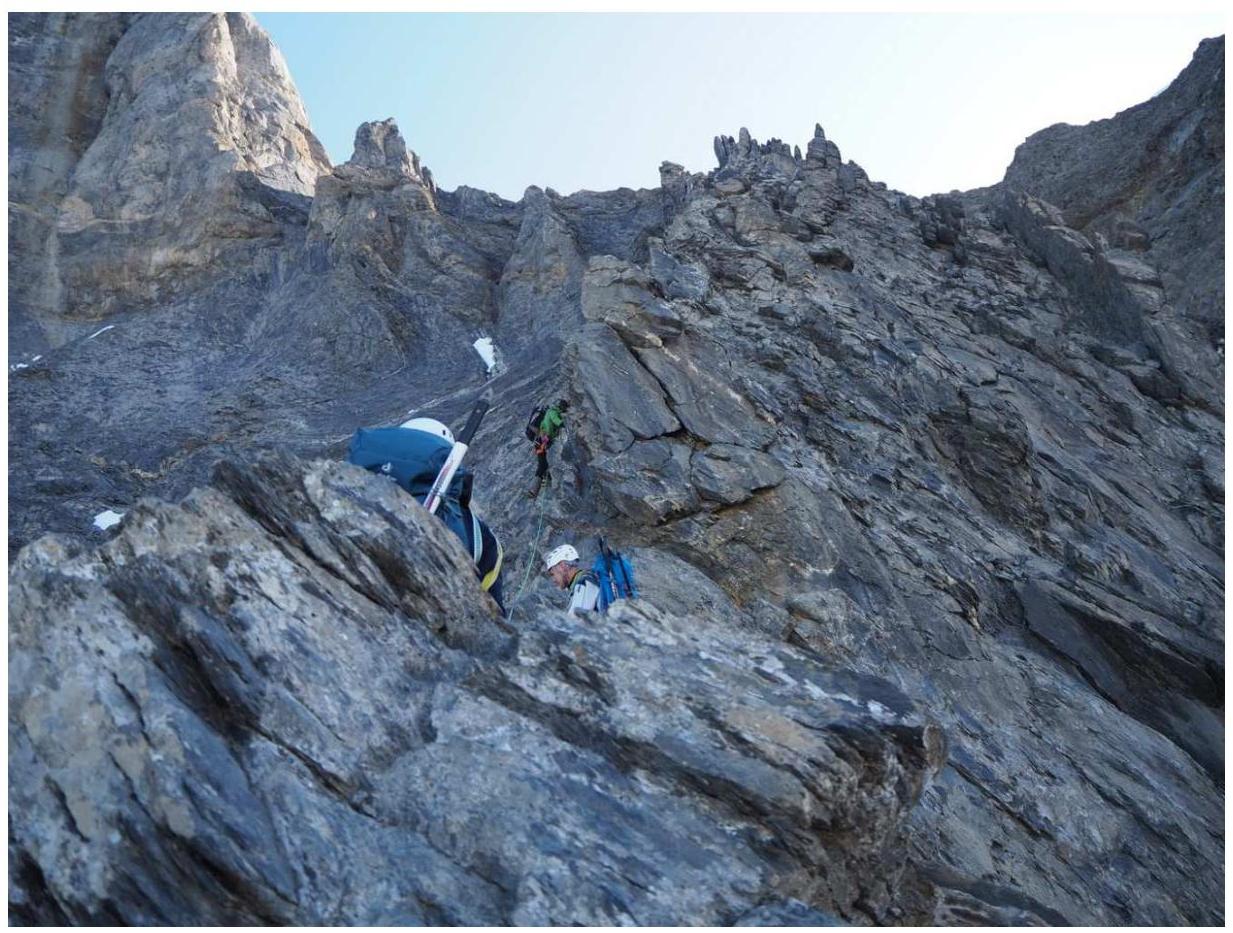
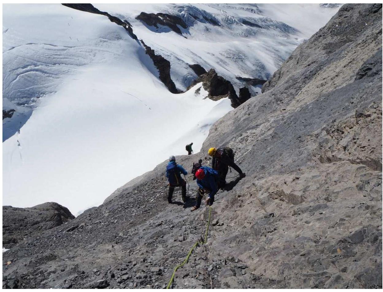
Section R6–R7, ridge

Section R6–R7, ridge (a German pair climbing ahead)
Section R8–R9, SE ridge
Section R9–R10, start of the bastion
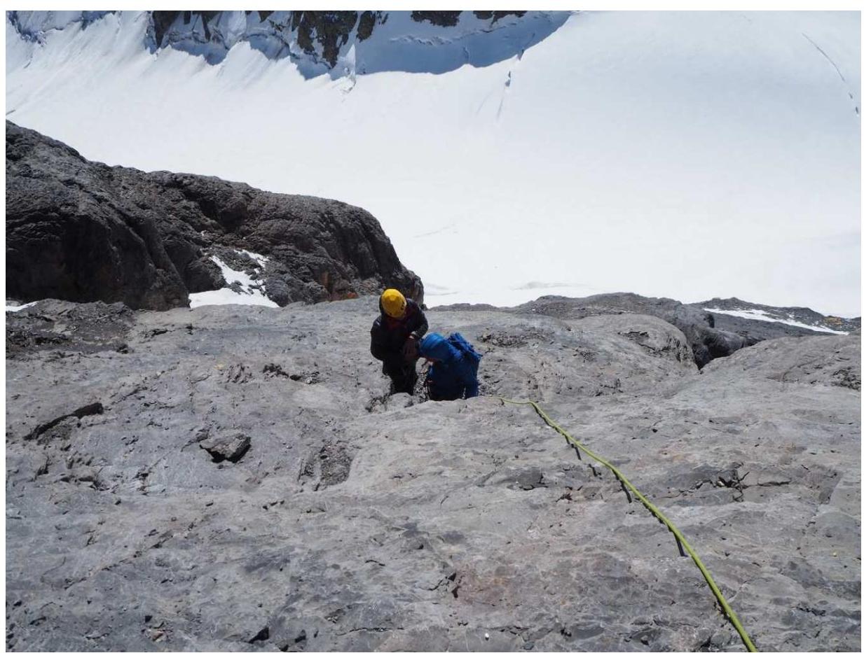
Section R9–R10
Section R9–R10


