Report
on the ascent to Peak Nadezhda, 5600 m Route via the counterfort of the SW wall. Cat. 4B
St. Petersburg, 2011
Ascent Passport
- Region 10.2, Karakoram mountains.
- 5600 m (Peak Nadezhda), via the counterfort of the SW wall.
- Cat. 4B.
- Route type: combined.
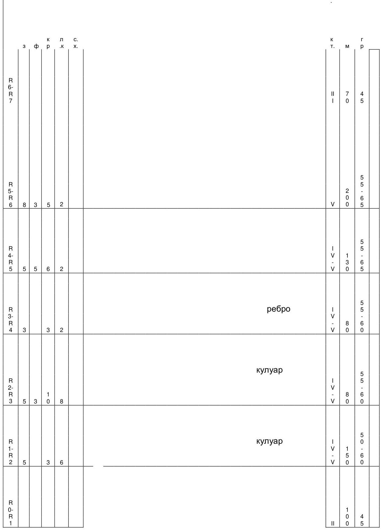
- Route characteristics: height difference — 580 m, wall section height difference — 460 m, route length — 810 m, wall section length — 710 m, length of sections with cat. 5 difficulty — 640 m, average steepness — 57°.
- Equipment used on the route: rock pitons (placed gear, ice screws, bolt pitons): 27, 37, 20, 0, 0. No equipment was left behind.
- Climbing hours — 12 hours.
- Overnight stays: lying down, on comfortable platforms.
- Group composition:
| Role | Name | Rank |
|---|---|---|
| 1. leader | Odintsov A.N. | MSMK |
| 2. participant | Dmitrenko E.V. | MS |
| 3. participant | Lonchinskiy A.S. | MS |
| 4. participant | Dожdev I.V. | CMS |
- Coach: Odintsov A.N.
- Approach to the route — May 26, 2011. Summit — May 27, 2011. Return to base camp — May 27, 2011.
Geographic Description of the Area
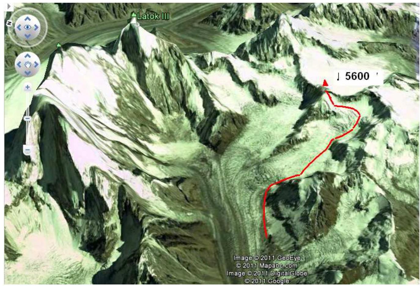
The Latok massif is a small cluster of steep mountain peaks in the Panmah Muztagh range, part of the Karakoram mountain system in Pakistan. They are located east of the Ogre group, with Baintha Brakk (Ogre) being the highest peak. Immediately south of the Latok group lies the Baintha Lukpar glacier, a small tributary of the Biafo glacier, one of the largest glaciers in the Karakoram. To the north lies the Choktoi glacier. The group consists of four main peaks:
- Latok I, north-central, 7,145 m, first ascent — 1979.
- Latok II, west, 7,108 m, first ascent — 1977.
- Latok III, east, 6,949 m, first ascent — 1979.
- Latok IV, southeast, 6,456 m, first ascent — 1980.
- Peak Nadezhda, southeast, 5600 m.
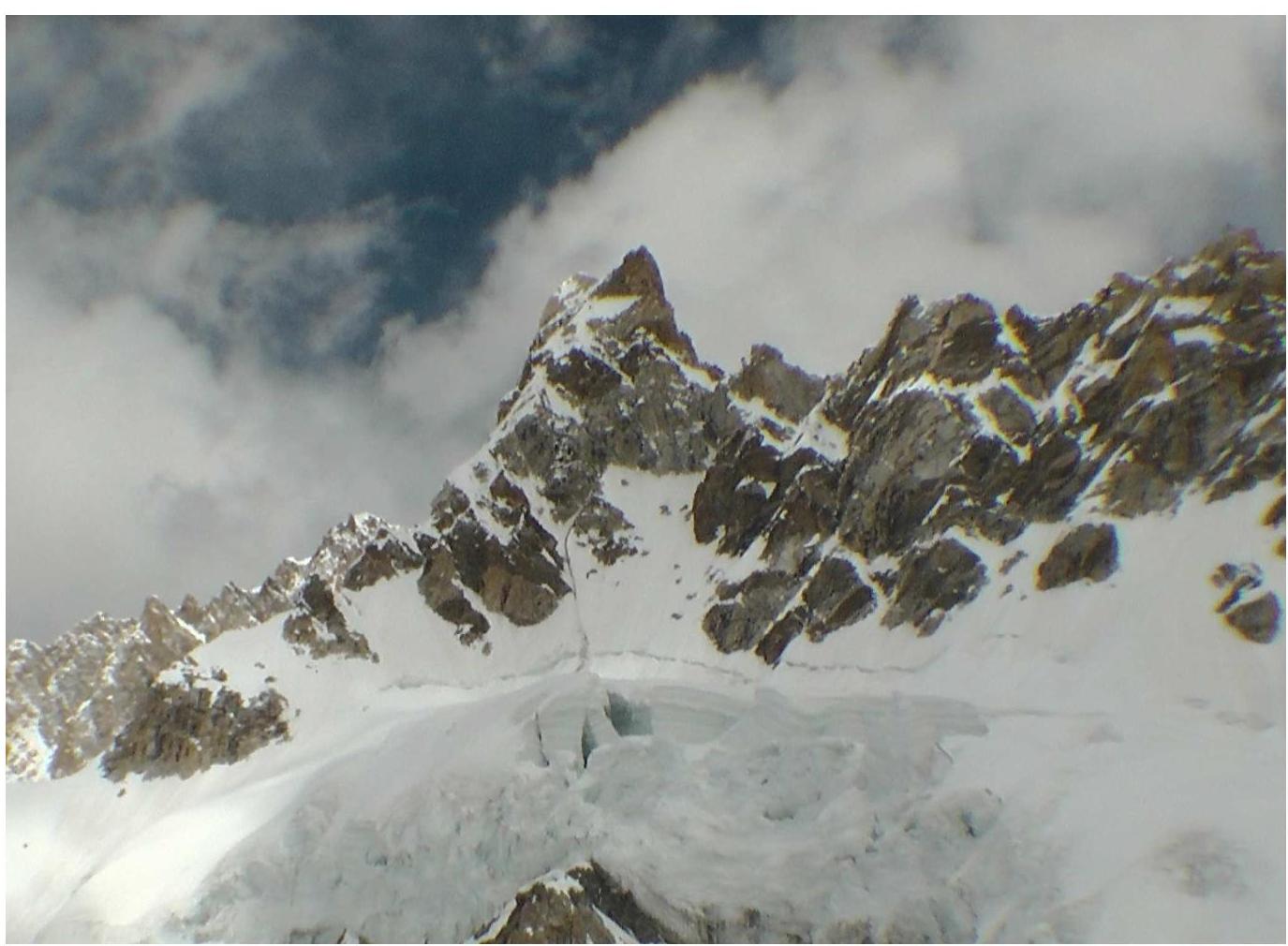
 The route wall face-on.
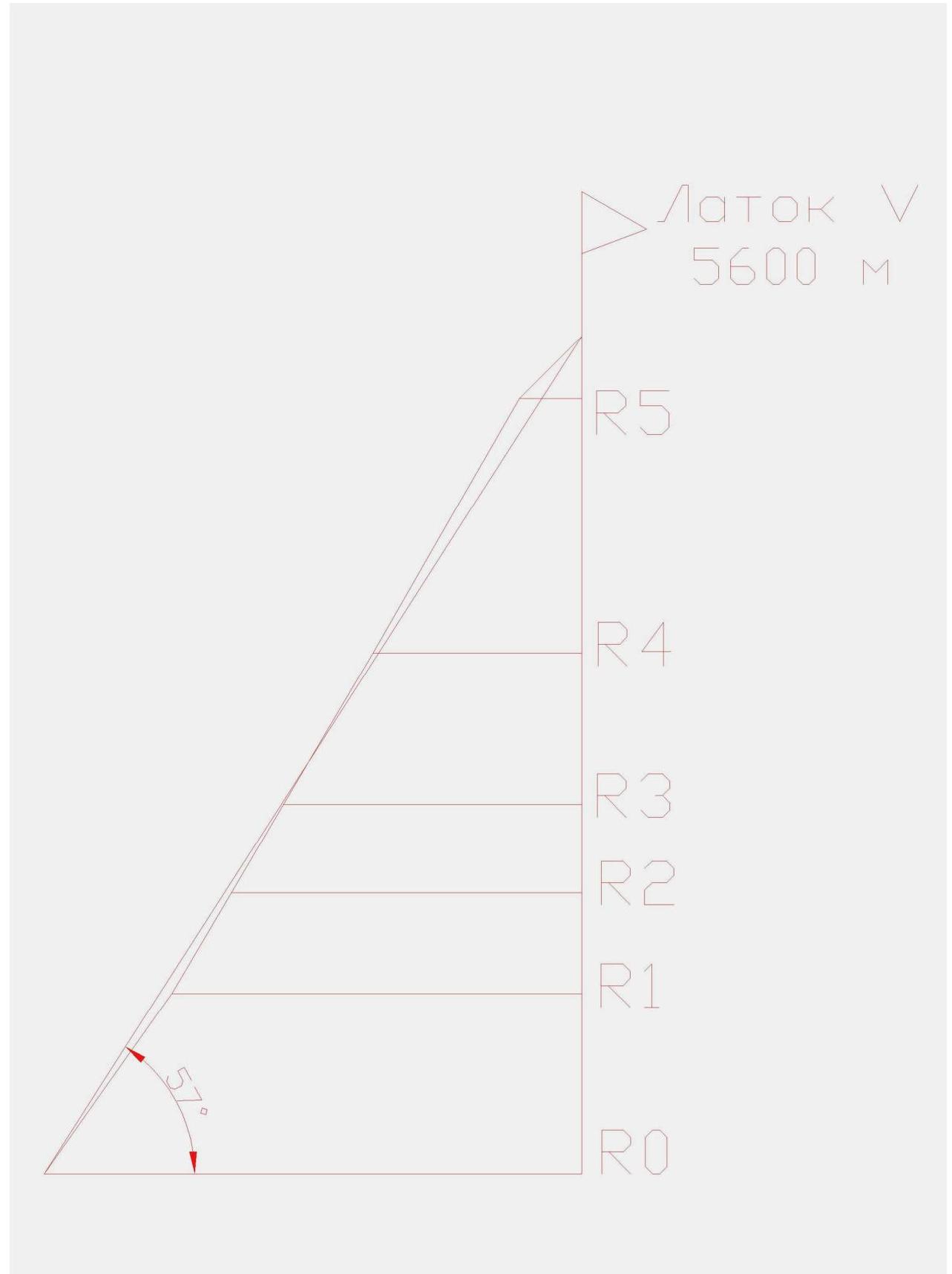
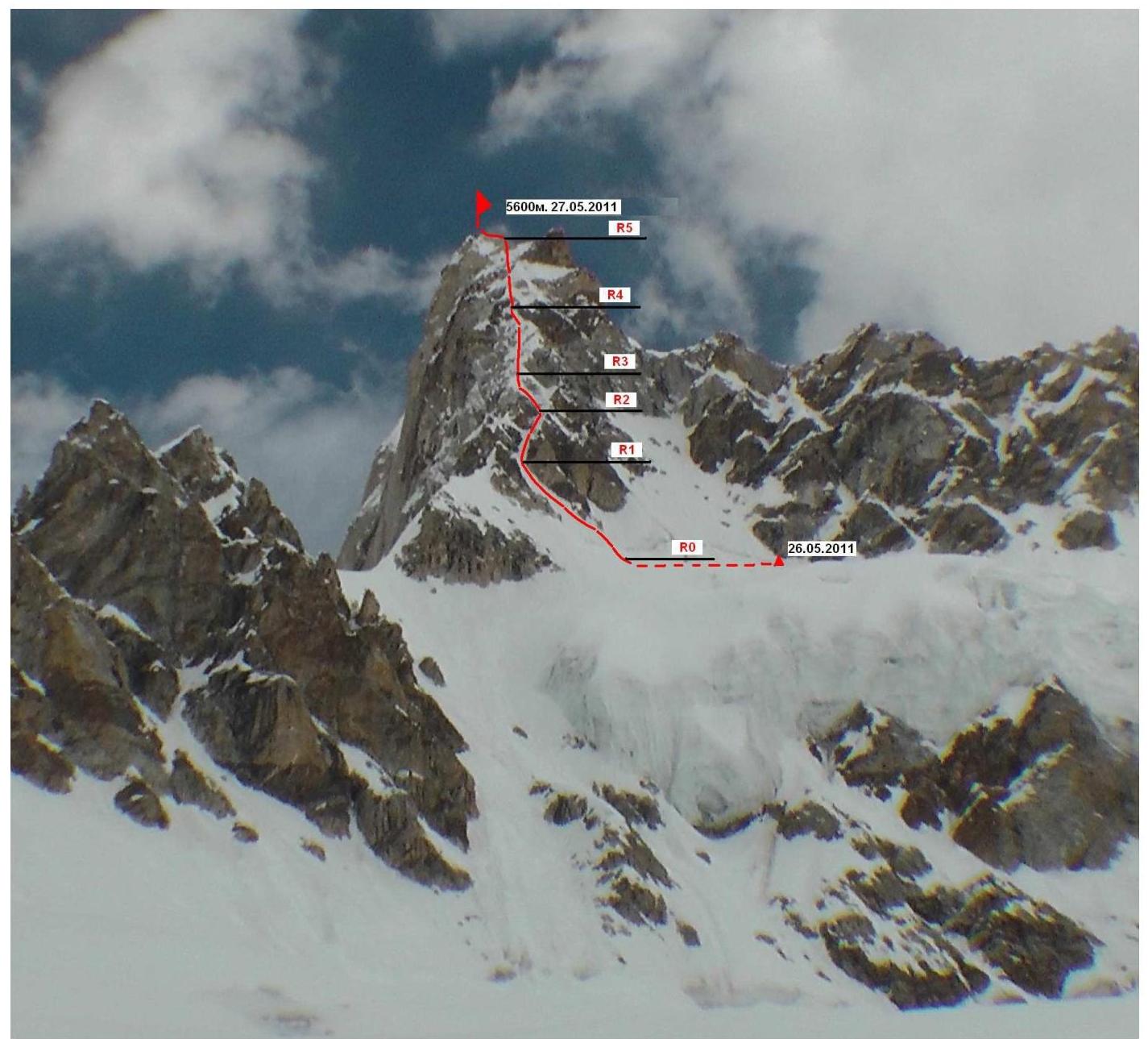
 Route profile.
 Route thread.
Route Description
R0–R1: Upward movement on firm snow to the bergschrund. 100 m. Cat. 2. 45°. Crossing the bergschrund head-on. Then, moving up and left, we proceed along the rock on ice (snow, névé) to the couloir. Ice, névé. 90 m. Cat. 4–5. 50–60°. R1–R2: Then, moving up and right, we proceed along the narrow couloir, bypassing the rocks. Ice, névé. 80 m. Cat. 4–5. 55–60°. R2–R3: Movement on snow and ice, sticking to the counterfort ridge. Snow drifts and cornices are extremely unreliable. 80 m. Cat. 4–5. 55–60°. R3–R4: Upward movement on rock slabs covered with a thick layer of snow. 130 m. Cat. 4–5. 55–65°. R4–R5: Moving towards the snowy shoulder. Ice, névé, sometimes mixed terrain on rock. On the shoulder, to the left of the exit, is a comfortable overnight stay. 200 m. Cat. 5. 55–65°. R5–R6: Ascent on the snowy slope, towards the summit. 70 m. Cat. 3. 45°.
Technical and Tactical Actions of the Team
May 25, 2011. We leave the base camp early in the morning. We move along the edge of the cirque from right to left. At 16:00, we stop for the night, within a half-hour walk from the intended start of the route. May 26, 2011. Departure at 8:00. We work on the route the entire day and by 18:00, we climb to the saddle, preparing a comfortable platform. May 27, 2011. The weather is good; we leisurely pack up the camp, ascend to the summit, and begin our descent. By 18:00, we are back at the base camp.
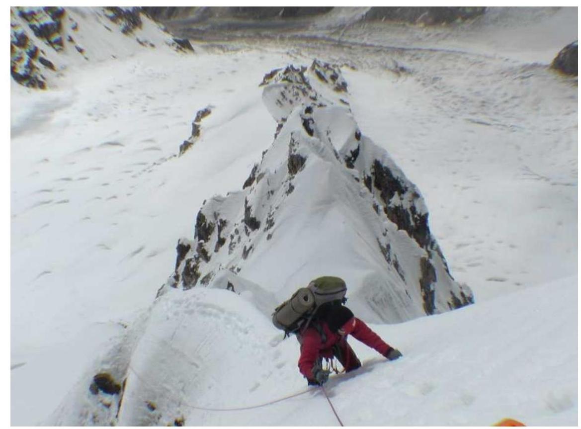
Photo 1. Movement on section R2.

Photo 2. R3.
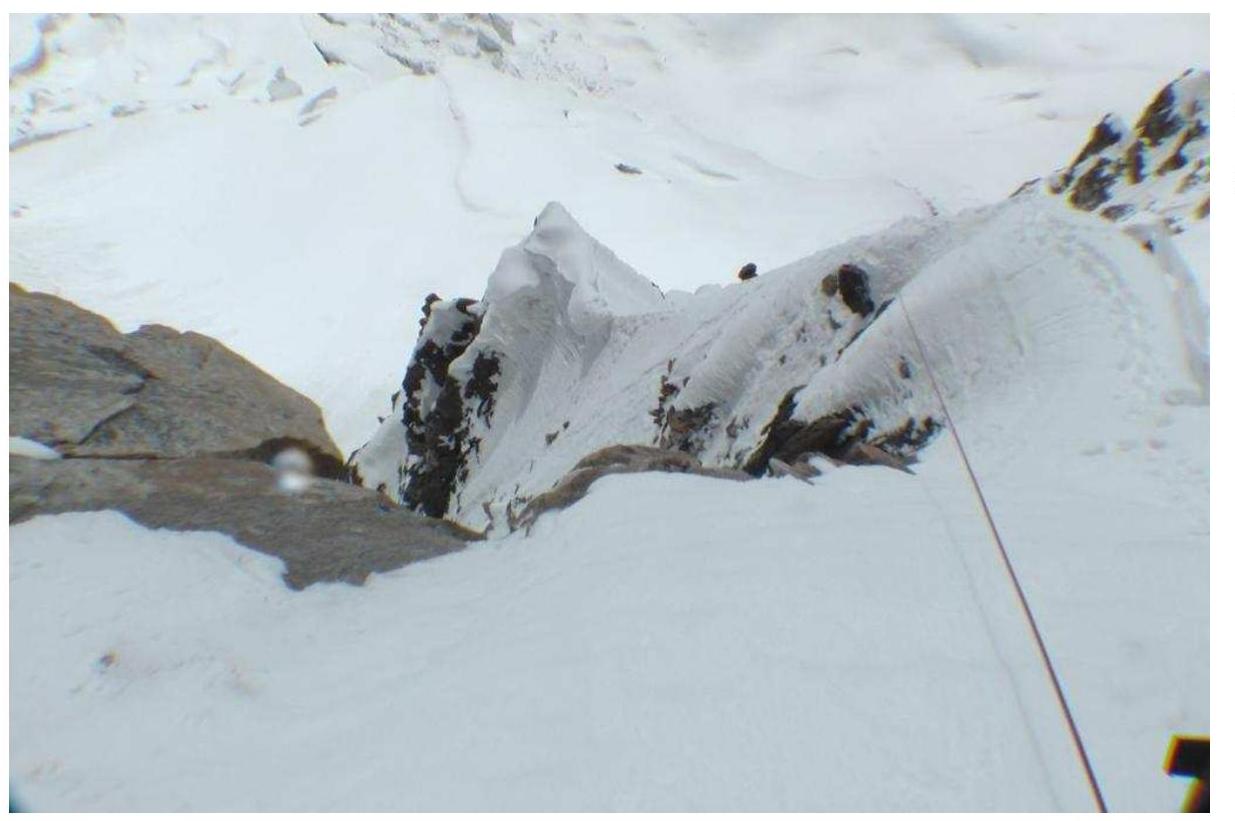
Photo 3. R4.
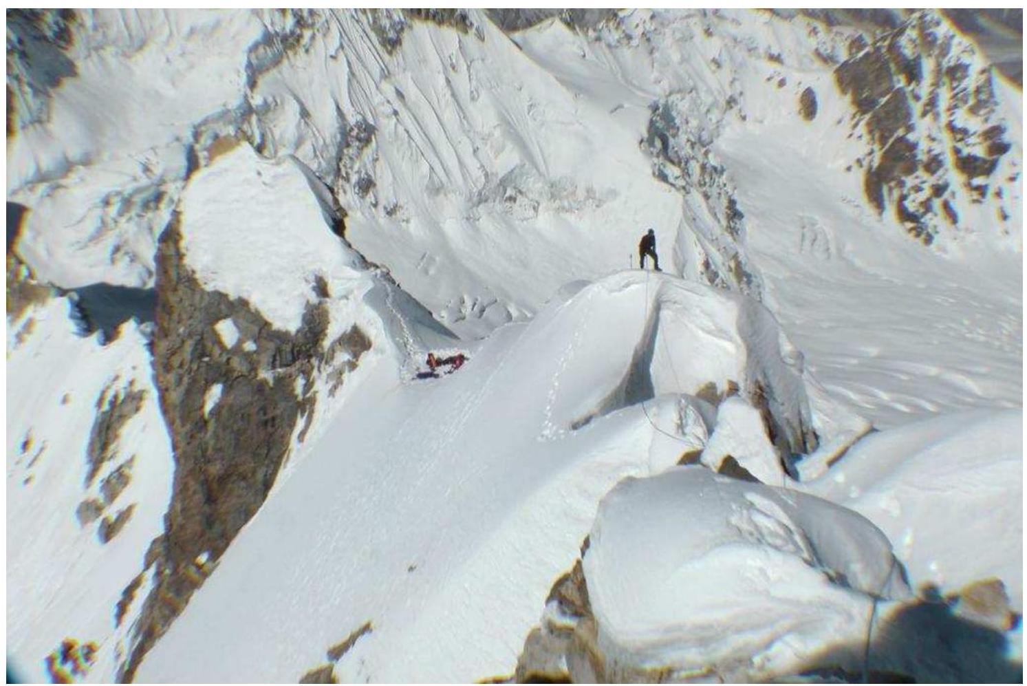
Photo 4. Photo taken from the summit. The overnight stay location is visible.

UIAA Scheme.