Russian Championship
Altitude Class
Report
on the ascent to Mt. Tamserku (6623 m)
Route on the central counterfort of the SW wall.
6A/6B category of difficulty, first ascent
St. Petersburg 2014
Ascent Passport
-
Region: Himalayas, Sagarmatha, Himal, Khumbu.
Coordinates: 27.8617° N, 86.8639° E.
-
Tamserku 6623 m, via the central counterfort of the SW wall.
-
6A/6B category of difficulty.
-
Route characteristics: combined.
-
Route characteristics:
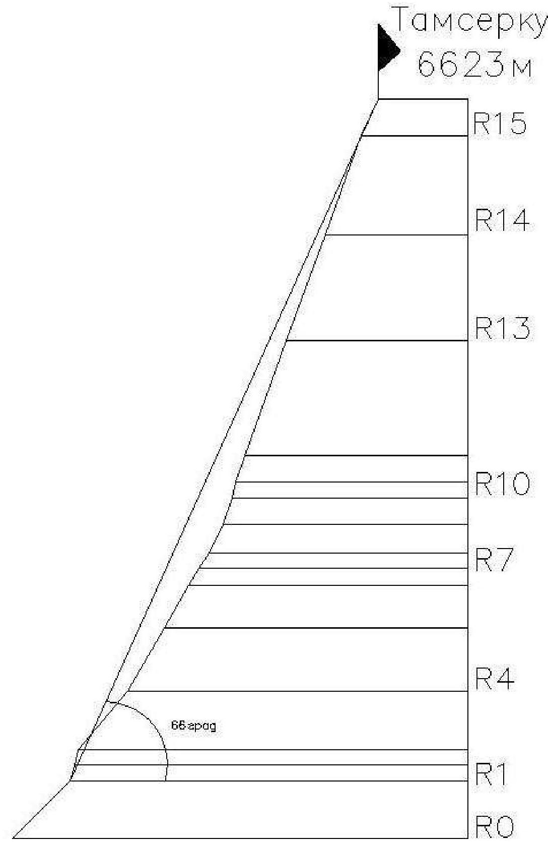
elevation gain — 1823 m, wall section elevation gain — 1623 m, route length — 2125 m, wall section length — 1805 m.
Section lengths:
- 5th category of difficulty — 585 m
- 6th category of difficulty — 1280 m
Average steepness of the wall section — 66°.
-
Equipment used on the route:
rock pitons, protection gear, ice screws, bolt pitons: 56, 57, 66, 0/0.
No equipment was left behind.
-
Climbing hours — 51 hours.
-
Nights: All nights were spent in a frameless single-layer tent reinforced with load-bearing straps.
-
Group composition:
| Role | Name | Discharge |
|---|---|---|
| 1. leader | Loncinskiy A.S. | MS |
| 2. participant | Gukov A.B. | CMS |
-
Coaches: Gukov A.B., Loncinskiy A.S.
-
Departure from Monjo village — April 24, 2014.
Departure to the route from Base Camp — April 27, 2014. Summit — May 3, 2014. Return to Base Camp — May 4, 2014 (actually June 4, likely a typo). Return to Monjo village — June 5, 2014.
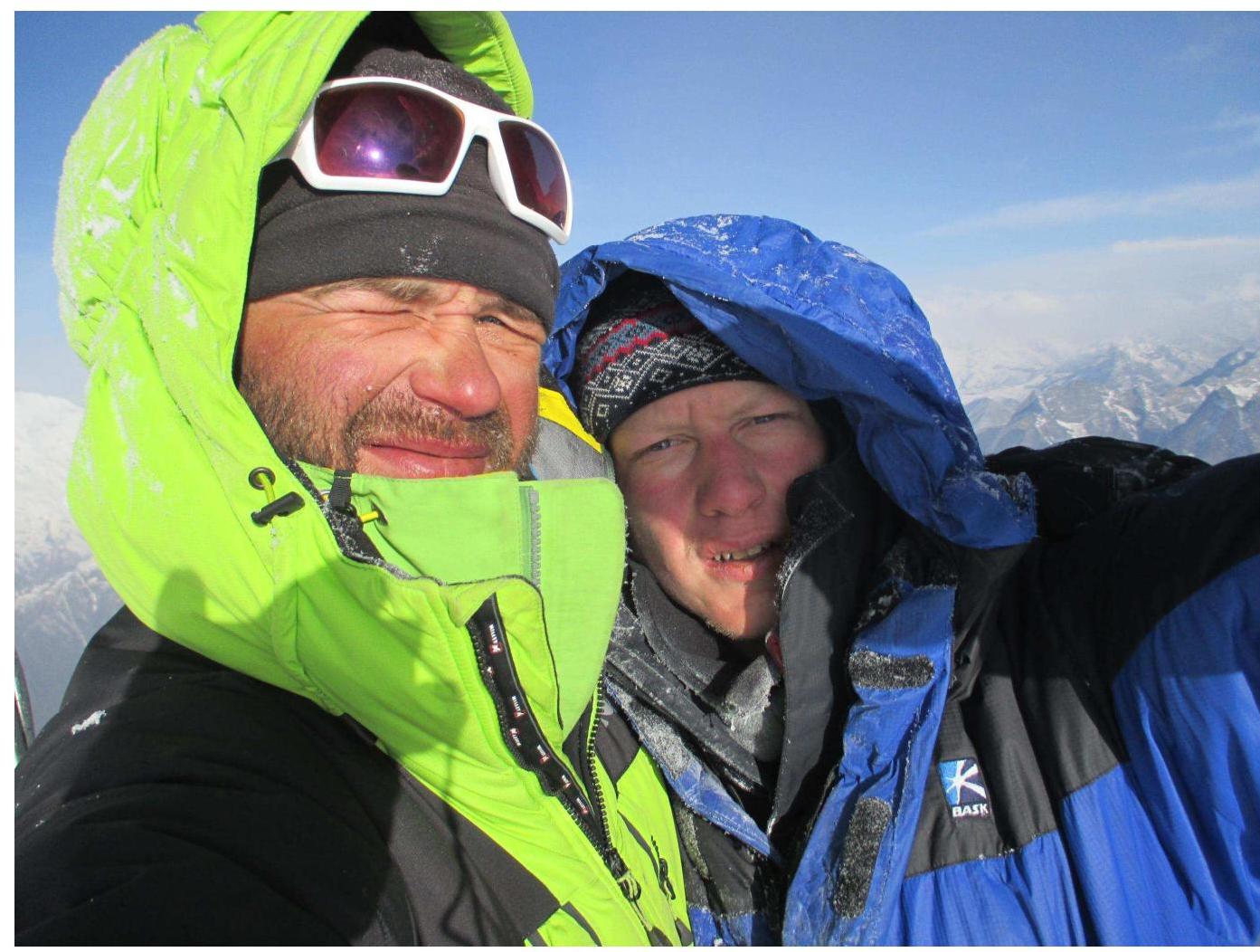
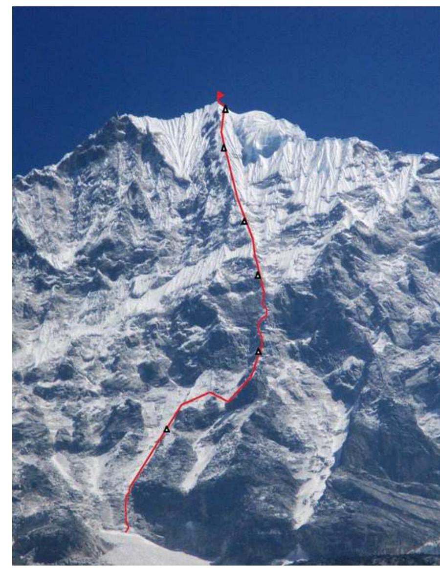
General Summit Photo

- Purple — 1964, New Zealand route led by E. Hillary
- Green — 1979, Japanese route led by Takeshi Kimura
- Red — 2014, "Stecнительная Девушка" (Shy Girl) route, Loncinskiy-Gukov
Profile photo on the right
Drawn profile of the route
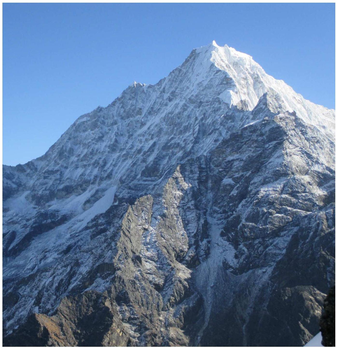
Area Photopanorama

Geographical Description of the Area
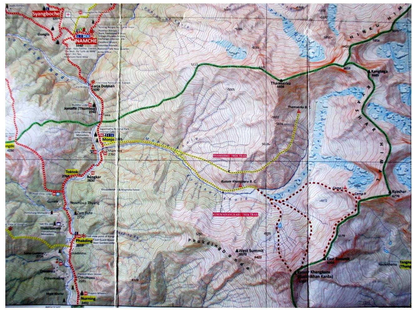
The Tamserku peak (6623 m) is located in Nepal, in one of the numerous southern spurs of the main Himalayan ridge, in the Khumbu region (within the Sagarmatha National Park). Nearby peaks include:
- Kantega
- Kusum Kangaru
- Kyashar
A very popular tourist and climber trail passes a few kilometers from the mountain, leading from Lukla airport to the base camps under Everest and Lhotse. The approach to the southwest wall begins from the Monjo settlement. The trekking trail goes to the base camps of Kusum-Kangaru and Tamserku — the eastern wall. Immediately after the first river, it's necessary to turn off the trail towards the wall, staying to the right of the long ridge. There is no trail here, and one has to make their way through thickets of bushes and numerous rocky screes overgrown with grass. With full backpacks, it takes 2 days to reach the high camp.
It's advisable to organize the base camp under the glacier at the wall at an altitude of 4850 m near the stream. There are good flat areas for several tents.
Weather conditions are favorable for climbing in spring and autumn, as the monsoons prevail in summer and late autumn, with a lot of snow and significantly lower temperatures at high altitudes. In late winter and spring, starting from March, the weather is quite stable, snowfalls are rare, and the air gradually warms up. Most expeditions take place in April-May, only because it's still quite cold in March.
For the first time, a New Zealand team led by E. Hillary ascended Mt. Tamserku in November 1964, starting their route also on the southwest wall, on its right part. Their route began on the right couloir towards the southern ridge. The group reached the ridge at around 5300 m and continued their ascent along the ridge to the summit.
In 1979, a Japanese team led by Takeshi Kimura ascended from the southwest side. Their route starts on the left part of the SW wall, exiting onto the western ridge near the western summit, clearly visible from Namche Bazaar. Then, along the western ridge to the summit.
In 1986, four Spaniards led by Jose Luis Fernandes attempted to climb the SW wall via the central counterfort but descended from an altitude of 6300 m due to:
- lack of fuel
- lack of time.
It's reasonable to descend from the summit via the ascent route to return to the base camp under the wall.
The southern ridge is currently very broken. The western ridge to the western summit also looks very broken from the main summit. However, one can descend via the glacier to the NW side; it's necessary to understand the state of the glacier and the further path down towards Namche Bazaar.
Route Schedule on Mt. Tamserku (6623 m)
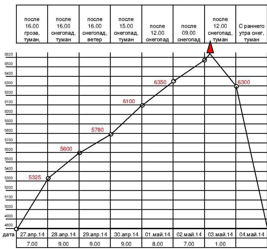
| after 16:00 thunderstorm, fog | after 16:00 snowfall, fog | after 16:00 snowfall, wind | after 15:00 snowfall, fog | after 12:00 snowfall | after 9:00 snowfall | after 12:00 snowfall, fog | Snow from early morning, fog | |
|---|---|---|---|---|---|---|---|---|
| Date | April 27, 2014 | April 28, 2014 | April 29, 2014 | April 30, 2014 | May 1, 2014 | May 2, 2014 | May 3, 2014 | May 4, 2014 |
| Time | 7:00 | 9:00 | 9:00 | 9:00 | 8:00 | 7:00 | 1:00 | — |
Route Progress Table
| Rock, anchor | Protection gear | Ice screws | Bolt pitons | Climbing day | Section № | Length, m | Average steepness, ° | Difficulty |
|---|---|---|---|---|---|---|---|---|
| 12 | April 28, 2014 | R4 | 180 | 60 | V | |||
| 8 | 6 | R2 | 40 | 75 | VI, M4, A2 | |||
| 7 | 6 | R1 | 40 | 75 | VI, M4, A2 | |||
| 12 | R3 | 190 | 50 | V | ||||
| 2 | May 3, 2014 | R15 | 100 | 65 | VI | |||
| 6 | May 2, 2014 | R14 | 260 | 70 | VI | |||
| 5 | 10 | 8 | May 1, 2014 | R13 | 280 | 70 | VI+, M4/M5 | |
| 9 | 12 | 10 | April 30, 2014 | R12 | 300 | 70 | VI+, M4/M5 | |
| 4 | 3 | 4 | R11 | 70 | 70 | VI+, M5 | ||
| 6 | 4 | 2 | R10 | 40 | 80 | VI+, A2, M5 | ||
| 9 | 6 | April 29, 2014 | R9 | 70 | 70 | VI, M4, A2 | ||
| 8 | 10 | R8 | 80 | 65 | VI | |||
| Rappelling down 30 m | R7 | 45 | 55 | V | ||||
| R6 | 50 | 60 | V+ | |||||
| R5 | 120 | 60 | V+ | |||||
| Total: | 56 | 57 | 66 | 0/0 | 2125 |
Technical Photograph of the Route

Route Description
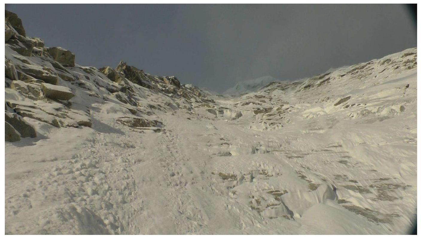
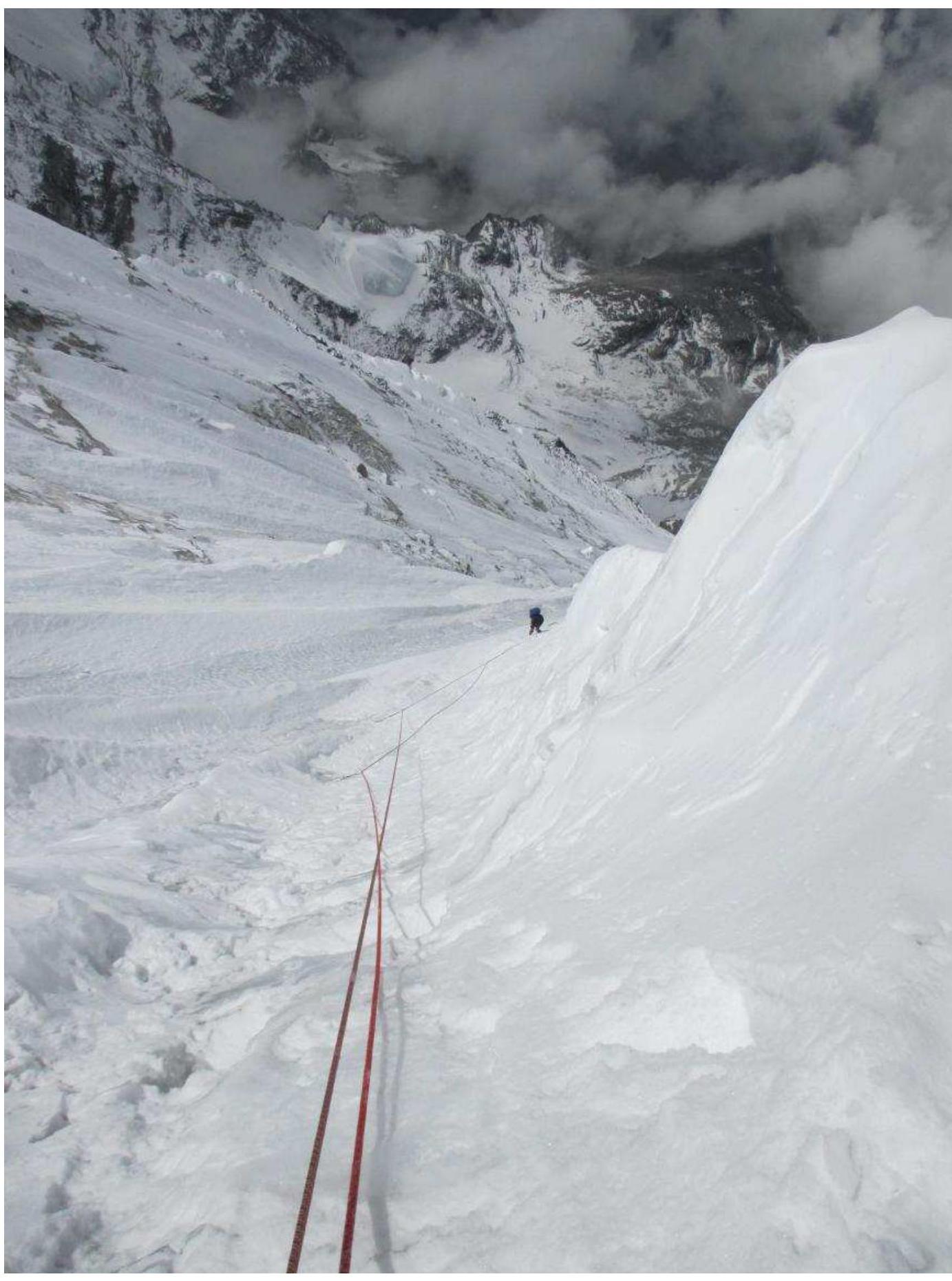
R0–R1. Approach to the wall along the snow-ice slope of the glacier. From the camps, move towards the protruding central rock "paw". Pass to the left of it to the upper part of the ice under the wall, covered with ice.
R1–R2. Start up the inner corner crack with a transition to slabs. 40 m, 75°, aid climbing.
R2–R3. Up the slabs with a series of cracks, exiting into a snow-ice couloir. 40 m, 75°, aid climbing.
R3–R4. Move up the snow-ice couloir, sticking to its right side, insurance on ice screws. 4 ropes, 190 m, 50°.
R4–R5. Continue moving up the couloir, the gradient increases to 60°, 2 ropes of 40 m. In this area, to the right on the rocks, there is a convenient ledge where, after chopping the ice, one can organize a lying bivouac for 2 people.
R5–R6. Continue moving up the couloir, 3 ropes, gradually moving right onto a snow-ice ridge. 120 m, 60°.
R6–R7. Traverse 40 m to the right onto the neighboring snow-ice ridge and rappel 30 m down with a traverse to the right into the neighboring couloir.
R7–R8. One rope up the steep snow-ice ridge towards the rock ridge.
R8–R9. Rock ridge, 2 ropes of 40 m, climbing is complex. Bivouac on a rock ledge. If you clear the shelf, you can lie down comfortably for two. 65°.
R9–R10. Along the rock slabs, 2 ropes of 35 m, with a move to the left to the inner corner to the left of the rock overhang. 70°, partially aid climbing.
R10–R11.
Key Section of the Route
- Up the inner corner and rock slabs;
- Exit to the lower part of the central counterfort;
- Very difficult climbing;
- In bad weather — powder avalanches from the upper part of the wall. Aid climbing. 1 rope, 40 m.
R11–R12. Continuation of the key section — 1 long rope, 80 m, due to the impossibility of organizing insurance when exiting into the snow-ice couloir — slabs covered with flow ice. Exit to the lower part of the central counterfort. The upper ice "gingerbread" is visible. Bivouac on a rock ledge. If you manage to clear the shelf, you can organize a semi-reclining bivouac.
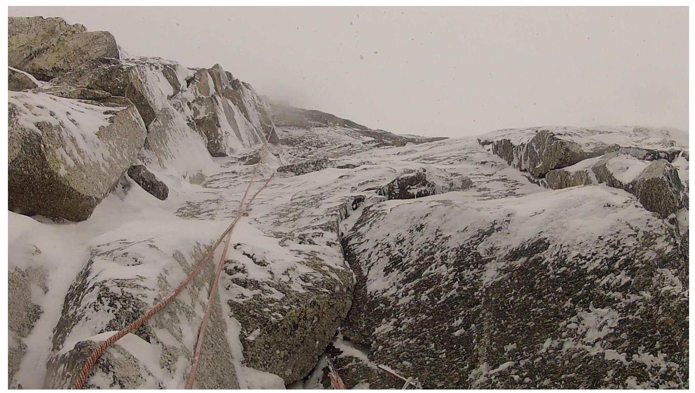
R12–R13. Movement along the central counterfort:
- Slabs and ledges covered with ice or snow;
- Difficult to find insurance spots;
- 330 m up. Bivouac in a dug snow cave — one rope lower. Rocks with a transition to ice and back. 70°.
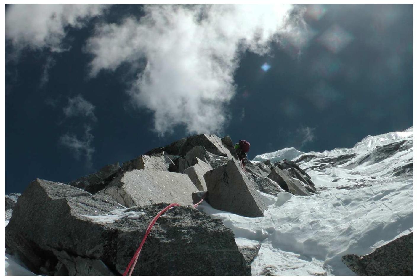
R13–R14. Continuation of movement along the counterfort. The picture doesn't change much, only the "gingerbread" is getting closer. Still, rocks and ice. Another 280 m. Bivouac in an ice mulde due to bad weather.
R14–R15. Up another 4 full ropes, mainly on steep ice on the right part of the counterfort. Then, transition to the right onto the top of the snow-ice "gingerbread". Large area. If you move a bit to the left, you can find a comfortable mulde for a bivouac, which we did due to bad weather. 260 m, 70°.
R15 – summit. Final 2 ropes on snowy firn:
- One rope up towards the summit;
- Then — a rope of steep traverse to the upper part of the snowy summit.
The summit is a series of snowy overhangs.
Photo Illustrations of the Report
Start of the route, sections R1 to R3
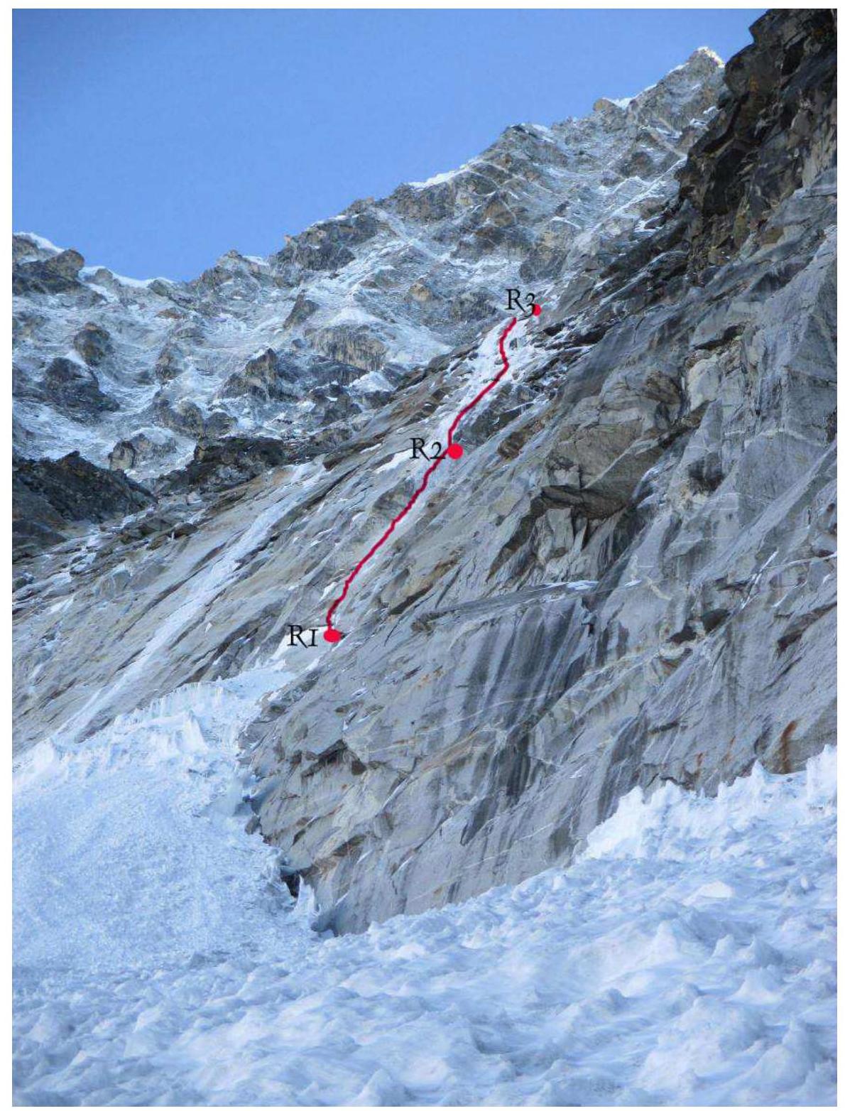
Section R1–R2
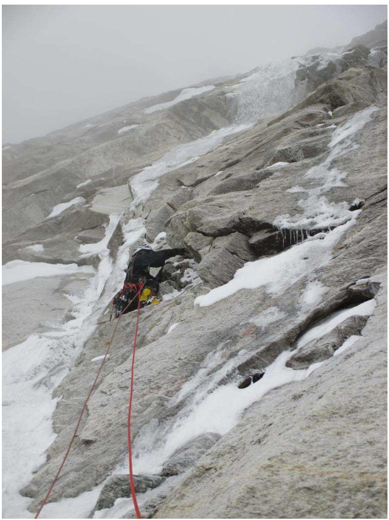
Section R8–R9
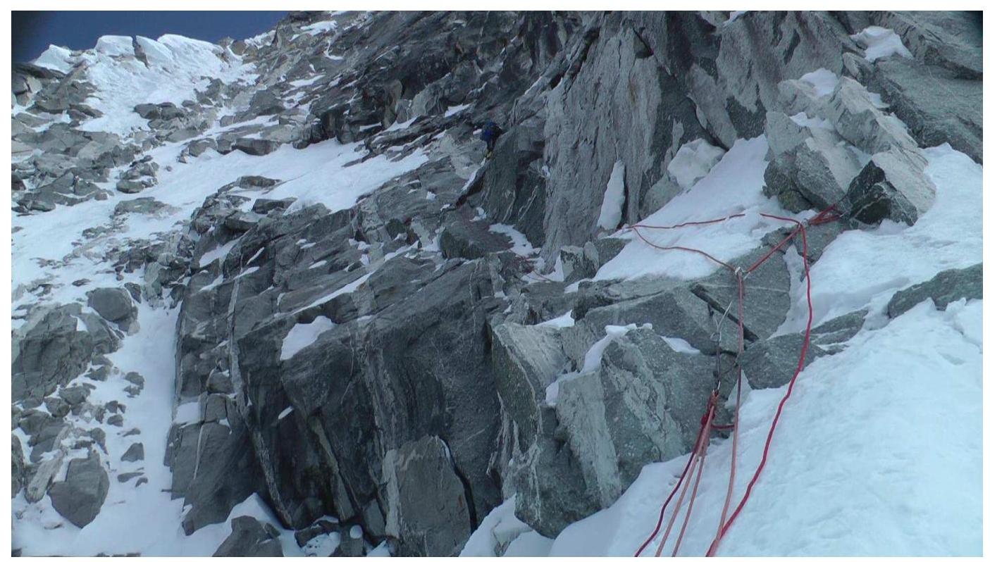
Section R10–R11

Section R11–R12
Section R12–R13
Sections R12–R15
At section R13–R14
Photograph at the summit