Passport
- High-altitude class.
- Central Himalayas, Main Himalayan Range.
- Makalu Peak (8463 m) via the West Face.
- Proposed 6B category of difficulty, first ascent.
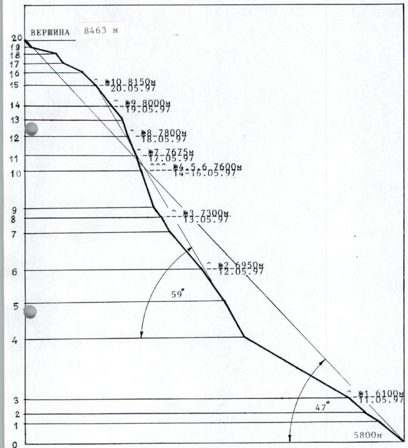
- Elevation gain: 2663 m; route length: 3920 m.
Length of sections:
- 5th category of difficulty — 530 m;
- 6th category of difficulty — 640 m.
Average steepness:
- Wall section of the route — 59° (6500–8150 m);
- Entire route (from the 1st bergschrund) — 47° (5800–8463 m).
- Number of pitons driven:
| Rock | Nuts | Ice |
|---|---|---|
| 92+4 | 139 | 56 |
Left on the route for descent:
- Rock — 26;
- Nuts — 5;
- Ice — 24.
- Team's total climbing hours: 154.5 hours, including preliminary route preparation time; days: 11 and preliminary route preparation days: 11.
- Overnight stays: 1st — 6100 m, lying in a tent. 2nd — 6950 m, lying in a tent. 3rd — 7300 m, lying in a tent. 4th, 5th, 6th — 7600 m, uncomfortable in a tent. 7th — 7675 m, uncomfortable in a tent. 8th — 7800 m, uncomfortable in a tent. 9th — 8000 m, lying in a tent. 10th — 8150 m, lying in a tent.
- Team leader: Khabibullin Salavat Zagitovich — Master of Sports of International Class
Team members: Bolotov Alexey Vasilyevich — Master of Sports Bugachevsky Igor Borisovich — Master of Sports Ermachek Yuri Vladimirovich — Master of Sports Zhilin Nikolai Fedorovich — Master of Sports Pavlenko Dmitry Vladimirovich — Candidate for Master of Sports
-
Coaches: Efimov Sergey Borisovich — Honored Master of Sports, Honored Coach of Russia Mikhaylov Alexander Alexandrovich — Master of Sports, Honored Coach of Russia
-
Departure to the route: May 11, 1997. Summit: May 21, 1997. Return: May 25, 1997.
-
Organization: Sverdlovsk Regional Sports Committee.
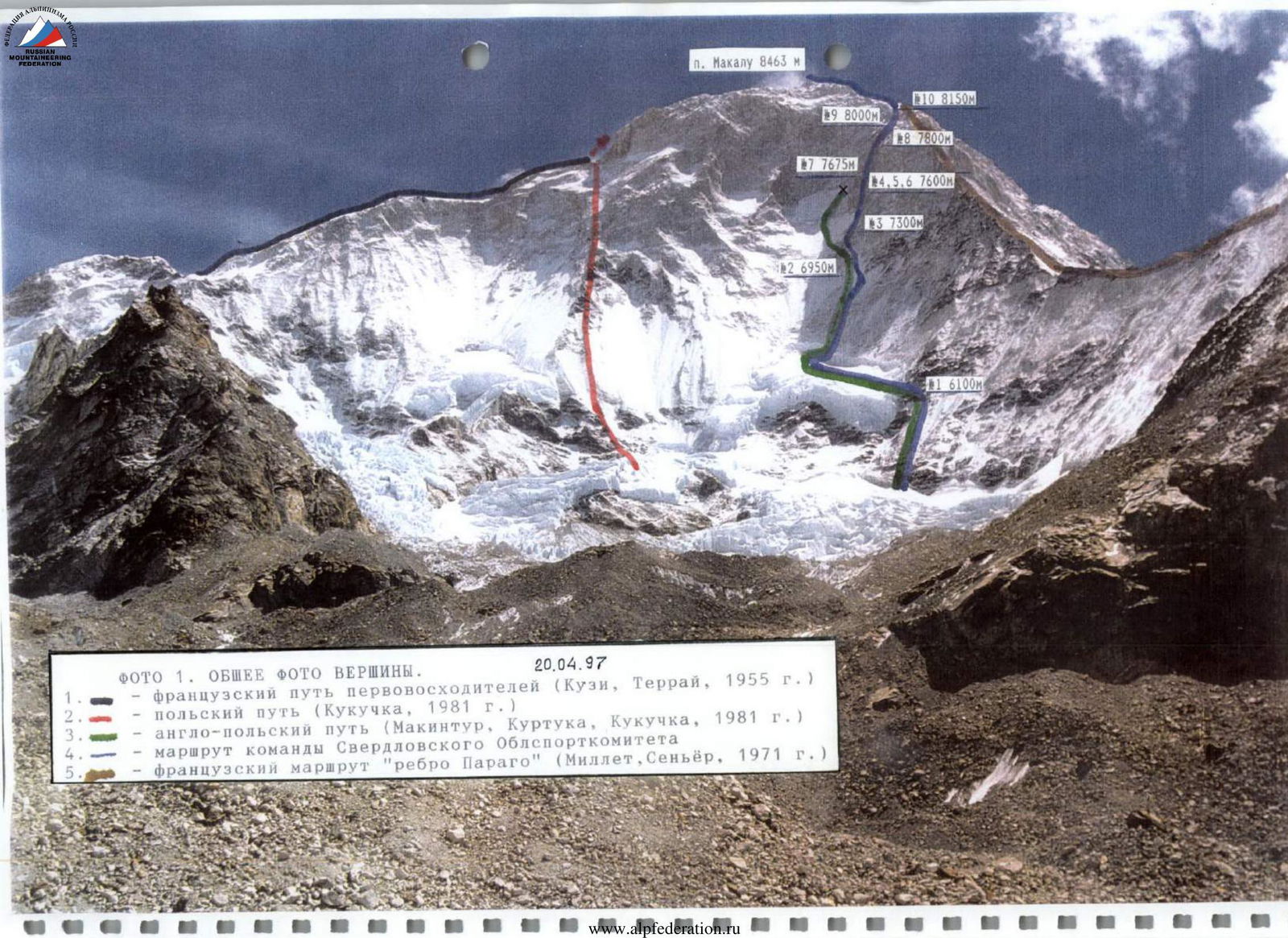
Photo 1. General photo of the summit. April 20, 1997.
- French route of the first ascenders (Couzi, Terray, 1955)
- Polish route (Kukuczka, 1981)
- Anglo-Polish route (Macintyre, Kourtouka, Kukuczka, 1981)
- Route of the Sverdlovsk Regional Sports Committee team
- French route "Paragot Ridge" (Millet, Seigneur, 1971)
Route Profile
Scale 1:15000
Makalu
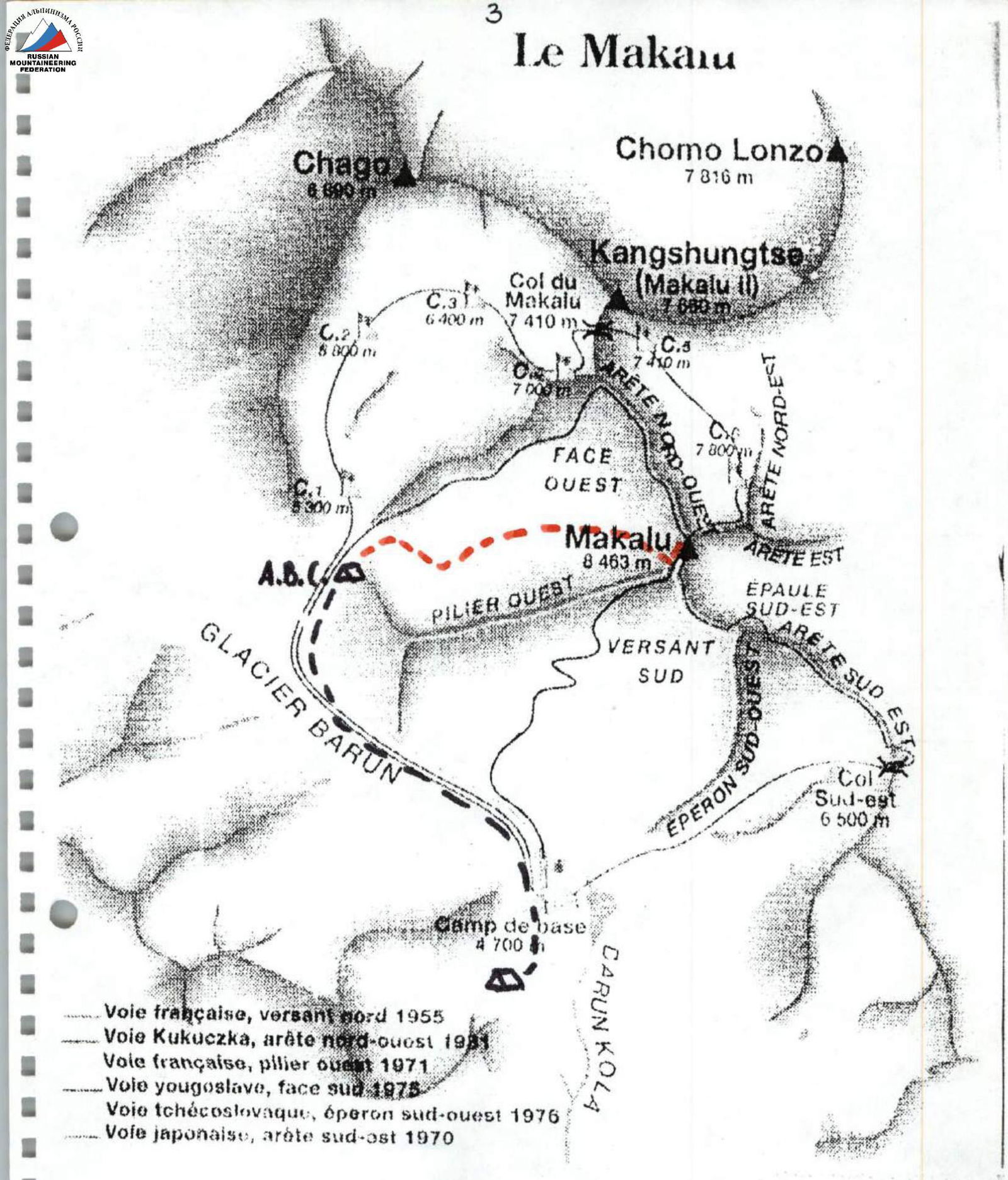
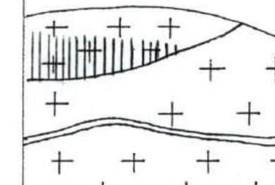
Base Camps
Route of the Russian Expedition Map — Diagram of the area
Brief Overview of the Climbing Area
The Himalayas are the highest mountains in the world, representing a system of giant parallel ranges located from 73° east longitude in the northwest to 96° east longitude in the southeast. The highest range of the Himalayan mountain system is known as the Main Himalayan Range. It stretches from the northwest bend of the Indus to the southeast bend of the Brahmaputra and reaches its maximum height in the Chomolungma massif (8848 m).
The southern neighbor of Chomolungma is Lhotse Peak (8501 m). East of the Lhotse massif, at the intersection of the Main Range and the Arun River, stands the fifth highest peak in the world — the monumental Makalu massif (8436 m).
In 1955, on May 15th, two members of a French expedition, Jean Couzi and Lionel Terray, first ascended the summit via the route through the North Col. Since 1981, attempts to climb the West Face by renowned climbers began. The challenging West Face remained unconquered.
It was chosen by the team from the Sverdlovsk Regional Sports Committee as the objective and was climbed as part of this year's Russian Championship in the high-altitude class.
Cargo and some team members were transported to the base camp (4600 m) under the South Face by helicopter from Lukla; trekking to the base camp from Hille takes twelve days. It takes 14 hours by bus from Kathmandu to Hille. The approach to the advanced base camp (ABC) under the West climate zone takes 4 hours. The height of ABC is 5300 m.
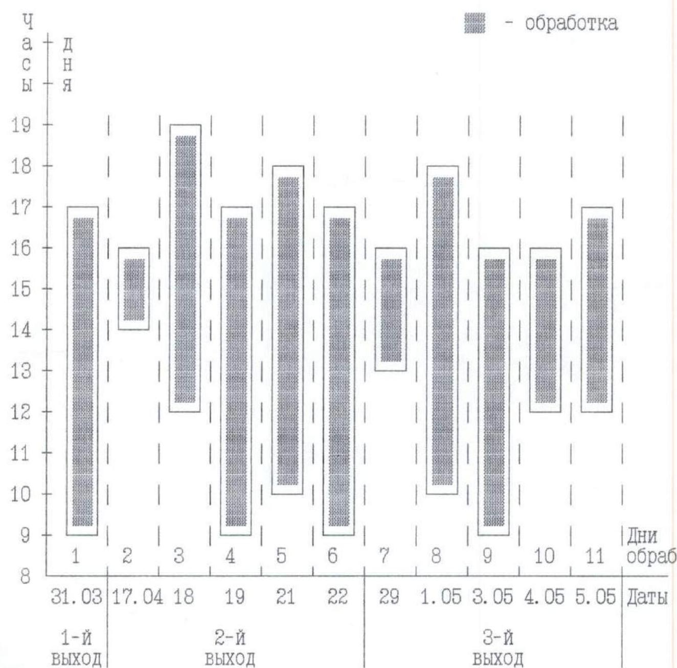
Ascent Schedule

Processing Schedule
Tactical Actions of the Team
The main factors in developing the tactical plan were:
- The route's significant steepness, length, and elevation gain,
- The combined nature of the terrain with frequent changes in its forms,
- The location of the main problematic wall sections above 7500 m, difficult to pass and organize safety,
- The absence of natural platforms for tents,
- The psychological tension of the route,
- The need to achieve a sufficient level of acclimatization for an oxygen-free ascent to an eight-thousander.
Accordingly, a tactical plan was developed, providing for the following:
- A reconnaissance sortie to determine the ascent path to the wall section of the route, processing the start of the route (5800–6100 m), and selecting a site for a camp at 6100 m,
- An acclimatization sortie to 7000 m to organize a camp at 6500 m (the second bergschrund from the start of the route), processing the route to 7000 m, and setting up a camp at this height,
- An acclimatization sortie to 7500 m for further route processing from 7000 m, organizing a camp at 7300 m, and reaching 7500 m to clarify the complexity of the main section of the rock bastion (7300–8150 m),
- A summit push and climbing the route from 7300 m to the summit (8463 m) in alpine style,
- Planned overnight stays at approximately 7600 m, 7650 m, 7800 m, 8000 m,
- A summit push from the last camp at around 8150–8200 m,
- Conducting acclimatization sorties and preliminary route processing by two groups of 3–4 people,
- The possibility of processing the route to a significant height during the ascent (taking six ropes) if the terrain or weather conditions require it,
- Climbing the main part of the route from 7300 m with interaction between rope teams, leading without a backpack, working on a double rope,
- Visual and radio communication between the team and the base camp,
- Descent from the summit via the ascent route using a significant number of fixed ropes on processed sections,
- Presence of a rescue team of three people (Mikhaylov, Efimov, Belkov) at the base camp, acclimatized to 6500 m.
According to the tactical plan, the duo Bolotov and Khabibullin processed the start of the route (5800–6100 m) and determined the location of Camp 2 before the caravan arrived from Hille. The first camp was established at a height of 5700 m on March 29.
Acclimatization sorties:
- First — to 6100 m, from April 8 to 14;
- Second — to 7200 m, from April 16 to 23;
- Third — to 7600 m, from April 26 to May 6.
On May 11, the first trio of climbers — Bugachevsky, Zhilin, Ermachek — left the base camp at 5300 m (ABC) to further process the route and attempt the ascent. Two days later, the second trio — Khabibullin, Bolotov, Pavlenko — left ABC. On May 16, both groups joined at Camp #6 (7600 m) to continue the ascent under Khabibullin's leadership. During further movement, the overnight stays also corresponded to those planned according to the tactical plan.
Key points of the route:
- Camp #7 (7675 m) — May 17;
- Camp #8 (7800 m) — May 18;
- Camp #9 (8000 m) — May 19;
- Camp #10, roof of the wall (8150 m) — May 20;
- Summit — May 21.
The good technical preparation of all participants allowed for regular rotation of the lead climber. During the ascent, the following were carried out:
- Changing the lead climber during the day;
- Changing rope teams every day.
The team was equipped with:
- A first-aid kit with a sufficient supply of medications;
- Two gas burners;
- Gas in sufficient quantity;
- MSR burners in lower camps;
- An oxygen cylinder for medical purposes;
- Reliable high-altitude "Kanchenjunga" tents.
| Pitons | UIAA Route Diagram Scale 1:2000 | Section # | Category of difficulty | Length (m) | Steepness (°) | ||
|---|---|---|---|---|---|---|---|
| Rock | Nuts | Ice | |||||
| - | - | - |  | R4 | 3 | 800 | 30 |
| 5 | 2 | 1 |  | R3 | 5 | 150 | 46 |
| - | - | 4 |  | R2 | 3 | 120 | 32 |
| 5 | 4 | - |  | R1 | 4 | 200 | 40 |
| Pitons | UIAA Route Diagram Scale 1:2000 | Section # | Category of difficulty | Length (m) | Steepness (°) | ||
|---|---|---|---|---|---|---|---|
| Rock | Nuts | Ice | |||||
| 5 | - | 6 |  | R9 | 4 | 80 | 54 |
| 2 | 2 | 3 | 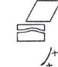 | R8 | 5 | 100 | 60 |
| 12 | 2 | 11 | 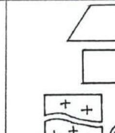 | R7 | 4 | 340 | 50 |
| - | - | 10 | 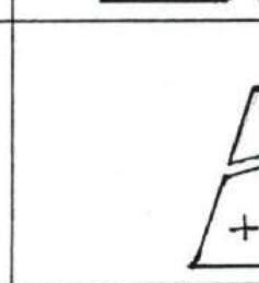 | R6 | 4 | 250 | 55 |
| 6 | 2 | 8 | 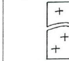 | R5 | 5 | 280 | 60 |
| Pitons | UIAA Route Diagram Scale 1:2000 | Section # | Category of difficulty | Length (m) | Steepness (°) | ||
|---|---|---|---|---|---|---|---|
| Rock | Nuts | Ice | |||||
| 15 | 30 | - |  | R13 | 6 | 100 | 75 |
| 10 | 32 | 4 |  | R12 | 6, A3 | 150 | 65 |
| 10 | 18 | 7 |  | R11 | 6, A3 | 140 | 70 |
| 18 | 14 | 2 |  | R10 | 6, A3 | 250 | 72 |
| Pitons | UIAA Route Diagram Scale 1:2000 | Section # | Category of difficulty | Length (m) | Steepness (°) | ||
|---|---|---|---|---|---|---|---|
| Rock | Nuts | Ice | |||||
| - | - | - |  | R17 | 3 | 200 | 25 |
| - | - | - |  | R16 | 3 | 100 | 45 |
| - | 12 | - | 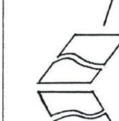 | R15 | 3 | 200 | 50 |
| 4 | 17 | - | 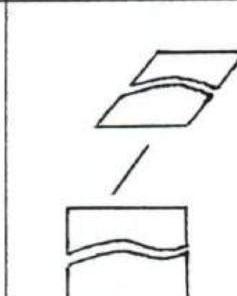 | R14 | 4 | 140 | 45 |
| Pitons | UIAA Route Diagram Scale 1:2000 | Section # | Category of difficulty | Length (m) | Steepness (°) | ||
|---|---|---|---|---|---|---|---|
| Rock | Nuts | Ice | |||||
| SUMMIT 8463 m | Total 154.5 climbing hours, including preliminary processing and route processing on ascent days. | ||||||
| - | - | - |  | R20 | 3 | 40 | 35 |
| - | - | - |  | R19 | 2 | 200 | 20 |
| - | 4 | - |  | R18 | 4 | 80 | 40 |
Route Description by Sections
Section R0–R1. After crossing the bergschrund via a snow-ice bridge, a series of 15–20 m ice-filled rock steps and inclined slabs lead to the base of a characteristic snow-ice blade.
Section R1–R2. Snow-ice blade. For organizing rope anchors, the following were used:
- Snow anchors;
- Ice screws.
Section R2–R3. Movement towards the right edge of the second step of the Makalu West Face cirque. The second half of the section completes the ascent to the first overnight stay location (6100 m) with a complex traverse across smooth slabs and a small rock step with rime ice.
Section R3–R4. Snow-ice slope with open crevasses. Movement towards the center of the second step of the glacier, where the bergschrund has the smallest gap. Simultaneous movement in rope teams.
Section R4–R5. After exiting the bergschrund (intermediate camp at 6500 m), alternating sections of steep winter ice with high hardness and smooth rock slabs. The overall steepness of the section is about 60°.
Section R5–R6. Snow-ice slope with rock outcrops. Movement towards the left edge of the "nose" of characteristic black rocks to the second overnight stay location.
Section R6–R7. Snow-ice slope transitioning into a series of rock steps and slabs requiring piton protection.
Section R7–R8. At the beginning of the section, a couloir with rime ice. Then movement is mainly across monolithic rock terrain. Choosing locations for intermediate protection is challenging. At the end of the section, a steep snow-ice slope hosts the third overnight stay on the route (7300 m).
Section R8–R9. Snow-ice ascent.
Section R9–R10. One of the most challenging rock sections of the route. Tense climbing using some ITO in certain places. The section ends with a snow-ice blade where the fourth overnight stay was organized, and further route processing was conducted during the ascent. At this location, according to the tactical plan, the second trio from the base camp joined the first, and further work was carried out by the entire group of six.
Section R10–R11. A key section of the route. Extremely difficult climbing, including traverses. A thirty-meter section of the wall was climbed entirely on ITO. At the end of the section is overnight stay #7. Height 7675 m.
Section R11–R12. The steepness of this section is slightly less than the previous one. Climbing remains complex and tense, with ITO used in certain places where the relief is overhanging.
Section R12–R13. The last technically challenging section before reaching the roof of the wall. Climbed using free climbing.
Section R13–R14. The terrain becomes technically simpler. At the end of the section is overnight stay #9. Height 8000 m.
Section R14–R15. A series of steps, ridges, and slabs leading to the roof (8150 m) of the Makalu West Face.
Section R15–R16. Exit onto the West Ridge of the summit.
Section R16–R17. Movement along the West Ridge.
Section R17–R18. For passage, 4 nuts and pitons left by previous climbers were used, as well as ropes fixed to them.
Section R18–R19. Continuation of the West Ridge.
Section R19–R20. Pre-summit ascent. Exit to the summit.
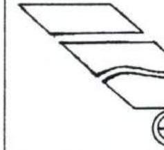
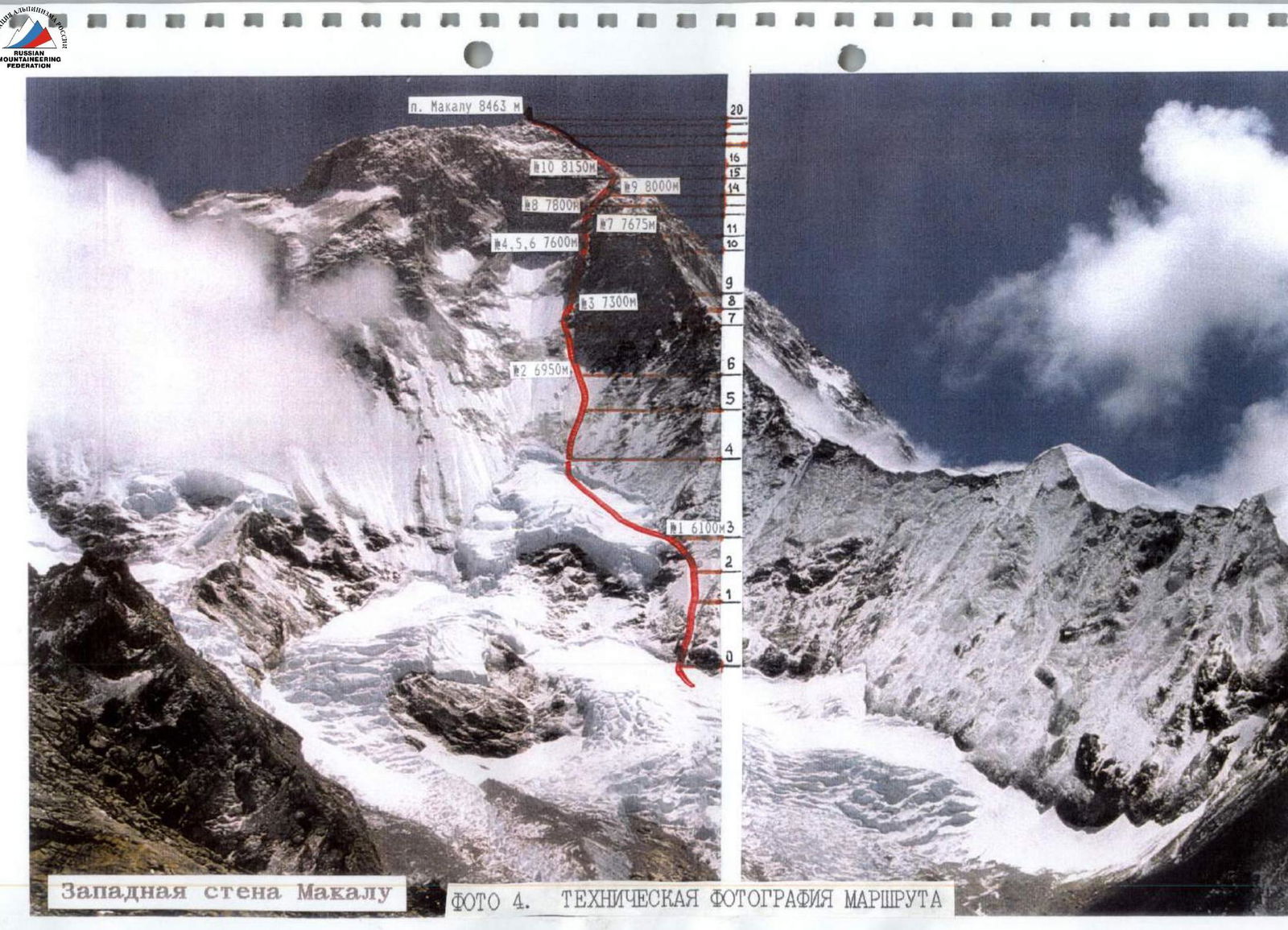 Photo 4. Technical photograph of the route.
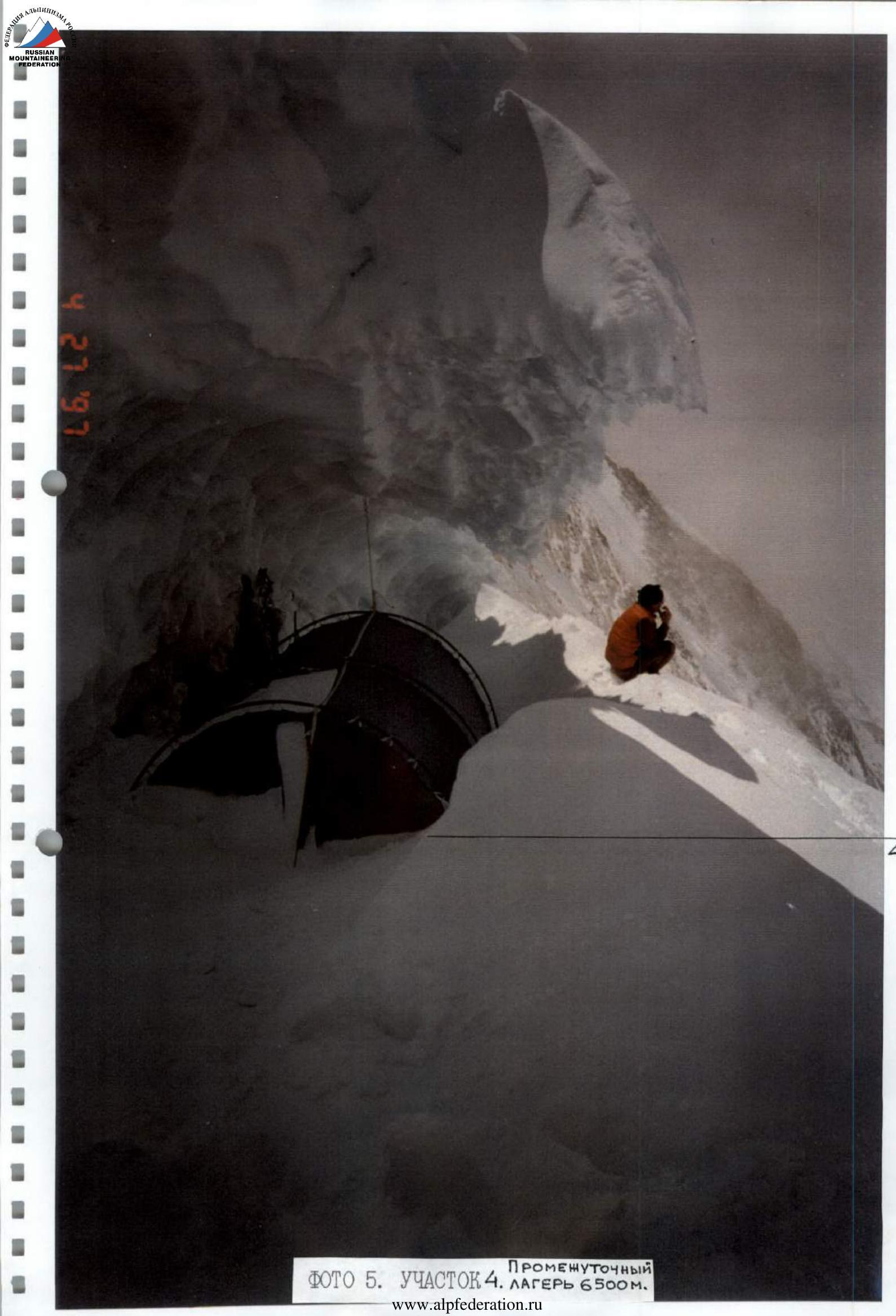 Photo 5. Section R4. Camp at 6500 m.
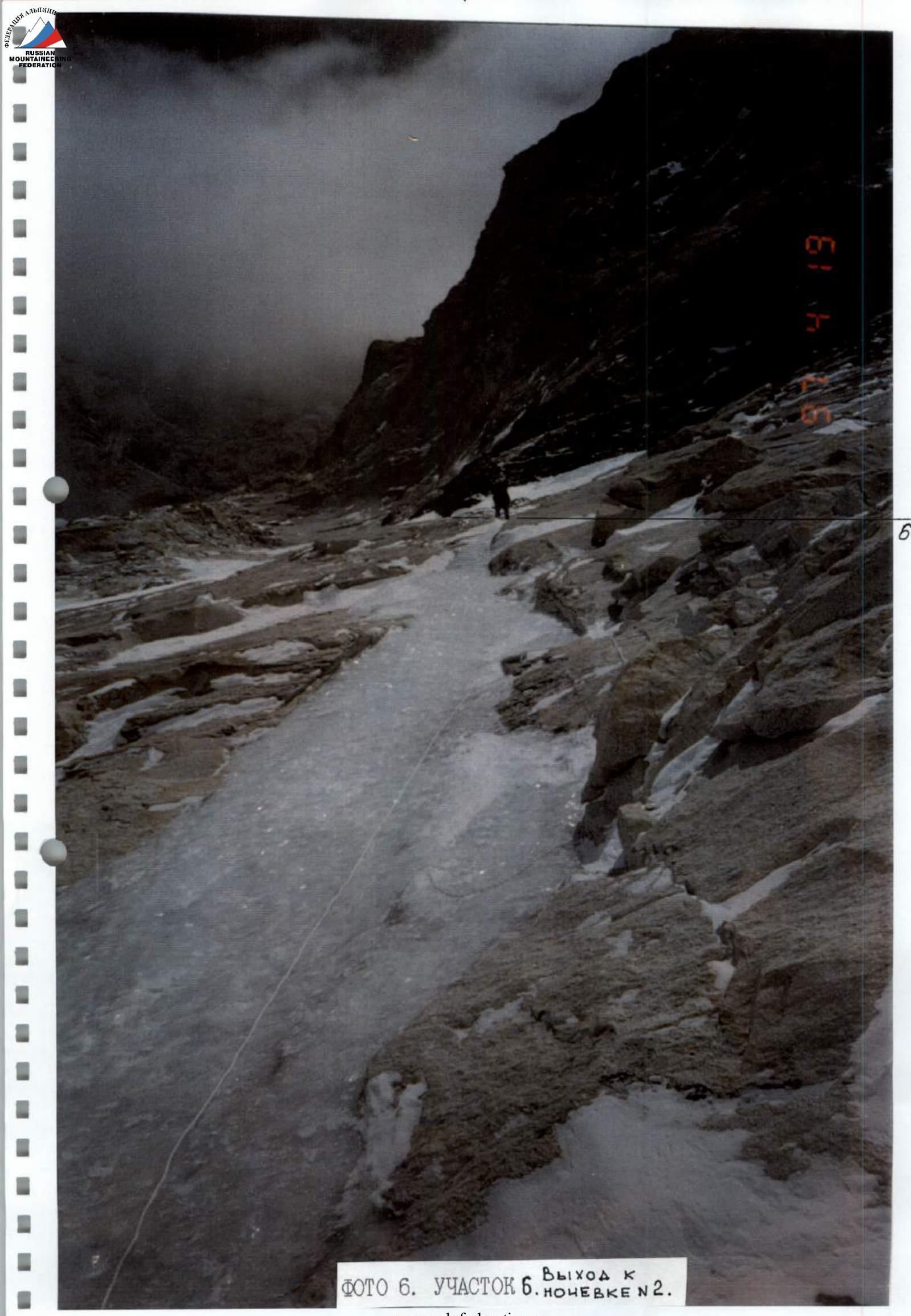 Photo 6. Section R6. Overnight stay #2.
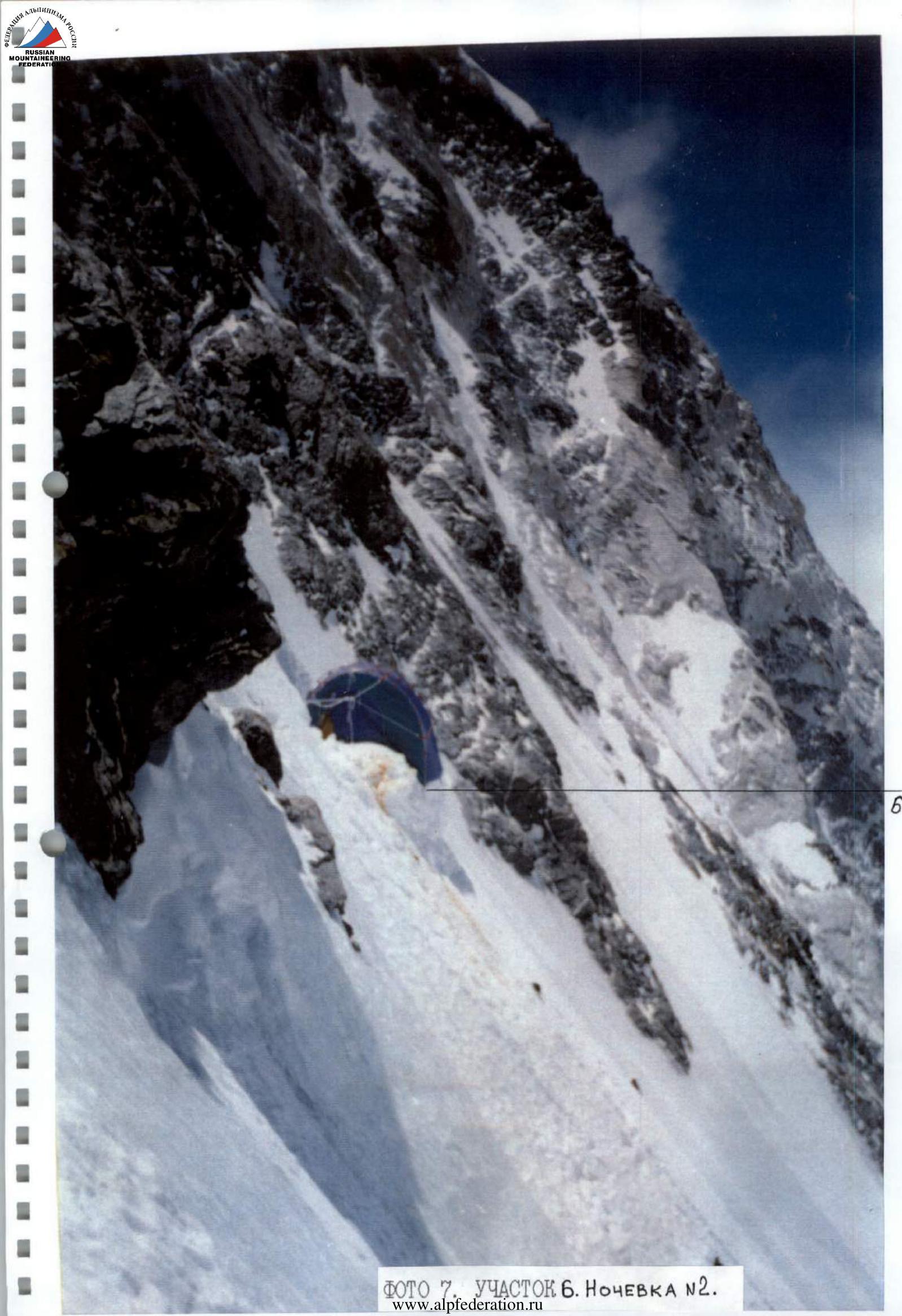 Photo 7. Section R6. Overnight stay #2.
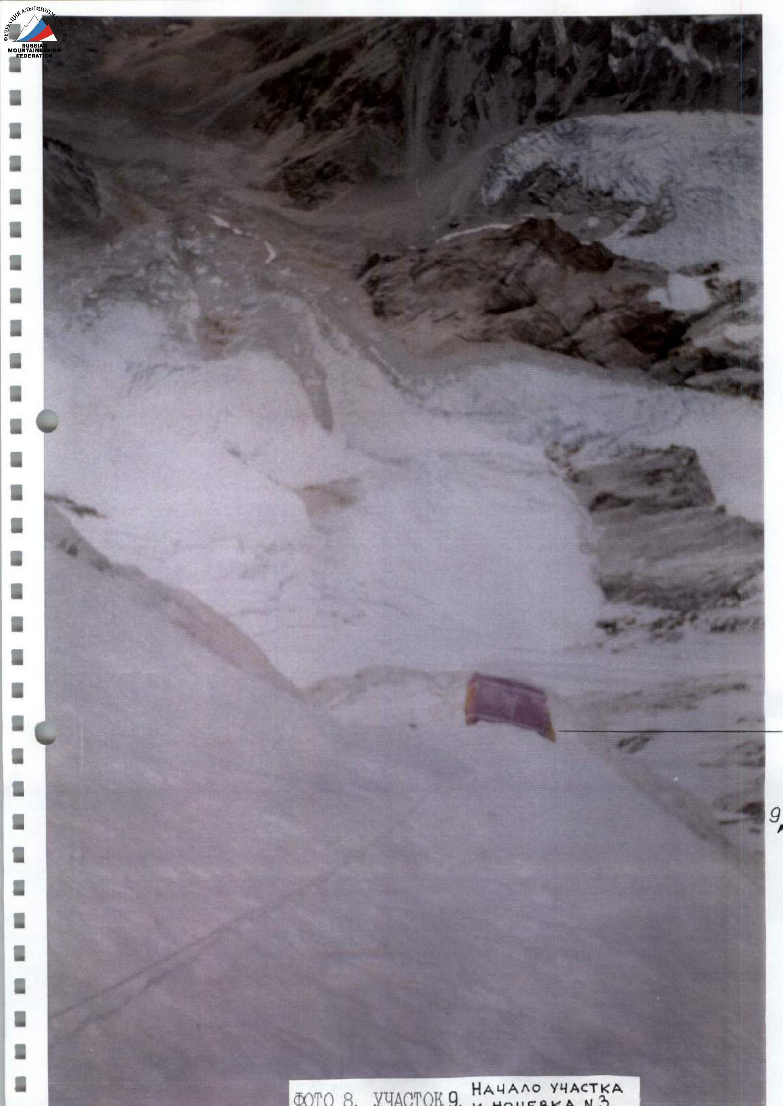 Photo 8. Section R9. Beginning of the section and overnight stay #3.
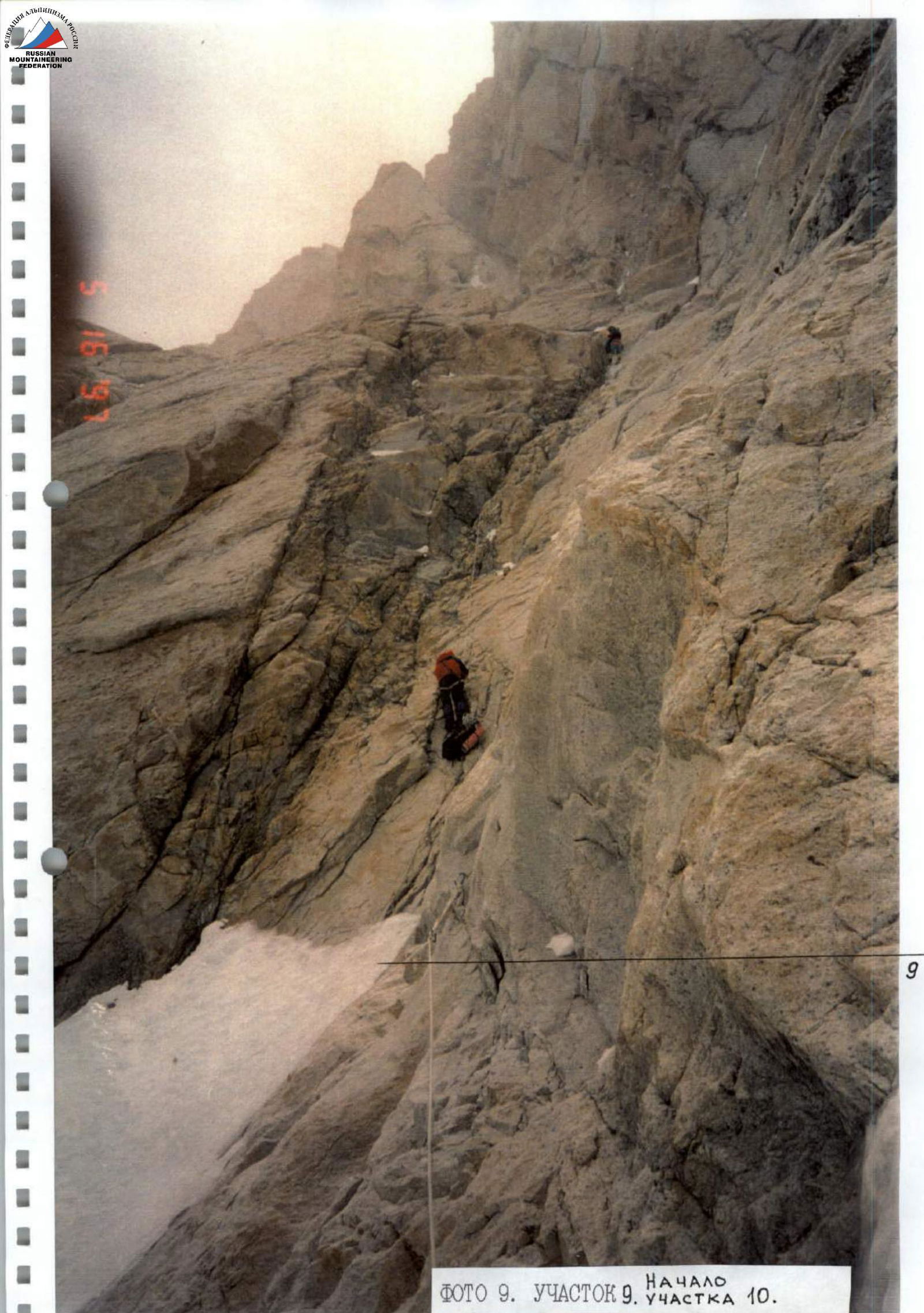 Photo 9. Section R9. Beginning of section R10.
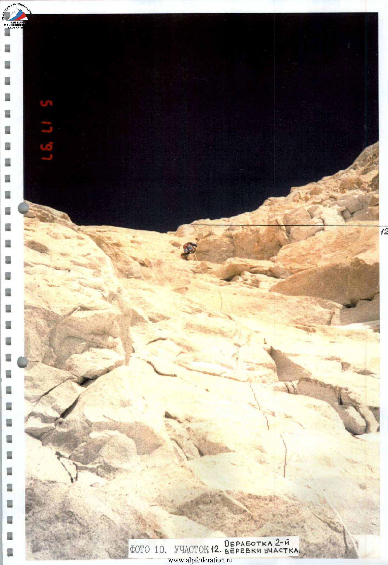 Photo 10. Section R12. Processing the second rope of the section.
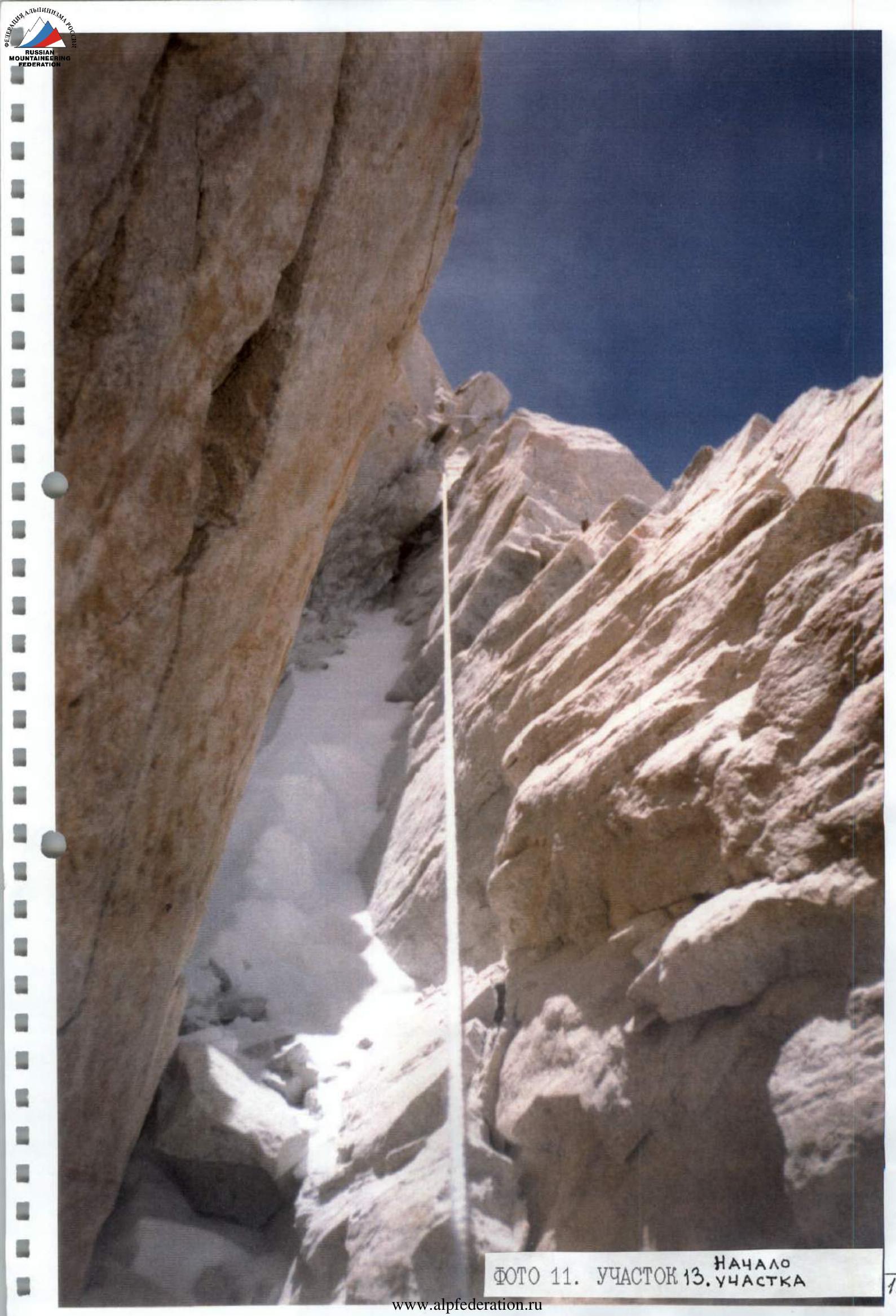 Photo 11. Section R13. Beginning of the section.
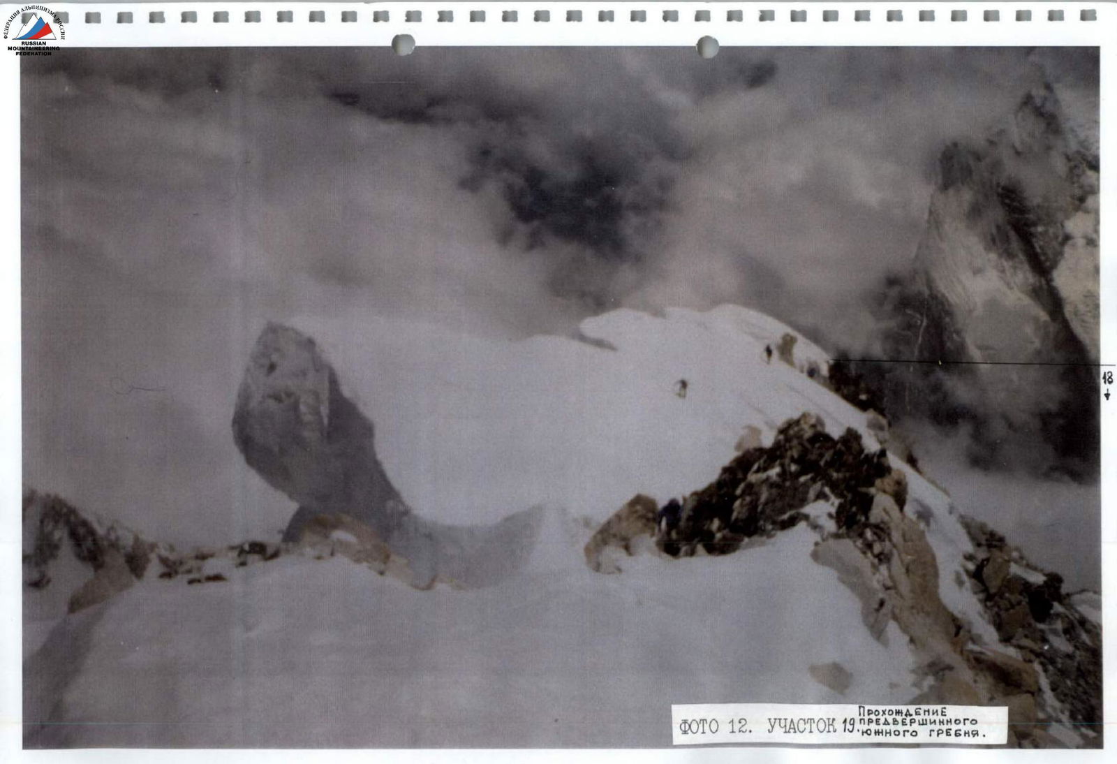 Photo 12. Section R19. Climbing the pre-summit south ridge.


