Ascent Record
To the summit of Island Peak 6130 m, Himalayas, Nepal
- Region — Himalayas, Nepal
- Summit — Island Peak 6130 m.
- Assumed category — 2B
- Route type — combined
- Route description:
Height difference from Island Peak Base Camp — 970 m (5160–6130), route length — 1500 m.
Section lengths:
- Category 1 complexity — 400 m
- Category 2 complexity — 350 m
Sections by complexity category:
- Category 3 complexity — 600 m
- Category 4 complexity — 150 m
Steepness of the most difficult sections — from 80 to 90 degrees.
Average steepness of the entire route — 60°
- Pitons used on the route:
- Ice screws — 15 pcs.
- Rock pitons — 0 pcs.
- Number of climbing hours on August 13, 2012 (12 hours):
from Island Peak BC (5160 m) to the start of the route — (2:00 — 2:20) along scree and trail to a series of rock walls — (2:20 — 4:20) ascent through rock walls to icefall — (4:20 — 6:30) ascent to the glacier and work until the ice-snow wall — (6:45 — 8:15) ascent up the ice-snow wall to the ridge — (8:15 — 11:00) ascent along the ridge to the summit — (11:00 — 11:30) descent via the ascent route — (12:00 — 14:00)
- Leader Gaynullin Timur Talgatovich, Candidate for Master of Sports
Team Members:
Karpeno Alexey Alexandrovich, Candidate for Master of Sports. Hakimullin Sergey, 1st sports category. Krutikov Pavel, 1st sports category. Yablonskikh Olga, 2nd sports category. Malysheva Anna, 2nd sports category. Ezhova Masha, 2nd sports category. Balin Evgeny, 2nd sports category. Cherkashina Elena, 2nd sports category.
9. Team Coach:
Gaynullin Timur Talgatovich, Candidate for Master of Sports
- The ascent was organized by the Tyumen Regional Federation of Alpinism.
Person responsible for the report — Gaynullin Timur Talgatovich. Email: teent@bk.ru
Map of the region.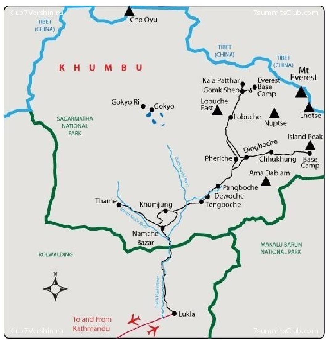
Route description by sections.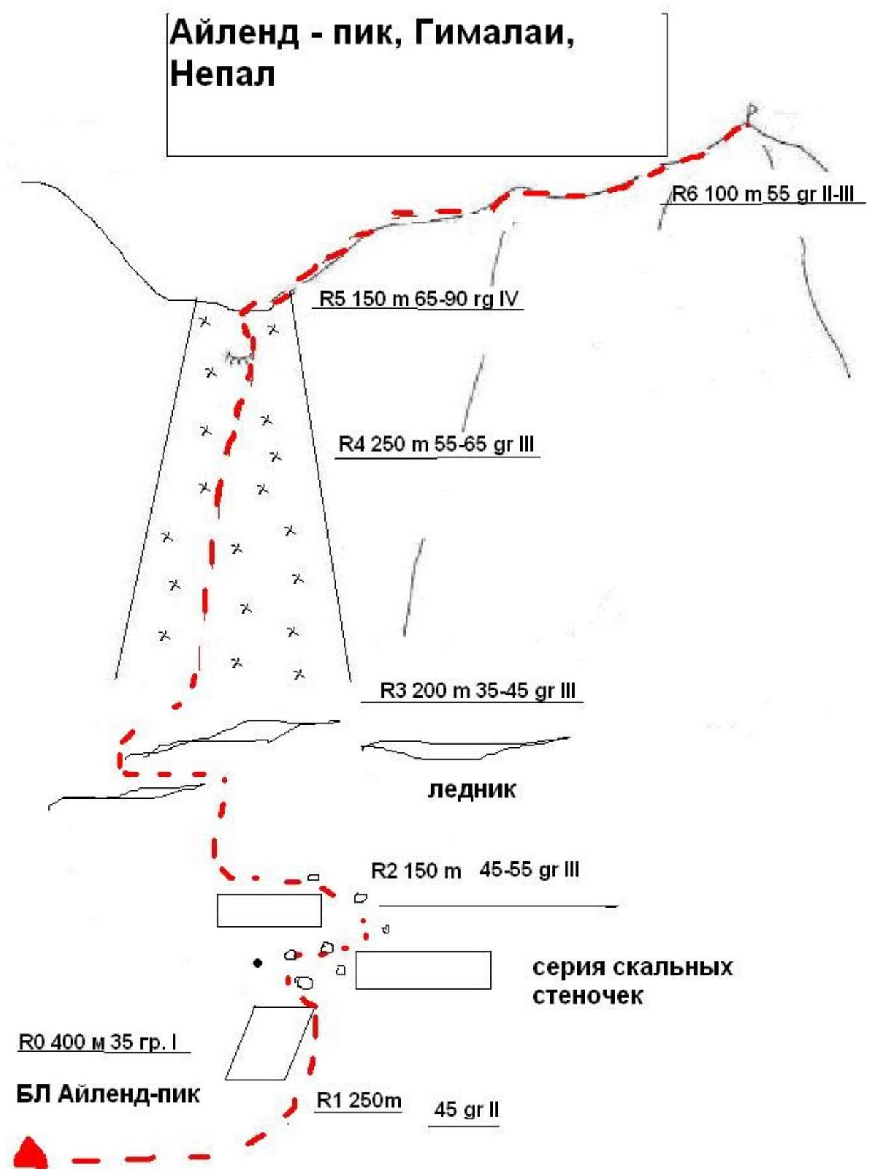
Equipment can be rented in Chukung (4900 m), the last settlement before Island Peak Base Camp. It's essential to arrange for food at the base camp, as not all local "canteens" are willing to accommodate climbers at a reasonable price. Here are approximate rental prices for equipment in May 2012, in rupees (to convert to rubles, divide by 3, price per day):
- Mat — 300 rupees
- Ice axe — 300–500 rupees (Black Diamond, Camp)
- Tent — 600 rupees (The North Face)
- Small gas cylinder — 1000 rupees
- Kovea gas burner — 2000 rupees
- Rope (static or dynamic, doesn't matter) — 1000 rubles, available at Island Peak BC for 2000 rubles
Approach from Island Peak BC (5160 m): move along the gorge via the trail, guided by cairns. Notably, throughout the ascent to the icefall, it's necessary to follow the cairns, which are abundant along the route.
R0–R1 — from BC, move along the trail. Average steepness 35 degrees.
R1–R2 — The trail gradually transitions into a steeper slope, which should be traversed until reaching rock walls of moderate complexity. Belaying is not strictly necessary here, as the rock walls largely consist of "ram's foreheads" with good footholds and handholds. In some places, stone steps have been constructed for convenience.
Just before exiting onto the glacier, there's a small rocky outcrop that may be icy in the morning. Here, it's recommended to:
- rope up,
- traverse with alternating belays,
- secure the rope to the terrain (approximately 10 m traverse).
The section ends at a large icefall, which one literally runs into. Here, everyone typically:
- puts on harnesses, crampons, carabiners, and helmets,
- leaves unnecessary gear (trekking poles, etc.).
MANDATORY ROPE-UP before entering the glacier. Average steepness 45°.
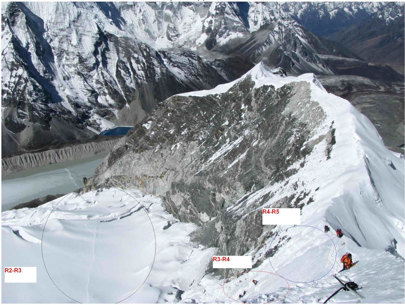
R2–R3 — to the right, there's a relatively gentle exit onto the glacier (exposed), followed by movement in ropes across the glacier. There are a couple of unpleasant spots where the path goes through snow-covered crevasses (usually following the trail of previous climbers), but safer routes can be chosen if the leader has extensive glacier travel experience. Average steepness 45°.
R3–R4 — this part of the route is typically crowded with groups. Some groups may not speak English and disregard safety rules, potentially ending up above you and swinging crampons overhead.
Three fixed rope lines are hung. The ropes are in average condition, with a diameter of approximately 9–10 mm. It's said that the ropes are updated. We advise bringing your own ropes for fixing — it's much safer.
Every 30–50 m:
- there's a belay station to switch to the next rope line,
- ice screws are screwed in,
- anchors are made.
R4–R5 — the key section of the route. A continuation of the same ice wall but with a steeper incline. Exit onto the ridge. The belay station has many ice screws. Average steepness 90°.
R5–R6 — movement along the ridge on fixed ropes to the summit, staying on the right side.
GENERAL VIEW OF THE ROUTE
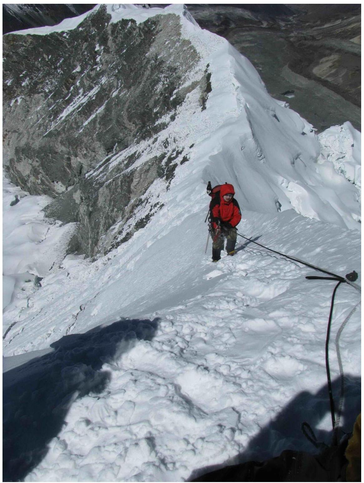
Section R5–R6
Ascent along the ridge to the summit
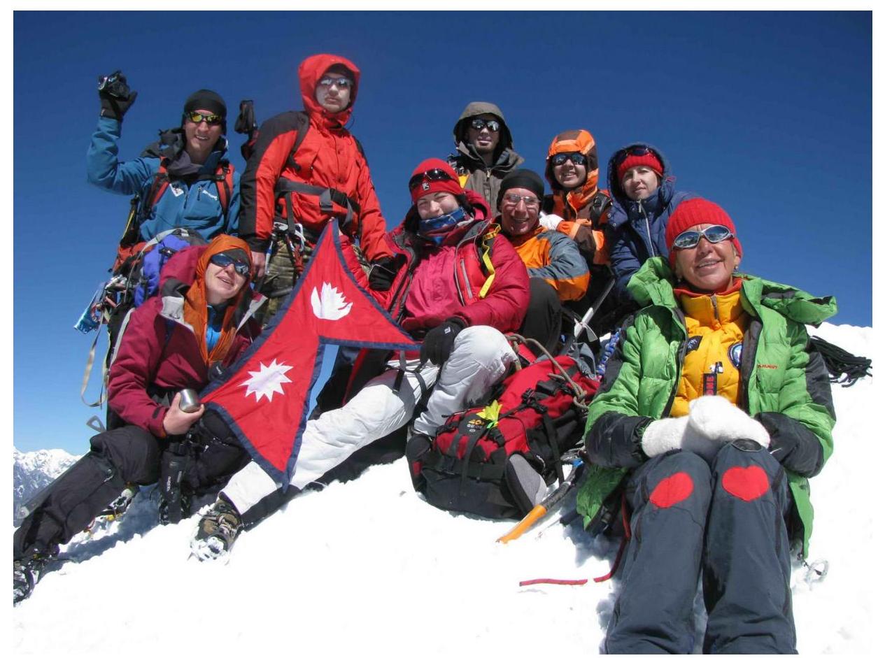
Team at the summit on May 13, 2012