
Report
On the first ascent of golets Babkha via the North-Eastern edge, approximately category 2B complexity, by the Baikal Alpine School team on June 1, 2020.
I. Ascent Report
| № | 1. General Information | |
|---|---|---|
| 1.1 | Full name, sports rank of the leader | Afanasyev A.E. — MS |
| 1.2 | Full name, sports rank of participants | Cherepanov A.V. — CMS |
| 1.3 | Full name of the coach | Afanasyev A.E. — MS |
| 1.4 | Organization | Baikal Alpine School |
| 2. Characteristics of the ascent object | ||
| 2.1 | Region | Baikal Highlands, Khamar-Daban ridge |
| 2.2 | Valley | Porozhiste |
| 2.3 | Number according to the 2013 classification table | 9.17. |
| 2.4 | Name and height of the peak | golets Babkha 2061 m |
| 2.5 | Geographical coordinates of the peak (latitude/longitude), GPS coordinates (1) | 51.5328; 104.0867. |
| 3. Characteristics of the route | ||
| 3.1 | Route name | NE edge |
| 3.2 | Proposed category of complexity | 2B |
| 3.3 | Degree of route development | First ascent |
| 3.4 | Nature of the route terrain | Combined |
| 3.5 | Elevation gain of the route (altimeter or GPS data) | 360 |
| 3.6 | Route length (in meters) | 540 |
| 3.7 | Technical elements of the route (total length of sections of various complexity categories with indication of terrain type: ice-snow, rock) | 1st cat. complexity combined — 198 m. 2nd cat. complexity rock/combined — 255 m. 3rd cat. complexity rock/combined — 35 m. 4th cat. complexity rock/combined — 13 m. 5th cat. complexity rock/combined — 39 m. Dülfer descent (on descent) — no |
| 3.8 | Descent from the peak | Along the NW ridge to the Semnadtsati sboros |
| 3.9 | Additional route characteristics | Presence of water: snow on the northern side |
| 4. Characteristics of the team's actions | ||
| 4.1 | Time taken (team's walking hours, in hours and days) | 7 hours 10 minutes. One day. |
| 4.2 | Overnights | no |
| 4.3 | Start of the route | 9:00, June 1, 2020 |
| 4.4 | Reaching the peak | 16:41, June 1, 2020 |
| 4.5 | Return to base camp | 18:30, June 1, 2020 |
| 5. Responsible for the report |
II. Ascent Description
1. Characteristics of the Ascent Object
1.1. General photo of the peak.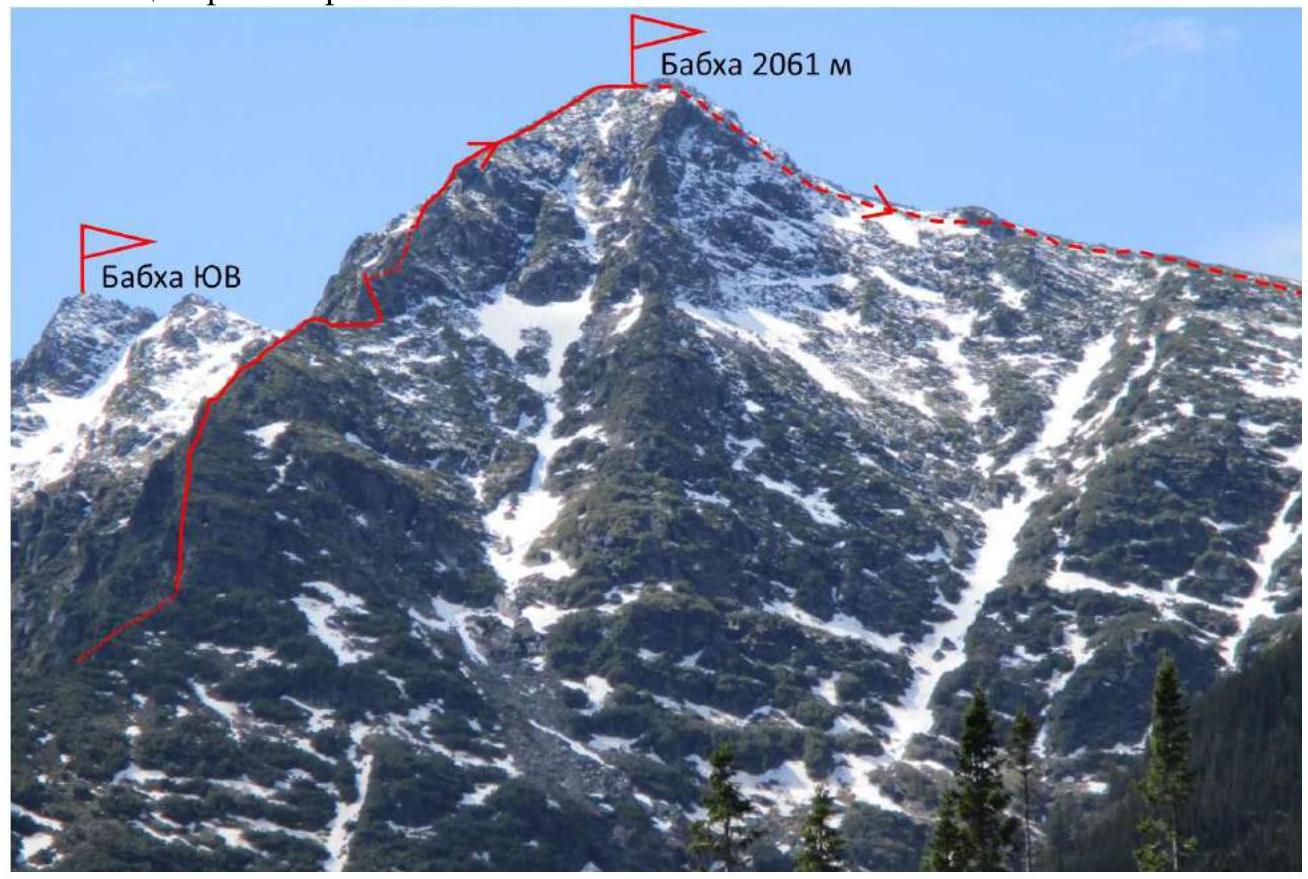
Photo 1. Taken from base camp on May 31, 2020.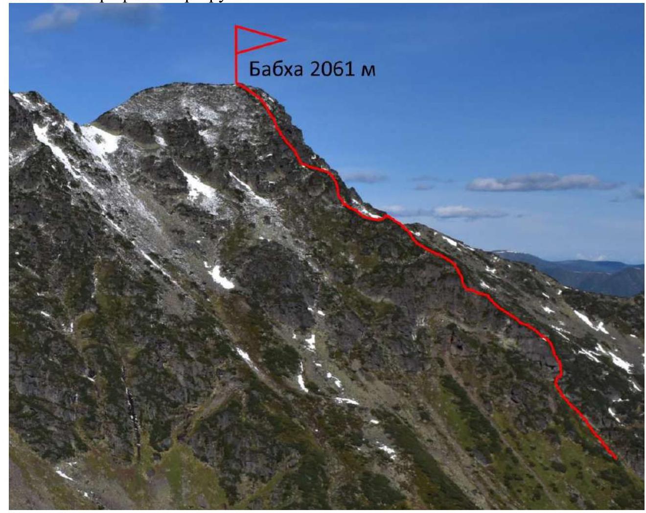
1.2. Photo of the route profile.
Photo 2.
1.3. Photopanorama of the area.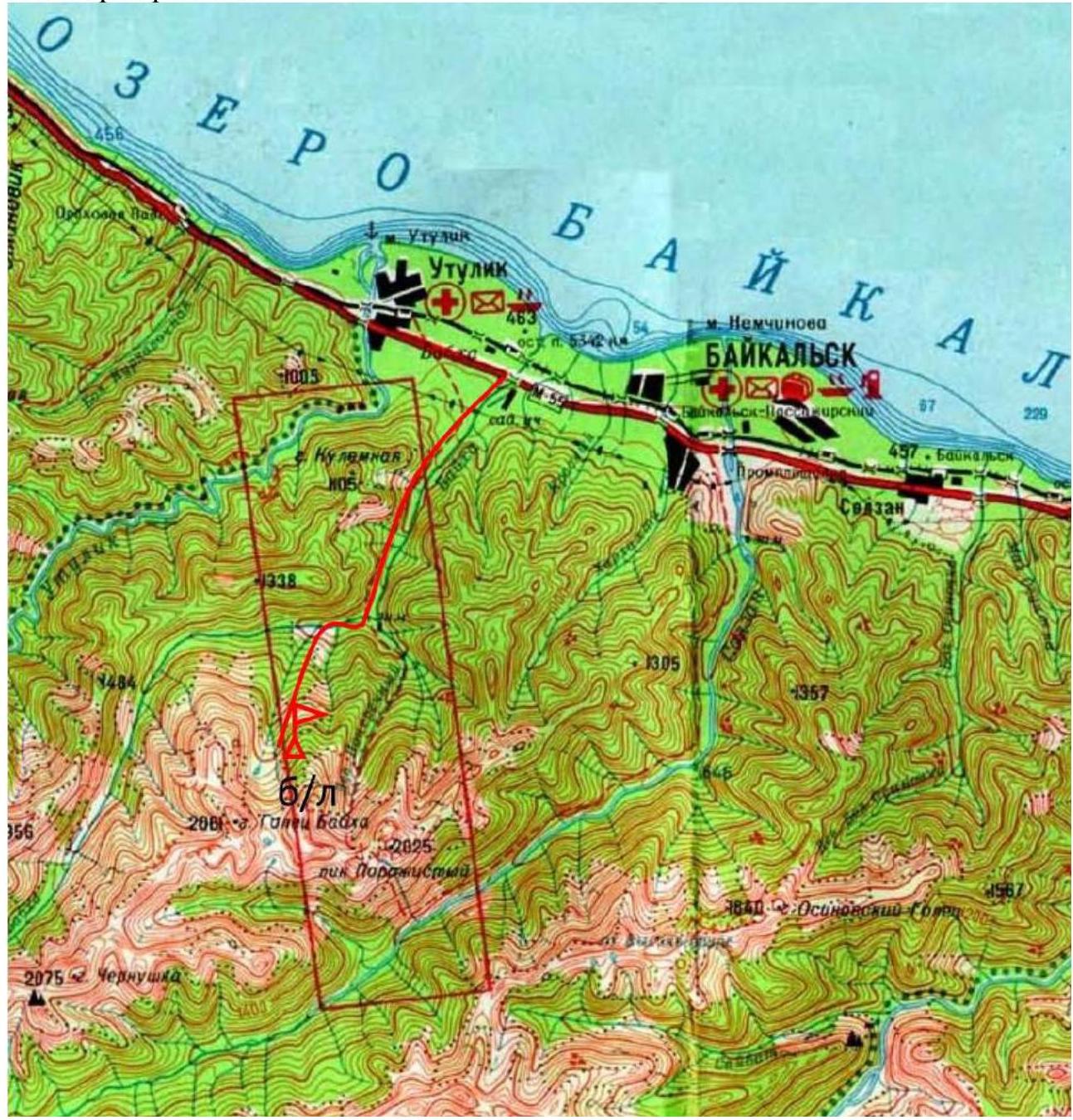
Photo 3.
1.4. Map of the area.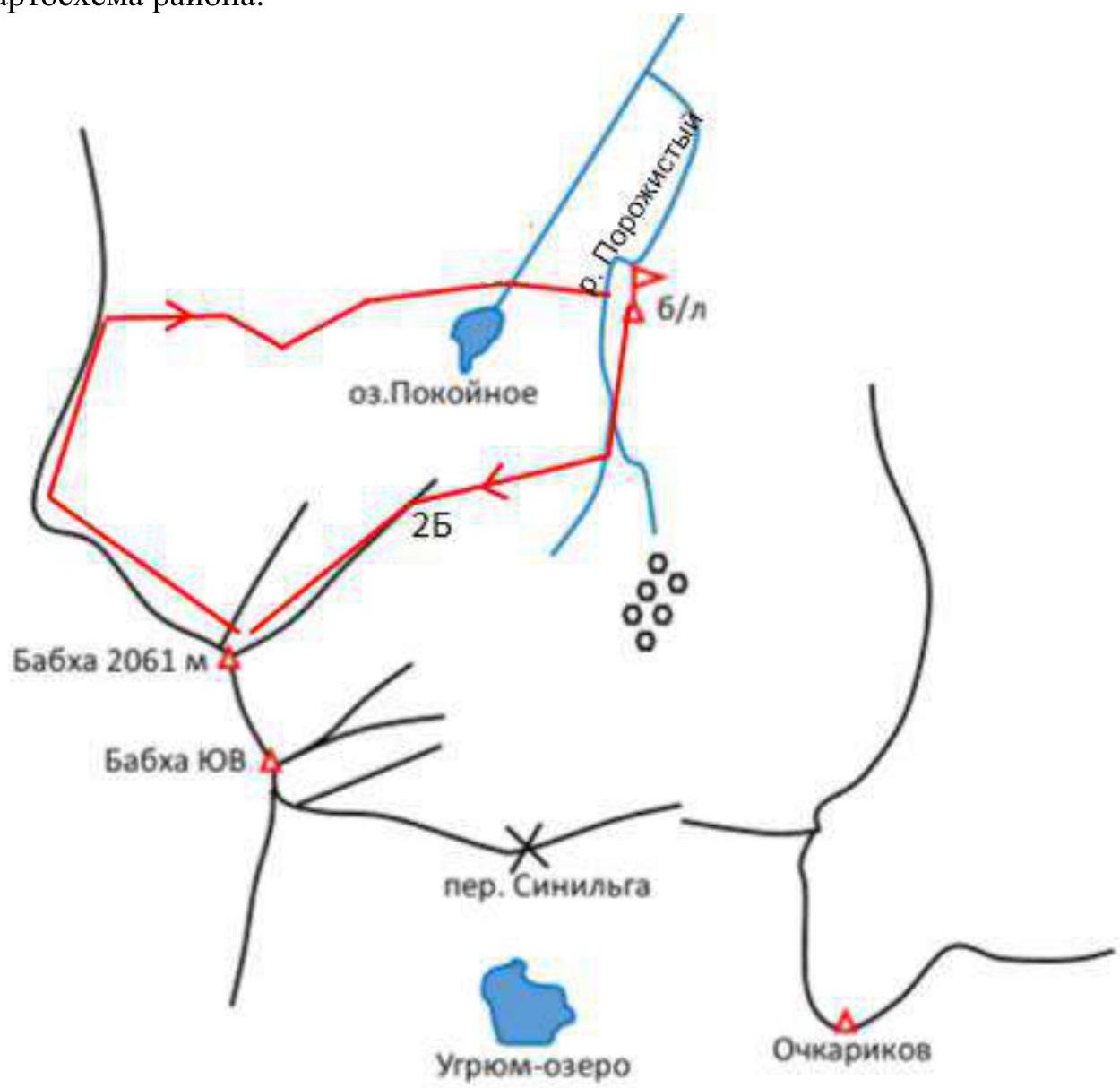
Photo 4. Area map.
The area is not developed in terms of mountaineering due to:
- the small number of alpine-type peaks;
- their great distance from each other;
- relative difficulty and remoteness of approaches;
- limited possibilities for categorized routes.
While nearby are the Sayan Mountains with their extensive, compact, and convenient forms of relief suitable for alpine routes of various complexity categories.
Geographically, the Khamar-Daban ridge is part of the South Siberian mountain system and the Baikal mountain country. It is located on the southern edge of Lake Baikal. Other ridges in the Baikal Highlands include:
- Primorsky and Baikal — on the western shore;
- Khamar-Daban, Ulan-Burgasy, Barguzinsky — on the southeastern shore.
The Baikal and Barguzinsky ridges have classified routes and retain potential for mountaineering development.
The Primorsky and Ulan-Burgasy ridges are not of sporting interest due to their low height and smoothed relief forms covered with forest. The Baikal Highlands should be considered a separate region, as it is not part of the Eastern Sayan or the Stanovoy Highlands, but is located between these mountain formations. The Baikal Alpine School turned its attention to Khamar-Daban due to the 2020 pandemic and the closure of the Buryat Republic to entry. The Babkha area is within the Irkutsk Oblast.
A characteristic feature and attractiveness of the area lies in its unique landscapes, celebrated in songs. In the sixties, a song by an unknown author appeared, sung in city courtyards and around taiga campfires: "Geologist hasn't been here, the scientific world has long forgotten about the wild country of Khamar-Daban." Vizbor also noted this area in one of his songs: "And underfoot, through the fog, the Khamar-Daban ridge cracks." Yuri Iosifovich, flying over Khamar-Daban, inspiredly remarked: "Irkutsk rises to meet us, apparently drunk." Indeed, when you emerge from the Khamar-Daban ordeals, everything around seems drunk. Due to the relatively warm and humid summer, fir and cedar dominate the forest zone. In some parts of Siberia, this combination is called dark taiga. Those who traveled along the Trans-Siberian Railway from start to finish, didn't give up, and diligently looked out the window, likely noticed that the most wonderful scenery is on the stretch from Slyudyanka to almost Mysovaya, and the described places are nearby.
In addition to the main tree species, various other trees are found here with different uniformity:
- pine;
- spruce of various species;
- larch;
- poplar;
- aspen;
- birch;
- and serious trees like rowan, bird cherry, willow, alder, as tall as an average tree.
All this can lie across a poor path. Also, branches of alder, bird cherry, raspberry, currant, Labrador tea, fir branches, stems, and leaves of certain grasses intrude from the sides and underfoot. And all this is a prelude to the appearance of cedar elfin wood thickets.
Khamar-Daban is the western edge of the elfin wood habitat. Here, due to more favorable conditions, cedar elfin wood is not just a shrub, as in the Northeast, but chaotically sprawling cedar trunks over the ground with persistent, "tin" branches. When it is encountered on a route, it creates additional difficulties and a local flavor to mountaineering in Khamar-Daban. The complexity category of the proposed routes does not take into account the difficulties of climbing through elfin wood. That is, when, God forbid, paths are trodden by hordes of Irkutsk mountaineers in the elfin wood on the routes, the attractiveness of ascents will wither, but the category of complexity will not suffer.
It is better to undertake ascents via the proposed routes and others potentially available in the summer — from May 15 to October 15. In winter, up to one and a half meters of snow falls here, and with snowdrifting, even more in some places, leading to increased avalanche danger. On May 3, 1985, 17 people, mostly female students from the Irkutsk Pedagogical Institute, died in an avalanche on Golets Babkha. The approach with a load from the bridge on the highway to the base camp takes 8 hours.
2. Characteristics of the Route
2.1. Technical photo of the route.
Photo 6.
2.3. Technical characteristics of route sections (5)
| Section № | Terrain characteristics | Category of complexity | Length, m, steepness | Number of pitons |
|---|---|---|---|---|
| 0–1 | Wall with a cleft and elfin wood bush | 4 | 8.75 m | |
| 1–2 | Wet chimney | 5 | 12.90 m | 4 |
| 2–3 | Frightful elfin wood | 3 | 5 to the right | |
| 3–4 | Wide ridge | 2 | 25.50 m | 1 |
| 4–5 | Narrow ledge with elfin wood over an abyss | 3 | 30.45 m | 4 |
| 5–6 | Rocks | 2 | 15.40 m | 1 |
| 6–7 | Hole in the ridge | 1 | 3 m | |
| 7–8 | Elfin wood on the ridge | 2 | 120.30 m | |
| 8–9 | Elfin wood on the ridge — exit to the top of a large rock | 2 | 50.20 m | |
| 9–10 | Ridge under the double bastion | 1 | 30.1 m | |
| 10–11 | Ledge to the right | 1 | 30.40 m | |
| 11–12 | Wet cleft to the left | 5 | 12.85 m | 3 |
| 12–13 | Elfin wood ridge. Exit to the 1st bastion | 1 | 35.25 m | |
| 13–14 | Elfin wood ledge to the left | 1 | 10 m | |
| 14–15 | Inner corner overgrown with badder. After clearing — cleft. Zaltsug partially. | 5 | 15.85 m | 5 |
| 15–16 | Wall. | 4 | 5.65 m | 1 |
| 16–17 | Left of the 2nd bastion. Exit to the edge. | 2 | 2 | |
| 17–18 | To the peak. | 1 | 90.20 m |
3. Characteristics of the Team's Actions
3.1. Brief description of the route passage.
From the base camp, the approach to the route takes 2 hours. The route begins from under a huge grotto in the rocks on the left side of the NE edge at an altitude of 1700 m above sea level.
| Section № | Description | Photo number |
|---|---|---|
| 0–1 | Wall with a cleft and elfin wood bush | 7 |
| 1–2 | Wet chimney | 7 |
| 2–3 | Frightful elfin wood | |
| 3–4 | Wide ridge | |
| 4–5 | Narrow ledge with elfin wood over an abyss | 8 |
| 5–6 | Rocks | |
| 6–7 | Hole in the ridge | 9 |
| 7–8 | Elfin wood on the ridge | |
| 8–9 | Elfin wood on the ridge — exit to the top of a large rock | 10 |
| 9–10 | Ridge under the double bastion | |
| 10–11 | Ledge to the right | |
| 11–12 | Wet cleft to the left | 11 |
| 12–13 | Elfin wood ridge. Exit to the 1st bastion | |
| 13–14 | Elfin wood ledge to the left | |
| 14–15 | Inner corner overgrown with badder. After clearing — cleft. Zaltsug partially. | 12, 13 |
| 15–16 | Wall. | 14 |
| 16–17 | Left of the 2nd bastion. Exit to the edge. | |
| 17–18 | To the peak. | 15 |
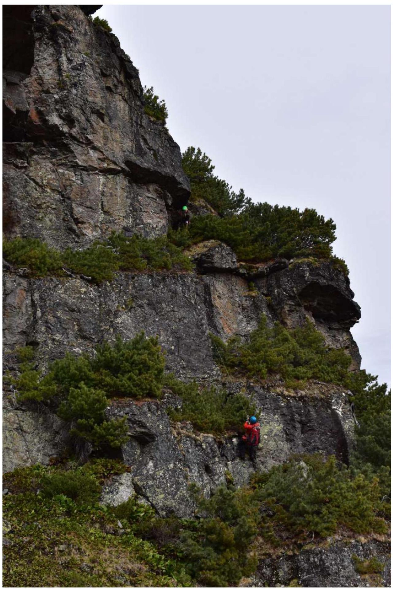
Photo 7. Section 0–1–2.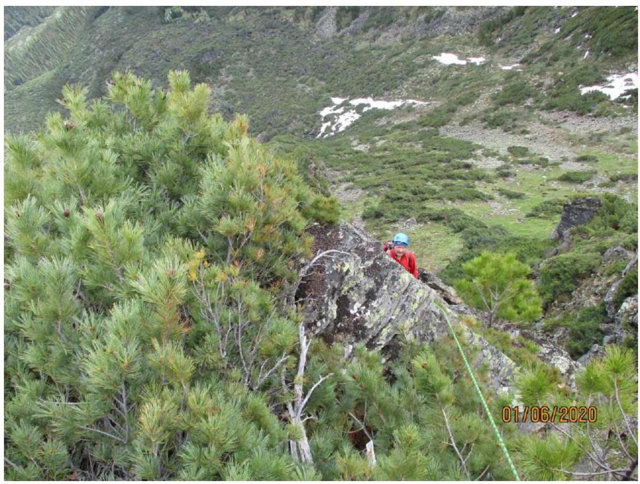
Photo 8. Section 4–5.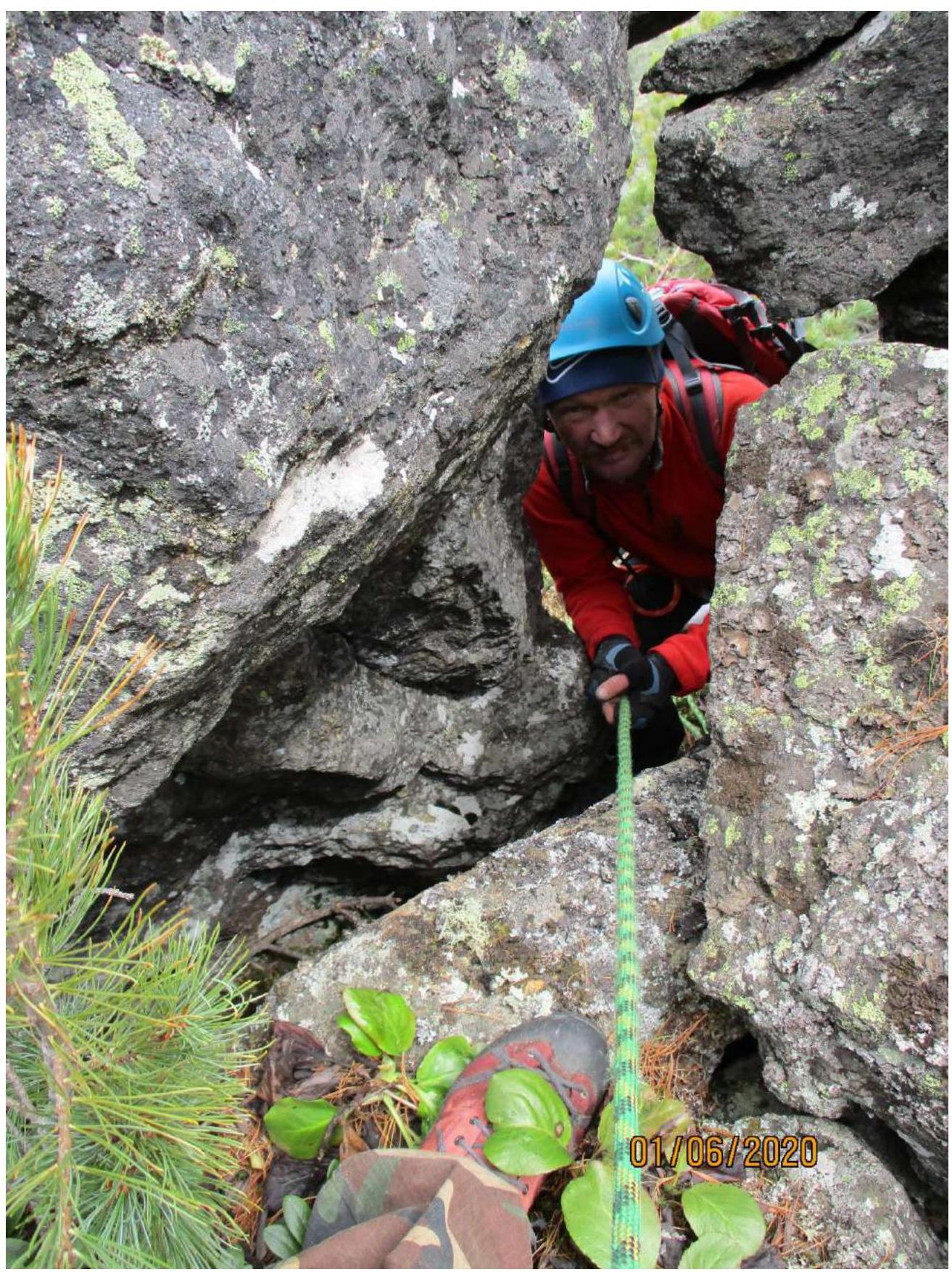
Photo 9. Section 7.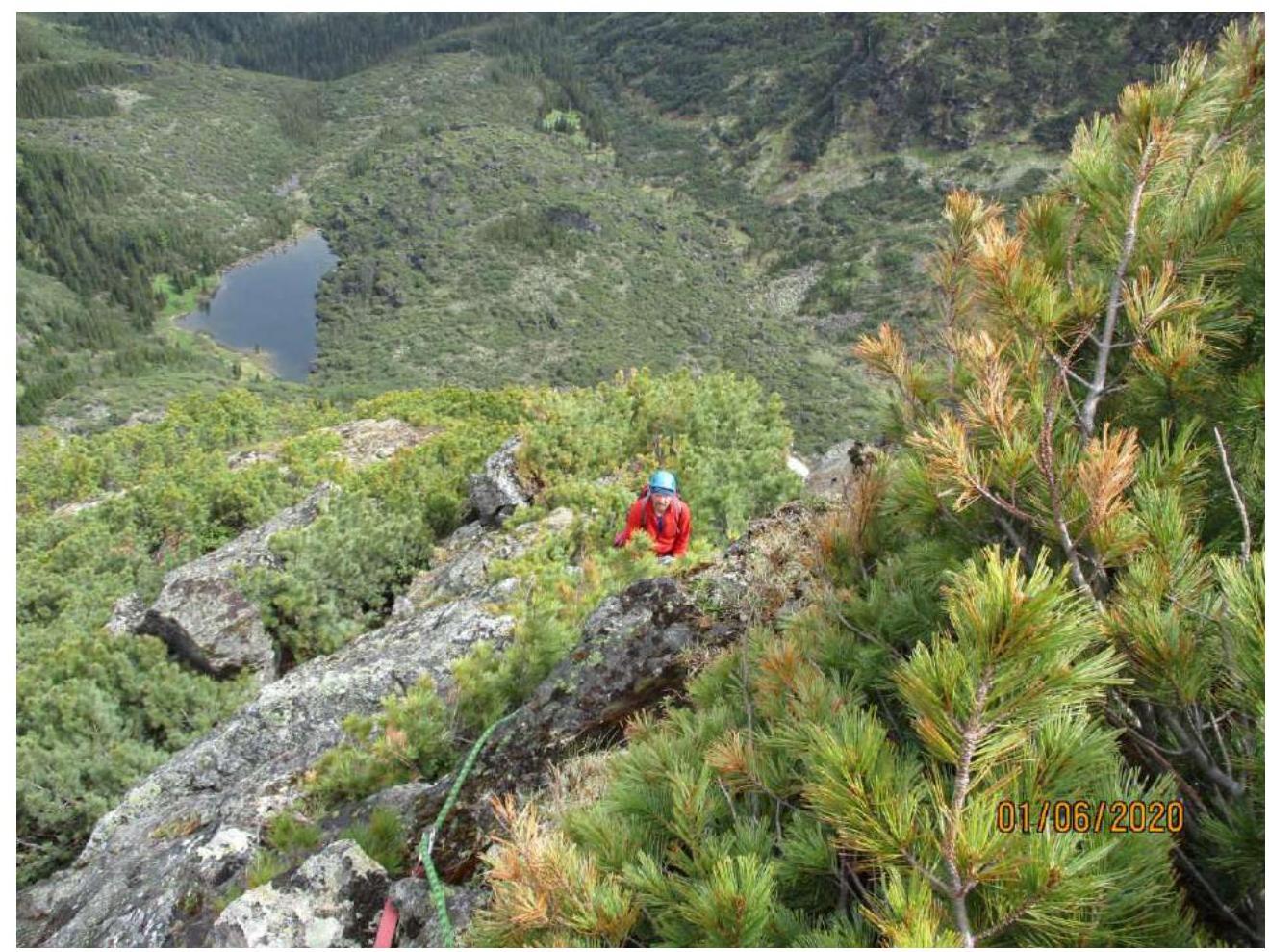
Photo 10. Section 8–9.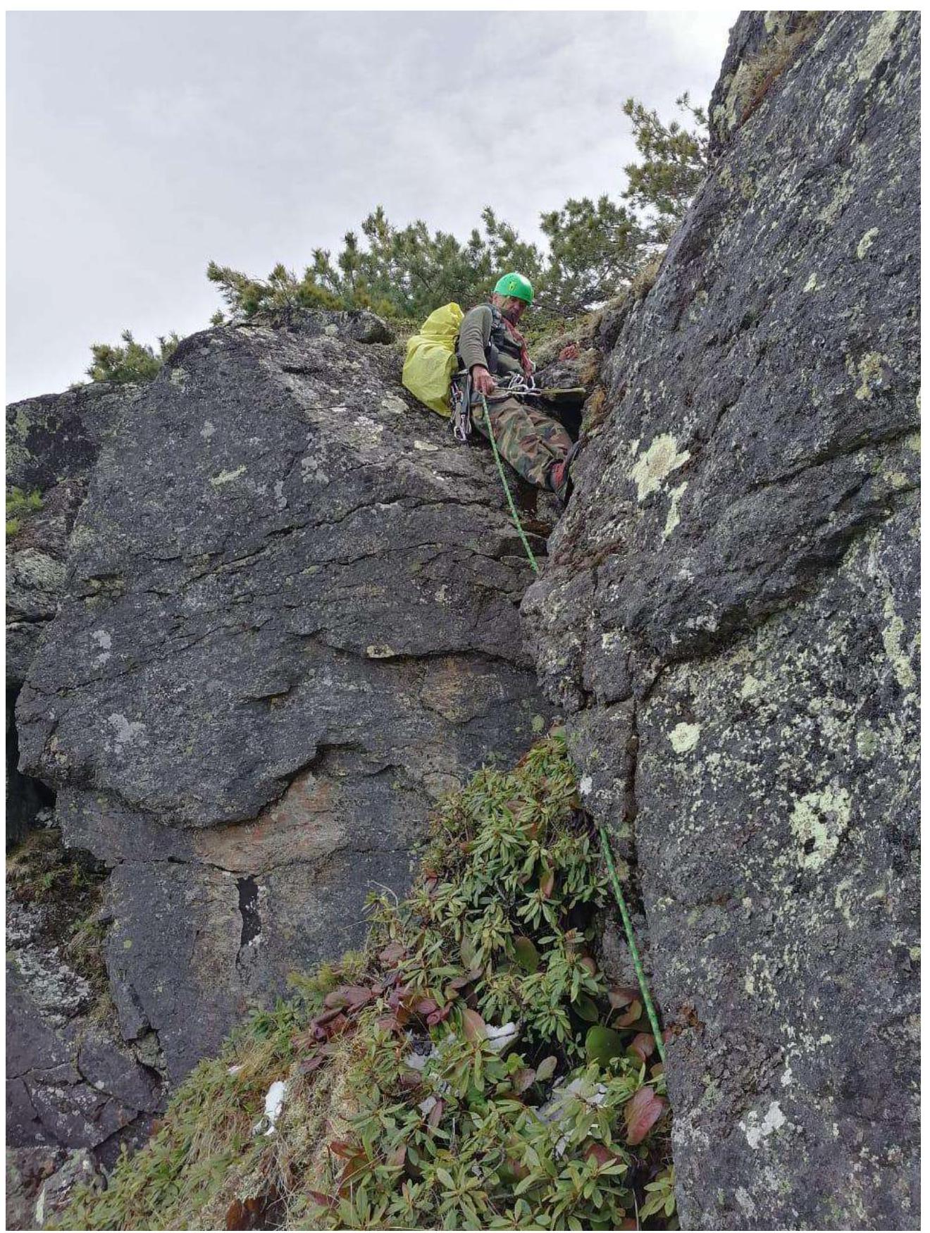
Photo 11. Section 11–12.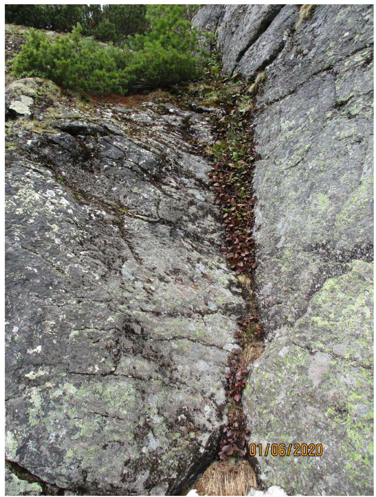
Photo 12. Section 14–15 before.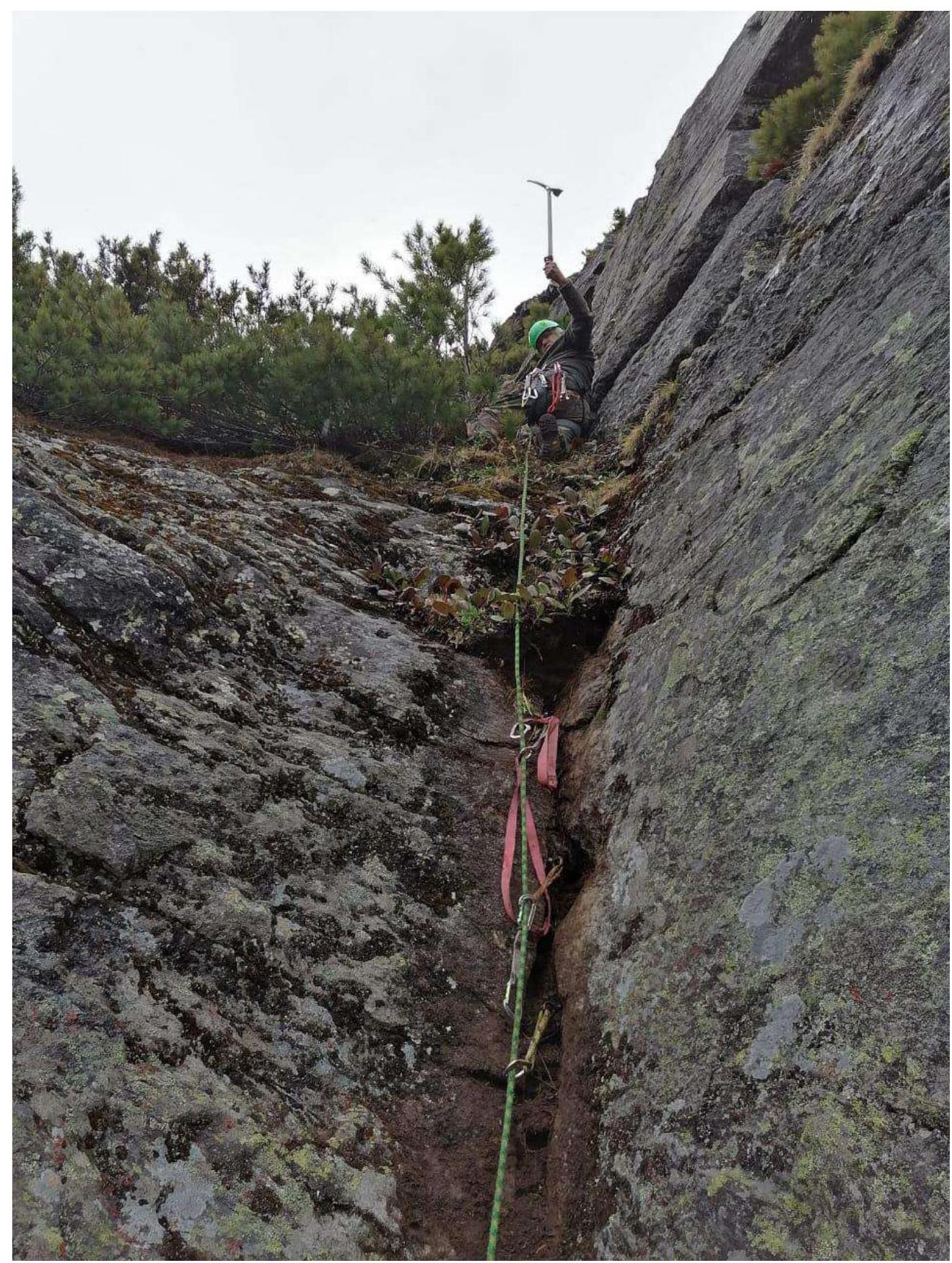
Photo 13. Section 14–15 after.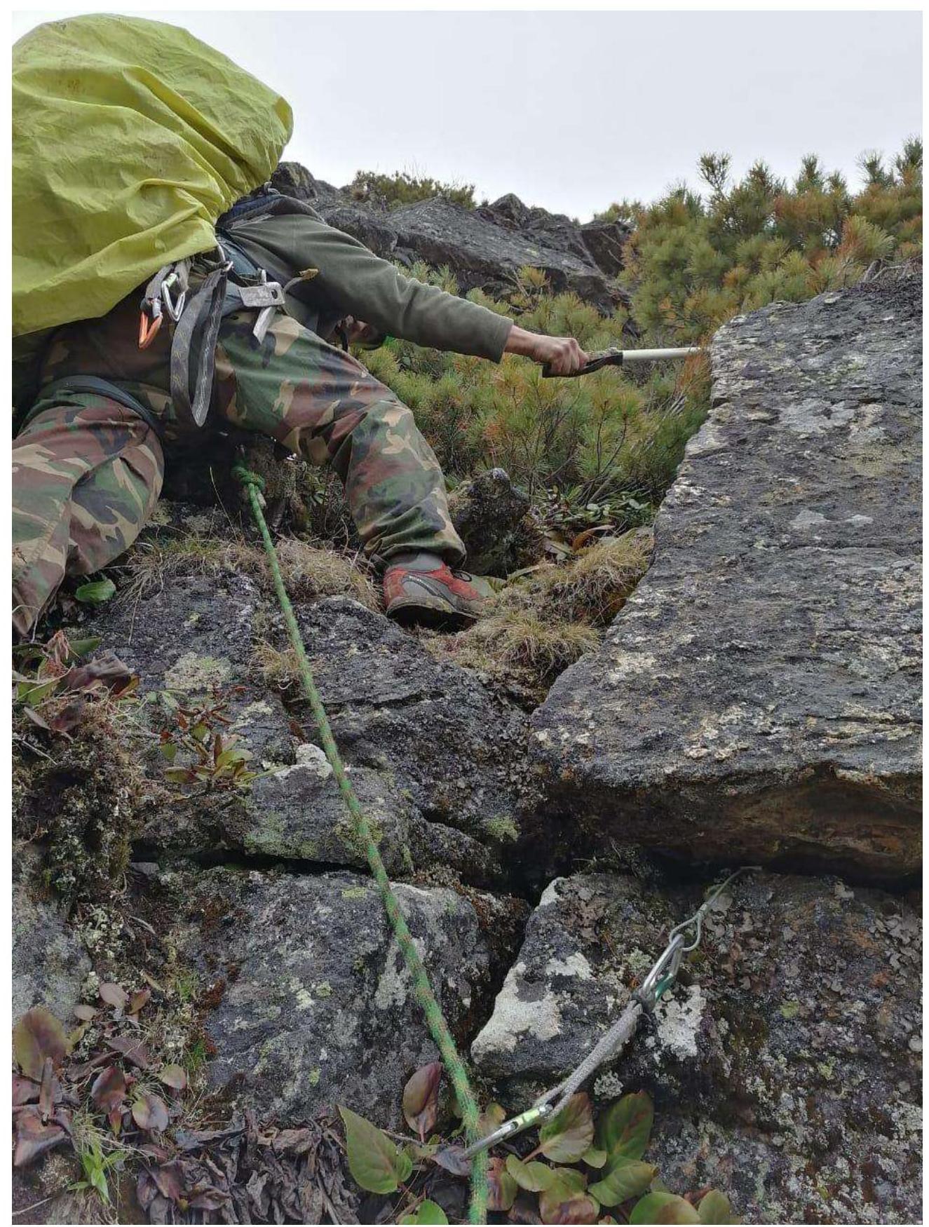
Photo 14. Section 15–16.
3.2. Photo of the team on the peak at the control tour.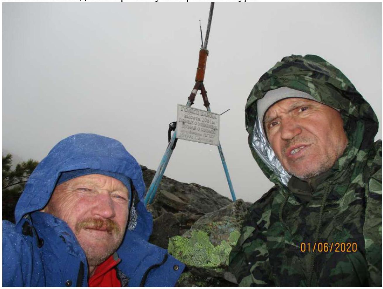
Photo 15.
3.3. The route is safe. There is cellular coverage in some places on the ridge and peak. In addition to the standard equipment for the second category, it is advisable for the first in the group to have an ice axe. An ice axe is convenient for catching onto elfin wood trunks or ground when breaking through the fir branches.
Descent from the peak:
- Along the NW ridge on a noticeable path in the elfin wood thickets;
- Then to the right onto the slope and along the scree to the bottom of the Semnadtsati sboros;
- Two steep sections inside the elfin wood "jungle" to the Pokoynoe lake;
- A bit further to the base camp on the clearing by the Porozhistaya river.
Comments
Sign in to leave a comment