REPORT ON THE FIRST ASCENT OF UAL PEAK (1891 m) VIA THE 3A DIFFICULTY ROUTE, ALONG THE SOUTHWEST RIDGE BY THE "UAL" TEAM ON AUGUST 30, 2023
I. Ascent Passport
| No. | 1. General Information | |
|---|---|---|
| 1.1 | Full Name, Sports Rank of the Leader | Egorov Yuri — CMS |
| 1.2 | Full Name, Sports Rank of the Participants | Pervushkin Egor — 3rd sports rank, Tikhonov Nikolai — 3rd sports rank, Esenin Alexander — 3rd sports rank. |
| 1.3 | Full Name of the Coach | Yakovenko Alexander Nikolaevich |
| 1.4 | Organization | Administration of Alpine Camps (UAL) |
| 2. Characteristics of the Ascent Object | ||
| 2.1 | Region | Magadan Oblast, Yagodninsky Urban District. Upper Kolyma Highlands, Bolshikh Porogov Ridge |
| 2.2 | Valley | Tok |
| 2.3 | Section Number according to the 2013 Classification Table | — |
| 2.4 | Name and Height of the Peak | UAL, 1891 m according to GPS |
| 2.5 | Geographical Coordinates of the Peak (Latitude/Longitude), GPS Coordinates | N 61° 47.253', E 150° 27.267' |
| 3. Characteristics of the Route | ||
| 3.1 | Name of the Route | Along the Southwest Ridge |
| 3.2 | Proposed Category of Difficulty | 3A |
| 3.3 | Degree of Route Exploration | First Ascent |
| 3.4 | Nature of the Route Terrain | Rocky |
| 3.5 | Height Difference of the Route (Altimeter or GPS Data) | 391 m |
| 3.6 | Length of the Route | 940 m |
| 3.7 | Technical Elements of the Route (Total Length of Sections of Various Difficulty Categories with Indication of Terrain Type (Ice-Snow, Rocky)) | 1st cat. diff. rocks — 350 m |
| 2nd cat. diff. rocks — 160 m | ||
| 3rd cat. diff. rocks — 310 m | ||
| 4th cat. diff. rocks — 120 m | ||
| Movement along a closed glacier — 0 m | ||
| Rappelling (on descent) — 1 rope, 12 meters | ||
| 3.8 | Descent from the Peak | Along the SW grassy slope, n/k |
| 3.9 | Additional Characteristics of the Route | There is no water along the entire route. It is necessary to bring it. |
| 4. Characteristics of the Team's Actions | ||
| 4.1 | Time of Movement (Team's Walking Hours) | 10 h 20 min |
| 4.2 | Overnight Stays | no |
| 4.3 | Start of the Route | 07:20, August 30, 2023 |
| 4.4 | Reaching the Peak | 15:20, August 30, 2023 |
| 4.5 | Return to the Base Camp | 17:40, August 30, 2023 |
| 5. Responsible for the Report | ||
| 5.1 | Full Name, e-mail | Tikhonov Nikolai Alexandrovich n9623551166@gmail.com |
II. Description of the Ascent
1. Characteristics of the Ascent Object
1.1–1.3 The most elevated part of the Bolshikh Porogov Ridge is located on the right bank of the Kolyma River, where peaks exceed 2000 m. The highest point is Mount Bolshoy Mandychan with a height of 2221 m. Other notable peaks include:
- Maly Mandychan (1973 m)
- Strashnaya (1999 m)
To the northwest, the ridge adjoins the Uaza-Ina mountains. The eastern slopes are drained by tributaries of the Bakhapcha River, while the western and southern parts are bounded by the Kongo and Bolshoy Mandychan rivers.
The highlands of the ridge have been subjected to glacial processing, featuring:
- Cirques and glacial lakes;
- Trough valleys;
- Arêtes and horns.
The territory of the ridge is completely uninhabited. To the northeast lies the settlement of Sinegorye, connected by a road to the Kolyma Highway. To the west, 50 km beyond the Obninskaya Ridge, is the settlement of Obo, which has a road connection to Ust-Omchug on the Tenka Highway.
UAL Peak is located northeast of the Tok River mouth. Figure 1 presents a general photo of the peak with the route taken by the team marked on it. There are no classified routes in the immediate vicinity, and named peaks are also absent. A neighboring peak with a height of 1933.1 m is noted, as per the map data.
1.4 Region of the Ascent:
- Magadan Oblast;
- Yagodninsky Urban District;
- Upper Kolyma Highlands;
- Bolshikh Porogov Ridge.
A map of the region is shown in Fig. 2. This is part of the P-56-073,074_1990 topographic map sheet. Link to the map: https://cloud.mail.ru/public/ukzq/J2SPpp9CR/P-56/P-56-073%2C074_1990.tif↗
The travel time from the nearest settlement, Ust-Omchug, to the base camp consists of several components:
- 130 km by high-clearance vehicle to the Mars artel — approximately 7 hours;
- 18 km on foot under backpacks — two days (7 hours on the first day and 5 hours on the second), passing near Lake Gagar and crossing Maly Mandychan.
The approach from the base camp (overnight stay 3 in Fig. 2) to the start of the route takes 1.5 hours.

Fig. 1. General photo of UAL Peak. August 29, 2023. Photo taken from the ridge in the same valley west of the Tok River.
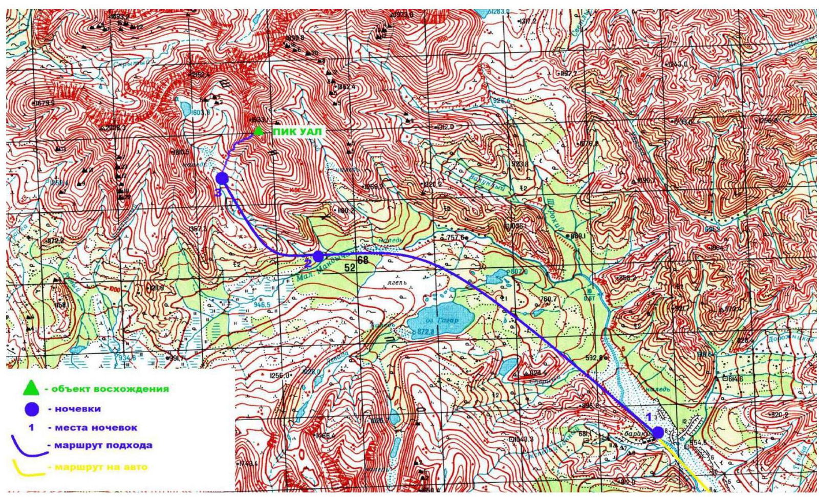
Fig. 2. Map of the region at a scale of 1:100,000. Published in 1992.
2. Characteristics of the Route
2.1. Technical Photograph of the Route
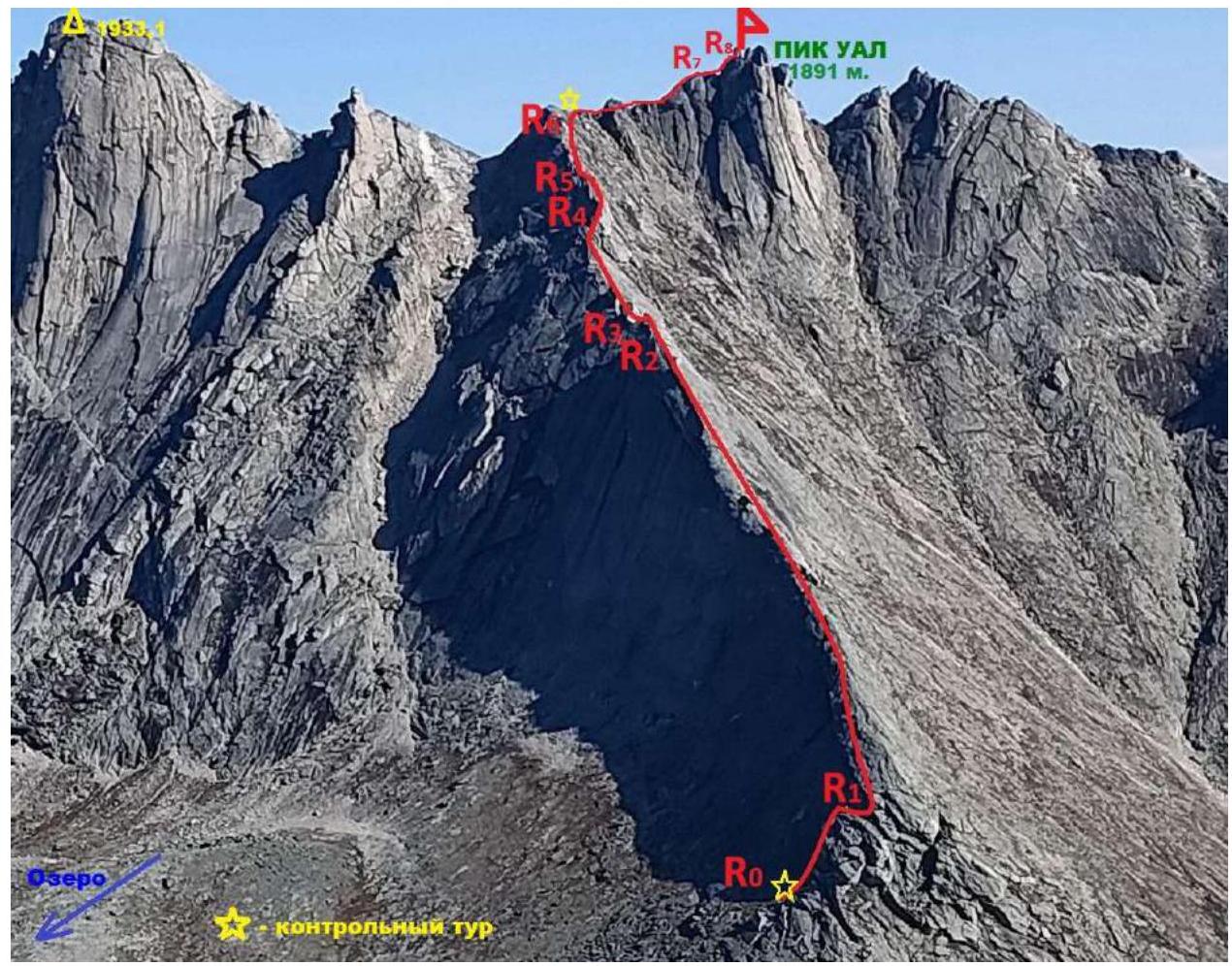
Fig. 3. Technical photograph of the route.
2.3. Technical Characteristics of the Route
| Section No. | Nature of the Terrain | Cat. Diff. | Length, m | Steepness | Type and Number of Pitons |
|---|---|---|---|---|---|
| R0–R1 | Rocky | 3 | 80 | 60–70 | Friends — 5, Nuts — 2 |
| R1–R2 | Rocky ridge | 1 | 350 | 30–40 | Friends — 3 |
| R2–R3 | Rocky wall | 3 | 30 | 70 | Loop — 1 |
| R3–R4 | Rocky ridge, inclined grassy ledge | 2 | 160 | 45 | Friends — 5 |
| R4–R5 | Crevice, internal angle | 3 | 50 | 55–60 | Friends — 2 |
| R5–R6 | Traverse along rocky terrain | 4 | 100 | 50 | Friends — 5, Loop — 2 |
| R6–R7 | Rocky ridge | 3 | 150 | 35–40 | Friends — 3 |
| R7–R8 | Rocky outcrop | 4 | 20 | 65 | Friend — 1, Loop — 1 |
3. Characteristics of the Team's Actions
3.1. Brief Description of the Route Passage
| Section No. | Description | Photo No. |
|---|---|---|
| R0–R1 | The start of the route is to the left of the ridge on a convenient ledge, marked by a cairn. Climbing consists of two sections of 3rd cat. diff. — 15 meters and 12 meters, respectively, leading to the ridge. Simultaneous belay. | Fig. 4, Fig. 5, Fig. 6 |
| R1–R2 | Passage along the ridge for 150 m. Simultaneous belay. | Fig. 7, Fig. 8 |
| R2–R3 | Wall-descent 12 m, 3rd cat. diff. Station on a rock using a main rope. Alternate belay. | Fig. 9 |
| R3–R4 | Traverse on friction for 10 m, 3rd cat. diff. (alternate belay on the section, station on a rock using a main rope) until returning to the pedestrian part of the ridge. | Fig. 10, Fig. 11 |
| R4–R5 | Bypassing the ridge on the left above the trail leading to the pass. Wall 14 m, 3rd cat. diff. Simultaneous belay. | Fig. 12 |
| R5–R6 | Traverse 50 m of rocks to the right, 4th cat. diff. Station made from a main rope on a rock. Belay on friends. Alternate belay. 100 m. Exit to a control cairn. | Fig. 13, Fig. 14 |
| R6–R7 | Move towards the peak, overcoming the pre-summit ascent, 3rd cat. diff. Simultaneous belay. 150 m. | Fig. 16 |
| R7–R8 | The key to the route is climbing a rock outcrop before the peak. There is a good platform before it. Climbing 10 m, 4th cat. diff. It is advisable to wear rock shoes. Intermediate points: friend and loop on the rocky outcrop. Rappel on a rock using a main rope. Caution! Loose rocks. | Fig. 17 |
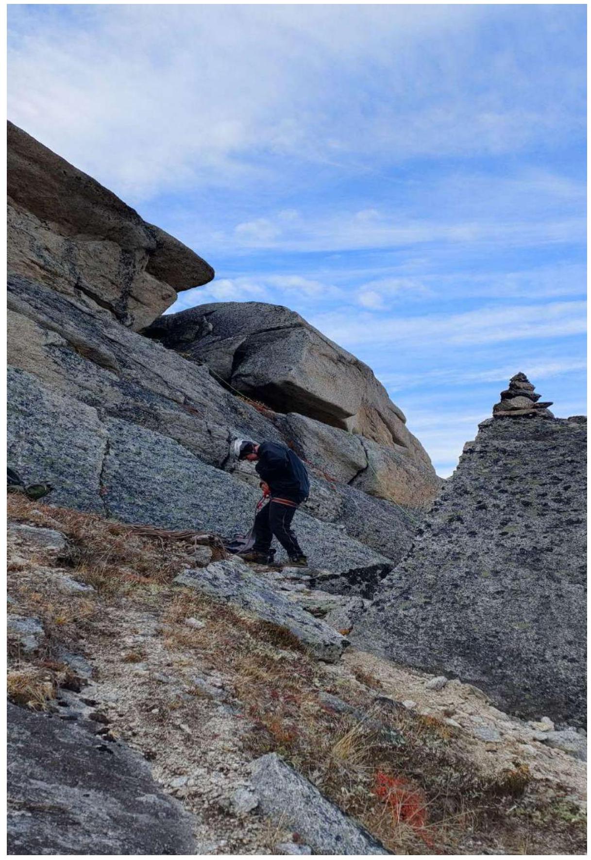
Fig. 4. Start of the route R0. Control cairn.
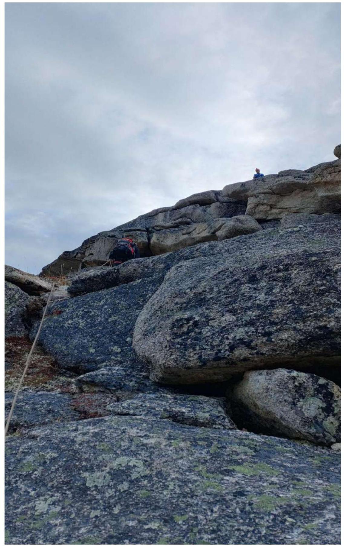
Fig. 5. Section R0–R1, 3rd cat. diff.
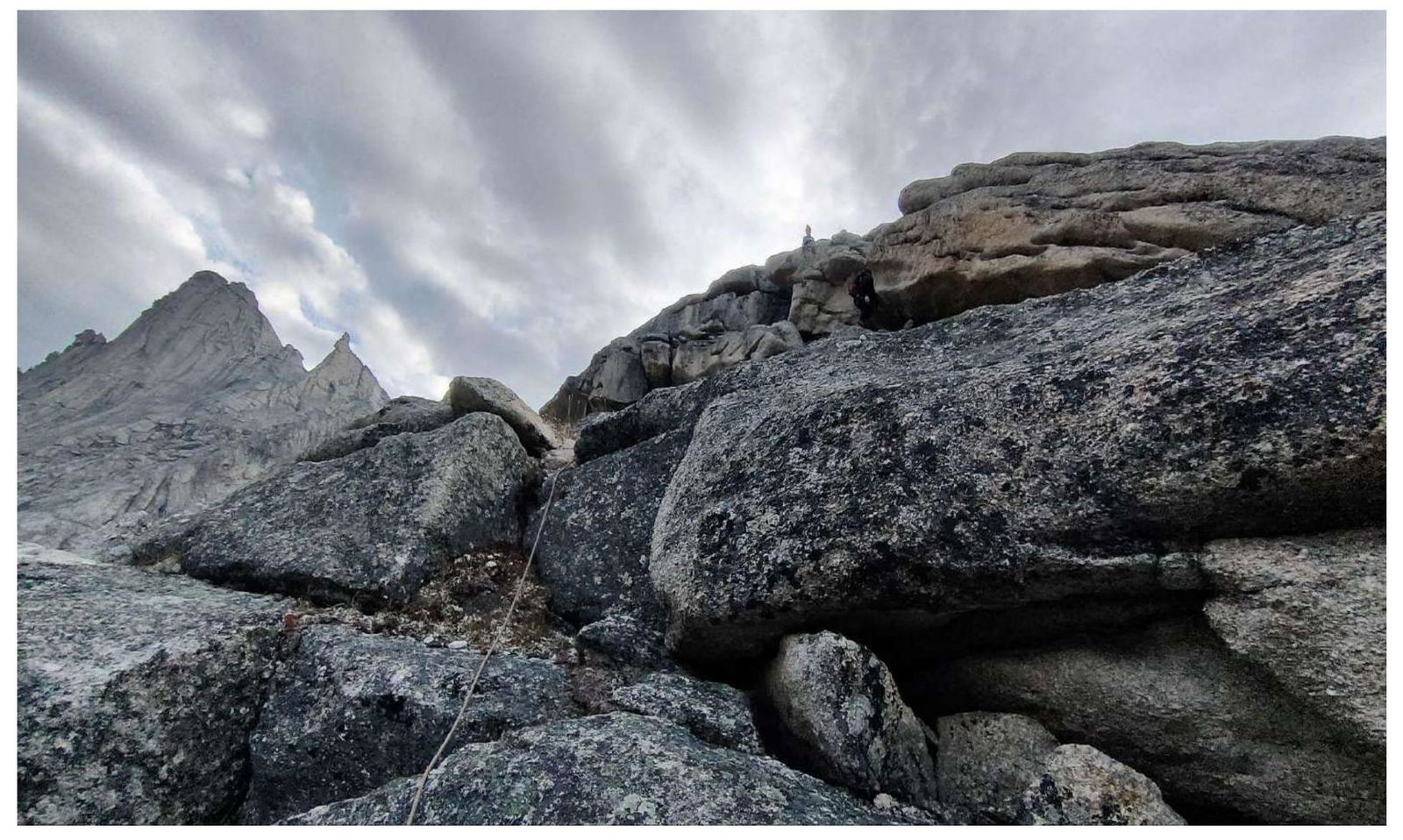
Fig. 6. Section R0–R1, 3rd cat. diff.
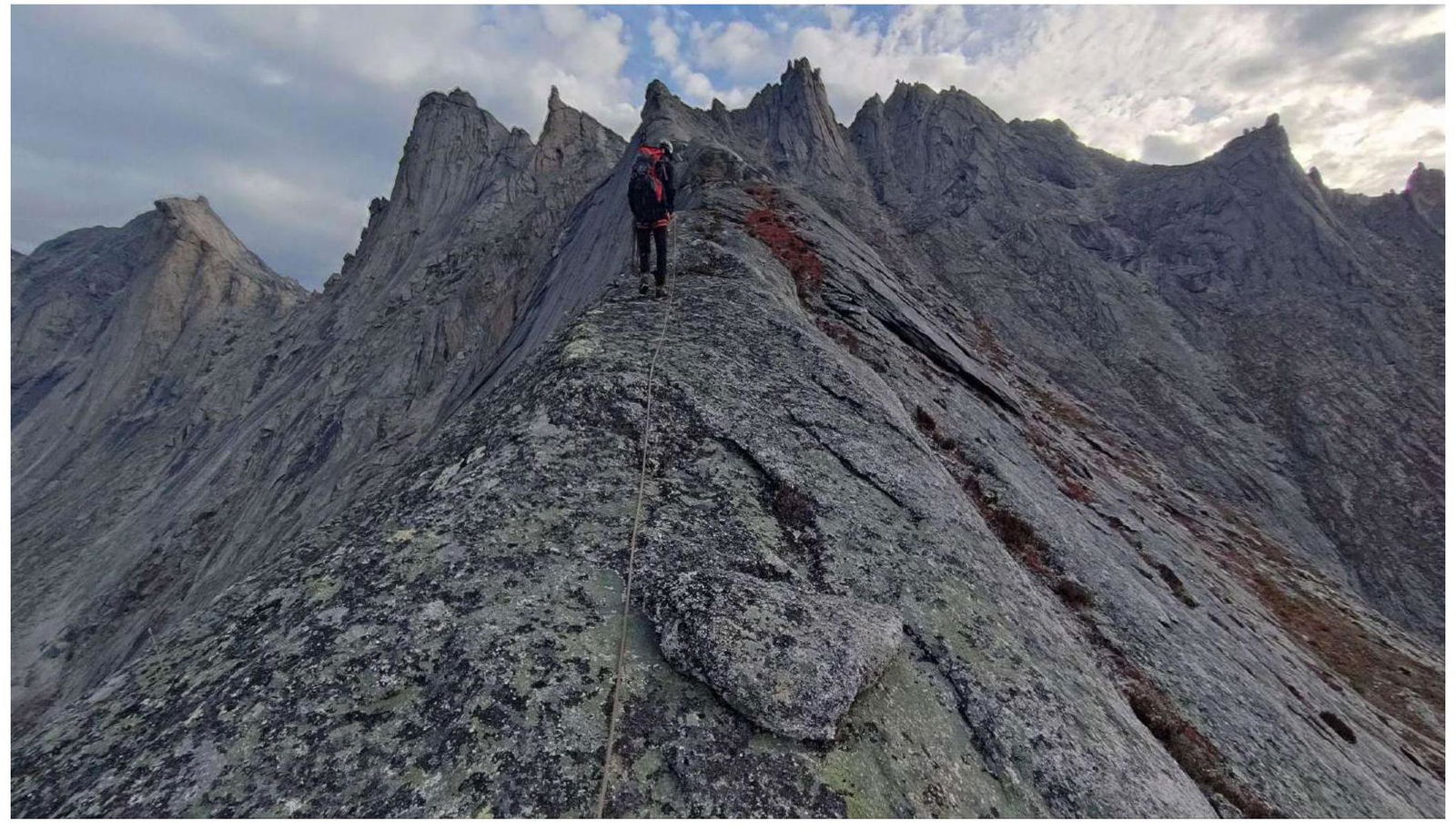
Fig. 7. Section R1–R13. Ridge, 1st cat. diff.

Fig. 8. Section R1–R2. Ridge, 1st cat. diff. (Photo looking down)
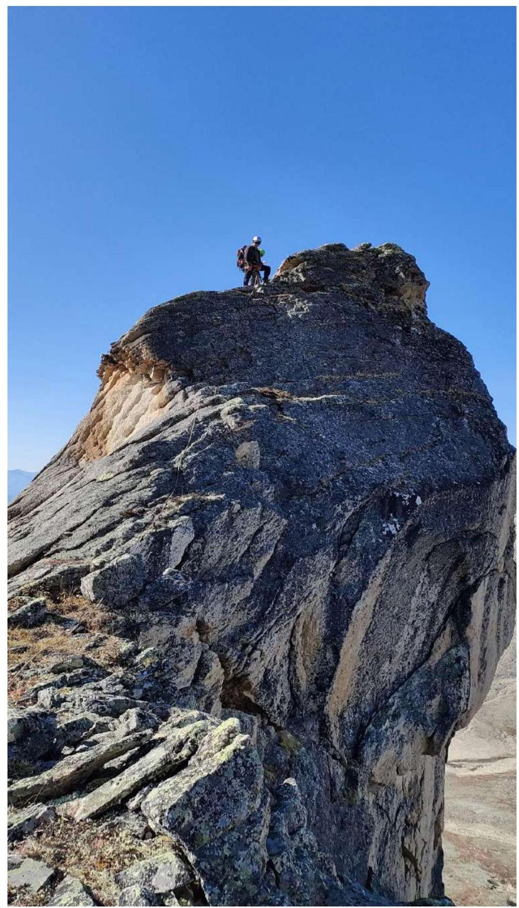
Fig. 9. Section R2–R3. Wall — descent 12 m.
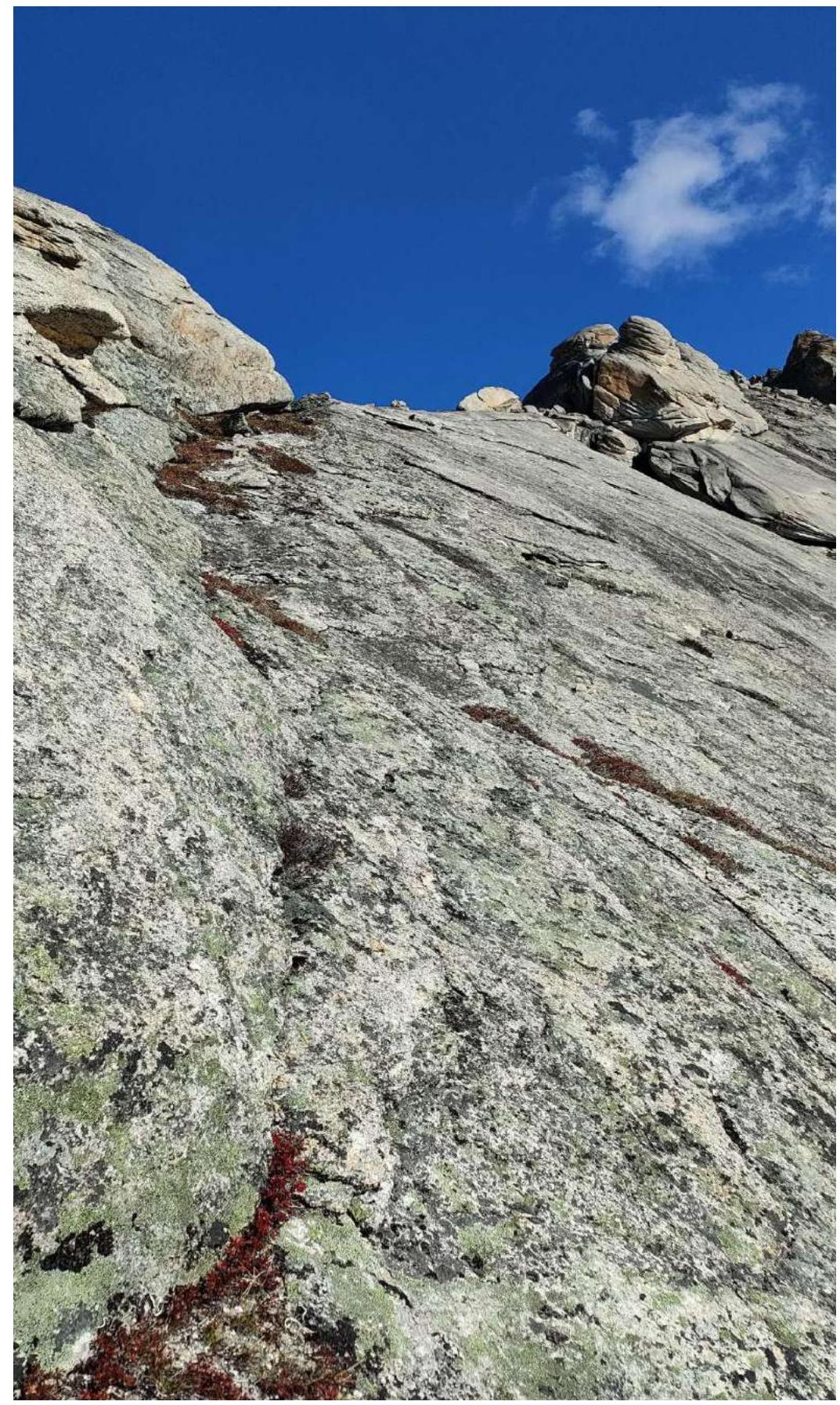
Fig. 10. Section R3–R4
- Traverse on friction until returning to the pedestrian part of the ridge.
- 3rd cat. diff.
- Alternate belay.
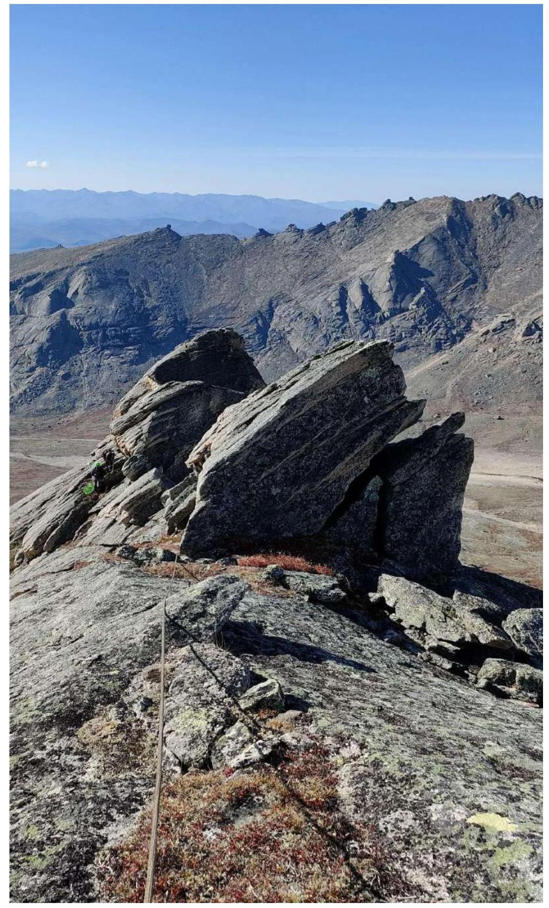
Fig. 11. Section R3–R4 (Photo looking down)
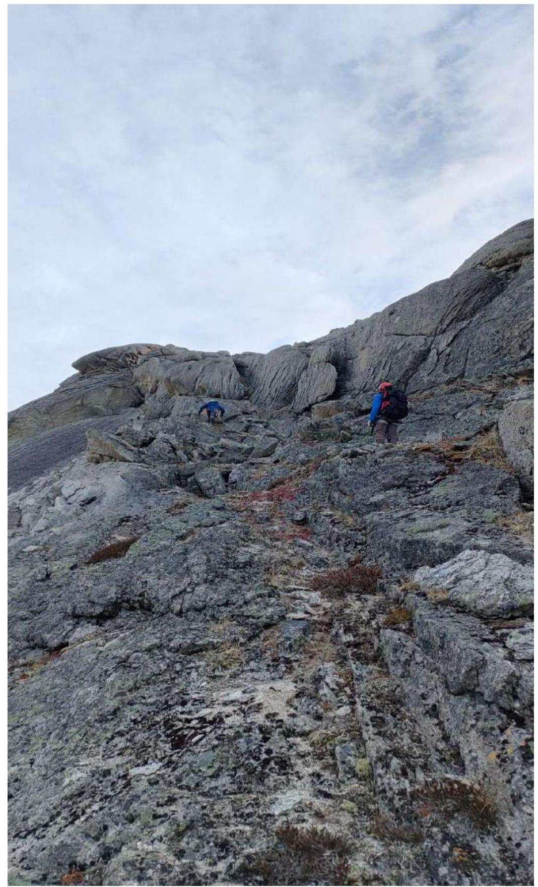
Fig. 12. Section R4–R5
- Wall 10 m.
- 3rd cat. diff.

Fig. 13. Section R5–R6 traverse, 4th cat. diff.
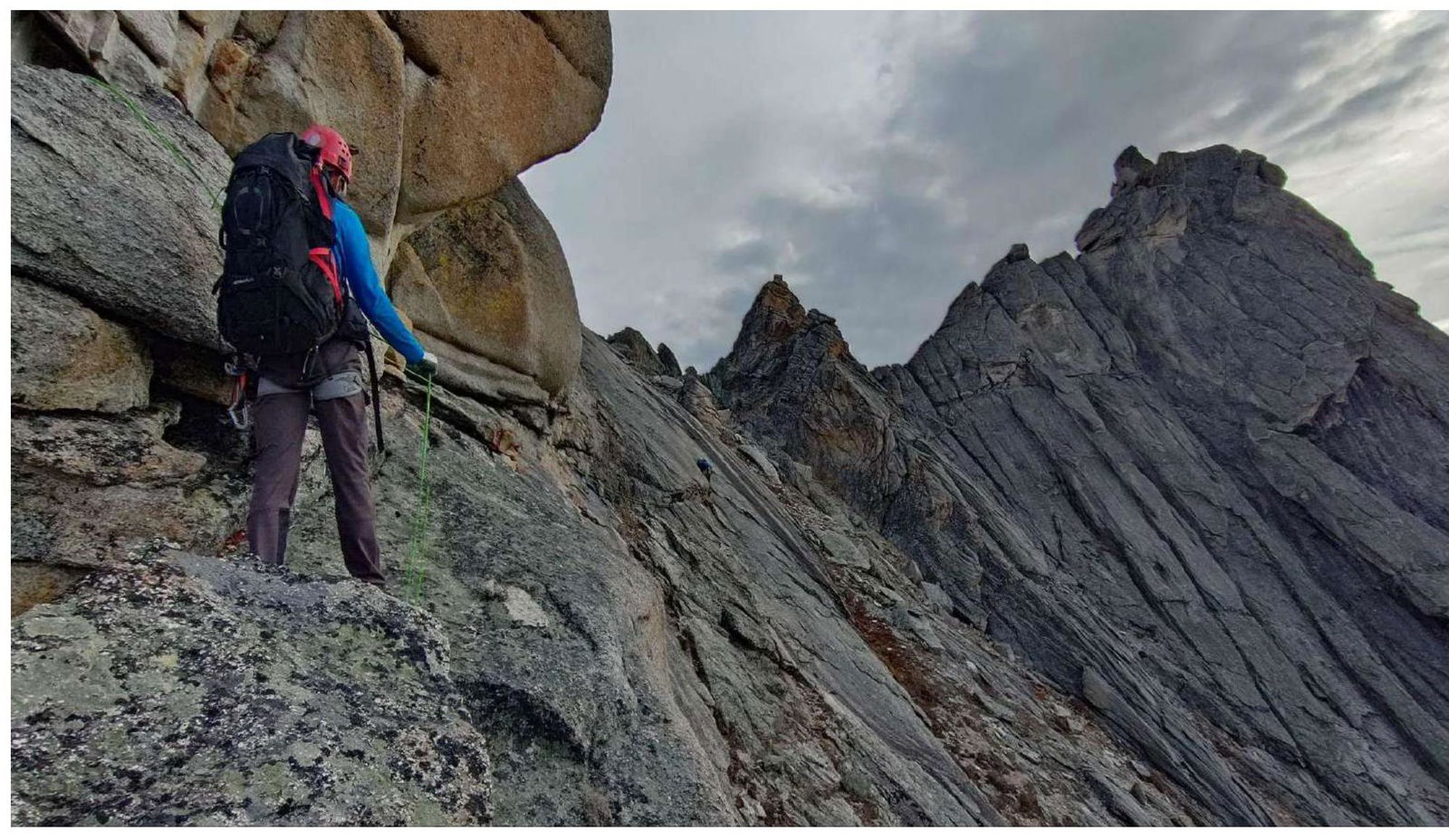
Fig. 14. Section R5–R6 traverse, 4th cat. diff.
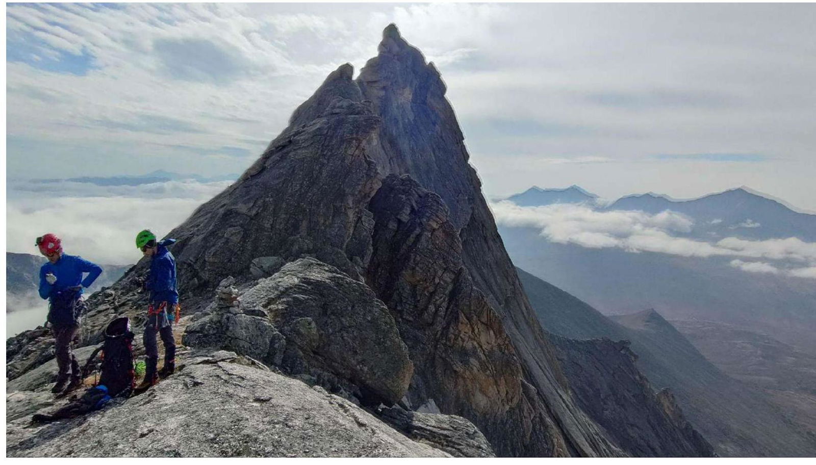
Fig. 15. Section after the ridge. Control cairn, view of the peak.
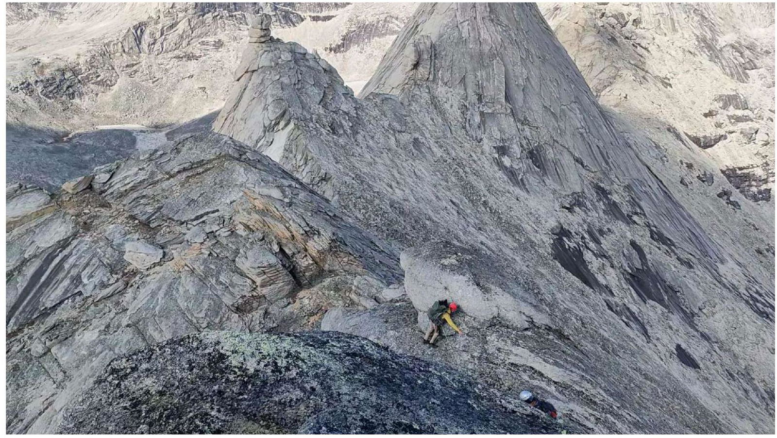
Fig. 16. Section R6–R7 pre-summit ascent, 3rd cat. diff. (Photo looking down)
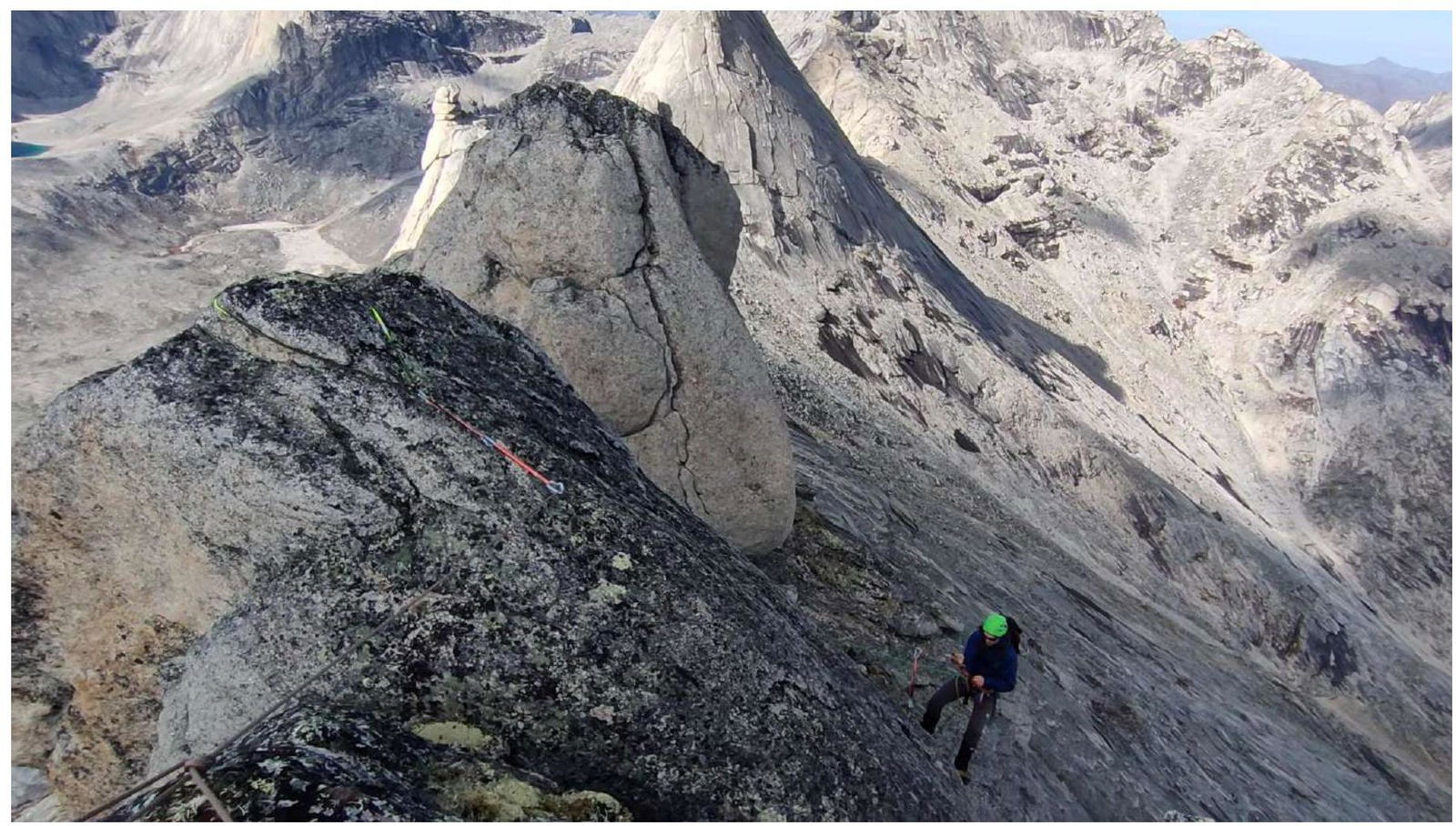
Fig. 17. Section R7–R8. Photo taken from UAL Peak looking down.
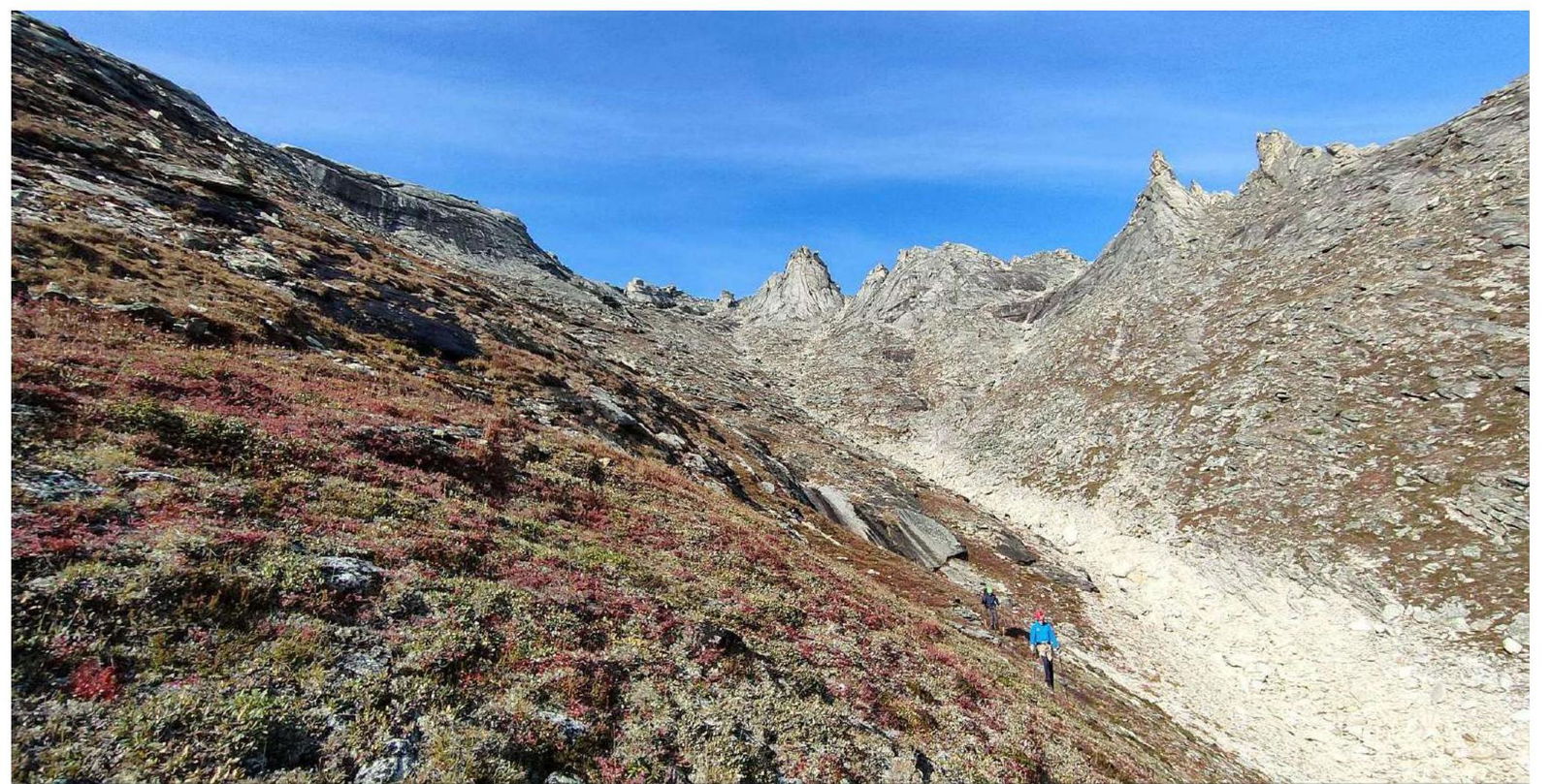
Fig. 18. Descent couloir.
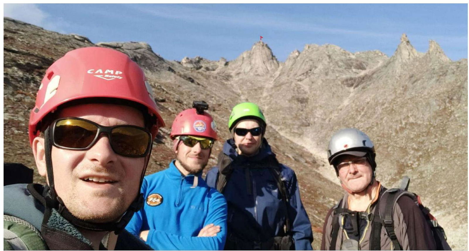
Fig. 19. Team in front of UAL Peak.
3.2. Photo of the Team on the Peak at the Control Cairn
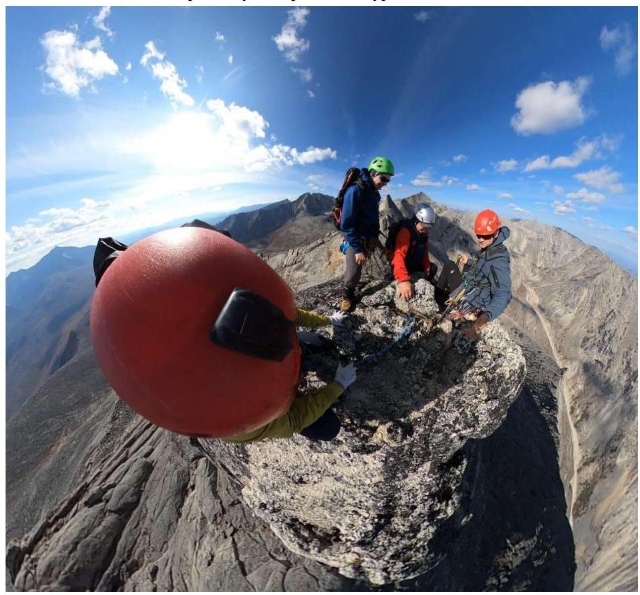
Fig. 20. Team on UAL Peak. Date: August 30, 2023. Time: 15:20.
3.3. Assessment of Route Safety
The route is recommended for passage by training groups. The approach to the start of the route from the camp takes about 1.5 hours. The route is ridge-like with good climbing and a logical line to the peak. Every 50 meters, and sometimes more frequently, there are suitable places for organizing belay stations where several people can gather.
The start of the route to the left of the ridge is marked by a control cairn. After the traverse section, upon exiting to the pass, there is also a complex control cairn. To its left is the route to GIMNAZISTOV Peak, and to the right is the continuation of the route.
Almost the entire ridge part of the route is visible from the base camp, radio reception is confident, and cellular communication is absent. Water supplies can be replenished before starting the route, about a hundred meters away, identifiable by characteristic depressions in the soil layer in thawed permafrost areas.
Recommendation for future climbers: friends and nuts work well. The sole of the boots should have good grip as there are sections that require "friction" passage. The presence of fungal colonies on the rock makes the stones extremely slippery when moist.
On the descent, trekking poles may be useful as they add confidence and speed to the descent because the grass can be very slippery.
The descent follows this route:
- Begins from the peak with a rappel (a loop made from a cordelette is organized) to section R6.
- From R6 — down the SW grassy slope to the approach trail.
This route was completed on August 30, 2023. Along the entire route, specifically on sections R0–R8, there were no signs of any human activity. We did not encounter any pre-existing cairn, trash, or abandoned sports equipment along the way, suggesting that we have traversed a new route on an unknown peak.
On the peak, we did not find a well-constructed cairn or any signs of a note's existence. We left our own note before descending.
Based on the objective difficulty of the technical part of the route to the new "UAL" peak along the southwest ridge and comparing it with other routes previously completed by the team, it is proposed to classify it as a 3A category of difficulty.