Report
ON THE FIRST ASCENT TO THE SUMMIT OF PIK 70-LETIIA MAGADANSKOI OBLASTI VIA THE EASTERN RIDGE, CATEGORY 1B, BY THE TEAM OF THE ALPINISM LAGERS ADMINISTRATION FOR THE PERIOD FROM AUGUST 29, 2023 TO AUGUST 29, 2023.
I. Ascent Report
| № | 1. General Information | |
|---|---|---|
| 1.1 | Full name, sports rank of the team leader | Kergin I.V., 1st sports rank |
| 1.2 | Full name, sports rank of the participants | Kergin I.V., 1st sports rank; Kichin A.B., 1st sports rank; Bobrinskiy K.I., 2nd sports rank; Pervushkin E.P., no rank; Berezhnoy M.I., no rank; Cherney A.I., no rank |
| 1.3 | Full name of the coach | Yakovenko A.N., Master of Sports |
| 1.4 | Organization | Administration of Alpine Camps, Federation of Mountaineering and Rock Climbing of Magadan Region |
| 2. Characteristics of the Ascent Object | ||
| 2.1 | Region | Bolshikh Porogov Ridge |
| 2.2 | Valley | Tok stream valley |
| 2.3 | Number according to the 2013 classification table | - |
| 2.4 | Name and height of the summit | 2152 m |
| 2.5 | Geographical coordinates of the summit (latitude/longitude), GPS coordinates | 61°48′05.77″ N 150°25′23.24″ E |
| 3. Characteristics of the Route | ||
| 3.1 | Name of the route | Via the Eastern Ridge |
| 3.2 | Proposed category of difficulty | 1B |
| 3.3 | Degree of route exploration | First ascent |
| 3.4 | Nature of the route terrain | Rocky |
| 3.5 | Elevation gain of the route (data from altimeter or GPS) | 565 m |
| 3.6 | Length of the route (in meters) | 870 m |
| 3.7 | Technical elements of the route (total length of sections of various difficulty categories with indication of terrain type (ice-snow, rocky)) | Category I rocky terrain — 820 m, Category II rocky terrain — 50 m |
| 3.8 | Descent from the summit | Via Category 1B terrain to Tok stream. Following the ascent route. |
| 3.9 | Additional characteristics of the route | Water is present on black streaks. Left of the ascent to the pass. |
| 4. Characteristics of the Team's Actions | ||
| 4.1 | Time of movement (team's walking hours, in hours and days) | 1 day, 13 hours |
| 4.2 | Overnight stays | None |
| 4.3 | Departure to the route | 5:00, August 29, 2023 |
| 4.4 | Arrival at the summit | 10:56, August 29, 2023 |
| 4.5 | Return to the base camp | 18:00, August 29, 2023 |
| 5. Person Responsible for the Report | ||
| 5.1 | Full name, e-mail, phone number | Kergin Ivan Vasilievich, ivan.kergin@mail.ru, 8-924-854-03-03 |
II. Description of the Ascent
1. Characteristics of the Ascent Object
1.1. General photo of the summit
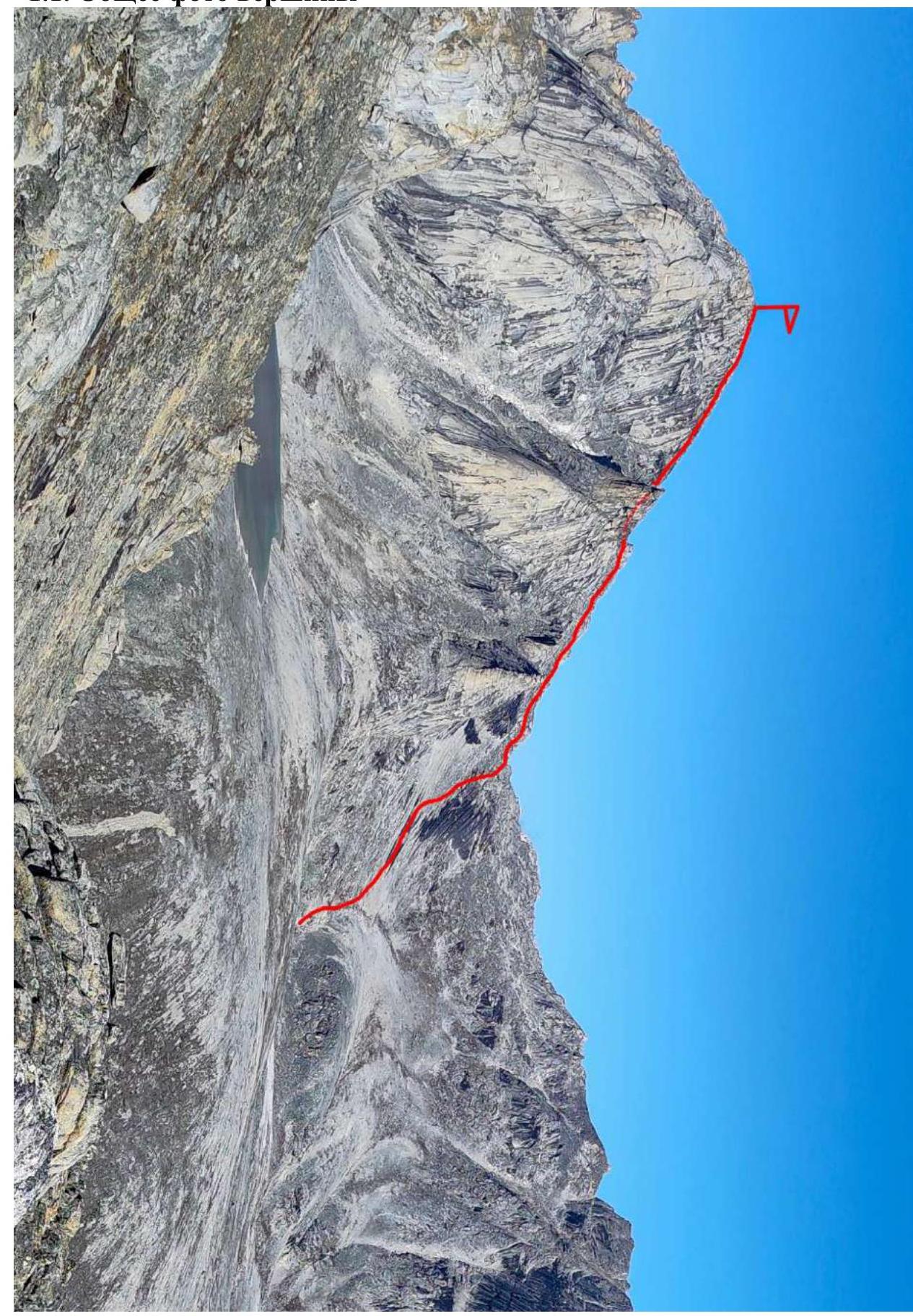
Photo #1. Photo from the northern ridge of Pik 100-letiya Otechestvennogo Alpinizma, August 29, 2023.
1.2. Photo of the route profile
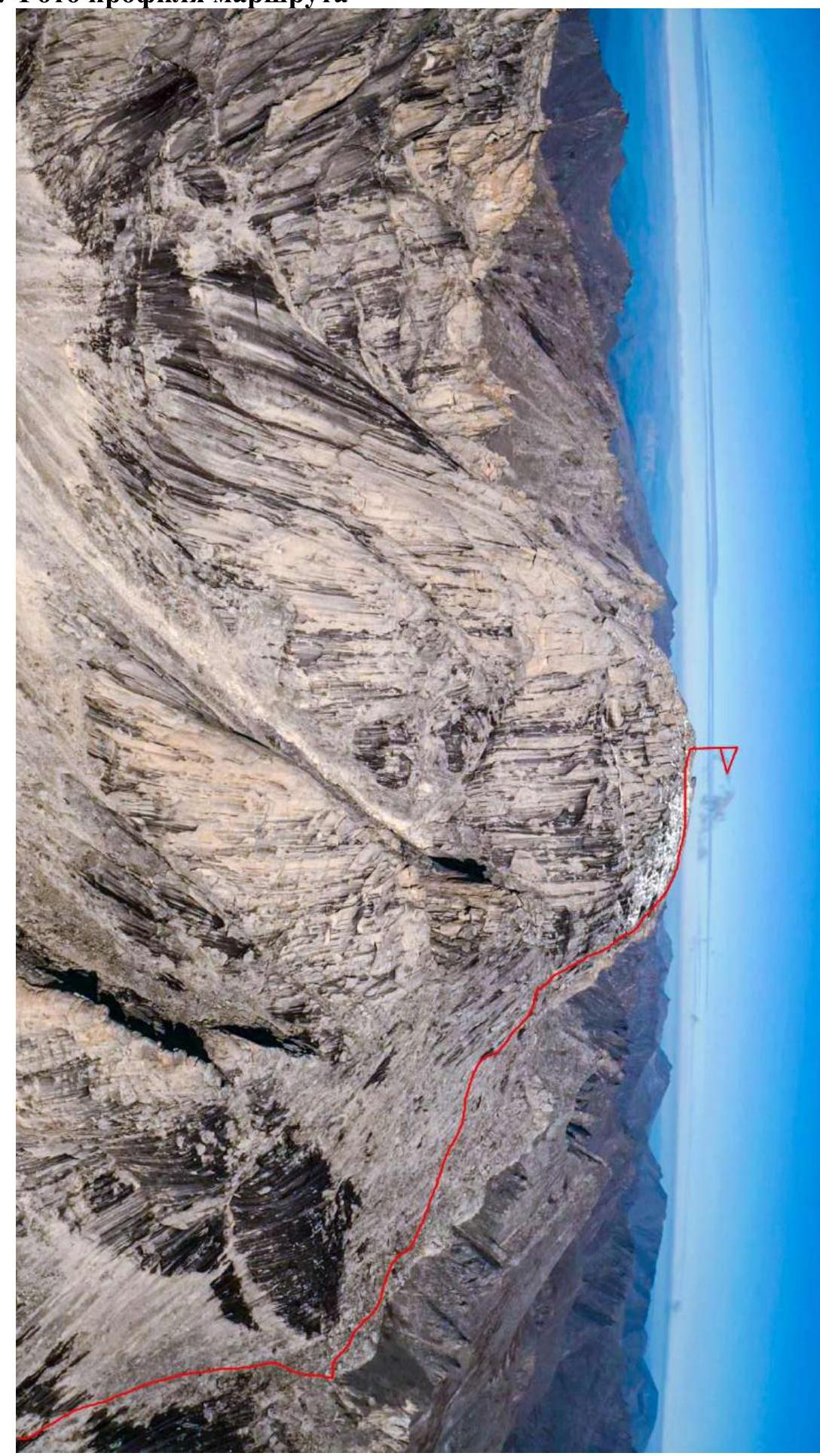
Photo #2. Photo from a drone, August 29, 2023.
1.3. Photopanorama of the area
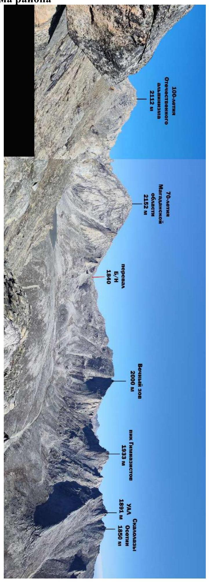
Photo #3. Photo from the northern ridge of Pik 100-letiya Otechestvennogo Alpinizma, August 29, 2023.
1.4. Geographical location of the area
Bolshikh Porogov Ridge is a 70 km long ridge. "The most elevated part of the ridge is located on the right bank of the Kolyma River, where the peaks exceed 2000 m. The highest point is Gora Bolshoy Mandychan, 2221 m. Rocky and difficult to access are the peaks Maly Mandychan (1973 m), Strashnaya (1999 m), and others. To the northwest, the ridge adjoins the Uaza-Ina mountains; its eastern slopes are drained by tributaries of the Bakhapcha River, and it is bounded to the west and south by the Kongo and Bolshoy Mandychan rivers.
The highlands of the ridge have been subjected to glacial processing. Cirques and glacial troughs, cirque lakes, narrow ridges, and arêtes are common. Geologists P.I. Skornyakov and N.V. Tupitsyn referred to the right-bank part of the ridge as a grandiose jagged wall. The wild gorges in the upper reaches of the Strashnaya, Dyadya Vanya, and Bolshoy Mandychan rivers are simply striking. The first researcher of the high-mountain part of the ridge, B.I. Vronsky, noted in 1933: "The massif is characterized by the presence of a large number of outliers with very bizarre shapes, bordering deep cirques, from which long valleys of streams originate, deeply incised into the massif. The abundance of these cirques and valleys gives the massif a very dissected appearance."
The territory of the ridge is completely uninhabited. To the northeast, there is the settlement of Sinegorye, connected by a road to the Kolyma Highway." — R.V. Sedov, "Kolymskaya gornaya strana", 2004.
1.5. Logistics of the expedition
Early departure from Magadan (7:00), then movement along the main highway to Palatka settlement (about 1 hour), followed by a turn onto the municipal road (Palatka – Kulu – Neksikan). From Palatka, drive to Ust-Omchug settlement (just over half a day, or 265 km from Magadan), after which a high-clearance vehicle is required. Along the old tractor road maintained by the Mars gold mining company, reach the Mars base, formerly Expeditsionny. Then, a full day's journey to the assault camp. We planned to arrive in 1 day. Didn't make it. Heavy overload. So, we arrived in 1.5 days. After that, we set out to the object of the ascent.
1.6. Map of the area

Magadan – Ust-Omchug settlement – Mars base camp – Assault camp – Pik 70-letiya Magadanskoy oblasti Fig. 1. Map of the area
2. Characteristics of the Route
2.1. Technical photograph
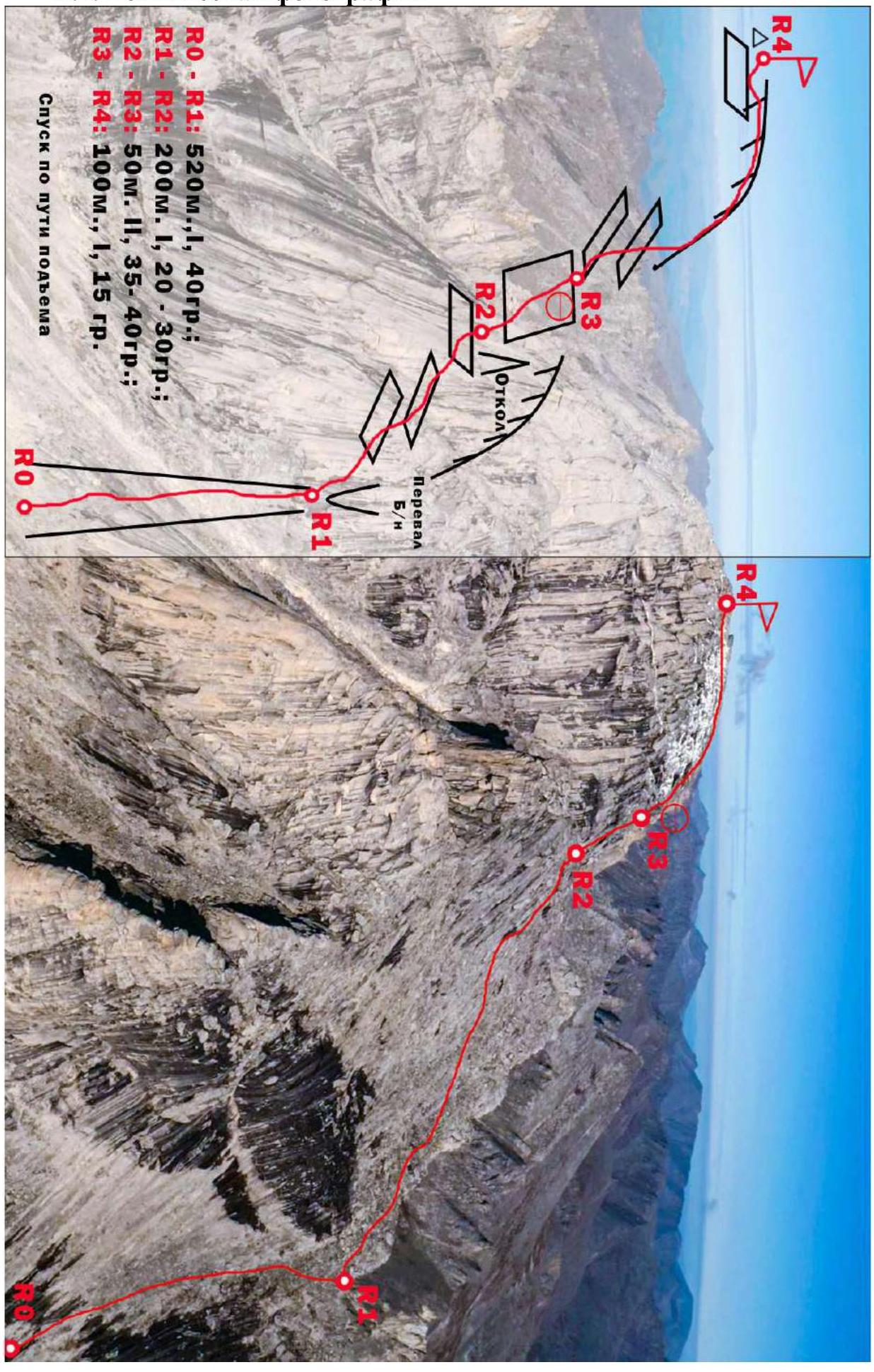
R0–R1: 520 m, I, 40°; R1–R2: 200 m, I, 20–30°; R2–R3: 50 m, II, 35–40°; R3–R4: 100 m, I, 15°. Descent via the ascent route Photo #4.
2.2. Section numbers
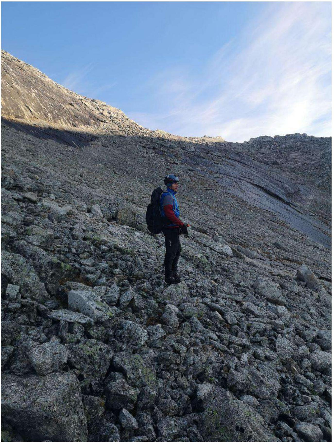
Photo #5. Section R0–R1
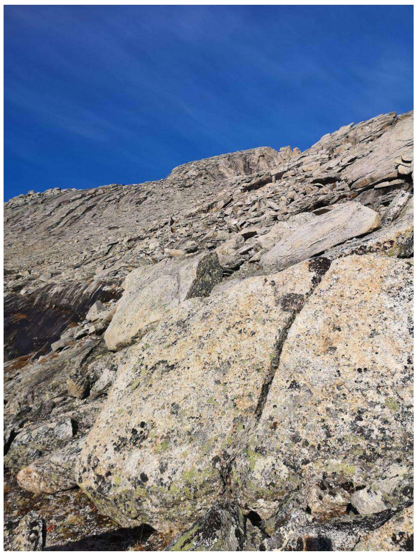
Photo #6. Section R1–R2
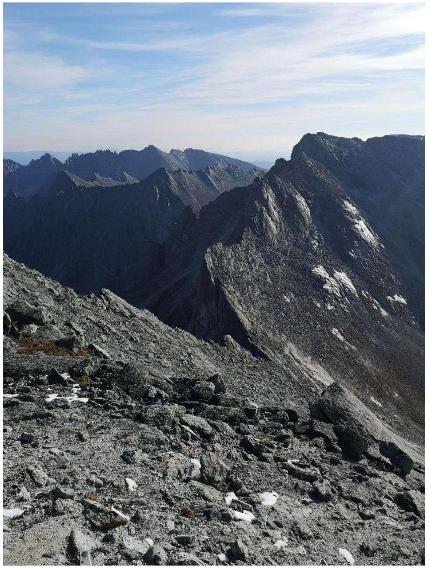
Photo #7. Section R1–R2

Photo #8. Section R2–R3
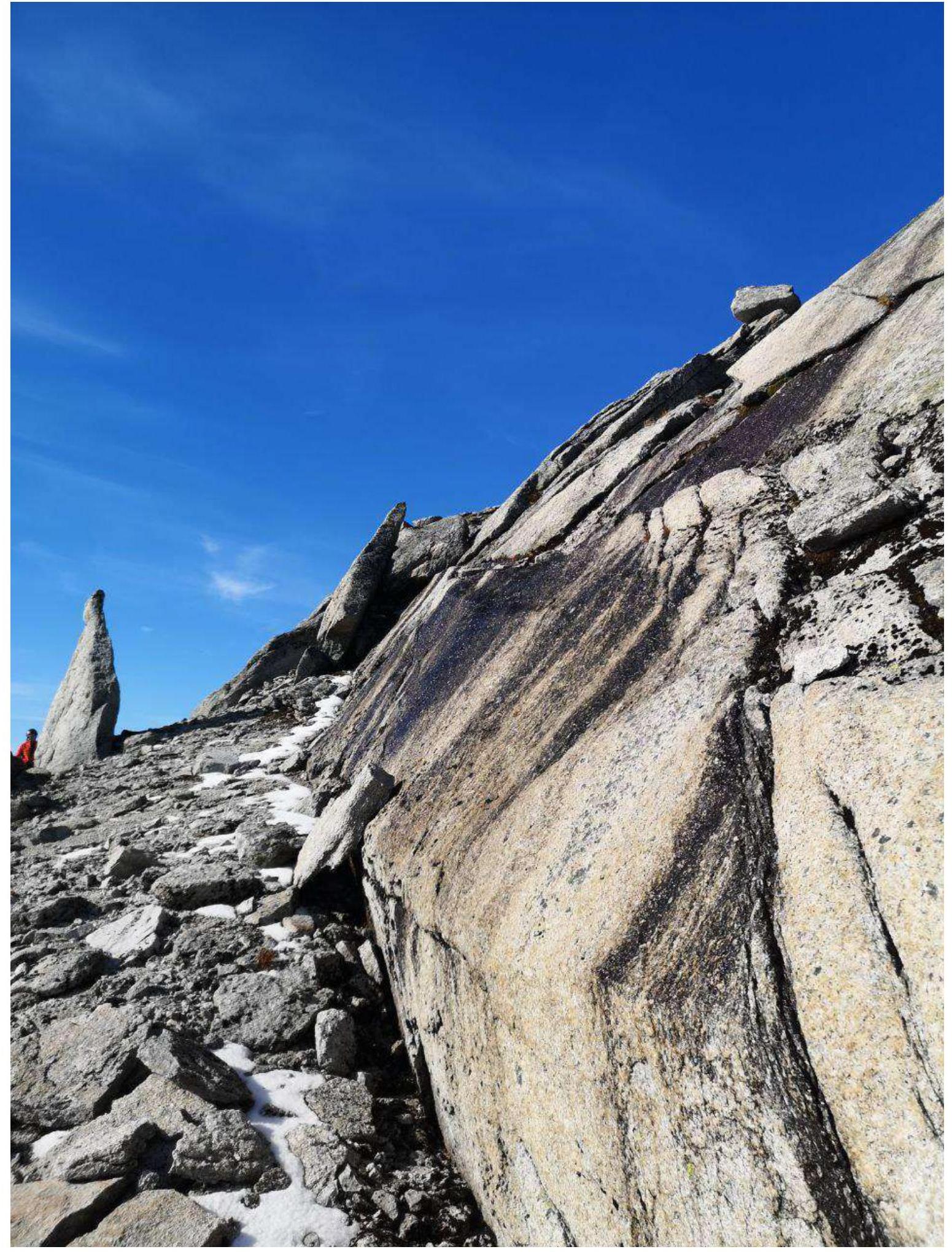
Photo #9. Section R2–R3. Key section. A large spall is visible on the ledge.
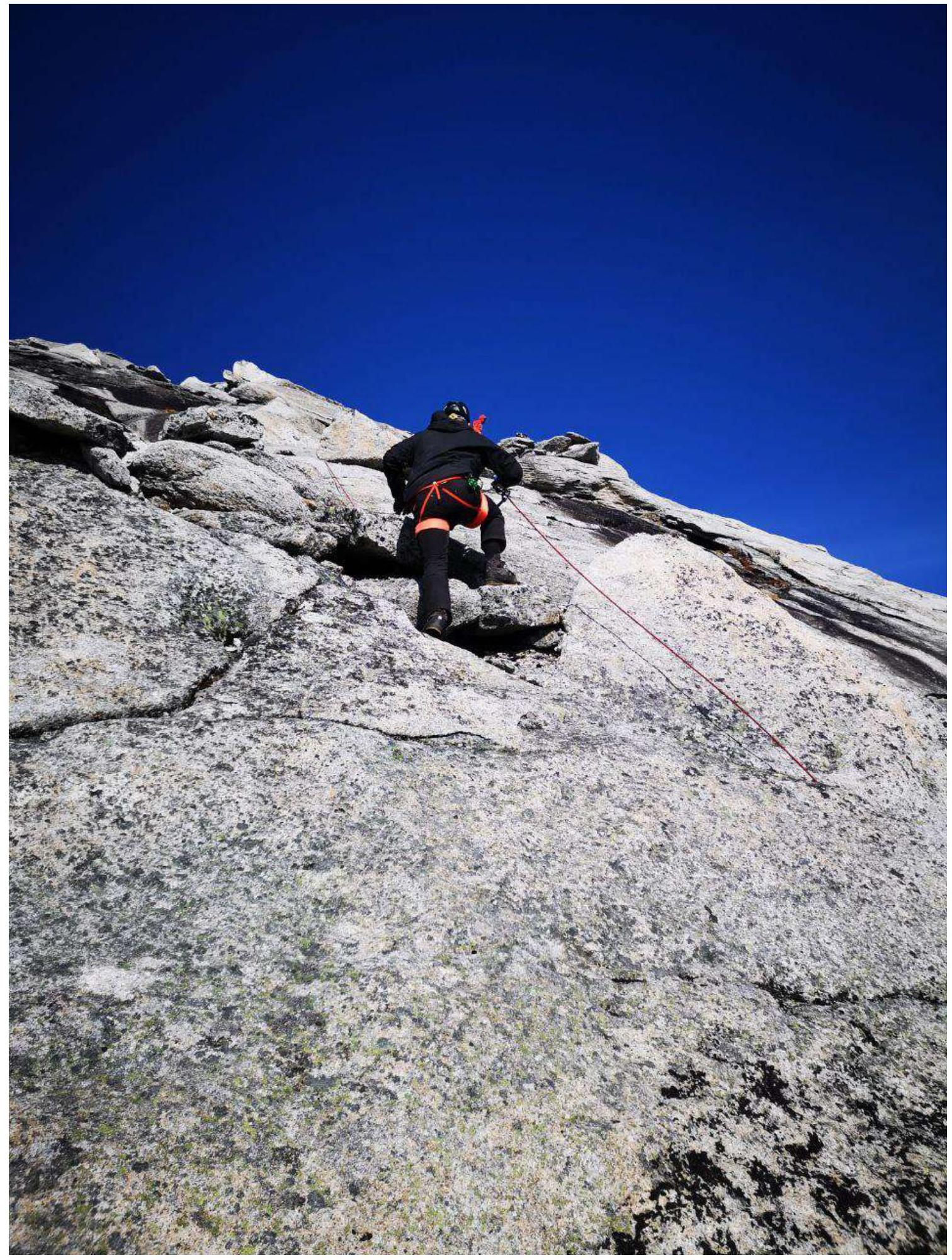
Photo #10. Section R2–R3. Passage of the key section.
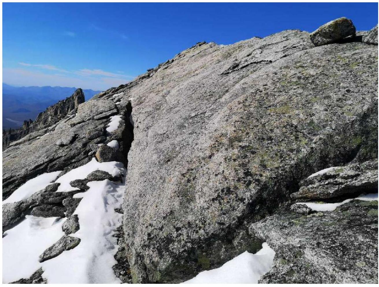
Photo #11. Section R3–R4. Along the pre-summit ridge to the summit.
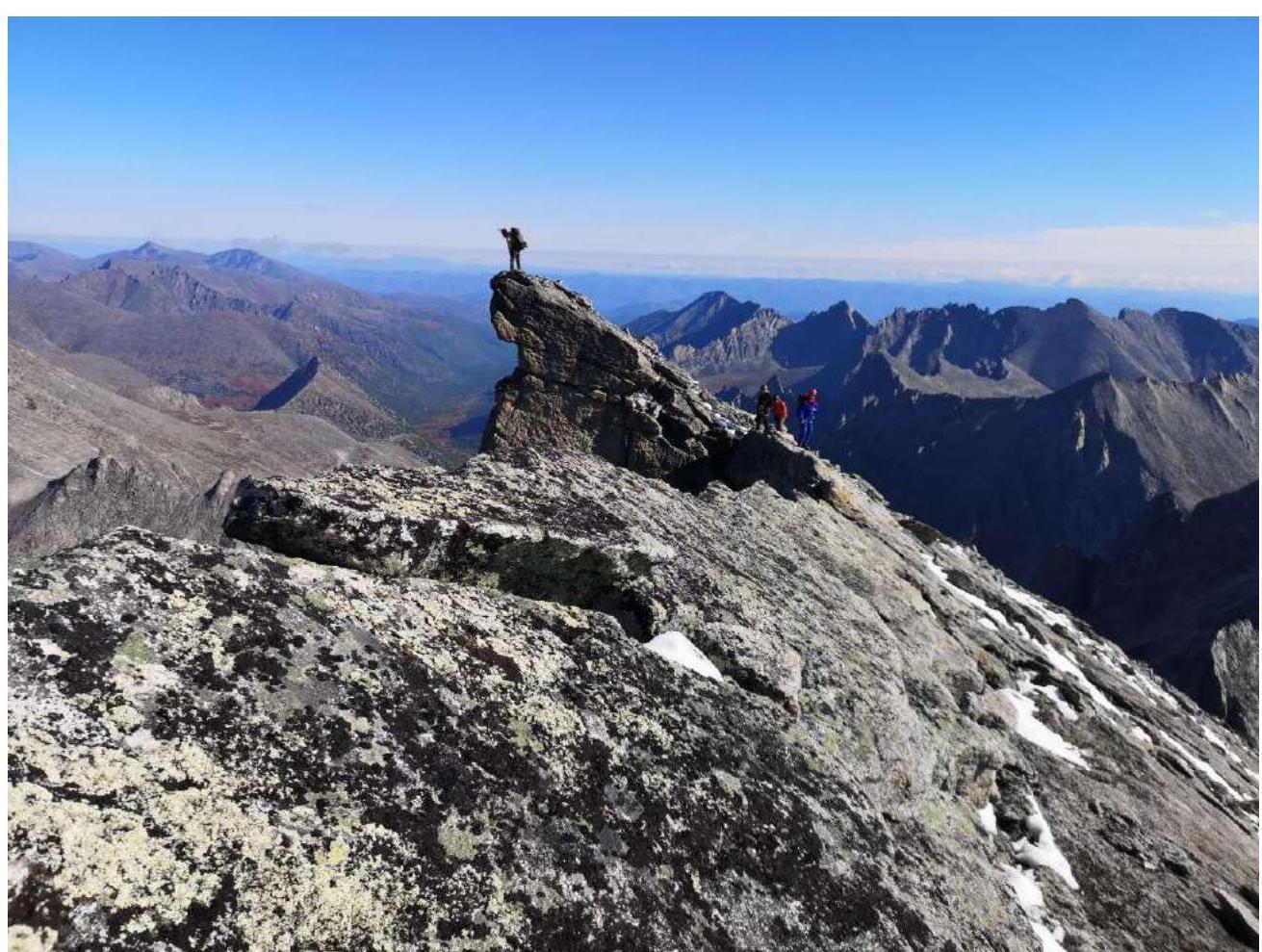
Photo #11a. Section R3–R4. Pre-summit ridge from the summit.
3. Characteristics of the Team's Actions
3.1. Brief description of the route passage
| Section | Description | Photo number |
|---|---|---|
| Approach | Departure from the assault camp, located on the right bank of the Tok stream, at 5:00. Gradual ascent up the stream to the unnamed pass. 2–2.5 hours. Simultaneous movement. | |
| R0–R1 | Ascent up the scree couloir straight up. To the left is a rocky belt with black streaks. To the right is a wet, icy rocky slab. Can be bypassed on the left or right. We bypassed on the left. Ascent is not difficult. There are easy descents. There are many large, loose rocks. At the pass, there is a large, convenient ledge. Can leave some equipment. Convenient spot. Simultaneous movement. | Photo #5 |
| R1–R2 | From the pass, turn left and begin a gradual ascent along the Eastern Ridge, keeping to its left side. The section ends by abutting a large inclined wall (glacial roches moutonnées). A characteristic sign of the end of the section is a large spall. Be cautious: large, loose rocks. Simultaneous movement. | Photo #6, #7 |
| R2–R3 | Key section. Alternate movement. 50 m section. Not difficult climbing. Up the little wall (glacial roches moutonnées), keeping to the right towards the ridge. No rocks. Convenient anchor on the spall. | Photo #8, #9, #10 |
| R3–R4 | Simultaneous movement. Along the pre-summit ridge to the summit. Slippery. Summit. | Photo #11, #11a |
| Descent | Descent via the ascent route. A short rappel on the key section. Be cautious. Slippery. Then, down to the assault camp. |
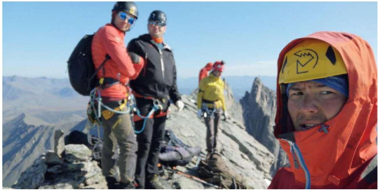
3.2. Photo of the team on the summit with the control post
3.3. Safety assessment of the route
Options for communication on the route Communication only via satellite phone. There is an option to maintain radio contact through the nearby Mars mining company. But we didn't check.
Recommendations for future climbers We recommend bringing crampons. Night frosts are possible, so the rocky slabs may be icy early in the morning. Not a bad idea.
Detailed information on the descent from the summit, indicating landmarks The descent is completely logical – strictly following the ascent route. You can't go wrong. However, there are many slippery slabs.
Conclusion on the preliminary assessment of the route The route turned out to be critically logical and intuitively understandable. Convenient for descent from potential wall routes. There is a full set of characteristic obstacles, confirming the estimated category 1B.