
Report
On ascending to the summit of Pik Skalolazov Osetii via the Southwest Ridge, category 1B, by the UAL Mountain Club team, for the period September 1, 2023.
| 1. General Information | ||
|---|---|---|
| 1.1 | Full name, sports rank of the leader | Chikin Artem Borisovich, 1st sports rank |
| 1.2 | Full name, sports rank of participants | Bobrinskiy K.I., 1st sports rank, Butakov A. S., 3rd sports rank, Marinich E. E., 3rd sports rank, Golovushkin E. Yu, 1st sports rank |
| 1.3 | Full name of coach | Yakovenko Alexander Nikolaevich |
| 1.4 | Organization | MC «UAL» |
| 2. Characteristics of the Ascent Object | ||
| 2.1 | Region | Magadan Oblast, Khrebet Bolshikh Porogov |
| 2.2 | Area | Ushchelie Ruchya Tok |
| 2.3 | Number of section according to the 2013 classification table | p.v. |
| 2.4 | Name and height of the summit | Pik Skalolazov Osetii 1989 m |
| 2.5 | Coordinates of the summit | 61.786881, 150.455956 |
| 3. Characteristics of the Route | ||
| 3.1 | Name of the route | via Southwest Ridge |
| 3.2 | Proposed category of difficulty | 1B |
| 3.3 | Degree of route exploration | First ascent |
| 3.4 | Relief characteristics of the route | rocky |
| 3.5 | Height difference of the route | 400 m |
| 3.6 | Length of the wall section of the route | 50 m |
| :--: | :--: | :--: |
| 3.7 | Technical elements of the route | 1st cat. diff. — 300 m. 2nd cat. diff. — 400 m. 3rd cat. diff. — 50 m. A1 — 5 m |
| 3.8 | Average steepness of the route, (°) | 30° |
| 3.9 | Average steepness of the wall section of the route, (°) | 30° |
| 3.10 | Descent from the summit | 1B |
| 3.11 | Additional characteristics of the route | no water, carried with them |
| 4. Characteristics of the Team's Actions | ||
| 4.1 | Time of movement (in hours, indicated in hours and days) | 3 h 30 min |
| 4.2 | Overnight stays | no |
| 4.3 | Time of route processing | 6 h, 100 m, 2 ropes |
| 4.4 | Departure on the route | 9:30, September 1, 2023 |
| 4.5 | Reaching the summit | 13:00, September 1, 2023 |
| 4.6 | Return to the base camp | 15:00, September 1, 2023 |
| 5. Characteristics of Weather Conditions | ||
| 5.1 | Temperature, °C | From 0° to +10° |
| 5.2 | Wind speed, m/s | Moderate, 1–2 m/s |
| 5.3 | Precipitation | None |
| 5.4 | Visibility, m | Fog |
| 6. Person Responsible for the Report | ||
| 6.1 | Full name, e-mail | Chikin A.B. artem.chikin@mail.ru |
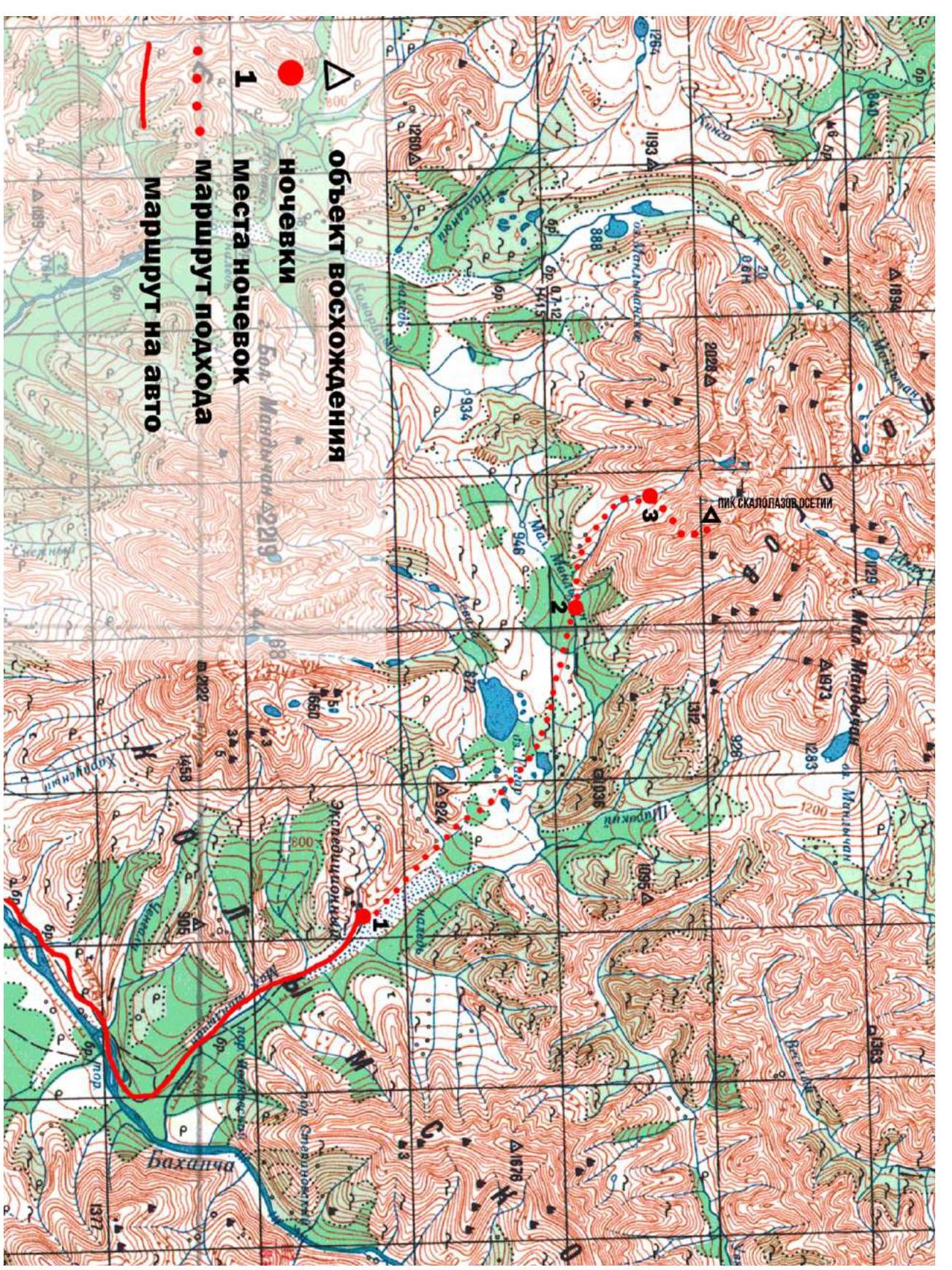 Area diagram
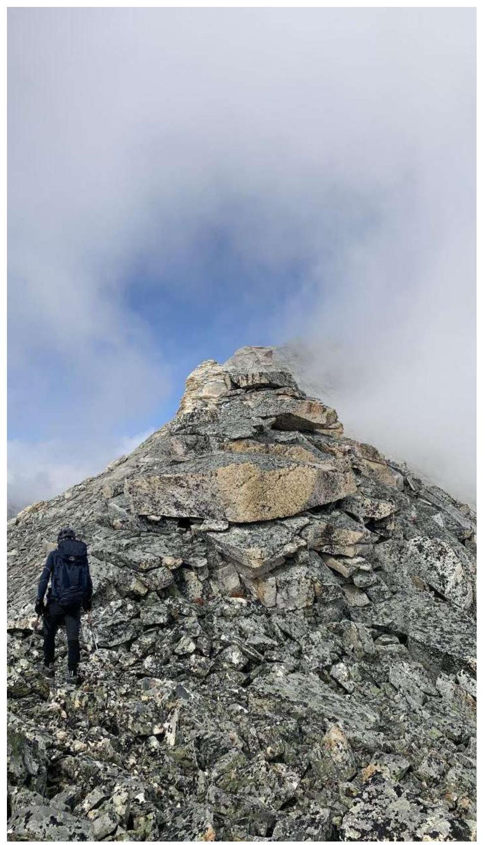
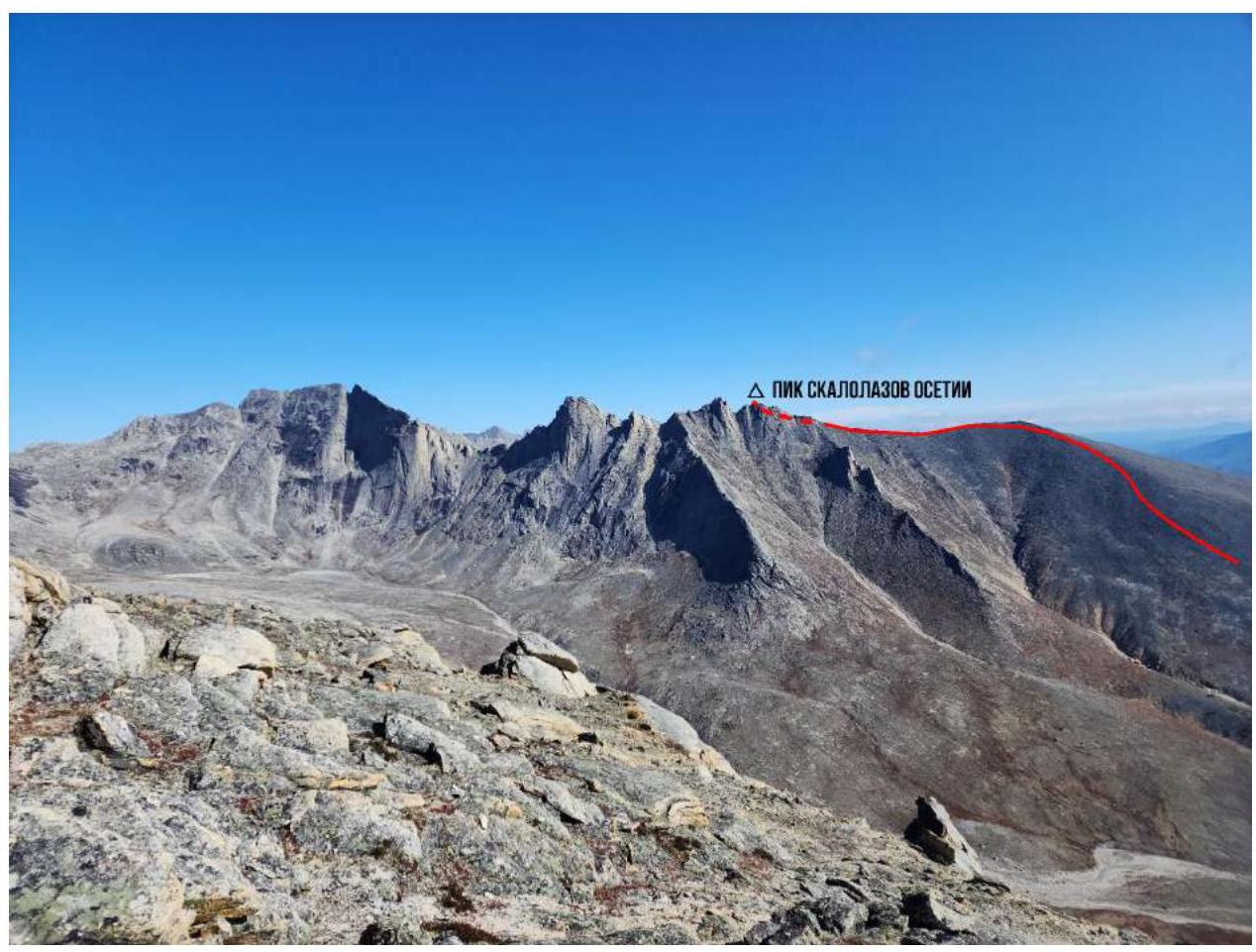 General view of the summit
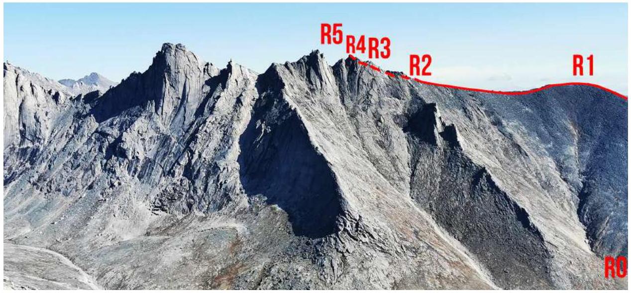 Location of sections
Route Description
R0–R1
Approach from the overnight stay near Ruchye Tok along the scree towards the scree summit and the southwest ridge.
R1–R2
500 m. 1st cat. diff. 300 m, 2nd cat. diff. 200 m After reaching the scree summit, continue moving along the southwest ridge and its northwest (left in the direction of travel) side, overcoming rocks of 1–2 cat. diff. About 500 m. Simultaneous belay on projections is possible.
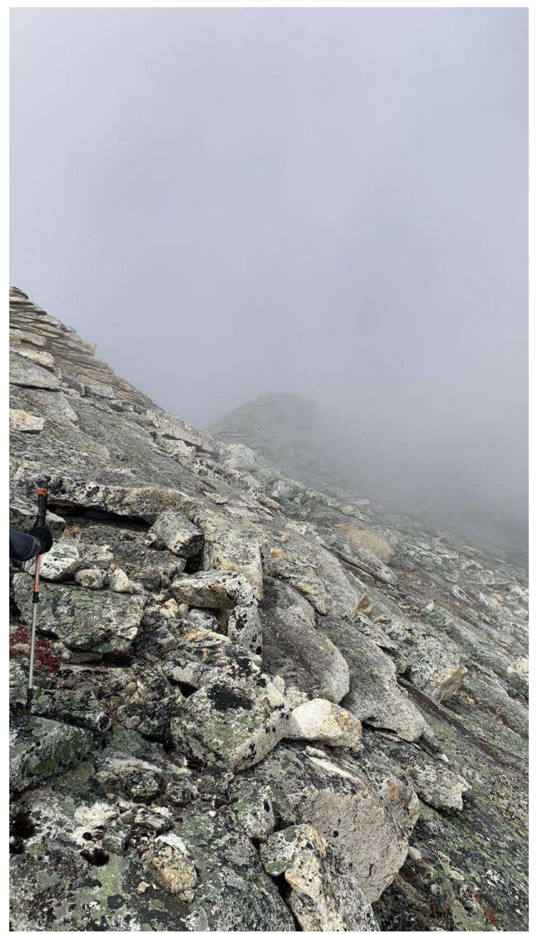
R2–R3
200 m. 2nd cat. diff. The ridge abuts a red gendarme — from here you need to move to the southeast side of the ridge and start bypassing the gendarme along slabs and rocks of 2nd cat. diff.
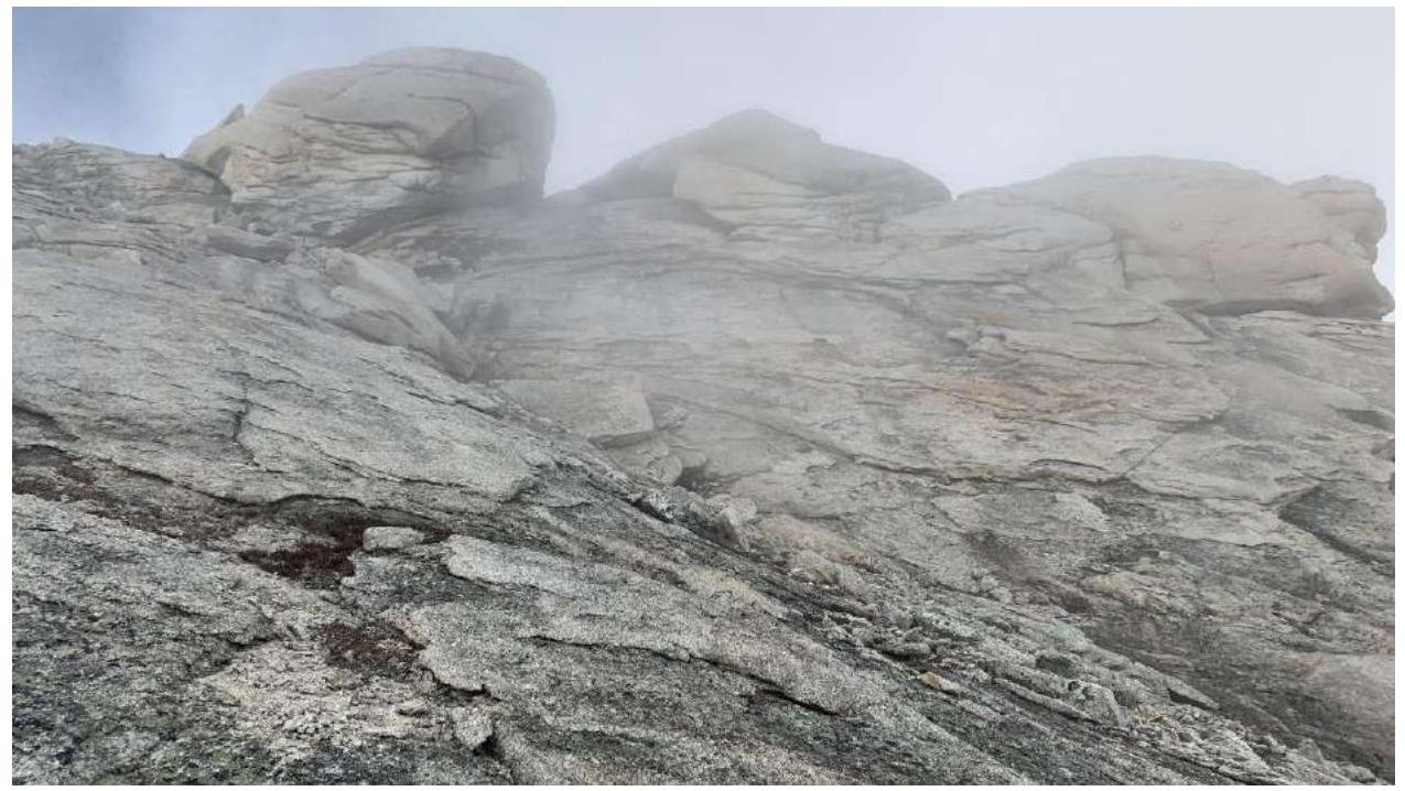
R3–R4
50 m. 3rd cat. diff. Having bypassed the gendarme, turn left towards the summit and along ledges with rock walls of 3rd cat. diff. reach the presummit.
R4–R5
5 m. 80° A1 5 m
The summit is a large boulder, about 5 m. To climb it, we set up a station on the north side of the boulder, threw a rope to the other side, and jumarred.
 Approaching R1, scree summit
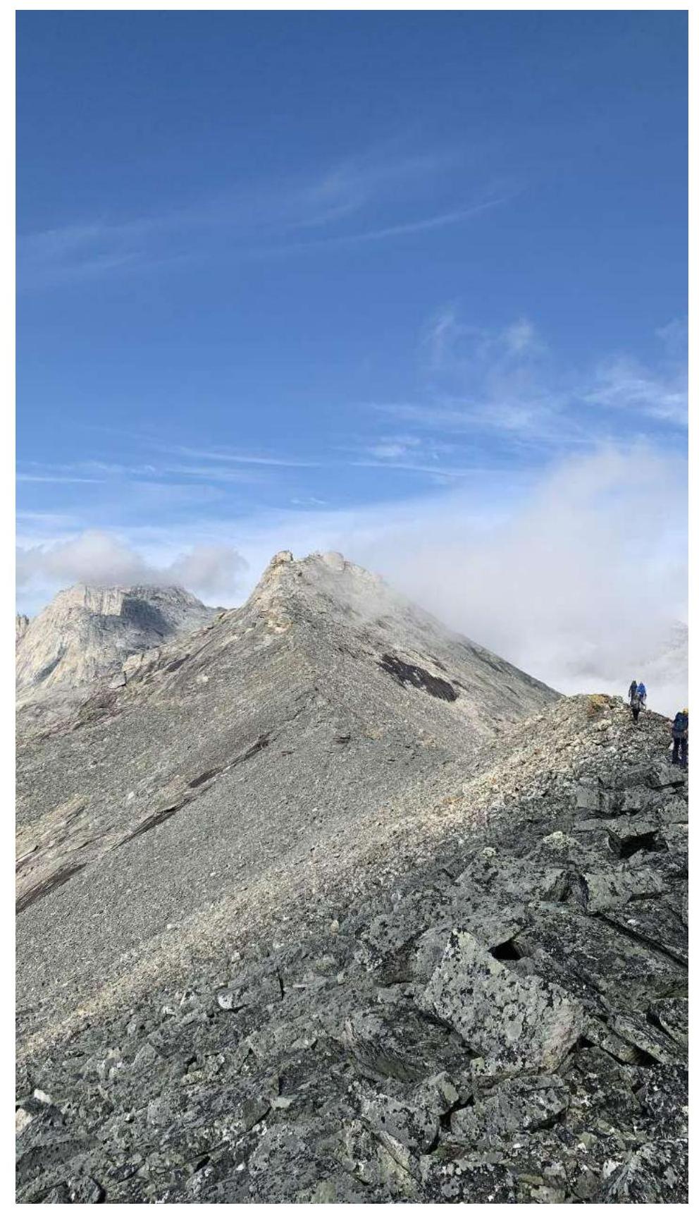
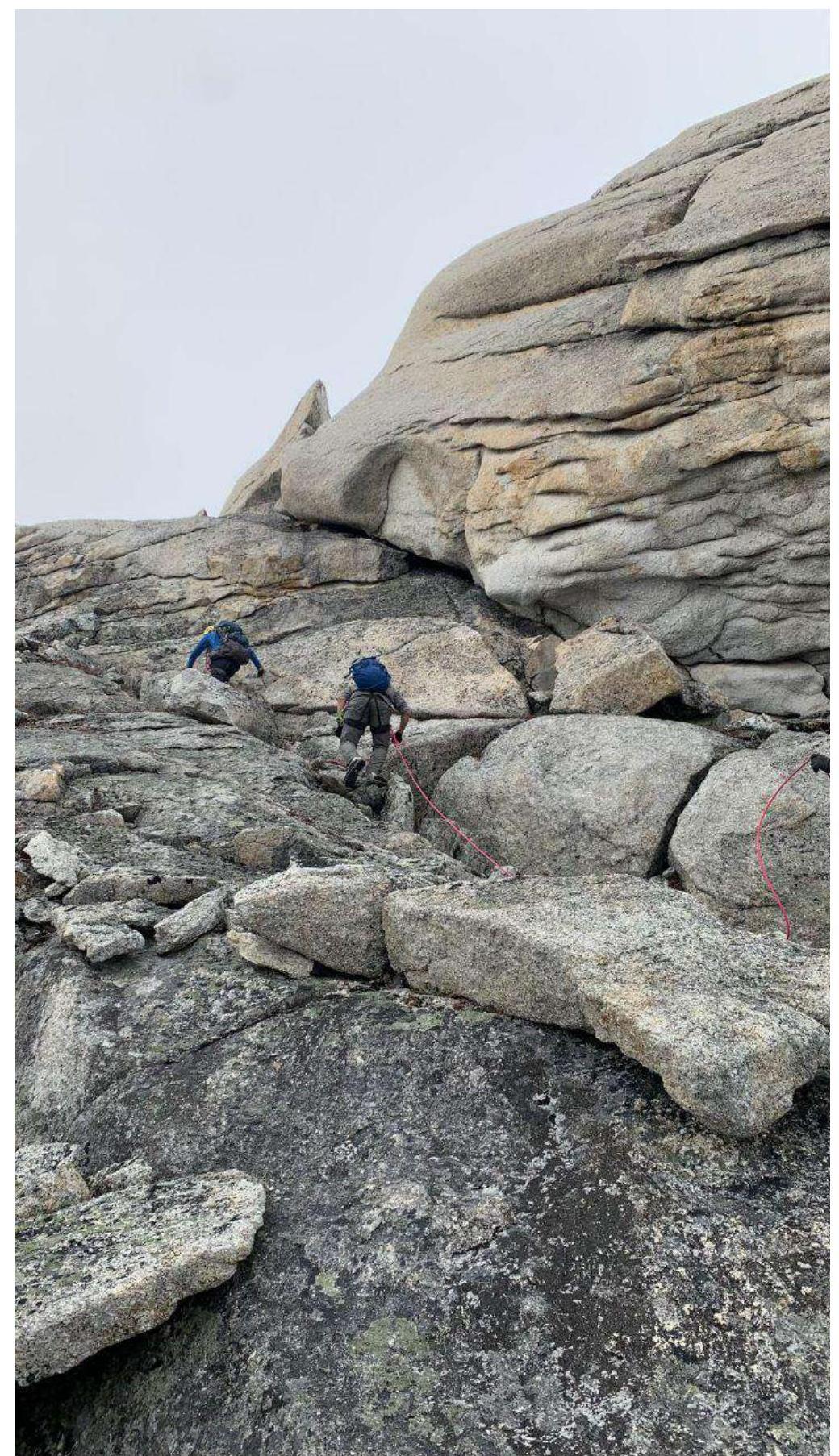
 Further along the ridge, section R1–R2
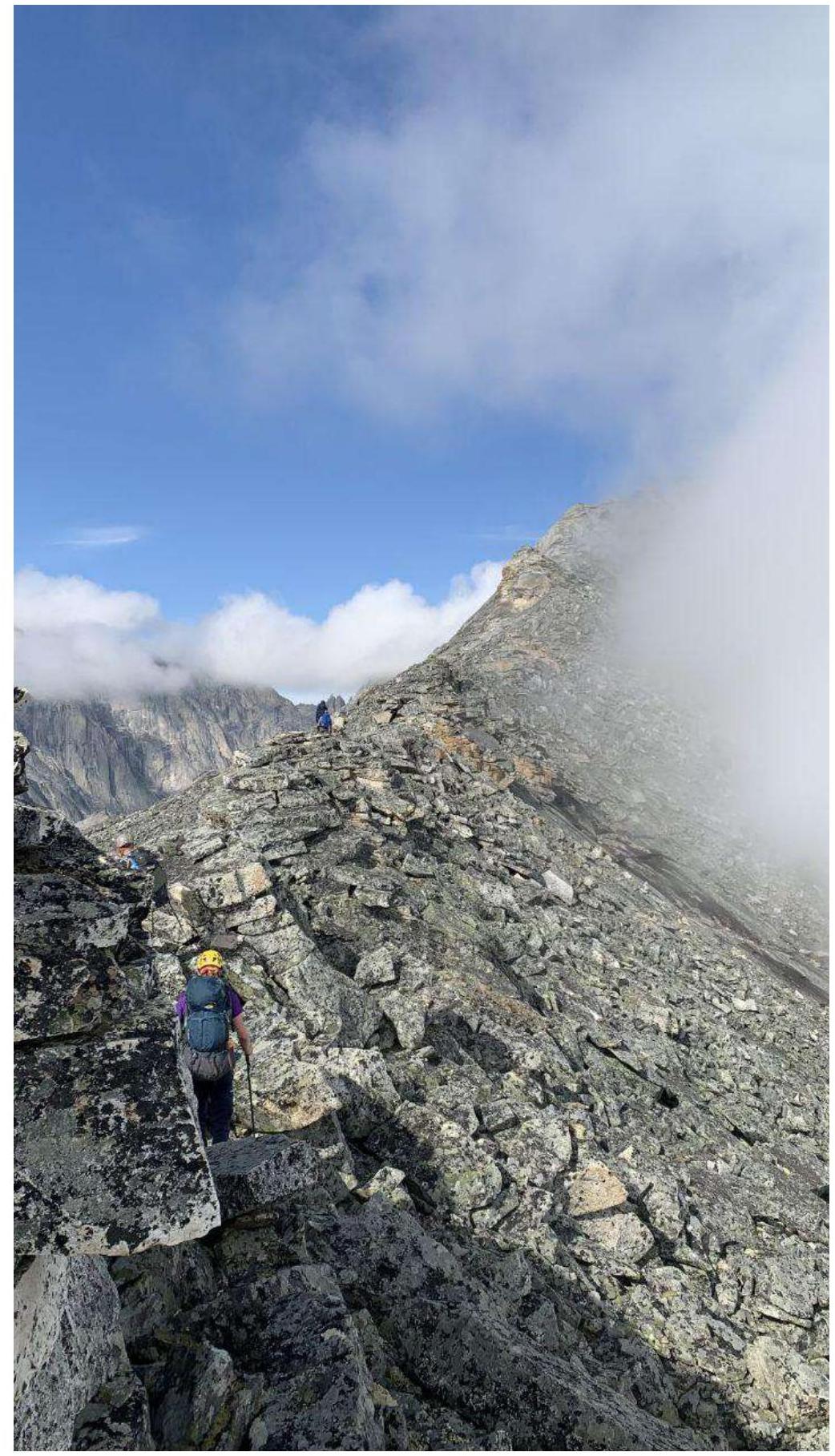 Further R1–R2, ahead is the red gendarme
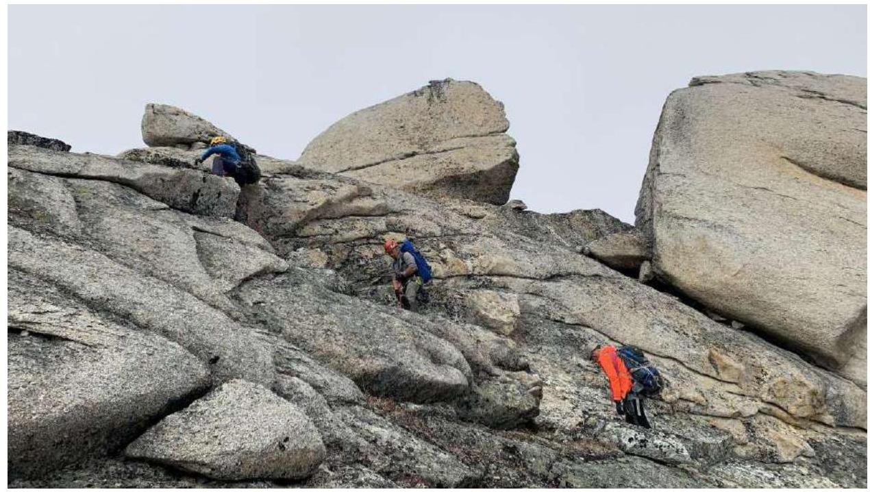
 Bypassing the red gendarme R2–R3
 R3–R4
R3–R4
 Section R3–R4
 Section R3–R4
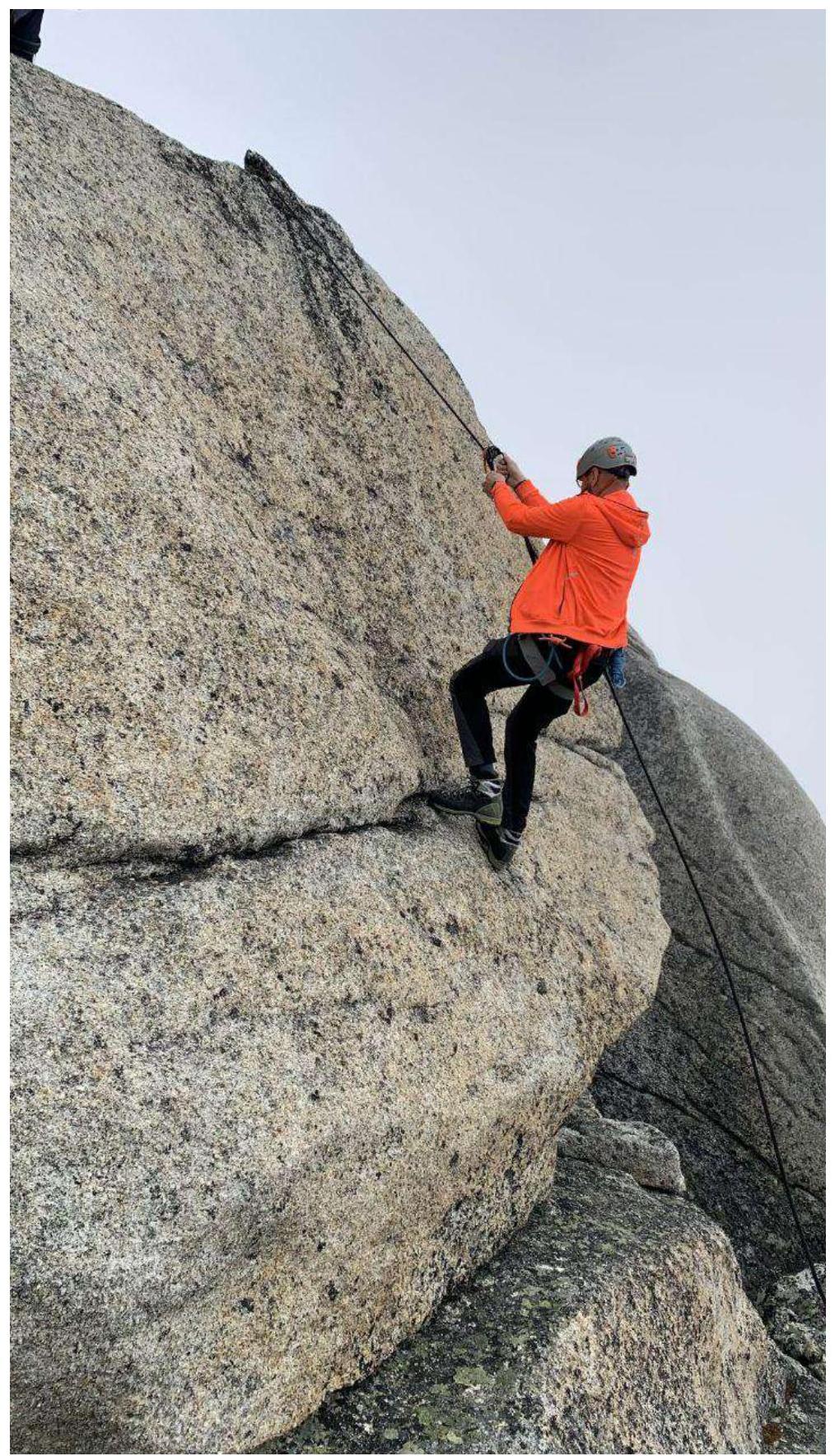 Section R4–R5
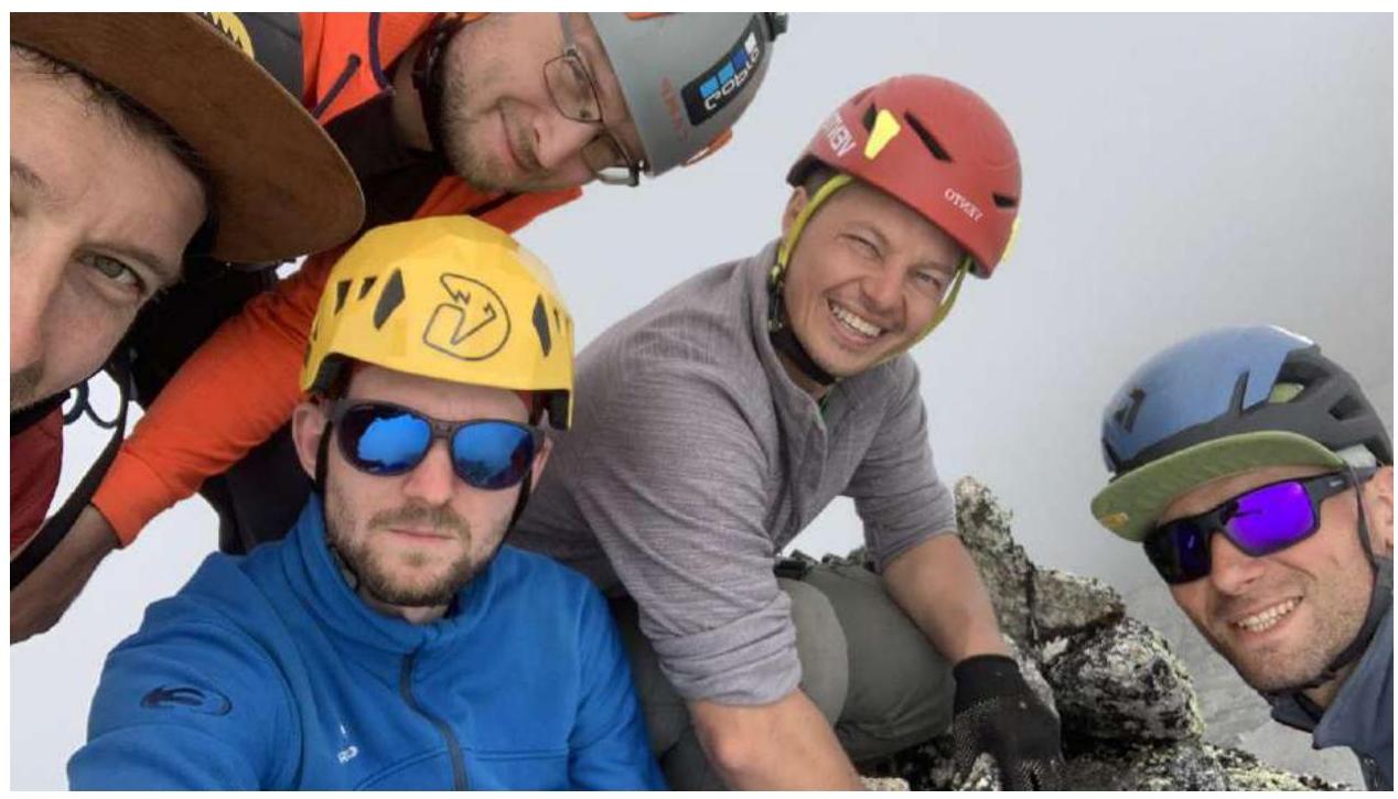 Team on the summit
Team Actions
The approach to the base camp from the Mars artel took 1.5 days. Inaccessible area, partly marshy terrain, partly obstructing vegetation in the form of stlanik.
We departed from the overnight stay at 9:30, ascended to the ridge; the path is logical, and detours around complex sections of the ridge are easily readable despite the fog on that day. Notable was the climb to the boulder-summit at the end of the route. We all climbed to the summit together at 13:00.
We changed the descent path as we saw a more convenient slope towards Ruchye Tok from the ridge, starting immediately behind the red gendarme.
Results, Conclusions, Comments
An interesting ridge route. From the overnight stay, it takes half a day for a training group. On the route, simultaneous belay skills are practiced, and jumar climbing to the summit is required.
Comments
Sign in to leave a comment