REPORT
ON THE FIRST ASCENT TO THE SUMMIT VECHNY ZOV (2000 m) VIA THE SOUTHWEST RIDGE BY ROUTE 2A CATEGORY OF COMPLEXITY BY THE TEAM OF THE ALPINISM CAMPS MANAGEMENT August 31, 2023
I. Ascent Passport
| № | 1. General Information | |
|---|---|---|
| 1.1 | Full name, sports rank of the leader | Yakovenko Alexander Nikolaevich - Master of Sports |
| 1.2 | Full name, sports rank of participants | Tyutereva O.I. - 3rd sports rank, Yesenin A.G. - 3rd sports rank, Golovushkin E.Yu. - 3rd sports rank, Zaretskaya M.M. - 3rd sports rank, Babakaeva Yu.R. - 3rd sports rank, Butakov A.S. - 3rd sports rank, Kalashnikov P.A. - 3rd sports rank |
| 1.3 | Full name of the coach | Yakovenko Alexander Nikolaevich |
| 1.4 | Organization | Alpinism Camps Management (ACM) |
| 2. Characteristics of the Ascent Object | ||
| 2.1 | Region | Magadan Oblast, Yagodninsky District. Upper Kolyma Highlands, Bolshikh Porogov Ridge |
| 2.2 | Valley | Tok Creek Valley |
| 2.3 | Section number according to the 2013 Classification Table | - |
| 2.4 | Name and height of the summit | Vechny Zov, 2000 m |
| 2.5 | Geographical coordinates of the summit (latitude/longitude), GPS coordinates | 61.802772° N, 150.448483° E |
| 3. Characteristics of the Route | ||
| 3.1 | Route name | Via the Southwest Ridge |
| 3.2 | Proposed category of complexity | 2A |
| 3.3 | Degree of route exploration | First ascent |
| 3.4 | Nature of the route terrain | Rock |
| 3.5 | Elevation gain of the route (altimeter or GPS data) | 61.802772° N, 150.448483° E |
| 3.6 | Route length | 2150 m |
| 3.7 | Technical elements of the route (total length of sections of various complexity categories with indication of terrain type (ice-snow, rock)) | Category I rock - 500 m |
| Category II rock - 250 m | ||
| Descent via a couloir - alternating belay through terrain | ||
| 3.8 | Descent from the summit | Via a couloir |
| 3.9 | Additional route characteristics | No water along the route; it is necessary to bring water. |
| 4. Characteristics of the Team's Actions | ||
| 4.1 | Time in motion (team's walking hours) | 7 hours 30 minutes |
| 4.2 | Overnights | None |
| 4.3 | Departure on the route | 7:00 August 31, 2023 |
| 4.4 | Reaching the summit | 12:00 August 31, 2023 |
| 4.5 | Return to base camp | 14:30 August 31, 2023 |
| 5. Responsible for the Report | ||
| 5.1 | Full name, e-mail | Tyutereva Olga Igorevna oligsa@yandex.ru |
II. Ascent Description
1. Characteristics of the Ascent Object
1.1. General Photo of the Summit
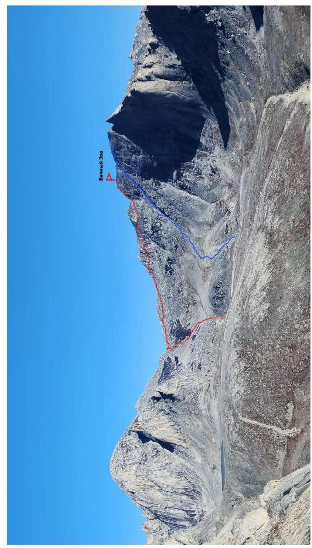
Photo 1. Overall photograph of the route line. View from the ridge of the Tok River valley. Red line - ascent line, blue - descent line.
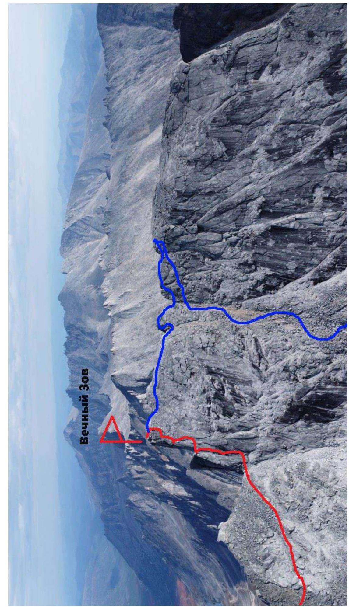
Photo 2. Photograph of the route line in its summit part, taken from a drone. Red line - ascent line, blue - descent line.
1.2. Geographical Location of the Region
Ascent region: Magadan Oblast, Yagodninsky District, Upper Kolyma Highlands, Bolshikh Porogov Ridge. The Bolshikh Porogov Ridge is a 70 km long ridge. The most elevated part of the ridge is located on the right bank of the Kolyma River, where the peaks exceed 2000 m. The highest points are Mount Bolshoy Mandychan (2221 m), Maly Mandychan (1973 m), Strashnaya (1999 m), and others. To the northwest, the ridge adjoins the Uaza-Ina mountains; its eastern slopes are drained by tributaries of the Bakhapcha River, and it is bounded to the west and south by the Kongo and Bolshoy Mandychan rivers.
The highlands of the ridge have been subjected to glacial processing. Cires, cirque lakes, trough valleys, narrow ridges, and karlings are common. The territory of the ridge is uninhabited. To the northeast, there is the settlement of Sinegorye, connected by a road to the Kolyma Highway. To the west, 50 km beyond the Obinskaya Gряда, lies the settlement of Obo, which has a road connection to Ust-Omchug on the Tenka Highway.

Figure 1. Scheme of the region. Magadan - Ust-Omchug - "Mars" Base Camp - Assault Camp - Vechny Zov Summit 1 - approach to the start of the route - 2 hours; 2 - transition from Base Camp to Assault Camp - 1.5 days (or one day with light backpacks); 3 - delivery to "Mars" Base Camp - a full day by a large all-terrain vehicle from Magadan.
1.3. Expedition Logistics
1) Magadan – Ust-Omchug
Departure from Magadan (7:00) along the main highway to the settlement of Palatka (about 1 hour), then turn onto the municipal road (Palatka - Kulu - Neksikan). From Palatka, drive to Ust-Omchug (265 km from Magadan).
2) Ust-Omchug – "Mars" Artel
Change vehicles to a high-clearance vehicle. Continue along the old tractor road maintained by the "Mars" gold mining artel. Reach the "Mars" base, formerly known as Expeditsionny.
3) "Mars" Artel - Base Camp (Assault Camp)
Move through the forest, crossing rivers (Maly Mandychan River), swamps, and lakes (Gagar Lake). The journey took 2 days. 1 day to the assault camp (8 hours) due to the heavy load of participants. Then, move to the base camp (5 hours).
4) Approaching the Ascent Object
Approach the ascent object. The approach from the assault camp to the start of the route takes 1-1.5 hours.
The described movements are shown in Figure 1.
2. Characteristics of the Route
2.1. Technical Photograph

Photo 3. Technical photograph of the route with section numbers. Red line - ascent line, blue - descent line.
2.2. Section Numbers

Photo 4. Point at the end of section R1-R2 (pronounced ascent onto the Southwest Ridge).
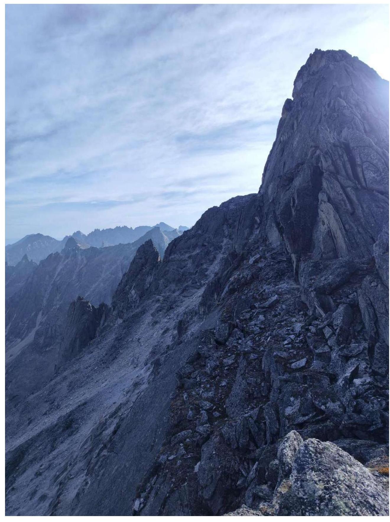
Photo 5. Partially sections R2-R3 and R3-R4. View from point R4.

Photo 6. Section R4-R5
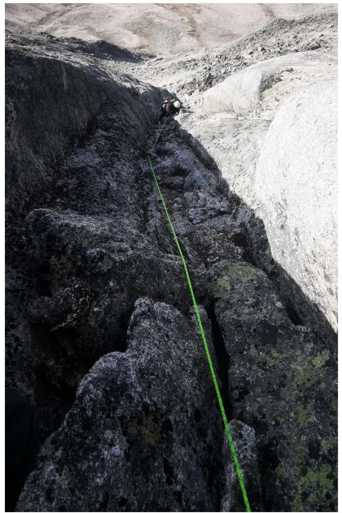
Photo 7. Section R4-R5
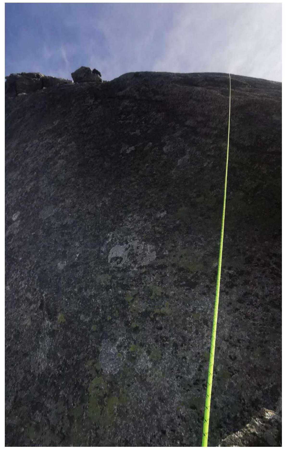
Photo 8. Section R4-R5
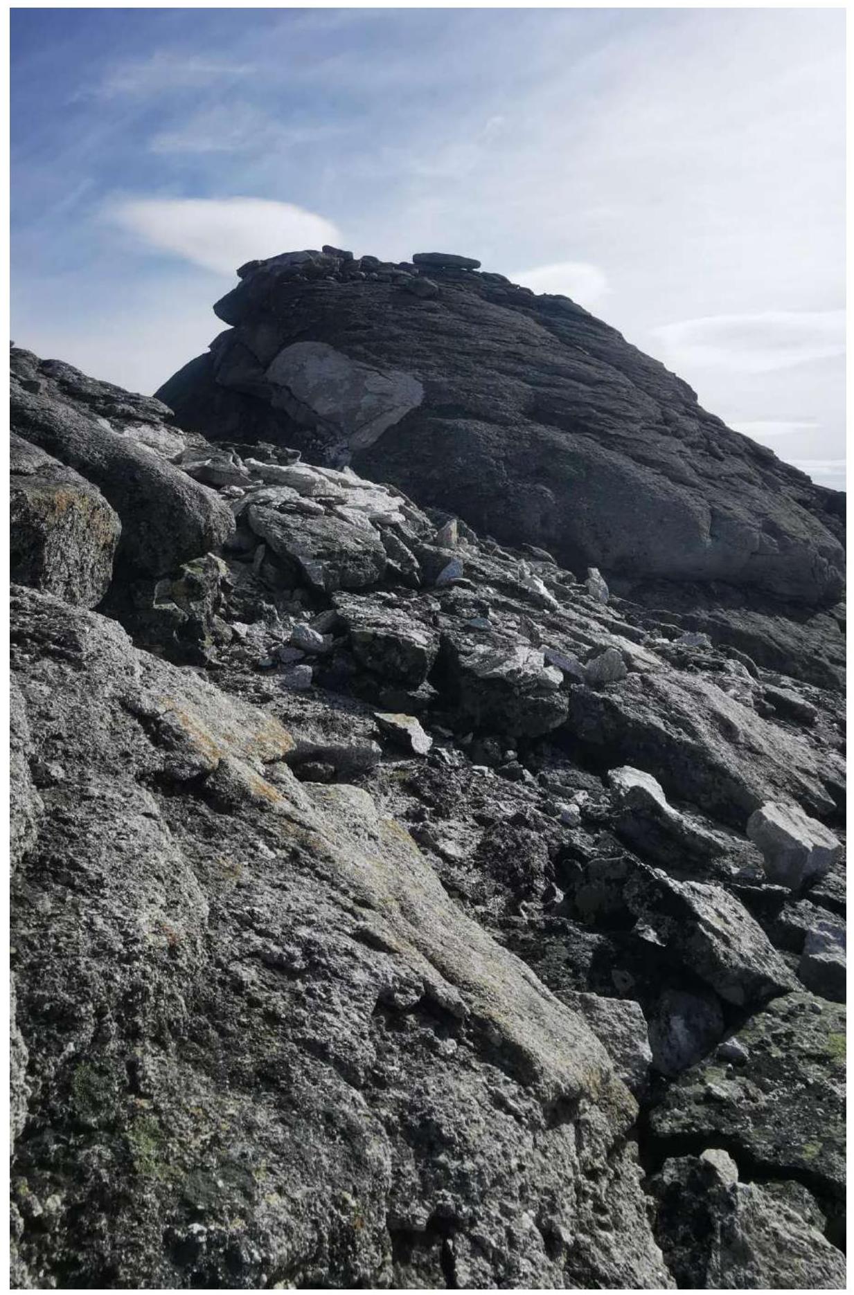
Photo 9. Section R4-R5, last 50 m, ascent to the summit.
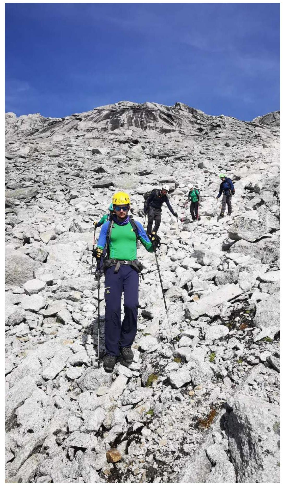
Photo 11. Section R7-R8.
3. Characteristics of the Team's Actions
3.1. Brief Description of the Route Passage
| Section № | Description | Photograph |
|---|---|---|
| Approach | Departure from the assault camp on the right bank of Tok Creek. Gradual ascent up the creek to the unnamed pass. Approach time 2 hours. Simultaneous movement. | |
| R0-R1 | Ascent via a scree couloir, bypassing the rock belt with black streaks on the left. Many large, loose rocks along the ascent path. A large, convenient ledge at the pass. Simultaneous movement. | |
| R1-R2 | From the pass, turn right and begin a gradual ascent along the Southwest Ridge, keeping to its right side. The section passes through rocky terrain, overcoming rocks of category 1-2. About 400 m. Simultaneous belay using terrain. | Photo №4 |
| R2-R3 | From the start of a pronounced ascent onto the Southwest Ridge, a landmark being a ledge, bypass it on the right and continue through rocky walls of category 3 (about 300 m). Simultaneous belay using terrain; in some places, setting up belays is possible. | Photo №5 |
| R3-R4 | Continue along the right side of the ridge through rocky walls of category 2, to a saddle (150 m). Simultaneous belay using terrain. | Photo №5 |
| R4-R5 | Key section of the route. Alternating movement. 200 m section. 150 m of climbing category 2-3 through a cleft. Four belay stations were set up: lower, two intermediate, and upper. Three 150-meter ropes were used. Intermediate protection - friends, nuts. The last 50 m to the summit involved simultaneous belay. | Photo №6, №7, №8, №9 |
| R5-R7 | Movement to a neighboring summit (to verify and check the height). The section passes through rocky terrain, overcoming rocks of category 1-2 (about 350 m). Simultaneous belay using terrain. | |
| R7-R8 | Descent via a scree couloir. The line is marked in blue (see Photo 1). Many large, loose rocks along the descent path. Simultaneous movement. Belay using terrain. | Photo № 12 |
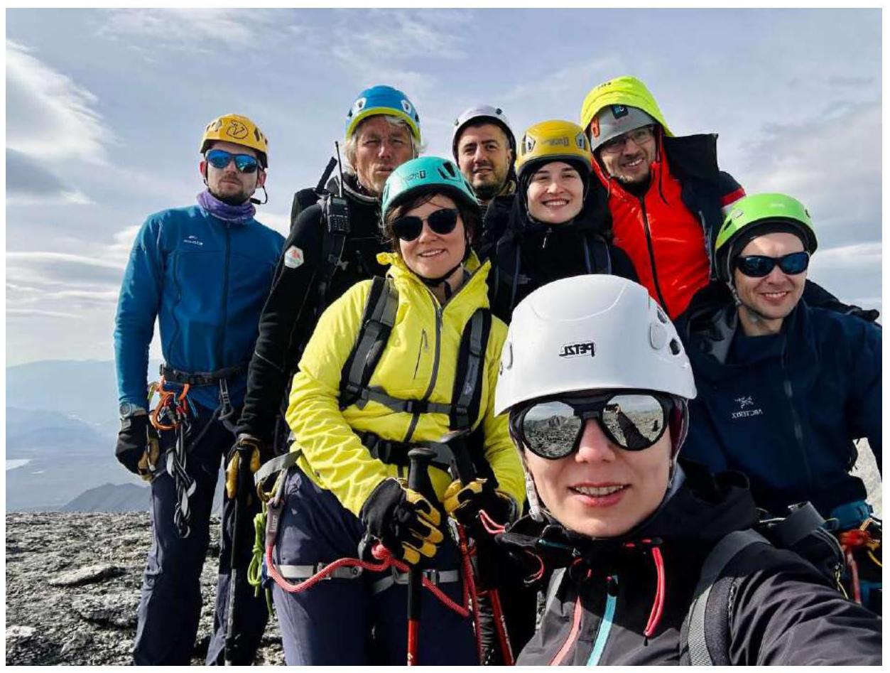
Photo 12. Photograph of the team on the summit near the control tour.
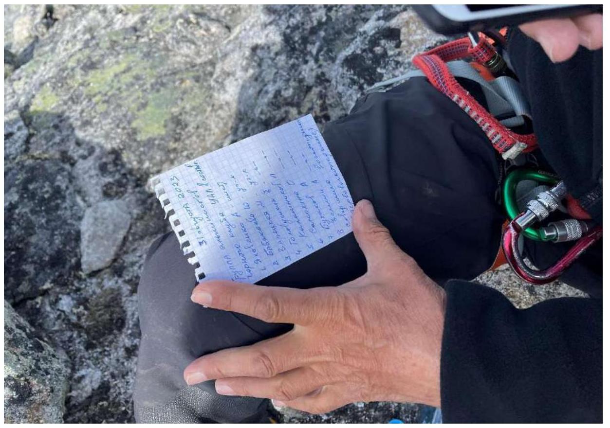
Photo 13. Note left on the summit in the control tour.
3.2. Route Safety Assessment
The route is recommended for training groups. The approach to the start of the route from the camp takes about 2 hours. Almost the entire route is visible from the base camp. Communication is only via satellite phone; cellular coverage is absent.
Water supplies can be replenished in the river on the approach before starting the route.
It is recommended to bring crampons, as the regional climate is unstable and nighttime frosts can occur, especially with possible ice formation on rock slabs early in the morning.
Trekking poles may be useful for ascent and descent, adding confidence and speed to the descent.
Descent is via a scree couloir. Many loose rock fragments; all slabs are live and constantly shifting; movement should be according to safety techniques.
Conclusion on Preliminary Route Assessment
The route turned out to be logical and intuitively understandable. It includes a full set of characteristic obstacles, confirming the estimated category of complexity 2A.