
Report
ON THE FIRST ASCENT TO THE SUMMIT EMILIA 1st VIA THE ROUTE RIGHT GENDARME OF THE CENTRAL COULISSE OF THE NORTHERN RIDGE, CATEGORY 2A, BY THE TEAM OF THE FEDERATION OF ALPINISM AND ROCK CLIMBING OF MAGADAN REGION, FROM 23.10.2022 TO 23.10.2022.
2022
I. Climbing Report
| № | 1. General Information | |
|---|---|---|
| 1.1 | Full Name, sports rank of the team leader | Kergin I.V. |
| 1.2 | Full Name, sports rank of the participants | Kergin I.V. Pervushkin E.P. |
| 1.3 | Full Name of the coach | Kergin I.V. |
| 1.4 | Organization | FAiS MO |
| 2. Characteristics of the Climbing Object | ||
| 2.1 | Region | Del-Urechen |
| 2.2 | Valley | Agan Valley |
| 2.3 | Number according to the 2013 classification table | – |
| 2.4 | Name and height of the summit | 1398 m |
| 2.5 | Geographical coordinates of the summit (latitude/longitude), GPS coordinates | N 60.312924 E 150.903817 |
| 3. Characteristics of the Route | ||
| 3.1 | Name of the route | Right Gendarme of the Central Coulisse of the Northern Ridge |
| 3.2 | Proposed category of difficulty | 2A |
| 3.3 | Degree of route exploration | First ascent |
| 3.4 | Character of the route relief | Rocky |
| 3.5 | Height difference of the route (altimeter or GPS data) | 208 m |
| 3.6 | Length of the route (in meters) | 450 m |
| 3.7 | Technical elements of the route (total length of sections of varying difficulty with indication of relief character: ice-snow, rocky) | Category 1 rocky – 360 m. Category 2 rocky – 35 m. Category 3 rocky – 55 m. Category 4 rocky – 45 m. Category 5 rocky – 45 m. Movement on closed glacier – 0 m. Dülfer descent (on descent) – 3 m |
| 3.8 | Descent from the summit | via Eastern Saddle |
| 3.9 | Additional characteristics of the route | No water |
| 4. Characteristics of the Team's Actions | ||
| 4.1 | Time of movement (team's walking hours, in hours and days) | 1 day, 9 hours |
| 4.2 | Overnights | No |
| 4.3 | Start of the route | 12:20, 23.10.2022 |
| 4.4 | Reaching the summit | 16:55, 23.10.2022 |
| 4.5 | Return to the base camp | 19:00, 23.10.2022 |
| 5. Responsible for the Report | ||
| 5.1 | Full Name, e-mail | Ivan.Kergin@mail.ru |
II. Description of the Ascent
1. Characteristics of the Climbing Object
1.1. General Photo of the Summit
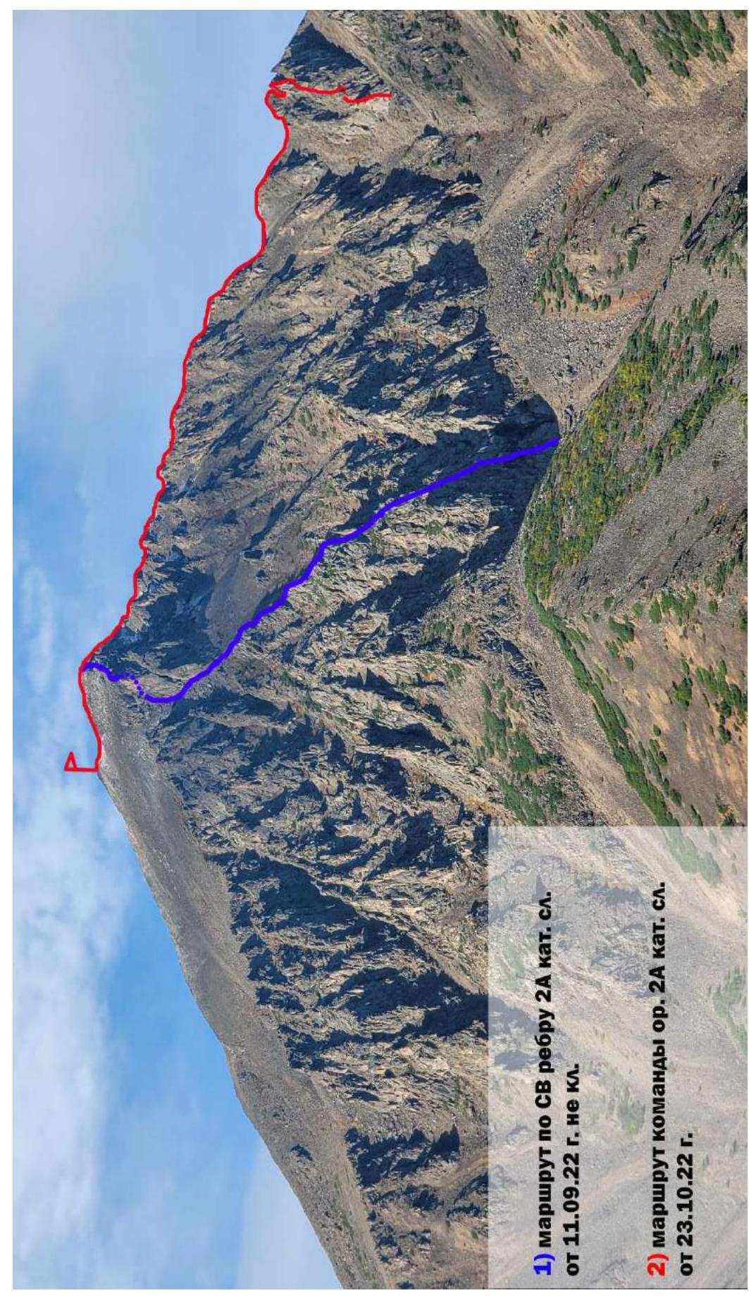
Photo. №1. Photo from a drone over the Agan River near the bridge.
1.2. Photo of the Route Profile
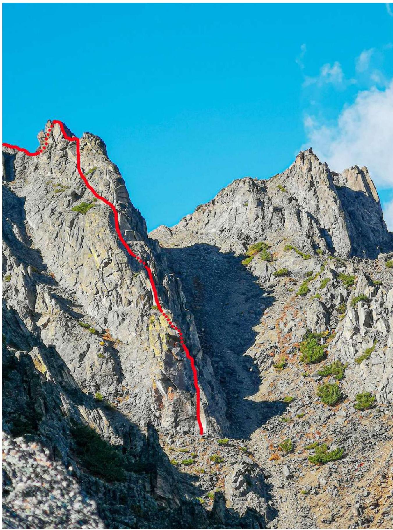
Photo. №2a. Photo from the route on the NE ridge, category 2A, 11.09.2022.
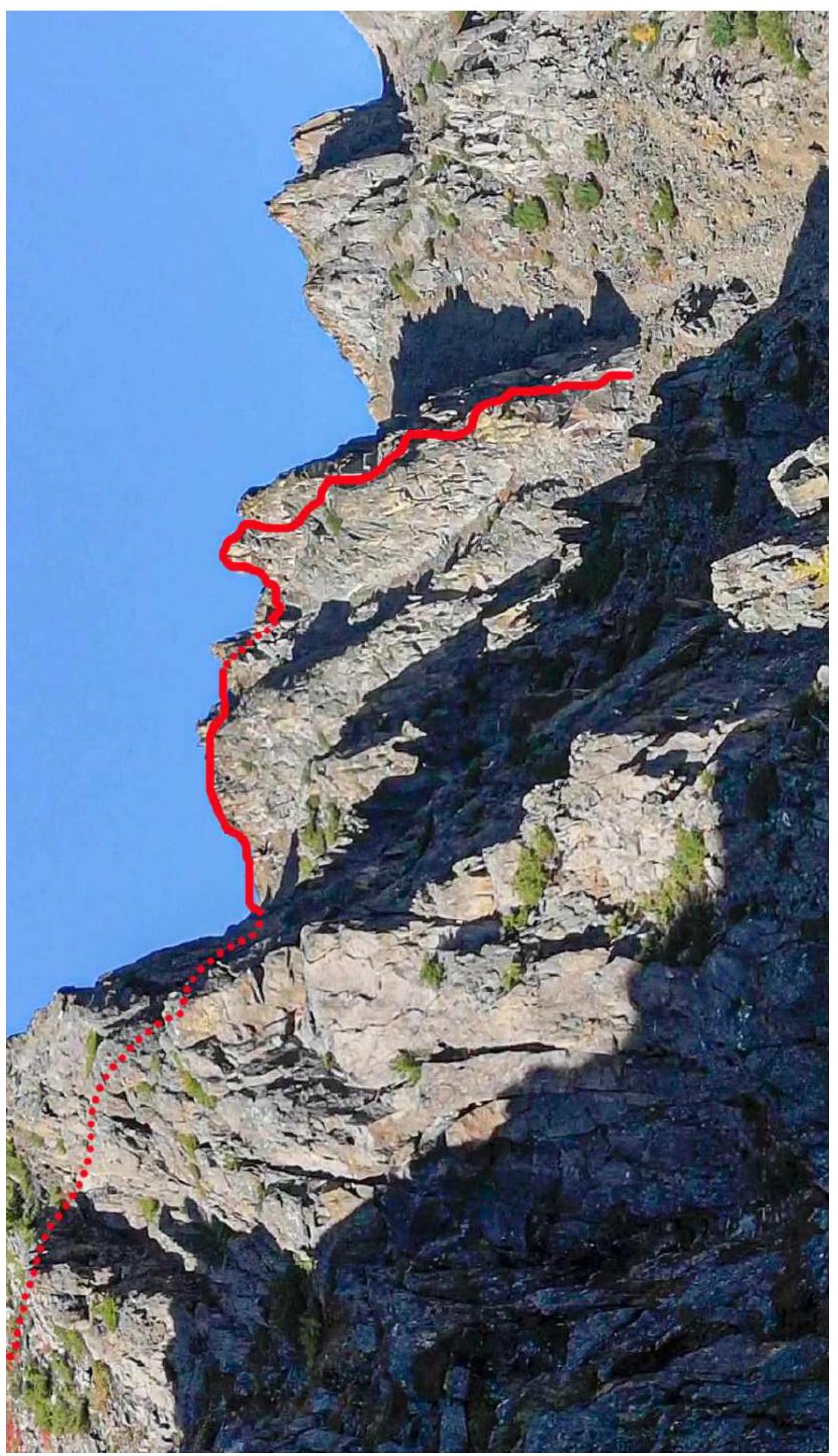
Photo. №2b. Photo from the route on the NE ridge, category 2A, 11.09.2022.
1.3. Photopanorama of the Area

Photo. №3. Photo from a drone over the Agan River near the bridge, 04.09.2022.
1.4. Geographical Location of the Area
The object of the ascent is Mount Emilia 1st (First) Main (Emilia Peak), height 1398 m, located in the Khasyn district, Magadan region, in the Del-Urechen massif in the Upper Kolyma Highlands. Its location is the upper reaches of the Nelkandi River in the Agan River valley. Mount Emilia is a long ridge with a spur – Emilia 1st (First), which is most attractive due to its pronounced rocky ridges, gendarmes, and kekurs.
“The Del-Urechen mountains are a small granite massif located in the Armani basin and bounded by the Kava-Tauysk lowland to the south and the Magadaven and Ola rivers to the north. It is characterized by significant snow accumulation and alpine features. On average, the mountains rise to 1100 m. Several peaks with elevations around 1500 m are crowned with cirque ridges. The highest point is Mount Agan (1718 m). The Del-Urechen mountains have a highly dissected relief. There are many cirques and narrow, serrated ridges. The northwestern part of the massif is dissected by Armani tributaries. To the south, tributaries of the Nelkandi River flow from the high peaks. The mountains are treeless, and only along the river valleys do forests penetrate deeply into them.” — R. Sedov, “Mountains of the Okhotsk Coast”.
The ascent was made from the side of the Agan River valley, right tributary of the Emilia stream, immediately from the bridge over the Agan River.
To reach the location from Magadan city, take cars to Palatka settlement (86 km, 1 hour), then take the federal highway R-504 “Kolyma” to the Customs Control Zone (ZTK), turn onto the municipal Tenka highway “Palatka – Kulu – Neksikan”. From the start of ZTK, drive 29 km on the Tenka highway to the Agan River and the bridge of the same name (29 km, 30–35 minutes). Leave cars near the bridge and start moving along the right bank of the Emilia stream, gradually traversing the slope to the right, then approach the central coulisse, which directly leads to the desired gendarme, 1.5–2 hours.
The nearest settlement with regular bus service is Palatka settlement, 86 km from Magadan city, and 43 km from the bridge.
1.5. Map of the Area
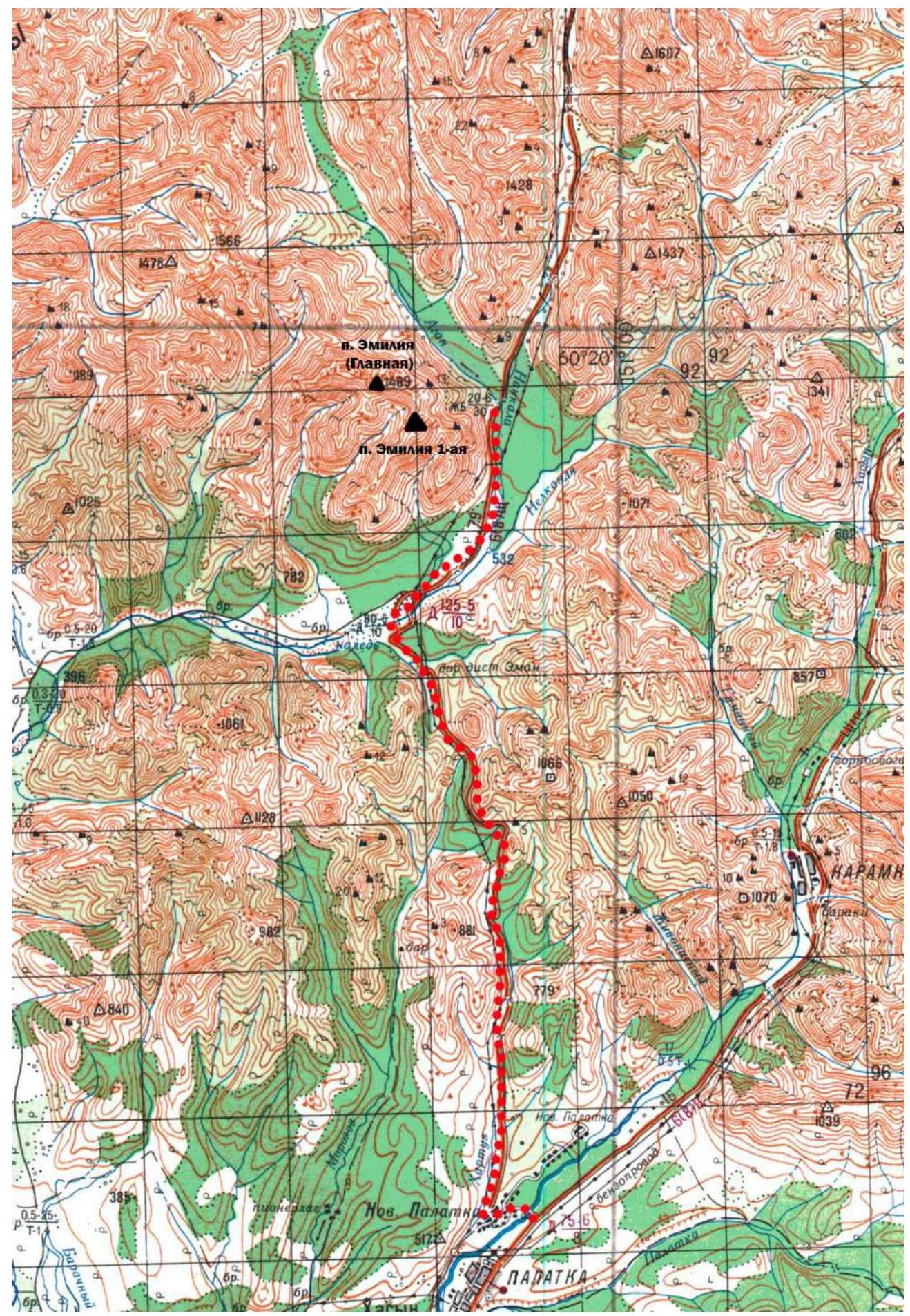
Photo. 3.1 Map of the area
1.6. Scheme of the Area
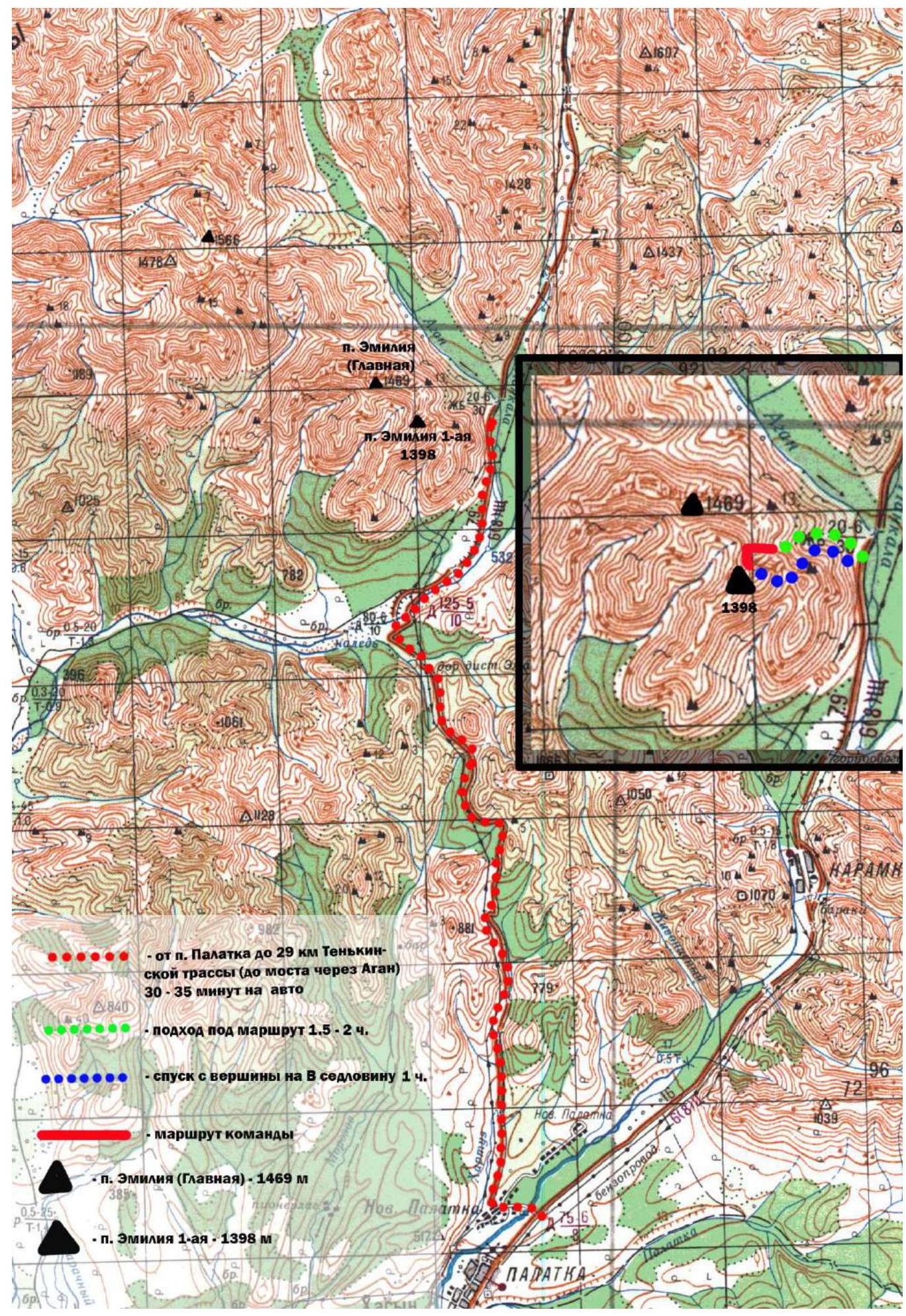
Photo. 3.2 Scheme of the area
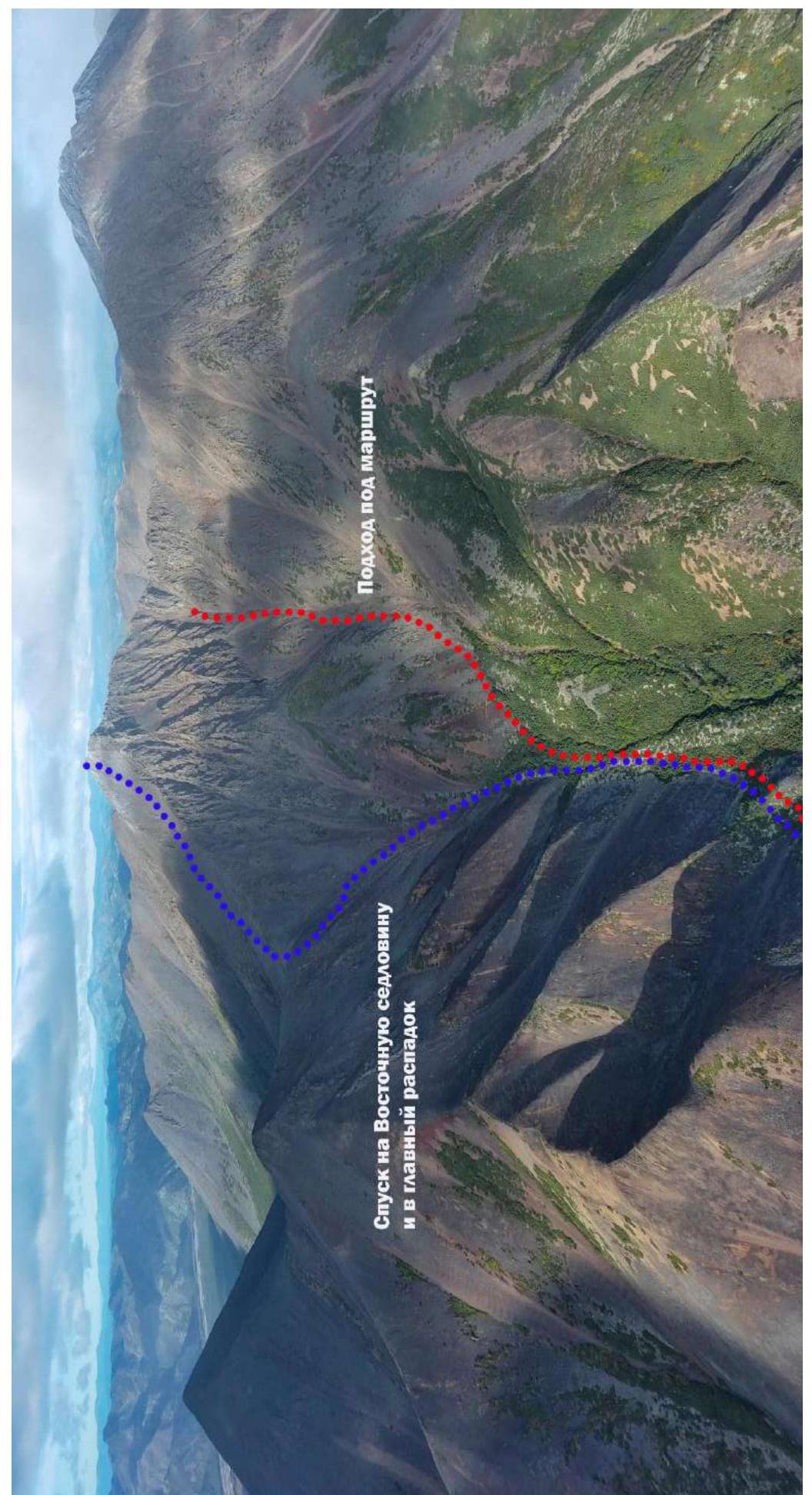
Photo. 3.3 Approach and descent from the summit
2. Characteristics of the Route
2.1. Technical Photograph of the Route
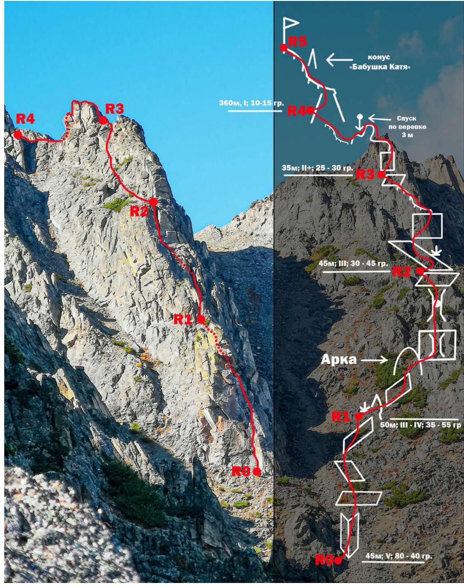
2.2. Technical Characteristics of Route Sections
| Section № | Character of Relief | Category of Difficulty | Length, m | Steepness, degrees | Type and number of anchors |
|---|---|---|---|---|---|
| R0–R1 | Rocks, inner corner, ledge, inclined slab, gendarme ridge. Dwarf pine | 5 | 45 m | 80–40° | Anchor hook – 3; Friend medium – 1; Stopper medium – 2 |
| R1–R2 | Inclined ledge, arch, snow. | 3–4 | 50 m | 35–55° | Stopper medium – 1; Anchor hook – 3 pieces; |
| R2–R3 | Long ledge, dwarf pine, snow, small wall, gendarme ridge | 3 | 45 m | 30–45° | Stopper medium – 2 |
| R3–R4 | Gendarme ridge, 3 m descent into coulisse | 2 | 35 m | 25–30° | Anchor hook – 2 |
| R4–R5 | Extended pre-summit ridge, snow, местами твёрдый наст | 1 | 360 m | 10–20° | – |
2.3. Section Numbers
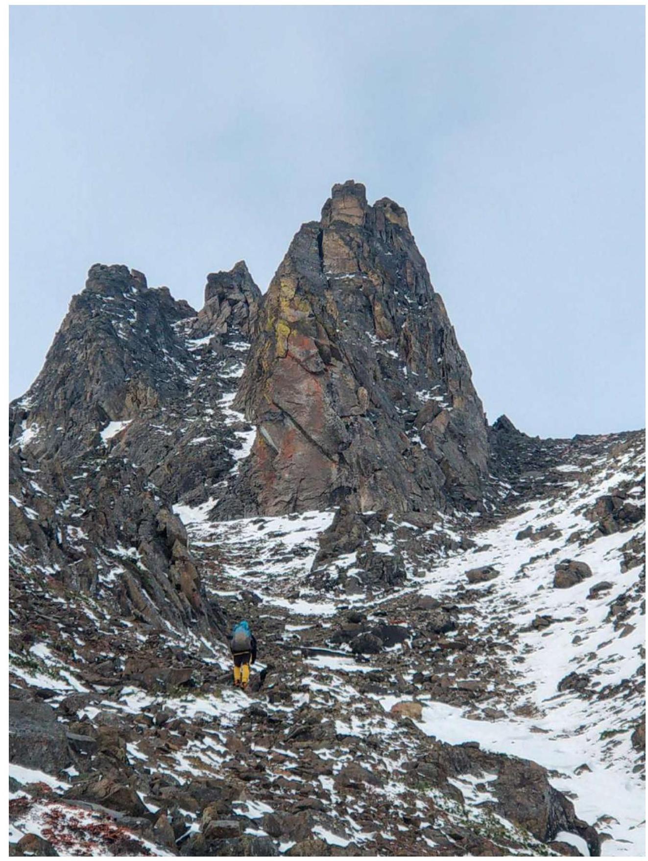
Photo. №4. Approach to the route

Photo. №5. R0–R1. Start of the route. Inner corner. Key to the route.
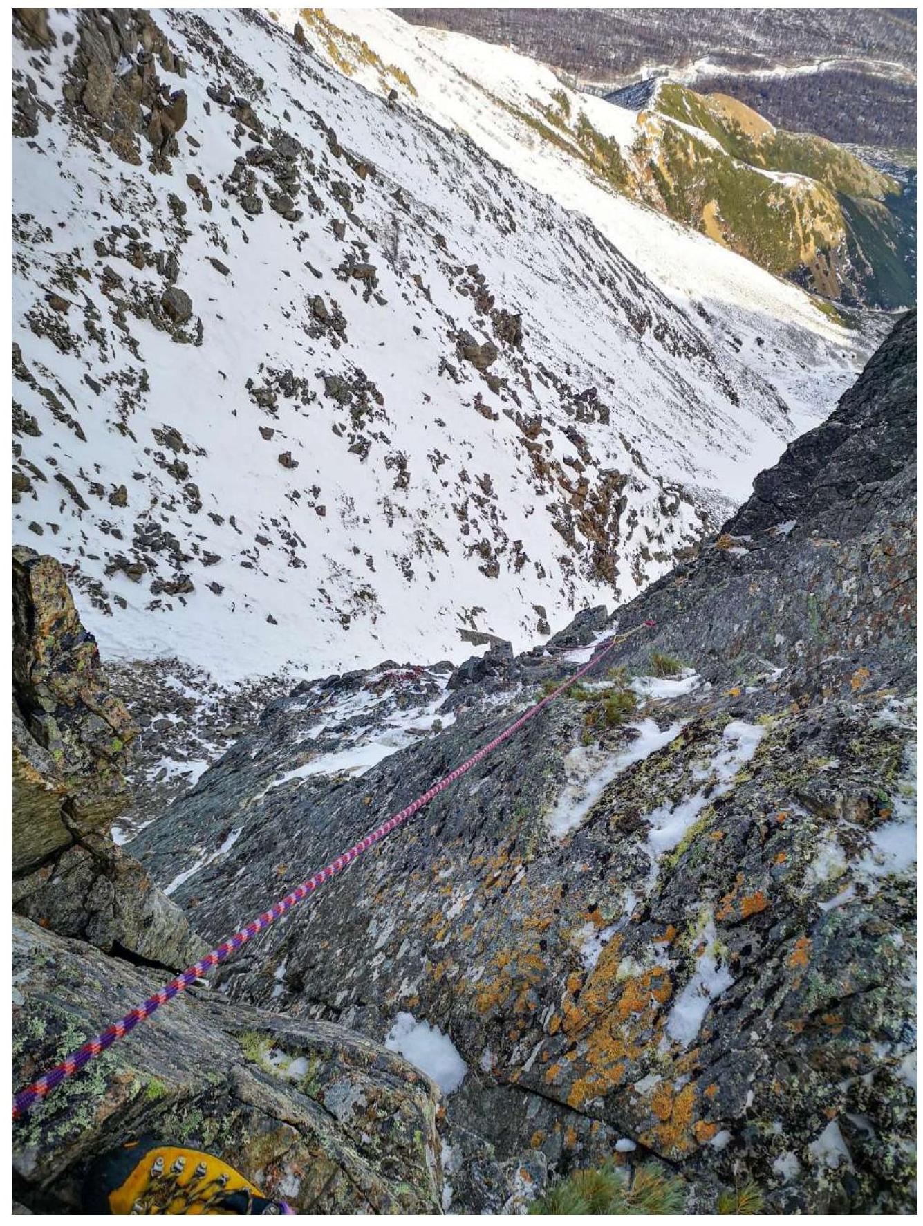
Photo. №6. Section R0–R1. View from the second station downwards.
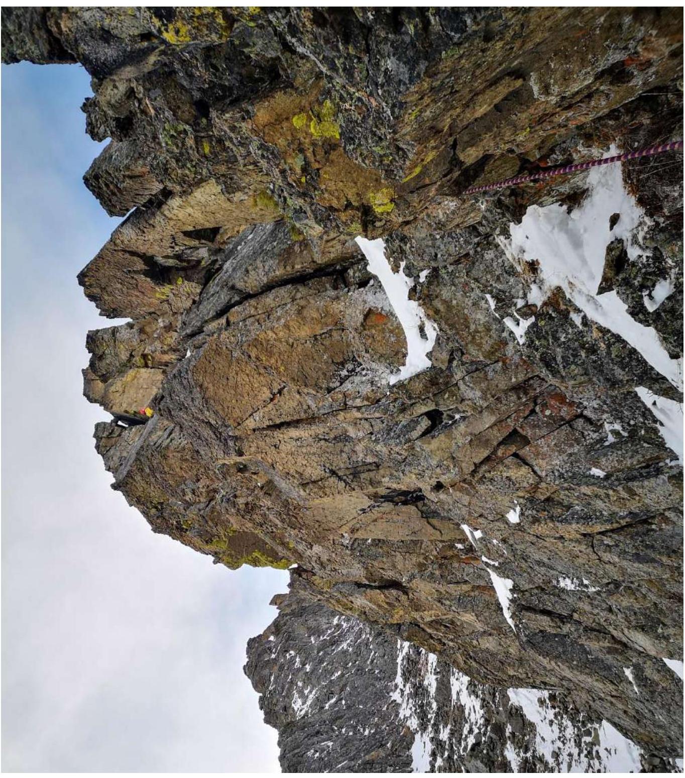
Photo. №7a. Section R1–R2. View from the second station to the arch and chimney with a cork.
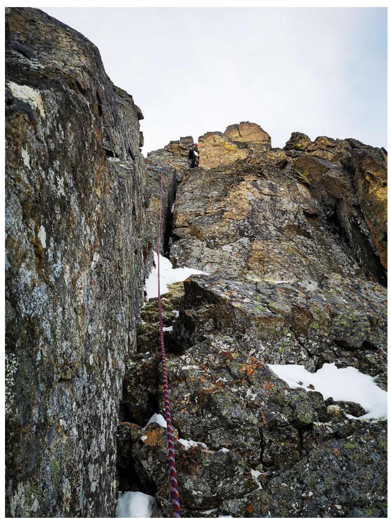
Photo. №7b. Section R1–R2. Chimney with a cork.
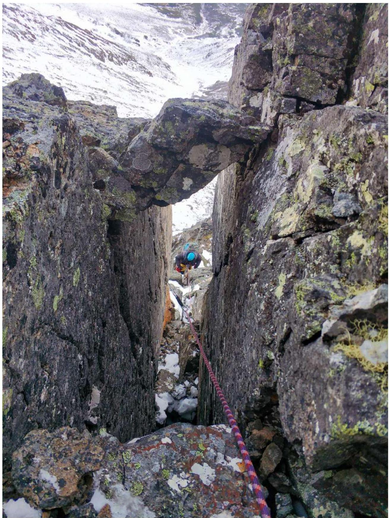
Photo. №7c. Section R1–R2. View from above from the 3rd station to the chimney.
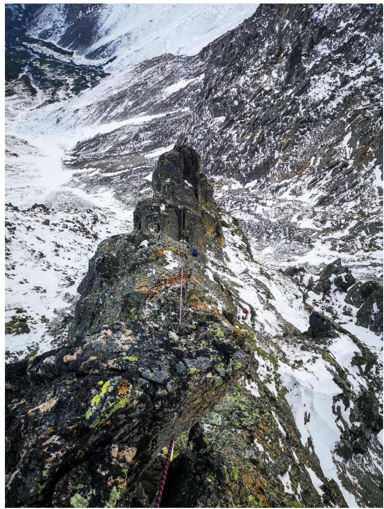
Photo. №8. Section R2–R3. Gendarme ridge.
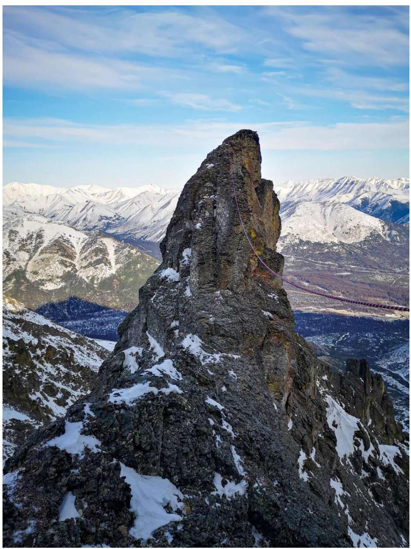
Photo. №9. Section R3–R4. Photo from the station in the coulisse.

Photo. №10. Section R3–R4. Coulisse and station, and view on the Northern ridge.
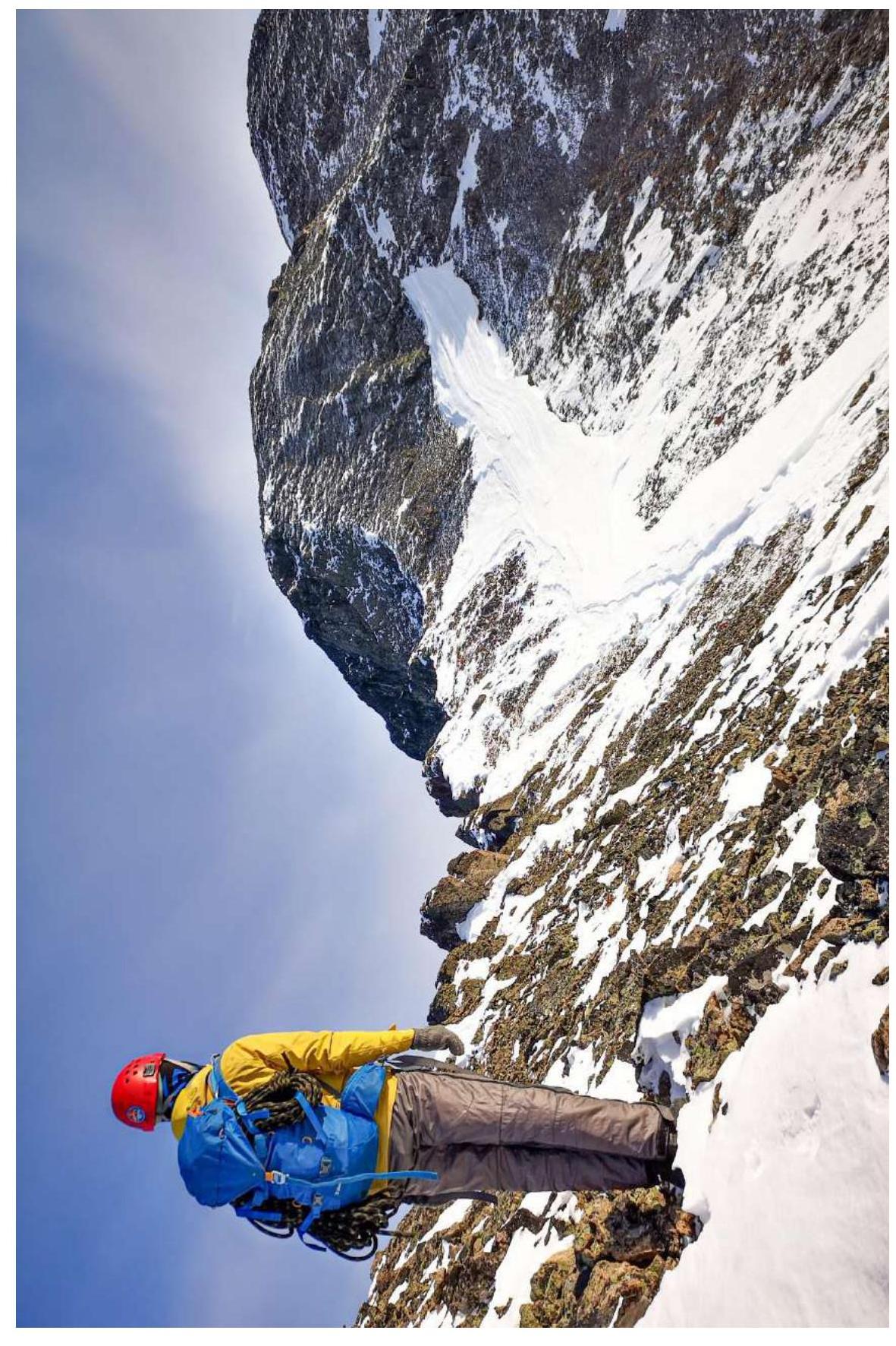
Photo. №11. Section R4–R5. Mini Gendarme — cone “Babushka Katya” and Long Northern ridge leading to the summit.
3. Characteristics of the Team's Actions
3.1. Brief Description of Route Passage.
| Section № | Description | Photo № |
|---|---|---|
| Approach to route | Overcoming an extended snowy coulisse with firm snow местами with boulders protruding from the firm snow, approach the start of the route. | Photo. №4 |
| R0–R1 | Start movement along a pronounced inner corner with a large crack and exit onto a large horizontal ledge, from the ledge straight up to the gendarme ridge. Landmark — a small dwarf pine bush, and directly above it — a convenient break for the belay station. Loop around the break. Alternate movement. Medium and small anchors work well. | Photo. №5, №6 |
| R1–R2 | From the station, move along a smoothly rising osypnaya inclined ledge towards the arch. Pass through the arch and exit to the other side of the gendarme ridge. Then straight up along a wide crack turning into a large chimney with a cork. After the chimney — a convenient belay station on anchors. Alternate movement. | Photo. №7a,b,c |
| R2–R3 | Then from the station, move along an osypnaya grassy and snowy ledge for about 10 meters, then climb straight onto the gendarme ridge along a small wall and move along it. Good convenient belay station on 2 anchors and a large stopper. Alternate movement. | Photo. №8 |
| R3–R4 | From the station straight up through the top of the gendarme. Then an uncomfortable descent down — 3 m into the coulisse. On the left side of the coulisse, along the direction of movement, a belay station on 1 large stopper and 2 medium anchors. Alternate movement. Belay through relief. | Photo. №9, №10. |
| R4–R5 | Exit the coulisse onto the Northern ridge, continue movement along it upwards, bypassing one most pronounced gendarme “Babushka Katya”, then proceed to the summit. Simultaneous movement. | Photo. №11 |
| Descent | Move down towards the municipal highway “Palatka – Kulu – Neksikan”, along the way a large saddle — a pass — will be visible. On the saddle, turn left downwards, then the paths of approach and descent coincide. | Photo. 3.3 |
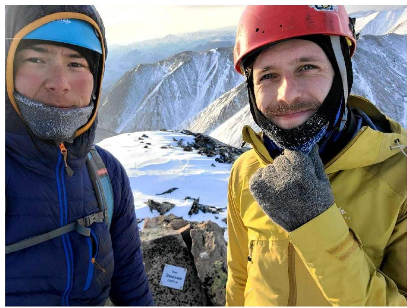
3.2. Photo of the Team on the Summit with the Control Tour
3.3. Safety Assessment of the Route:
The route is safe and has multiple options for emergency descent into nearby coulisses. A significant advantage of this route is its easy accessibility and minimal time expenditure for both approach and ascent. It is possible to complete in one day. The descent into the coulisse on section R3–R4 is somewhat concerning, but it does not pose significant difficulty as there is relief that allows various descent methods.
Communication on the route: Cellular communication is absent throughout the route. Only on the summit does the MagFon cellular operator have a signal, due to the nearby presence of Palatka settlement.
Radio communication is not required on the route as the convenient location of belay stations and the relief itself allow for easy communication in a classic manner — brief commands. However, it is recommended to bring at least one radio station for interaction with other tourist groups or Ministry of Emergency Situations employees.
Recommendations for future climbers:
- In winter, the ascent will require a lot of time for the approach due to potential large snow cover.
- There is a probable risk of avalanche danger, so it is essential to familiarize oneself with the weather and precipitation.
- In summer, the ascent can be made in more comfortable conditions, but there may be no water on the route.
- Be cautious on the gendarme ridge — loose rock.
Detailed information about the descent from the summit with indication of landmarks:
- The descent begins towards the highway in the direction of a large saddle to the East.
- Descend onto the saddle, turn left and go down.
- Further descent path coincides with the approach path.
Conclusion
The route turned out to be relatively short but effective, with a number of interesting obstacles that require good application of various techniques for movement on rocky terrain. In winter conditions, it is excellent for initial winter ascents due to its good transport accessibility and infrastructure.
The saturation with obstacles and variety of relief makes this route very attractive and interesting, as each section of the route has a logical continuation and convenient belay stations, for which a variety of belay equipment can be used.
However, it is not recommended to attempt this 2A as a first route, as the key to the route may present several complexities.
We evaluate this route as a solid 2A, with suitable length and obstacle composition. Compared to other routes of similar difficulty category in our experience in this area, the route taken was:
- significantly more challenging than the category 1B route to Vozmozhnost Peak via the NW ridge;
- slightly easier than the route on Trog Peak via the E coulisse of the S wall, category 2B.
Therefore, in our view, the route's difficulty has an appropriate category.