
Report
On the first ascent to the summit Vozmozhnost via the Northwest Ridge route, category 1B, by the team of the Magadan City Tourist Club, from September 12, 2020, to September 12, 2020.
2020
I. Climbing Report
| № | 1. General Information | |
|---|---|---|
| 1.1 | Full Name, Sports Rank of the Leader | Ivan Vasilievich Kergin — 2nd sports rank |
| 1.2 | Full Name, Sports Rank of the Participants | Yakov Alekseevich Leukhin — Badge Atabala Rovshanovich Kasumov — No rank |
| 1.3 | Full Name of the Coach | Ivan Vasilievich Kergin |
| 1.4 | Organization | Magadan City Tourist Club |
| 2. Characteristics of the Climbing Object | ||
| 2.1 | Region | Magadan Oblast, Dël–Urėkchen Mountains (between the Armani and Ola rivers) |
| 2.2 | Valley | Agan Valley |
| 2.3 | Number according to the 2013 Classification Table | — |
| 2.4 | Name and Height of the Summit | Vozmozhnost Peak, 1519 m |
| 2.5 | Geographical Coordinates of the Summit (latitude/longitude), GPS Coordinates | 60°21′04″ N 150°49′03″ E |
| 3. Characteristics of the Route | ||
| 3.1 | Route Name | Northwest Ridge |
| 3.2 | Proposed Category of Difficulty | 1B |
| 3.3 | Degree of Route Exploration | First ascent |
| 3.4 | Terrain Characteristics of the Route | Rocky |
| 3.5 | Elevation Gain of the Route (altimeter or GPS data) | 319 m |
| 3.6 | Route Length (in meters) | 630 m |
| 3.7 | Technical Elements of the Route (total length of sections with different difficulty categories, indicating terrain type: ice-snow, rocky) | Category 1 difficulty ice/rock/combination — 540 m. Category 2 difficulty ice/rock/combination — 90 m. Category 3 difficulty ice/rock/combination — 0 m. Category 4 difficulty ice/rock/combination — 0 m. Glacier travel — 0 m Rappelling (on descent) — 7 m |
| 3.8 | Descent from the Summit | Via the ascent route |
| 3.9 | Additional Route Characteristics | No water. Strong cold wind from the northeast. |
| 4. Characteristics of the Team's Actions | ||
| 4.1 | Time on the Move (team's travel hours, in hours and days) | 1 day, 5.5 hours |
| 4.2 | Overnight Stays | No |
| 4.3 | Start of the Route | 11:00 |
| 4.4 | Summit Ascent | 14:30 |
| 4.5 | Return to Base Camp | 16:30 |
| 5. Person Responsible for the Report | ||
| 5.1 | Full Name, e-mail | Ivan Vasilievich Kergin, ivan.kergin@mail.ru |
II. Climbing Description
1. Characteristics of the Climbing Object
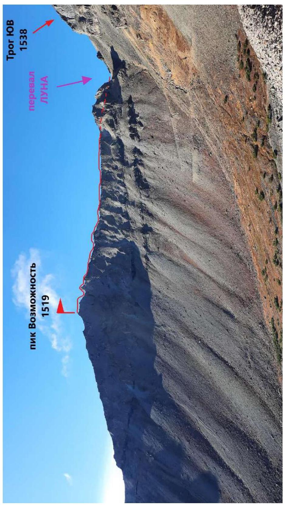
Fig. 1. General view of the summit. Photo from the tractor road from the east. September 12, 2020.
Photo by: Ivan Kergin
1.2. Route Profile Photo
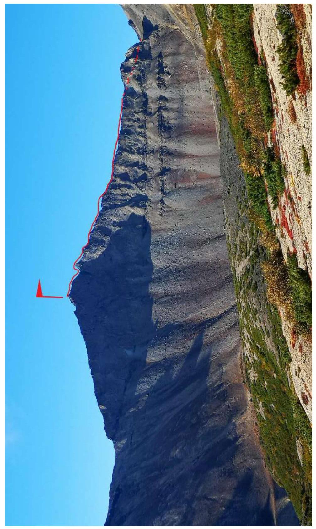
Fig. 2. Route profile photo. Near Base Camp. Photo from the east. September 12, 2020.
Photo by: Ivan Kergin
1.3. Panoramic Photo of the Area

Fig. 3. Photo from summit 1243 m. Photo from the east. August 22, 2020.
Photo by: Ivan Kergin
1.4. Geographical Location of the Area
The climbing object — Vozmozhnost Peak, 1519 m, is located in the Khasynsky District, Magadan Oblast, in the Dël–Urėkchen Massif in the Kolyma Highlands. Its location is in the upper reaches of the Nelkandi River, in the Agan River valley. Vozmozhnost Peak is a slightly peaked summit that drops off with a sheer wall to the northeast and has a gentle slope with large, medium, and small scree on the opposite, southwest side.
"The Dël–Urėkchen Mountains are a small granite massif located in the Armani River basin, bounded to the south by the Kava-Tauysk Lowland and to the north by the Magadaven and Ola rivers. It is characterized by significant snow accumulation and alpine features. On average, the mountains rise to 1100 m. Several peaks with elevations around 1500 m crown the ridges of cirques. The highest point is Mount Agan (1718 m). The Dël–Urėkchen Mountains have a highly dissected relief. There are many cirques and narrow, rugged ridges. The northwest part of the massif is dissected by Armani River tributaries. To the south, tributaries of the Nelkandi River flow from the high peaks. The mountains are treeless, and only along the river valleys do forests penetrate deeply into them"1.
The ascent was made from the Agan River valley, a right tributary of the Trog Stream. The base camp was located on the left bank.
From Magadan, take cars to Palatka settlement (86 km, 1 hour), then take the R-504 "Kolyma" federal highway, turn onto the municipal Tenka highway "Palatka–Kulu–Neksikan" at the customs control zone, and drive to the 29th km of the Tenka highway to the Agan River and the bridge (29 km, about 30–35 minutes). After the bridge, turn left and take the old tractor road. Leave the cars there and head up the Agan River on foot along the forest road, which leads to the right tributary of Agan — Trog Stream and to the base camp (14 km, 5–6 hours), located at the foot of the mountain. (This path from the Agan River to the foot of Trog (Main) and Vozmozhnost Peak can be taken by a high-clearance vehicle to save time and energy. The journey will take about 2–3 hours).
From the base camp, follow the tractor road, then start traversing the slope towards the Luna Pass. Here begins the route to Vozmozhnost Peak.
The nearest settlement with regular bus service is Palatka, 86 km from Magadan, and 43 km from the base camp.
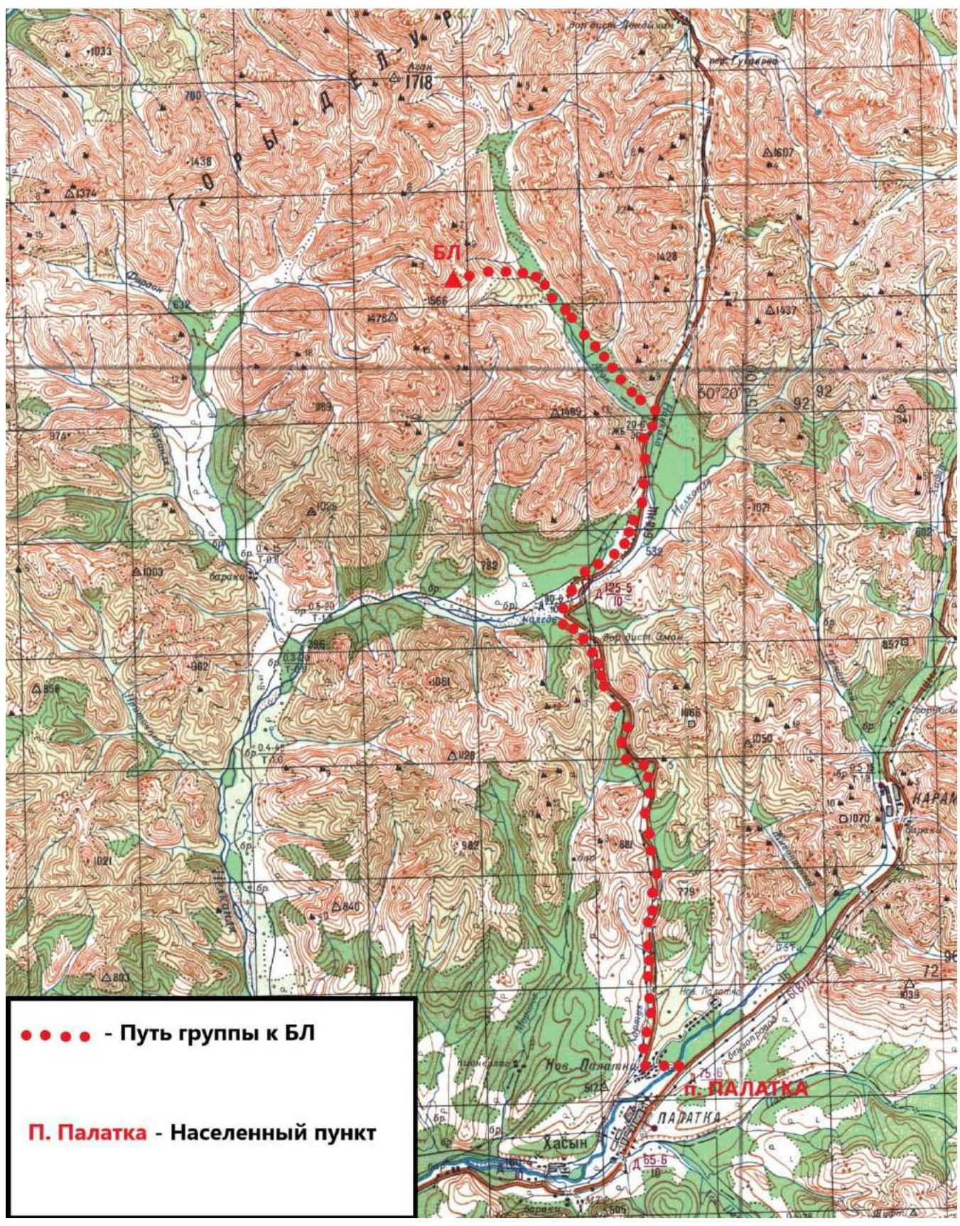
Fig. 4. Area map
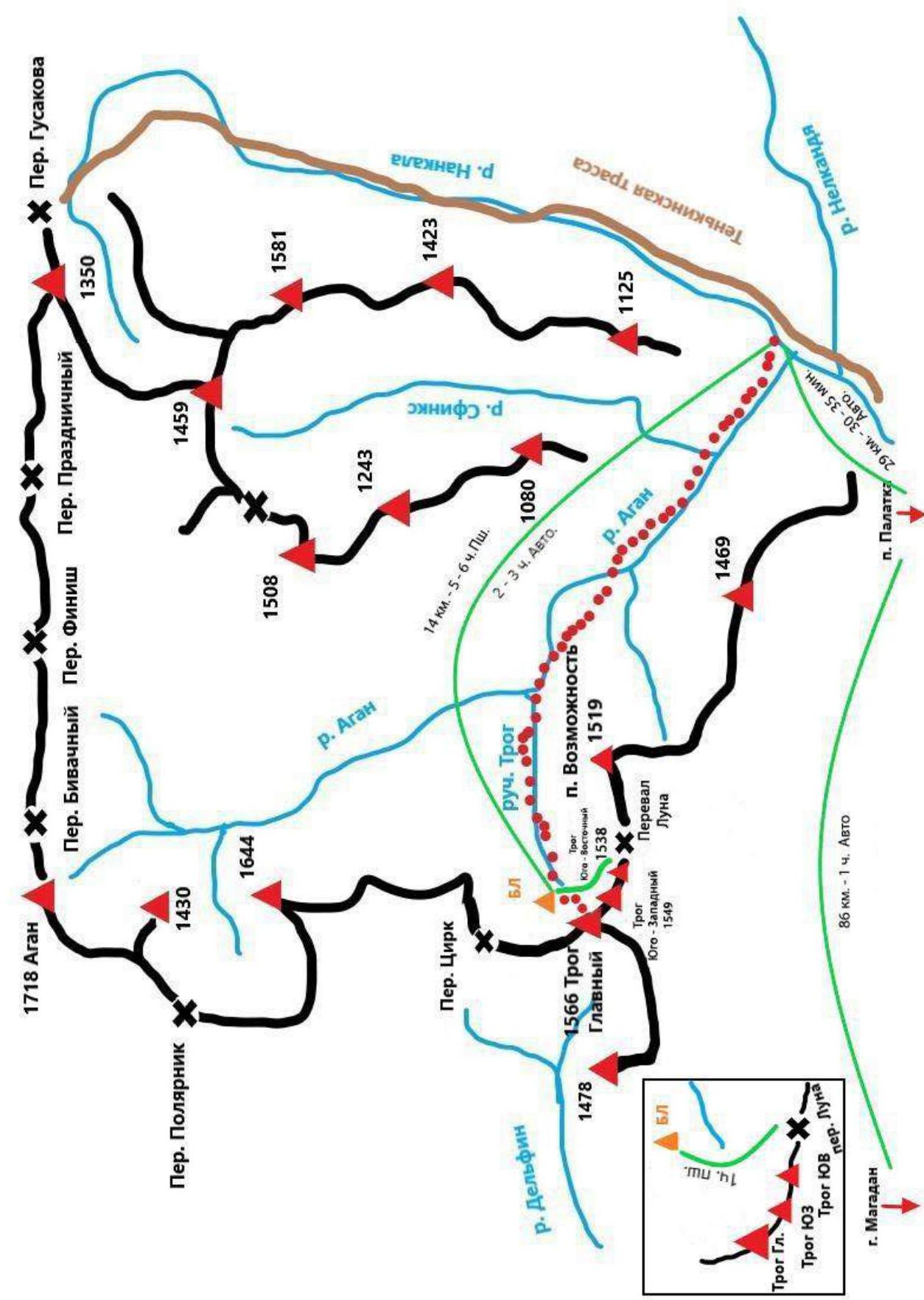
Fig. 5. Area schematic map
2. Route Characteristics
2.1. Technical Photograph of the Route
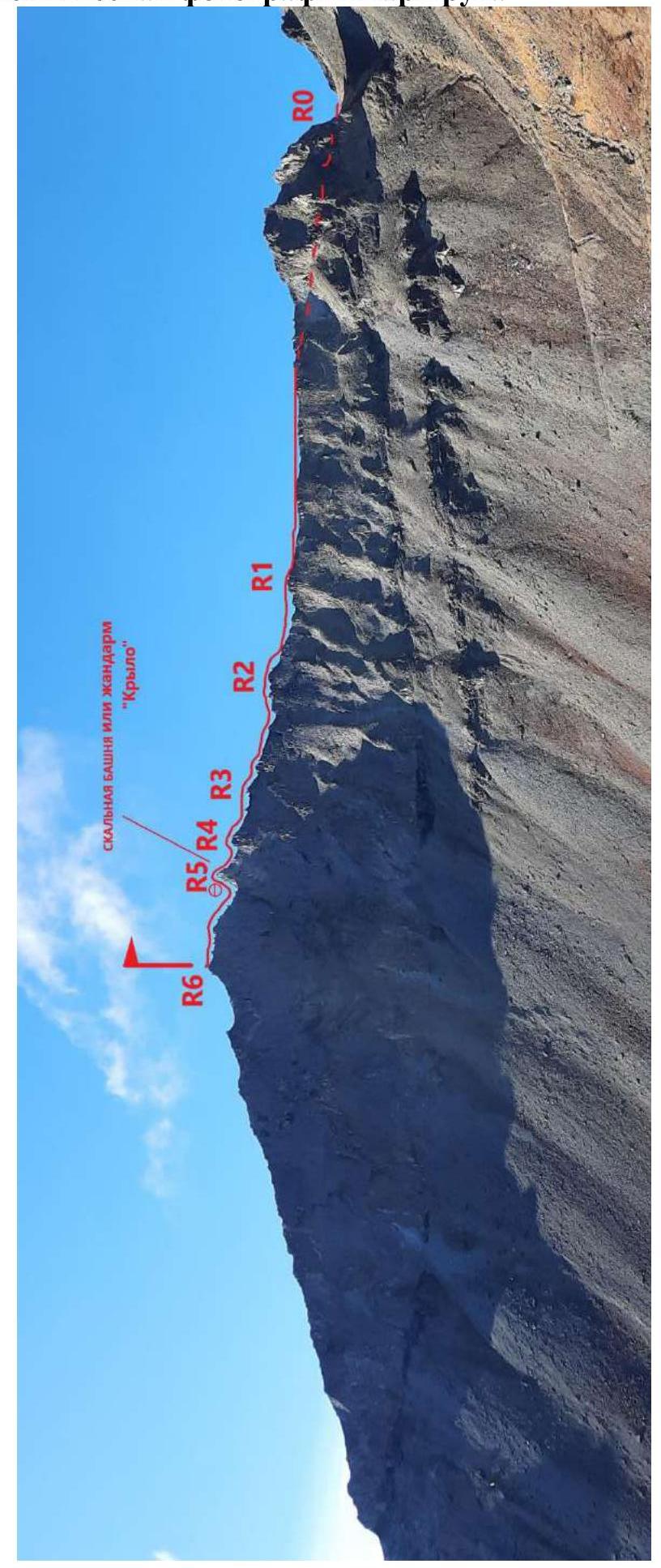
Fig. 6. Technical photograph of the route, September 12, 2020.
Photo by: Atabala Kasumov
2.2. Section Numbers
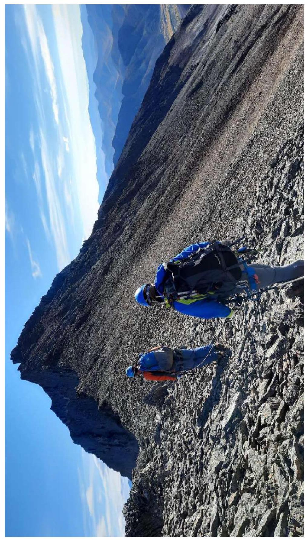
Fig. 7. Section R0–R2
Photo by: Atabala Kasumov
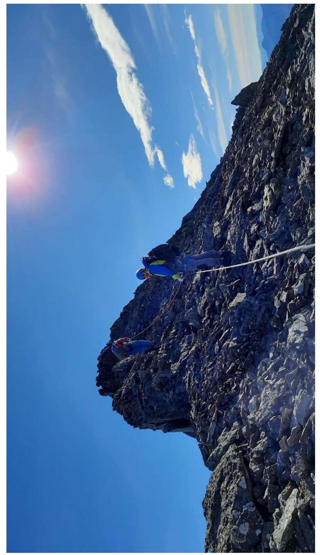
Fig. 8. Section R2–R3
Photo by: Atabala Kasumov
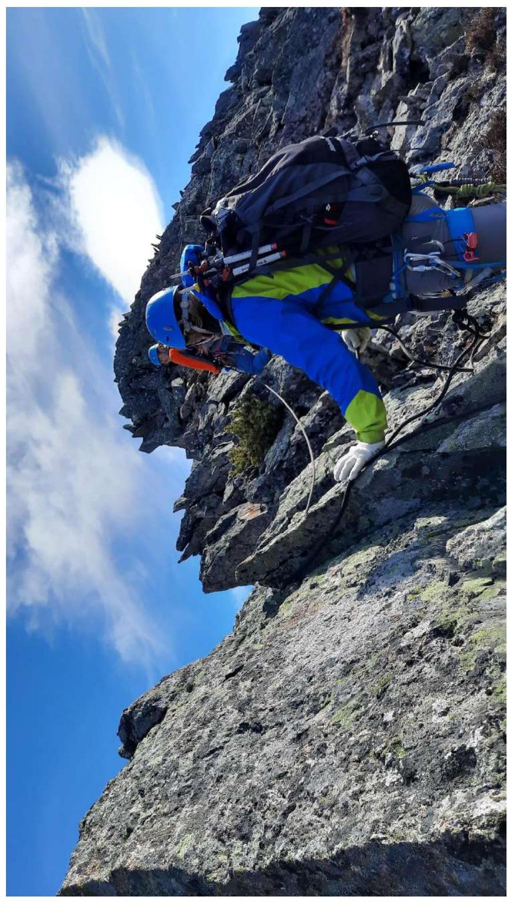
Fig. 9. Section R3–R4
Photo by: Atabala Kasumov
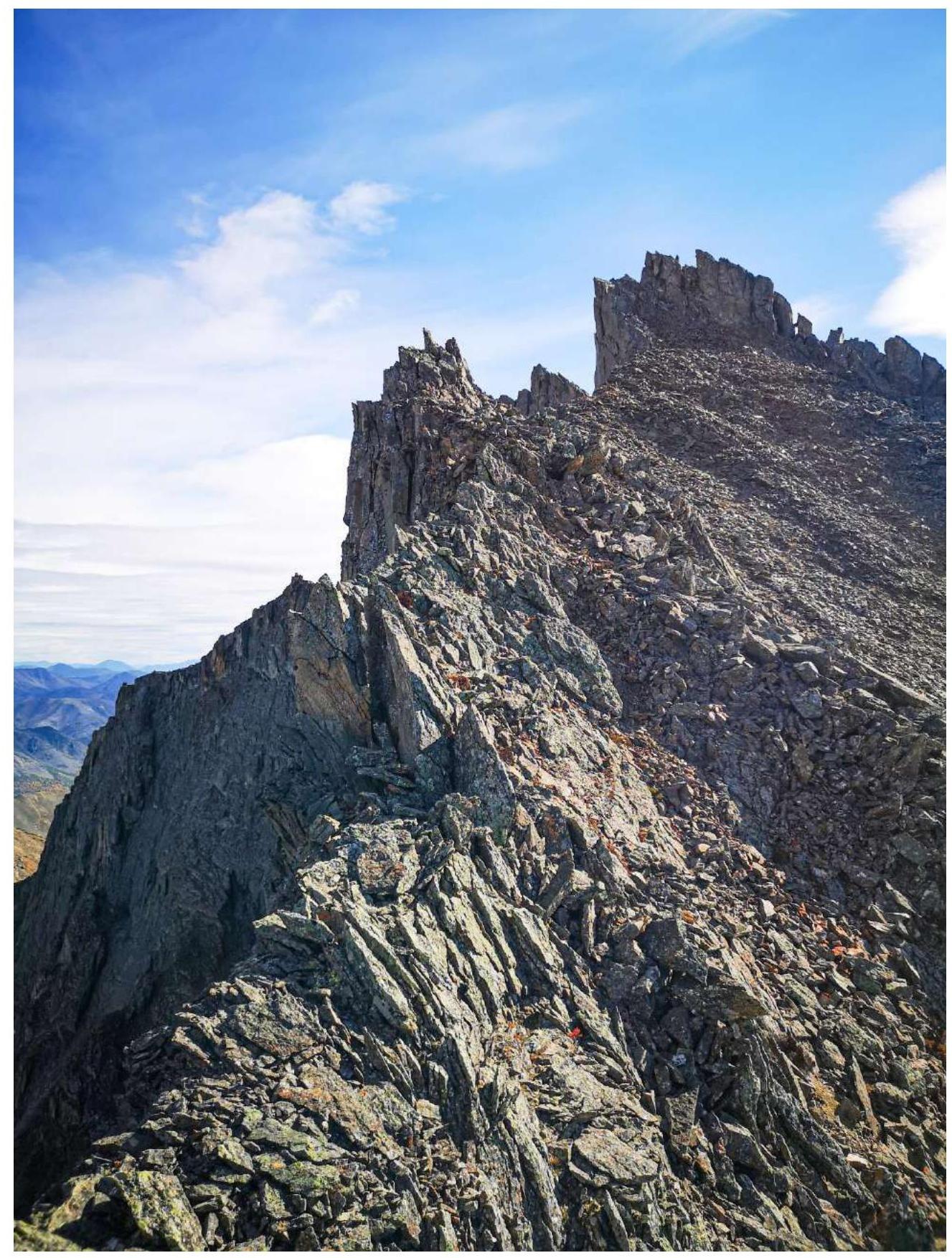
Fig. 10. Sections R3–R5
Photo by: Ivan Kergin
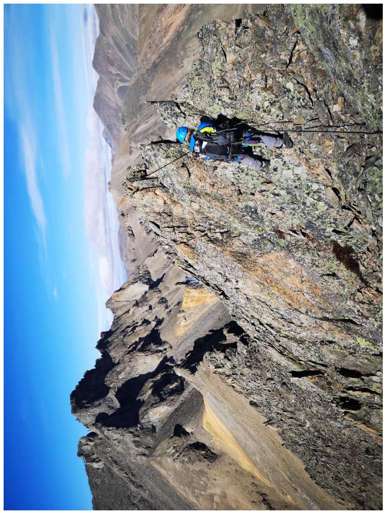
Fig. 11. Section R4 (Photo from the ridge before R5)
Photo by: Ivan Kergin
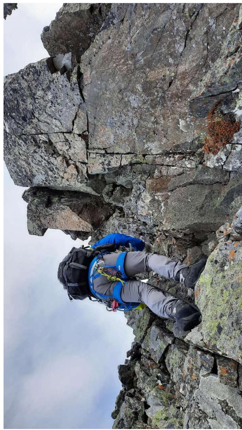
Fig. 12. Section R5 (Passing the "Krylo" gendarme)
Photo by: Atabala Kasumov
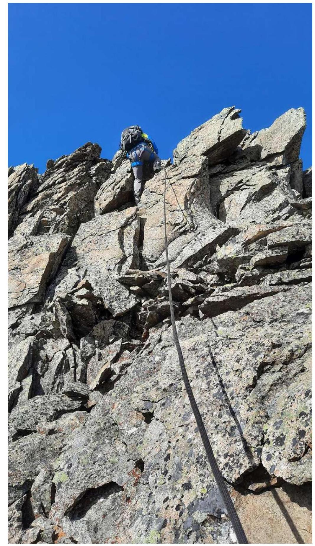
Fig. 13. Section R5 (Rappelling from the "Krylo" gendarme)
Photo by: Atabala Kasumov
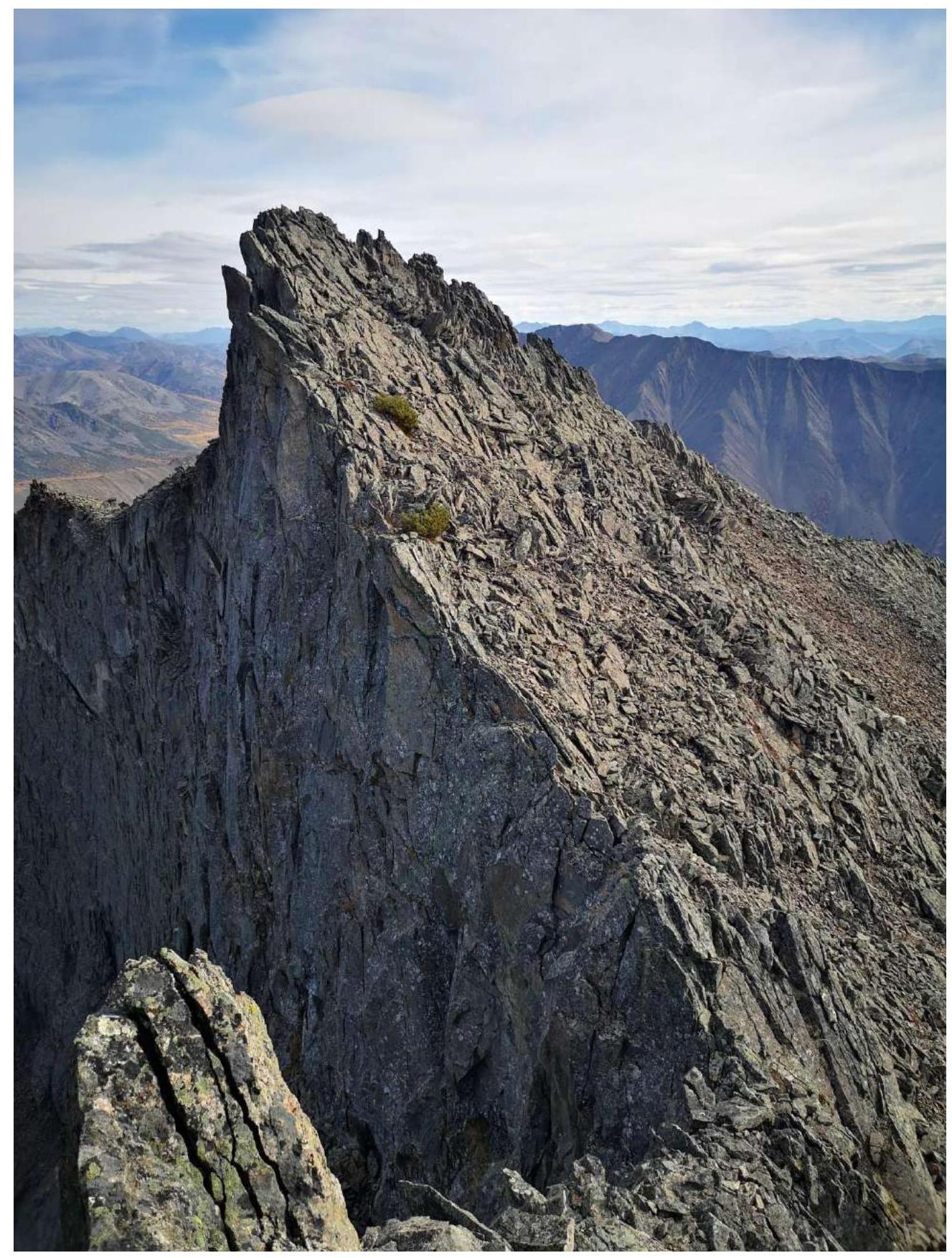
Fig. 14. Section R5–R6 (Photo from the "Krylo" gendarme)
Photo by: Ivan Kergin
2.3. Technical Characteristics of the Route
| Section | Terrain Characteristics | Difficulty Category | Length, m | Steepness | Type and Number of Pitons |
|---|---|---|---|---|---|
| R0–R1 | Medium and small scree, gendarme | 1 | 280 m | 5°–20° | 0 |
| R1–R2 | Ridge, scree, gendarme | 1 | 35 m | 15° | 0 |
| R2–R3 | Ridge. Scree. Gendarme | 1 | 155 m | 20° | 0 |
| R3–R4 | Ridge. Scree. Gendarme | 1 | 40 m | 25° | 0 |
| R4–R5 | Gendarme, ridge, scree | 1 | 30 m | 20° | 0 |
| R5–R6 | Ridge, broken rocks | 2 | 90 m | 20°–45° | Stopper — 1, Friend — 1 |
2.4. Technical Characteristics of the Route in UIAA Symbols

Fig. 15. UIAA Symbols
3. Characteristics of the Team's Actions
3.1. Brief Description of the Route Ascent
| Section | Description | Photo Number |
|---|---|---|
| R0–R1 | From the pass, traverse the scree slope and reach the ridge, approach the first gendarme. Belay through terrain. Simultaneous movement. | Fig. 7 |
| R1–R2 | From gendarme #1, move along the ridge to gendarme #2. Scree. Belay through terrain. Simultaneous movement. | Fig. 7 |
| R R2–R3 | From gendarme #2, move along the ridge to gendarme #3. The third gendarme is passed on the right along a small rocky ledge. From the ledge, there is a small ridge. Belay through terrain. Simultaneous movement. | Fig. 8 |
| R3–R4 | After gendarme #3, there is a ridge. From it, immediately a small ascent to gendarme #4. This gendarme is climbed head-on along simple rocks. Belay through terrain. Simultaneous movement. Scree. | Figs. 9, 10, 11 |
| R4–R5 | From gendarme #4, move along the ridge to the "Krylo" gendarme, pass it on the left along easy rocks (Route Key), climb up, and set up a belay station. A convenient "anchor" for the station is a loop. The first climber sets up a top-rope belay for the second, the second sets up a top-rope belay for the third. Then rappel 5–7 m to the ridge. | Fig. 10 |
| R5–R6 | From the ridge, move along the pre-summit ridge to the summit along easy broken rocks. Belay through terrain. Simultaneous movement. | Figs. 12, 13, 14 |
3.2. Team Photo at the Summit with the Control Cairn
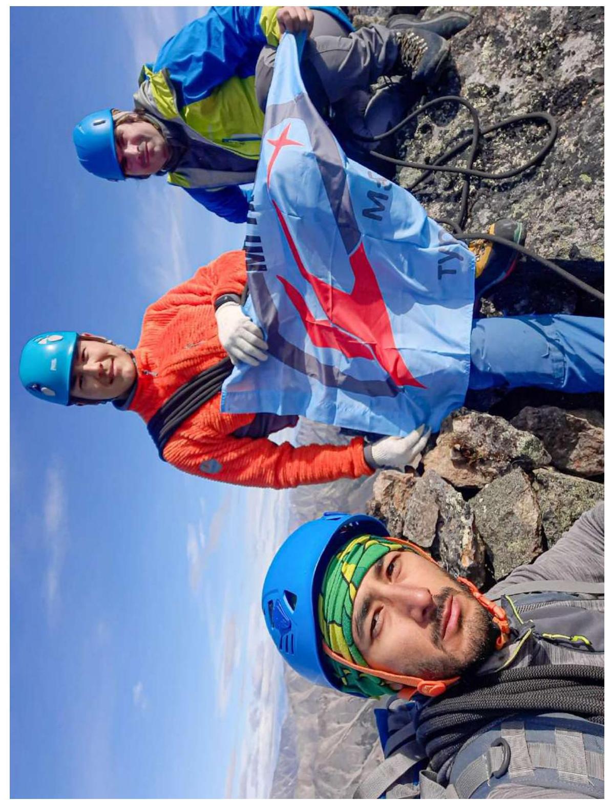
Fig. 16. Photo at the summit near the cairn
Photo by: Atabala Kasumov
3.3. Route Safety Assessment
The route is very simple and logical. It is well-suited for training exercises and as a first introduction to mountaineering.
There is cellular coverage at the summit, but it is weak. It is better to use portable radios to stay in touch with each other. Truck drivers passing near the Agan Valley can also be helpful in maintaining contact and, in case of an emergency, can notify the nearest settlement, Palatka.
Recommendations for future climbers: do not approach the edge, as the scree is medium and not well-compacted, and rocks can slip from underfoot. Gloves are essential, as the rocks are sharp. A strong gusty wind can blow from the wall side. The route is clearly visible from the base camp. Do not approach the northeast wall, as it often sends rocks down to the base of the mountain.
The descent from the summit is via the ascent route. The "Krylo" gendarme can be bypassed along a rocky ledge on the left, in the direction of descent.
This route was climbed on September 12, 2020. No signs of human presence were found at the summit: no cairn, no can with a note, no other distinguishing features. Therefore, we concluded that our team was the first to ascend Vozmozhnost Peak.
Based on the objective difficulty of the technical part of the route on Vozmozhnost Peak, and comparing it with other routes climbed previously by Kergin I. and Leukhin Y., it is proposed to classify it as category 1B.
Footnotes
-
R. Sedov, "Mountains of the Okhotsk Coast". ↩
Comments
Sign in to leave a comment