
ASCENT REPORT
to the summit of Mt. Chyorny Utyos (759 m) via the north-eastern ridge (Primorsky Krai, Partizansky District, Lozovy Range)
Report compiled based on the ascent on May 4, 2018. Khabarovsk Regional Public Organization "Khabarovsk Regional Alpine Federation"
Compiled by Morkovin Roman Olegovich
Khabarovsk 2018
Ascent Passport
- Location: Primorsky Krai, Partizansky District, Lozovy Range
- Mt. Chyorny Utyos, 759 meters, via the north-eastern ridge.
- Proposed category: 2A cat. diff.
- Route type: rock.
- Height difference: 470 m (by altimeter)
Route length 1220 m. Average slope:
- key sections – 60° (up to 75°)
- main part of the route – 29°, entire route – 23°
Length of sections with I–II cat. diff. – 240 m, II cat. diff. – 80 m.
- Pitons used/left on the route: rock – 5/0, ice – 0/0, chocks 3/0, natural protection 9/0, bolted pitons – 0/0.
- Team's climbing hours: 6 hours.
- Leader (instructor): Kurdyukov Vasily Vladimirovich, #197.
Climbers – training group, ascending as part of the NP program:
- Morkovin Roman Olegovich;
- Muzychishin Oleg Anatolyevich;
- Ostanina Nadezhda Andreevna;
- Snigurenko Olesya Alexandrovna;
- Sudeykin Sergey Nikolaevich;
- Shershenova Anastasia Andreevna.
- Senior coach: Krasnolutsky Alexander Vyacheslavovich, CMS, #606.
- Route entry on May 4, 2017: 9:00 AM. Summit reached: 2:50 PM. Return to BL: 6:25 PM.
- Organization: Khabarovsk Regional Public Organization "Khabarovsk Regional Alpine Federation". 680007, Khabarovsk, Shimanovskaya St., 8–17.
The route is of significant interest as a training ground for ascents within the NP1 and NP2 programs. The accessibility of the location allows for regular ascents at any time of the year, which is crucial for the development of mass mountaineering by attracting newcomers to alpine clubs and sections.
Description of the Area
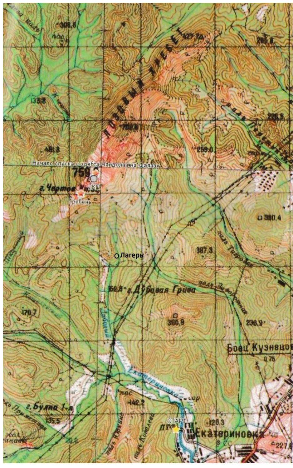
The Lozovy Range (historically known as Chandalaz Range until 1972/1978) is located 10 km NNW of the village Ekaterinovka in the Partizansky District of Primorsky Krai. The range stretches in a north-eastern direction, is relatively small (8x2 km at its base), and is composed of reef limestones. The highest point of the range is Mt. Chyorny Utyos, 759 m above sea level. The southern and south-eastern parts of the range around Mt. Chyorny Utyos consist of numerous ridges and rock formations; the northern part is lower and gentler, partially forested.
Access to the range is via a dirt road from the poultry farm near the village Ekaterinovka. The presence of multiple junctions, ravines, and fords, along with the sometimes poor condition of the road, complicates the approach directly to the start of the routes, especially without local knowledge. With optimal access, the camp is set up at one of the sources of the Dubovy ("Chyorny") stream, along the valley of which one can approach directly to the start of the routes. The distance from the camp to the start of the ascent is about 1.5 km.
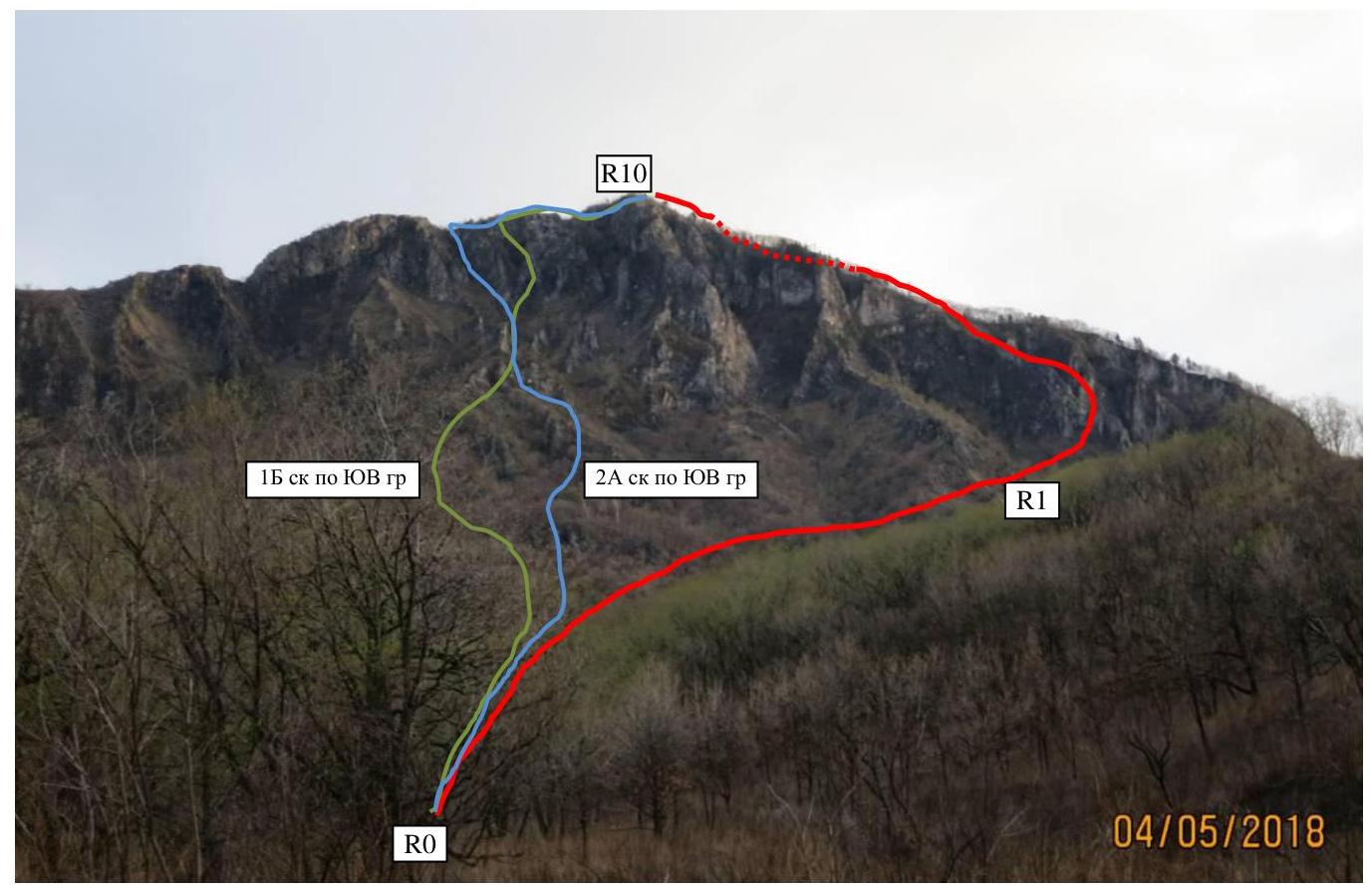
 General view of the route
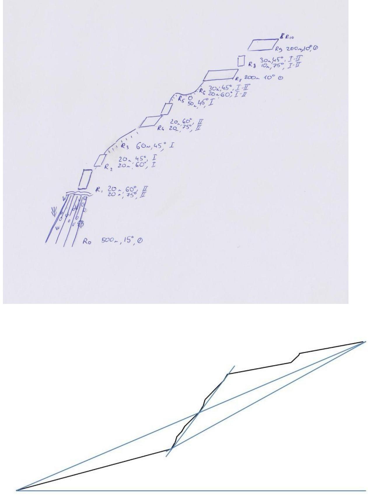
 Route diagram and profile
 Technical Description
| Section | Meters | Slope | Cat. Diff. | Description |
|---|---|---|---|---|
| R0–R1 | 500 | 15° | 0 | Traverse and ascent to the start of the ridge. Simultaneous movement. Movement across a grassy, rocky slope through sparse forest. |
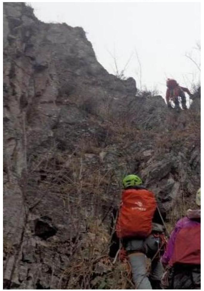
| R1–R2 | 20 | 60–75° | II | 1st key section. Ascending a rock face. Movement on fixed ropes. Used 2 cams + natural protection + a loop on a tree with a quickdraw. |
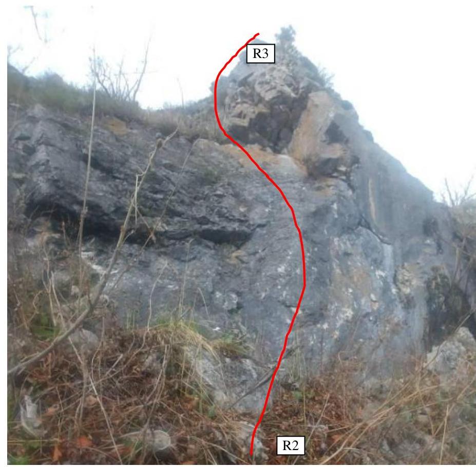
| R2–R3 | 20 | 45–60° | I | Movement on fixed ropes up a rock face, exiting onto the ridge. Used 1 chock + 1 anchor + natural protection. Station on a tree. |
| R3–R4 | 60 | 45° | I | Movement along the ridge on fixed ropes. Used 1 loop on a rock outcrop with a quickdraw. Station on a tree. |
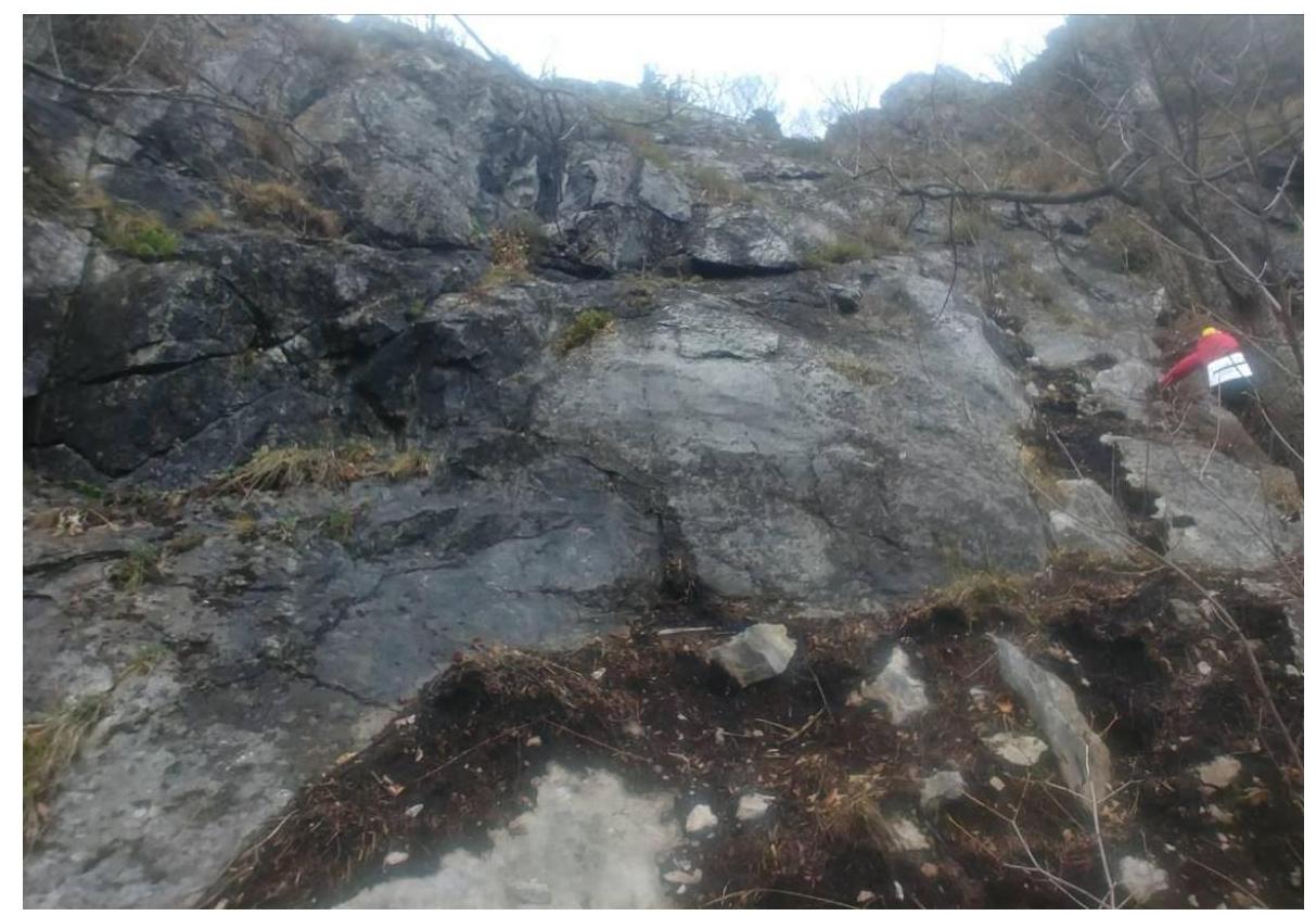
| R4–R5 | 20 | 60–75° | II | 2nd key section. Movement on fixed ropes, first traversing along the face, then ascending the face to the ridge. Used 1 chock + 1 anchor + natural protection. Station on a tree. |
| R5–R6 | 50 | 0–45° | I | Movement along the ridge on fixed ropes. Used a loop on a rock outcrop with a quickdraw. Station on a tree. |
| R6–R7 | 30 | 45–60° | I–II | Movement along the ridge and small rock faces on fixed ropes. Used 1 piton + natural protection. Station on a rock outcrop. |
| R7–R8 | 200 | 10° | 0 | Exit onto a broad ledge. Simultaneous movement along a wide ridge with natural protection. |
| R8–R9 | 30 | 45–75° | I–II | Movement on fixed ropes up a small rock face with a wide crack. Used 1 cam and a loop on a rock outcrop with a quickdraw. Station on a tree. |
| R9–R10 | 200 | 10° | 0 | Traverse along the broad crest of the ridge through sparse forest towards the summit. Simultaneous movement. |
Description of the route via the south-eastern ridge
Access to the start of the route is via the Nakhodka–Partizansk road, through the village Ekaterinovka. A landmark is the village's poultry farm. Just 100 m from the farm gates, before the bridge, a dirt road turns left. This road leads to a large field with power line poles. The road is sometimes badly damaged.
From the field at the crossroads, turn right, passing two fords. Further road choice is difficult without local knowledge. The ridge itself is clearly visible from the field. After the second ford, the campsite is less than 3 km away in a straight line.
The approach to the route is through the forest. The group first heads towards the main rock wall leading to the summit of Chyorny Utyos, then turns right (north) and follows along the ridge to the second ridge from the wall. The route's profile is clearly visible from the approach. The route is logical, passing along the north-eastern ridge of the mountain, exiting onto a spur 200 m from the summit of Chyorny Utyos.
The ascent begins on a slope covered with sparse grass, individual bushes, and a few trees. Movement is simultaneous. The ridge is clearly visible from the approaches.
The further ascent generally follows rock faces and connecting ridge sections. The terrain is rich, though partially degraded in some ridge sections. There are two sections of wall climbing with II cat. diff., which are the key sections of the route (at the beginning and in the middle). In the upper part of the route leading to the summit, the slope becomes gentler, transitioning into a not-too-steep, wide slope covered with sparse forest and small bushes.
Descent is possible by several methods: via the couloirs south of the route; via route 1B, diverging into a couloir southward from its midpoint; or along a path going south along the ridge crest with a descent at the end of the path onto its eastern slope. All descent options imply organizing two rappels at full rope length.
Recommendations for subsequent groups. On the main part of the route, live rocks and the possibility of slipping onto rock formations pose a potential danger. There are two sections of II cat. diff. with a total length of about 80 m.
Recommended equipment for a 6-person group: 3 climbing harnesses, 6–8 quickdraws, 5–6 rock pitons, hammer, 5–6 chocks. Helmets are mandatory for all participants!
The complexity of the route increases with snow and icy rocks.
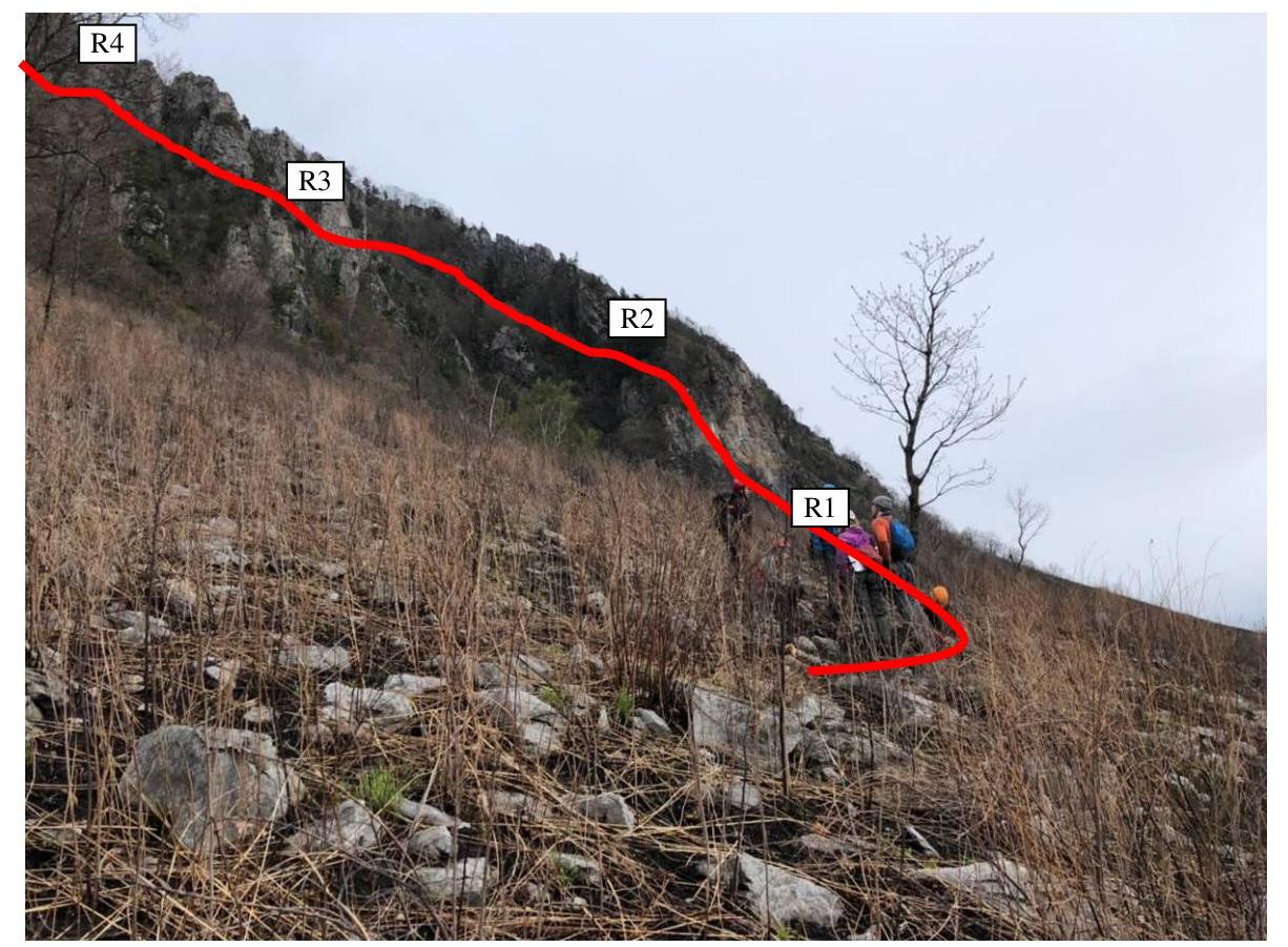
Section R1–R2
Section R2–R3
Section R4–R5
Section R6–R7
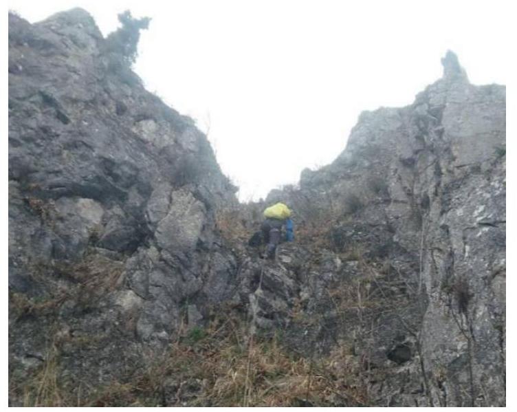
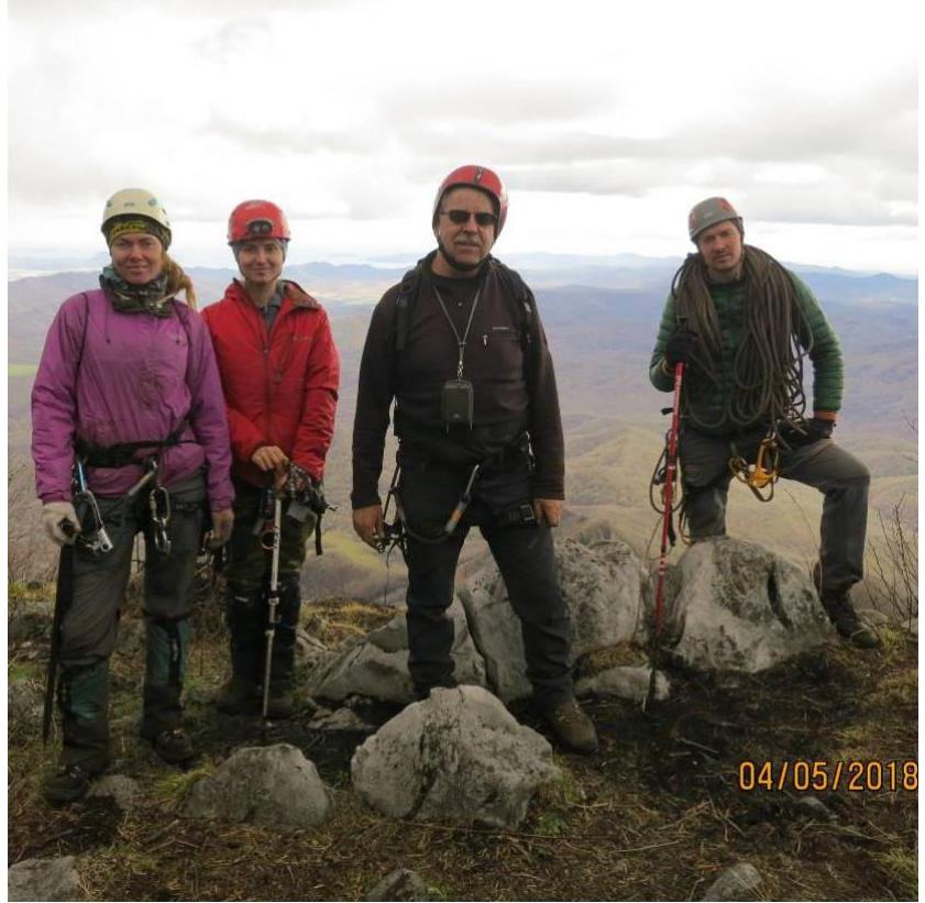
Photo at the summit
Comments
Sign in to leave a comment