
Report
on the first ascent to the summit "Tatyana" 2446 m via the route along the northern ridge 1B category of complexity for the period from July 14, 2020 to July 14, 2020.
I. Climbing Passport
| 1. General Information | ||
|---|---|---|
| 1.1 | Full Name, Sports Rank of the Leader | Ramazanova Anastasia Evgenevna, St. Petersburg |
| 1.2 | Full Name, Sports Rank of Participants | Penkina Polina Vadimovna, 2nd sports rank, Yekaterinburg; Sycheva Darya Sergeevna, St. Petersburg; Abramov Grigory, Irkutsk |
| 1.3 | Full Name of Coach | Glazunov Evgeny Vladimirovich (Master of Sports) |
| 1.4 | Organization | Irkutsk Regional Public Organization "Club of Active Recreation and Alpinism "Mountains of Baikal", project "Impossible is not forever" |
| 2. Characteristics of the Climbing Object | ||
| 2.1 | Region | South-Muya Ridge |
| 2.2 | Valley | Western side of Pik Mechta |
| 2.3 | Number of section according to the 2013 Classification Table | 9.11 |
| 2.4 | Name and Height of the Summit | Tatyana, 2446 m |
| 2.5 | Geographical Coordinates of the Summit (latitude/longitude), GPS Coordinates | 55°29′24.01″ N 112°39′48.59″ E |
| 3. Characteristics of the Route | ||
| 3.1 | Name of the Route | Along the northern ridge |
| 3.2 | Proposed Category of Complexity | 1B |
| 3.3 | Degree of Route Exploration | First Ascent |
| 3.4 | Nature of the Route Terrain | Rocky |
| 3.5 | Altitude Difference of the Route (data from altimeter or GPS) | 804 m |
| 3.6 | Length of the Route (in meters) | 1800 m |
| 3.7 | Technical Elements of the Route (total length of sections of various complexity categories with indication of terrain character (ice-snow, rocky)) | Rocky terrain, category I — 900 m, category II — 900 m |
| 3.8 | Descent from the Summit | Via the ascent route |
| 3.9 | Additional Characteristics of the Route | Water is available before the start of the couloir |
| 4. Characteristics of Team Actions | ||
| :--: | :--: | :--: |
| 4.1 | Time of Movement (team's working hours) | 5.5 hours |
| 4.2 | Overnight | No |
| 4.3 | Time at Control Points | Departure from the base camp under Pik Mechta — 5:00, start at R0 — 5:15, summit — 7:20, return to BC — 10:30 |
| 5. Characteristics of Weather Conditions | ||
| 5 | Cloudy, no precipitation, temperature approximately +20 °C. | |
| 6. Person Responsible for the Report | ||
| 6.1 | Full Name, e-mail | Sycheva Darya Sergeevna, dora_thr_explorer@list.ru, +79310038902 |
II. Description of the Ascent
- Characteristics of the Climbing Object
1.1. General Photo of the Summit
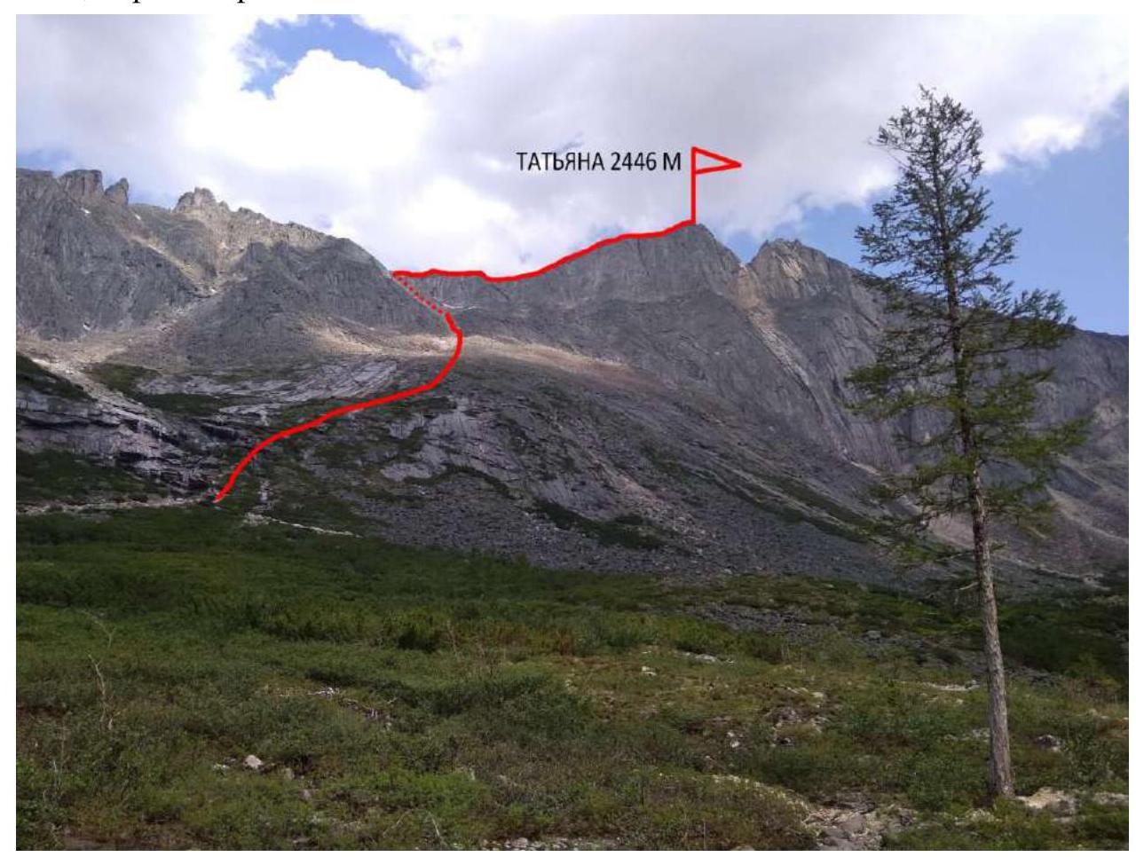
Photo 1. Date of shooting — July 12, 2020.
1.2. Photopanorama from the summit of Maks Frya
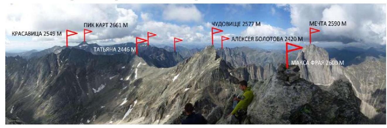
Photo 2. Date of shooting — July 15, 2020.
1.3. Map of the Area

Photo 3. Map of the area. Map of the area, expedition path 2020.
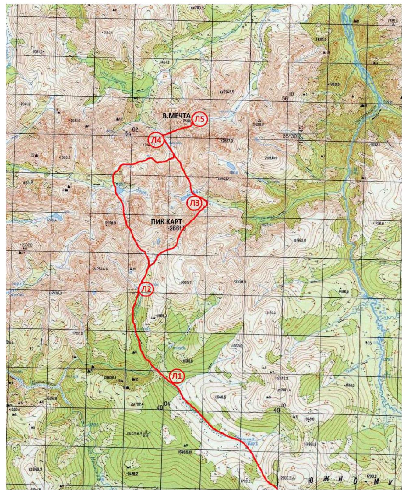
Photo 4. Map of the area. The summit Tatyana is located in the southwestern part of the South-Muya Ridge near the Prazdnichny pass. The nearest settlement is Baunt, located 400 km north of Chita, 120 km from Bagdarin. Baunt is a small village where you can find accommodation for a drop-off, and there is a store. There is no cell phone signal.
From Baunt, head north towards the Ayan River and then along the Maly Ayan River for about 20 km until you reach the border of the marshes and the forest. This section can be traversed by an all-terrain vehicle. At the end of the all-terrain vehicle drop-off, the main base is organized with supplies and tents, as well as equipment for charging devices in expedition conditions. Coordinates of the base camp for the 2020 expedition:
- 55°18′27.8″ N 112°47′34.02″ E
From the base, move towards the upper reaches of the Maly Ayan River, then ascend to a non-categorized pass, 1900 m. From the pass, descend to the Inamakita River and move along its right bank until it merges with the Stlanikova River. Then, ascend along the Stlanikova River to its upper reaches. It is convenient to set up a camp in the forest zone near the ice (camp coordinates under Kart:
- 55°25′44.49″ N 112°37′25.98″ E (marked on the map as L2))
The drop-off from the base camp to the camp under Kart takes 1–1.5 days. You can set up an intermediate camp before reaching the confluence of the Inamakita and Stlanikova rivers (on the map L1, coordinates:
- 55°23′00.17″ N 112°39′02.27″ E)
There are few suitable places for tents at the confluence of the rivers.
The terrain on the approach is complex:
- On the ascent and descent from the pass — forest and talus
- The upper reaches of Inamakita are marshy
- Animal trails are found along the banks
- The ascent along Stlanikova is mainly along the riverbed, over rocks, choosing a more convenient path along the banks, mainly on the left orographic bank
- Ice is encountered
After a large ice field (a few kilometers from the confluence of the rivers; Pik Kart is visible from this ice field), the trail goes up the left bank.
From the camp under Kart, move upstream along the Stlanikova River. We move:
- Through dwarf pine
- Then through grass and talus
- There are good animal trails
Further:
- Ascent to the Razvedchikov Pass (2B)
- Descent from it to a lake
- After the lake, turn left, following the trail, reach BL "Akuлья Pactь" (marked on the map as L3 — 55°28′15.28″ N 112°40′14.61″ E)
- Bypass the lake near the camp on the left
- Ascend to the Alenka Pass
- Descend into the gorge under the western wall of Pik Mechta
- Reach L4 (55°29′52.18″ N 112°38′30.85″ E)
You can reach L4 from L2 in one day or set up an intermediate camp in L3.
From the base camp Mechta, we move towards the Prazdnichny Pass along a dry stream. Bypassing the waterfalls, we start moving along the western slope.
- Characteristics of the Route
2.1. Technical Photograph of the Route
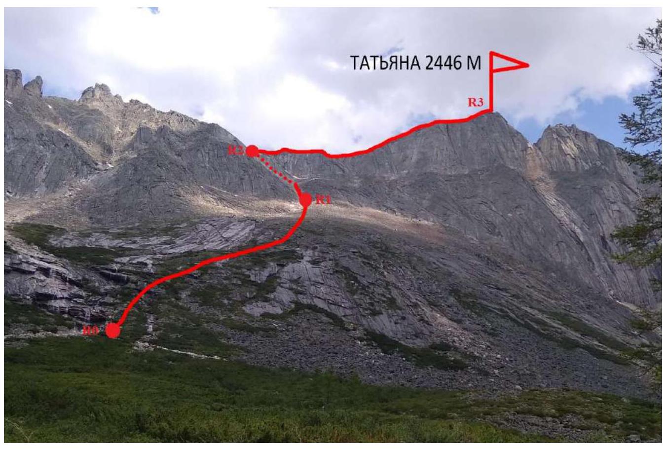
Photo 5. Technical photo of the route
2.1. UIAA Symbol Route Diagram
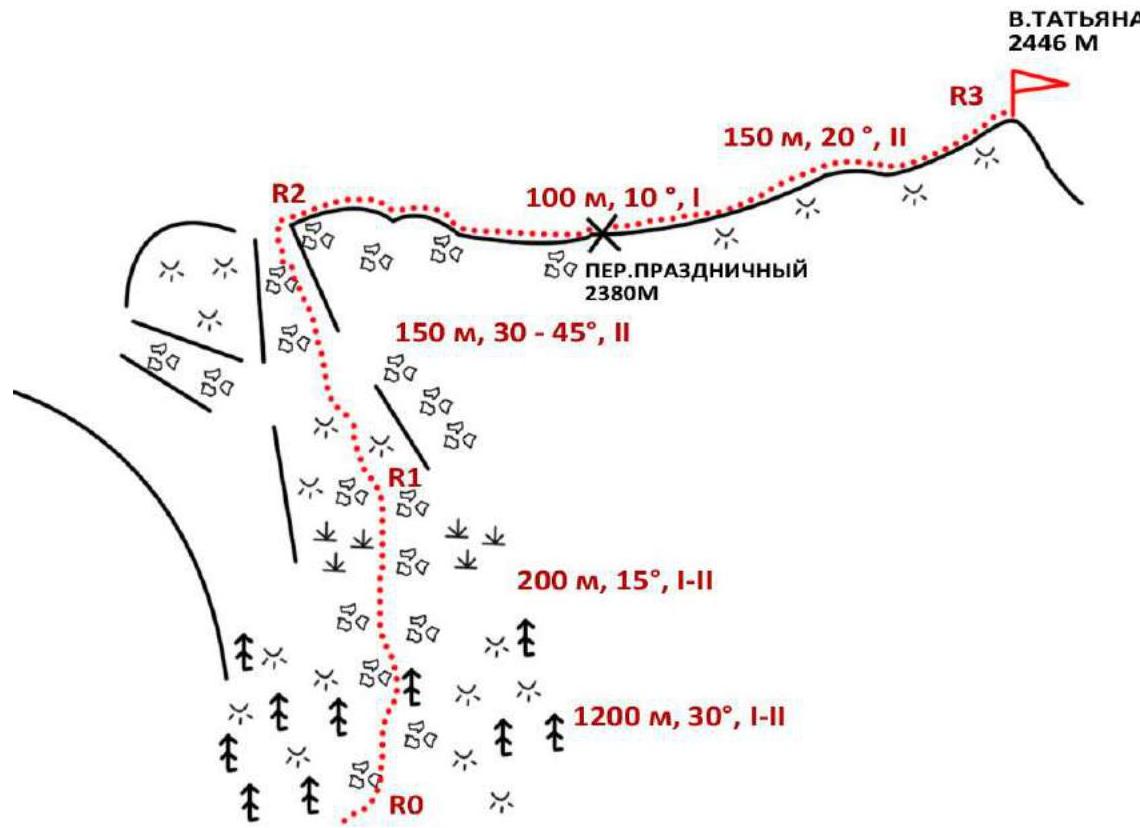
Photo 6. UIAA Diagram
2.2. Technical Characteristics of Route Sections
| Section # | Terrain Characteristics | Category of Complexity | Length, Angle | Type and Number of Pitons |
|---|---|---|---|---|
| 0-1 | Slabs with grass, dwarf pine. | I–II | 1200 m 30° | - |
| Large-block talus. | I–II | 200 m 15° | ||
| 1-2 | Talus. | II | 150 m 30°–45° | - |
| 2-3 | Talus. | I | 100 m 10° | - |
| Ridge, slabs. | II | 150 m 20° |
III. Characteristics of Team Actions
| Section # | Description | Photo Number |
|---|---|---|
| 0-1 | Movement along slabs with grass and dwarf pine, then along talus. On foot, choosing the most logical ascent route, bypassing waterfalls on the right. Exit to the couloir. | 7-8 |
| 1-2 | Movement in a tight group along live talus, bypassing "ram's foreheads" on the right. Then the couloir splits into two; we follow the right one. Exit to the ridge. | 9 |
| 2-3 | Movement along the ridge: first along talus, then along slabs. | 10-11 |
Photos from the Ascent
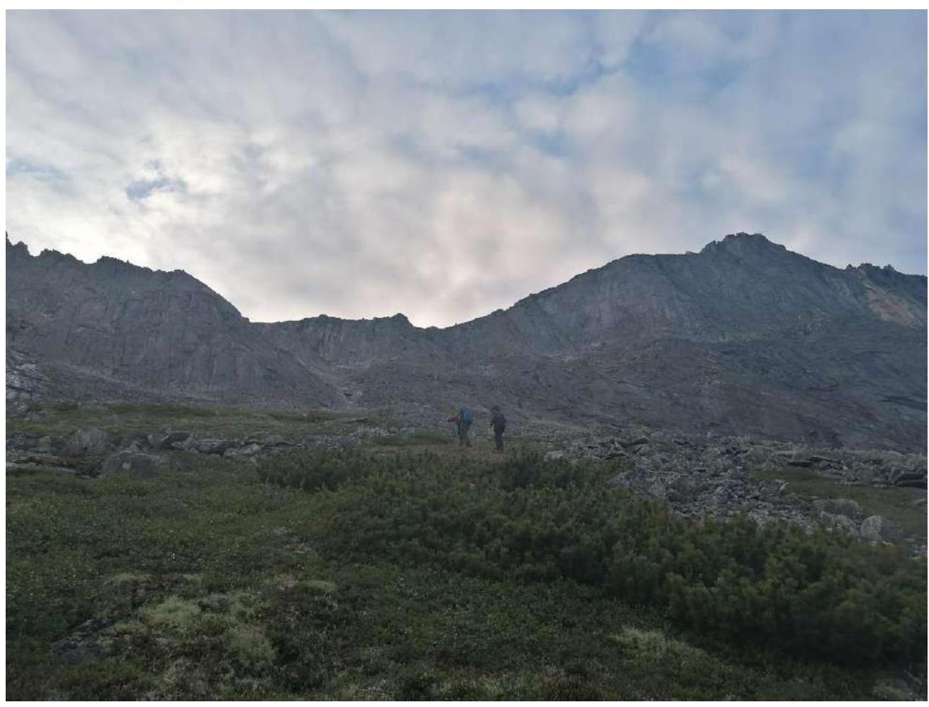
Photo 7. Beginning of section R0–R1
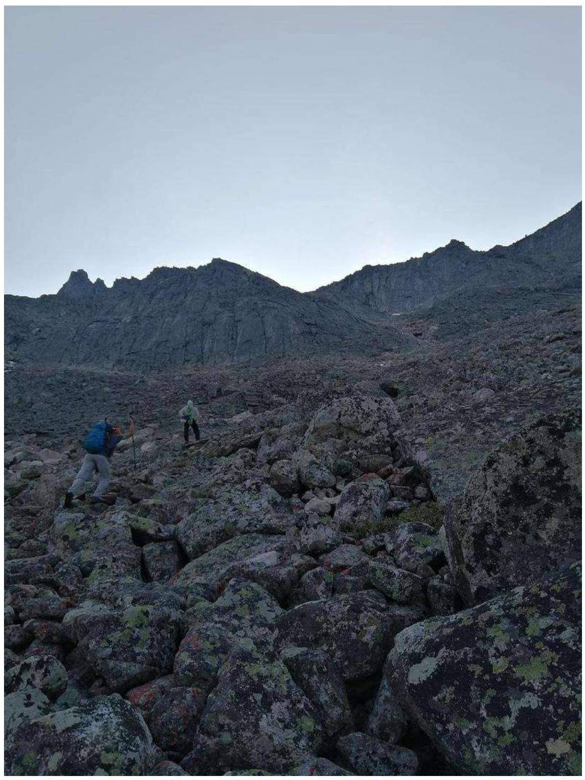
Photo 8. Section R0–R1

Photo 9. Section R1–R2
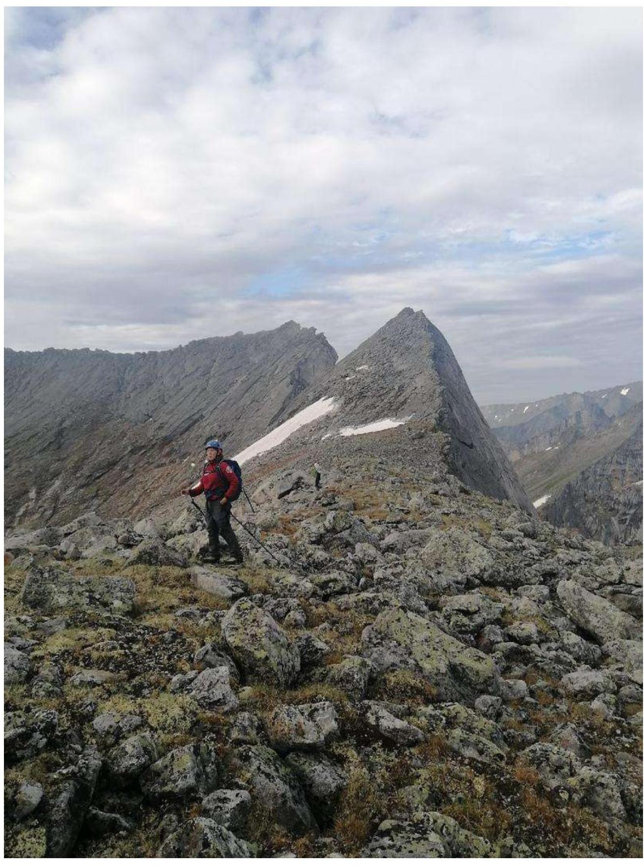
Photo 10. Beginning of section R2–R3
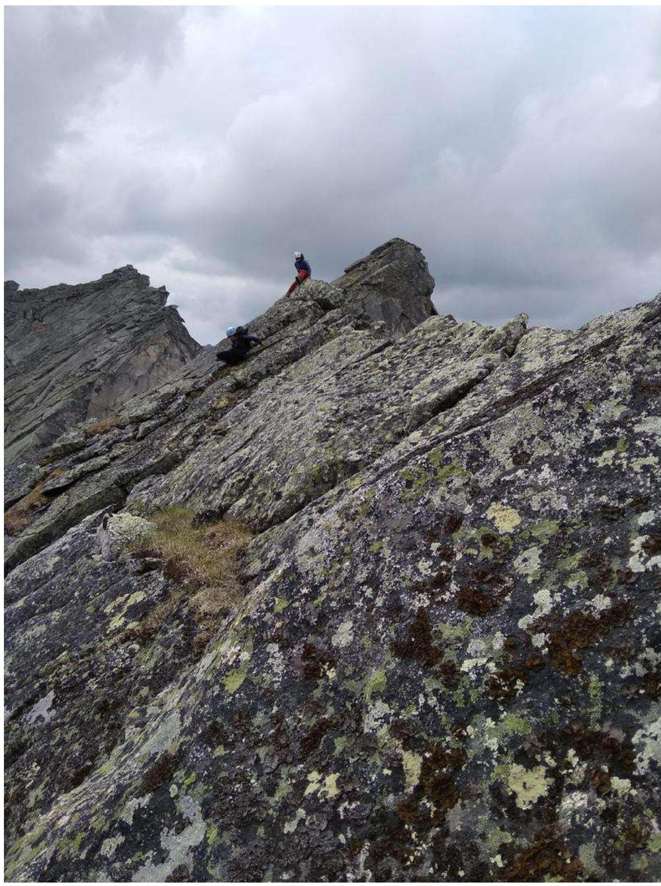
Photo 11. Section R2–R3
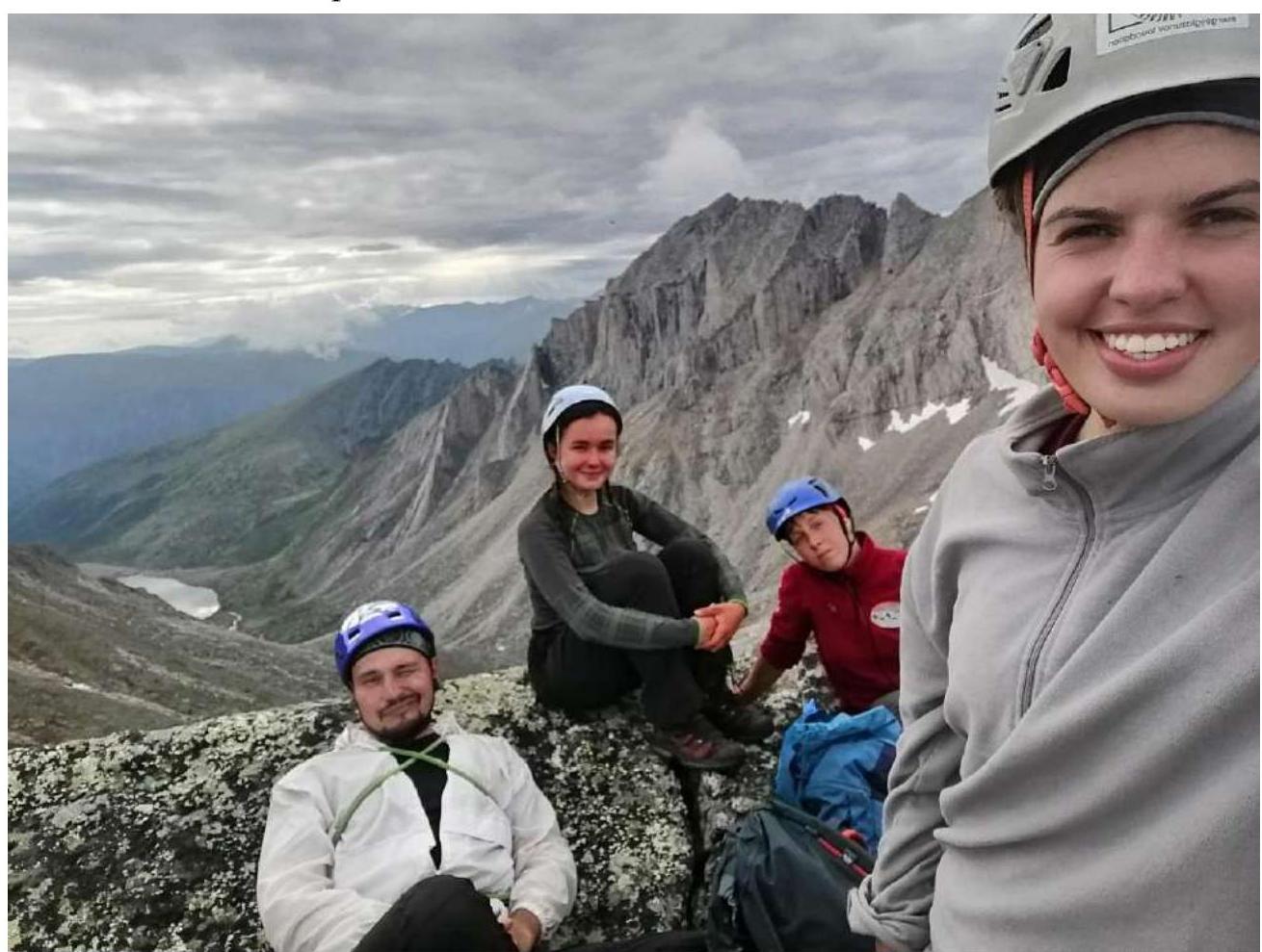
Team Photo at the Summit
3.3. The route is relatively safe because it is a ridge route. Communication with the base camp was carried out using a radio station. Descent was made via the ascent route. The предполагаемая категория трудности маршрута 1Б, по сложности и протяжённости маршрут сравним с маршрутами этой категории.