
Report
On the ascent to the summit of Kart 2661 m via the East Ridge, approximately 2A category of difficulty, from July 5, 2020, to July 5, 2020.
I. Climbing Report
| 1. General Information | ||
|---|---|---|
| 1.1 | Full Name, Sports Rank of the Leader | Penkina Polina Vadimovna, 2nd sports rank |
| 1.2 | Full Name, Sports Rank of the Participants | Ramazanova Anastasia Evgenievna, Sycheva Daria Sergeevna |
| 1.3 | Full Name of the Coach | Glazunov Evgeny Vladimirovich (Master of Sports) |
| 1.4 | Organization | Irkutsk Regional Public Organization Club of Active Recreation and Alpinism "Gory Baikala", project "Невозможно — это не навсегда" |
| 2. Characteristics of the Climbing Object | ||
| 2.1 | Region | South Muy Ridge |
| 2.2 | Valley | Stlanikova River |
| 2.3 | Classification Number according to the 2013 Classification Table | 9.11 |
| 2.4 | Name and Height of the Summit | Kart, 2661 m |
| 2.5 | Geographical Coordinates of the Summit (Latitude/Longitude), GPS Coordinates | 55°27′32.0″N 112°39′22.7″E |
| 3. Route Characteristics | ||
| 3.1 | Route Name | Via the East Ridge |
| 3.2 | Proposed Category of Difficulty | 2A |
| 3.3 | Degree of Route Exploration | The first ascender is unknown; the route is used by climbers; it serves as a descent route for other routes to Kart |
| 3.4 | Terrain Characteristics | Rocky |
| 3.5 | Elevation Gain of the Route (data from altimeter or GPS) | 460 m |
| 3.6 | Route Length (in meters) | 820 m |
| 3.7 | Technical Elements of the Route (total length of sections with different categories of difficulty, indicating the terrain type (ice-snow, rocky)) | Rocky terrain, 1st category — 300 m, 2nd category — 480 m, 3rd category — 40 m. |
| 3.8 | Descent from the Summit | Via the ascent route |
| 3.9 | Additional Route Characteristics | Water available before the saddle (streams and snowfields) |
| 4. Characteristics of the Team's Actions | ||
| :--: | :--: | :--: |
| 4.1 | Time in Motion (team's total climbing hours) | 2 hours 20 minutes |
| 4.2 | Overnights | No |
| 4.3 | Time at Control Points | Departure from the base camp under Kart — 7:30. Start at R0 — 9:40. Summit — 12:20. Start of descent — 13:00. Return to BC — 17:30 |
| 5. Weather Conditions | ||
| 5 | Clear | |
| 6. Person Responsible for the Report | ||
| 6.1 | Full Name, e-mail | Penkina Polina Vadimovna, polinapenkina4055@gmail.com, 89021558617 |
II. Climbing Description
1. Characteristics of the Climbing Object
1.1. General Photo of the Summit
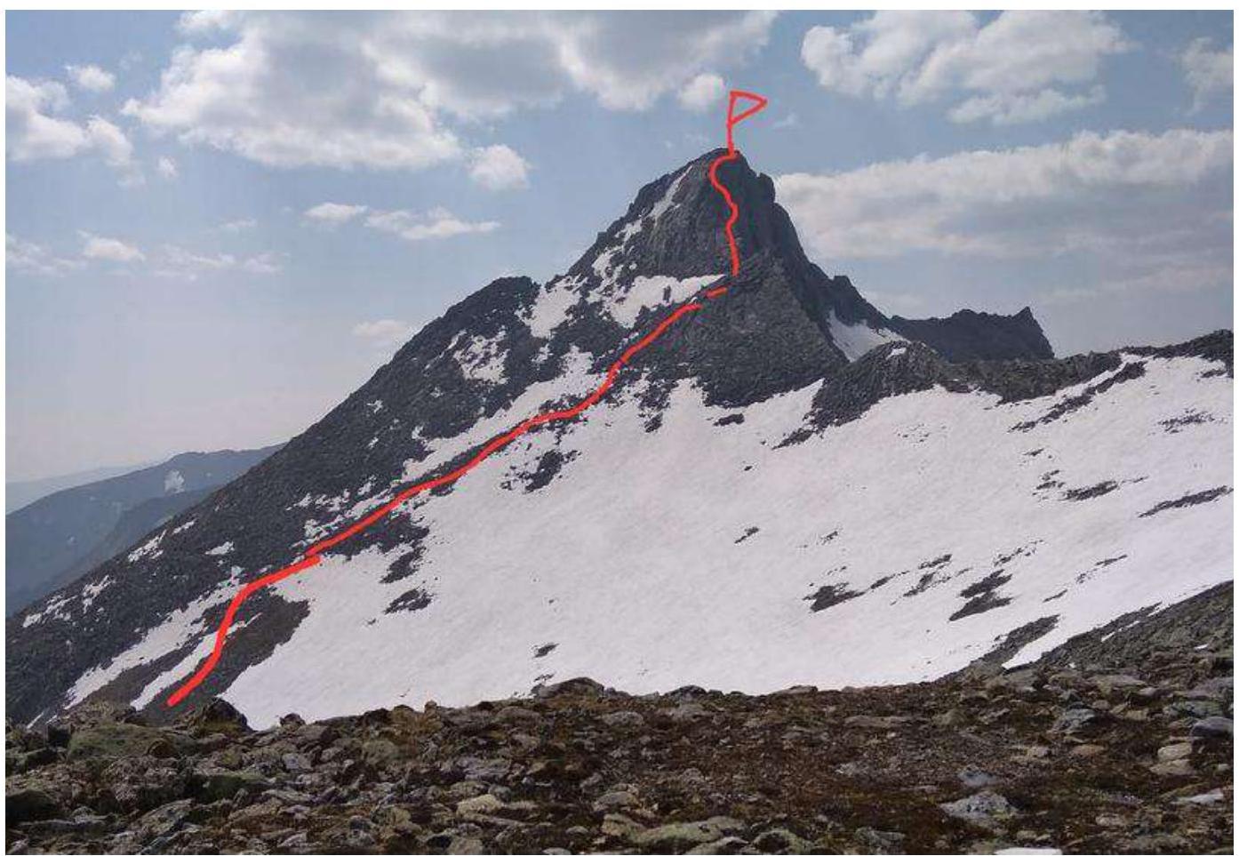
Photo 1. Taken on July 5, 2020, from the Razvedchikov Pass
1.2. Photo of the Route Profile
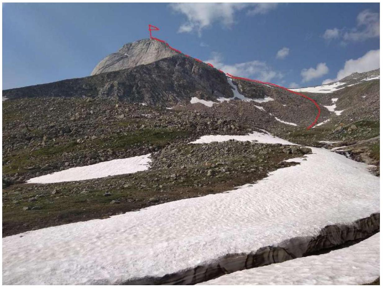
Photo 2. Taken on July 5, 2020.
1.3. Panoramic Photo of the Upper Reaches of the Stlanikova River
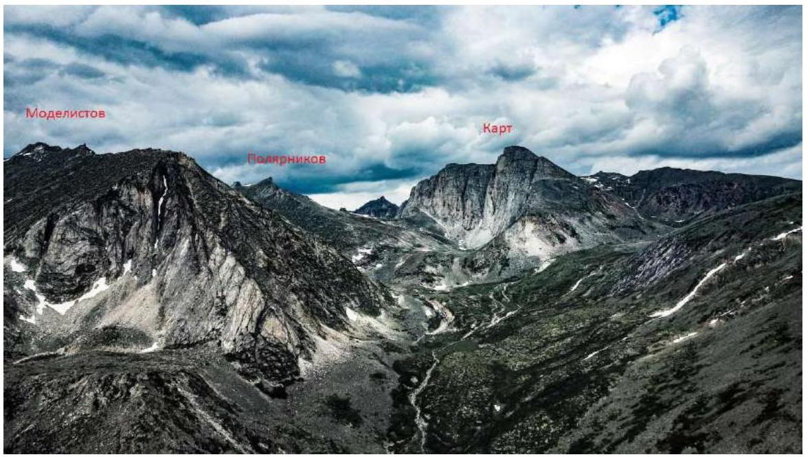
Photo 3. Panoramic view
1.4. Map of the Area
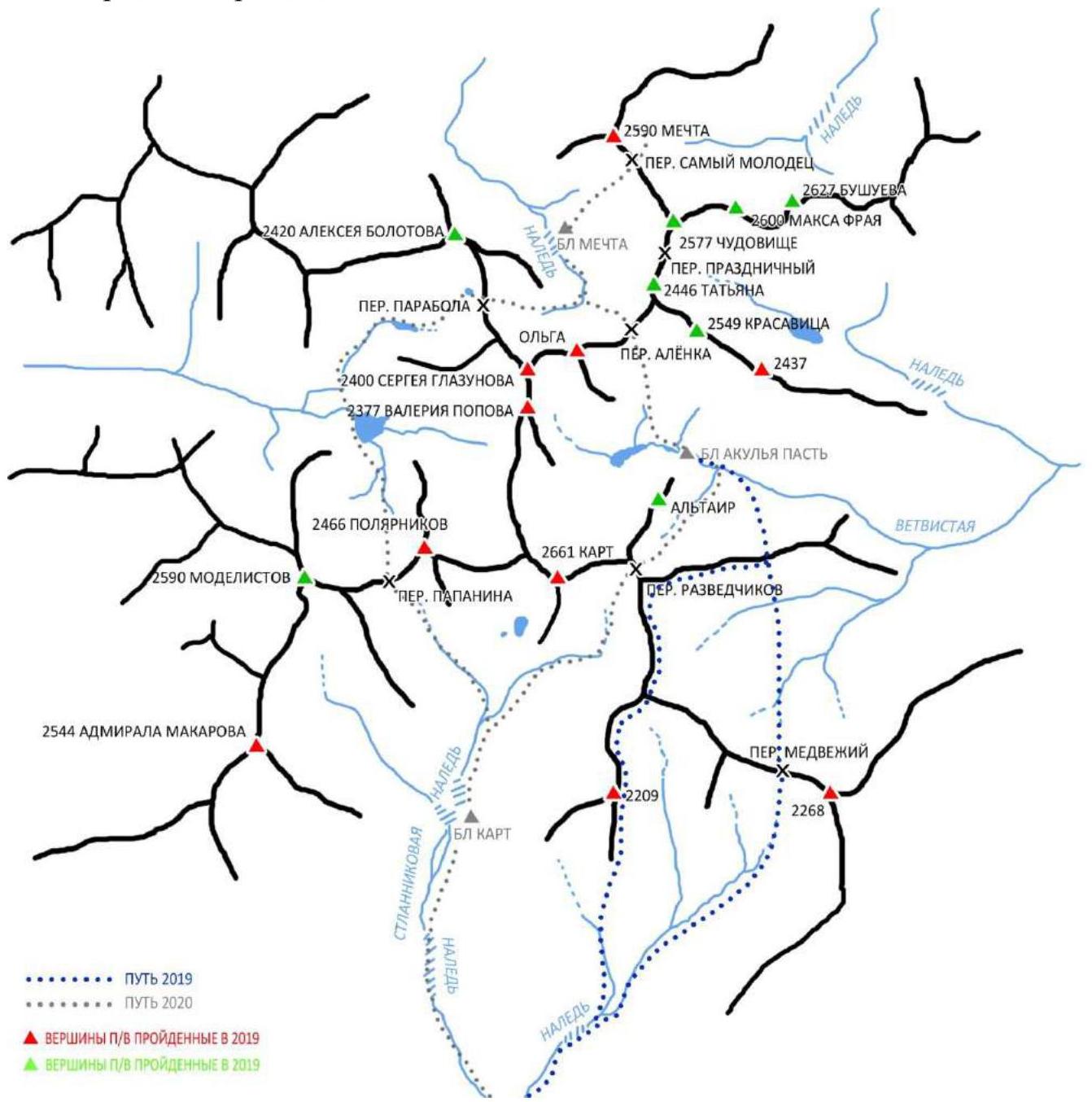
- PATH 2019
- PATH 2020
- SUMMITS CLIMBED IN 2019
- SUMMITS CLIMBED IN 2019
Photo 4. Map of the area
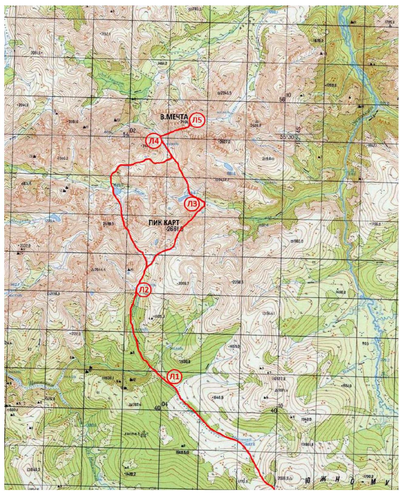
Photo 5. Expedition route
The summit of Kart is located in the southwestern part of the South Muy Ridge in the upper reaches of the Stlanikova River valley. Currently, 7 routes have been laid to the summit by the team of the project "Невозможно — это не навсегда" with categories of difficulty ranging from 1B to 5B. The nearest settlement is Baunt, located 400 km north of Chita, 120 km from Bagdarin. Baunt is a small village where one can find overnight accommodation upon arrival, and there is a store. There is no cell phone coverage. From Baunt, head north towards the Ayan River and then along the Maly Ayan River for about 20 km until reaching the boundary between the marshland and the forest. This section can be traversed by all-terrain vehicle; at the end of the all-terrain vehicle route, the main base is set up with provisions and tents, as well as equipment for charging devices during the expedition. The coordinates of the 2020 expedition base camp are 55°18′27.8″N 112°47′34.02″E. From the base, move towards the upper reaches of the Maly Ayan River, then ascend to the non-categorized 1900 m pass. Descend from the pass to the Inamakyt River and move along its right bank until the confluence with the Stlanikova River. Then ascend along the Stlanikova River to its upper reaches. It is convenient to set up a camp in the forest zone near the ice (coordinates of the camp under Kart: 55°25′44.49″N 112°37′25.98″E, marked as L2 on the map). The trek from the base camp to the camp under Kart takes 1–1.5 days. An intermediate camp can be set up before reaching the confluence of the Inamakyt and Stlanikova rivers (marked as L1 on the map, coordinates: 55°23′00.17″N 112°39′02.27″E). There are limited spots for tents at the confluence of the rivers. The terrain on the approach is challenging. The ascent and descent from the pass involve forest and scree. The upper reaches of the Inamakyt are marshy; further along the bank, there is an animal trail. The ascent along the Stlanikova River is mostly along the riverbed, over stones, choosing a more convenient path along the banks, primarily on the left orographic bank. There are ice fields. After a large ice field (a few kilometers from the confluence of the rivers; Kart peak is visible from this ice field), the trail goes up along the left bank. From the camp under Kart, move upstream along the Stlanikova River, then turn right towards the Razvedchikov Pass. The approach is through dwarf pine, then over grass and scree. There are good animal trails. The start of the route is at an altitude of 2200 m.
2. Route Characteristics
2.1. Technical Photo of the Route
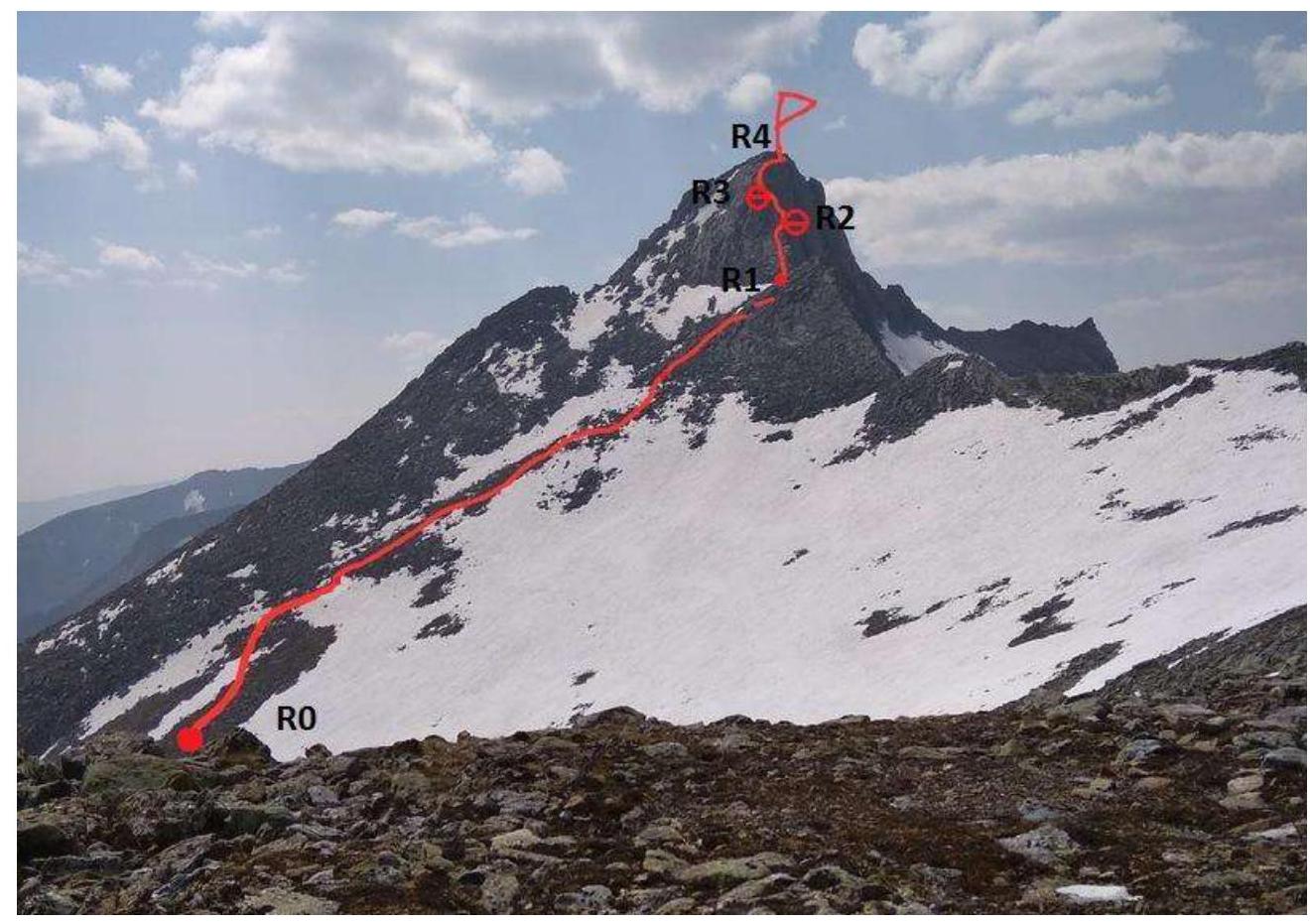
Photo 6. Technical photo of the route
2.2. UIAA Symbol Route Diagram
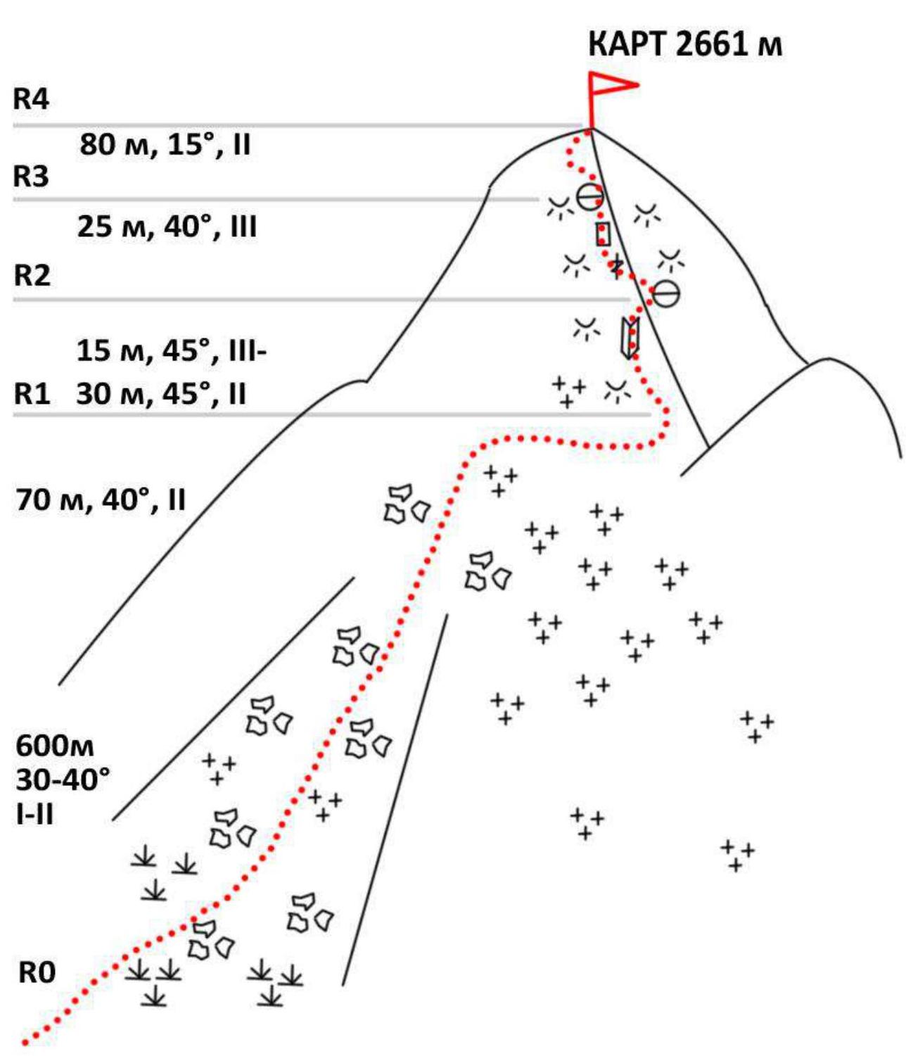
Photo 7. UIAA diagram
2.3. Technical Characteristics of Route Sections
| Section Number | Terrain Characteristics | Category of Difficulty | Length, Angle | Type and Number of Pitons |
|---|---|---|---|---|
| 0-1 | Scree with grass, then with snow. | 1–2 | 600 m 30–40° | - |
| Rocky outcrops, scree. | 2 | 70 m 40° | - | |
| Rocky outcrops, broken rocks. | 2 | 30 m 45° | - | |
| Slab. Movement along a crack, then over boulders. | 3 | 15 m 45° | - | |
| 2-3 | Gentle part of the ridge | 2 | 25 m 40° | - |
| 3-4 |
Pitons and chocks were not used; belays were taken on natural features.
III. Characteristics of the Team's Actions
| Section Number | Description | Photo Number |
|---|---|---|
| 0-1 | Approach over scree with grass, then with snow. On foot, bypassing snowfields to the left. A gentle gendarme remains to the right; exit to the saddle. | |
| 1-2 | Simultaneous movement over broken rocks and rocky outcrops. Belays on natural features. Starting from the inner corner — alternating belays, anchor on a rock. | 8 |
| 2-3 | Movement along a crack, then over boulders. Alternating belays, anchor on a rock. | 9 |
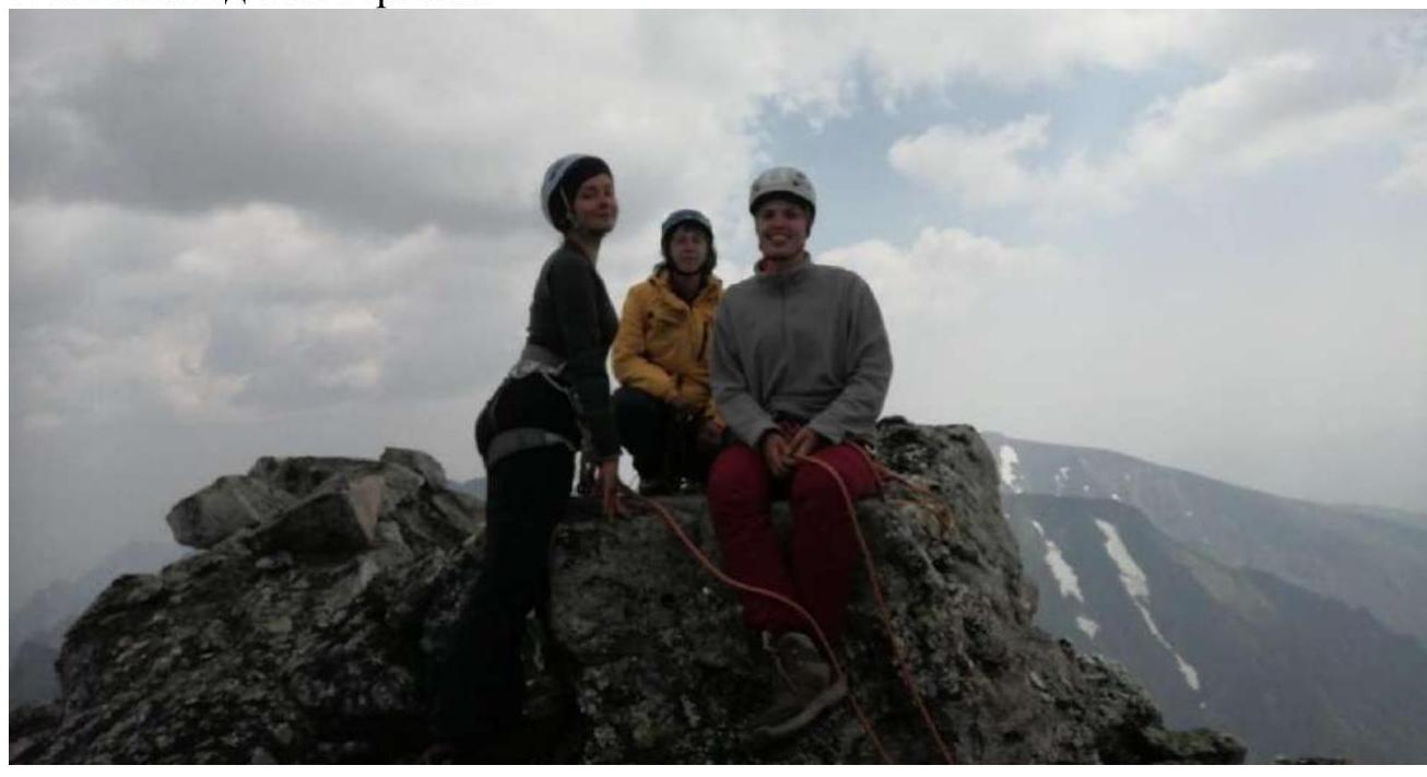
| 3-4 | Simultaneous movement along the ridge. | 10 |
Photos from the ascent
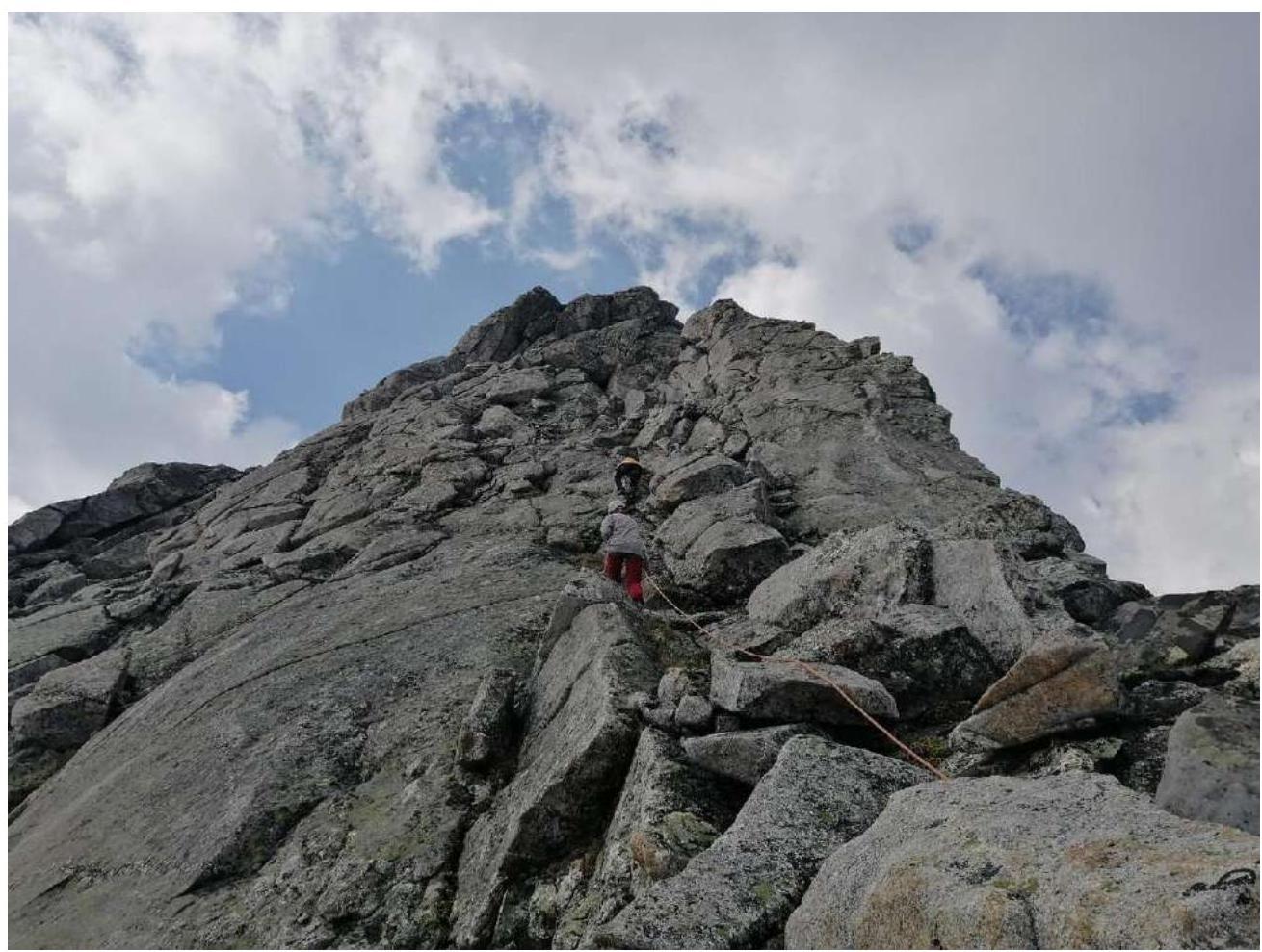
Photo 8. Section R1–R2
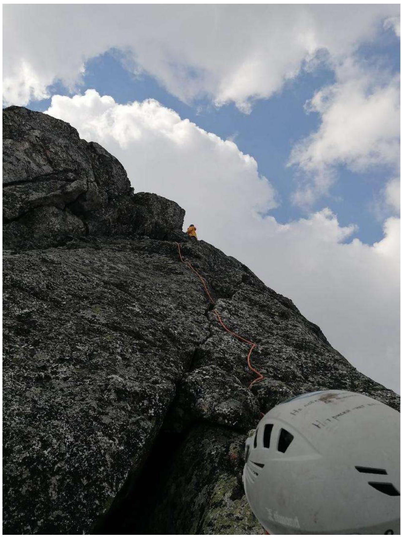
Photo 9. Section R2–R3
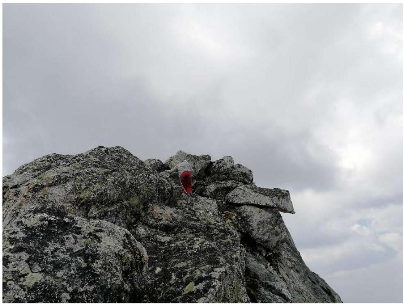
Photo 10. Start of section R3–R4. Team photo at the summit
3.3. The route is relatively safe because it is a ridge route. Communication with the base camp was maintained via radio station. Descent was via the ascent route. The proposed category of difficulty for the route is 2A, comparable in complexity and length to routes of this category.