
Report
on the first ascent to the summit of Kart 2661 m via the "Cascade" route along the center of the Western wall of the main bastion, approximately 5B category of difficulty, from July 3, 2020, to July 3, 2020.
I. Ascent Passport
| 1. General Information | ||
|---|---|---|
| 1.1 | Full Name, Sports Rank of the Leader | Boyko Alexey Andreevich, CMS, St. Petersburg. |
| 1.2 | Full Name, Sports Rank of Participants | Tkachenko Pavel Valentinovich, 1st sports rank, Chita |
| 1.3 | Full Name of Coach | Glazunov Evgeny Vladimirovich (MS) |
| 1.4 | Organization | Irkutsk Regional Public Organization Club of Active Recreation and Alpinism "Gory Baikala", project "Nevozmozhno - eto ne navsegda" |
| 2. Characteristics of the Ascent Object | ||
| 2.1 | Region | South Muya Range |
| 2.2 | Valley | River Stlanikovaya |
| 2.3 | Section Number according to the 2013 Classification Table | 9.11 |
| 2.4 | Name and Height of the Summit | Kart, 2661 m |
| 2.5 | Geographical Coordinates of the Summit (latitude/longitude), GPS Coordinates | 55°27'32.0"N 112°39'22.7"E |
| 3. Route Characteristics | ||
| 3.1 | Route Name | Along the center of the Western wall of the main bastion |
| 3.2 | Proposed Category of Difficulty | 5B |
| 3.3 | Degree of Route Exploration | First Ascent |
| 3.4 | Terrain Type along the Route | Rock |
| 3.5 | Height Difference along the Route (altimeter or GPS data) | 555 m |
| 3.6 | Route Length (in meters) | 825 m |
| 3.7 | Technical Elements of the Route (total length of sections with varying difficulty, specifying terrain type: ice-snow, rock) | Rock 1st cat. diff. — Rock 2nd cat. diff. — 10 m. Rock 3rd cat. diff. — Rock 4th cat. diff. — 300 m. Rock 5th cat. diff. — 90 m. Rock 6th cat. diff. — 160 m. Rock 6, A1 — 95 m. Rock 6, A2 — 180 m. |
| 3.8 | Descent from the Summit | Along the ridge to the east and then down the talus slope to the south, to the shoulder of peak Kart. From there, descend along the overgrown slopes into the valley of River Stlanikovaya. |
| 3.9 | Additional Route Characteristics | Lack of water |
| 4. Characteristics of Team Actions | ||
| :--: | :--: | :--: |
| 4.1 | Time in Motion (team's travel hours) | 12.5 hours |
| 4.2 | Overnight Stays | No |
| 4.3 | Time at Control Points | Departure from the base camp under peak Kart — 5:00, start on R0 — 7:30, summit — 20:00, return to BC — 22:00 |
| 5. Weather Conditions | ||
| 5 | Overcast, no precipitation, temperature approximately +20 °C. | |
| 6. Person Responsible for the Report | ||
| 6.1 | Full Name, e-mail | Boyko Alexey Andreevich alexeiboiko1@gmail.com +79249956290 |
II. Ascent Description
1. Characteristics of the Ascent Object
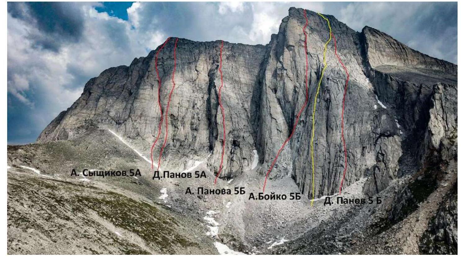
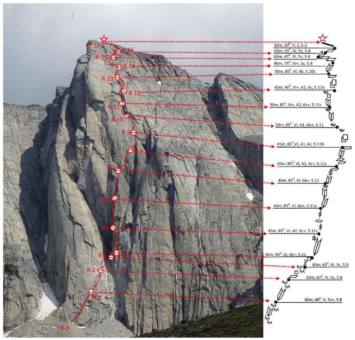
1.1. General Photo of the Western wall of peak Kart with the route line and other climbed routes
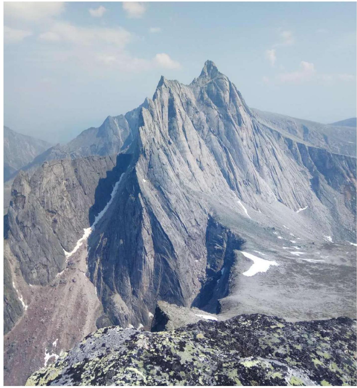
1.2. Photo of the profile of the Western wall of peak Kart
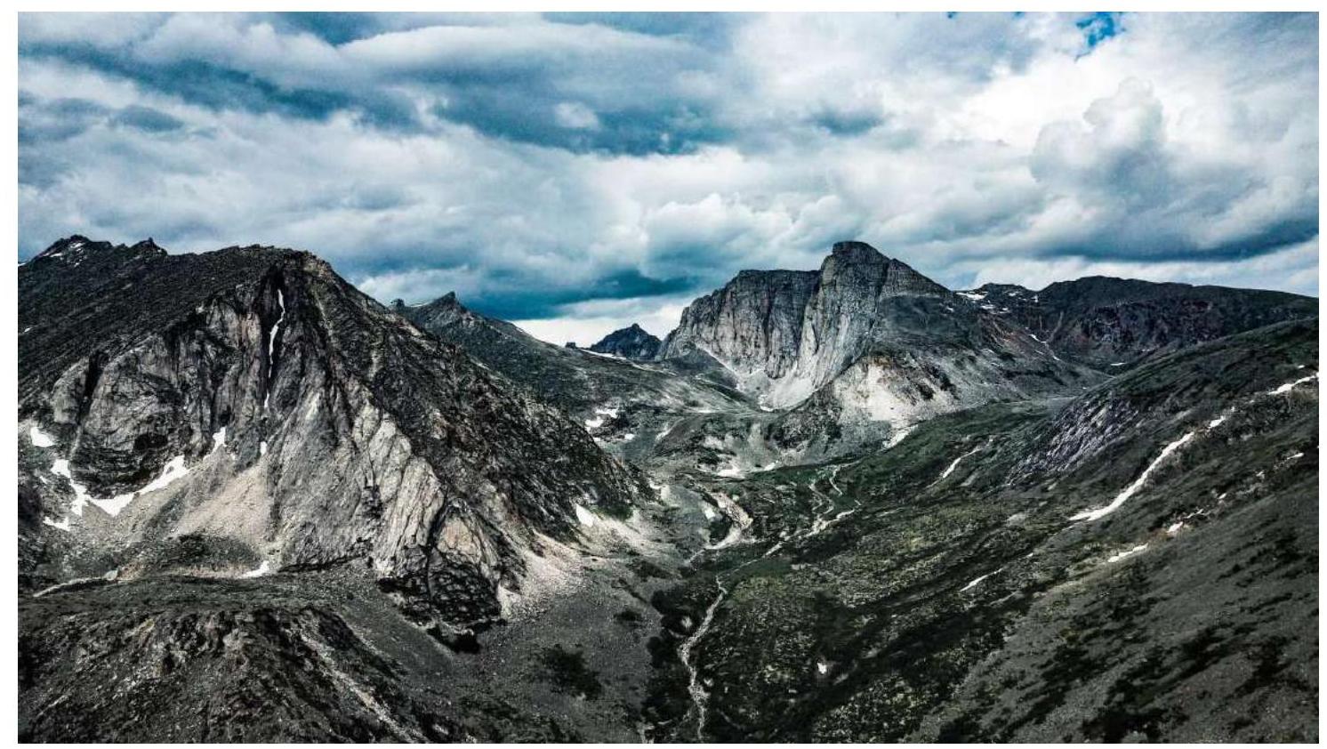
1.3. Photopanorama of the upper reaches of River Stlanikovaya
1.4 Map of the Area

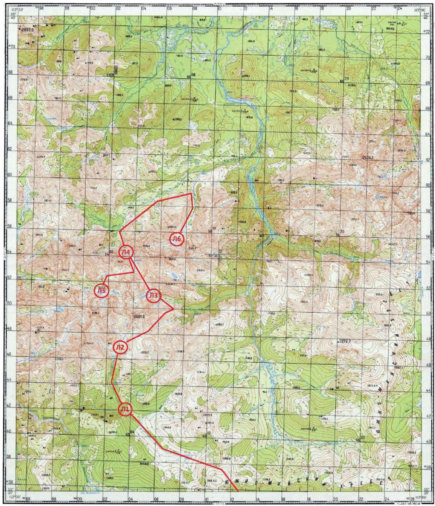 Map of the area, 2019 expedition route
Peak Kart is located in the southwestern part of the South Muya Range in the upper reaches of the River Stlanikovaya valley. Currently, 7 routes have been laid to the summit by the team of the "Impossible is not forever" project, ranging from 1B to 5B category of difficulty.
The nearest settlement is Baunt, located 400 km north of Chita, 120 km from Bagdarin. Baunt is a small village where one can find:
- overnight stay at the drop-off point;
- a store.
There is no cell phone coverage.
From Baunt, head north towards River Ayan and then along Maly Ayan for about 20 km. This section can be traversed by all-terrain vehicle; at the end of the all-terrain vehicle drop-off, the main base is organized with:
- food supplies and tents;
- equipment for charging devices during the expedition.
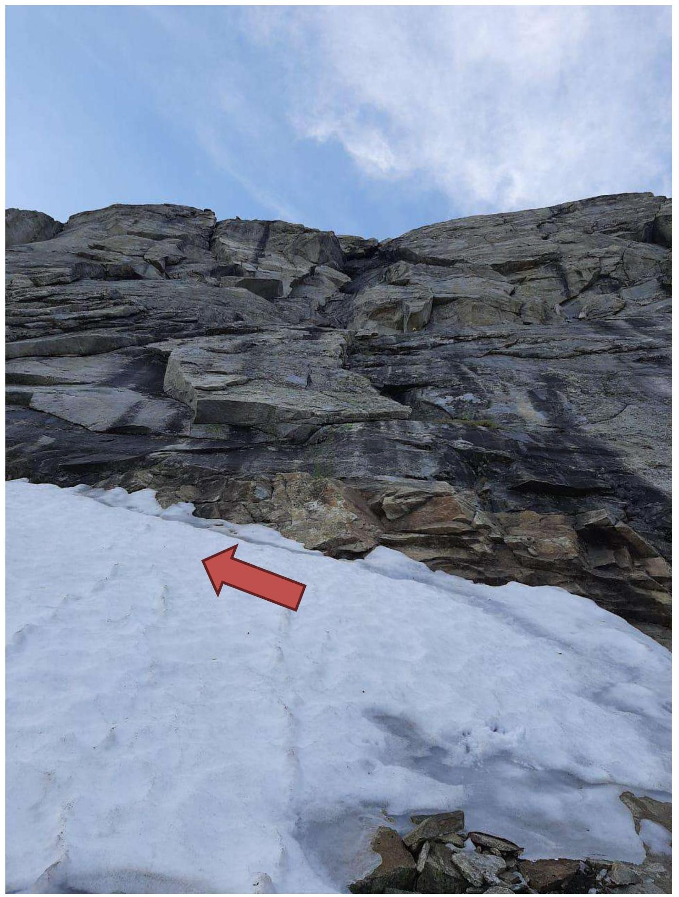
From the base, move towards the upper reaches of River Maly Ayan and then ascend to a non-category pass, 1900 m. From here, the views of the southwestern part of the South Muya Range open up. Descend from the pass to River Inamakkit and move along its right bank until it meets River Stlanikovaya. Then, ascend along Stlanikovaya to its upper reaches. It is convenient to set up camp in the forest zone, before reaching the second ice field (BC 1 on the map). The terrain on the approach is challenging:
- The ascent and descent from the pass involve talus.
- The upper reaches of Inamakkit are marshy.
- Animal trails are encountered along the banks.
- The ascent along Stlanikovaya is mostly along the riverbed, over stones, choosing a more convenient path along the banks.
- Two ice fields are encountered — ice masses formed as a result of layered freezing of river waters.
The chosen line along the Western wall is beautiful and logical. The route follows a system of cracks and internal corners, veering right in the upper part, and emerges onto a simple pre-summit ridge. The approach to the route from the base camp takes about 1 hour. Overnight stay is possible under the Western wall near the lake; in this case, the ascent to the wall will take 20 minutes.
According to the team's assessment, the route corresponds to the 5B category of difficulty.
2. Route Characteristics
2.1. Technical Photograph of the Route

2.2. Route Diagram in UIAA Symbols
3. Characteristics of Team Actions
3.1. The approach to peak Kart from the base camp takes 1–1.5 hours. Move along River Stlanikovaya, pass the ice field, and continue up the valley. Through the dwarf pine thickets, ascend the grassy slope and reach the lake under peak Kart. From the lake, veering slightly left, approach the oblique corner that leads into the large wet corner — this is the start of the route.
3.2. Section-by-Section Description
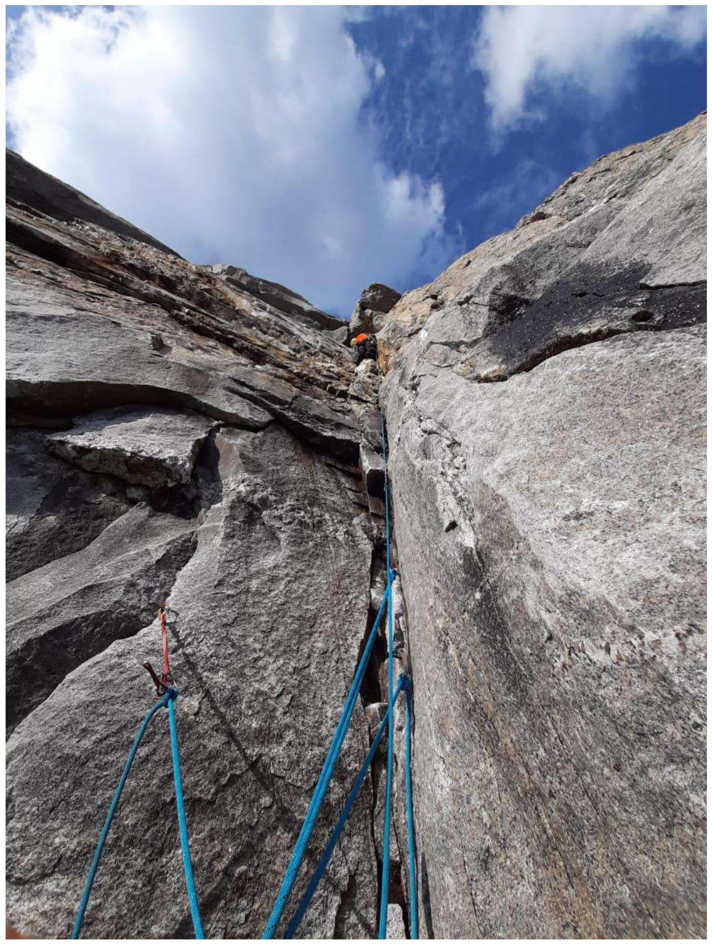
R0–R1 Movement along a series of smooth corners and small ledges, piton belay, station on a sloping ledge with rocks.
R1–R2 From the station, move along smooth corners, then transition to the foreheads, move towards the large "Cold Corner", station on a small ledge.
R2–R3 From the station, initially a small traverse right and down the slab, then up the wet corner and further along the cascade of rams' foreheads to reach the "Cold Corner", station on the right wall under a slightly overhanging slab-chimney.
R3–R4 From the station, straight up under the large slab, then traverse right along a series of walls with small holds on friction, reach a ledge under the base of the huge internal corner.
R4–R5 From the station, up the corner by climbing, then on aid climbing (ITO) through cracks, reach a small ledge, station.
R5–R6 Up free climbing along a monolithic crack, then through a series of corners with holds sometimes on friction and in opposition, inconvenient station on pitons.
R6–R7 Movement along corners with cracks and in opposition, approach a small overhanging cornice with a crack, pass it head-on, station on a large ledge.
R7–R8 Move right into the internal corner, through overhanging blocks, then along the crack on ITO, further traverse right and up along a series of walls and ledges, station on a ledge.
R8–R9 Move right along slabs and ledges, then up a one-way corner towards a large cornice, station on a ledge.
R9–R10 From the station, up on ITO along the cornice sometimes with sub-steps on slabs and corners, station on the cornice, in a crevice underfoot between the slabs.
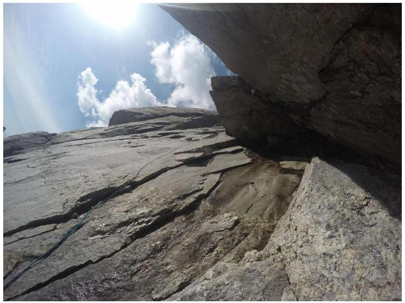
R10–R11 From the station, left, then up, bypassing the cornice on ITO, then along cracks in the internal corner towards a large, destroyed, hanging cascade of cornices. Station is hanging.
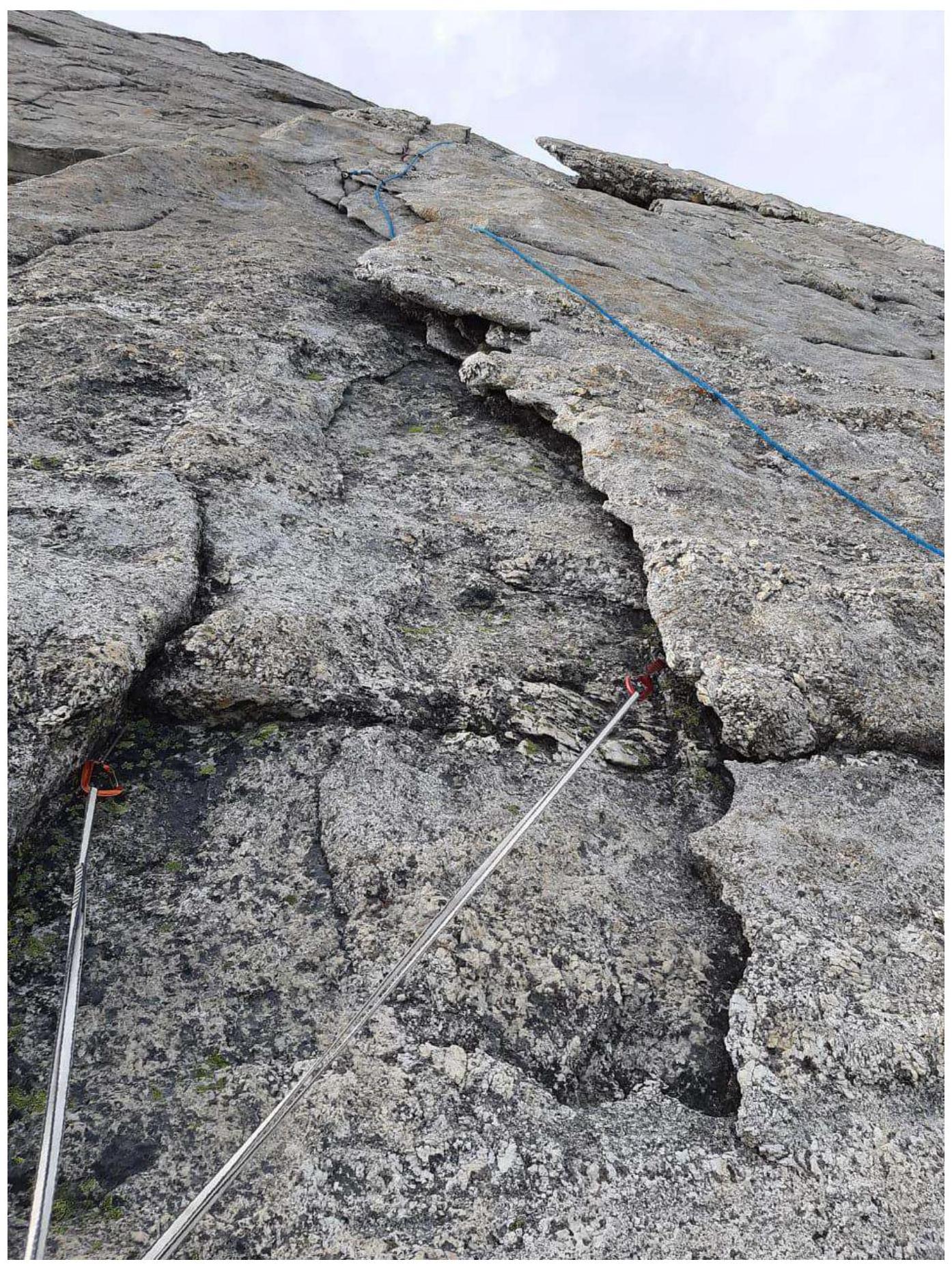
R11–R12 From the station, up several meters, not reaching the cascade, sharply veer right onto yellow weathered slabs with resonant slabs and rough holds.
R12–R13 From the station, move up on friction, proceed with caution, the belay is not reliable, bypass the large hanging slab on the left, emerge onto monolithic terrain, pass through the internal corner, reach a large ledge.
R13–R14 From the station, up, climb onto a large block on the right, then traverse 3 m left, reach the internal corner, walk up the corner to a huge pre-summit ledge, can be divided into two sections.
R14–R15 From the ledge, traverse left and up, bypassing rams' foreheads, then right towards a crevice, receive the partner on the station, simultaneous movement is possible.
R15–R16 From the station, right, then up into the crevice, receive the partner.
R16–R17 Up along the end of the crevice, pass over it, and emerge onto the summit.
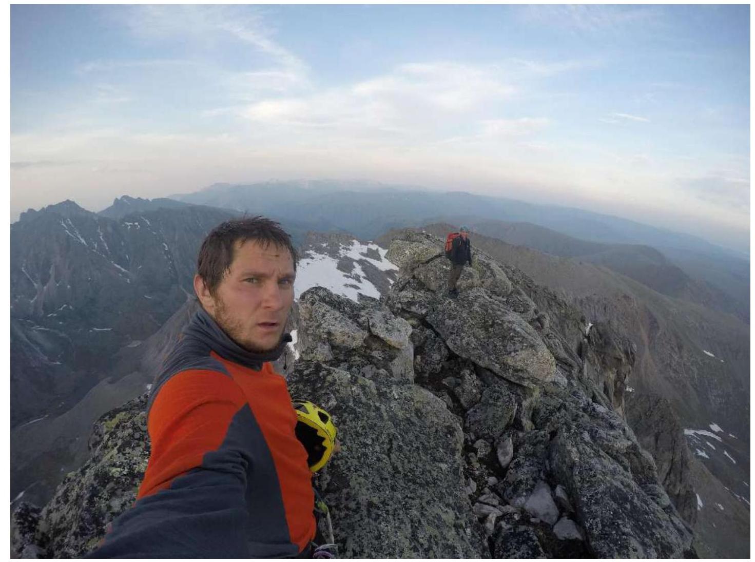
3.3. Photo of the Team on the Summit
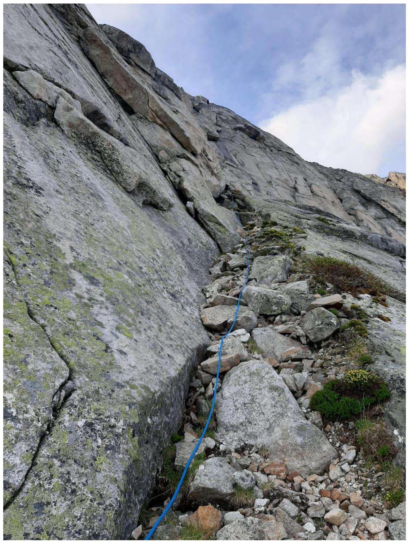
3.4. Descent along the ridge to the east and then down the talus slope to the south — to the shoulder of peak Kart. From there, descend along the overgrown slopes into the valley of River Stlanikovaya.
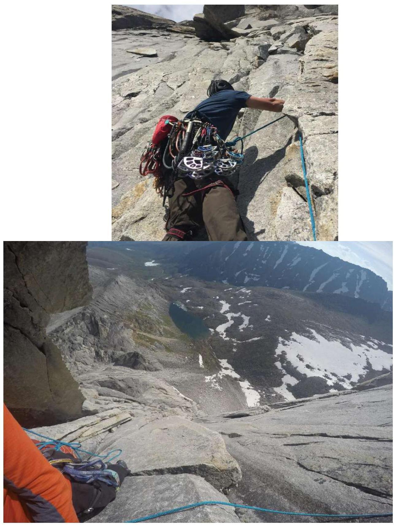
3.5. Photo Report by Sections
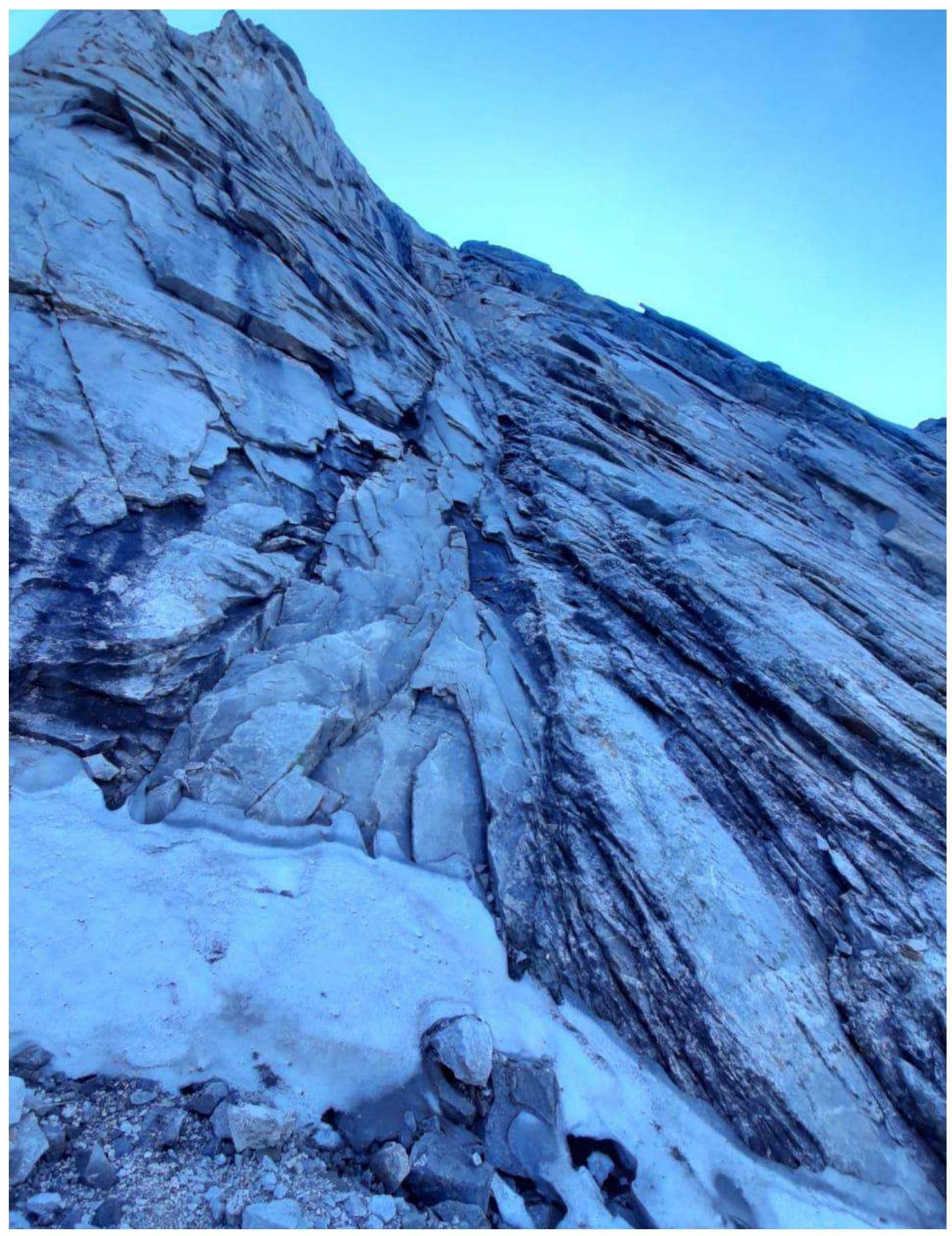
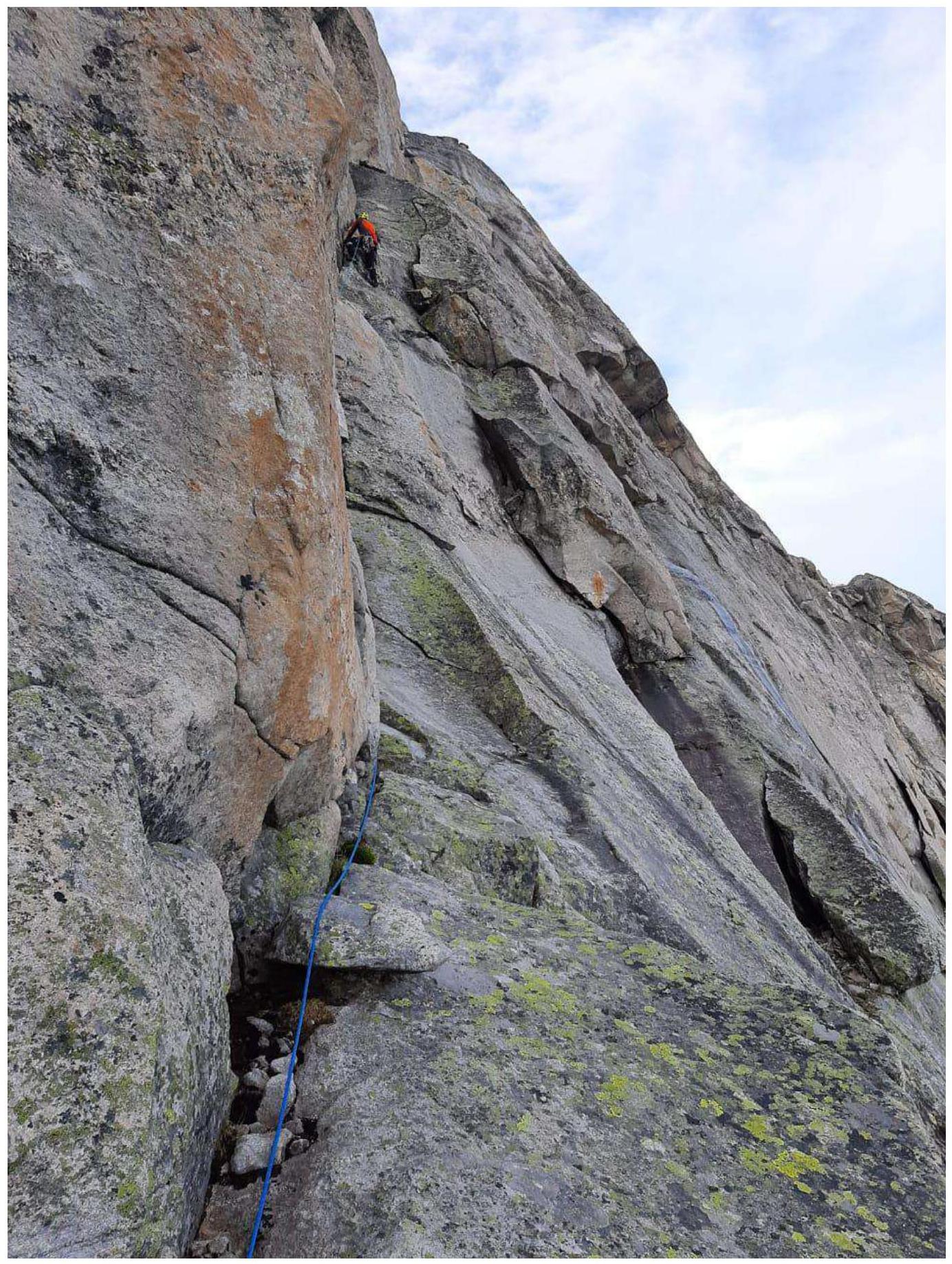
Section R0–R1 — start of the route
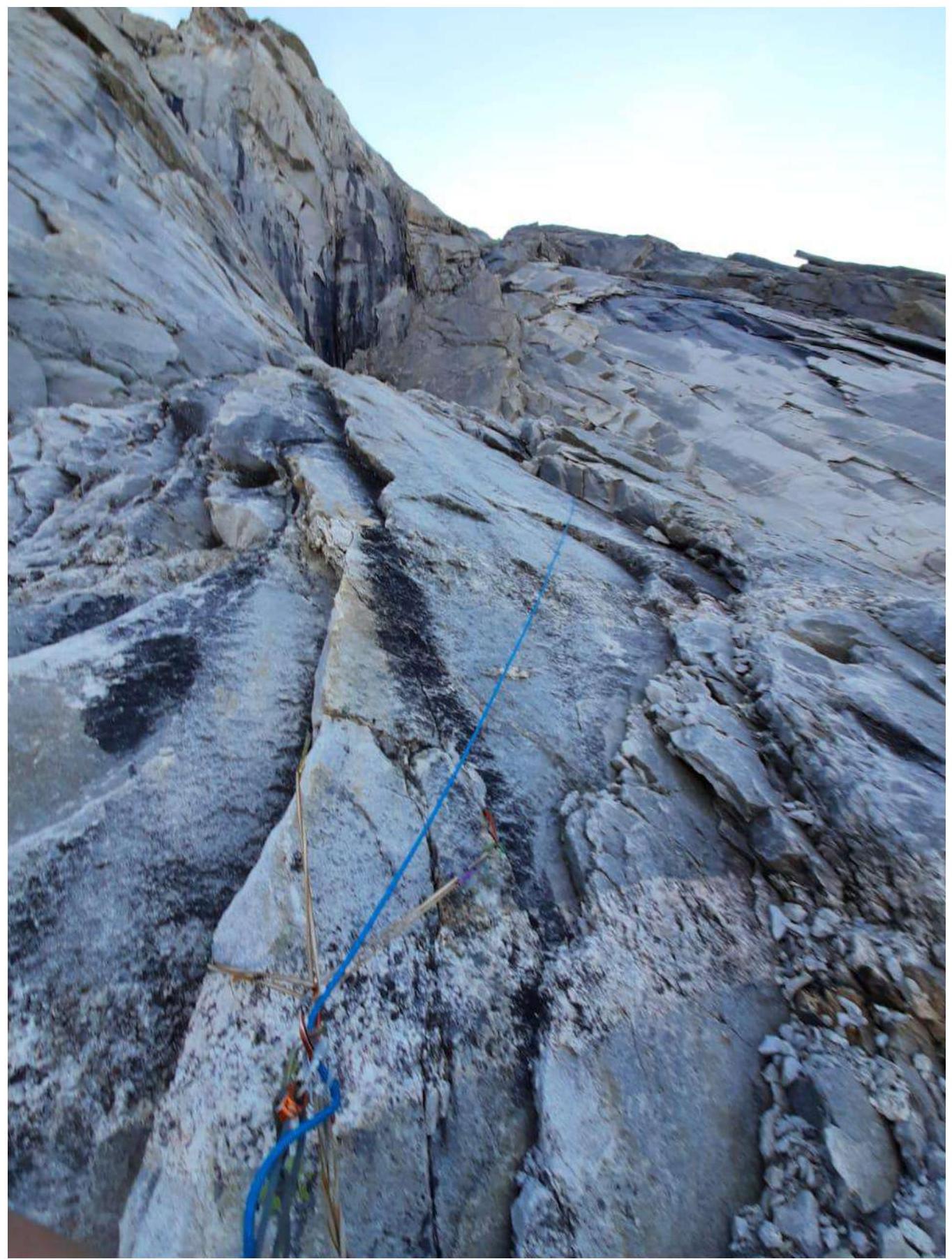
Section R1–R2
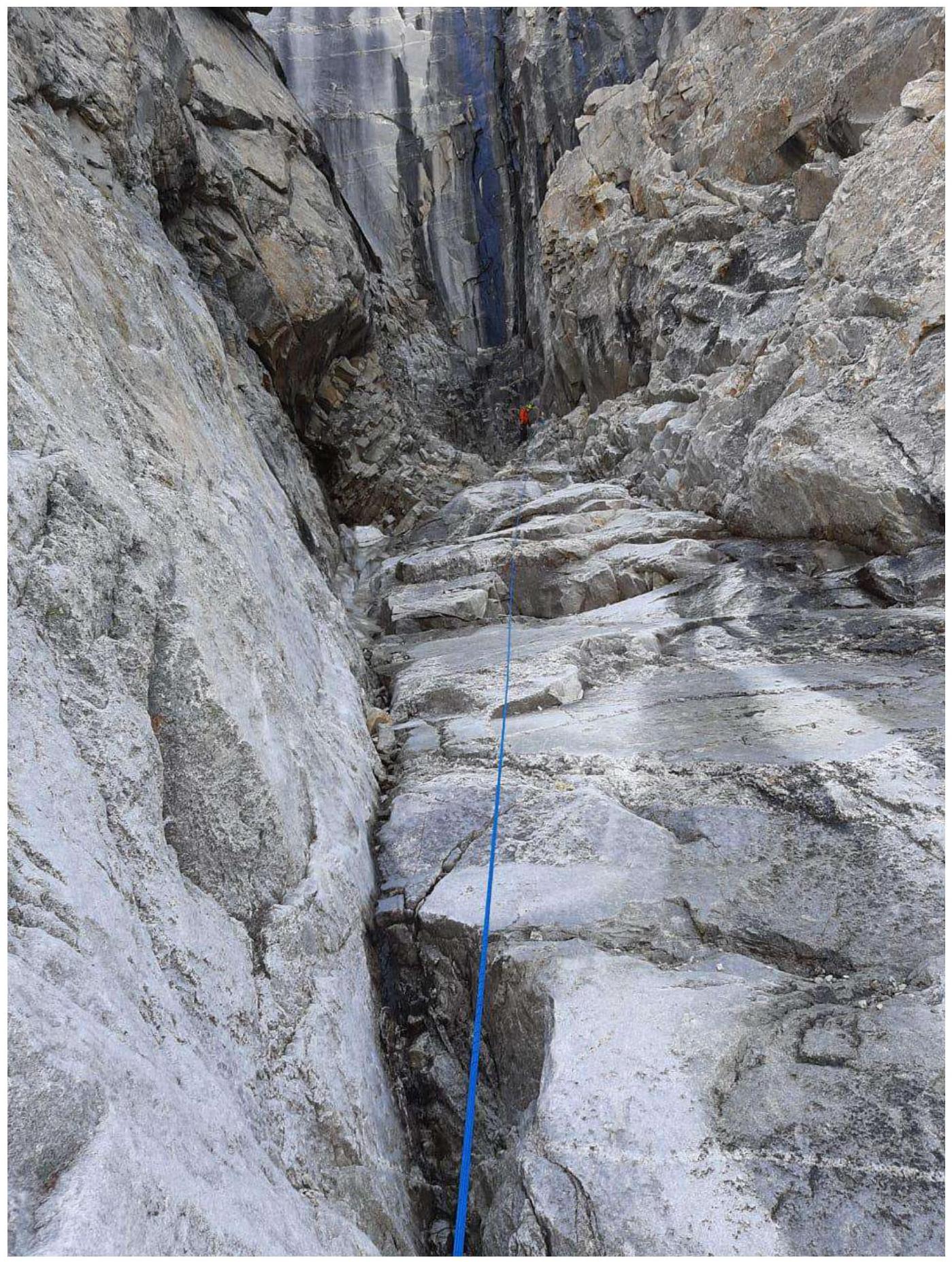
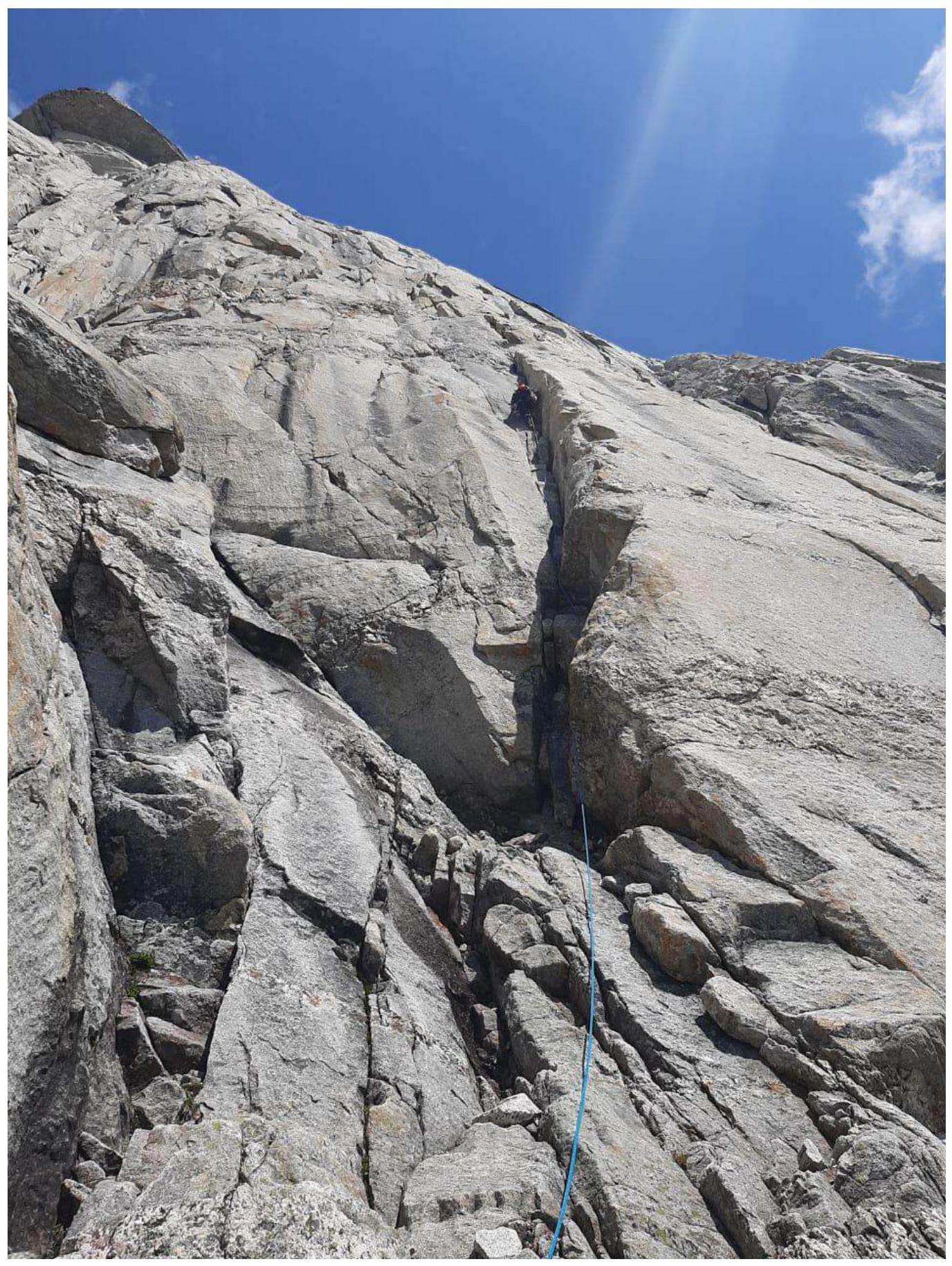
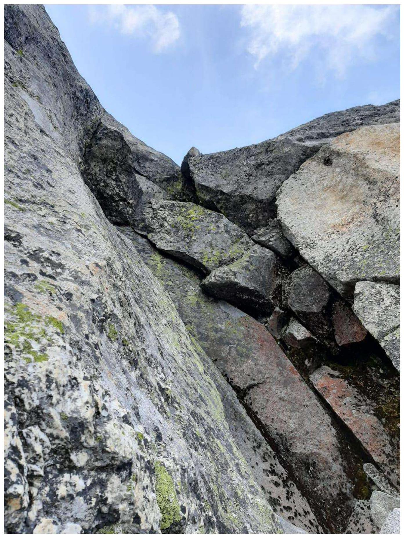
Section R2–R3 — "Cold Corner"
Section R3–R4
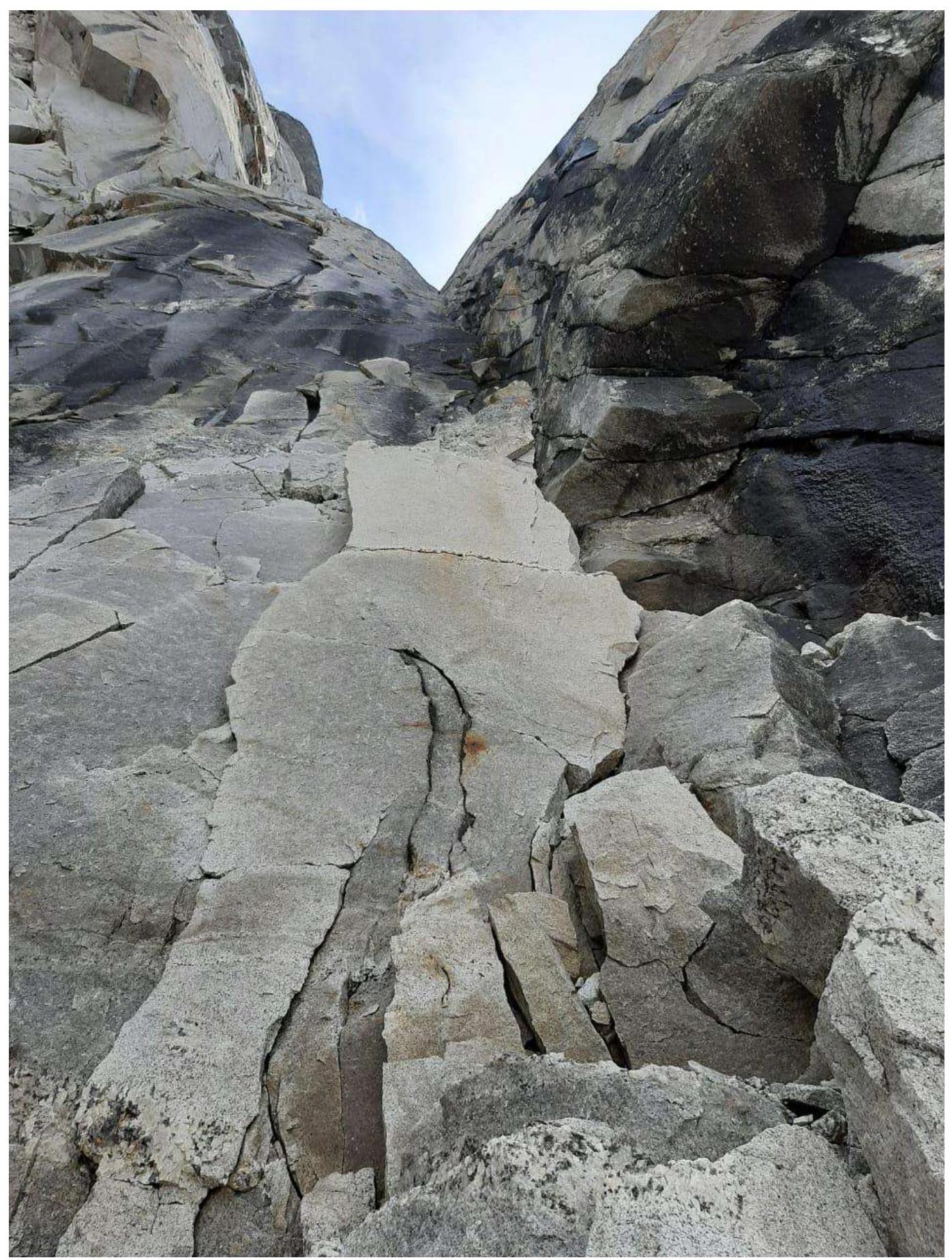
Section R4–R5 — start of the large corner
Section R5–R6

Section R6–R7
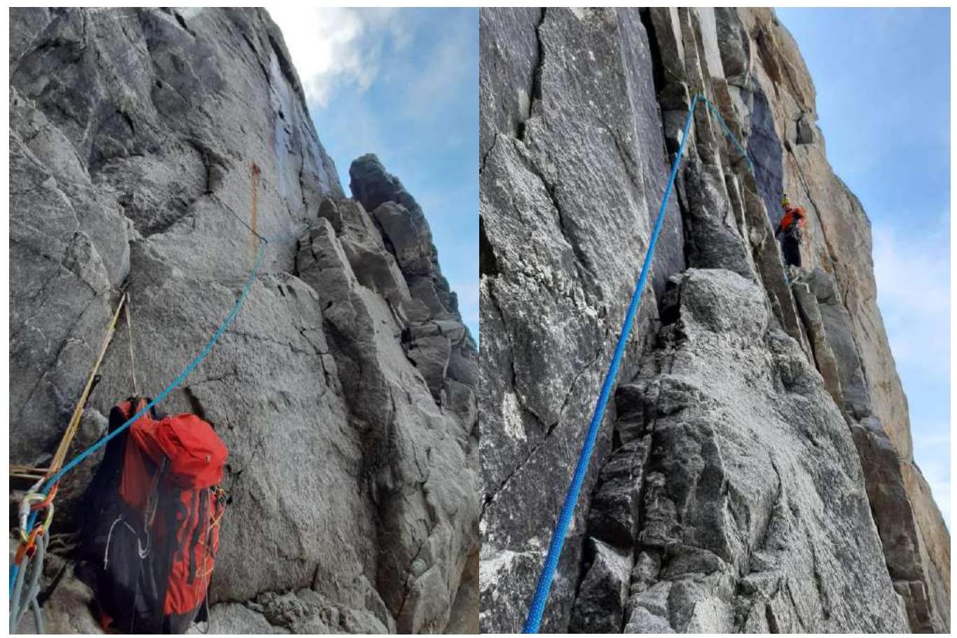
Section R7–R8 — movement from the large ledge
Section R8–R9
Section R9–R10
Section R10–R11 — start
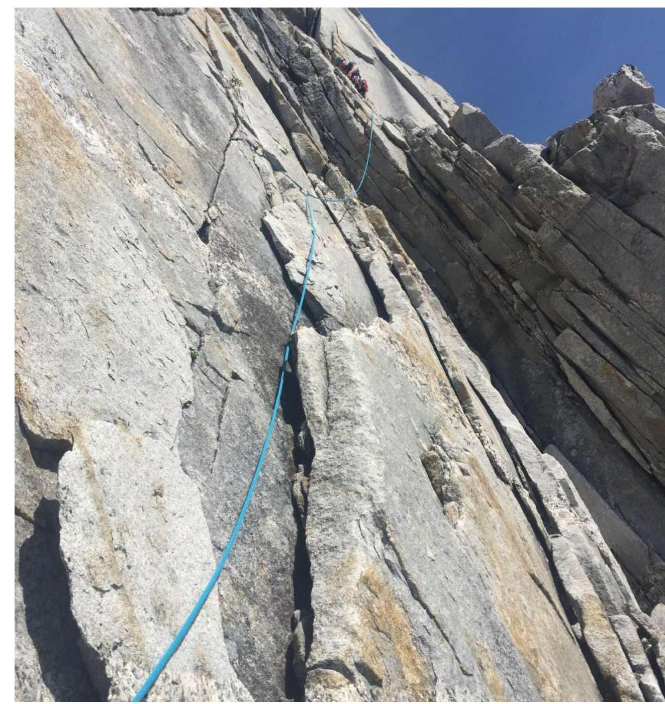
Section R11–R12 — with transition to the right
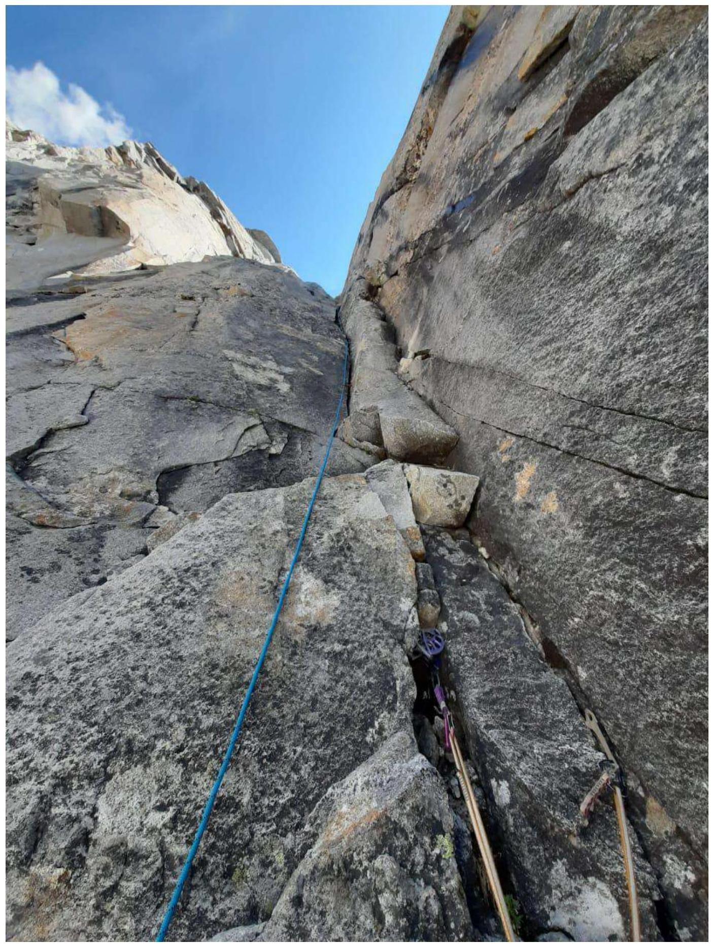
Section R12–R13 — yellow slabs
Section R13–R14
Section R14–R15 — traverse left and up
Section R15–R16
Section R16–R17 — before reaching the summit