Report
on the first ascent to the summit of Kart 2661 m via the Western wall route, approximately category 5B complexity,
from July 15, 2019, to July 15, 2019.
2019
I. Ascent Passport
| 1. General Information | ||
|---|---|---|
| 1.1 | Full name, sports rank of the leader | Glazunov Evgeny Vladimirovich, Master of Sports, St. Petersburg |
| 1.2 | Full name, sports rank of participants | Oleneva Nadezhda Aleksandrovna, Candidate Master of Sports, Perm; Tkachenko Pavel Valentinovich, 1st sports category, Chita |
| 1.3 | Full name of coach | Glazunov Evgeny Vladimirovich (Master of Sports) |
| 1.4 | Organization | Irkutsk Regional Public Organization Club for Active Recreation and Alpinism "Gory Baikala", project "Nevozmozhno - eto ne navsegda" |
| 2. Characteristics of the Ascent Object | ||
| 2.1 | Region | South Muya Range |
| 2.2 | Valley | River Stlanikovaya |
| 2.3 | Section number according to the 2013 classification table | 9.11 |
| 2.4 | Name and height of the summit | Kart, 2661 m (name appears in tourist reports and a note from the summit) |
| 2.5 | Geographical coordinates of the summit (latitude/longitude), GPS coordinates | 55°27′32.0″N 112°39′22.7″E |
| 3. Characteristics of the Route | ||
| 3.1 | Name of the route | Via the Western wall |
| 3.2 | Proposed complexity category | 5B |
| 3.3 | Degree of route development | First ascent |
| 3.4 | Nature of the route terrain | Rocky |
| 3.5 | Height difference of the route (according to altimeter or GPS data) | 605 m |
| 3.6 | Length of the route (in meters) | 970 m |
| 3.7 | Technical elements of the route (total length of sections of various complexity categories with indication of terrain type (ice/snow, rocky)) | Rocky I cat. – Rocky II cat. – Rocky III cat. – 100 m. Rocky IV–V cat. 250 m. Rocky V cat. – 230 m. Rocky VI cat. – 245 m. Rocky VI, A1 – m. Rocky VI, A2 – 15 m. |
| 3.8 | Descent from the summit | Along the ridge in the east direction and then down the talus slope to the south, to the shoulder of peak Kart. From it, descent along overgrown slopes into the valley of river Stlanikovaya. |
| 3.9 | Additional route characteristics | Lack of water |
| 4. Characteristics of the Team's Actions | ||
| 4.1 | Time of movement (team's trekking hours) | 8 hours |
| 4.2 | Overnights | No |
| 4.3 | Time at control points | Departure from the base camp under Admiral Makarov's peak — 5:00, Start on R0 — 6:30, Summit — 14:30, Return to BC — 20:00 |
| 5. Characteristics of Weather Conditions | ||
| 5 | Clear, no precipitation, temperature approximately +15 °C. | |
| 6. Person Responsible for the Report | ||
| 6.1 | Full name, e-mail | Glazunov Evgeny Vladimirovich, Evgenii-glazunov@mail.ru, +7 950 084 3341 |
II. Ascent Description
- Characteristics of the Ascent Object
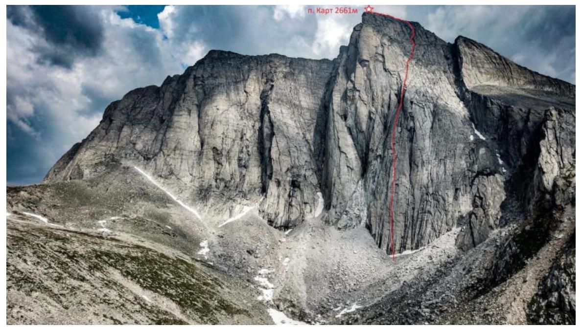
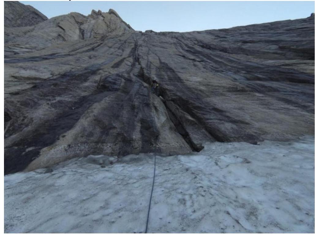
1.1. General photo of the Western wall of peak Kart with the route line
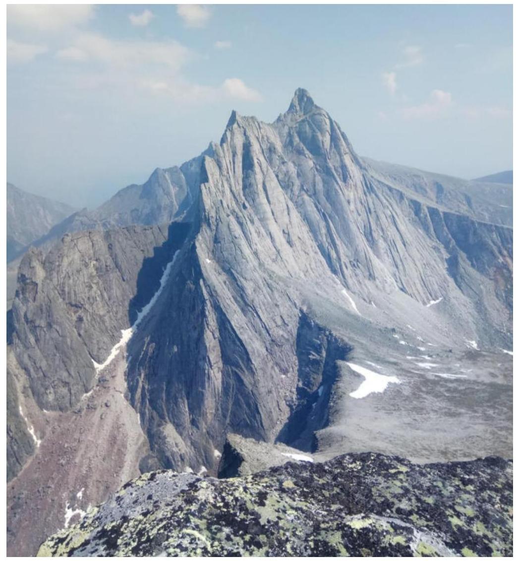
1.2. Photo of the profile of the Western wall of peak Kart
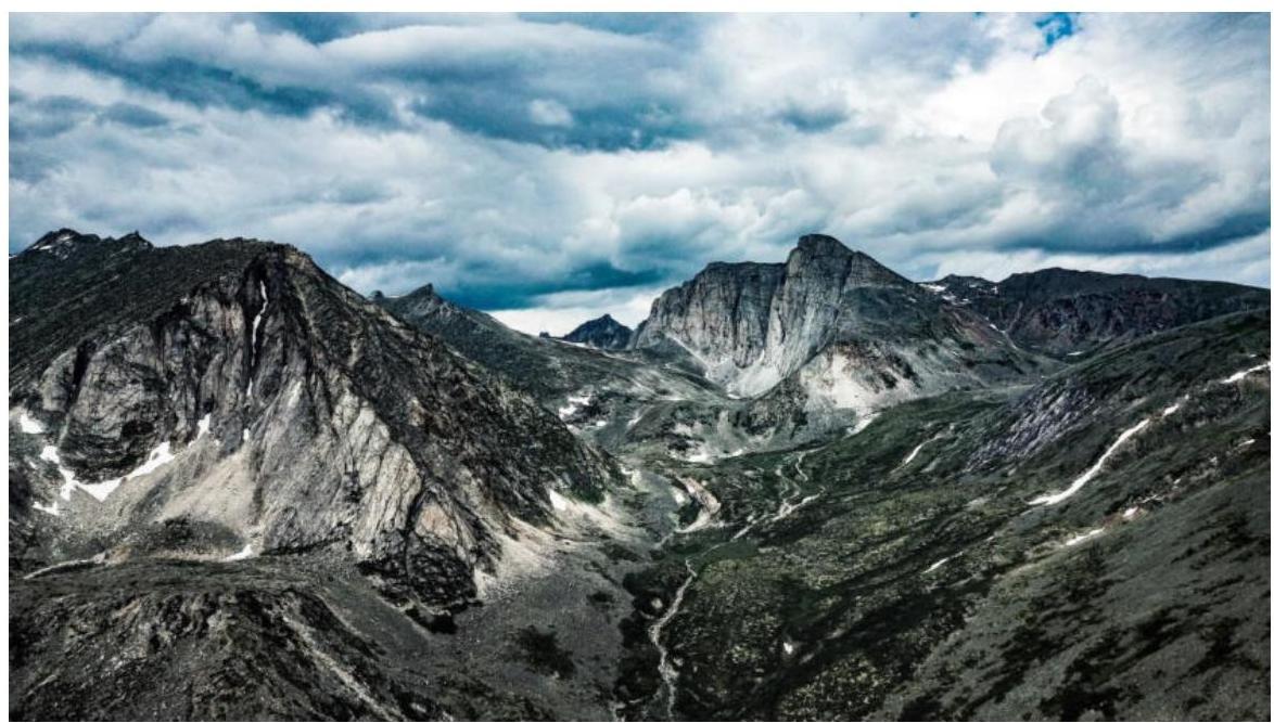
 1.3. Photopanorama of the upper reaches of river Stlanikovaya
1.4. Map of the region
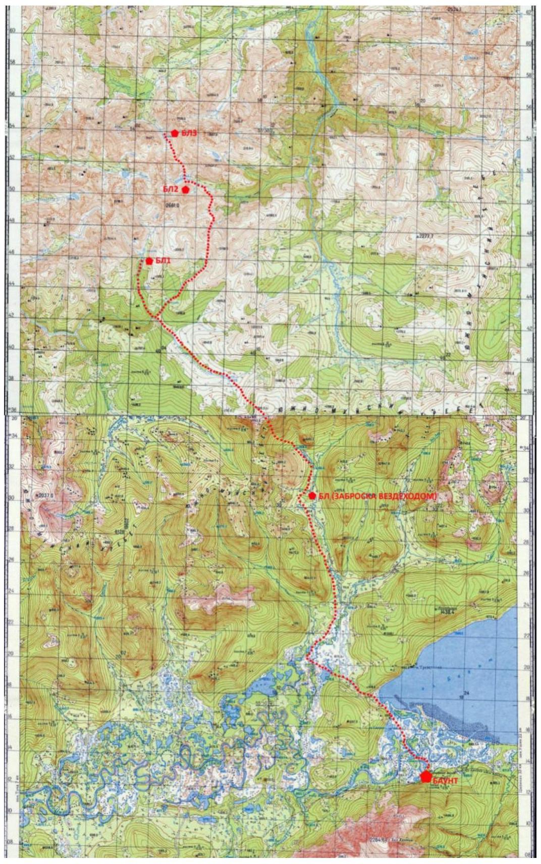
Path of the 2019 expedition.
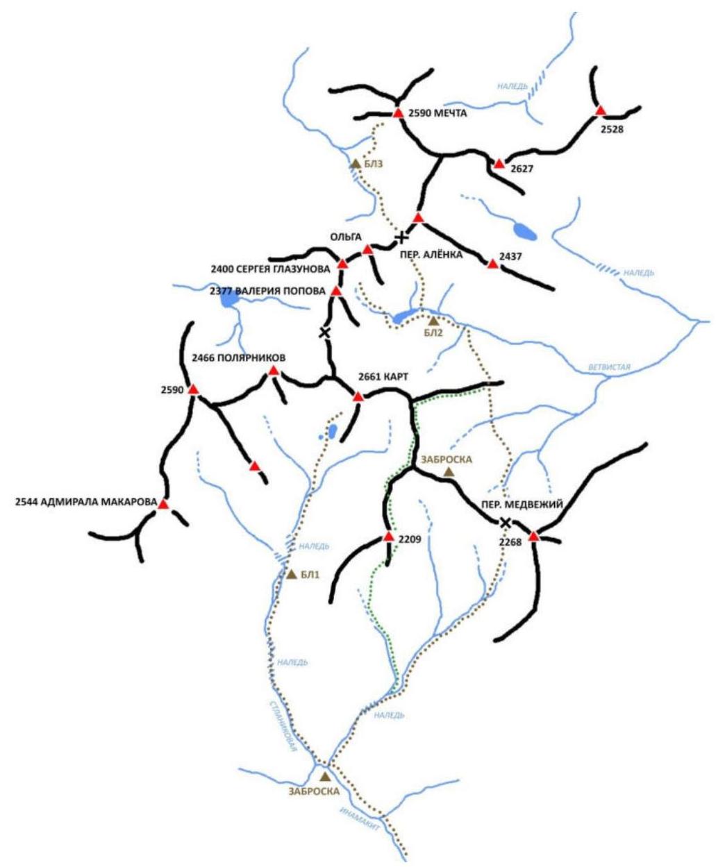
The summit of Kart is located in the southwestern part of the South Muya Range in the upper reaches of the Stlanikovaya river valley. There are no established routes on its walls, despite the diversity of terrain combined with steepness and length, as well as the monolithic nature of the rock, allowing for first ascents up to category 6B inclusive.
We are aware of several ascents to this summit by tourists from groups undertaking hikes here. The straightforward path to the summit via the Eastern slope makes it accessible even without equipment. From the summit, we retrieved a note dated August 15, 2007, which in turn mentioned a previous note dated 1989. This indicates that the summit has been visited extremely rarely, due to its remote location from populated areas and challenging approach with:
- no roads,
- no trails,
- no other paths.
The nearest populated area is Baunt, located 400 km north of Chita, 120 km from Bagdarin settlement. Baunt is a small village where:
- one can find lodging on a drop-off,
- there is a store.
There is no cell phone coverage.
From Baunt, head north towards the Ayan river and continue along the Maly Ayan river for about 20 km until reaching the boundary between the marshes and the forest. This section can be traversed by all-terrain vehicle, which we did.
At the end of the all-terrain vehicle drop-off, we established a large base camp with:
- food supplies,
- batteries for charging equipment,
- a spare tent.
From the base, move towards the upper reaches of the Maly Ayan river and then ascend to a non-categorized pass, 1900 m. From here, views open up towards the southwestern part of the South Muya Range.
Descend from the pass to the Inamakikit river and move along its right bank until the confluence with the Stlanikovaya river. Then, ascend along the Stlanikovaya river to its upper reaches. It is convenient to set up camp in the forest zone, before reaching the second aufeis (marked as BC 1 on the map).
The terrain on the approach is challenging:
- The ascent and descent from the pass involve talus.
- The upper reaches of Inamakikit are marshy.
- Animal trails are encountered along the banks.
- The ascent along Stlanikovaya is mainly along the riverbed, over rocks, choosing a more convenient path along the banks.
- Two aufeis formations are encountered — ice masses formed by the layered freezing of river waters.
The chosen route along the Western wall is beautiful and logical. The route follows a system of cracks and internal corners, veering right in the upper part, and leads to a straightforward pre-summit ridge.
Approach to the route:
- Takes about an hour from the base camp.
- Overnight stay is possible under the Western wall near the lake.
- In this case, the ascent to the wall will take 20 minutes.
The team assessed the route as corresponding to category 5B. The route was climbed 95% by free climbing, excluding 15 m of artificial technical climbing (ITC) in a wet crack on sections R1–R2, R2–R3.
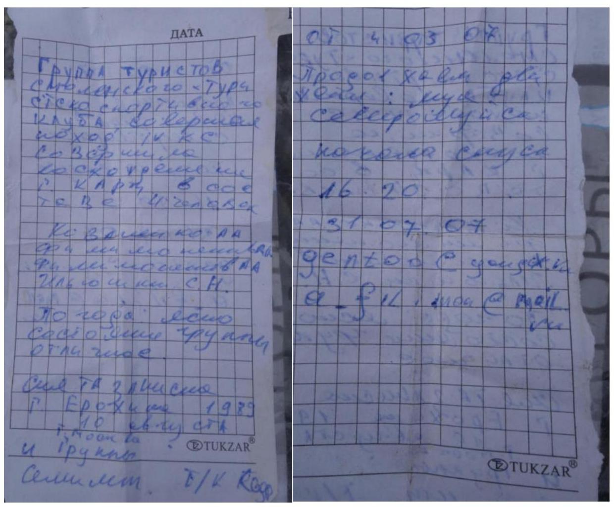
Note from the summit.
- Characteristics of the Route
2.1. Technical photograph of the route
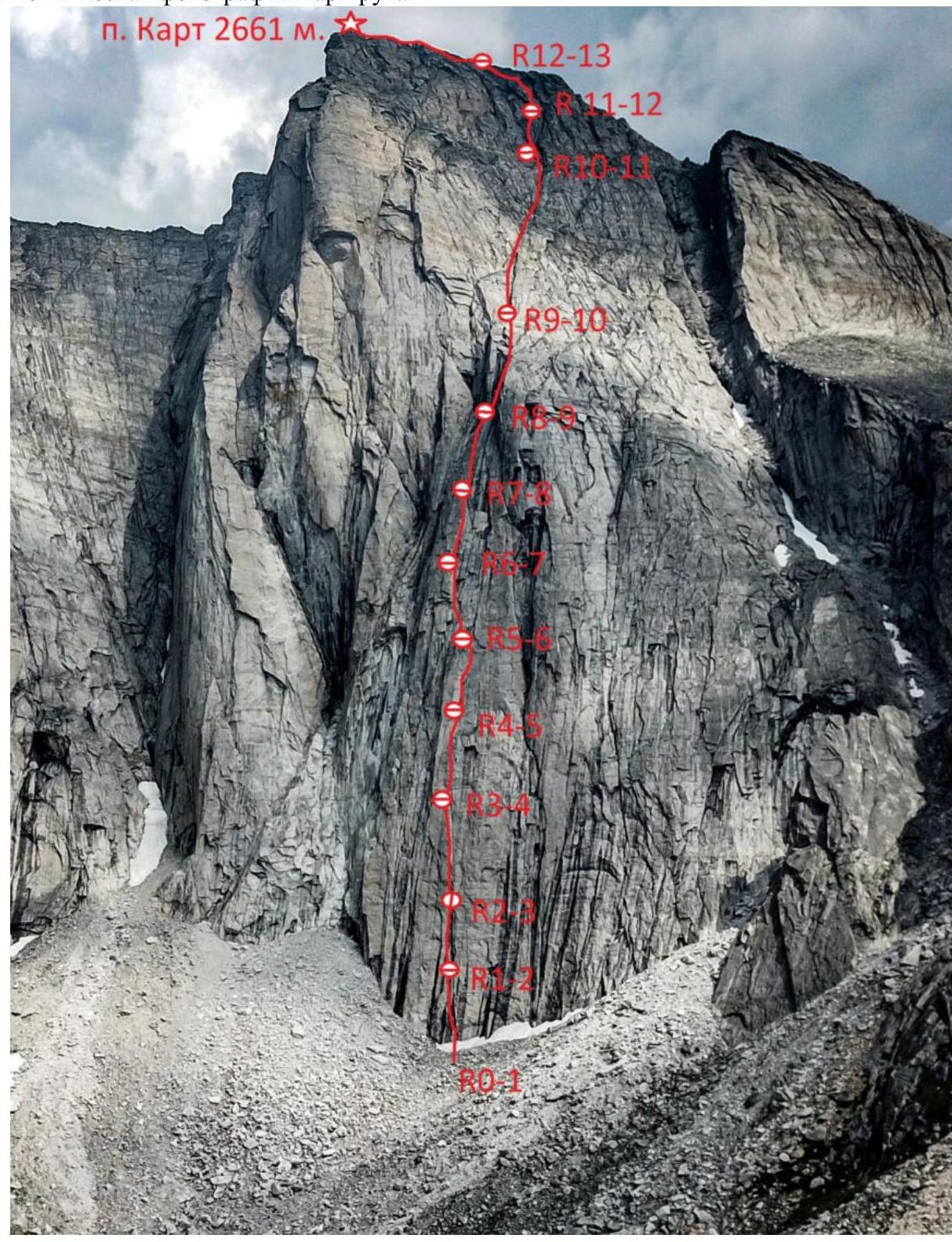 2.2. Section numbers on the technical photograph correspond to section numbers on the UIAA symbol route diagram.
2.3. Route diagram in UIAA symbols.
2.2. Section numbers on the technical photograph correspond to section numbers on the UIAA symbol route diagram.
2.3. Route diagram in UIAA symbols.
| Section | Length (m) | Steepness (gr) | Difficulty |
|---|---|---|---|
| R12–R13 | 100 | 45 | III |
| R11–R12 | 50 | 80 | V |
| R10–R11 | 45 | 70 | IV–V |
| R9–R10 | 250 | 60 | II–III |
| R8–R9 | 60 | 80 | V |
| R7–R8 | 55 | 80 | V |
| R6–R7 | 55 | 80 | V |
| R5–R6 | 55 | 80 | VI |
| R4–R5 | 50 | 90 | VI |
| R3–R4 | 50 | 90 | VI |
| R2–R3 | 50 | 85 | V–VI A2 |
| R1–R2 | 50 | 85 | V–VI A2 |
| R0–R1 | 50 | 85 | V–VI |
- Characteristics of the Team's Actions
3.1. Approach to peak Kart from the base camp takes 1 hour. Follow along the Stlanikovaya river, pass the aufeis, and continue upwards along the valley. Through thickets of dwarf pine, ascend a grassy slope and reach a lake under peak Kart. From the lake, ascend via talus towards the start of the route.
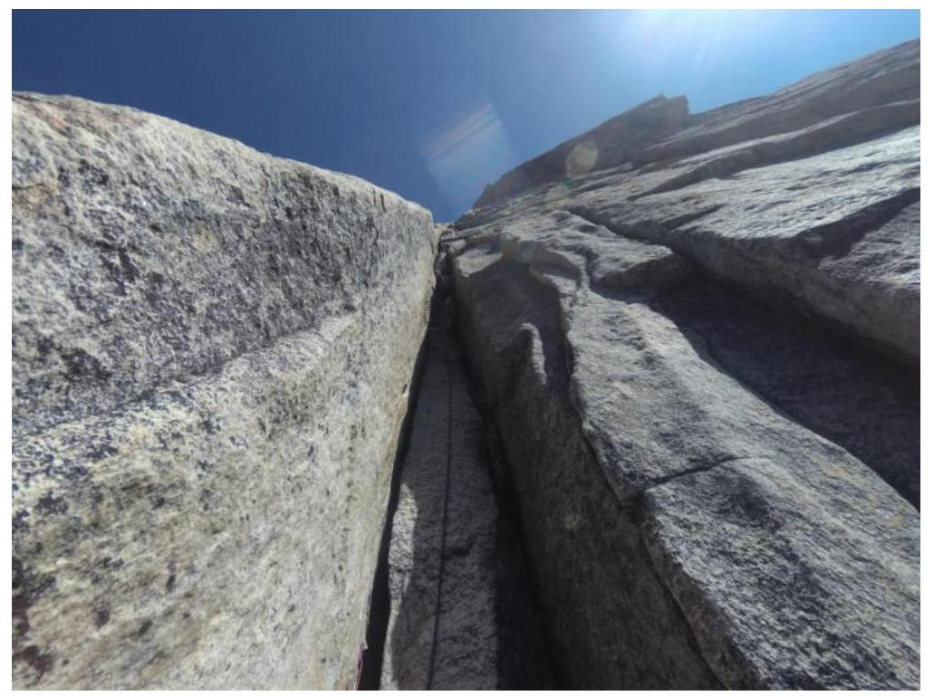
R0–R1: From the snowpatch, ascend directly via a system of pronounced corners and cracks. Station on a convenient ledge with anchors. 50 m, 85°, V–VI.
R1–R2: Straight up via an internal corner and then along a crack, station on a small ledge. 50 m, 85°, V–VI A2.
R2–R3: Up the crack, pass the overhang on the right, and then through a wall and crack to reach a good ledge. 50 m, 85°, V–VI A2.
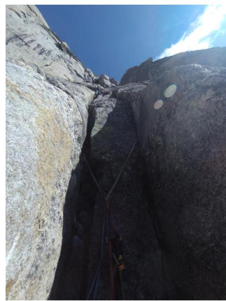
R3–R4: Via a system of cracks to a ledge. 50 m, 90°, VI.
R4–R5: Through a good crack, bypassing the overhang on the right, into an internal corner to a ledge. The crux of the route. 50 m, 90°, VI.
R5–R6: Via cracks through a slab, then move slightly left into a chimney. Station in the chimney. 55 m, 80°, VI.
R6–R7: Further up the chimney, station before exiting it. 55 m, 80°, V.
R7–R8: Exit the chimney and through a wall with cracks and poor terrain — into a large internal corner (cold). 50 m, 80°, V.
R8–R9: Continue movement along the corner to its end, then exit right via a crack onto a ledge. 60 m, 90°, V.
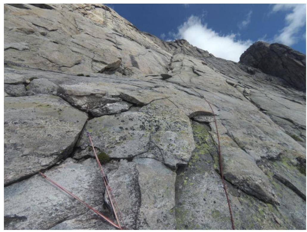
R9–R10: 250 m along a simple inclined internal corner with good terrain. Simultaneous movement is possible. 250 m, 70°, II–III.
R10–R11: Through a series of ledges and walls, exit onto an inclined ledge right of the start of the chimney. 45 m, 75°, V.
R11–R12: Left into a chimney with a plug. After its end, exit left onto an inclined slab and, bypassing the overhang on the left, reach the gentle slabs of the ridge. The rope is just enough. 60 m, 80°, V–VI.
R12–R13: Along the simple ridge, reach the summit. 100 m, 45°, III.
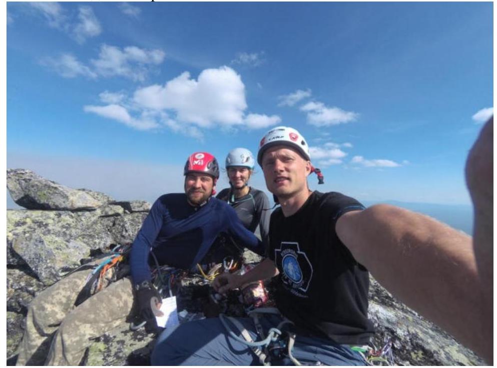
3.2. Photo of the team on the summit
3.3. Descent:
- Along the ridge in the east direction
- Then down the talus slope to the south — onto the shoulder of peak Kart
- From it, descend along overgrown slopes into the valley of river Stlanikovaya
3.4. Photo report by sections
Start of the route R0

Start of section R1–R2
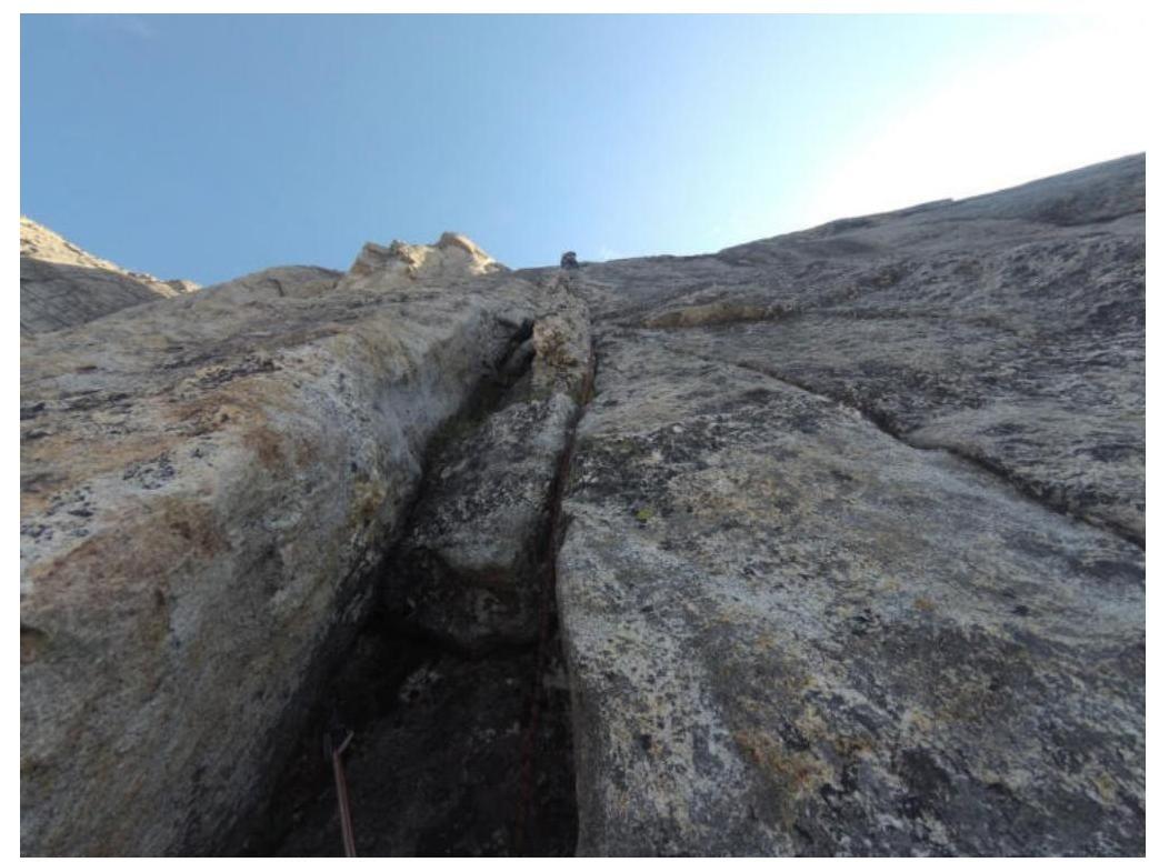
Start of section R2–R3
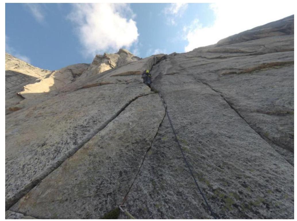
Start of section R4–R5
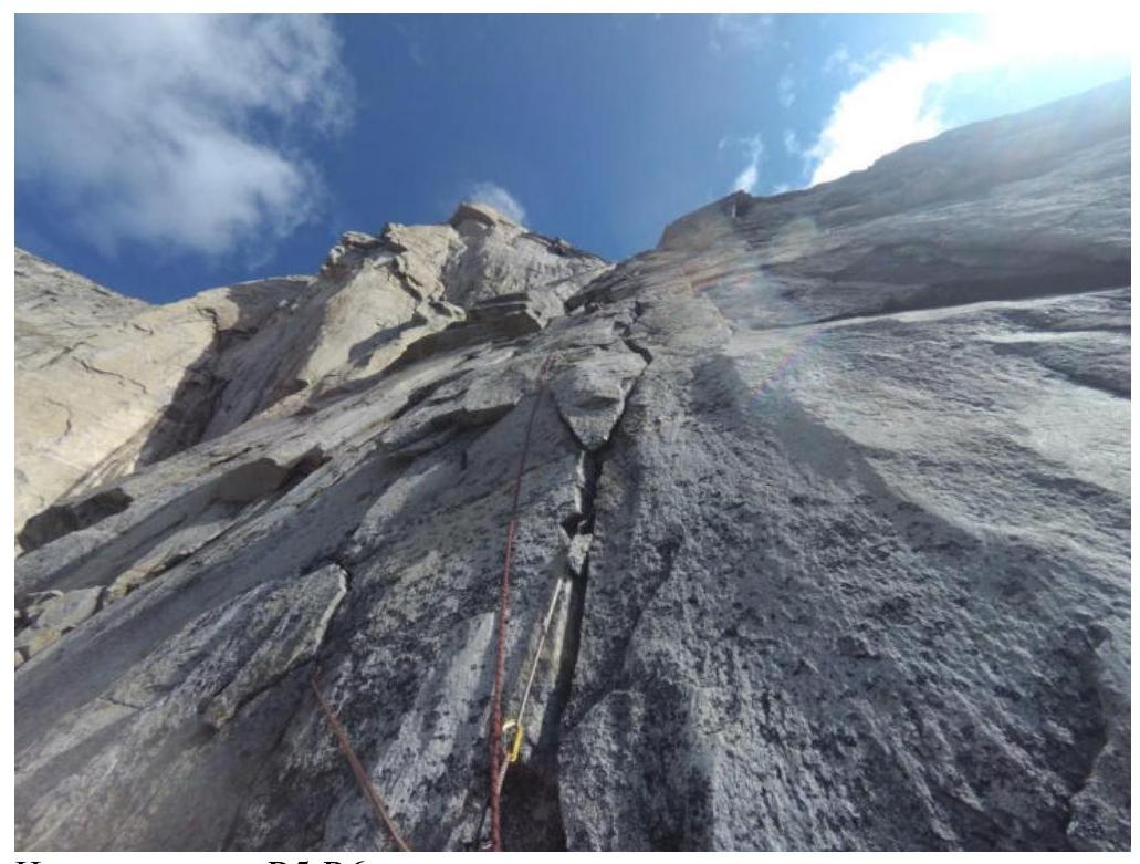
Start of section R5–R6
Chimney at station R6
Start of section R7–R8

Start of section R8–R9
Section R9–R10
}
Chimney on section R11–R12