
Ascent Passport
- Ascent category. Rock climbing.
- Ascent area. Mountain system of Tuva. Tsagan-Shibetu ridge.
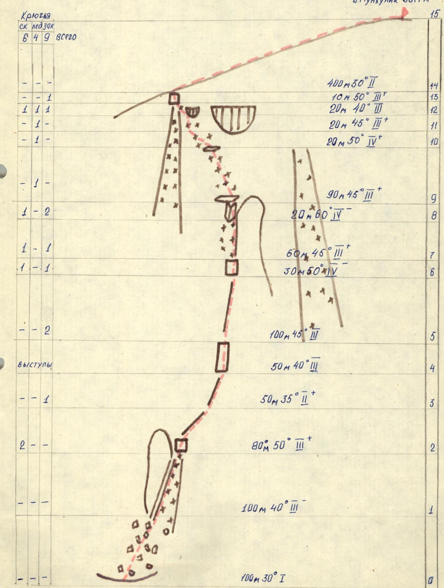
- Peak Munkhulik, 3577 m above sea level, via N ridge, combined route.
- Proposed category of difficulty — 3B.
- Route characteristics:
height difference — 700 m; length of sections: 3rd category of difficulty — 530 m, 4th category of difficulty — 70 m; average steepness — 45° 6. Pitons hammered: rock — 6, ice — 4, chocks — 9. 7. Climbing hours — 8 hours. 8. No overnight stays. 9. Leader: Zakharov Nikolay Nikolayevich, Master of Sports
Participants:
- Egunov Vladimir Aleksandrovich, Master of Sports
- Afanasyev Andrey, Master of Sports
- Miller Irina Petrovna, Candidate for Master of Sports
- Yarovikov Sergey Georgievich, 1st sports category
-
Team coach: Zakharov Nikolay Nikolayevich.
-
Date of starting the route — May 6, 1986. Return — May 6, 1986.
-
Team of the Krasnoyarsk Regional Sports Committee.
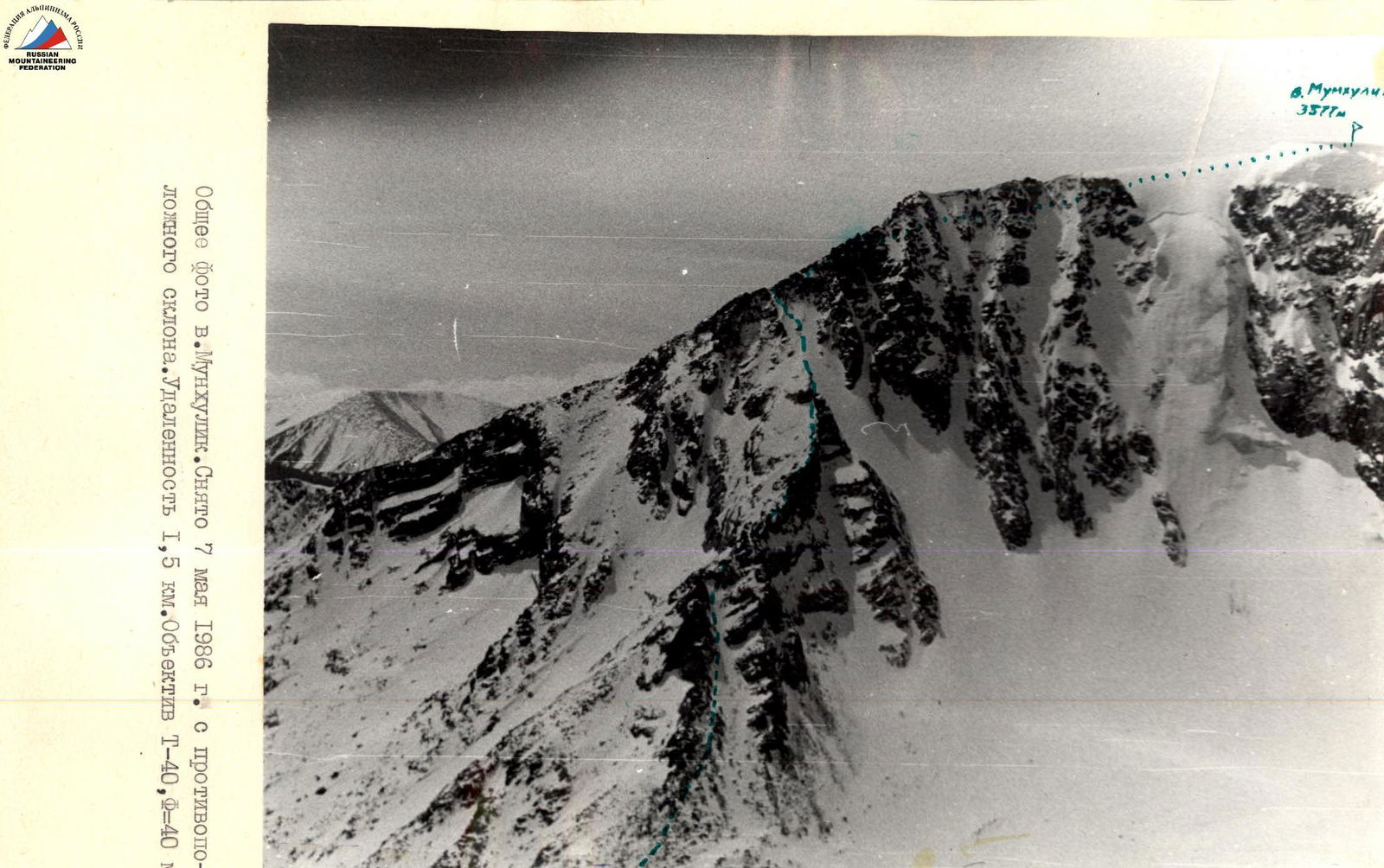
General photo of p. Munkhulik. Taken on May 7, 1986 from the opposite slope. Distance 1.5 km. Lens T-40, F=40 mm.
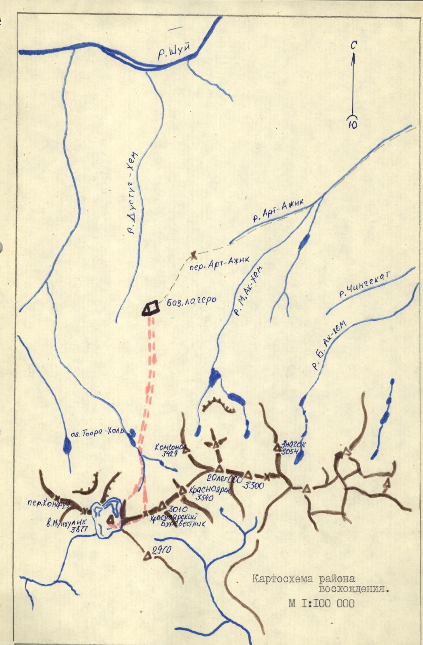
Brief description of the approach to the route
From the base camp, ascend along the trail in a southerly direction until reaching the high-altitude stony plateau (1 hour). Then cross the plateau in the direction of p. Munkhulik to the south-southwest and descend into the Ozernoe gorge (1 hour 30 minutes). Further, the path lies along the gorge along the lakes to the south, then the gorge turns right under the northern wall of p. Munkhulik. Along it, approach the base of the northern ridge (1 hour 30 minutes). The route begins with a clearly defined saddle under the northern ridge.
Comments
Sign in to leave a comment