Report
On the first ascent to the summit 1960 m via the route: 4th buttress of the Western wall of the Northern ridge, 2B cat. dif., by the team of FАiS of the Republic of Sakha (Yakutia) for the period from 8:00 to 17:00 on July 8, 2021.
2. I. Ascent Passport
| №№ p.p. | 1. General Information | |
|---|---|---|
| I.1 | Full name, sports rank of the leader | Ivanov Vasily Ivanovich, CMS |
| I.2 | Full name, sports rank of the participants | Bogomolov Valery Alexandrovich, 1st sp. razryad |
| I.3 | Full name of the coach | Ivanov Vasily Ivanovich № 72 |
| I.4 | Organization | FАiS of the Republic of Sakha (Yakutia) |
| 2. Characteristics of the ascent object | ||
| 21 | Region | Tас Kystabyt (Sarycheva) ridge, South-3 part of Chersky ridge. |
| 22 | Valley | Valley v. Afrodita. |
| 23 | Number of the section according to the 2013 classification table | Section 9.7 |
| 24 | Name and height of the summit | v. 1960 m. |
| 25 | Geographical coordinates of the summit | 64°28′673″ N 143°17′148″ E |
| 3. Characteristics of the route | ||
| 31 | Name of the route | Via the 4th buttress of the Western wall of the Northern ridge |
| 32 | Proposed category of difficulty | 2B |
| 33 | Degree of route development | First ascent |
| 34 | Nature of the terrain | Rocky |
| 35 | Height difference of the route | 280 m |
| 36 | Length of the route | 420 m |
| 37 | Technical elements of the route | I cat. dif. rocks — 40 m. II cat. dif. rocks — 120 m. III cat. dif. rocks — 260 m. |
| 38 | Descent from the summit | Via scree to the pass |
| 4. Characteristics of the team's actions | ||
| 41 | Time of movement | 3 hours |
| 42 | Overnights | - |
| 43 | Start of the route | 8:00 July 8, 2021 |
| 44 | Reaching the summit | 12:00 July 8, 2021 |
| 45 | Return to the camp | 13:30 July 8, 2021 |
| 5. Responsible for the report | ||
| 51 | Full name, e-mail | Ivanov Vasily Ivanovich ivi4057@mail.ru |
3. II. Description of the Ascent
1. Characteristics of the Ascent Object
 1.1 General photo of the summit 1960 m. Date taken June 25, 2019.
Due to fires and haze in 2021, acceptable photos of the route profile were not obtained.
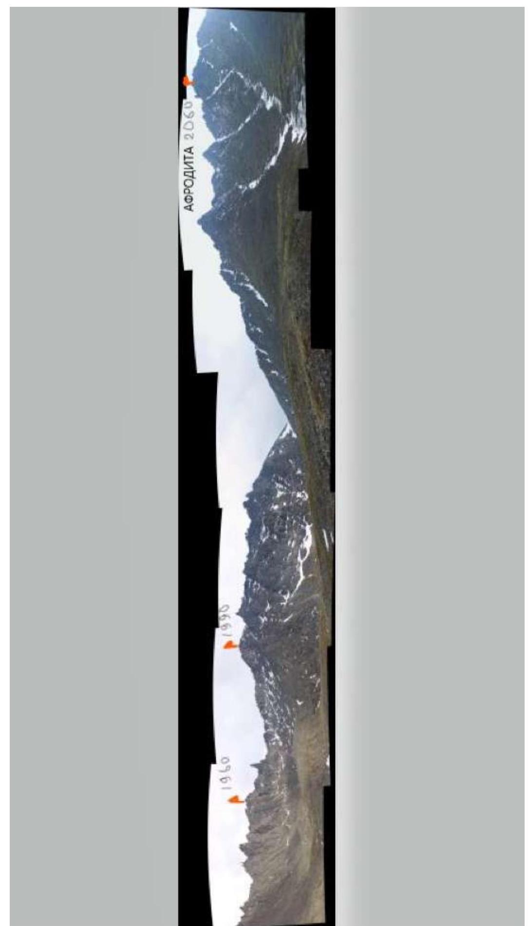 1.3 Photopanorama of the area. Taken on June 21, 2009 from the base camp.
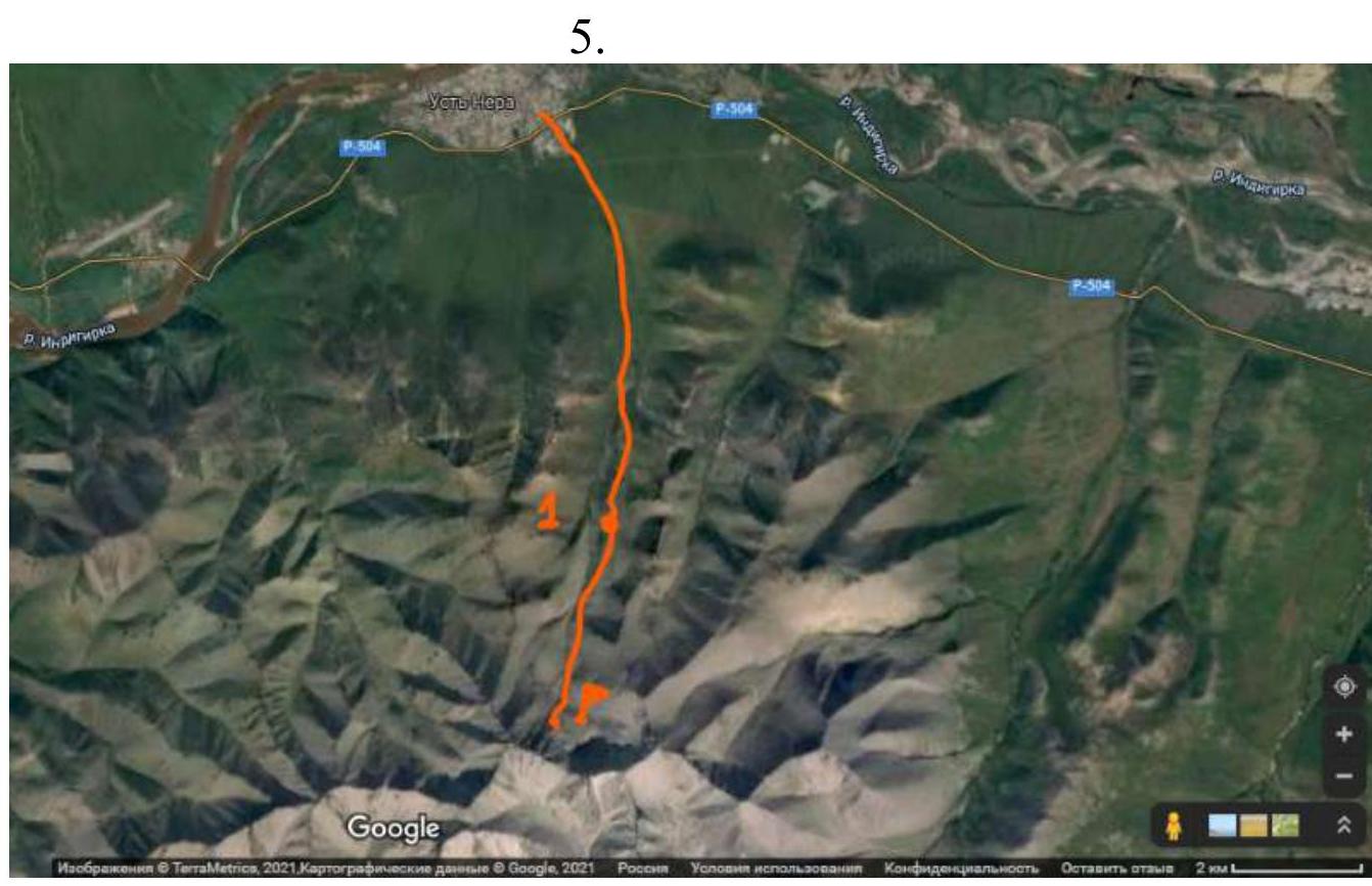 1.4 Map of the area. The number 1 marks the ski camp.
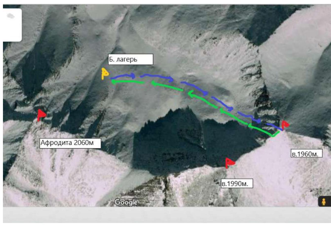 1.5 Snapshot of the cirque from space. Google Maps.
Brief geographical description of the area
The most accessible area for ascents in the Republic of Sakha (Yakutia) is located near the settlement of Ust-Nera, Oymyakon district, by the Indigirka river. The area is promising in terms of mountaineering. The Tас Kystabyt (Sarycheva) ridge is located in the Oymyakon district, which predetermines harsh climatic conditions here. Low temperatures and a large amount of precipitation are characteristic of this area.
You can reach the settlement of Ust-Nera from Yakutsk by car along the "Kolyma" highway (about 1000 km), or by plane "Yakutsk-Ust-Nera". From Ust-Nera to the base camp is approximately 11 km. Movement is to the south. Initially, there is a road to the abandoned ski base (8 km).
Currently, the base is being restored, and you can arrange for a pickup. Further, to the base camp, there are approximately 3 km along an indistinct trail.
The best time for ascents is the end of June, July.
The summit 1960 m is clearly visible from the base camp, which is located at the foot of v. Afrodita. From the base camp, along a grassy slope along the stream, we ascend to the Western wall, which consists of five clearly defined buttresses.
From the base camp to the start of the route is approximately 40 minutes walk.
2. Characteristics of the Route
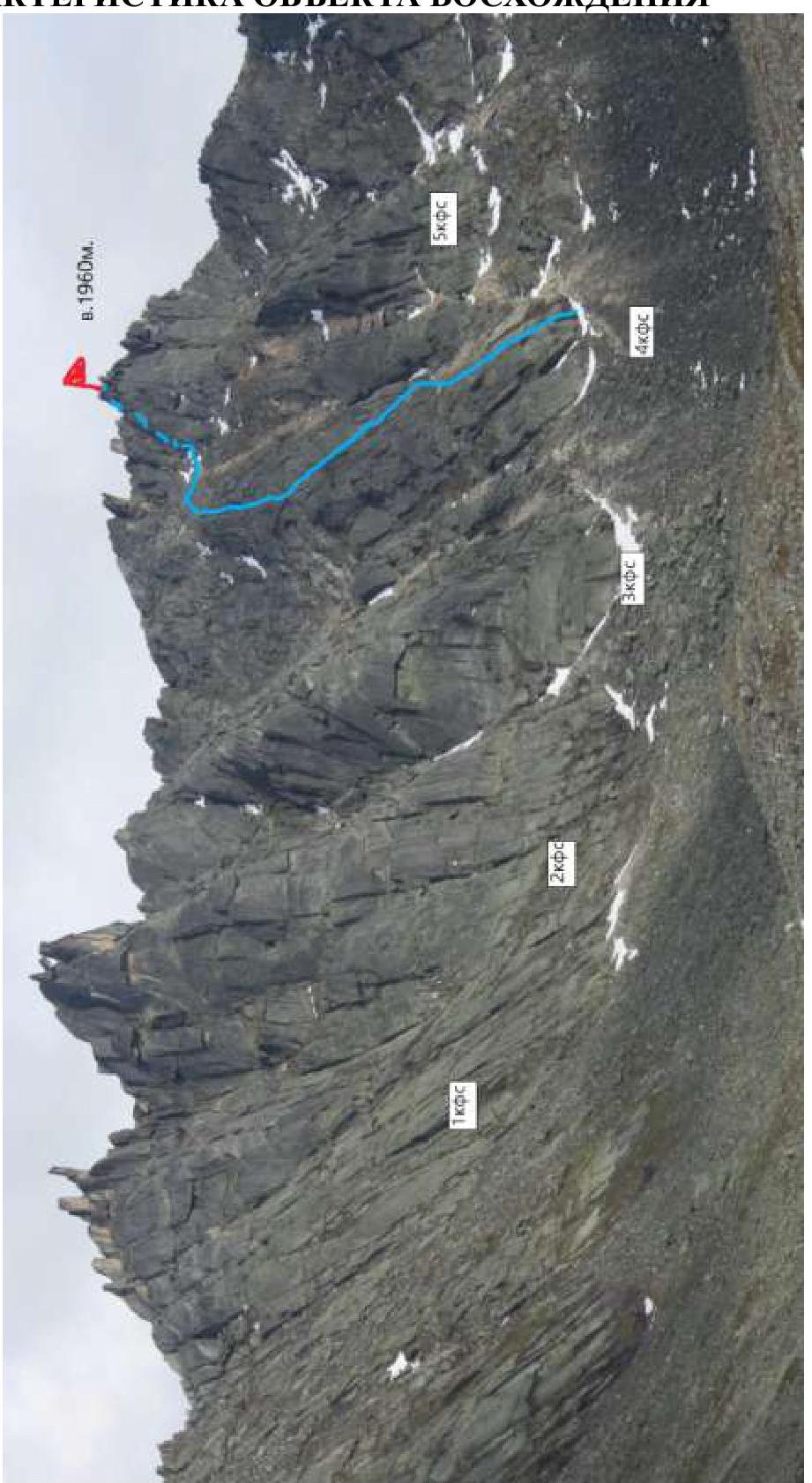
 2.1 Technical photograph of the route.
Technical characteristics of the route sections.
| Section № | Nature of the terrain | Category of difficulty | Length, m | Type and number of hooks |
|---|---|---|---|---|
| R0–R1 | Slabs | 3 | 50 | Friends, stoppers — 4 |
| R1–R2 | Ledge | 1 | 40 | |
| R2–R3 | Slabs | 3 | 50 | Friends, stoppers — 4 |
| R3–R4 | Slabs | 3 | 50 | Friends, stoppers — 3 |
| R4–R5 | Slabs | 3 | 40 | Friends, stoppers — 5 |
| R5–R6 | Broken rocks | 2 | 90 | |
| R6–R7 | Large blocks | 3 | 70 | Friends, stoppers — 3 |
| R7–R8 | Large blocks | 2 | 30 |
3. Characteristics of the Team's Actions
3.1 Brief description of the route passage
| Section № | Description | Photo № |
|---|---|---|
| R0–R1 | The route starts to the right of a large fault at the beginning of the buttress. We move up a vertical crack 50 m to exit onto a large ledge. Station, rope barriers. | 1 |
| R1–R2 | We cross the ledge towards the wall in the right part of the buttress. | |
| R2–R3 | Along two parallel cracks, we move from right to left upwards 50 m. Station, rope barriers. | 2 |
| R3–R4 | We continue to move left upwards 50 m to exit onto a small ledge. Station, rope barriers. | 3 |
| R4–R5 | From the ledge, directly up the wall, we exit onto the dome of the buttress. Station, rope barriers, hook belay. | |
| R5–R6 | Simultaneously, along broken rocks, we cross a wide couloir and approach the pre-summit chimney. | 4 |
| R6–R7 | The chimney consists of large blocks, with a plug in the upper part. Belay, rope barriers. Exit onto the ridge. | 5 |
| R7–R8 | After the chimney, in a spiral, along large blocks, we ascend to the summit. |
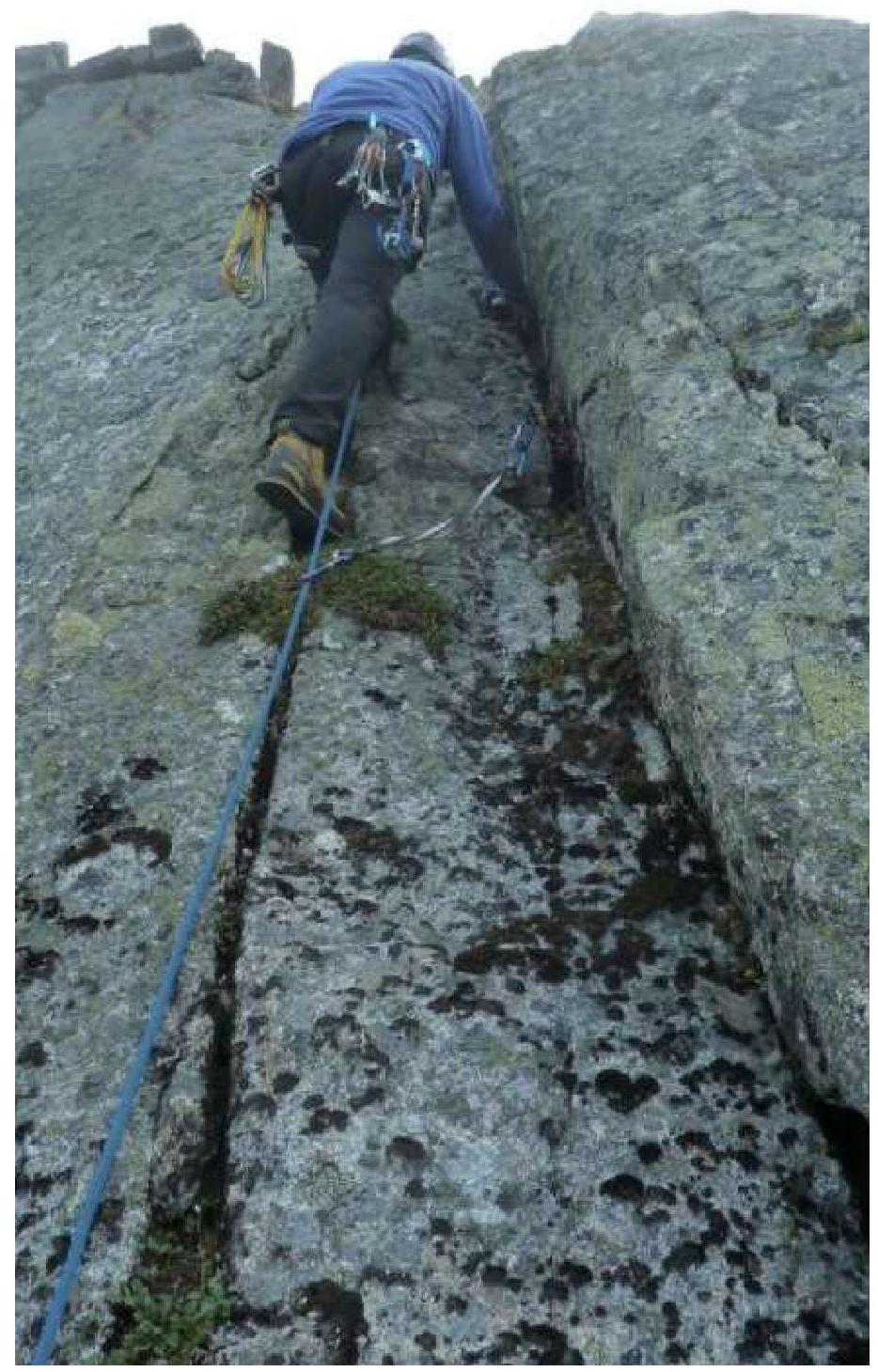
Photo 1. Section R0–R1
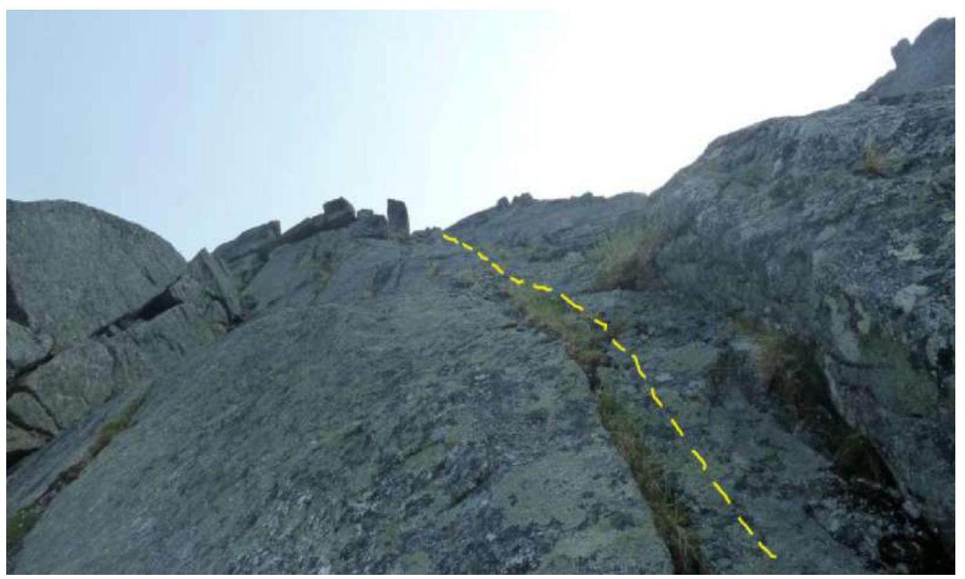
Photo 2. Section R2–R3
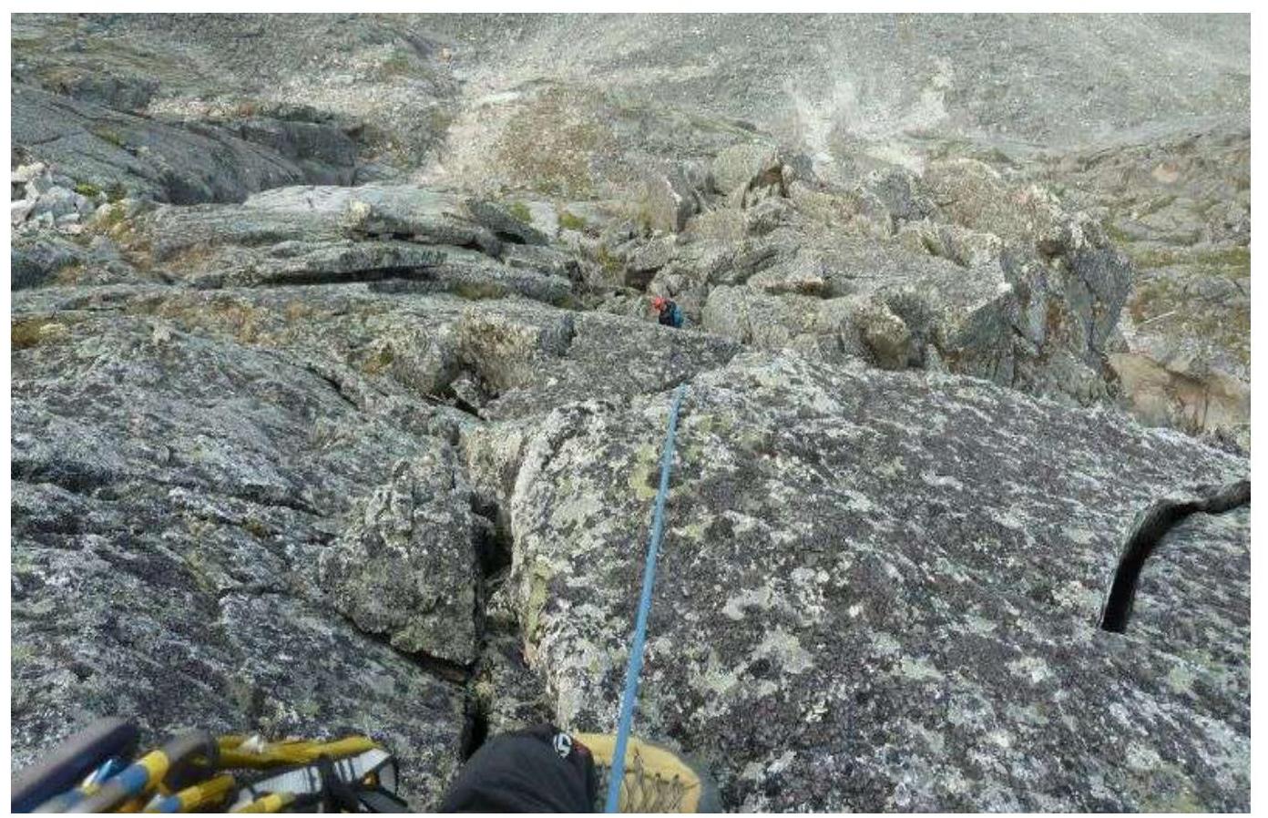
Photo 3. Section R4–R5. Exit onto the dome of the buttress
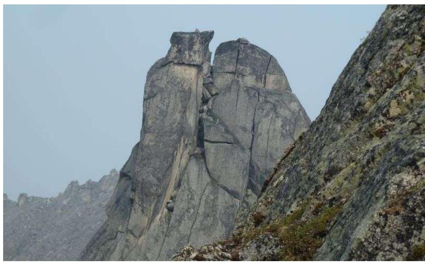
Photo 4. Section R5–R6. View of the dome of the 2nd buttress
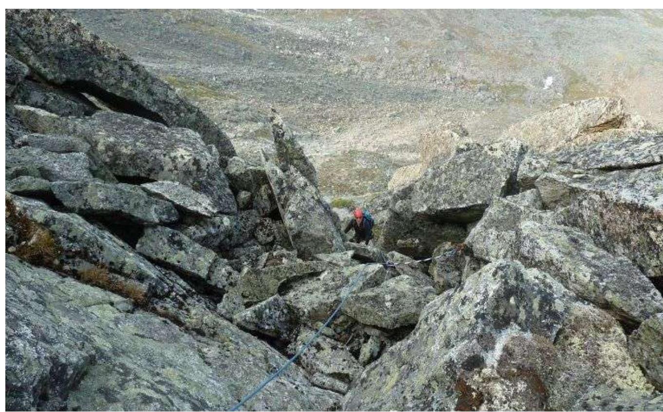
Photo 5. Section R6–R7. Exit onto the N. ridge.
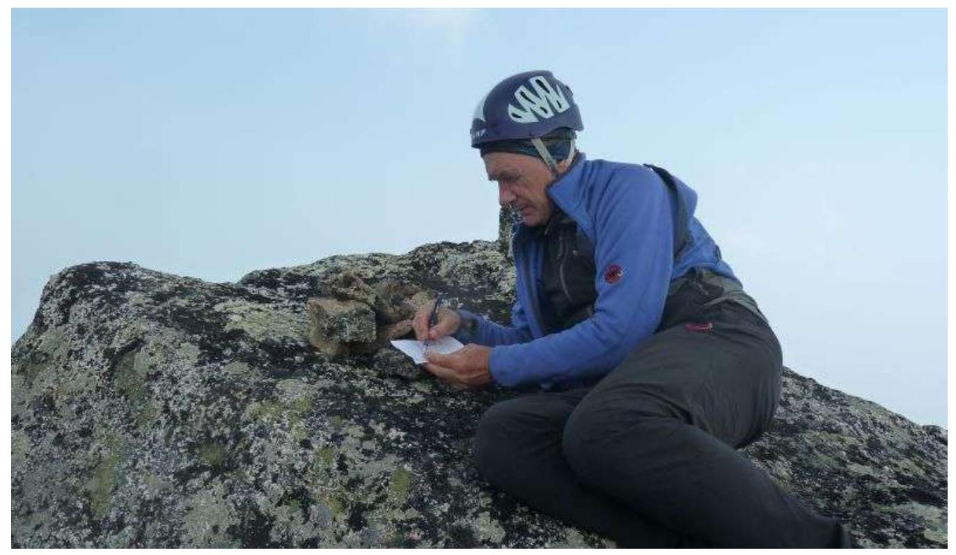
3.2 Photo at the summit
3.3 Route Assessment
The route is very logical, there's no place to get lost. Not prone to rockfall — practically no "live" stones. The descent from the summit is simple: via scree to the pass and further to the camp. Recommended for training groups in dry weather.