
Climbing Passport
- Climbing area: Tas Kystabyt Ridge (Sarychev), southwestern part of Chersky Range — Sakha Republic (Yakutia), section 9.7
- Peak, route: p. 2060 m (local name Aphrodite), Central Counterfort of the Eastern Ridge Peak coordinates: 64°28′719″ N, 143°14′297″ E according to GPS.
- Estimated category of difficulty: 2B, first ascent
- Route type: Rocky
- Route characteristics:
- Height difference according to GPS — 490 m Route length — 950 m Section lengths:
- 2nd category of difficulty — 790 m
- 3rd category of difficulty — 160 m
- Time taken to reach the summit: 5 h 30 min.
- Leader: Ivan Vasilyevich Ivanov, Candidate Master of Sports
Participants:
- Valery Alexandrovich Bogomolov, 1st sports category
- Alexander Ilyich Spiridonov, 2nd sports category
- Coach: Ivan Vasilyevich Ivanov, #72
- Departure from Base Camp: hour, date, month, year. Route started at 8:00 on June 24, 2019. Reached the summit at 13:30 on June 24, 2019. Descent from the summit via the Eastern Ridge to the pass (via route 2A category of difficulty).
- Organization:
- FAiS of Sakha Republic (Yakutia)
- Person responsible for the report: Ivan Vasilyevich Ivanov, ivi4057@mail.ru, +79504066061.
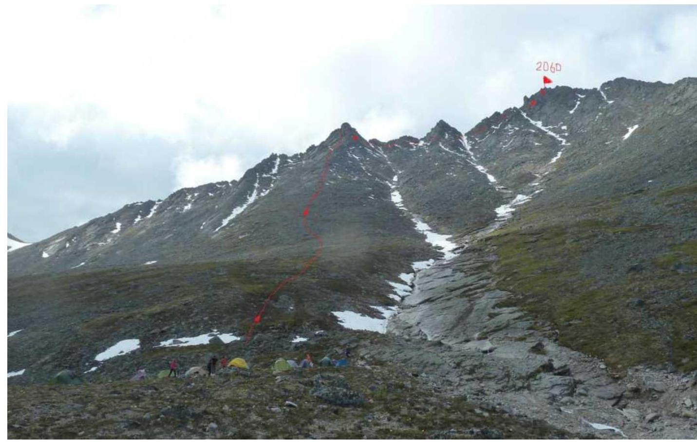 Photograph of peak 2060 m (Aphrodite) from the base camp on June 21, 2019.
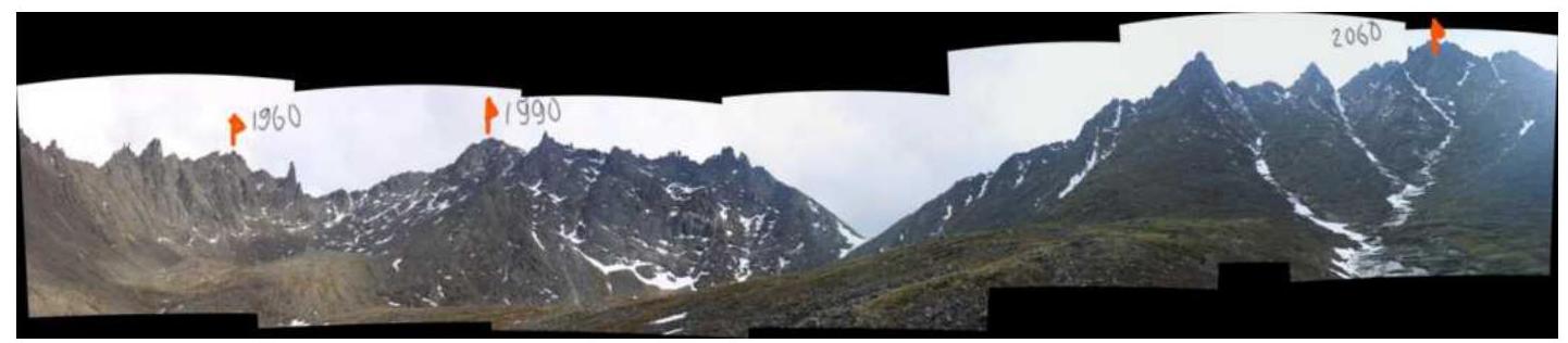 Photopanorama of the area. Shows a cirque with three peaks.
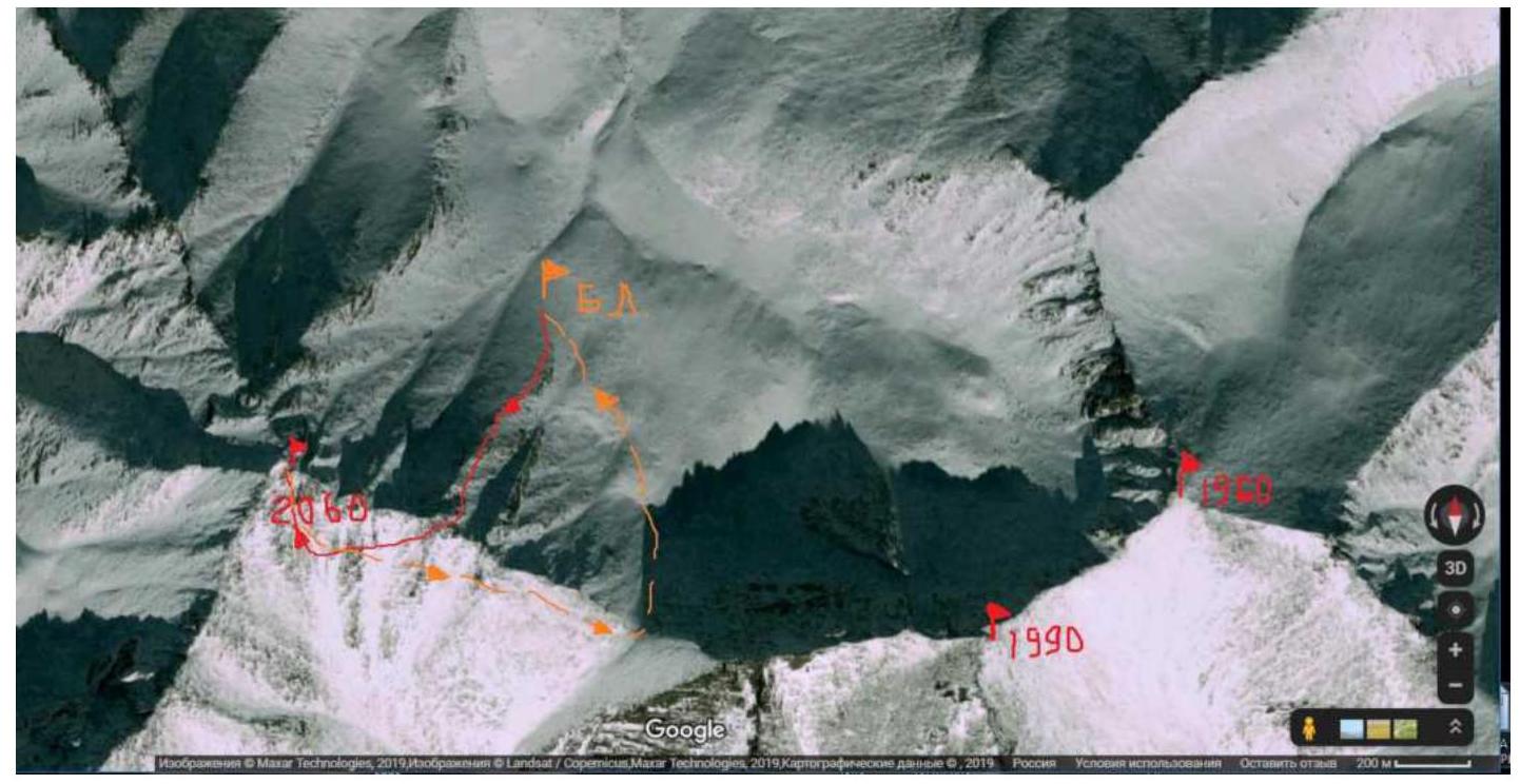 Satellite image of the cirque. Google Maps.
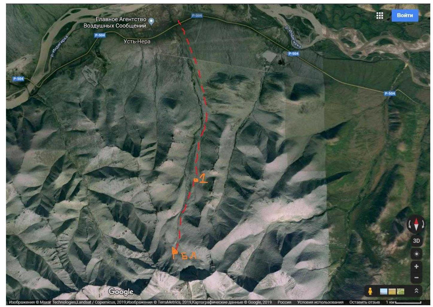 Map of the area. Number 1 indicates an abandoned ski base.
Brief geographical description of the area
The most accessible area for climbing in Sakha Republic (Yakutia). Located near the settlement of Ust-Nera, Oymyakon district, by the Indigirka River. The area is promising for alpinism. Tas Kystabyt Ridge (Sarychev) is located in Oymyakon district, which determines the harsh climatic conditions here. This area is characterized by:
- low temperatures
- high precipitation.
Climbing conditions in the area
One can reach Ust-Nera from Yakutsk by car via the "Kolyma" highway (about 1000 km) or by plane "Yakutsk–Ust-Nera". From Ust-Nera to the base camp is 11 km. Move south. Initially, there is a road to the abandoned ski base (8 km). (Depending on the road conditions, one can arrange for a drop-off). Then to the base camp is 3–4 km. The best time for climbing is late June, July.
TABLE OF TECHNICAL SECTIONS OF THE ROUTE
| Section # | Length | Steepness | Terrain characteristics | Category of difficulty | Number of pitons |
|---|---|---|---|---|---|
| R0–R1 | 380 m | 35° | Large blocks | 2 | |
| R1–R2 | 70 m | 45°–50° | Slabs, monolith | 3 | 6 |
| R2–R3 | 410 m | 30° | Large blocks | 2 | |
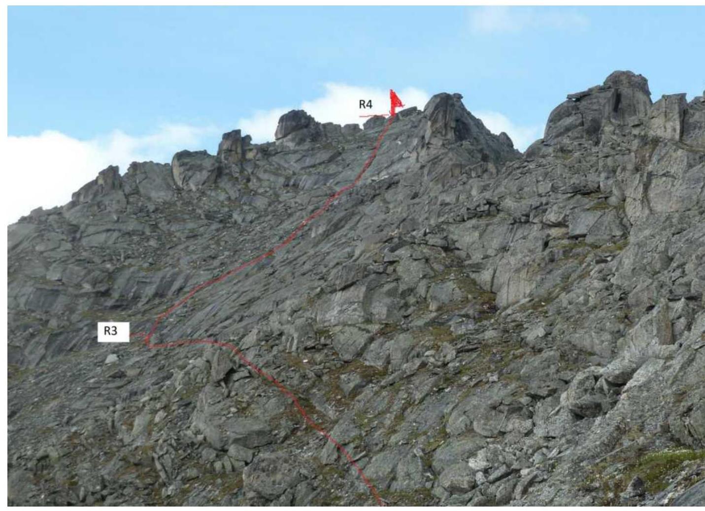
| R3–R4 | 90 m | 45°–50° | Slabs | 3 | 8 |
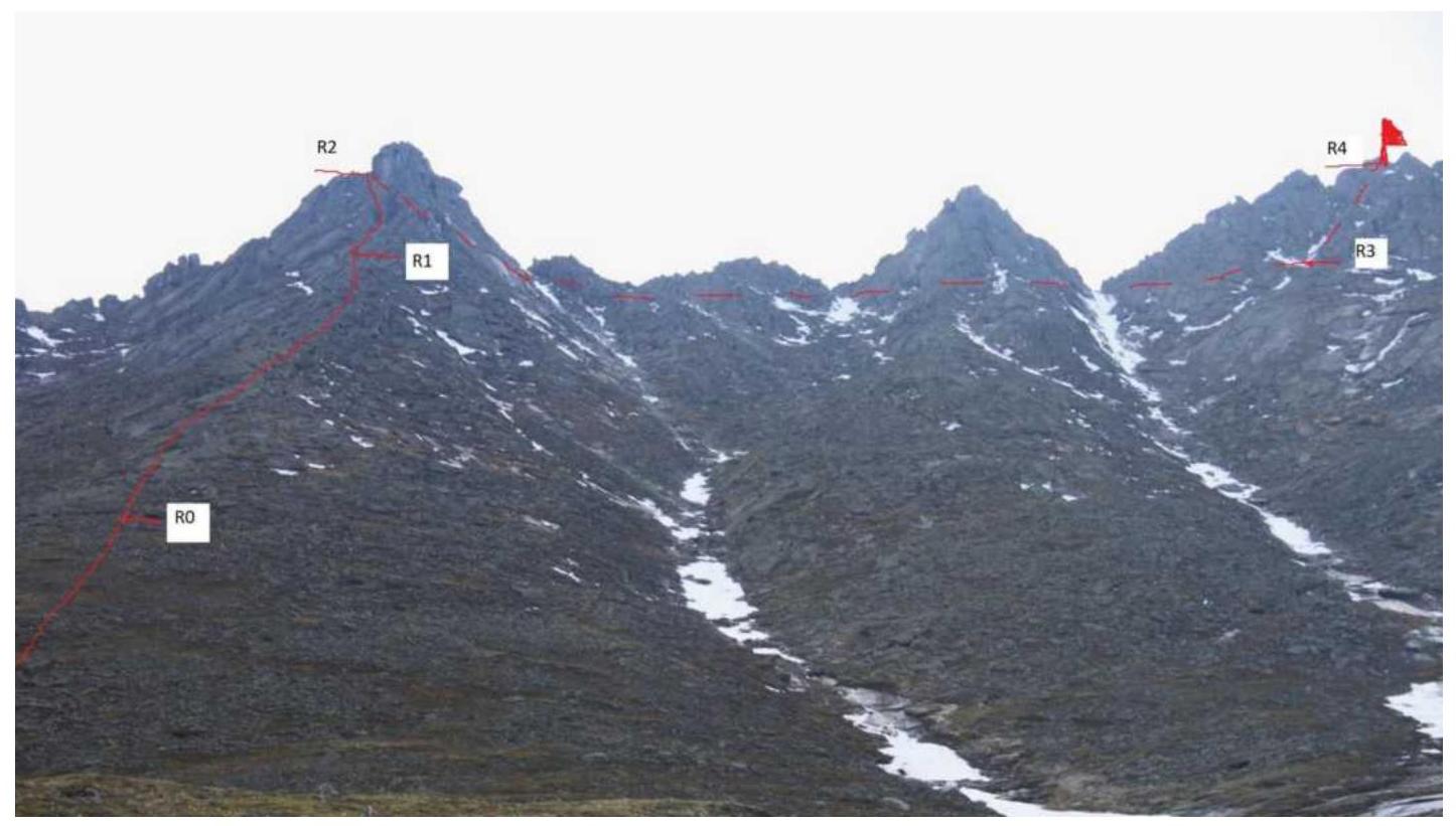
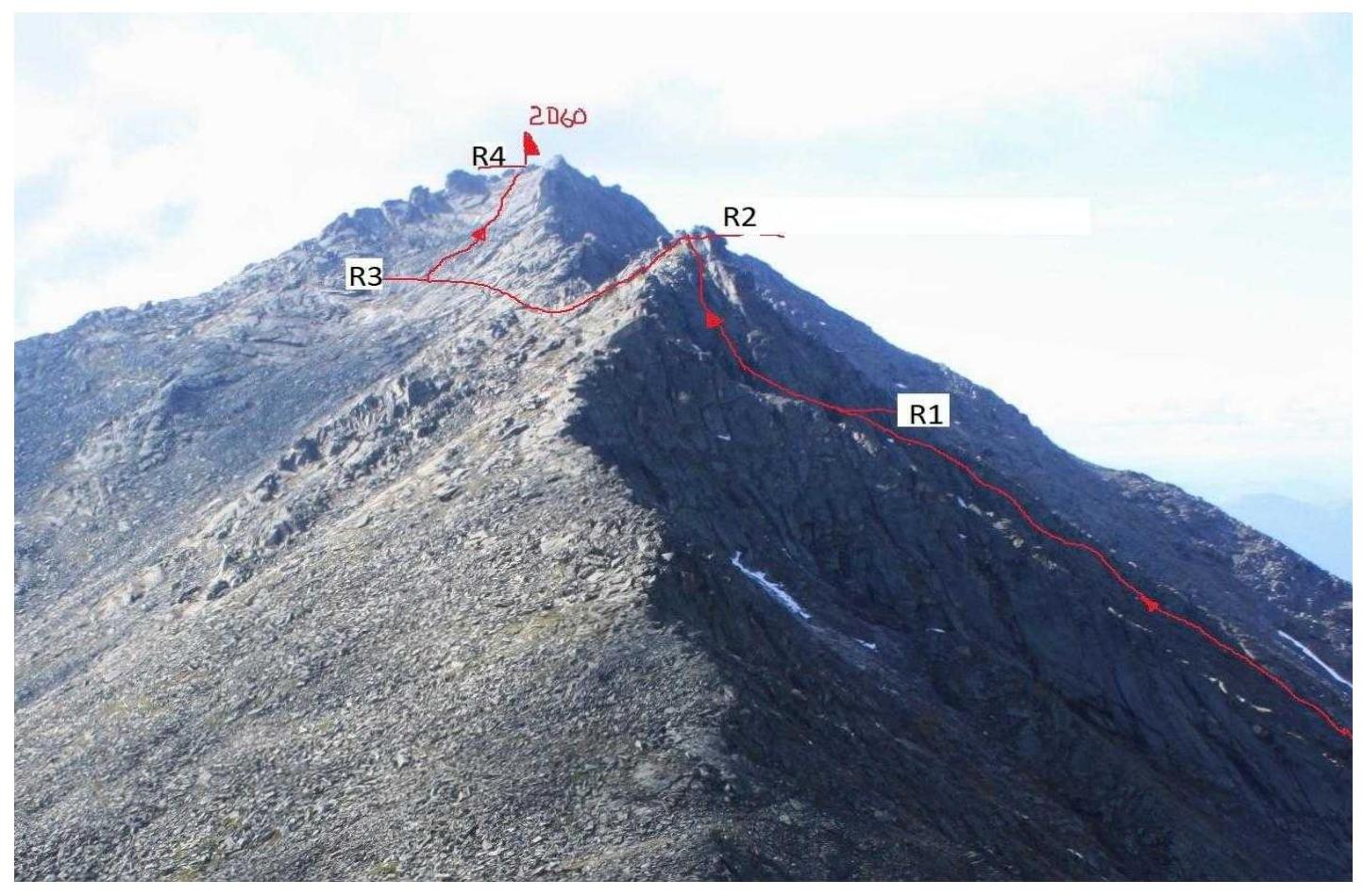 Technical photographs of the route. Route to peak 2060 m (Aphrodite) via Central Counterfort of the Eastern Ridge, 2B (orientation).
Brief description of the route
The base camp is practically under the route. We ascend directly up the grassy slope to the start of the slabs — 40 min. Start of the route R0. In the hollow under the slab, we tie in. We begin moving with varied protection across large blocks and slabs to the start of the gendarme. R1. Then we move from left to right via a diagonal crack — 40 m (rappel). Another rappel (30 m) up to the depression on top of the gendarme. R2. We reach the Eastern Ridge. We move along the left side of the ridge across large blocks and inclined slabs (alternate protection) in the direction of the summit tower. R3. To reach the summit, we hang 2 rappel ropes (90 m) along the center of the wall, consisting of monolithic slabs and "ram's foreheads" R4. In the upper part, the route coincides with route 2A along the Eastern Ridge. Descent from the summit along the Eastern Ridge to the pass and then to the camp. Descent options:
- Via scree gullies between counterforts. The route is not rockfall-prone. Recommended for training climbs.
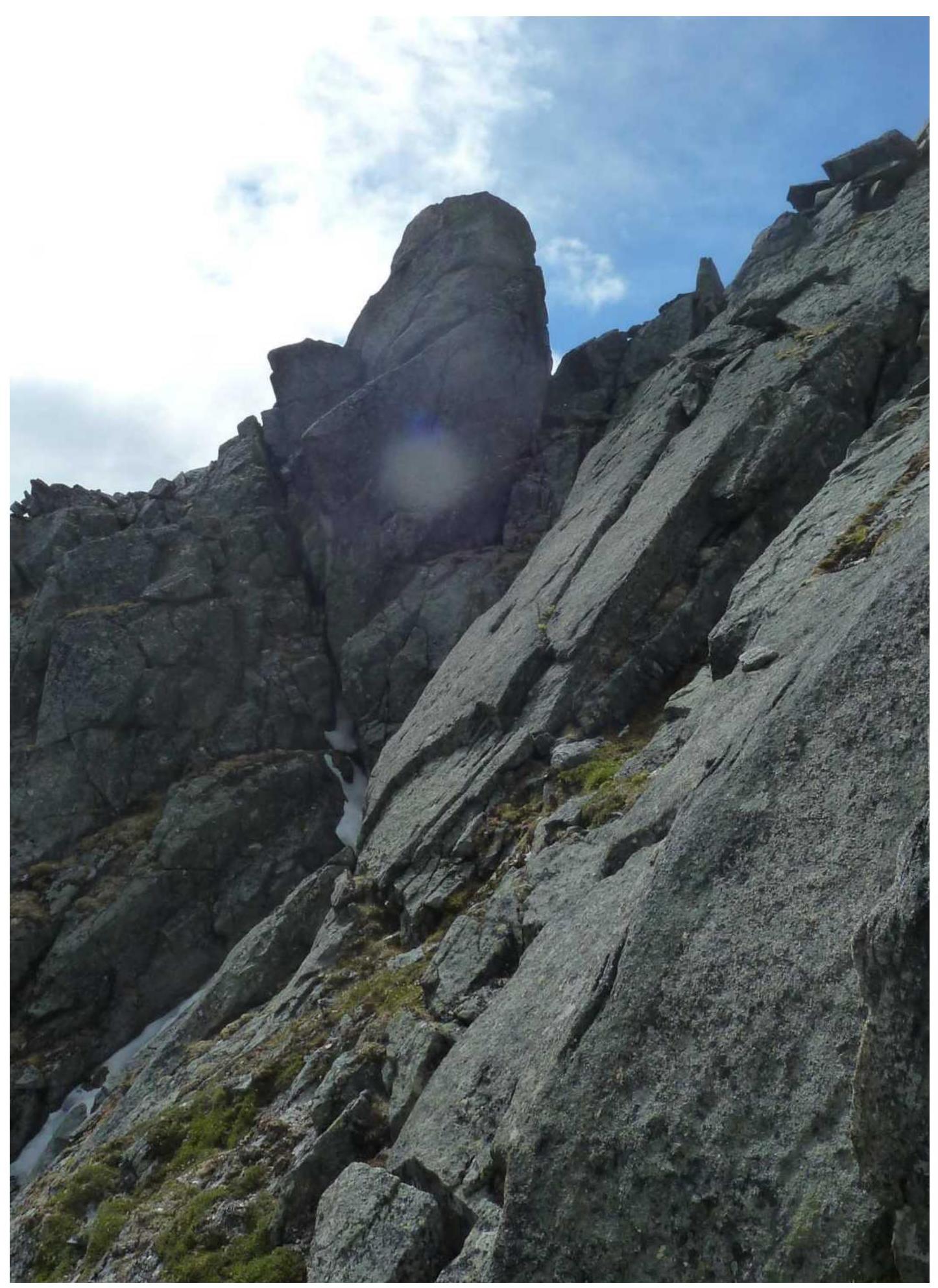 Section R0–R1.
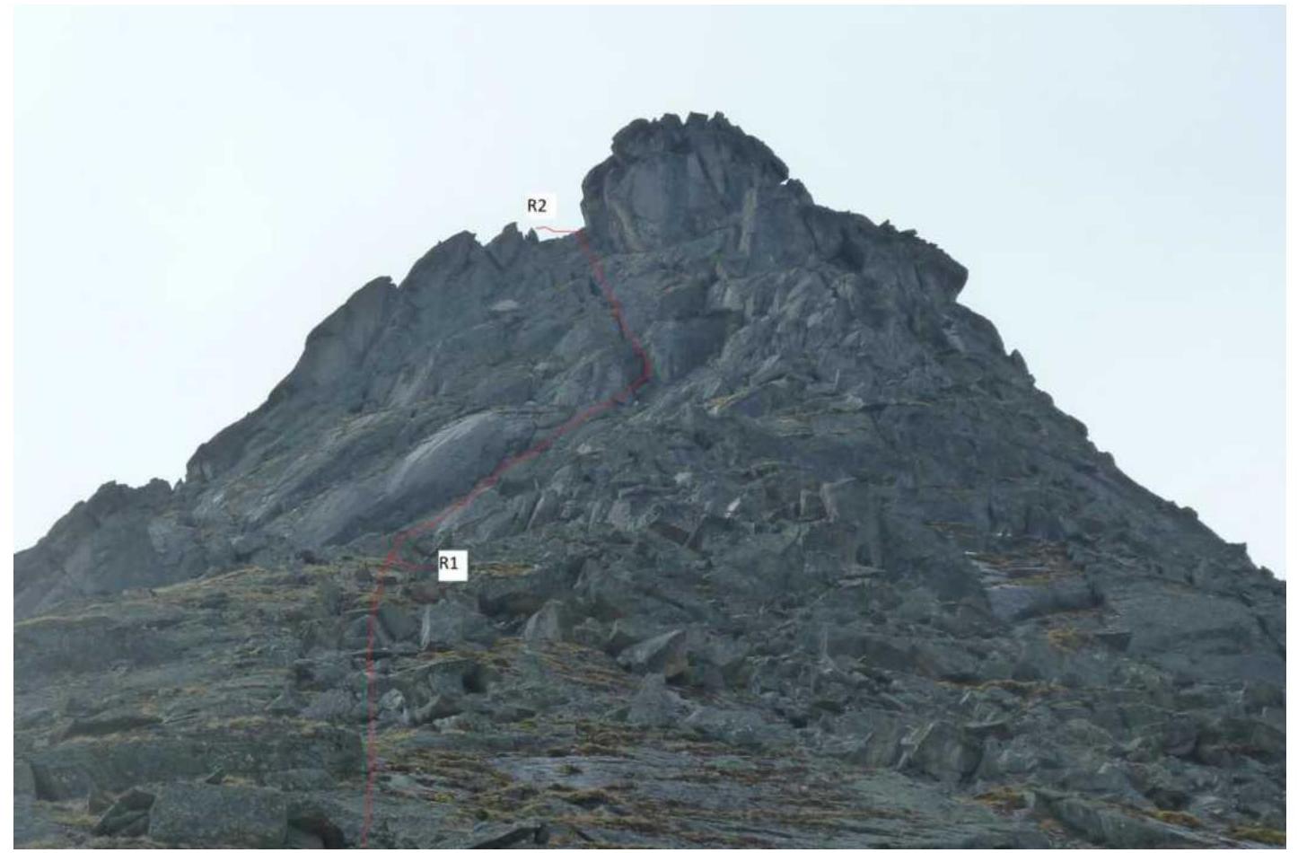 Section R1–R2.
 Ascent to the top of the gendarme. Section R1–R2.
 Section R2–R3.
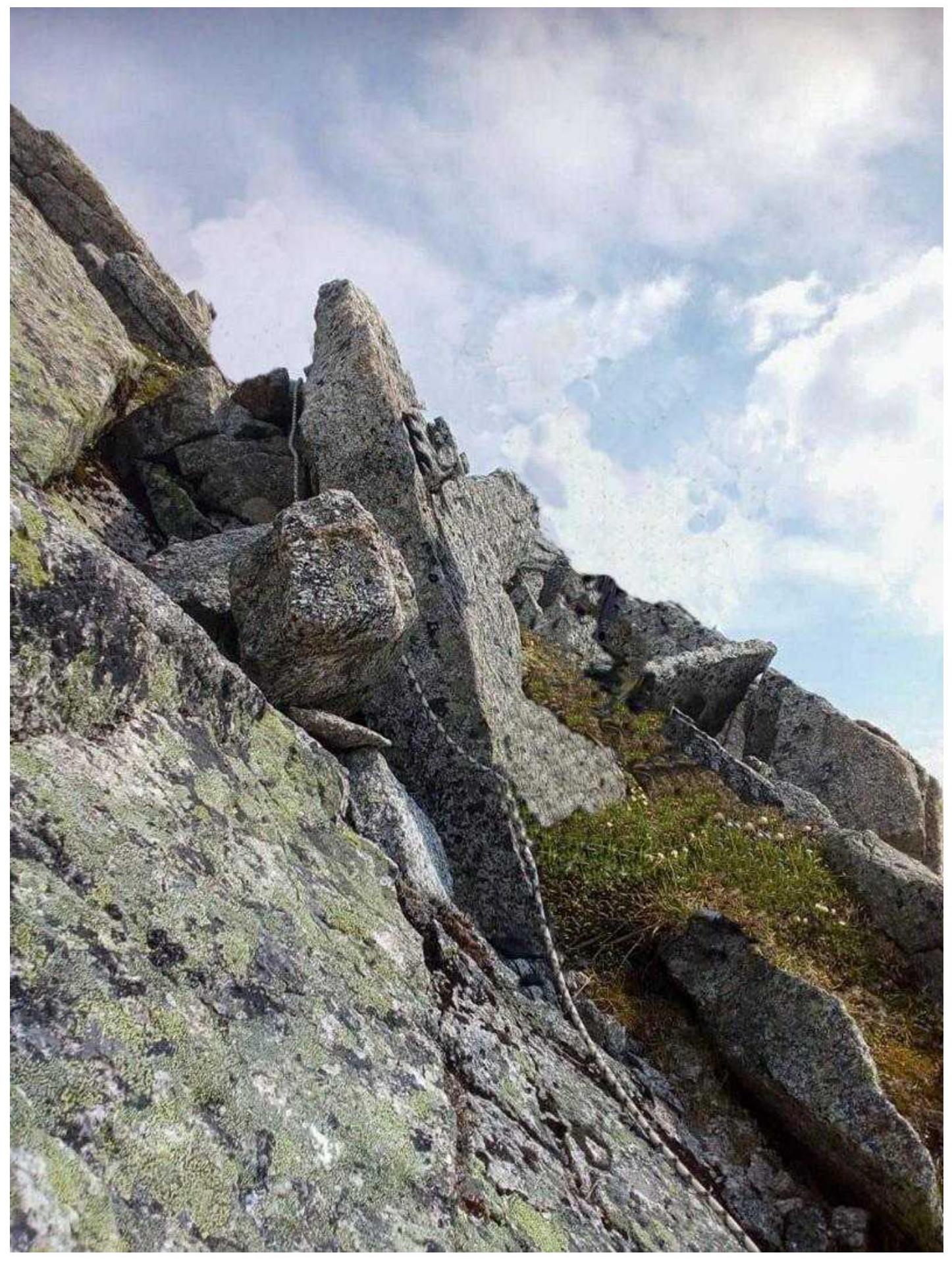
 Section R3–R4.
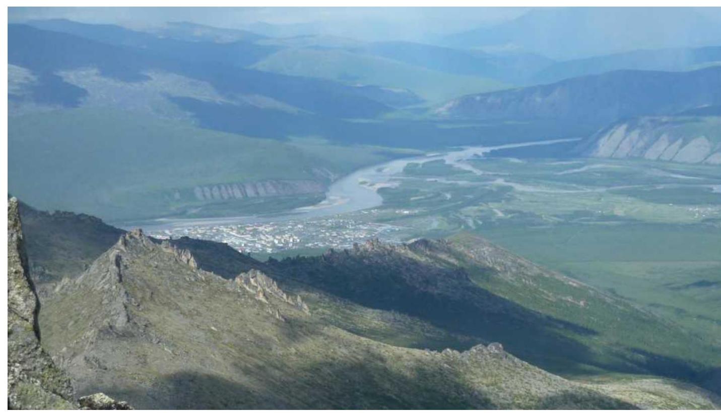 View from the summit towards Ust-Nera settlement.
Comments
Sign in to leave a comment