
Report on the First Ascent to Bolshaya Bariernaya Peak via Orlov's Route, Category 2B, by Orlov's Team on April 8, 2022
1. Object Passport
| № | 1. General Information | |
|---|---|---|
| 1.1 | Full Name, Sports Rank of the Team Leader | Orlov Dmitry Sergeevich, 2nd sports rank in alpinism |
| 1.2 | Full Names, Sports Ranks of the Team Members | Chindashev Alexey Leonidovich, 2nd sports rank in alpinism, Sedov Denis Valerievich, 3rd sports rank in alpinism |
| 1.3 | Full Name of the Coach | Stukalov Mikhail Mikhailovich |
| 1.4 | Organization | |
| 2. Characteristics of the Climbing Object | ||
| 2.1 | Region | Putorana Plateau |
| 2.2 | Valley | Lontokoy Kamen Plateau |
| 2.3 | Section Number according to the 2013 Classification Table | 9 |
| 2.4 | Name and Height of the Peak | Bolshaya Bariernaya Mountain 583 m |
| 2.5 | Geographic Coordinates of the Peak (Latitude, Longitude), GPS Coordinates | Latitude 69.288670° N, Longitude 88.281369° E |
| 3. Characteristics of the Route | ||
| 3.1 | Route Name | Orlov's Route via the 4th North-East Buttress |
| 3.2 | Proposed Category of Difficulty | 2B winter |
| 3.3 | Degree of Route Exploration | First Ascent |
| 3.4 | Nature of the Route Terrain | Combined |
| 3.5 | Height Difference of the Route (data from altimeter or GPS) | 590 m according to the altimeter (measurements taken with Suunto 9 Baro altimeter) |
| 3.6 | Route Length (in meters) | 1960 m |
| 3.7 | Technical Elements of the Route (total length of sections of various difficulty categories with indication of terrain type (ice-snow, rock)) | Category I — ice-snow — 224 m. Category II — combination — 261 m. Category III — combination — 79 m. Category IV — combination — 26 m |
| 3.8 | Descent from the Summit | Category 1B |
| 3.9 | Additional Route Characteristics | Be very attentive on the key section of the route! |
| 4. Characteristics of Team Actions | ||
| 4.1 | Time of Movement (team's walking hours, in hours and days) | 3 hours 52 minutes (from the starting point to descent under 1B) |
| 4.2 | Overnights | No overnight stay |
| 4.3 | Start of the Route | April 8, 2022, 9:30 |
| 4.4 | Reaching the Summit | April 8, 2022, 13:22 |
| 4.5 | Return to Base Camp | April 8, 2022, 13:40 |
| 5. Responsible for the Report | ||
| 5.1 | Full Name, e-mail | Orlov Dmitry Sergeevich, mr.dmitriiorlov@yandex.ru |
II. Climbing Report
1. Characteristics of the Climbing Object
1.1. General Photo of the Peak
Photo № 13.
1.2. Profile Photo
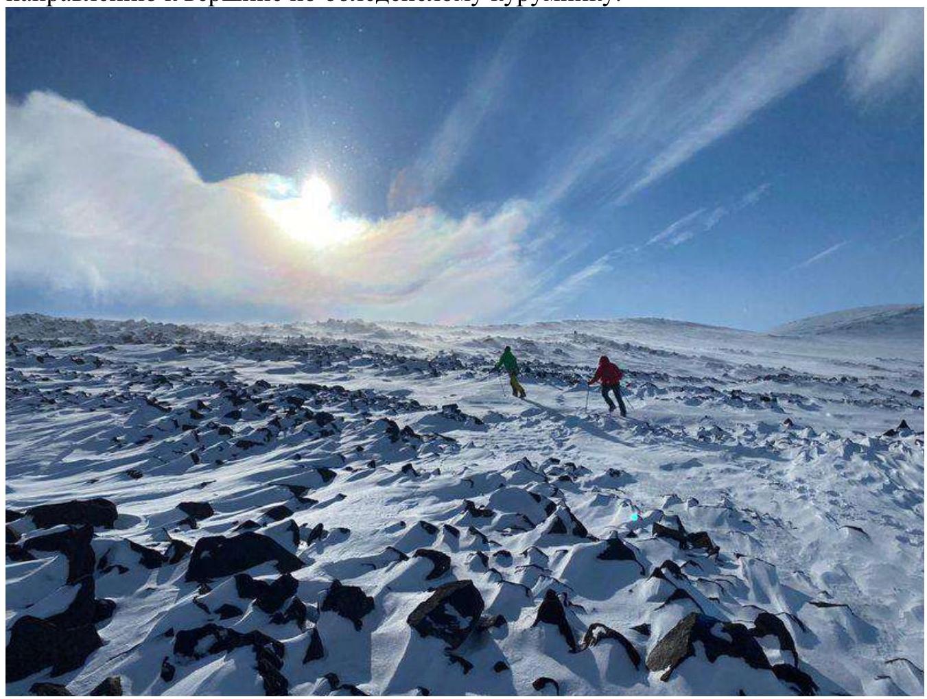
Photo № 1.
1.3. Photopanorama
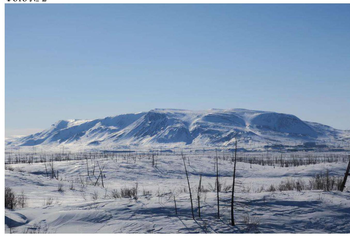
Photo № 2.
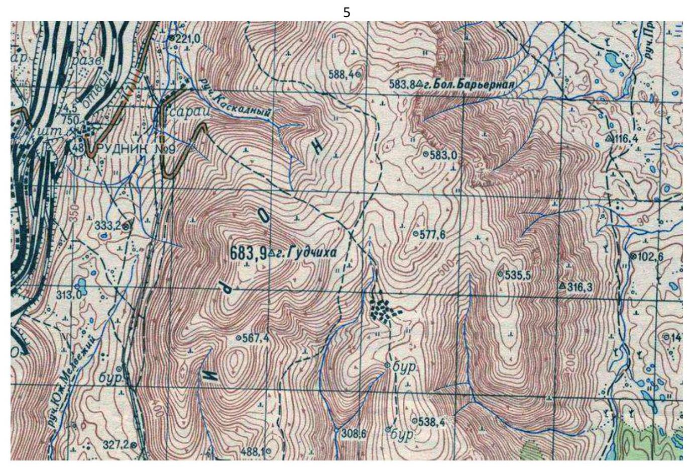
1.4. Map of the Region.
2. Characteristics of the Route
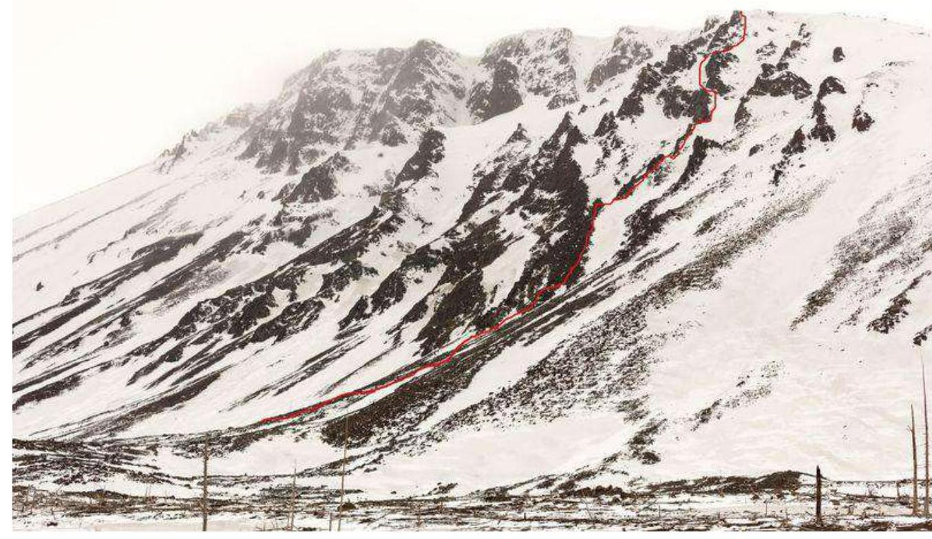
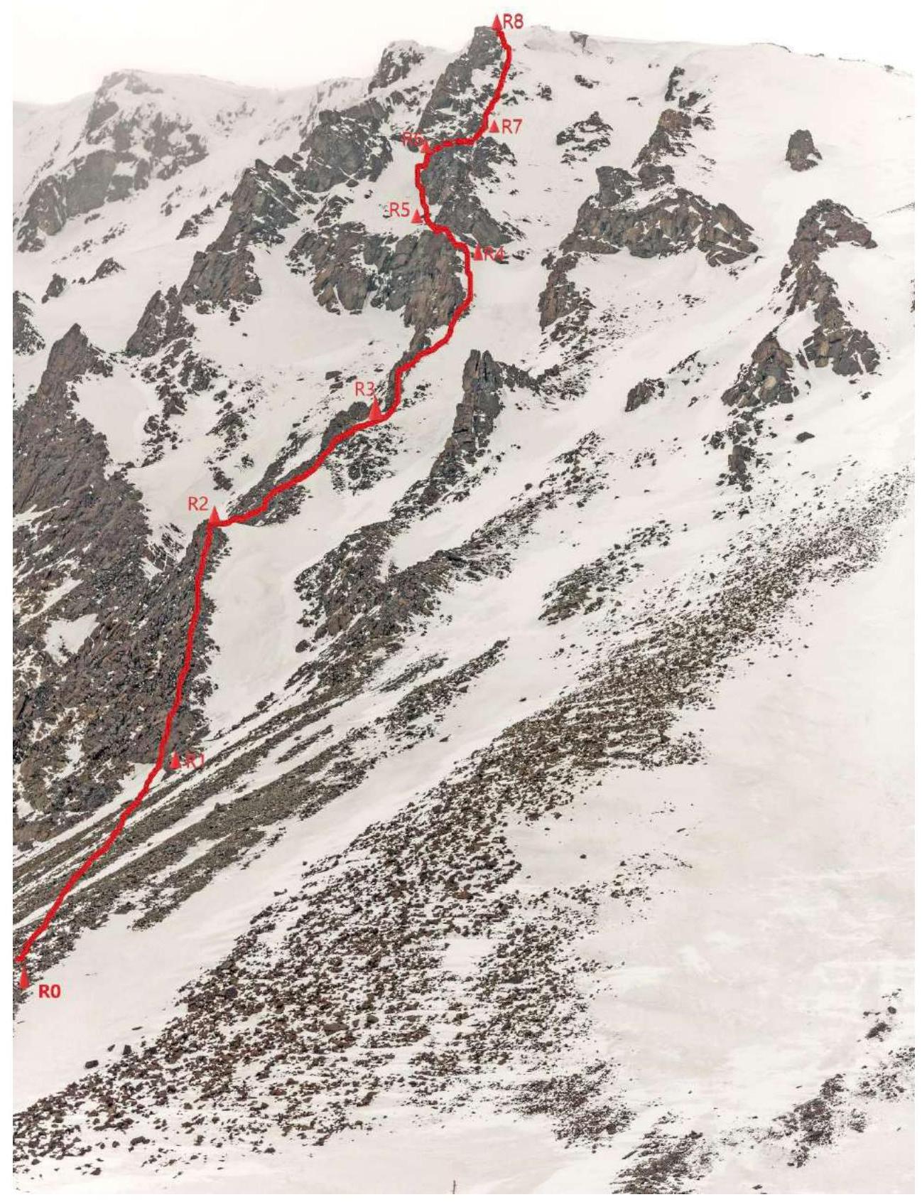
2.1. Technical Photograph of the Route
Photo № 3.
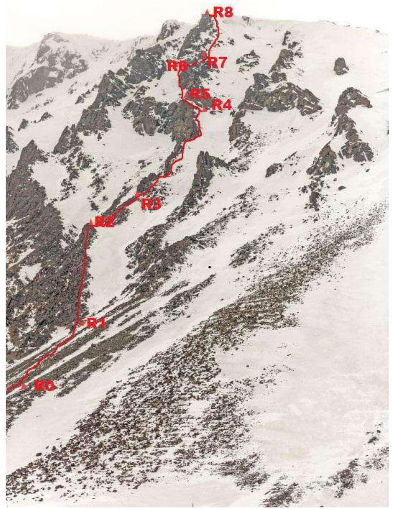
2.2. Participant Numbers on the Technical Photograph
Photo № 4. Participants № 2 and № 3 on R0–R1 on a scree slope at the beginning of the route.
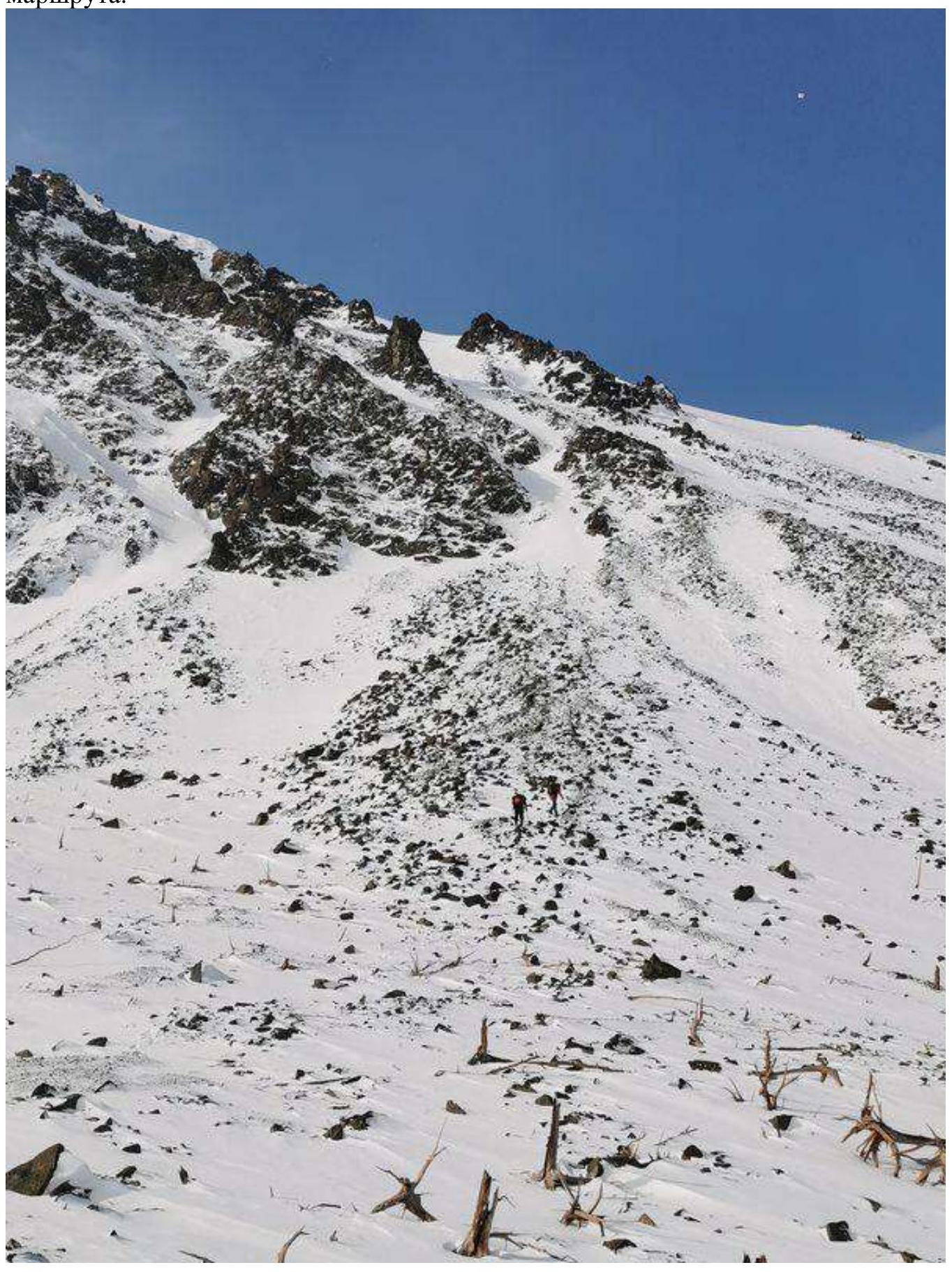
Photo № 5. Participants № 2 and № 3 on the R1–R2 section moving across snow-covered rocks.
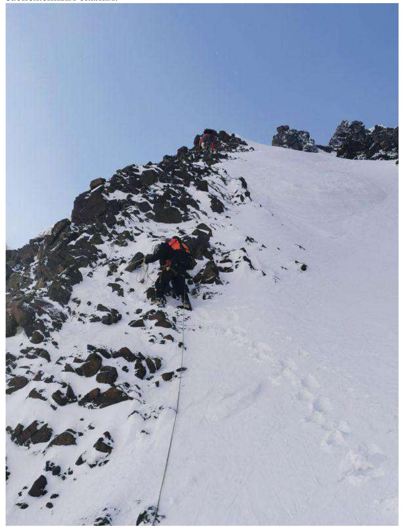
Photo № 6. Participants № 2 and № 3 on the R2–R3 section on a scree ridge.
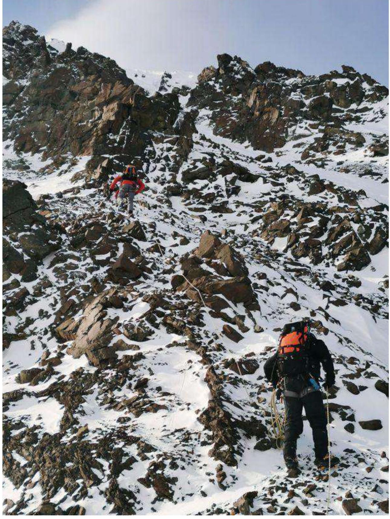
Photo № 7. Participants № 2 and № 3 on the R3–R4 section bypassing rock gendarmes on the right.

Photo № 8. Participants № 2 and № 3 on the R4–R5 section approaching a rock bastion, which is bypassed on the left.
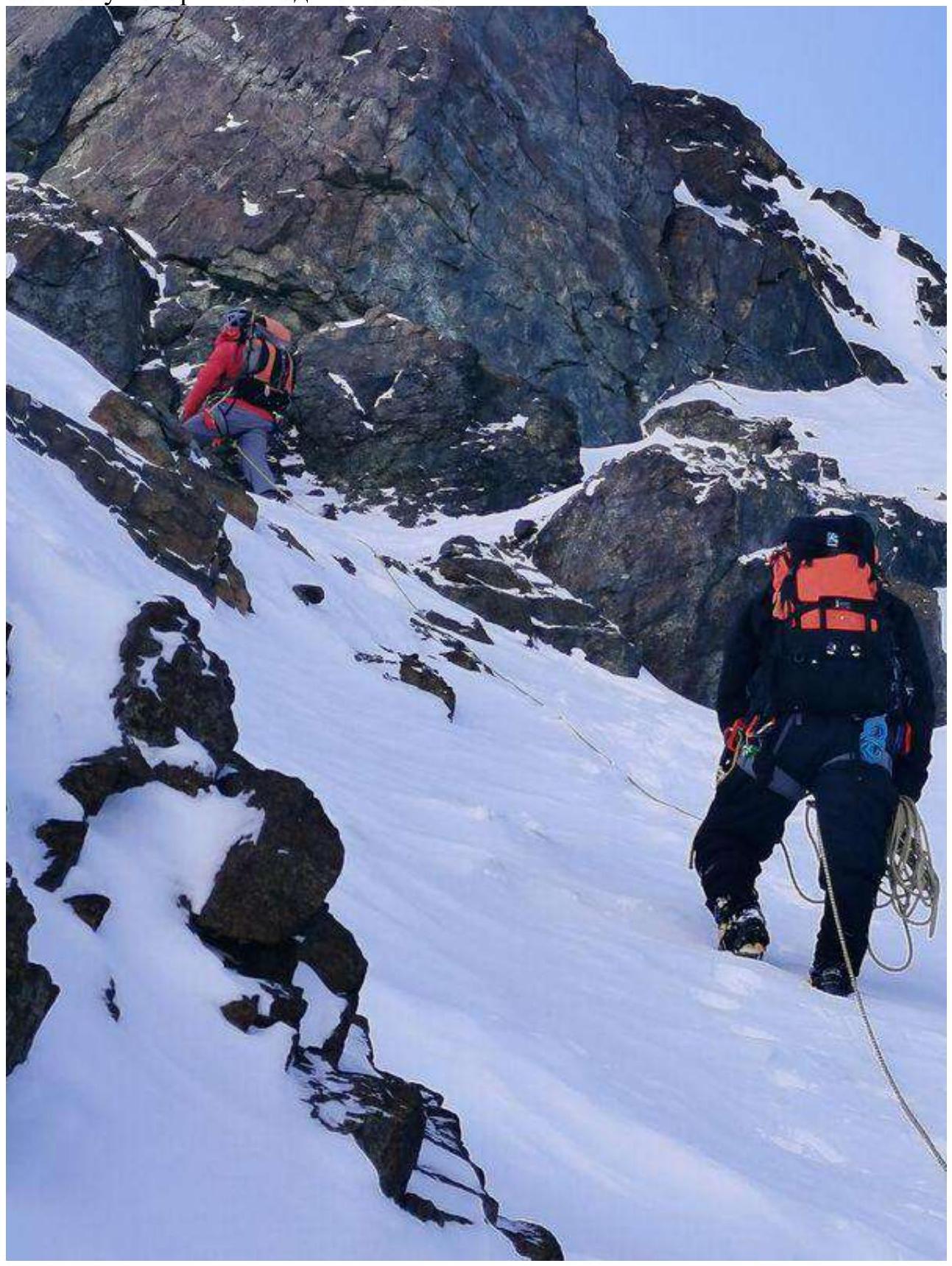
Photo № 9. Participant № 1 on the R5–R6 section bypassing the rock bastion.
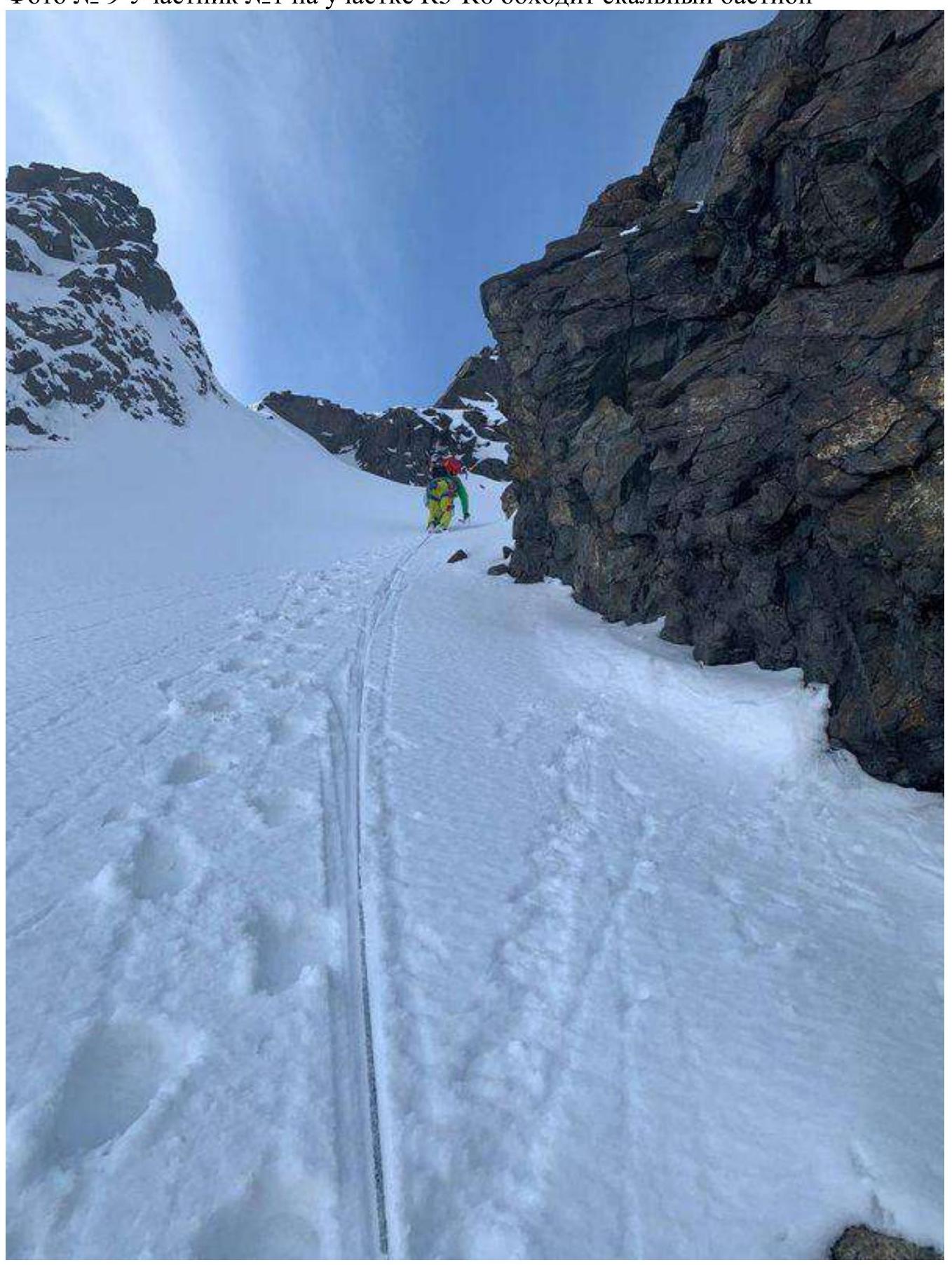
Photo № 10. Participant № 1 on the R6–R7 section moving rightward from the last rock bastion under the key section of the route.
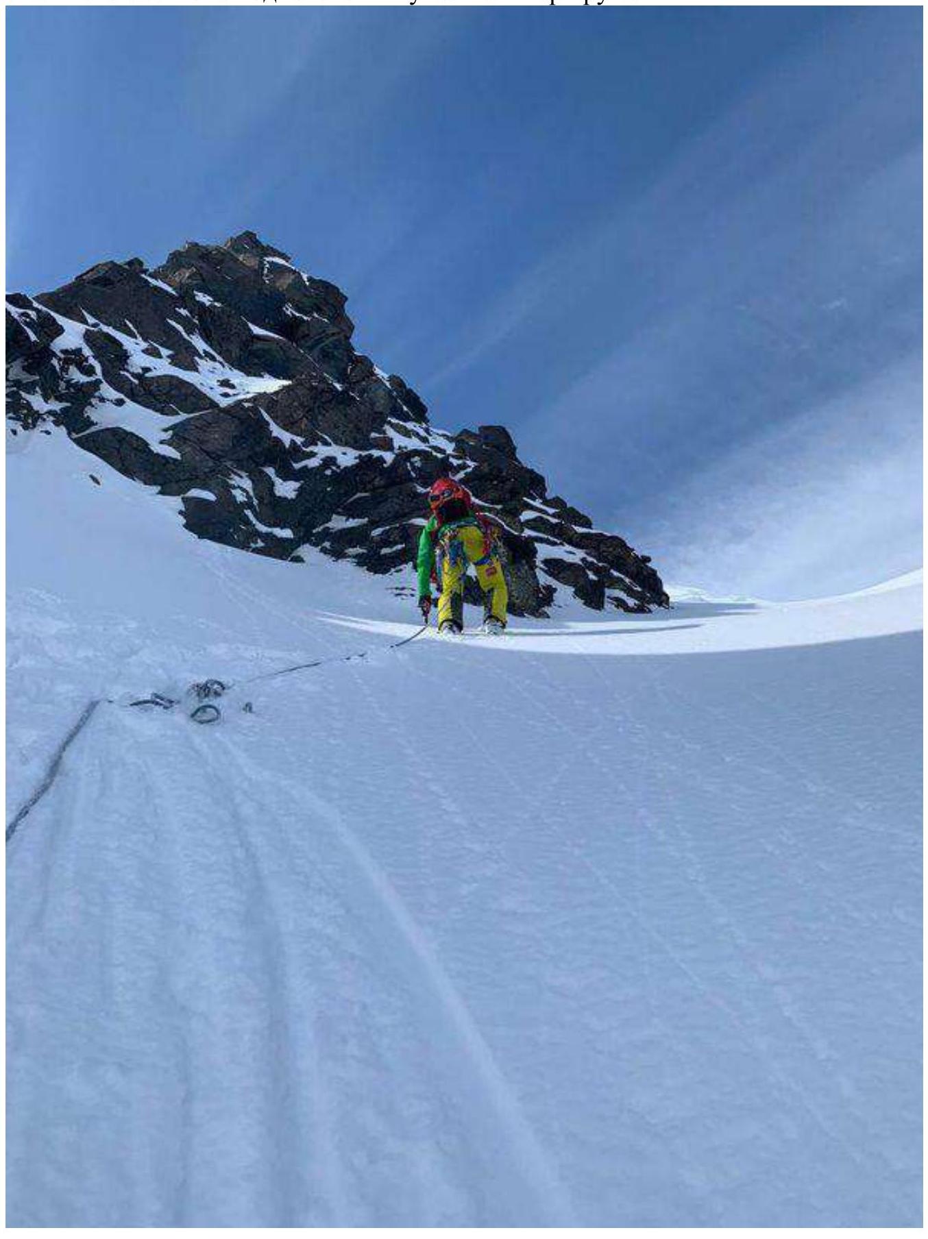
Photo № 11. Participant № 1 on the R7–R8 section at the route's key section, before reaching a large terrace.
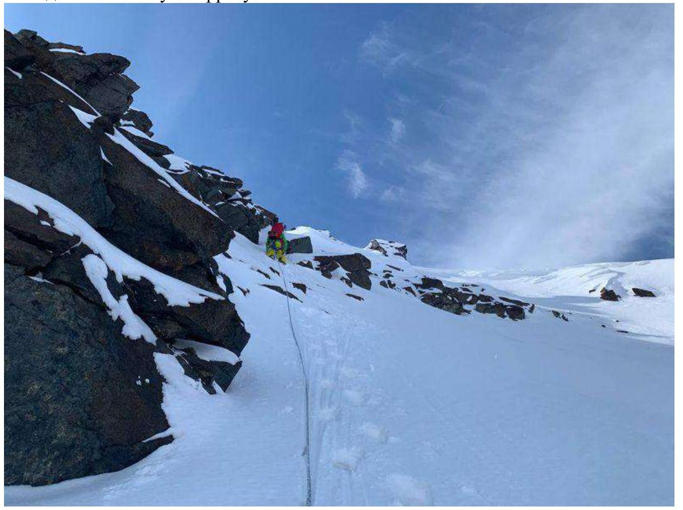
Photo № 12. Participants № 1 and № 2 on the R8–R9 section moving towards the summit across icy scree.
2.3. Technical Characteristics of Route Sections
| Section | Terrain Character | Difficulty Category | Length, m | Type and Number of Pitons |
|---|---|---|---|---|
| R0–R1 | Snow-ice | 2 | 160 | none |
| R1–R2 | Combination | 2 | 47 | none |
| R2–R3 | Combination | 2 | 16 | none |
| R3–R4 | Combination | 2 | 38 | none |
| R4–R5 | Snow-ice | 3 | 28 | none |
| R5–R6 | Combination | 3 | 31 | Stopper (2) |
| R6–R7 | Combination | 3 | 20 | Stopper |
| R7–R8 | Combination | 4 | 26 | Anchor (3), Stopper (1) |
| R8–R9 | Snow-ice | 1 | 224 | none |
3. Character of Team Actions
3.1. Brief Description of Route Passage
| Section | Description | Photo Number |
|---|---|---|
| R0–R1 | Firm snow, small scree, slope angle from 20° to 40°, simultaneous insurance, movement in crampons with ice axes. | № 4 |
| R1–R2 | Snow-covered rocks, slope angle 35°. We reach a snow shelf. Simultaneous insurance, intermediate points from loops on rock outcrops. | № 5 |
| R2–R3 | Scree ridge 35°. Simultaneous insurance. | № 6 |
| R3–R4 | We move to the right of the gendarmes on firm snow, slope angle 40–45°, simultaneous insurance, rope laid around rock outcrops. | № 7 |
| R4–R5 | Continue moving on firm snow under a rock bastion, veering left on snow, slope angle increases to 50°. Simultaneous insurance. | № 8 |
| R5–R6 | Bypass the bastion on the left, pressing against the rock for intermediate insurance points and for further movement to the right of the next bastion, points on small and medium-sized stoppers. Alternate insurance. Slope angle 40–50°. | № 9 |
| R6–R7 | From the large rock bastion, we move upwards to the right, pressing against the rocks for insurance points, slope angle from 50° to 60°. Alternate insurance. | № 10 |
| R7–R8 | Key section of the route. On R7, establish a reliable stance on anchors. Upward movement passes along inclined icy slabs covered with snow, traversed with an ice tool, requires attentiveness as holds are not visible under the snow and are scarce. Crampons slide on the slabs. Intermediate points on anchors and stoppers. The exit upwards is logical and visible. Average slope angle 60°. | № 11 |
| R8–R9 | Firm snow, closed medium scree, open medium scree with icy stones. | № 12 |
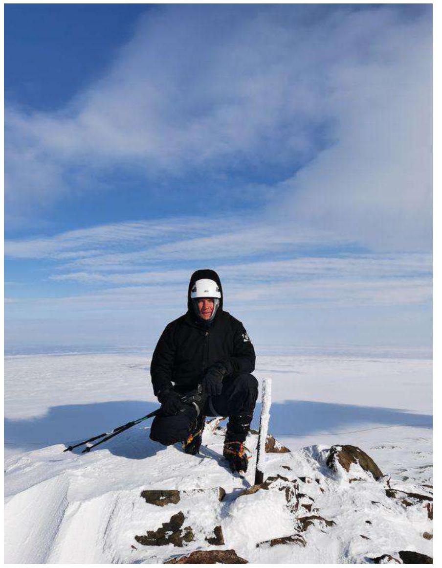
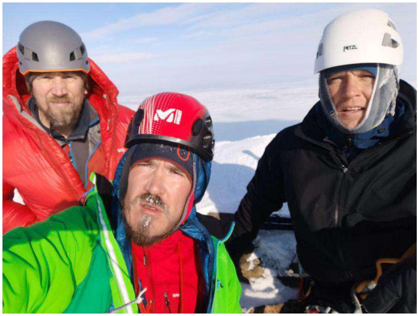
3.2. Team Photo at the Summit
Photo № 14.
3.3. Route Safety Assessment
The route is well observable and logical in terms of navigation. It is very good for cultivating moral and volitional qualities. It belongs to combined educational and sports routes of category 2 complexity. It allows for the training of a group in traversing all forms of mountainous terrain. For this route, good preparation in traversing combined terrain is required.
«The Norilsk mountains essentially represent a plateau, constituting the most north-western extremity of the vast mountainous country — the Putorana Plateau of the Central Siberian Plateau, stretching across the entire space between the Yenisei and Lena north of the Nizhnyaya Tunguska. Wide and deep valleys divide this plateau into a series of table-topped elevations, one of which is the Norilsk Plateau. It is also not monolithic but is further divided into a series of individual flat-topped mountains. The most western of these — a high, up to 600 m, table mountain, effectively terminating to the north towards the Norilsk valley, was named Medvezhiy Kamen (Bear Rock) by Middendorf».
Later, Nikolai Urvantsev renamed Medvezhiy Kamen to Mount Schmidt — in honor of Fyodor Schmidt, the first scientist to visit Norilsk. Urvantsev's expedition also named other peaks in the Norilsk mountains: Rudnoy, Nadezhda, Bariernaya, Guchikha. These toponyms are still present on maps of Taymyr. Incidentally, if one looks at the map, the Norilsk mountains are not a separate "piece" of the Putorana Plateau but are part of the Lontokoy Kamen ridge (on some maps, Longdokoy Kamen), occupying a vast space between Norilsk and the Khantayskoye reservoir. To the south of the ridge lies Mount Lontoko, apparently giving its name to this entire elevation.
https://gazetazp.ru/news/gorod/55600000-goryi-kotoryie-nelzya-pokorit.html ↗
South of the Taymyr Peninsula, in the North-Western part of the Putorana Plateau (Lontokoy Kamen Plateau), in the valley of the Ergalah river. The peak Bolshaya Bariernaya (583.3 m) is located in the north-eastern part of Mount Guchikha (683.4 m).
How to Reach the Route
From Norilsk's bus station by city bus:
- № 6 Medny Zavod — HKC;
- № 11 Avtovokzal — HKC.
Travel to the final stop "HKC". 100 m along the direction of the bus — a railway crossing. After the railway crossing, follow the dirt road towards the industrial waste dump for 1.2 km to the road turn, then turn right and move perpendicular to the road towards Bolshaya Bariernaya mountain to the 4th buttress.
Route Description
The route begins with an ascent along small scree towards the 4th buttress. From below, the buttress is marked by a large triangular rock bastion. On the 5th buttress, a pronounced gendarme serves as a landmark. We approach the rocks, press against the right edge, and begin movement in rope teams, insuring simultaneously and making intermediate points from loops on outcrops. We reach a snow shelf and see a large gendarme of the 5th buttress on the right. We then move upwards along a destroyed ridge with a slight incline. We approach rocks, which we bypass on the right on firm snow, insuring simultaneously and laying the rope around outcrops. We reach a large rock bastion, which we bypass on the left on firm snow, pressing against the rocks for intermediate points on stoppers. Before us, we see another large rock bastion with exits to the right and left; we need to go left and make a stance on anchors under the bastion. Bypassing the bastion, we press against it and move upwards on snow-covered rocks. Intermediate points on anchors and slings. The first participant needs to be very attentive as there are inclined slabs under the snow. We insure alternately. After reaching a large terrace, the further path to the summit is straightforward and technically not challenging, with an average slope angle of 25° and consisting of firm snow and partially closed medium scree. In places, the scree is open with icy stones. In poor weather conditions, when the summit is not visible, it is better to follow along the rock cliff, but not too close (due to snow cornices). On the summit, a pipe protrudes from a borehole.
The descent from the summit follows the Category 1B route, located to the left of the large couloir; it's better not to enter the couloir. On the key section of the descent (after the large scree terrace), for a large group, it is recommended to hang fixed ropes for a quicker and safer descent.
In any case, here is another technical photograph of the route in better quality.
Comments
Sign in to leave a comment