
Report on the First Ascent to the summit of Bolshaya Barrierная via Orlov's Route, Category 1B, on April 2, 2021
1. Object Description
| № | 1. General Information | |
|---|---|---|
| 1.1 | Full Name, sports rank of the team leader | Orlov Dmitry Sergeevich, 2nd sports rank in alpinism |
| 1.2 | Full Name, sports rank of the participants | Ryabinin Vasily Viktorovich, 3rd sports rank in alpinism |
| 1.3 | Full Name of the coach | |
| 1.4 | Organization | |
| 2. Characteristics of the ascent object | ||
| 2.1 | Region | Putorana Plateau |
| 2.2 | Valley | Lontokoy Kamen Plateau |
| 2.3 | Section number according to the 2013 classification table | 9 |
| 2.4 | Name and height of the summit | Gora Bolshaya Barrierная 583 m |
| 2.5 | Geographic coordinates of the summit (latitude, longitude), GPS coordinates | Latitude 69.288670° N, Longitude 88.281369° E |
| 3. Characteristics of the route | ||
| 3.1 | Name of the route | Orlov's Route via the North-Eastern counterfort |
| 3.2 | Proposed category of difficulty | 1B winter |
| 3.3 | Degree of route development | First ascent |
| 3.4 | Character of the route relief | Combined |
| 3.5 | Height difference of the route (altimeter or GPS data) | 595 m according to the altimeter |
| 3.6 | Route length (in meters) | 1840 |
| 3.7 | Technical elements of the route (total length of sections of various difficulty categories with indication of relief character (ice-snow, rock)) | I category ice-snow – 358 m. II category ice-snow – 166 m. III category combination – 71 m. |
| 3.8 | Descent from the summit | Category 1B, via the ascent route |
| 3.9 | Additional characteristics of the route | Loose rocks on the key section |
| 4. Characteristics of the team's actions | ||
| 4.1 | Time of movement (team's travel hours, in hours and days) | 3 hours 6 minutes (from the starting point to the same location) |
| 4.2 | Overnight stays | No overnight stays |
| 4.3 | Start of the route | April 2, 2021, 10:24 |
| 4.4 | Reaching the summit | April 2, 2021, 12:37 |
| 4.5 | Return to the base camp | April 2, 2021, 13:30 |
| 5. Person responsible for the report | ||
| 5.1 | Full Name, e-mail | Orlov Dmitry Sergeevich, mr.dmitriiorlov@yandex.ru |
II. Ascent Description
1. Characteristics of the Ascent Object
1.1. General photo of the summit
Photo № 10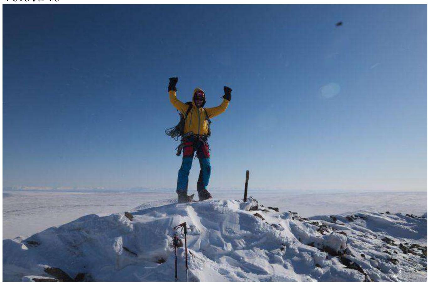
1.2. Profile photo
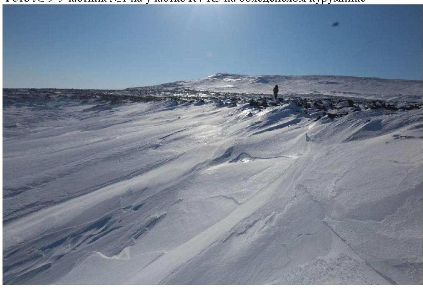
Photo № 1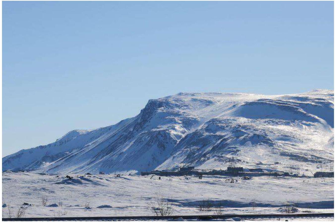
1.3. Photopanorama
Photo № 2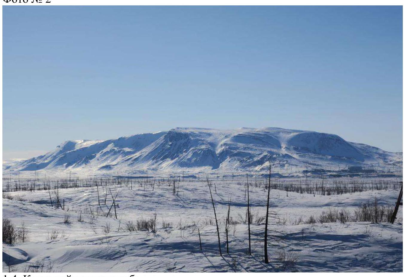
1.4. Map of the area
2. Characteristics of the Route
2.1. Technical photograph of the route
Photo № 3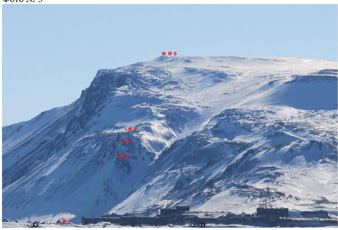
2.2. Participant numbers on the technical photograph
Photo № 4. Participant № 1 on R2 under the gendarme at the start of the key section.
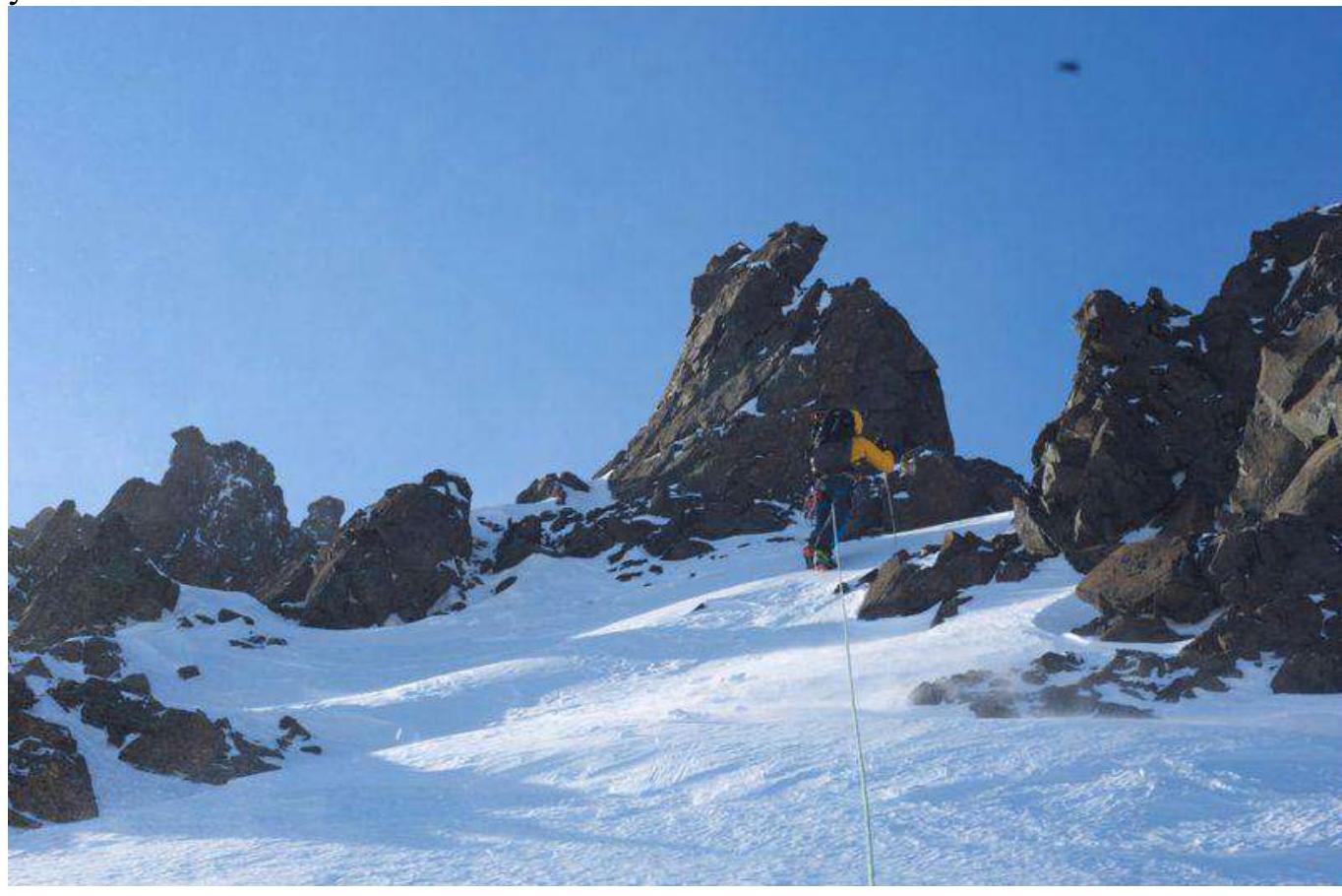
Photo № 5. Participant № 2 on section R1–R2 to the right of the large couloir after the snow knife.
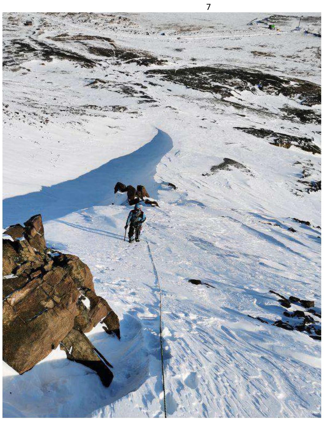
Photo № 6. Participant № 1 on section R2–R3 on one of the couloirs on the key section of the route
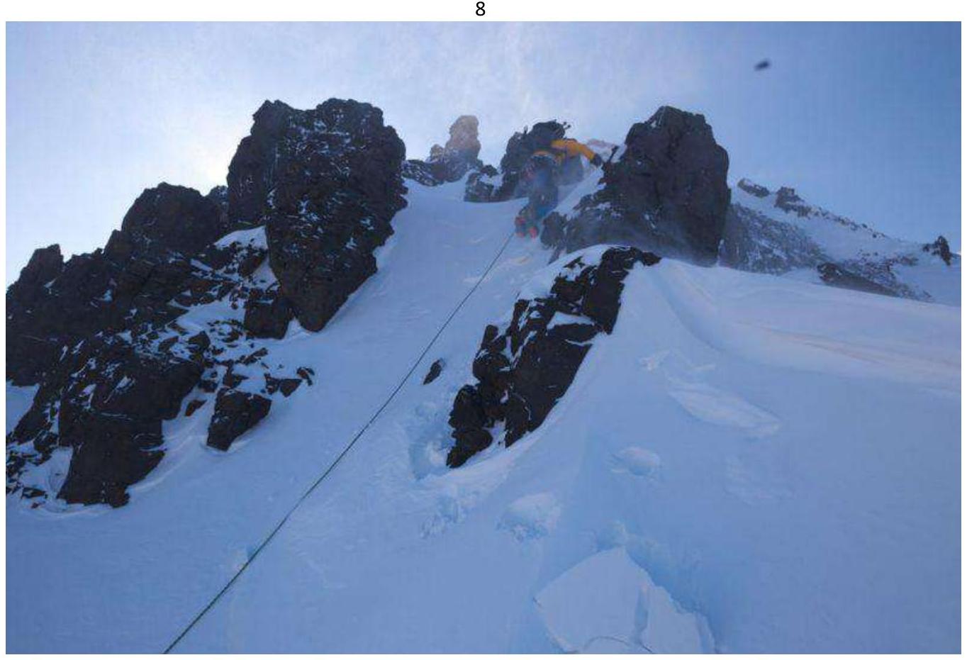
Photo № 7. Participant № 1 on section R3–R4 on the key of the route
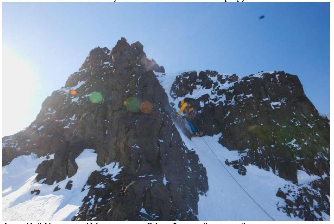
Photo № 8. Participant № 1 on section R4 on the large talus terrace after the key, from where the summit and the further ascent path are visible.
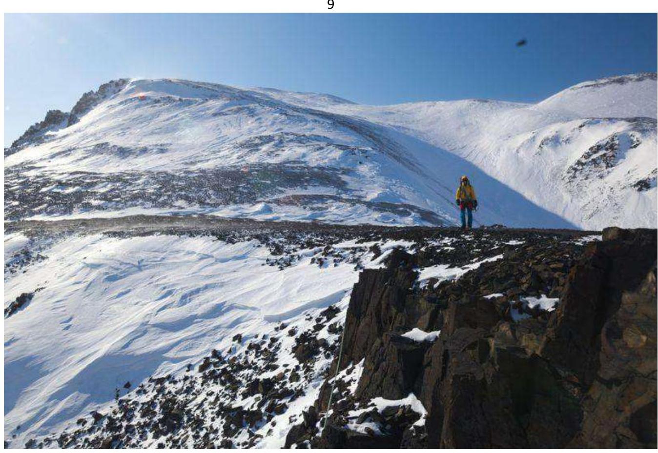
Photo № 9. Participant № 1 on section R4–R5 on the frozen scree
2.3. Technical characteristics of the route sections
| Section № | Relief character | Category of difficulty | Length, m | Type and number of hooks |
|---|---|---|---|---|
| R1–R2 | Ice-snow | 2 | 166 | none |
| R2–R3 | Combination | 2 | 55 | none |
| R3–R4 | Combination | 3 | 16 | none |
| R4–R5 | Ice-snow | 1 | 358 | none |
3. Character of the Team's Actions
3.1. Brief description of the route passage
| Section № | Description | Photo № |
|---|---|---|
| R1–R2 | Firned snow, angle of inclination from 20° to 40°, simultaneous belay, movement in crampons with ice axes. Occasionally movement on the front crampon points. | № 5 |
| R2–R3 | Firned snow, angle of inclination from 40° to 60°. Alternating belay, stations from loops on rock outcrops. | № 6 |
| R3–R4 | Snow-covered rocks and firn. Alternating belay. | № 7 |
| R4–R5 | Firned snow, closed medium scree, open medium scree with frozen stones. | № 9 |
3.2. Photo of the team on the summit
Photo № 11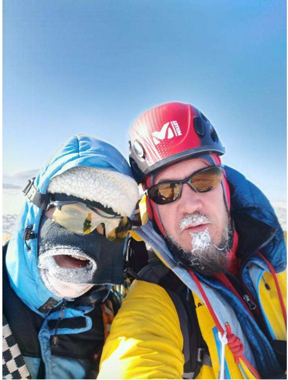
3.3. Safety assessment of the route.
The route is clearly visible, logical in orientation. It is very good for developing moral and volitional qualities. It belongs to combined educational and sports routes of category 1B. It allows working out the movement on all forms of mountain relief with a training group.
«The Norilsk mountains, in essence, represent a plateau that is the most northwestern extremity of the vast mountain country — the Putorana Plateau of the Central Siberian Plateau, stretching across the entire space between the Yenisei and Lena rivers north of the Nizhnyaya Tunguska River. Wide and deep valleys divide this plateau into a series of tabular elevations, one of which is the Norilsk Plateau. It is also not monolithic, but in turn is divided into a number of separate flat-topped mountains:
- The most western of them — a high, up to 600 m, tabular mountain, effectively terminating to the north, to the Norilsk valley, Middendorf named it the Medvezhy Kamen cliff».
Later, Nikolai Urvantsev renamed Medvezhy Kamen to Gora Schmidt — in honor of Fyodor Schmidt, the first scientist to visit Norilsk. Urvantsev's expedition gave names to other peaks of the Norilsk mountains:
- Rudnoy,
- Nadezhda,
- Barrierная,
- Gudchikha.
These toponyms are still present on the maps of Taymyr. By the way, if you look at the map, the Norilsk mountains are not a separate "piece" of the Putorana Plateau, but are part of the Lontokoy Kamen ridge (on some maps Lоngdokoy Kamen), which occupies a vast space between Norilsk and the Khantayskoye Reservoir. To the south of the ridge lies Gora Lontoko, apparently giving its name to this entire elevation.
https://gazetazp.ru/news/gorod/55600000-goryi-kotoryie-nelzya-pokorit.html ↗
South of the Taymyr Peninsula, northwestern part of the Putorana Plateau (Lontokoy Kamen Plateau), Ergalah River valley. The summit of Bolshaya Barrierная (583.3 m) is located in the northeastern part of Gora Gudchikha (683.4 m).
How to reach the route
From Norilsk city bus station by city bus:
- № 6 Medny Zavod — HKC;
- № 11 Avtovokzal — HKC.
Travel to the final stop "HKC". 100 m in the direction of the bus movement — railway crossing. After the railway crossing, along the dirt road in the direction of the industrial dump, walk 1.2 km to the road turn, then turn right and move perpendicular to the road towards Gora Bolshaya Barrierная to the couloir about 0.7 km to the start of the route.
Route
The route passes to the left along the counterfort from the large couloir. The beginning of the route starts along the snow knife towards the rocks, the angle of ascent is 30°. Simultaneous belay. The rocks are bypassed on the left, the angle of ascent increases to 40°. We reach the gendarme, from which the key section of the route begins. The gendarme is bypassed on the left. We ascend upwards along a series of small couloirs, bypassing the gendarmes, the direction of the bypass is logical, intuitively understandable. Alternating belay, stations on outcrops. The angle of inclination is more than 50°. The last couloir is the key to the route, has an angle of inclination of 65° and 16 m height difference, in places climbing on snow-covered rocks. Further, the route leads to a large talus terrace, from where we continue moving upwards towards the summit. Further, the angle of ascent is on average 25° and represents firned snow and in places closed medium scree. In places, the scree is open with frozen stones. In poor weather conditions, when it is impossible to see the summit, it is better to move along the rocky cliff, but not too close (snow cornices). On the summit, a pipe sticks out of a borehole.
The descent from the summit follows the ascent route; on the key section, it is recommended to hang a rope for a faster and safer descent for a large group.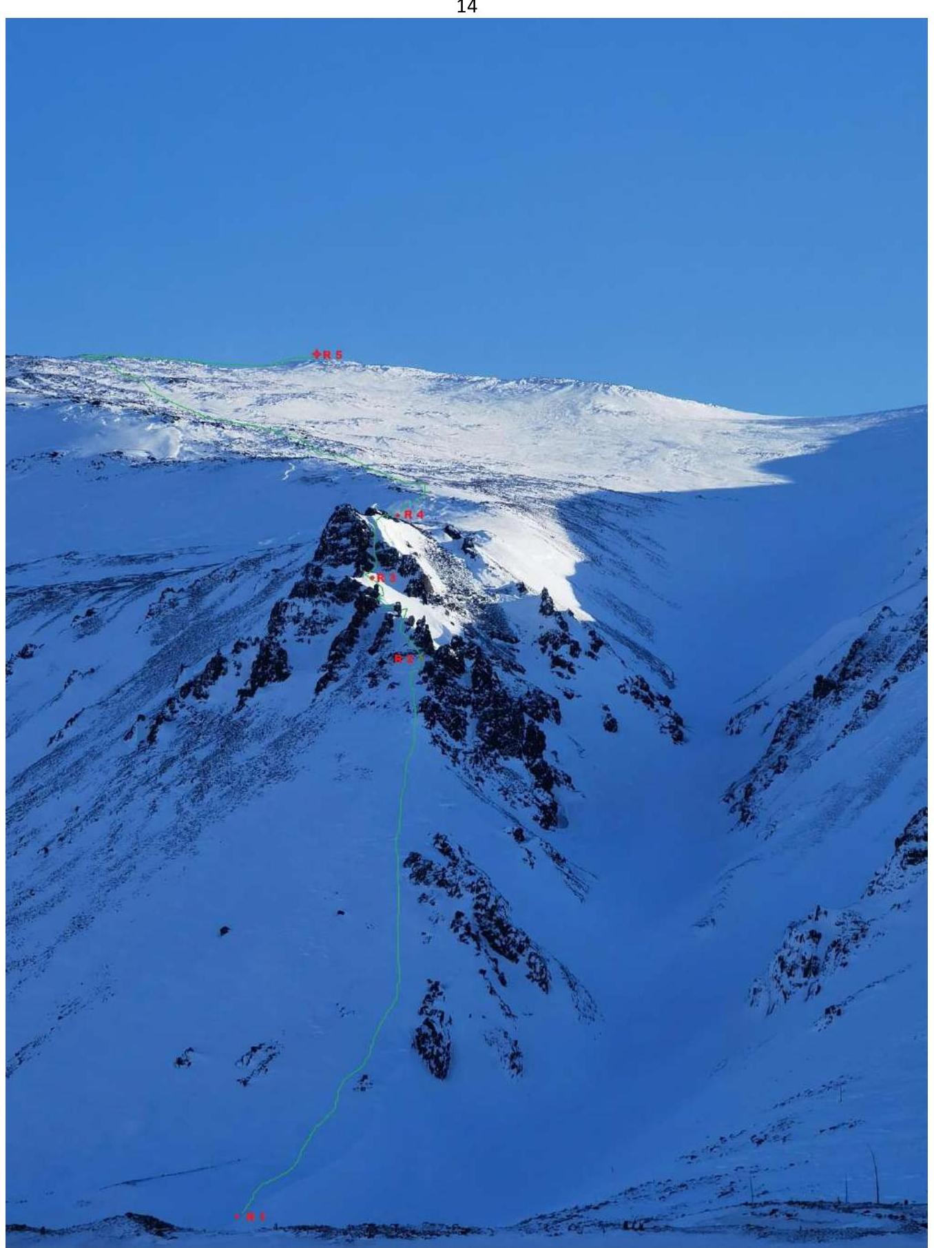
Just in case, another technical photograph of the route, taken later on a different day!
Comments
Sign in to leave a comment