Far Eastern and Siberian Federal Districts Alpine Climbing Championship 2024 in the High-Altitude Technical Category
Report
On the ascent to the summit of Begemot 1600 m, in the Altai Republic via the route "Podkustovnyy vypolzень" on the South wall, category 5B (rocky terrain) by a team from the Altai Krai from October 26 to 28, 2024.
Team members:
- Trufanov M.S. — Master of Sports
- Zanina N.N. — 2nd sports category
- Chernenko V.O. — 1st sports category
I. Ascent Passport
| № | 1. General Information | |
|---|---|---|
| 1.1 | Full name, sports rank of the team leader | Trufanov Maxim Sergeevich, Master of Sports |
| 1.2 | Full name, sports rank of team members | Zanina Natalia Nikolaevna, 2nd sports category, Chernenko Vadim Olegovich, 1st sports category |
| 1.3 | Full name of the coach | Guselnikov Viktor Mikhailovich, Master of Sports |
| 1.4 | Organization | ARSOC "FA "Voshozhdenie" Altai Krai |
| 2. | Characteristics of the ascent object | |
| 2.1 | Region | Ongudai region, Altai Republic. Chuya river watershed |
| 2.2 | Ridge | Aigulak ridge |
| 2.3 | Number according to the 2020 classification table | 1.5 ALTAI |
| 2.4 | Name and height of the summit | Begemot, 1600 m |
| 2.5 | Geographic coordinates of the summit (latitude/longitude), GPS coordinates | 50.351942, 87.220562 |
| 3. | Characteristics of the route | |
| 3.1 | Route name | "Podkustovnyy vypolzень" |
| 3.2 | Proposed category of difficulty | 5B |
| 3.3 | Degree of route development | Second ascent |
| 3.4 | Route terrain type | Rocky |
| 3.5 | Route elevation gain (according to GPS data) | 400 m (250 m wall section) |
| 3.6 | Route length (in meters) | 605 m (294 m wall section) |
| 3.7 | Technical elements of the route (total length of sections with different categories of difficulty, indicating terrain type) | Entirely rocky terrain 1st cat. diff. — 342 m 2nd cat. diff. — 0 m 3rd cat. diff. — 20 m 4th cat. diff. — 25 m 5th cat. diff. — 93 m 6th cat. diff. — 108 m Including 86 m of artificial aids A1 — 2 m A2 — 12 m A3 — 54 m A1e — 2 m A2e — 16 m |
| 3.8 | Descent from the summit | Via the ascent route |
| 3.9 | Additional route characteristics | |
| 3.10 | Equipment used | 10 rock anchors, 2 sets of friends up to 2" (BD 4s and 1x 5 BD), set of nuts, 12 quickdraws, pitons, Talon skyhooks |
| 4. | Characteristics of team actions | |
| 4.1 | Time on the move (team's walking hours) excluding approaches (climbing + rappelling) | 23 hours |
| 4.2 | Overnight stays | At a clearing near the Chuya river |
| 4.3 | Departure and return to base camp | October 26, 2024, 9:00 to 19:00, October 27, 2024, 9:00 to 19:00, October 28, 2024, 9:00 to 19:00 |
| 4.4 | Summit arrival | October 28, 2024, 16:00 |
| 4.5 | Return to base camp | 19:00 |
| 5. | Person responsible for the report | |
| 5.1 | Full name, e-mail | Trufanov M.S., maxtru1@rambler.ru, +7 961 991–13–48 |
II. Ascent Description
1. Characteristics of the Ascent Object
1.1. General photo of the route

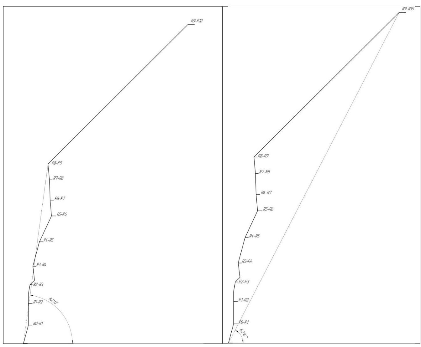
1.2. Hand-drawn profile of the route
1.3. Map of the ascent object
The ascent object is located 410 km from Biysk (6 hours by car) and 326 km from Gorno-Altaisk (4 hours by car). The nearest settlement is Chibit, 25 km away, with shops and mobile phone coverage. A hospital with an emergency room is available in Aktash (10 km further from Chibit along the Chuya highway).
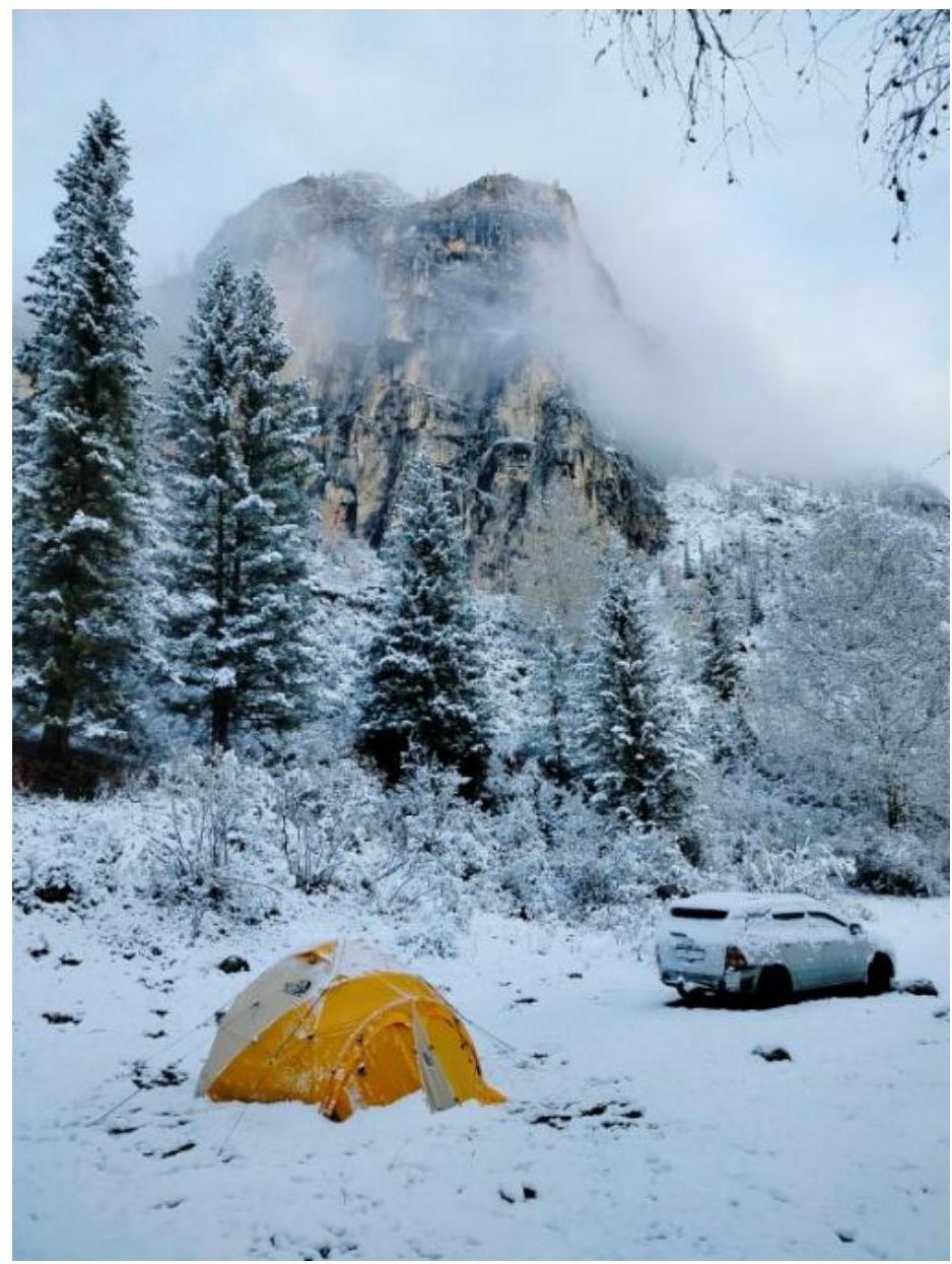
The Shirlak waterfall ("Devichye Slezzy") on the western slope of Begemot can be used as a navigation point. The car can be parked at the large parking lot under the waterfall. For a bivouac, one can descend on foot or by a steep dirt road with large boulders to the Chuya river, where there are nice clearings for a tent. Water can be collected from the waterfall or the Chuya river if there's no flood or spring thaw. One can also drive 3 km further along the highway and collect water from the cleanest Aigulak stream, which has the tastiest and cleanest water available in the area.
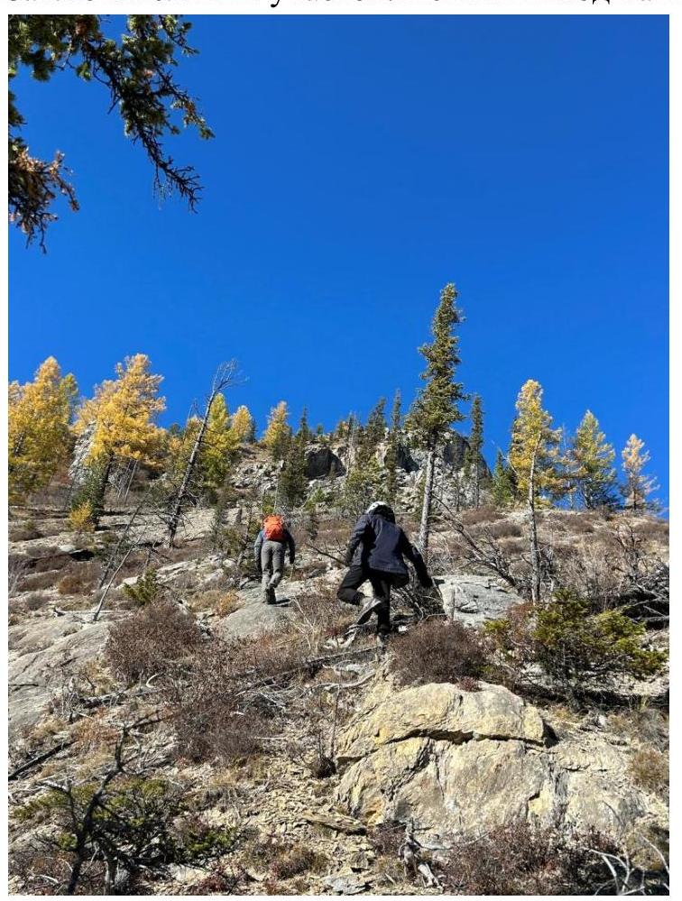
The ascent to the route from the river campsite with a load takes about half an hour. It's worth examining the path from the road and choosing the least overgrown areas with small thorny bushes.
Map №1

2. Route Characteristics
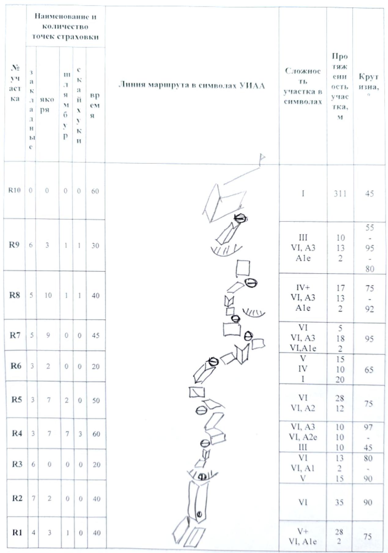
2.1. Route scheme in UIAA symbols
| № | Anchors | Pitons | Friends | Nuts | Slack | Section difficulty in symbols | Section length, m | Angle, ° |
|---|---|---|---|---|---|---|---|---|
| R10 | 0 | 0 | 0 | 0 | 60 | 1 | 311 | 45 |
| R9 | 6 | 3 | 1 | 1 | 30 | 3, 6, A3, A1e | 10, 13, 2 | 95 |
| R8 | 5 | 10 | 1 | 1 | 40 | 4+, 6, A3, A1e | 17, 13, 2 | 92 |
| R7 | 5 | 9 | 0 | 0 | 45 | 6, A3, A1e | 5, 18, 2 | 95 |
| R6 | 3 | 2 | 0 | 0 | 20 | 5, 4, 1 | 15, 10, 20 | 65 |
| R5 | 3 | 7 | 2 | 0 | 50 | 6, A2 | 28, 12 | 75 |
| R4 | 3 | 7 | 7 | 3 | 60 | 6, A3, A2e, 3 | 10, 10, 10 | 97, 45 |
| R3 | 6 | 0 | 0 | 0 | 20 | 6, A1, 5 | 13, 2, 15 | 80, 90 |
| R2 | 7 | 2 | 0 | 0 | 40 | 6 | 35 | 90 |
| R1 | 4 | 3 | 1 | 0 | 40 | 5+, A1e | 28, 2 | 75 |
3. Characteristics of Team Actions
On the first day, Zanina N.N. worked on the first three sections. The line is logical and direct through the overgrown inner corner with a series of overhangs, leading to the shoulder. Climbing was intense due to the specifics of the rock and the fact that the inner corner was overgrown, partially wet, and the rock was damaged. Section difficulty was 5-6 category, with artificial aids A1. After completing the sections, they left the ropes and descended via rappelling to the campsite.
On the second day, Chernenko V.O. worked on the next three sections, which were more monolithic. There was movement on skyhooks, and overhanging sections up to 90° appeared. Climbing was intense due to the wall's slope and scarcity of relief for setting up protection. Section difficulty was 5-6 category, with artificial aids A2. After completing the sections, they left the ropes and descended via rappelling to the campsite.
On the third day, Trufanov M.S. worked on the final four sections. Three were technical, and the fourth was an extended section leading to the summit along the slope. Climbing was incredibly intense due to overhanging sections and damaged rock. Section difficulty was 5-6 category, with artificial aids A3. They finished the technical sections by 14:00, removed the equipment, and walked to the summit. They reached the summit at 16:00, rested, and then rappelled down to the starting point via the ascent route, straightening the ropes. They walked back to the campsite by 19:00.
Snow fell on the clearing at night, but since the wall faces south, it had time to dry out.
3.1. Photos of work on sections
Zanina N. at the end of the first section:
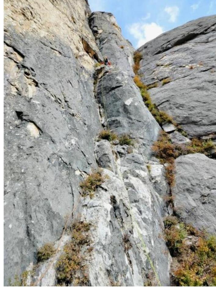
Zanina N. at the start of the second section:
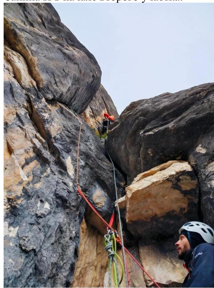
Chernenko V. passing a cornice:
Chernenko V. passing another cornice:
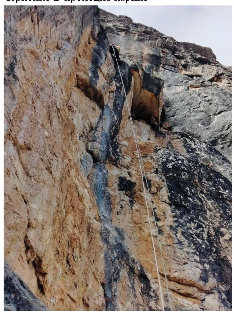
Trufanov M. passing a damaged overhanging inner corner:
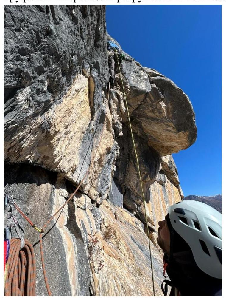
Trufanov M. passing a damaged cornice:

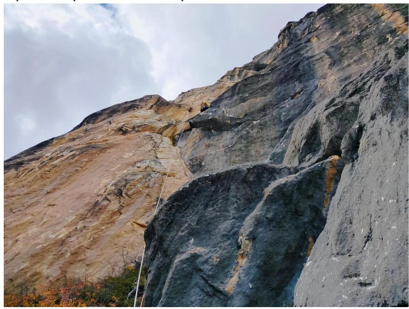
Final section. Walking to the summit:
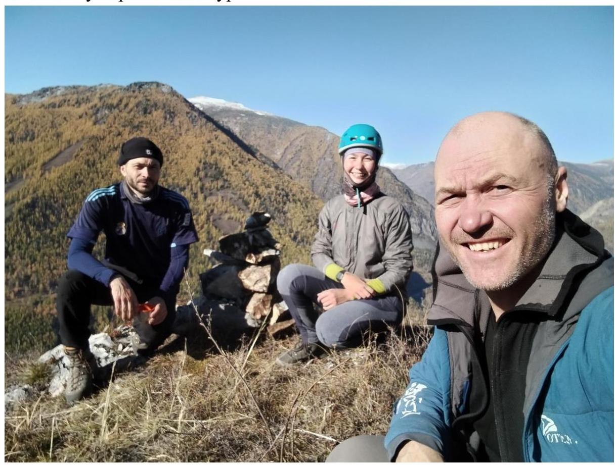
3.2. Photos at the summit