Report
on the first ascent route
To the summit of Begemot
1600 m
Altai Republic, Shirlak waterfall area
Route "Podkustovnyy vypolzzen'"
via the southern wall proposed 5B cat. diff. (rock) April 21, 2024
Participants
Temerev Ivan Mikhailovich, Master of Sports Khasanov Nail Albertovich, 2nd sports category
I. Ascent Passport
| № | 1. General Information | |
|---|---|---|
| 1.1 | Full name, sports rank of the leader | Temerev Ivan Mikhailovich, Master of Sports |
| 1.2 | Full name, sports rank of the participants | Khasanov Nail Albertovich, 2nd sports category |
| 1.3 | Full name of the coach | Temerev Ivan Mikhailovich, Master of Sports |
| 1.4 | Organization | Tomsk Alpinism Federation regional public organization |
| 2. Characteristics of the Ascent Object | ||
| 2.1 | Area | Ongudaysky District, Altai Republic. Chuya River watershed |
| 2.2 | Ridge | Aygulak Ridge |
| 2.3 | Section number according to the 2020 classification table | 1.5 Altai |
| 2.4 | Name and height of the summit | Begemot, 1600 m |
| 2.5 | Geographical coordinates of the summit (latitude/longitude), GPS coordinates | 50.351942, 87.220562 |
| 3. Route Characteristics | ||
| 3.1 | Route name | "Podkustovnyy vypolzzen'" |
| 3.2 | Proposed category of difficulty | 5B |
| 3.3 | Route освоенности | First ascent |
| 3.4 | Route terrain | Rock |
| 3.5 | Route elevation gain (GPS data) | 400 m (250 m wall section) |
| 3.6 | Route length (in meters) | 605 m (294 m wall section) |
| 3.7 | Technical elements of the route (total length of sections with different categories of difficulty and terrain type) | Entirely rock terrain: I — 342 m, II — 0 m, III — 20 m, IV — 25 m, V — 93 m, VI — 108 m. Including artificial aids: 86 m, A1 — 2 m, A2 — 12 m, A3 — 54 m, A1e — 2 m, A2e — 16 m. |
| :--: | ||
| 3.8 | Descent from the summit | Via the ascent route with a 70 m rope — 4.5 sections. Possible with 50 m rope, but 8 sections. All stations have bolt anchors. Alternatively, on foot to the west, one rappel from the ridge to the slope, on foot to the stream, and then 1 rappel along the waterfall. Work is underway to equip the last section with pitons. |
| 3.9 | Additional route characteristics | Thanks to Tomsk Alpinism Federation regional public organization for the insurance points. |
| 3.10 | Equipment used | 10 rock anchors, 2 sets of friends up to 2" (including 4 and 5 BD), set of stoppers, 12 quickdraws, angle grinders, Talon skyhooks. |
| 4. Team Actions Characteristics | ||
| 4.1 | Time taken (team's total climbing hours) | 12.5 (leader's work 5.75) |
| 4.2 | Overnight stays | At a clearing near the Chuya River |
| 4.3 | Start of the ascent | April 20, 2024, from 12:40 to 19:00, April 21, 2024, from 11:00 to 17:20 |
| 4.4 | Reaching the summit | April 21, 2024, at 18:00 |
| 4.5 | Return to the base camp | 20:00 |
| 5. Person Responsible for the Report | ||
| 5.1 | Full name, e-mail | Temerev I.M., ivantem-79@yandex.ru, +7 913 848 05 59 |
II. Ascent Description
1. Characteristics of the Ascent Object
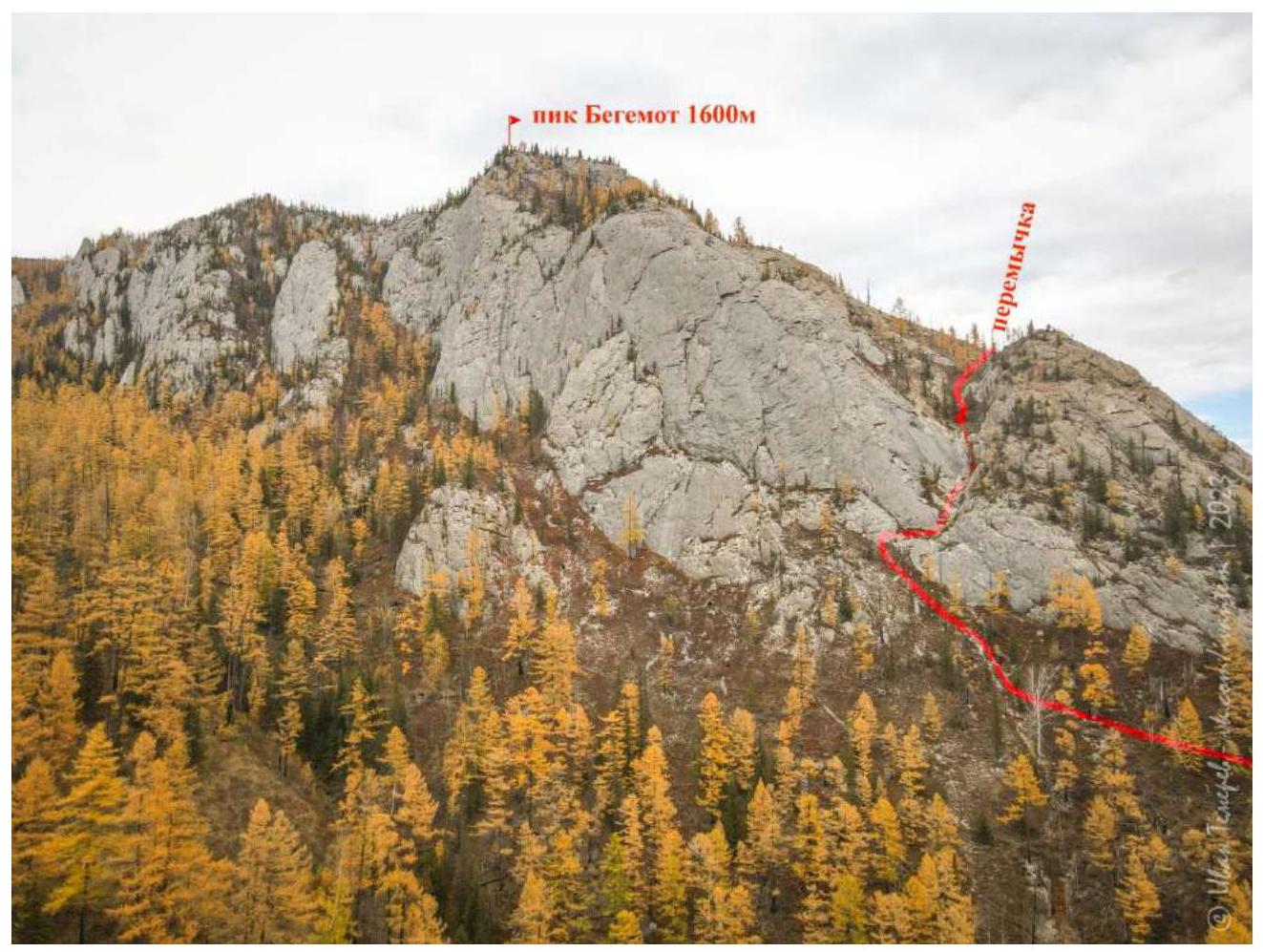
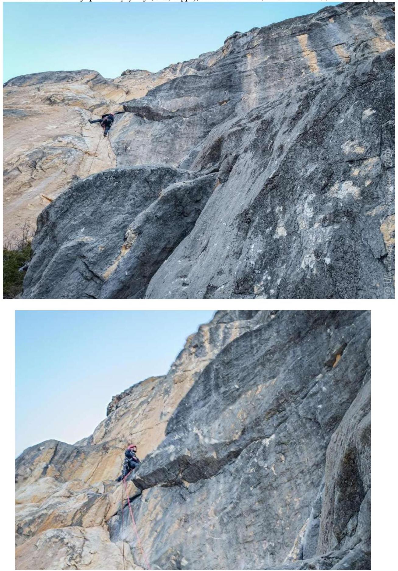
1.1. General photo of the summit
Photo №1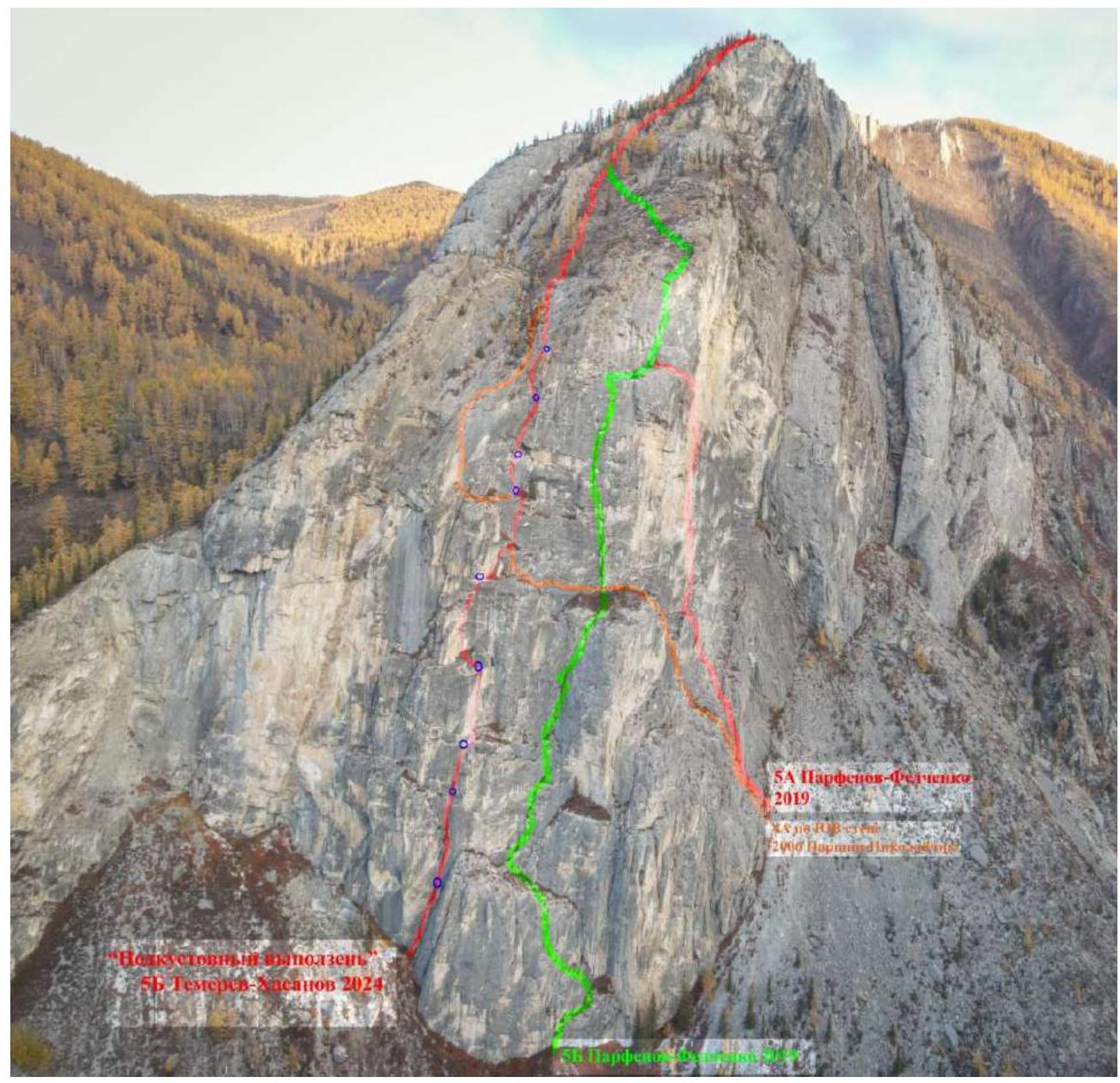
Photo №2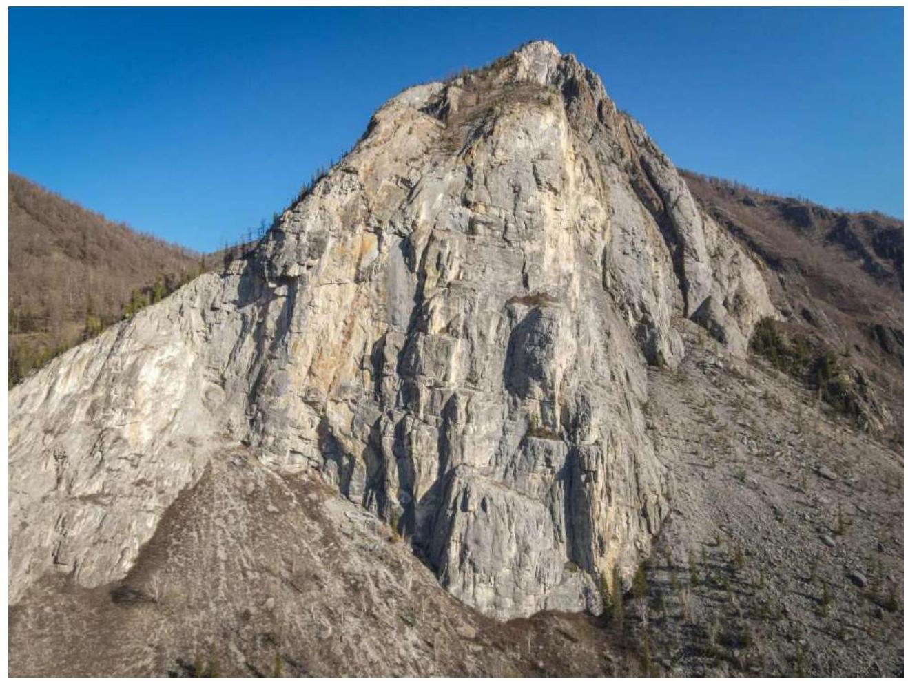
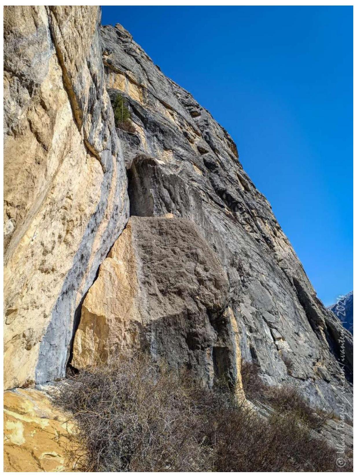
1.2. Route profile photo
Photo №3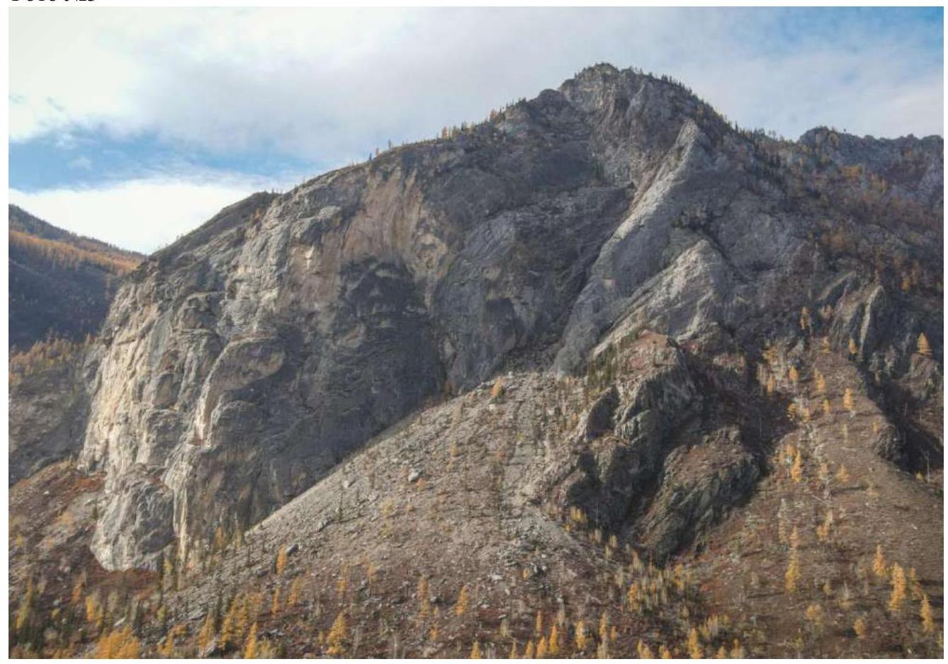
Photo №4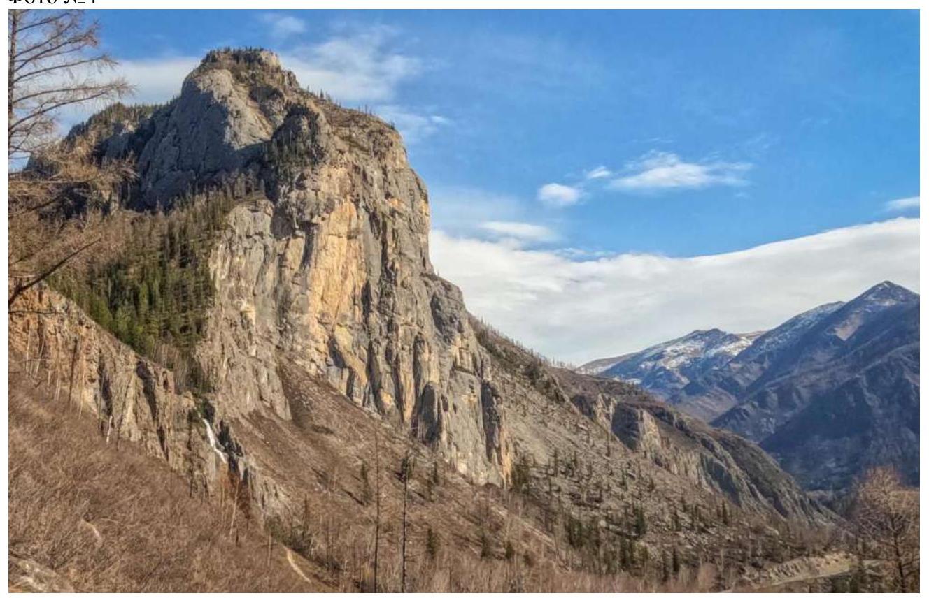
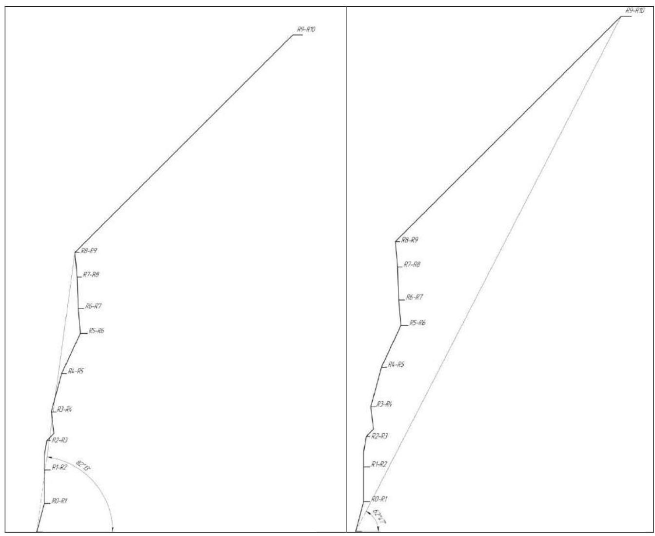
1.3. Hand-drawn route profile
1.4. Ascent object map
The ascent object is located 410 km from Biysk (6 hours by car) and 326 km from Gorno-Altaisk (4 hours by car). The nearest settlement is Chibit village — 25 km away, with shops and mobile phone coverage. A hospital with an emergency department is definitely available in Aktash village (further from Chibit along the Chuya highway by 10 km).
The Shirlak waterfall (“Deviich’i slezy”) on the western slope of Begemot can be used as a reference point in the navigator. The car can be left at the large parking lot under the waterfall. For a bivouac:
- you can walk down to the Chuya River,
- or descend via a steep dirt road with large boulders to the Chuya River.
There are excellent clearings for a tent. Water can be collected:
- from the waterfall,
- or from the Chuya River if there is no flood or spring thaw.
You can also drive further from Begemot about 3 km along the highway and collect water from the crystal-clear Aygulak stream. It has the tastiest and cleanest water among all available in this location.
It takes about half an hour to reach the route from the river campsite with a load. It's worth reviewing the path from the road and choosing areas with the least overgrowth of small thorny bushes.
Map №1
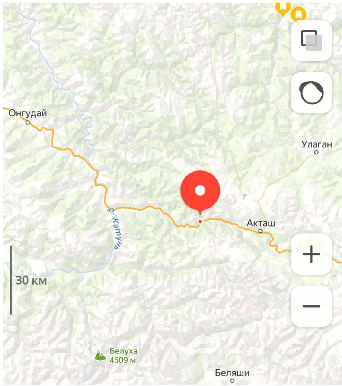
Map №2
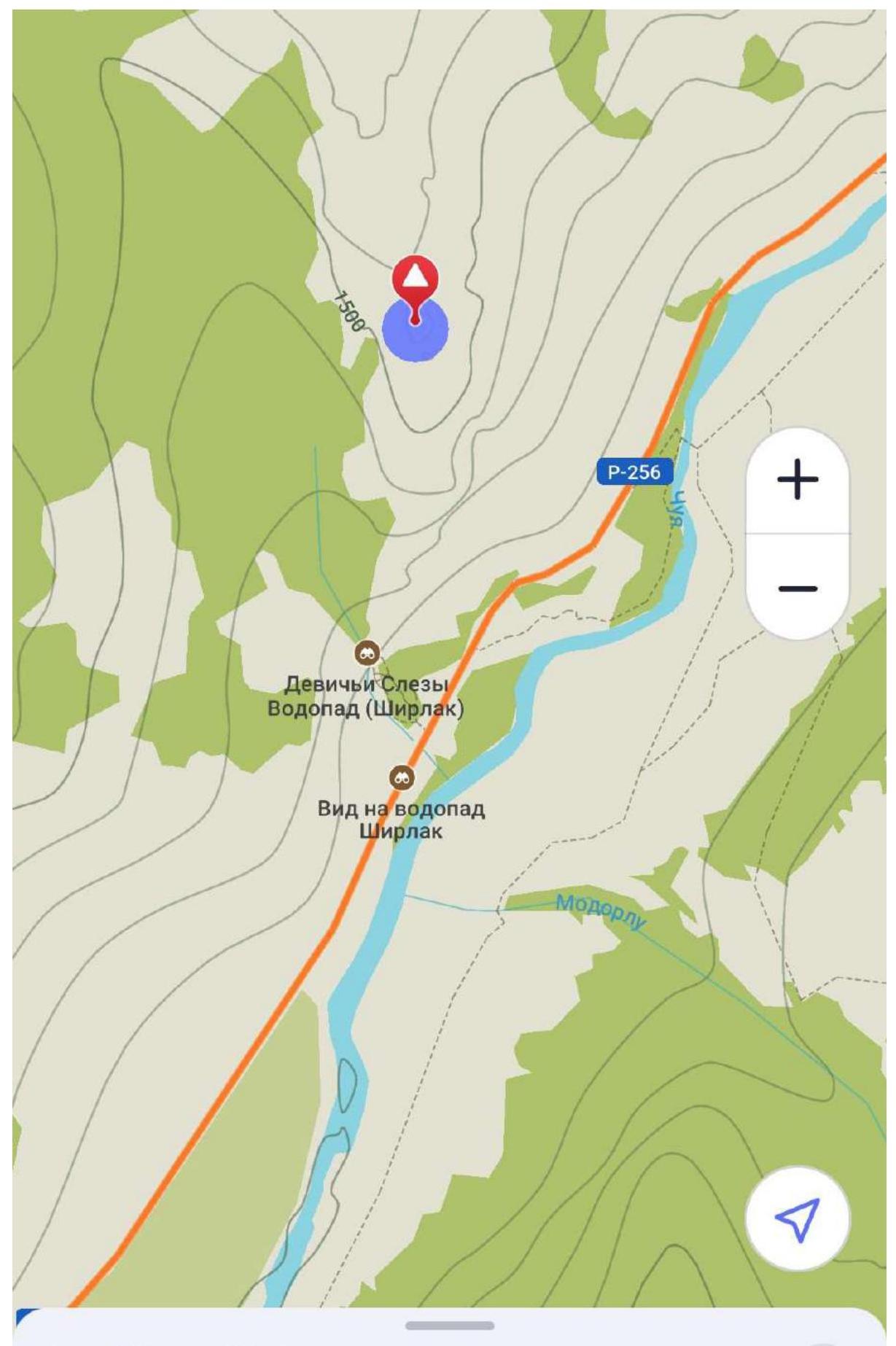
My Marks • Mountain Begemot summit
2. Route Characteristics
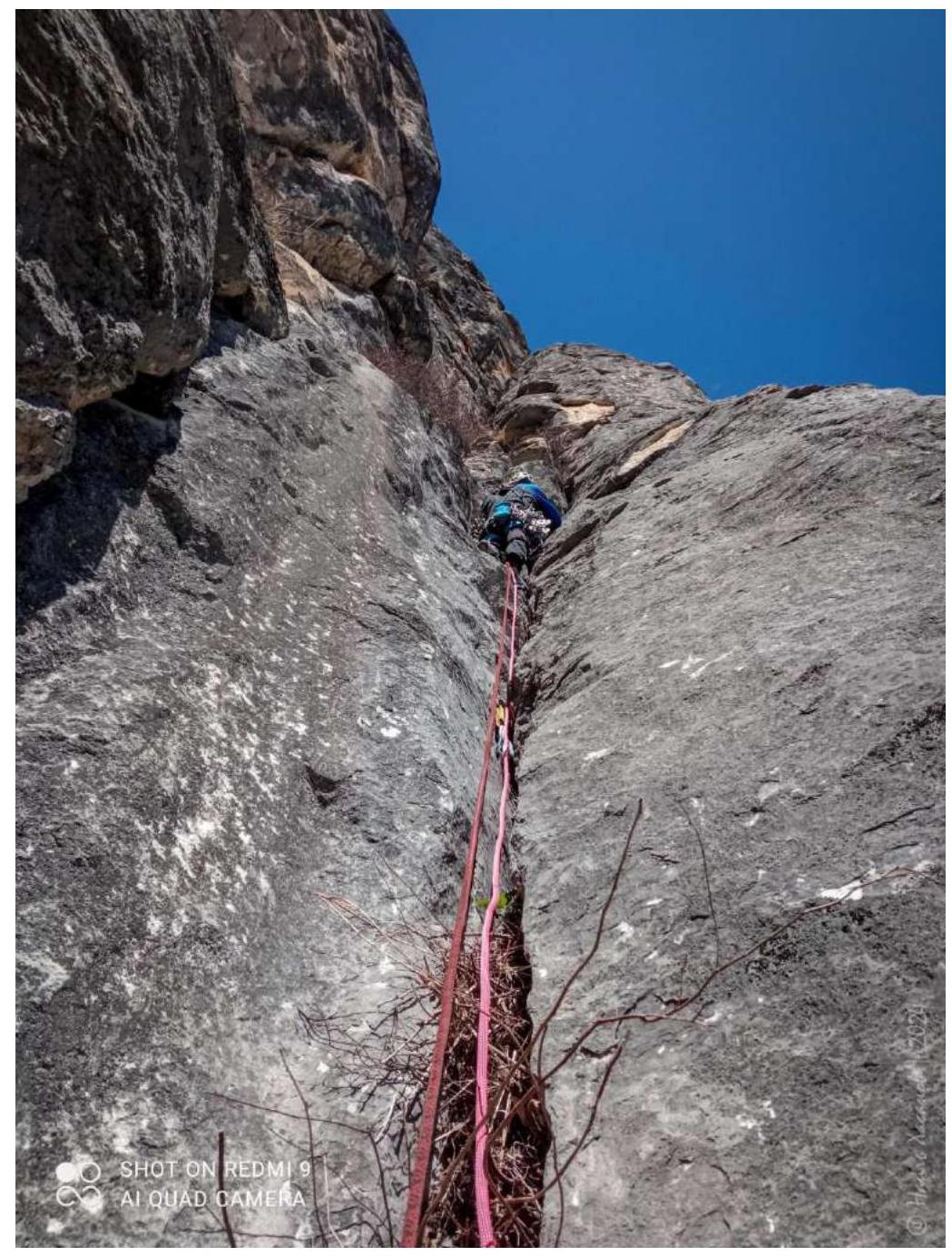
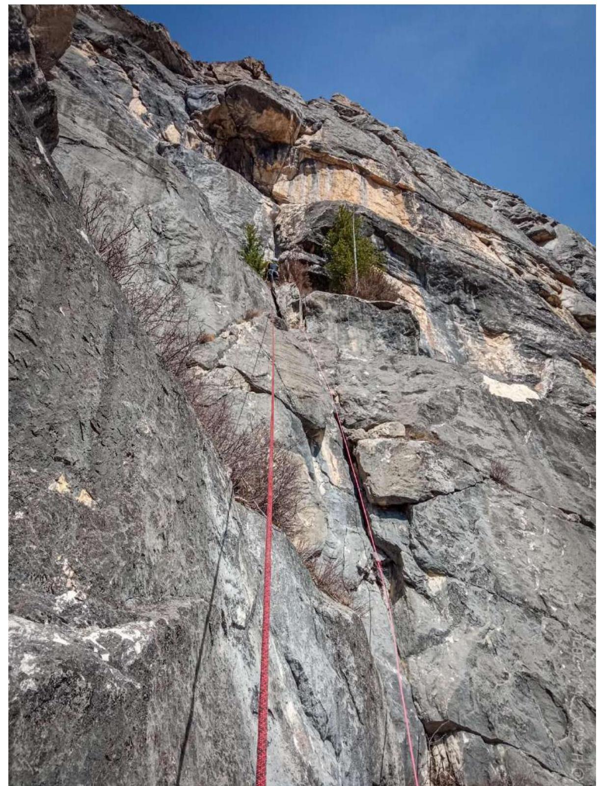
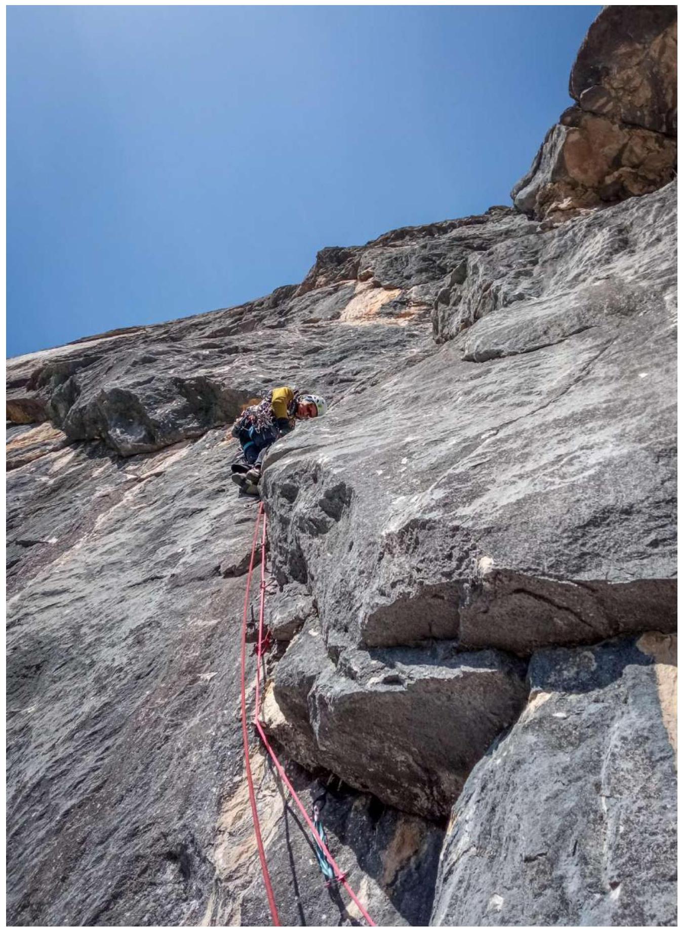
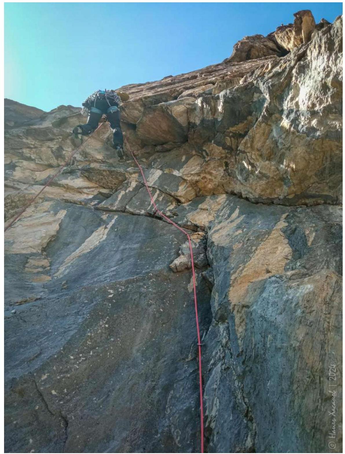
2.1. Technical photo of the route
Photo №5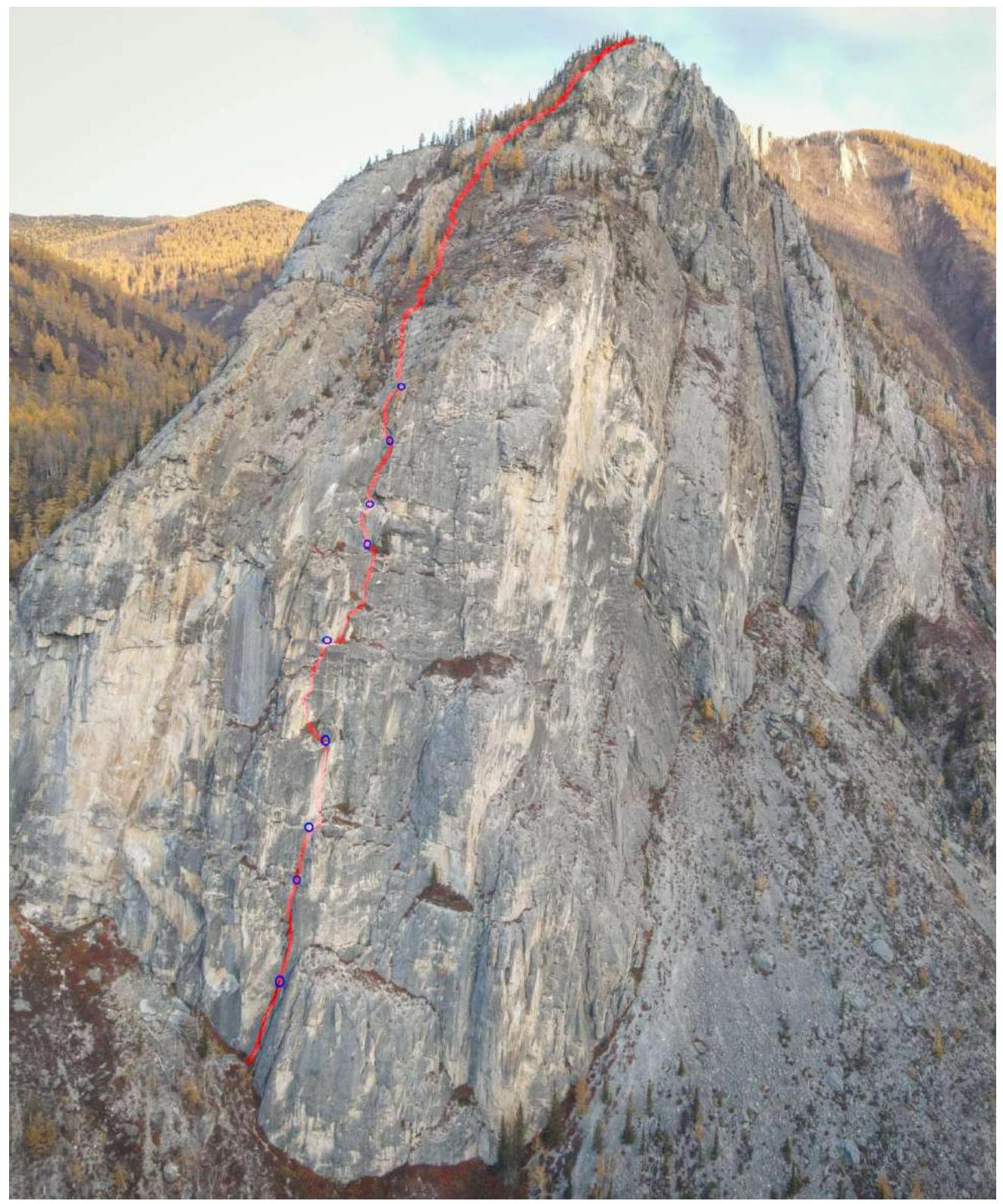
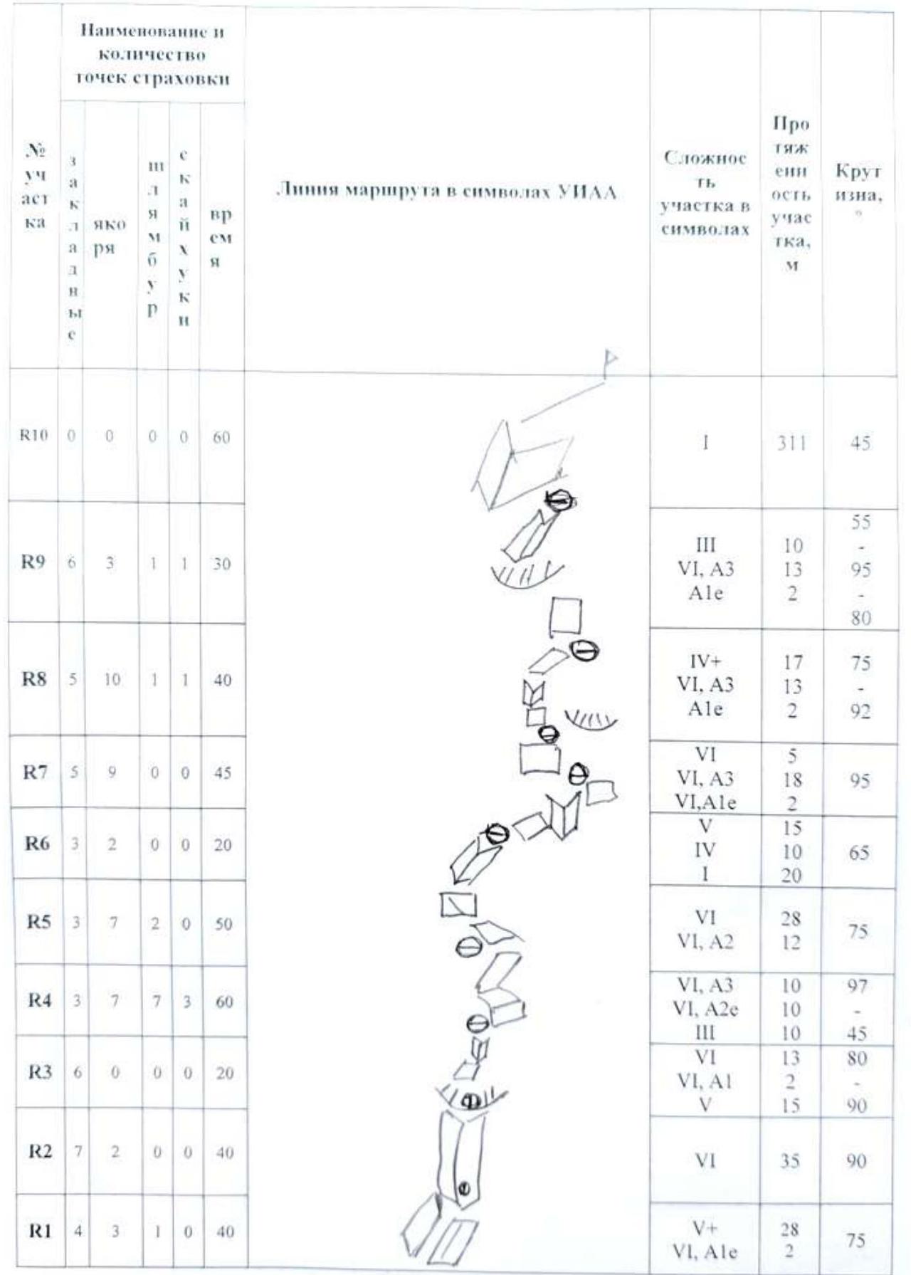
2.2. UIAA symbol route diagram
3. Team Actions Characteristics
3.1. Brief description of the route passage
We left the clearing near the Chuya River on April 20, 2024, at 11:40. We approached the route at 12:10 and started climbing at 12:40.
R0–R1
30 m, 75°, V–V+, 1 bolt — 2 m A1e (3 anchors, 3 friends, 1 stopper), 40 min. Station on two bolts is not very convenient. When the leader passes the second section, rocks may fall on the station! Be attentive and cautious!
R1–R2
35 m, 90°, V–VI, 2 m А1 (7 friends, 2 anchors, BD № 4 and 5 camalots work well!), 40 min. Hanging station on a bolt and a camolot.
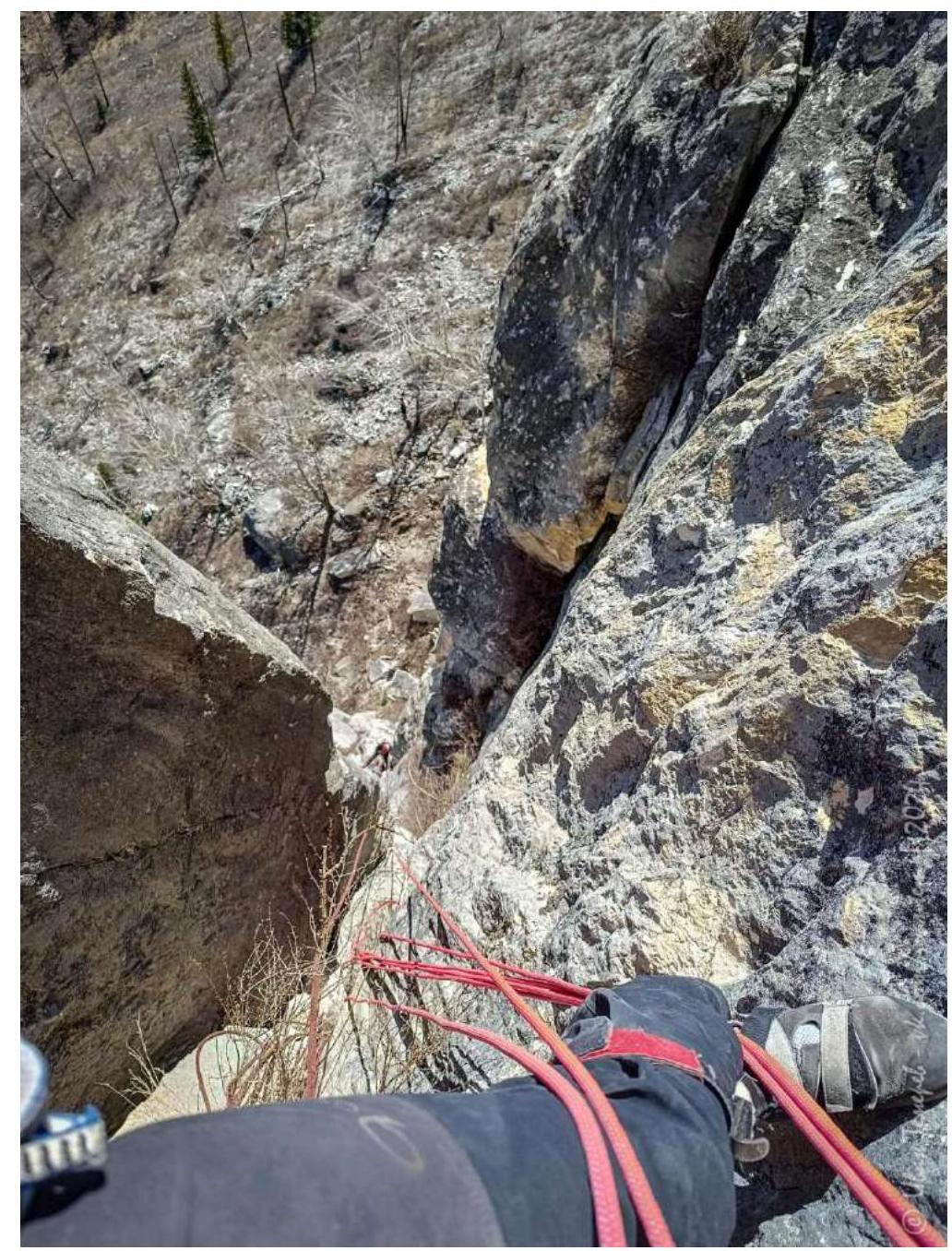
View from the second station down at the second pitch.
R2–R3
30 m, 90° — 15 m VI, 15 m V (6 friends), 20 min. Station at the beginning of a good large ledge. Two bolts.
R3–R4
32 m – 10 m, 45°, III, 22 m, 97°, VI, A3, A1e — 7 bolts, 3 steps on holey skyhooks (7 anchors, 3 friends), 60 min. Station on a good ledge on two bolts.

R4–R5
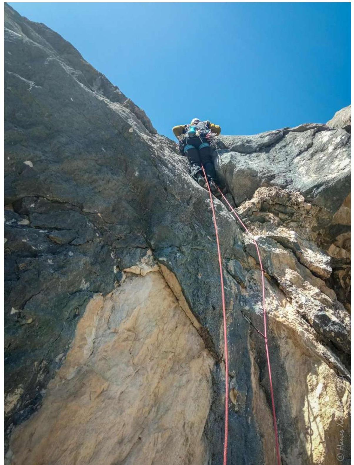
40 m — along a slanting ledge to the left 8 m, I, 12 m VI A2 (6 anchors, 1 friend), climbing 10 m, V, 2 bolts, 10 m V along a slab and an internal corner (1 anchor, 2 friends), 50 min. Station on a ledge — two bolts.
View of the second part of R5 from above

R5–R6
On April 21, we started working on the last processed sections at 11:00.
45 m.
- Along a ledge to the right 8 m, I
- Along a slab 8 m, 45°, IV
- 3 m, V (1 friend)
- 15 m, I, coincides with the mark 4A — 16 m, IV–V to a ledge with trees (20 min).
To the left of them on the wall, there is a station on 2 bolts.
View of the lower part of R5–R6
R5–R6 view of the upper part
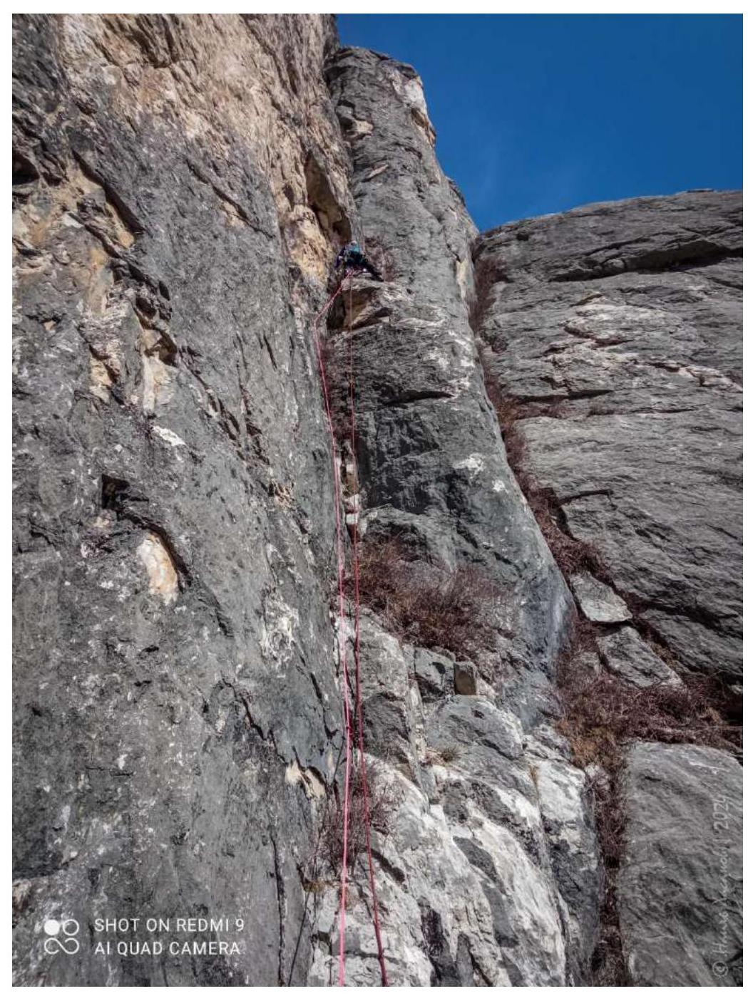
R6–R7
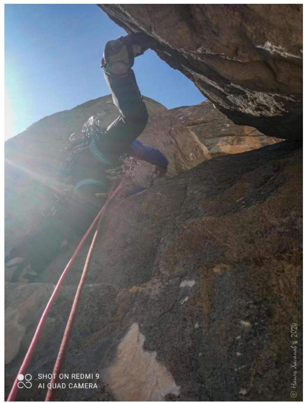
25 m, 95–90–85°. From the ledge along a vaguely expressed internal corner to the left upwards. Artificial aids A3 (9 anchors, 5 friends), 45 min. Station under a large overhang to the left.
In 2006, Anton Parshin passed this section from the right along a widely opened internal corner on holey skyhooks under the overhang and a couple of holes to the left of it. It was unclear how far he managed to climb; there is a flaking crust in the corner, and insurance is problematic. Therefore, we decided to move left along the terrain.
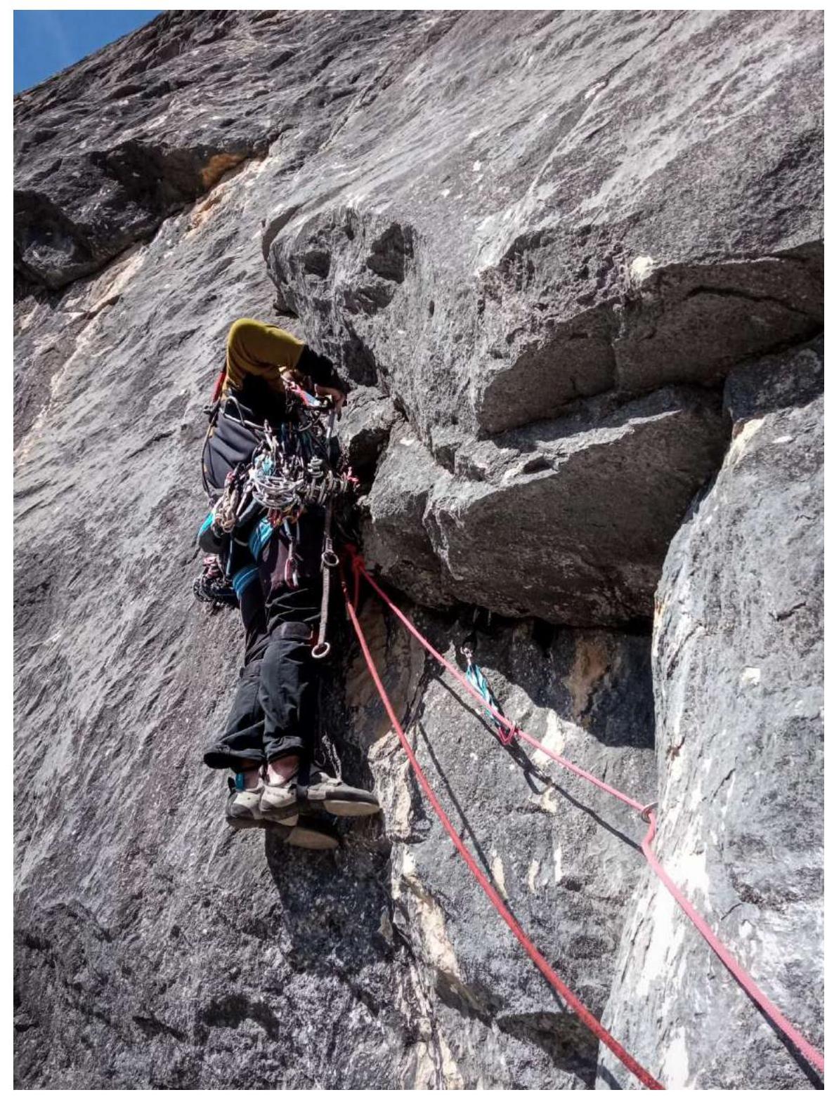
Photo R6–R7
R7–R8
32 m, 92–75°. 40 min. Upwards to the left of the overhang along a monolithic, weakly overhanging slab 92° into a destroyed internal corner 15 m A3, A1e —
- 1 step on a 6 mm skyhook
- 1 step on a bolt (6 anchors, 5 friends) Further 17 m IV+ (2 anchors), 75°. Station before a vertical wall with a small overhang (1 bolt, 8 mm and a friend).
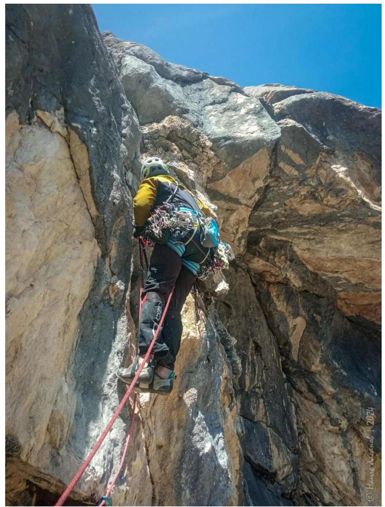
Photo R7–R8
R8–R9
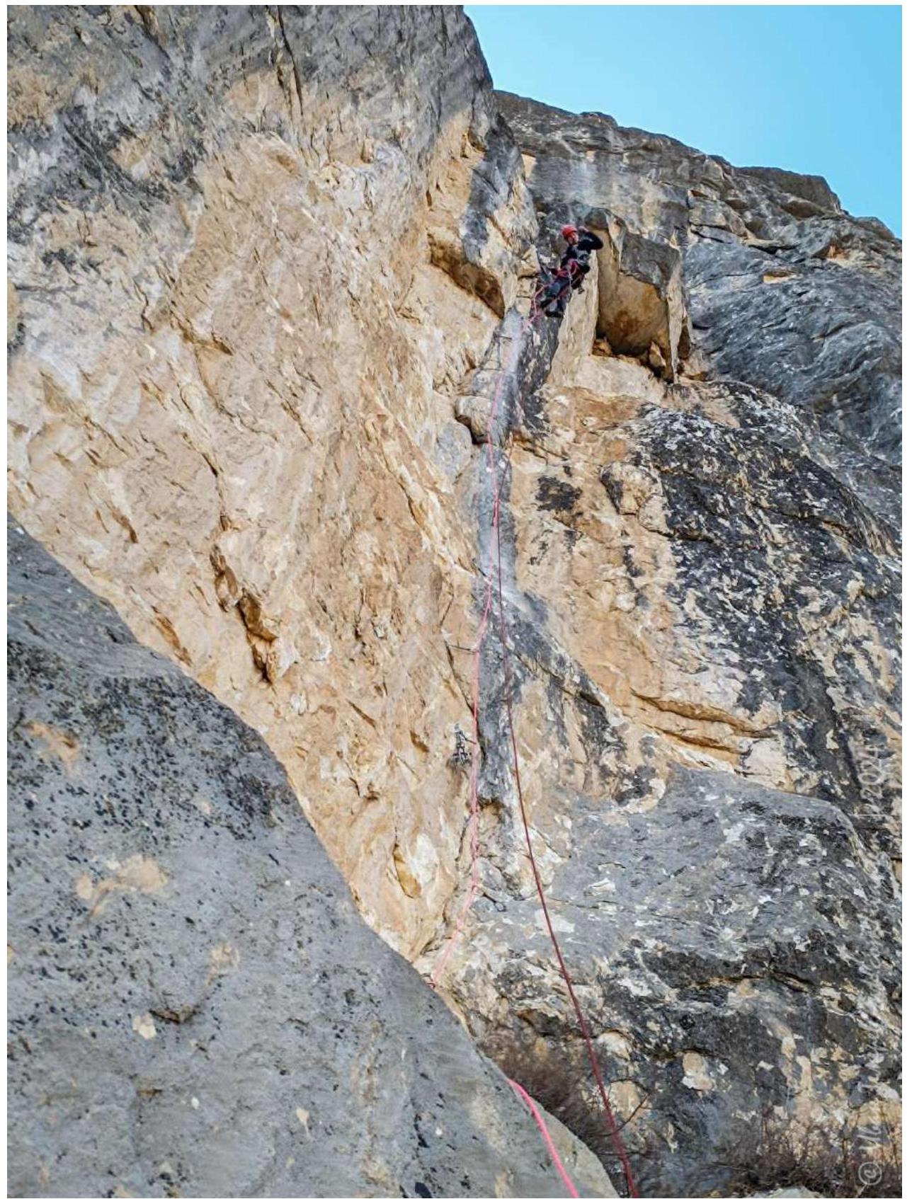
25 m, 80–95–55°, 30 min. 15 m along a slab to the left and through an overhang VI, A3, A1e — 1 step on a skyhook, 1 step on a bolt (6 friends, 3 anchors). Exit to a crumbling internal corner.
Along it 10 m III upwards very carefully. Station on bolts on a monolithic gentle slab to the right.
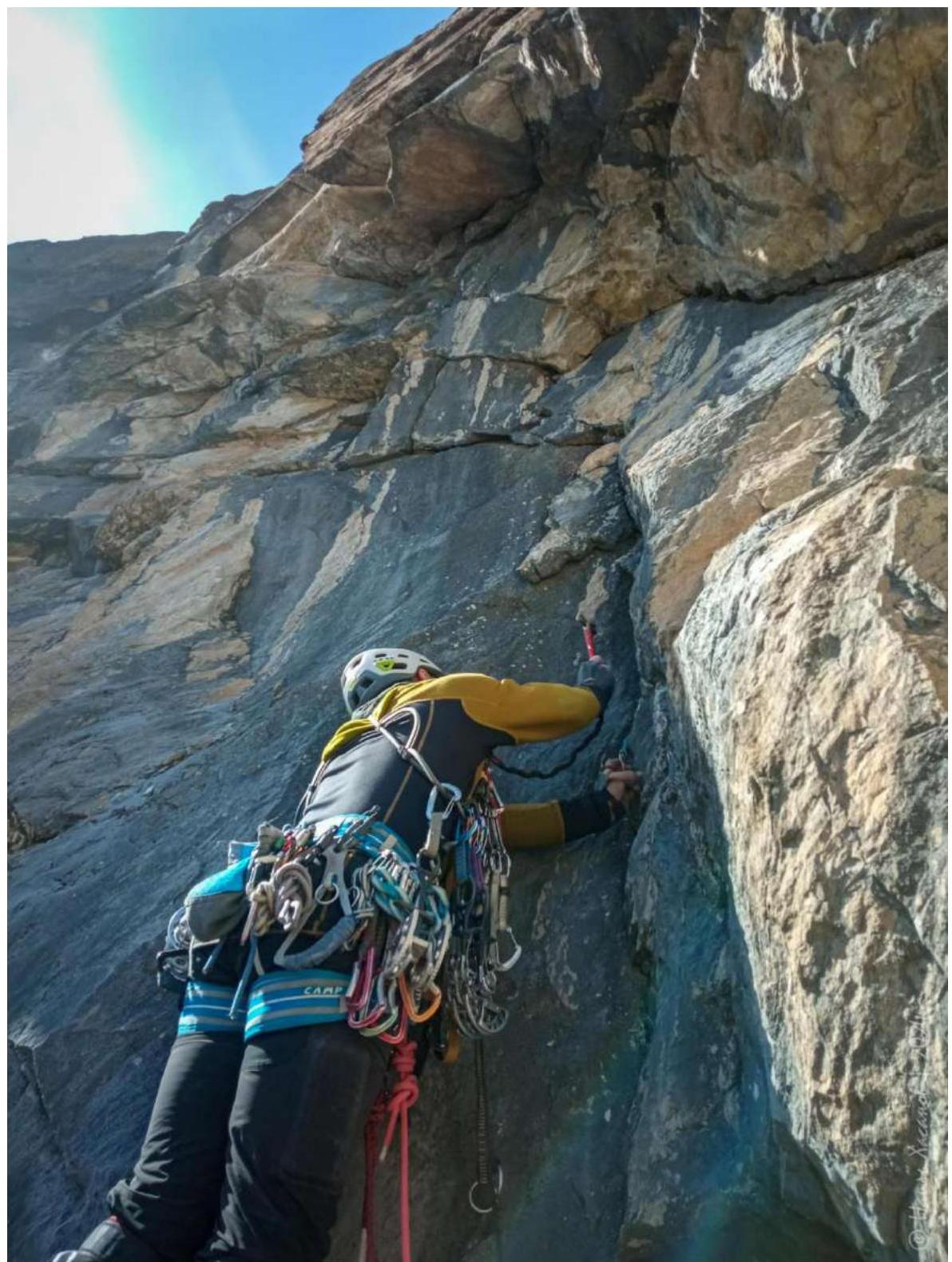
Photo R8–R9
R9–R10
40 min, 311 m, I.
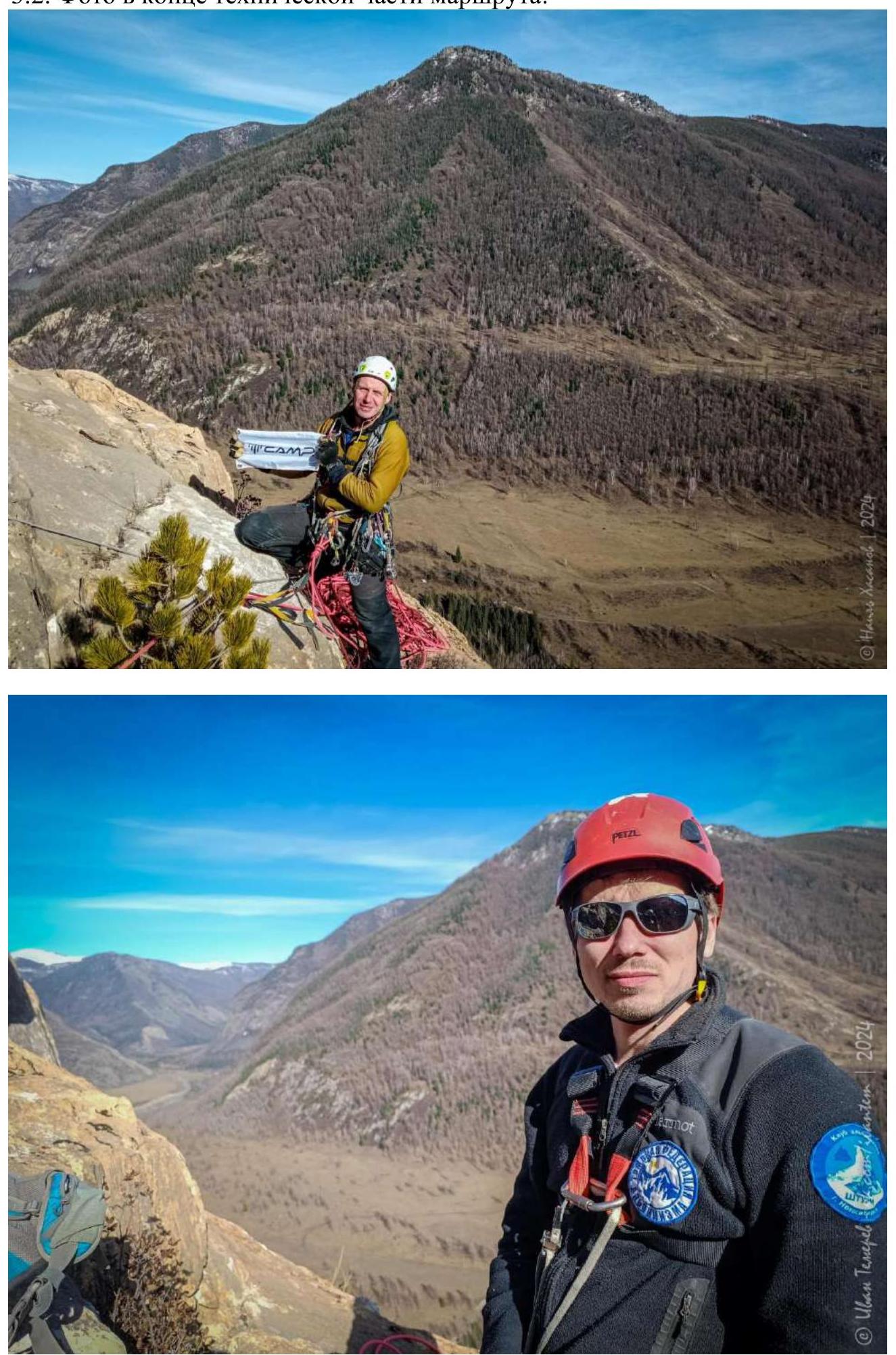
3.2. Photo at the end of the technical part of the route
3.3.1. Route safety assessment
The route is fairly safe. We cleaned it maximally from loose rocks, bushes, and dirt. However, be attentive and cautious on R1, in the middle of R2, and especially at the end of R9!
3.3.2. Conclusion on the preliminary route assessment compared to classified routes of the same category of difficulty in the team's climbing experience
I have climbed at least 10 routes of 5B category in Crimea. Our route on Begemot summit looks quite confident compared to them.
Below is a comparative table of route difficulties.
| Route name and difficulty | Begemot, "Podkustovnyy Vypolzzen'" 5B | Morcheka, Kensitskogo 5B | Sokol, "Alisa" 5B | Chelebi, A. Verby 5B |
|---|---|---|---|---|
| Length | 9 pitches 294 m | 5 pitches 160 m | 4 pitches 160 m | 5 pitches 155 m |
| Pitches of IV category | 25 m | 45 | 0 | 0 |
| Pitches of V category | 93 m | 85 | 40 | 75 |
| Pitches of VI category | 108 m | 40 | 120 | 70 |
| Including artificial aid pitches | 86 m | 20 | 60 | 70 |
3.3.3. Descent from the summit is possible in two ways
- Via the ascent route with a 70 m rope – 4.5 sections (all stations have bolt anchors and a carabiner):
- A 66 m rope is enough to reach the ledge with firs (intersection with 4A), but the knot needs to be pulled through the bend, so a 70 m rope is better. We barely made it through the first bend.
- 40 m.
- A 66 m rope is enough to reach the ledge with a tree
- 60 m
- 30 m descent to the ground.
With a 50 m rope, there will be 8 sections.
- On foot to the west, one rappel from the ridge to the slope, on foot to the stream, and then 1 rappel along the waterfall. Work is underway to equip the last section with pitons (on the orographic right side of the waterfall).