Passport
- Region — Altai, Saylyugem Ridge
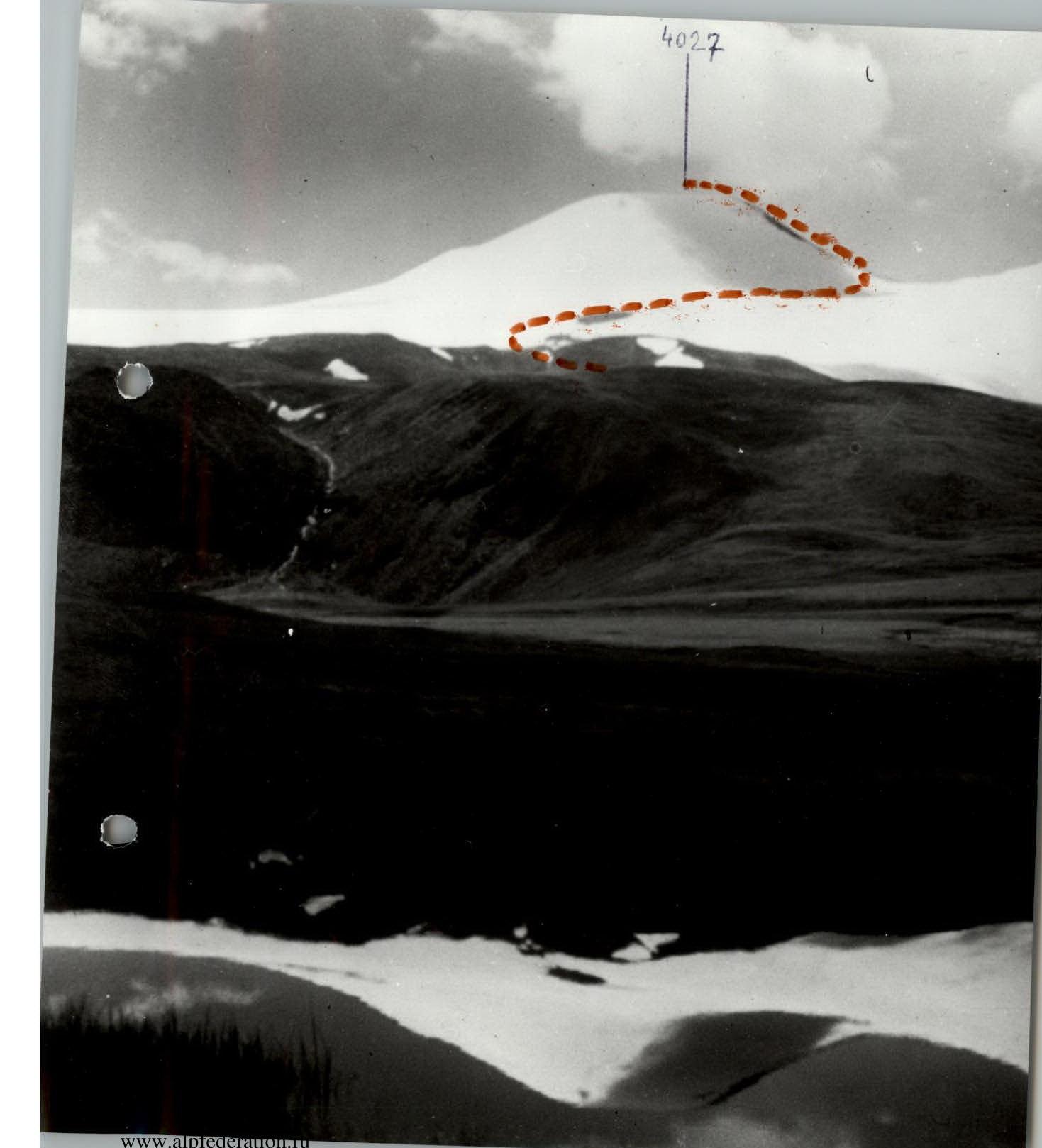
- Peak — Lod i Plamen (4027 m)
- Route — along the 3rd ridge, cat. 1B, first ascent
- Height difference — 600 m Steepness of the route — 25°
- Travel hours — 5 h
- Group composition: Vlasov V.A. — Master of Sports Odintsov L.G. — 1st sports category Efremov S.V. — 1st sports category Sutyagina L.V. — 3rd sports category
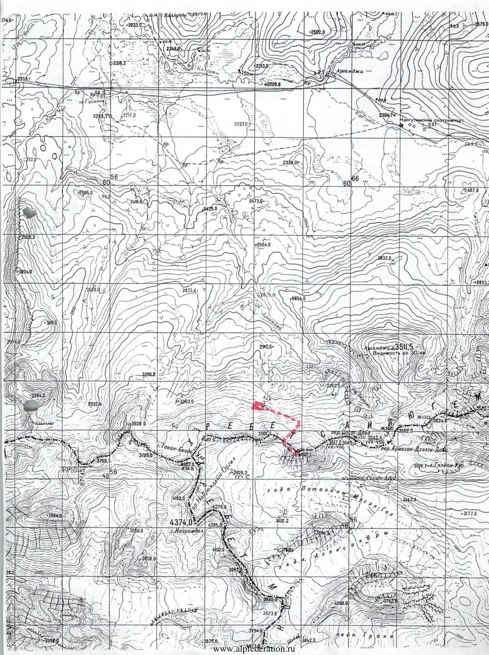
- Date of ascent — July 18, 2000 Peak "Lod i Plamen" is located in the Saylyugem Ridge, which is a continuation in the latitudinal direction of the South Altai Ridge.
These ridges are located on the territory of the Kosh-Agach administrative district. From the Biysk railway station to Kosh-Agach — along the Chuysky highway — 550 km.
Further, the path goes along a dirt road in a southwesterly direction (approximately 100 km) to the Teply Klyuch pass — height 3300 m. After the pass, another approximately 30 km along the valley to the place marked on the map as "Argamji".
From Argamji to the peak "Lod i Plamen" in a straight line to the south — approximately 20 km. The approach takes about 10 hours. The terrain is treeless, with occasional stunted shrubs. The northern slopes of the Saylyugem Ridge have weak glaciation. Overnight stay — at the snowline.
From the overnight stay, the path goes along the snow to the pass between the peaks "Lod i Plamen" and "peak Gorodov-Geroev". The southern slopes of these peaks are strongly destroyed rocks. Under the pass on the southern side, the beginning of the Potanin Glacier is visible. Along the northwestern (or western) ridge — ascent to the summit. The route is similar to traditional 1B routes, for example: peak Nikolaev, peak Semenov-Tian-Shansky. From the summit in a northwesterly direction, Belukha is visible.
Routes to the summit from the south, from the Mongolian side — snowless.
4027 3901