The route to the summit of Pik V. Shumilova via the left part of the North slope,
snow-ice, coordinates: 49°44.068′ N, 87°58.504′ E, height 3555 m according to
the navigator, approximately for
c/tr.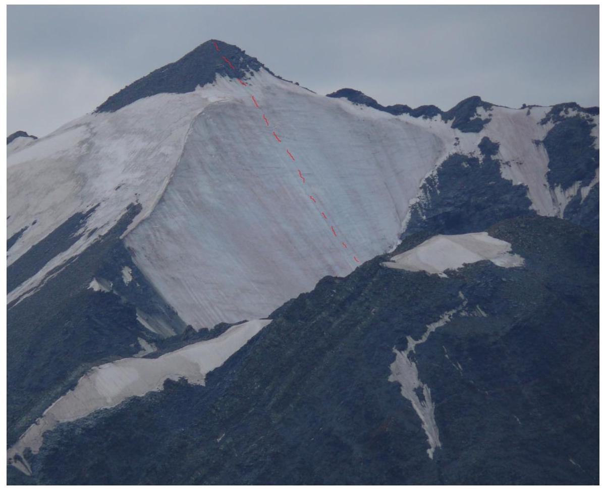
The route, view from the
northeast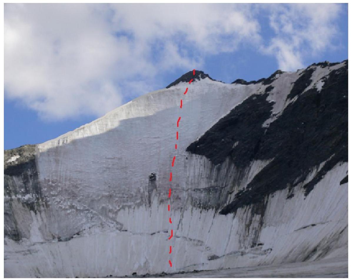 The route,
view from the
glacier
The route,
view from the
glacier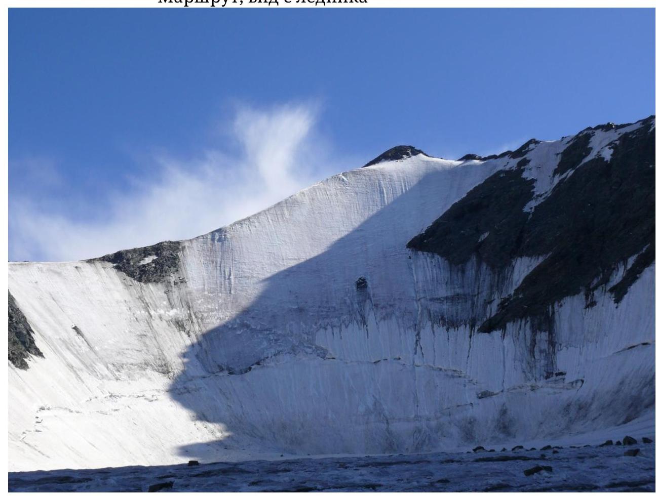
View from the
glacier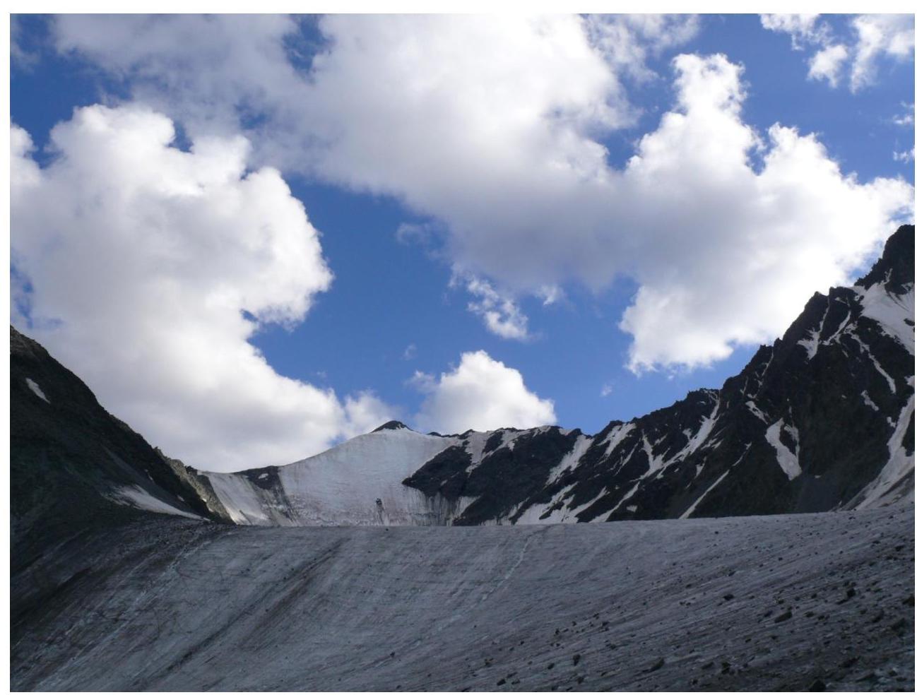
View from the moraine under the
glacier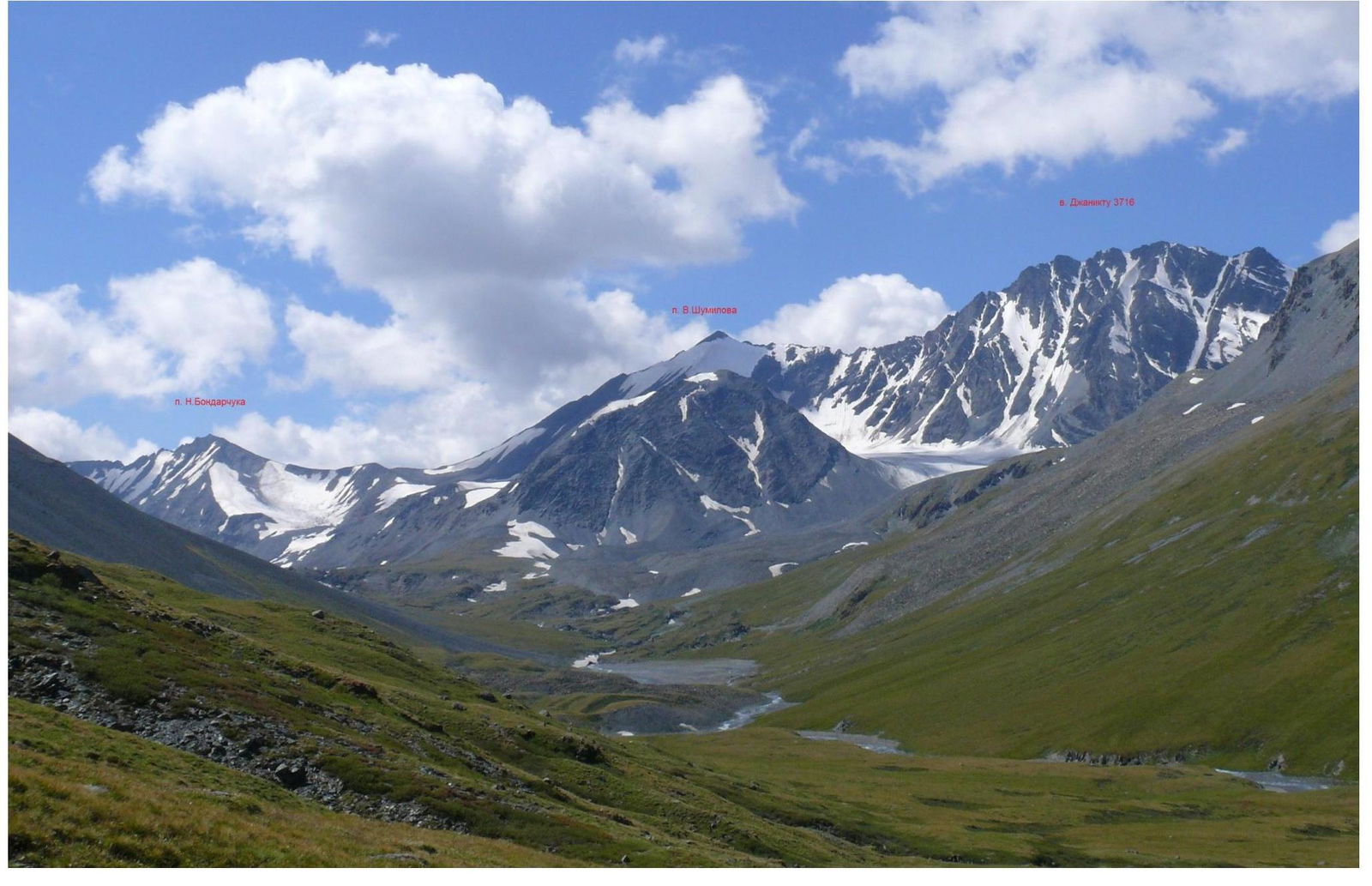
Pik V. Shumilova, view from the
northeast Yuzhno-Chuysky
ridge, Elangash valley
Yuzhno-Chuysky
ridge, Elangash valley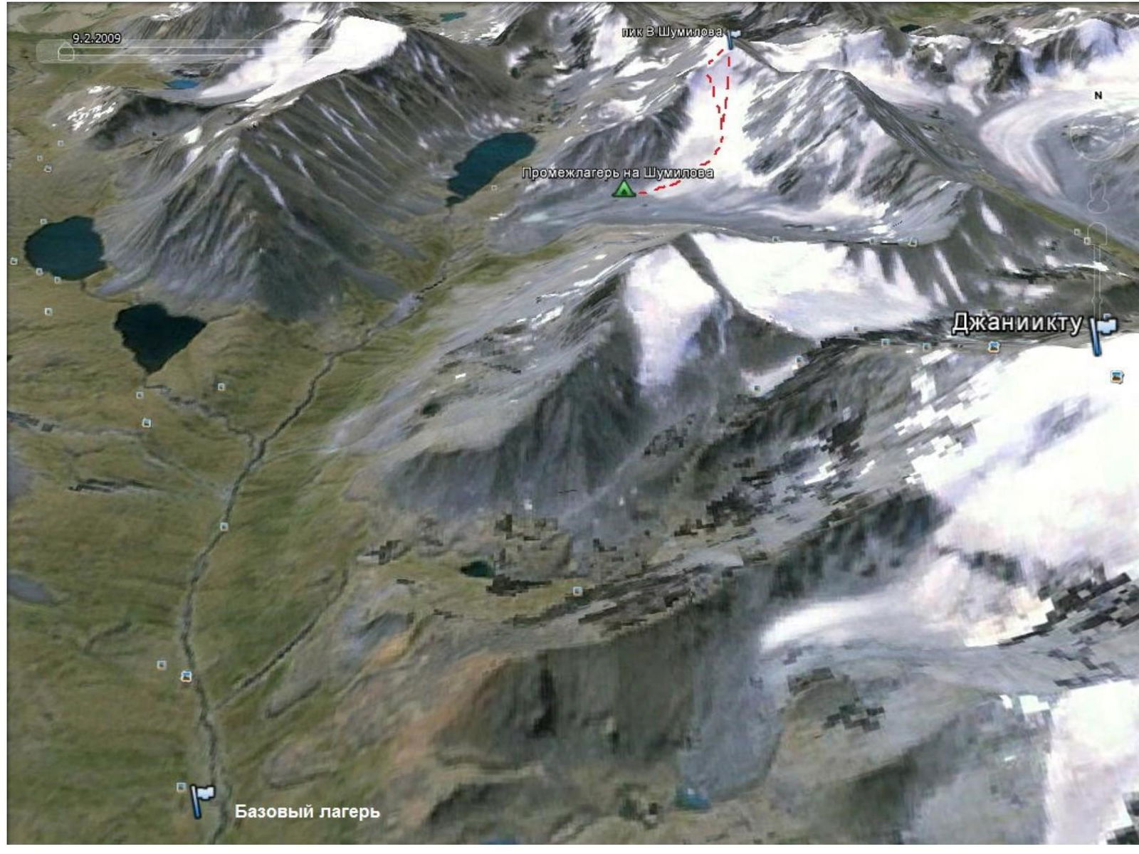
Routes to Pik V. Shumilova, base and advanced (intermediate) camp
From the advanced camp, located under the tongue of the glacier below v. Djaniktu (3716), move along the center of the glacier, orienting towards the summit of Pik Shumilova.
Approach the route via the glacier.
Approach from the advanced camp — 1–2 hours.
Movement on the route.
From the glacier, move in the direction of the rocky peak, choosing a passage through the bergshrund, then between rocky outcrops.
From the bergshrund:
- movement is alternating, insurance via ice screws;
- the slope becomes steeper in the upper part;
- from the bergshrund to the ridge 7–8 ropes.
Then move simultaneously along simple rocks to the summit.
Descent — along the northeast ridge, then onto the glacier. UIAA scheme
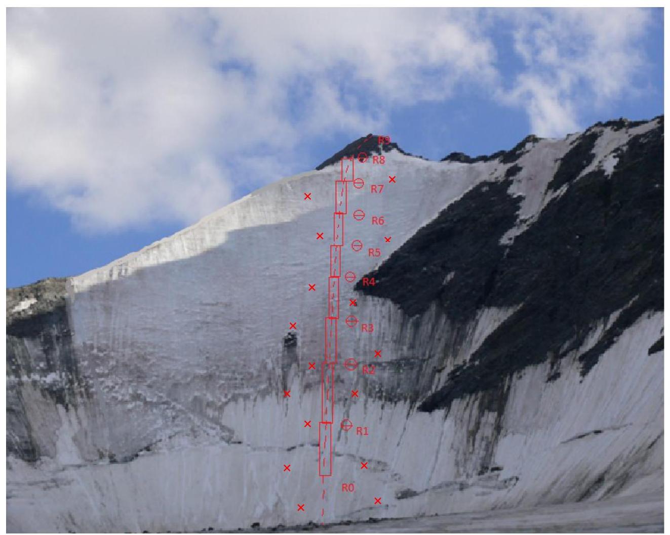
R0–R1: 10–12 m, 50–60°, II — overcoming the bergshrund, insurance is alternating, ice screws, 1
R1–R2: 50 m, 40–50°, II — snow-ice slope, insurance is alternating, ice screws, 2
R2–R3: 50 m, 45–55°, II — snow-ice slope, insurance is alternating, ice screws, 3
R3–R4: 50 m, 45–55°, III — snow-ice slope, insurance is alternating, ice screws, 3
R4–R5: 50 m, 55–60°, III — snow-ice slope, insurance is alternating, ice screws, 3
R5–R6: 50 m, 55–65°, III — snow-ice slope, insurance is alternating, ice screws, 3
R6–R7: 50 m, 60–65°, III — snow-ice slope, insurance is alternating, ice screws, 3
R7–R8: 50 m, 30–40°, II — snow-ice slope, insurance is alternating, ice screws, 2
R8–R9: 25–30 m, 15–30°, I — destroyed rocks, insurance is simultaneous.