
peak V. Shumilov via the direct line of the North face 3A cat. sl., lc Badanov P.A. Altai, South-Chuya Ridge 1.3
Passport
- Class: ice and snow.
- Altai, South-Chuya Ridge, Elangash valley, 1.3
- Peak V. Shumilov via the center of the North face.
Coordinates: (49°44.068′ N, 87°58.504′ E, height 3555 according to the navigator)
- Proposed — 3A cat. sl., first ascent.
- Elevation difference: 500 m (between the summit and intermediate camp: 744 m); length — 600 m. Average steepness of the route — 25–35 degrees.
- Pitons used on the route: ice screws — 20.
- Team's travel hours: 3 h 20 min from the glacier to the summit; 5 h from glacier to glacier; 7 h 30 min from advanced base camp to advanced base camp (49°44.886′ N, 87°59.368′ E, height 2811 according to the navigator).
- Overnight stays — none.
- Climbing pair: Badanov Pavel Aleksandrovich, 2nd sports category. Korneev Vladimir Stanislavovich, 1st sports category.
- Coach: Drakin Andrey Valentinovich, 1st category (№68).
- Departure from advanced base camp: 6:30, August 5, 2015. Start of the route: 8:00, August 5, 2015. Reaching the summit: 11:20, August 5, 2015. Descent to the glacier: 13:00, August 5, 2015. Return to advanced base camp: 15:30, August 5, 2015.
- Organization: Altai Krai Alpine Federation training camp

Peak V. Shumilov, view from the northeast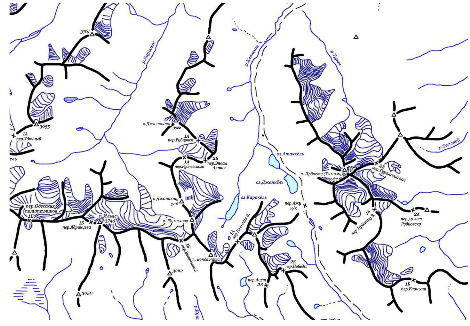
South-Chuya Ridge, Elangash valley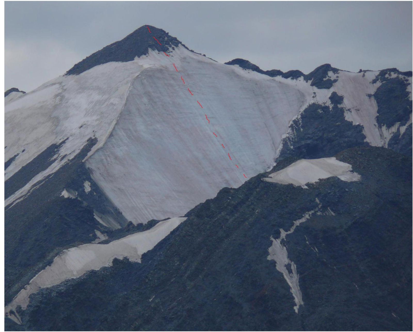
Peak V. Shumilov via the center of the North face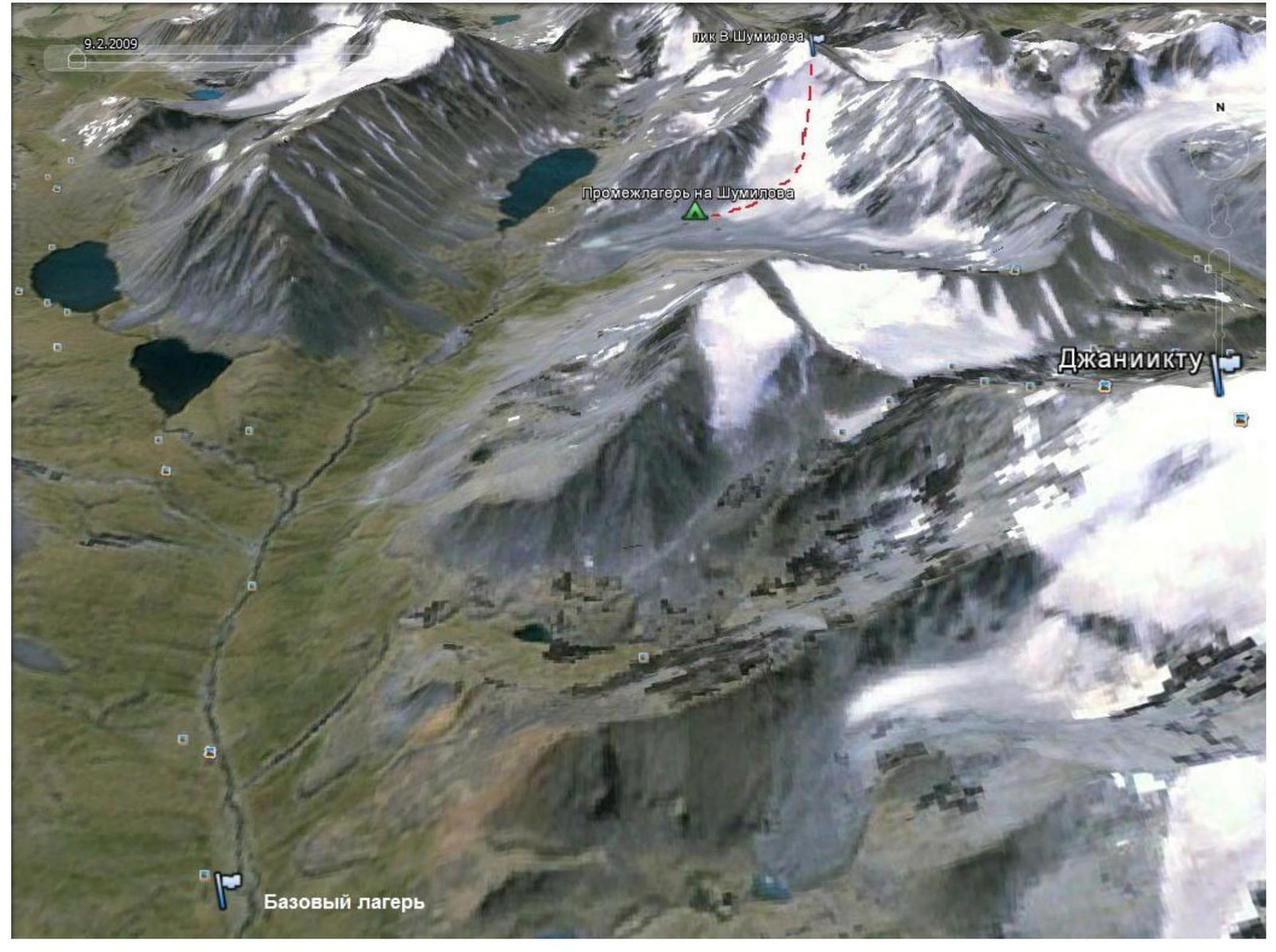
Route to peak V. Shumilov