the summit of Peak V. Shumilov via the left part of the North slope 3A category, ice-snow, Barnov S.I.
Altai, South Chuya Ridge
1.3
Passport
- Class: ice-snow.
- Altai, South Chuya Ridge, Elangash valley, 1.3
- Peak V. Shumilov via the left part of the North slope.
Coordinates: (49°44.068′ N, 87°58.504′ E, height 3555 m according to the navigator)
- Proposed - 3A category, first ascent.
- Elevation gain: 500 m (between the summit and the intermediate camp: 744 m);
length - 1600 m. Average steepness of the route - 25-35 degrees, up to the ridge
- 3550 m.
- Number of pitons used on the route: ice screws - 12.
- Team's moving hours: 5 h 40 min from the glacier to the summit;
8 h from the glacier to the glacier; 10:30 from the advanced camp to the advanced camp (49°44.886′ N, 87°59.368′ E, height 2811 m according to the navigator).
- Overnights - none.
- Team: Barnov Sergey Ivanovich, 1st sports category.
Guselnikov Vitaly Mikhailovich, Master of Sports. 10. Coach: Drakin Andrey Valentinovich, category 1 (№68).
- Departure from the advanced camp: 6:30, August 5, 2015.
Departure on the route: 8:00, August 5, 2015. Reaching the NE ridge: 12:30, August 5, 2015. Reaching the summit: 13:40, August 5, 2015. Returning to the glacier: 16:00, August 5, 2015. Returning to the advanced camp: 17:00, August 5, 2015.
- Organization: Altai Regional Federation of Alpinism. Route to
the summit of Peak V. Shumilov via the left part of the North slope, ice-snow,
coordinates: 49°44.068′ N, 87°58.504′ E, height 3555 m according to the navigator,
approximately for category
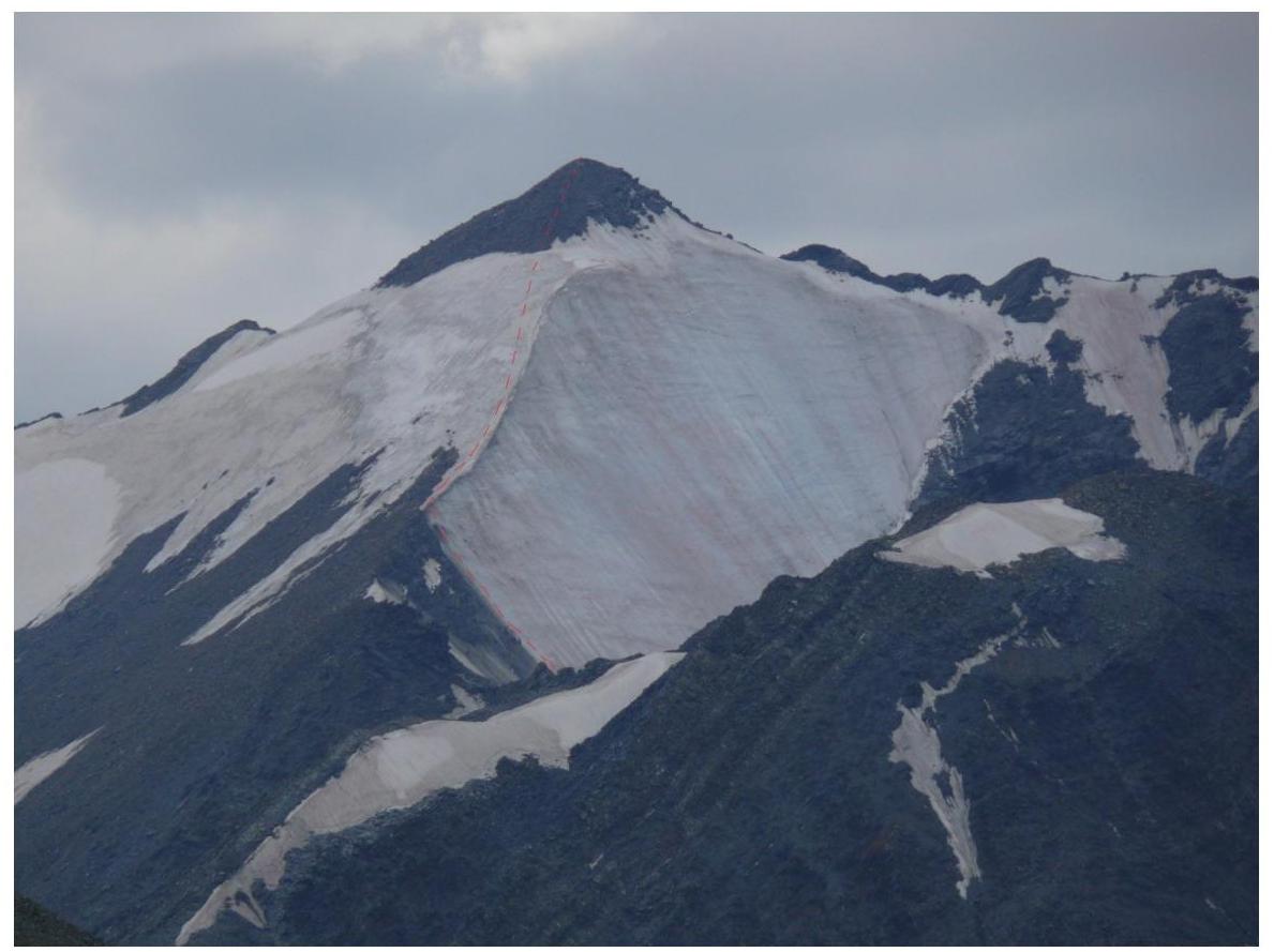
The route, view from the
northeast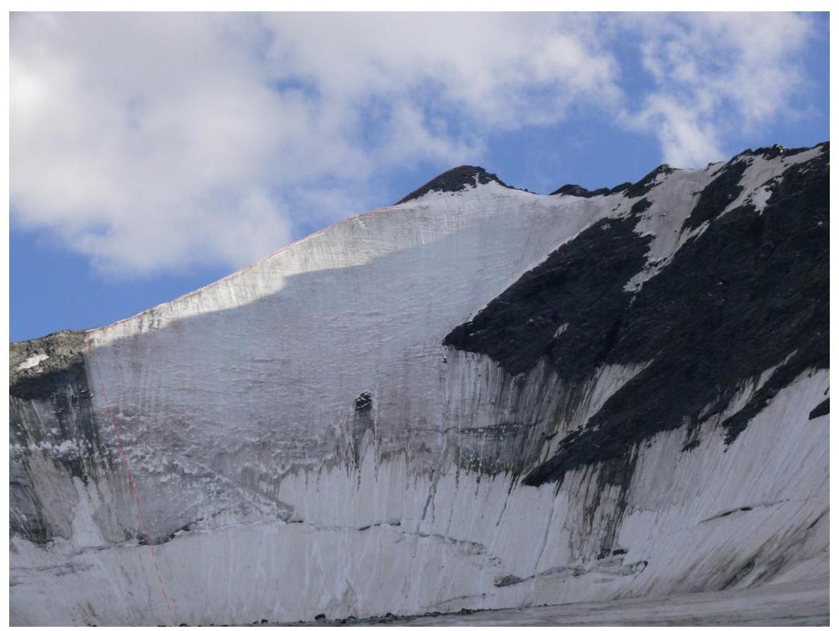
The route, view from the
glacier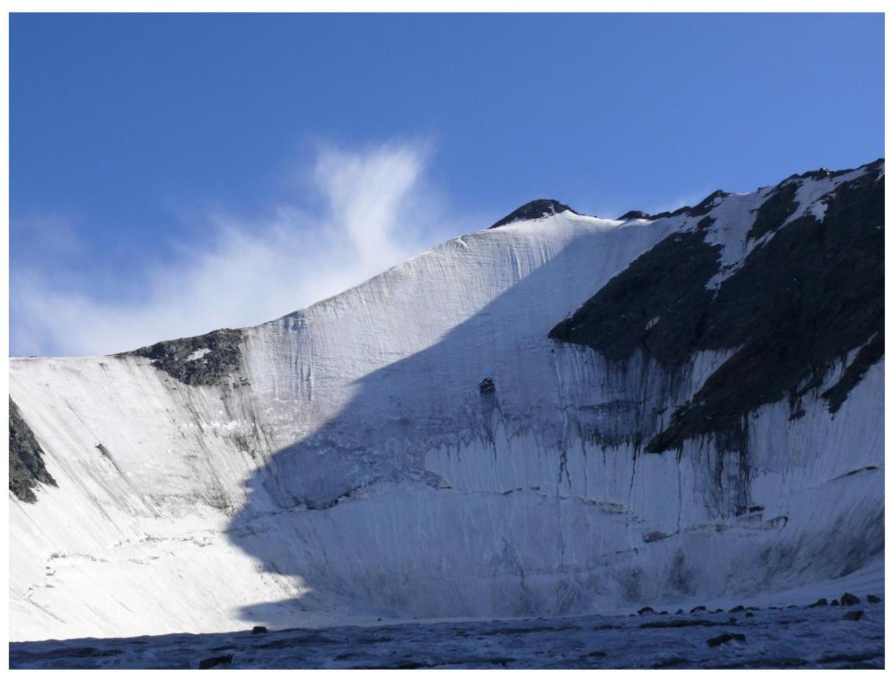
View from the
glacier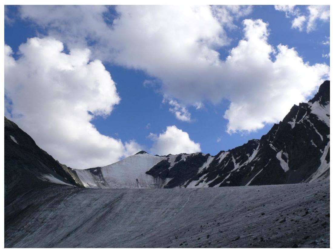
View from the moraine under the
glacier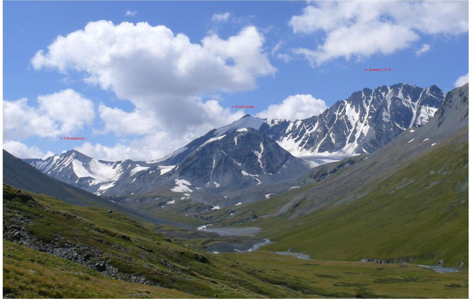
Peak V. Shumilov, view from the
northeast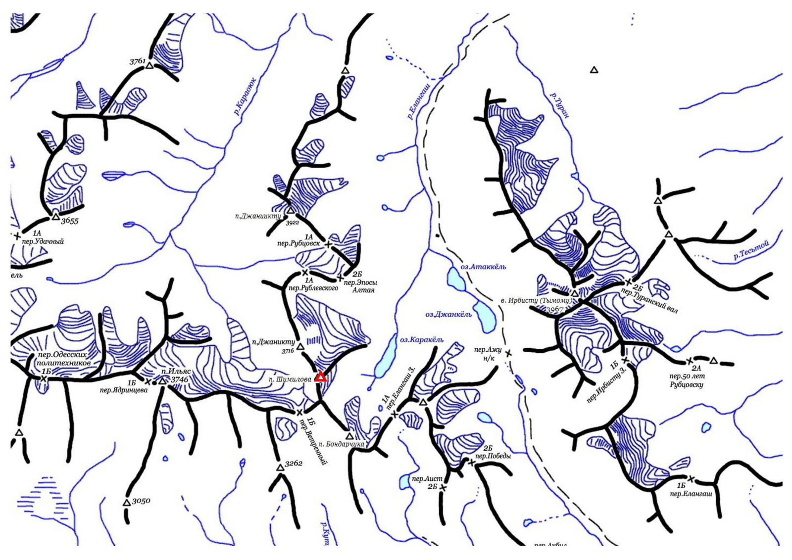 South Chuya
Ridge, Elangash
valley
South Chuya
Ridge, Elangash
valley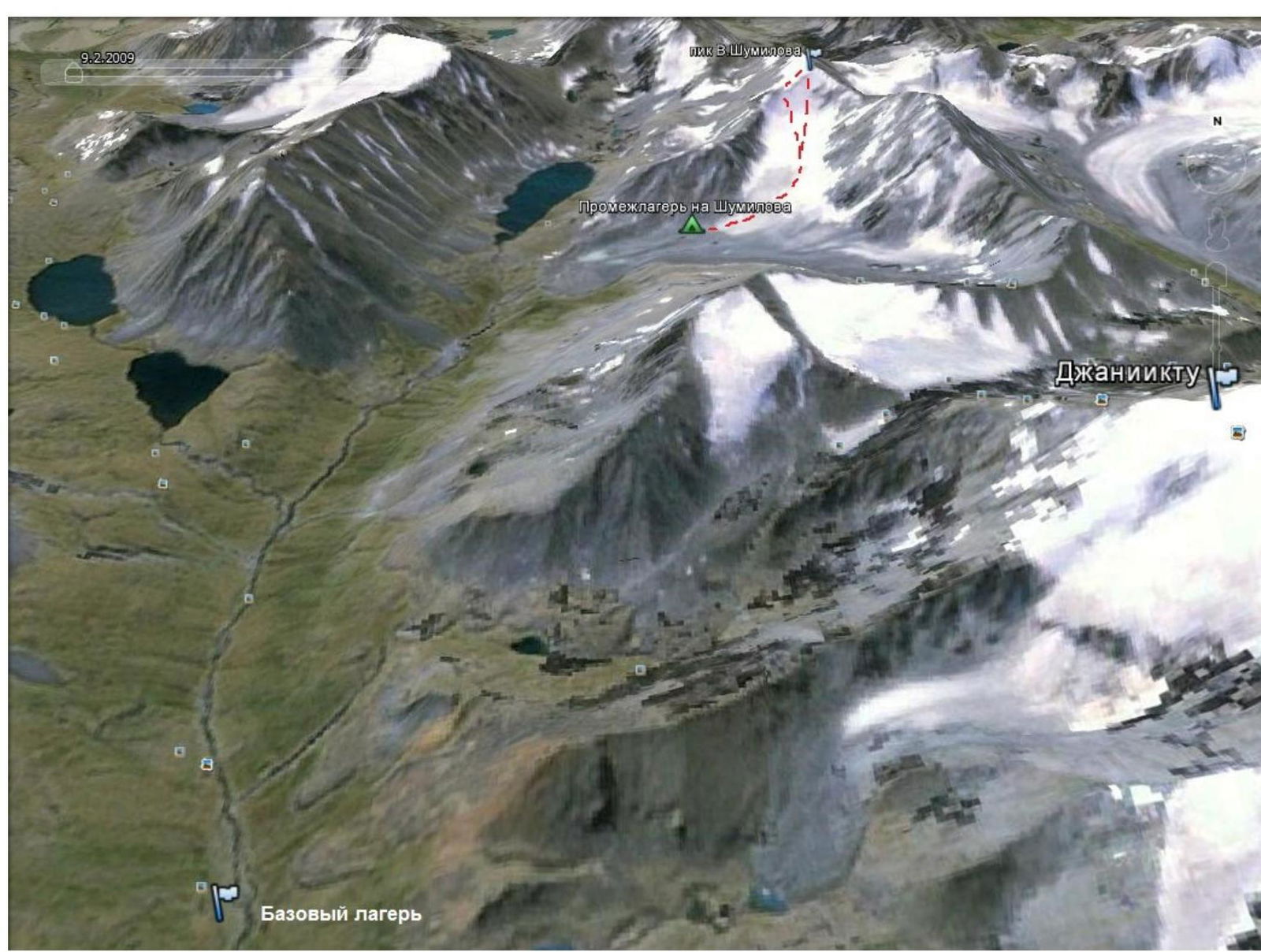 Routes
to Peak V. Shumilov, base and advanced (intermediate) camp. From the advanced
camp, located under the tongue of the glacier below v. Janiku (3716), move along
the center of the glacier, orienting towards the right rocky outcrop on the NE
ridge of Peak Shumilov. To the left of the slope, stonefall paths were observed,
so a less stone-hazardous option was chosen. Approach the route from the glacier.
The approach from the advanced camp takes 1-2 hours.
Routes
to Peak V. Shumilov, base and advanced (intermediate) camp. From the advanced
camp, located under the tongue of the glacier below v. Janiku (3716), move along
the center of the glacier, orienting towards the right rocky outcrop on the NE
ridge of Peak Shumilov. To the left of the slope, stonefall paths were observed,
so a less stone-hazardous option was chosen. Approach the route from the glacier.
The approach from the advanced camp takes 1-2 hours.
Movement on the route.
From the glacier, move towards the gap between the right rocky outcrop on the NE ridge and the cornices above, choosing a passage through the bergschrund.
From the bergschrund, move alternately, with insurance through ice screws.
The slope becomes steeper in the upper part, and the ice in the upper part changes its structure, sometimes breaking off in lenses.
From the bergschrund to the ridge, there are 5.5-6 ropes.
On the ridge, move simultaneously to the destroyed rocky massif of the summit, a snowy-icy ascent. Attention - cornices on the right! On simple rocks, 100-150 m to the summit, move simultaneously. From the exit to the ridge to the summit, it takes 1-1.5 hours.
Descent - via the ascent route
R0-R1: 5-8 m, 50-60°, II - overcoming the bergschrund, insurance is alternating, ice screws, 1
R1-R2: 2×50 m, 30-40°, II - snowy-icy slope, insurance is alternating, ice screws, 2
R2-R3: 50 m, 40-50°, II - snowy-icy slope, insurance is alternating, ice screws, 1
R3-R4: 50 m, 45-55°, III - snowy-icy slope, insurance is alternating, ice screws, 3
R4-R5: 50 m, 55-60°, III - snowy-icy slope, insurance is alternating, ice screws
R5-R6: 15-20 m, 60-65°, IV - snowy-icy slope, destroyed rocks on the left, hard ice
R6-R7: 300-350 m, 10-30°, I - snowy-icy slope, cornices on the right, insurance is simultaneous, ice screws
R7-R8: 100-150 m, 15-30°, I - destroyed rocks, insurance is simultaneous


