Ascent Passport
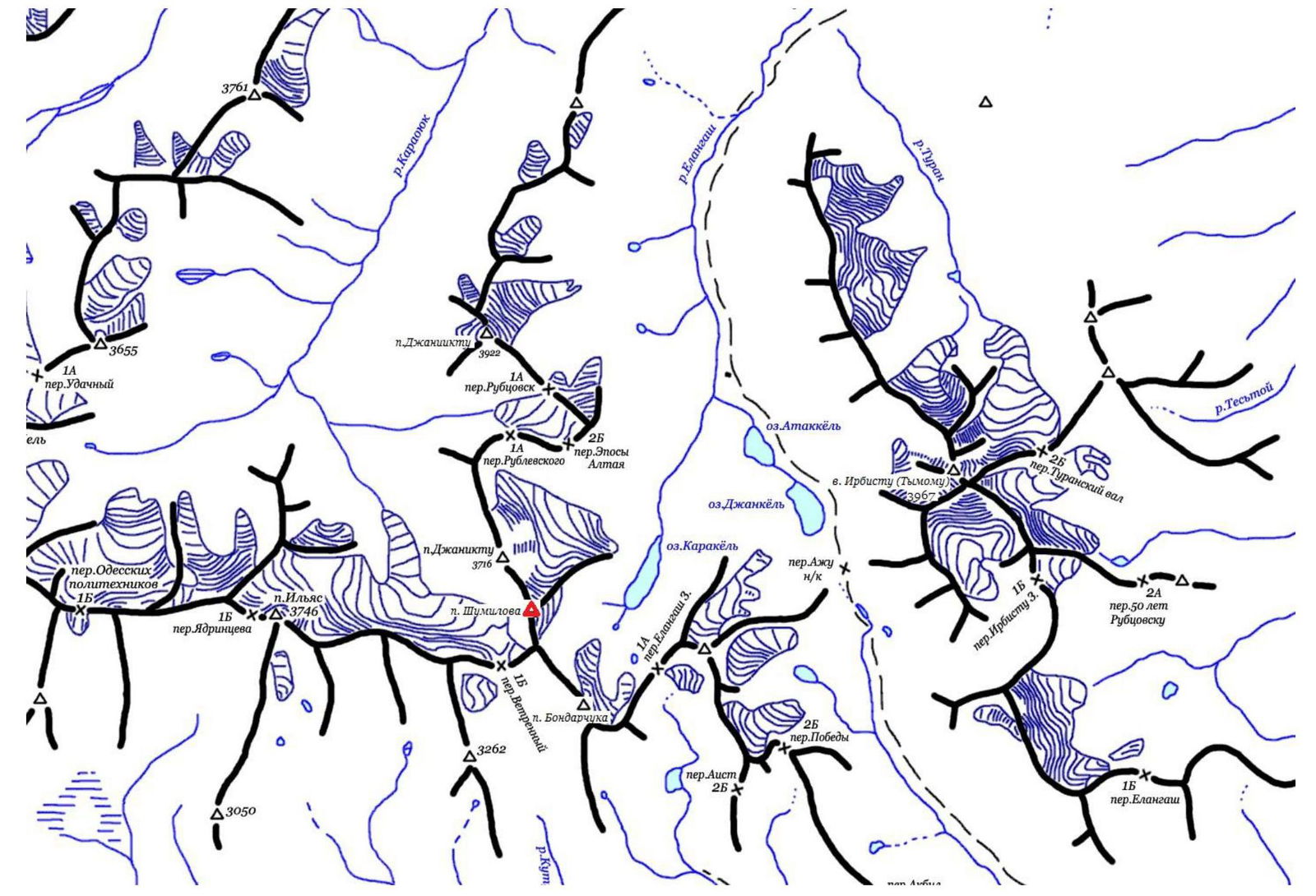
- Altai, South Chuya Ridge, Elangash valley, 1:3
- Peak V. Shumilov via the center of the Eastern slope.
Coordinates: (49°44.068' N, 87°58.504' E, height 3555 m according to the navigator)
- Proposed — 2B cat. dif., first ascent.
- Route type: combined
- Elevation gain: 500 m (between the summit and intermediate camp: 780 m); length — 600 m. Average steepness of the route — 25–35 degrees.
- Number of pitons used on the route: ice screws — 20, left behind — 0.
- Team's travel time: 2 h 50 min from the glacier to the summit; 4 h 30 min from the glacier to the glacier; 6 h 40 min from the advanced camp to the advanced camp (49.735° N, 87.998° E).
- Climbing duo: Semenov Sergey Alexandrovich, 1st sports category. Bezrukov Sergey Yakovlevich, 1st sports category.
- Coach: Drakin Andrey Valentinovich, I category (№68).
- Departure from the advanced camp: 7:00, July 3, 2015. Departure onto the route: 8:40, July 3, 2015. Reaching the summit: 11:20, July 3, 2015. Reaching the scree slopes: 13:00, July 3, 2015. Return to the advanced camp: 14:20, July 3, 2015. Descent via the ascent route.
- Organization: Altai Regional Alpine Federation gathering
- Responsible for the report:
- Badaev Pavel. Email badanov2@mail.ru, phone +7-960-966-6842
- Barnov Sergey. Email barnov@mail.ru, phone +7-983-555-1954
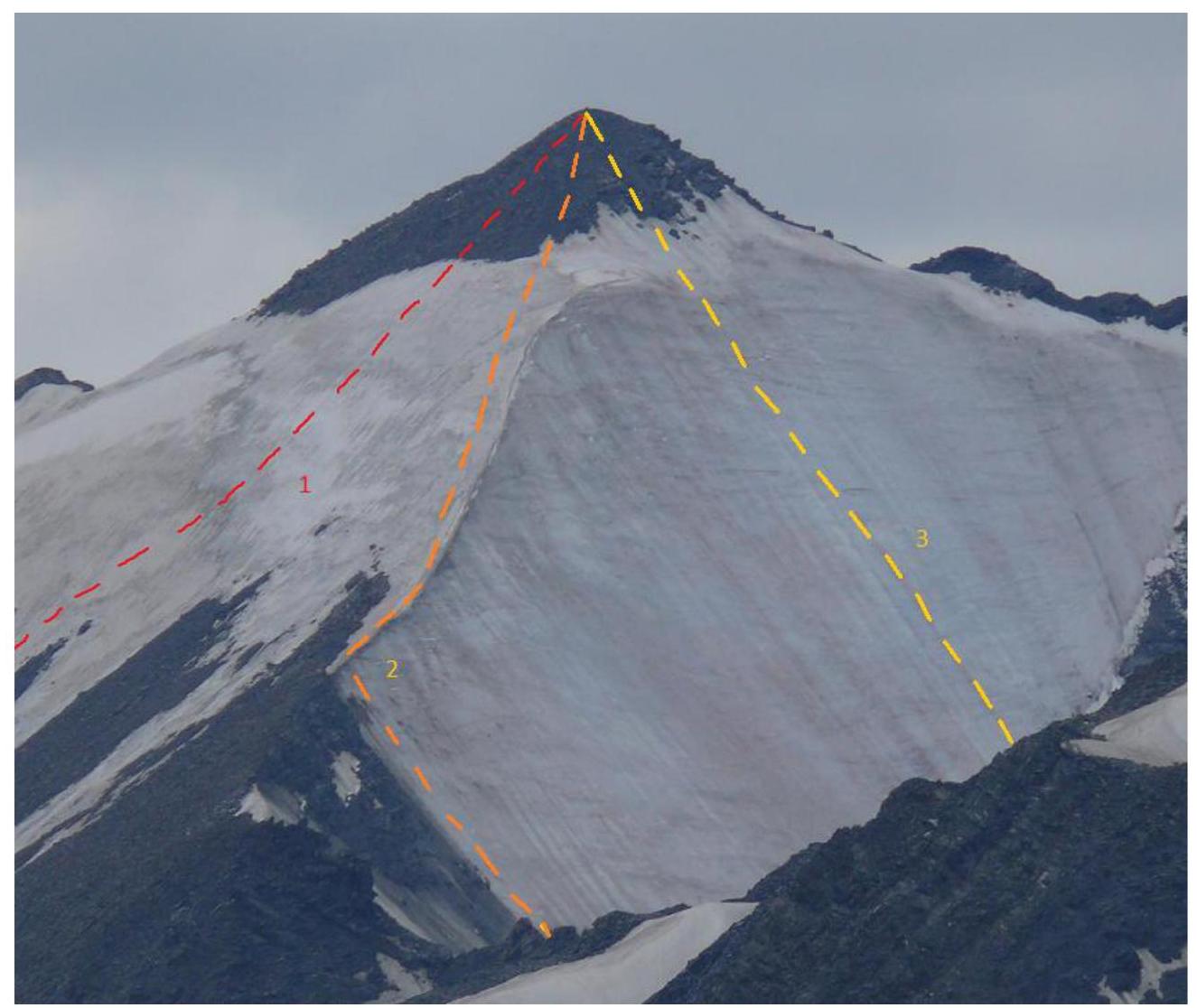
Peak V. Shumilov via the center of the Eastern slope.
- climbed route
- 2B route on the left part of the S slope, №36
- 3A route via the center of the S slope, №37
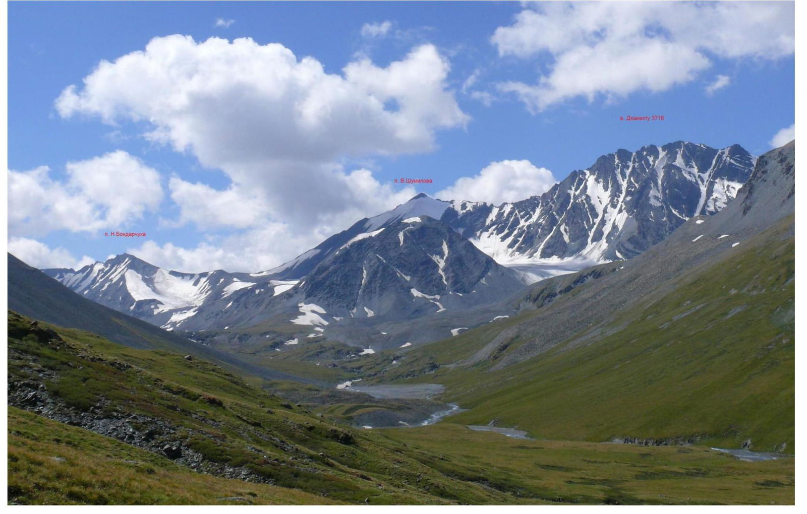
Photo taken — August 3, 2015, just below Lake Atakkol
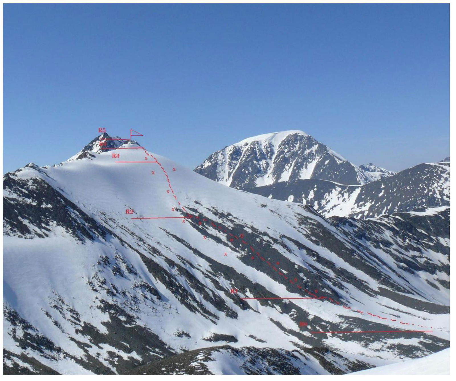
Photo of the route profile from the left
Photopanorama: view from the northeast
- p. N. Bondarchuka (3403 m)
- Peak V. Shumilov (3500 m)
- v. Dzhaniktu (3716 m)
South Chuya Ridge, Elangash valley, map 1
1
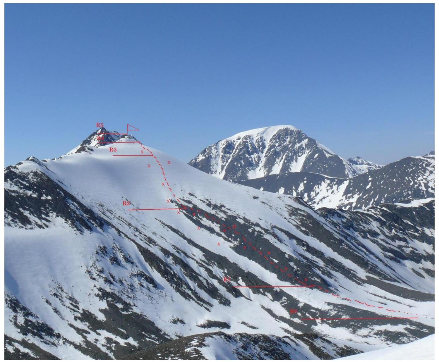
Route to Peak V. Shumilov via the center of the Eastern slope, map 2, view from the north
| Section № | Length (m) | Steepness, deg. | Terrain type | Cat. dif. | Number of pitons |
|---|---|---|---|---|---|
| R0–R1 | 300 m | 15–25° | snow-ice slope | 1 | - |
| R1–R2 | 350 m | 25–30° | scree slope, simultaneous movement | 1 | - |
| R2–R3 | 250 m | 35–40° | snow-ice slope, alternate belay, ice screws | 2 | 19 |
| R3–R4 | 80 m | 25–30° | snow-ice slope, simultaneous belay | 2 | - |
| R4–R5 | 25–30 m | 15–30° | broken rocks, simultaneous belay | 1 | - |
Technical photo of the route Photo taken — May 9, 2014.
Route description
From the advanced camp, located near Lake Karakol (49.735° N, 87.998° E), move along the scree slopes, orienting towards the summit of Peak Shumilov. Approach the route via scree. Approach from the advanced camp — 1–2 hours.
Movement on the route
From the beginning of the glacier, move between rock outcrops, then along the northeastern ridge. From the start of the route to the rocks — 5–6 rope lengths. Then move simultaneously along simple rocks to the summit.
Descent — via the ascent route.