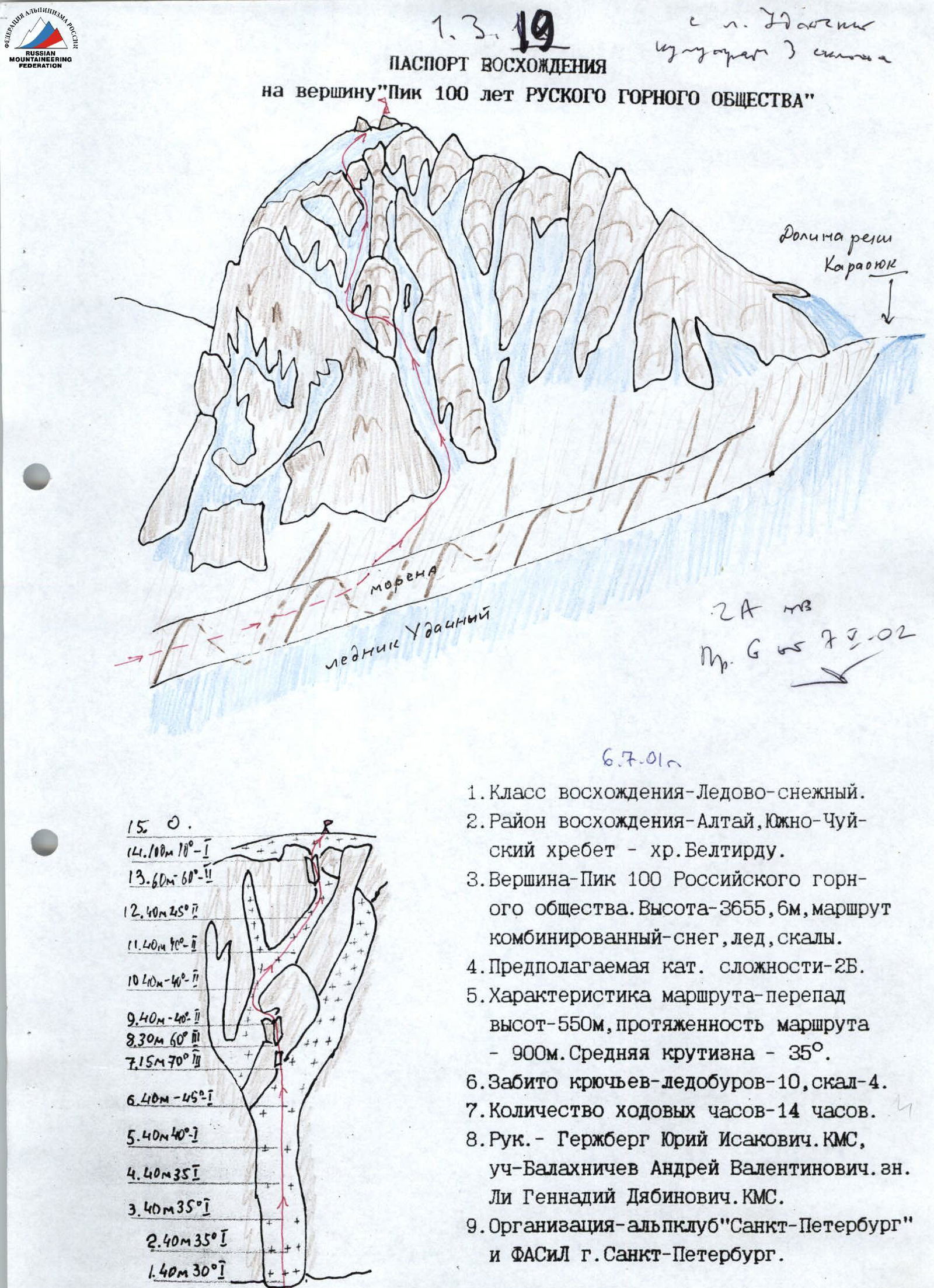
ASCENT CERTIFICATE for the summit “Peak 100th Anniversary of RUSSIAN MOUNTAINEERING SOCIETY” (July 6, 2001)
- Ascent category — snow and ice climb.
- Ascent area — Altai, South Chuya Range — Beltirdu ridge.
- Summit — Peak 100th Anniversary of Russian Mountaineering Society. Elevation — 3655.6 m, combined route — snow, ice, rocks.
- Anticipated category of difficulty – 2B.
- Route description: elevation gain – 550 m, route length – 900 m. Average slope – 35°.
- Ice screws used – 10, rock pitons – 4.
- Total climbing time – 14 hours.
- Team leader — Yuri Gerzhberg, CMS; participant — Andrey Balakhnichev; guide — Gennady Li, CMS.
- Organisation — Alpinism Club “St. Petersburg” and FASIL St. Petersburg.
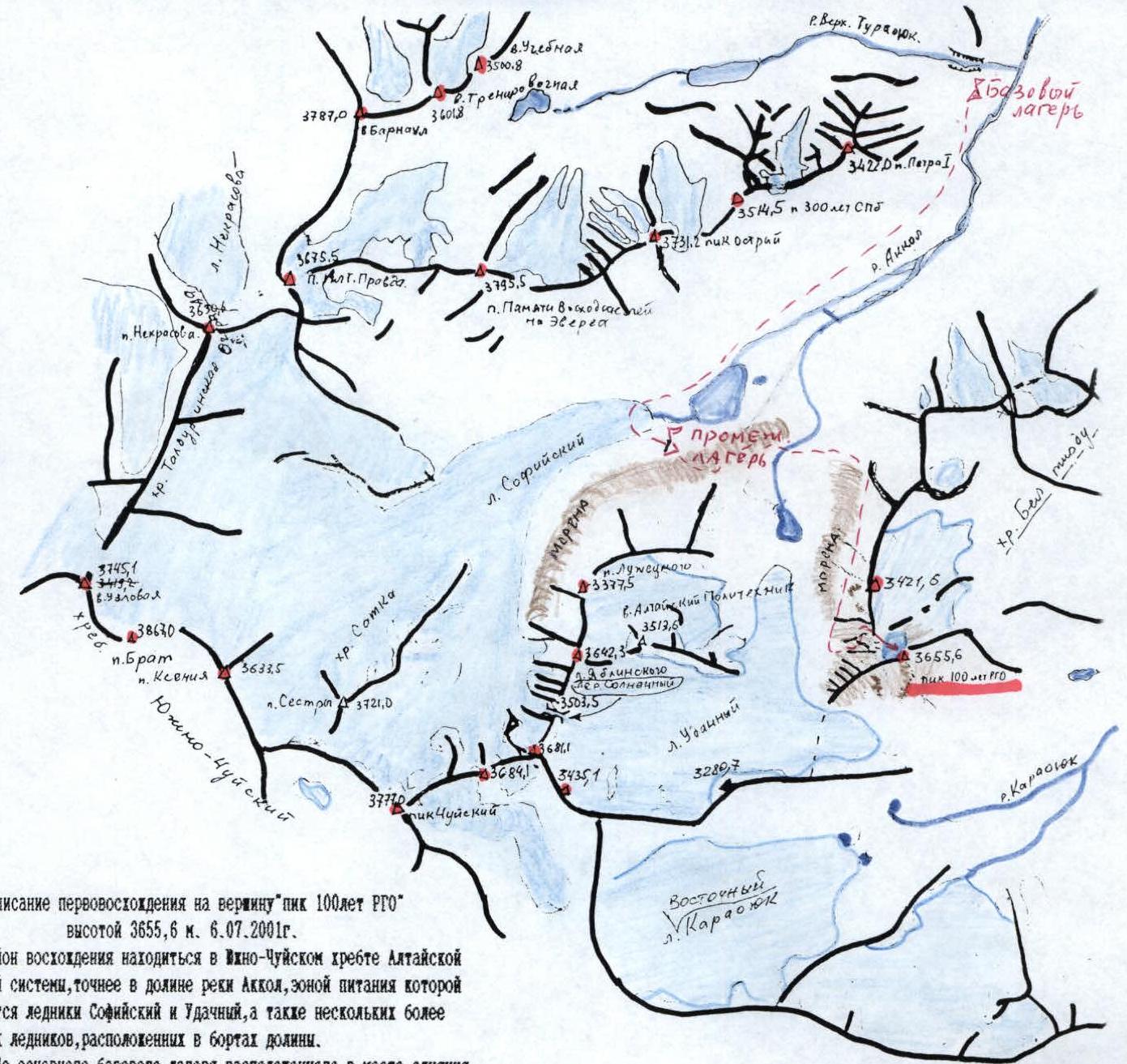
Description of the first ascent to the summit “Peak 100th Anniversary of RMS” with an elevation of 3655.6 m, July 6, 2001. The ascent area is located in the South Chuya Range of the Altai mountain system, more precisely — in the Ak-Khol river valley, which is fed by glaciers:
- Sofiyskiy,
- Udachny,
- and several smaller glaciers located on the sides of the valley.
To reach the main base camp, located at the confluence of the Upper Turaonok river and Ak-Khol river, one can follow these directions:
- From Biysk city along the Chuya highway to Ortalyk village (590 km).
- Cross the Chuya river.
- Continue to Beltiir village.
In Beltiir village, it is recommended to switch to an all-terrain vehicle (GAZ-66) and follow:
- Along the left orographic bank of the Chegan-Ak-Khol river to the Ak-Khol river.
- Then — to the point where the Upper Turaonok river flows into it.
An intermediate camp for the ascent was set up at the end of the Sofiyskiy Glacier. 5 hours from the main base.
The path to the start of the route leads:
- To the right orographic moraine of the Sofiyskiy Glacier.
- Along the moraine to the middle of the Udachny Glacier valley.
- Descend from it and transition to the pocket of the right orographic moraine of the Udachny Glacier.
- Ascend through it to the start of the route.
The route begins via the 5th couloir (counting from the beginning of the mountain to the southwest). The upper two ropes — firn, gradually transitioning into deep snow (3 ropes), and after the couloir turns right — ice appears.
The transition to the 6th couloir is made via a saddle on the ridge leading from the summit.
- First, along a small wall (–15 m).
- Then along an internal corner (–60 m).
The rocks are heavily deteriorated.
Further along the 6th couloir (ice with a thin layer of snow) 4 ropes to the internal corner leading to the upper plateau of the summit. The rocks are heavily deteriorated; it is necessary to maintain a minimal gap between team members. A cairn is built on the northeastern summit plateau on a distant pile of stones.
The following were used: 5 ice screws, 2 m each, rock pitons hammered — 2 times, 2 m each.
Descent from the summit follows the ascent route. Time from the intermediate camp:
- to the route — 4 hours,
- to the summit — 4 hours,
- descent to the moraine — 3 hours,
- to the intermediate camp — 3 hours.
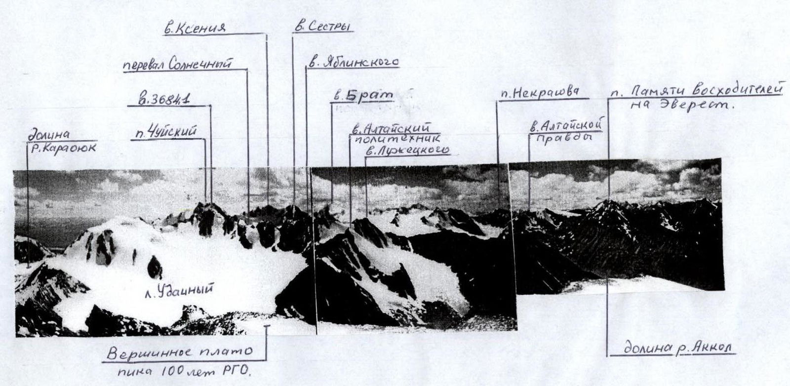
Panorama of the South Chuya Range. Taken from Peak 100th Anniversary of RMS. Photo by A. V. Balakhnichev.