
Report
of the Altai Regional Alpinism Federation (ARAF) team on the first ascent of the traverse of Pik Nikolaya Bondarchuka and Pik Druzhby, South Chuya Ridge, Elangash valley.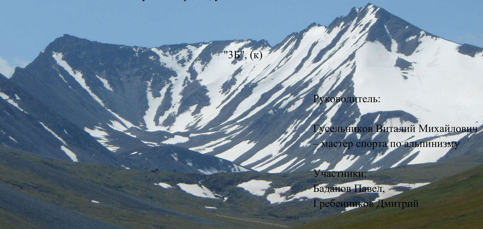
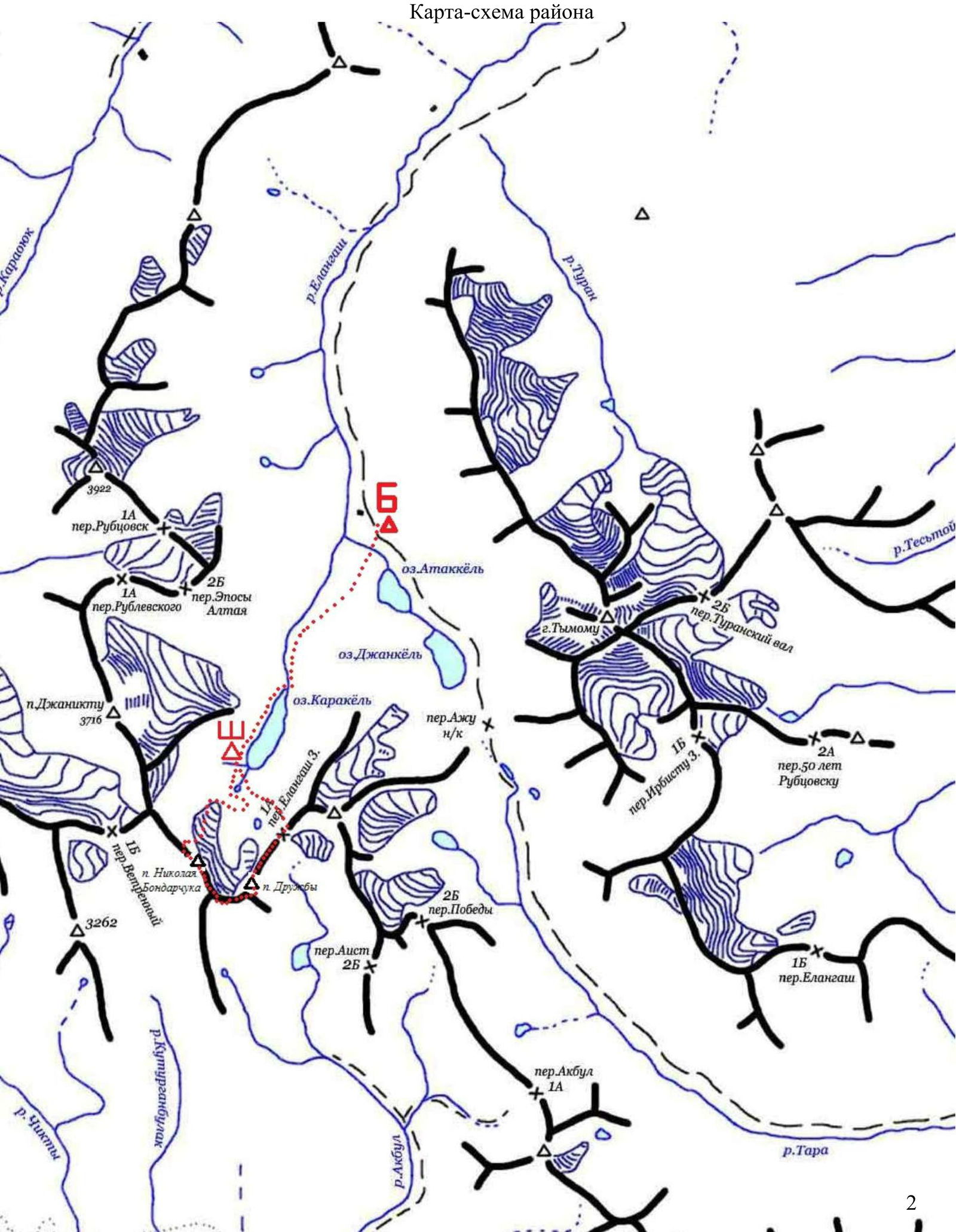
Area map
Ascent Passport
- South Chuya Ridge, Elangash valley.
- Pik Bondarchuka, via the right part of the NW slope – Pik Druzhby via the 3rd ridge – descent via the E ridge through Elangash 3 pass.
- First ascent, presumably 3B category of difficulty.
- Route type: combined.
- Height difference of the route — 500 m.
Route length from the assault camp to the assault camp — 17 km. Route length from the snow depression to the lake under the pass (excluding approach and retreat to the assault camp) — 11 km. Section lengths:
- I category of difficulty — 8500 m
- II category of difficulty — 1200 m
- III category of difficulty — 650 m
- III+–IV category of difficulty — 450 m.
- Equipment used on the route:
Station loops — 28 pcs, ice screws — 2 pcs, rock pitons — 7 pcs.
- Team's climbing hours: hours, 1 day.
- Leader:
Vitaly M. Guselnikov — Master of Sports in Alpinism, Instructor 3rd category, "Rescue Team" badge holder.
Team members:
- Pavel Badanov
- Dmitry Grebennikov.
- Coach:
K.N. Bondarchuk.
- Departure from the assault camp — "Medvezhya" bivouac: 5:00, August 3, 2013.
Start of work on the route: 6:30, August 3, 2013. Reach the ridge: 9:20, August 3, 2013. Reach the first summit: 10:10, August 3, 2013. Reach the second summit: 14:20, August 3, 2013. Reach the pass col: 20:00, August 3, 2013. Reach the lake: 20:30, August 3, 2013. Return to the assault camp: 21:30, August 3, 2013.
- Organization: Altai Regional Alpinism Federation.
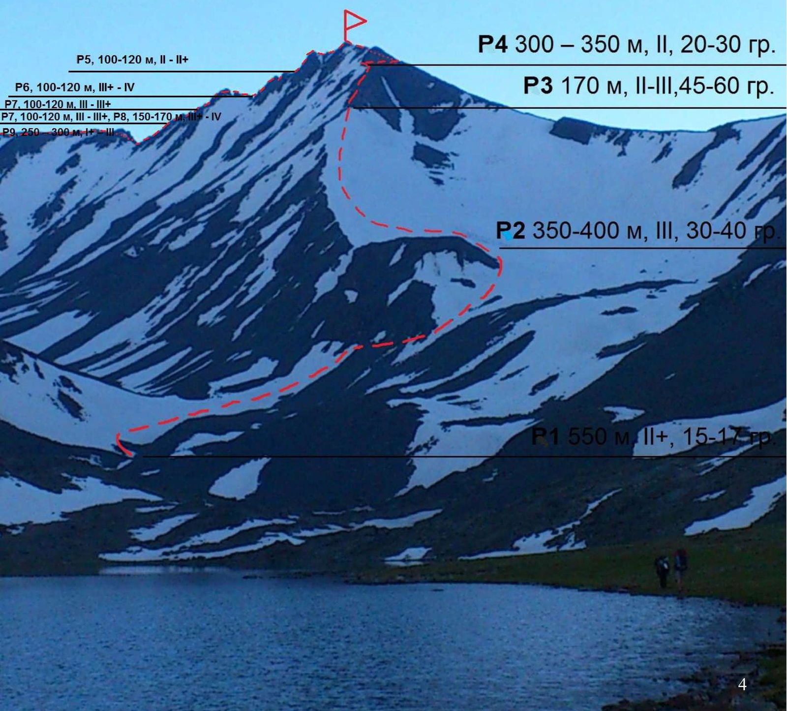
Scheme of the first part of the route by sections
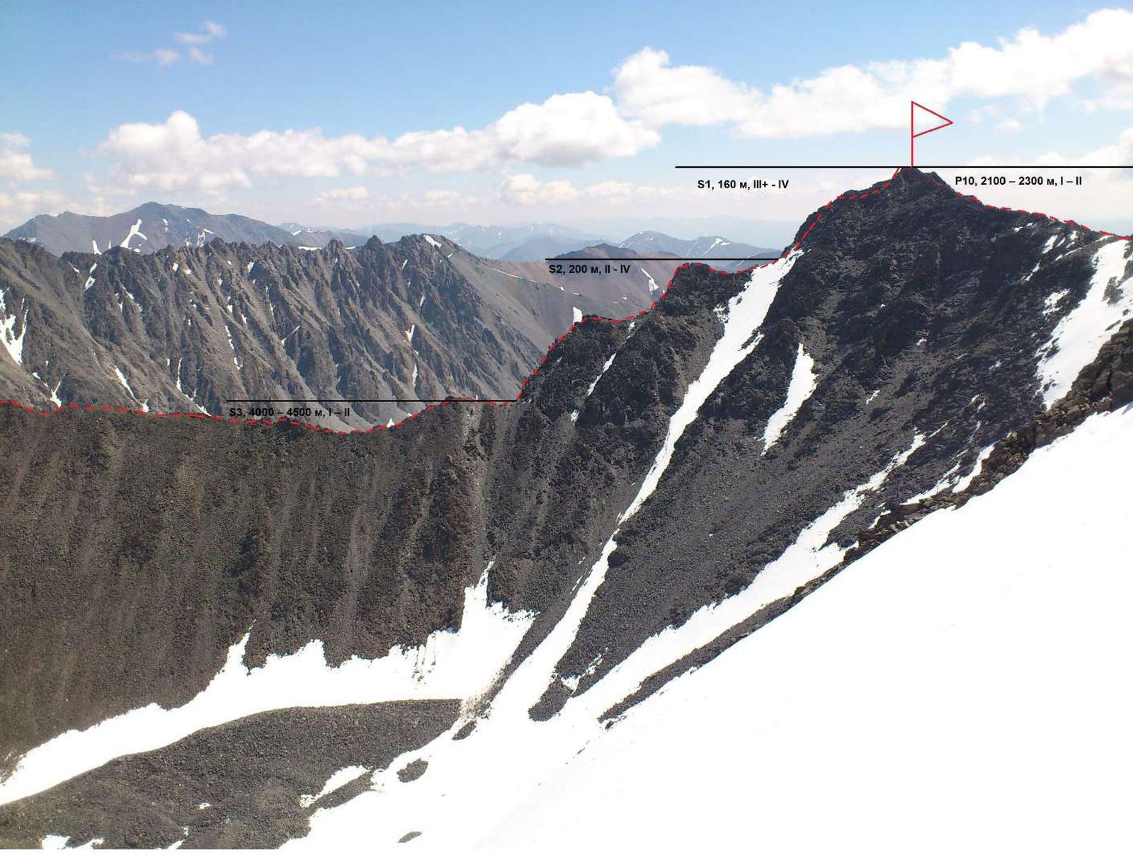
Scheme of the second part of the route by sections
Route Description
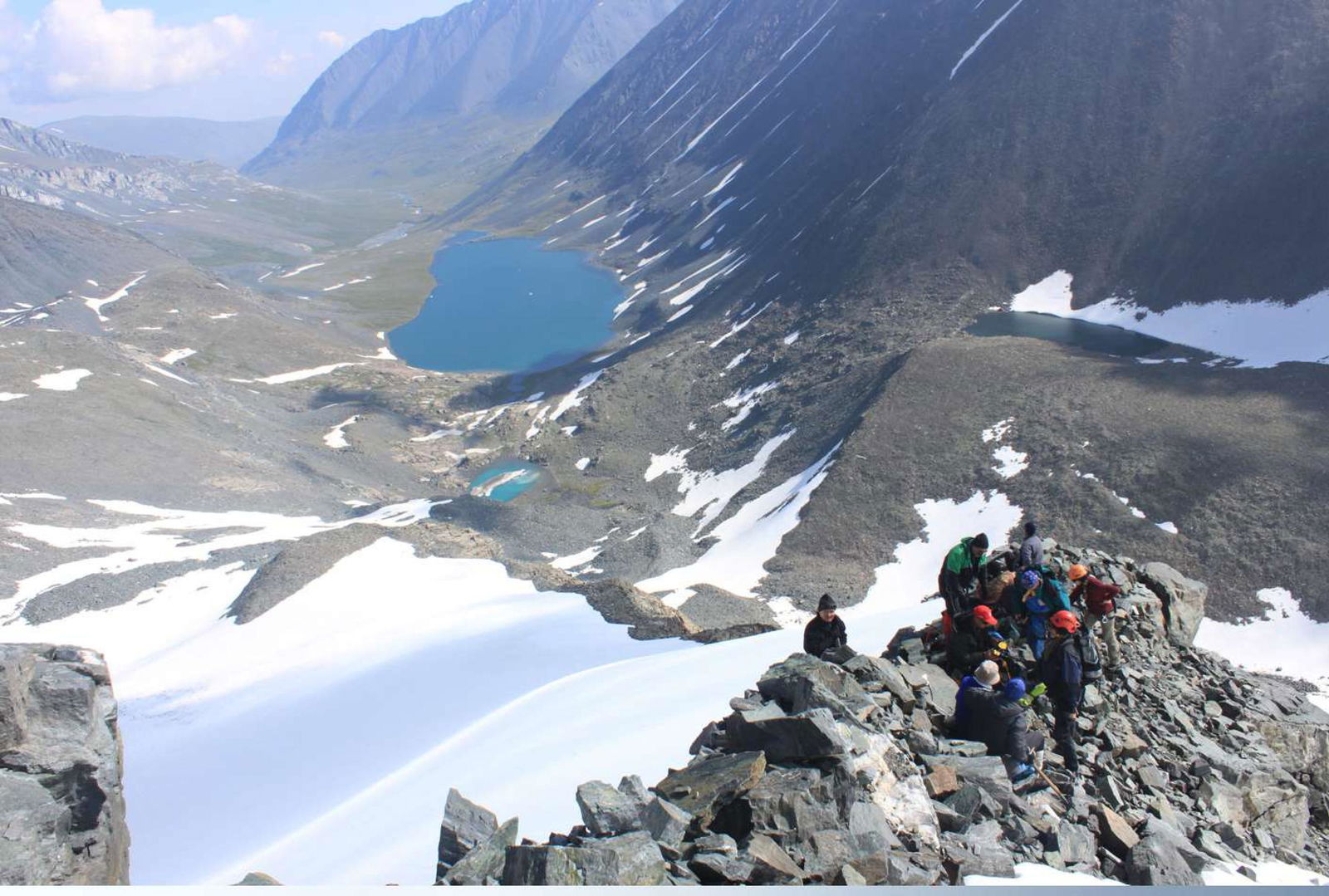
From the base camp, located above the upper shepherd's bivouacs in the Elangash valley, move with a slight ascent along the left (orographic) bank of the Elangash river to Karakul lake (about 3 hours). Before reaching the lake, cross the river to the opposite bank. Go around Karakul lake; there are grassy terraces on the right bank — a convenient place for an assault camp. By a common decision of the first ascenders, the bivouac near the lake was named "Medvezhya" (Bear's), as they saw fresh bear tracks nearby. You can set up tents and leave unnecessary equipment here.
From "Medvezhya" bivouac, move up a large moraine talus for about 1–1.5 hours — this is the start of the route.
R1, 550 m, I, 15–17°. Here, to ensure safety, it is necessary to tie into ropes and put on crampons. In icy conditions, it is recommended to use ice screws. Cross the snowfield in ropes, in the direction of a clearly defined rock shoulder, the massif of which is bypassed on the right along the snowfield, and exit onto the firn plateau.
R2, 350–400 m, II, 30–40°. Further movement for teams of two or three people is recommended to be simultaneous, with insurance through ice screws in the upper part. For a larger group, movement with the organization of belays is recommended. Go to a clearly defined rock platform. Passing the second section takes 1.5–2 hours.
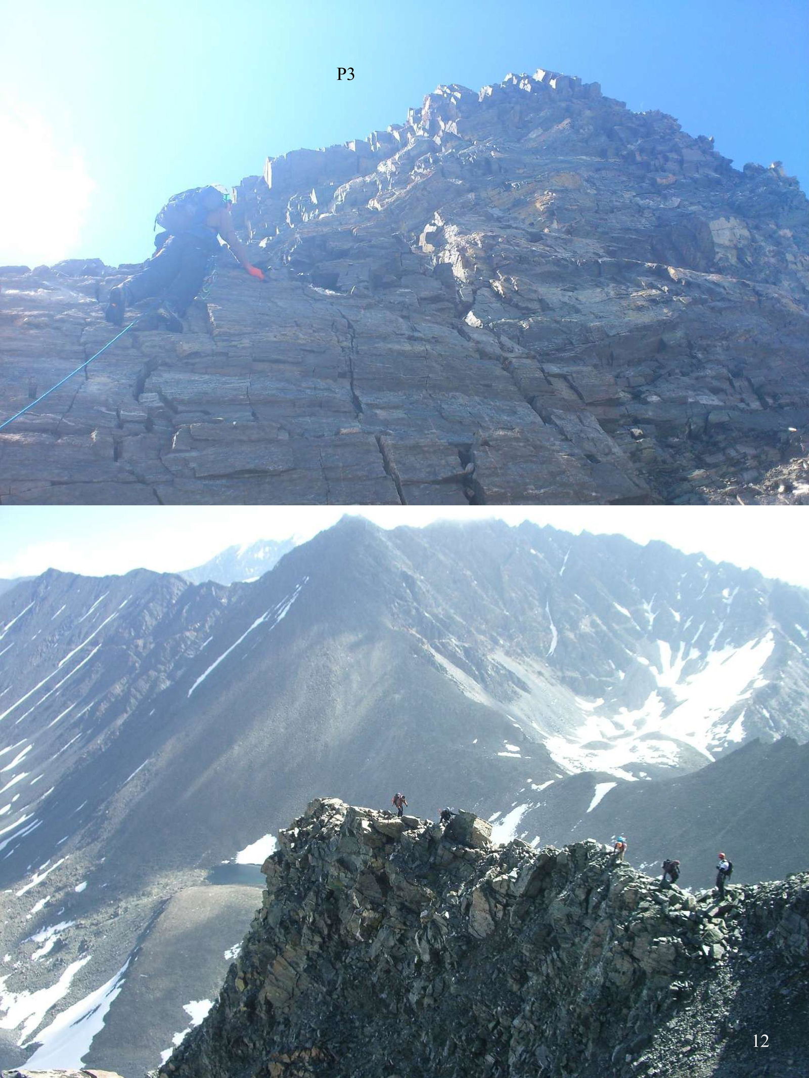
R3, 170 m, III, 45–60°. The key section of the route to Pik Nikolaya Bondarchuka — broken rocks, heavily shedding! From the rock ledge, move up towards the gendarme's summit with alternate belays. Use large-diameter loops as intermediate points. Belaying is difficult. After passing two belay ropes, exit onto a sharp, broken ridge and organize movement in ropes until the pre-summit tower with insurance through ledges.
R4, 300–350 m, II, 20–30°. Traverse the pre-summit massif from left to right — one rope to a clearly defined platform on the ridge. From the tower's summit, large rocks can fall; move as quickly as possible, with alternate belays recommended. Exit onto a clearly defined platform, from which the path lies along the ridge towards the summit. Move simultaneously in ropes with insurance through ledges. Passing the fourth section takes 1 hour. The summit is a clearly defined rock peak.
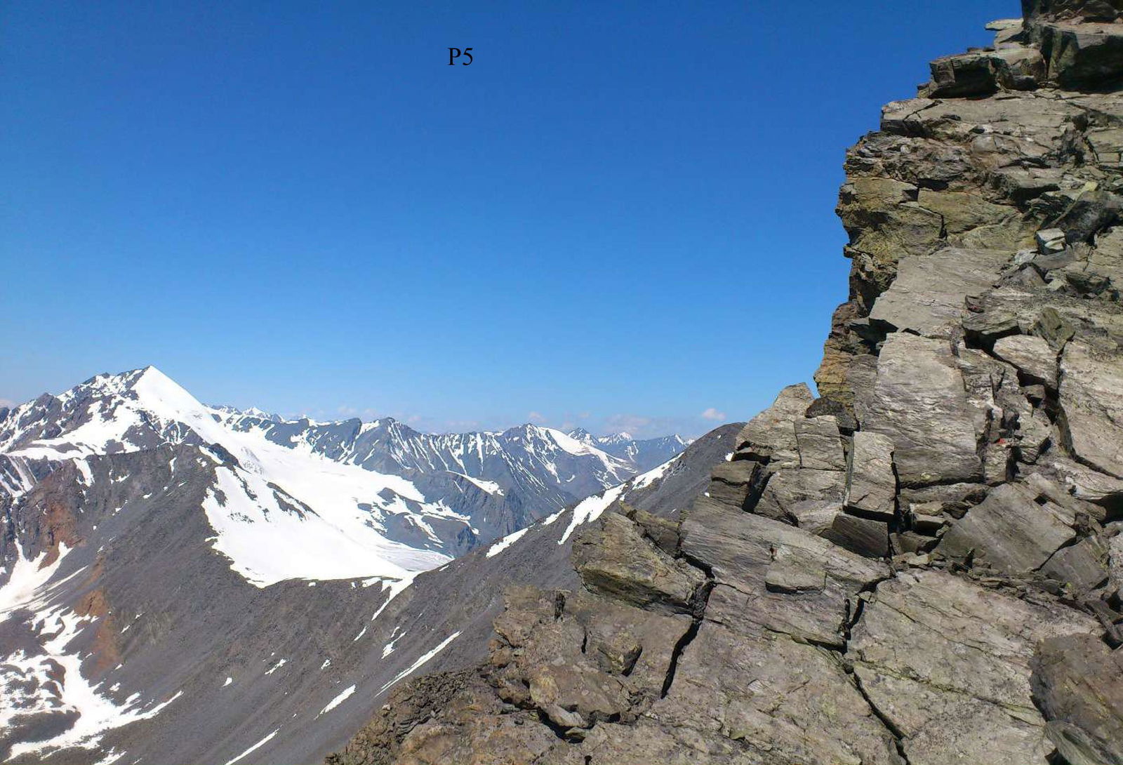
R5, 100–120 m, 2–3. After passing Pik Bondarchuka towards Pik Druzhby, descend to a small col — one rope. Rocks are heavily broken. The first gendarme is ahead. Move through the gendarme's summit, descend from the summit to the next col on the ridge — one rope, 3. The section is passed simultaneously in ropes with insurance through ledges.
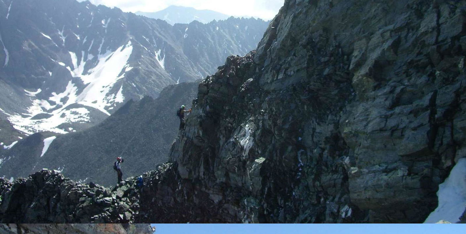
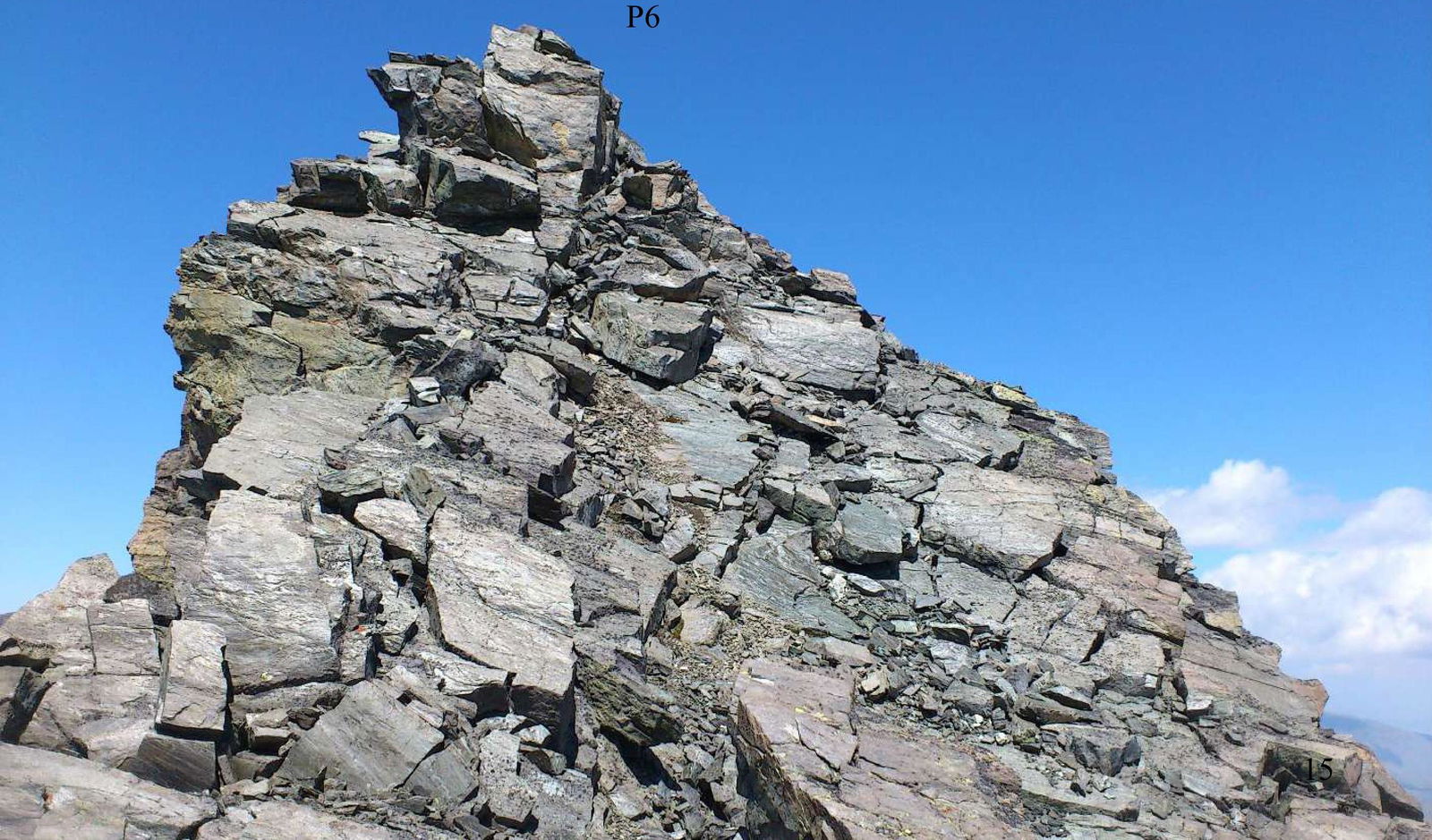
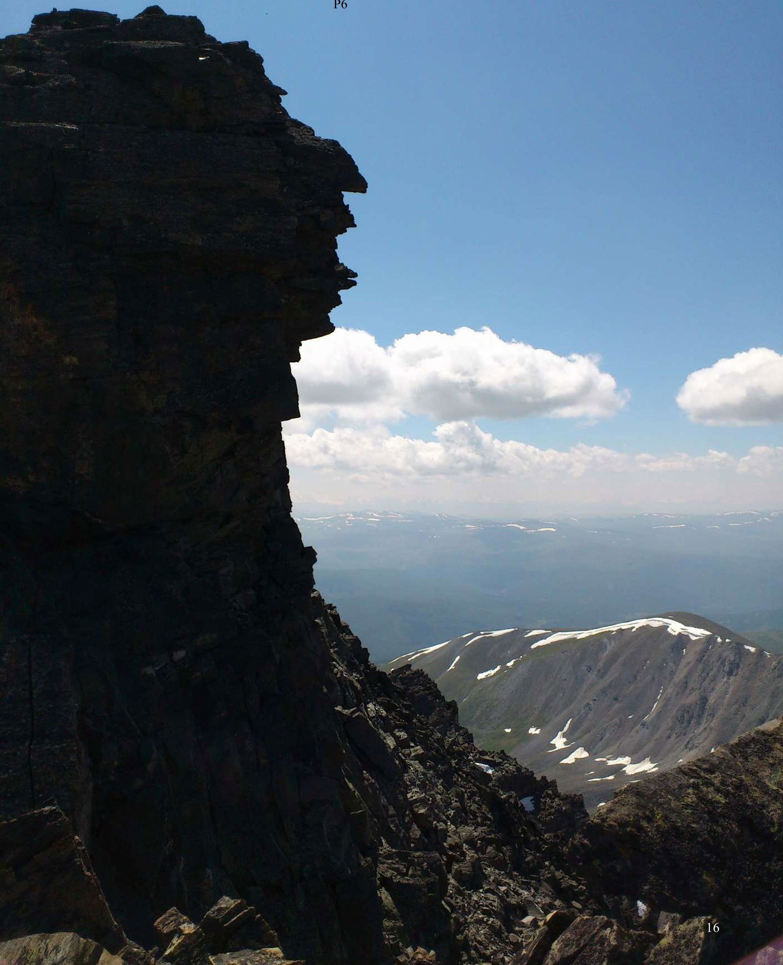
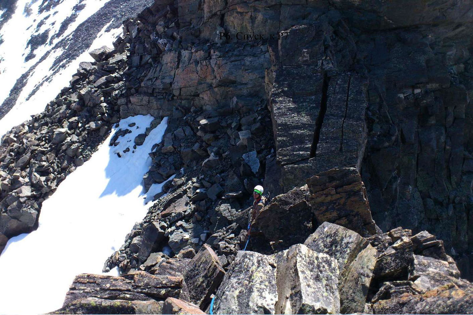
R6, 100–120 m, 4. From the col, move alternately. The second gendarme is ahead; it is necessary to pass it directly via the summit — one rope (sections of climbing up to 4, move alternately with thorough piton insurance). Then, from the summit, rappel down to a convenient platform between the second and third gendarmes (the section is steep, broken rocks). It is better to bypass the third gendarme on the left, with alternate insurance, to a convenient platform between the third and fourth gendarmes.
R7, 100–120 m, 3–4. The fourth gendarme is ahead; it is best to bypass it on the left with alternate insurance. Overcoming one rope of broken rocks (25–30 m, 4, many "live" slabs, insurance is difficult), exit onto a sloping snow ledge, from which it is necessary to move up and to the right along the broken rocks 2–3 (insurance through rock ledges) to the ridge crest. There is a small ledge here.
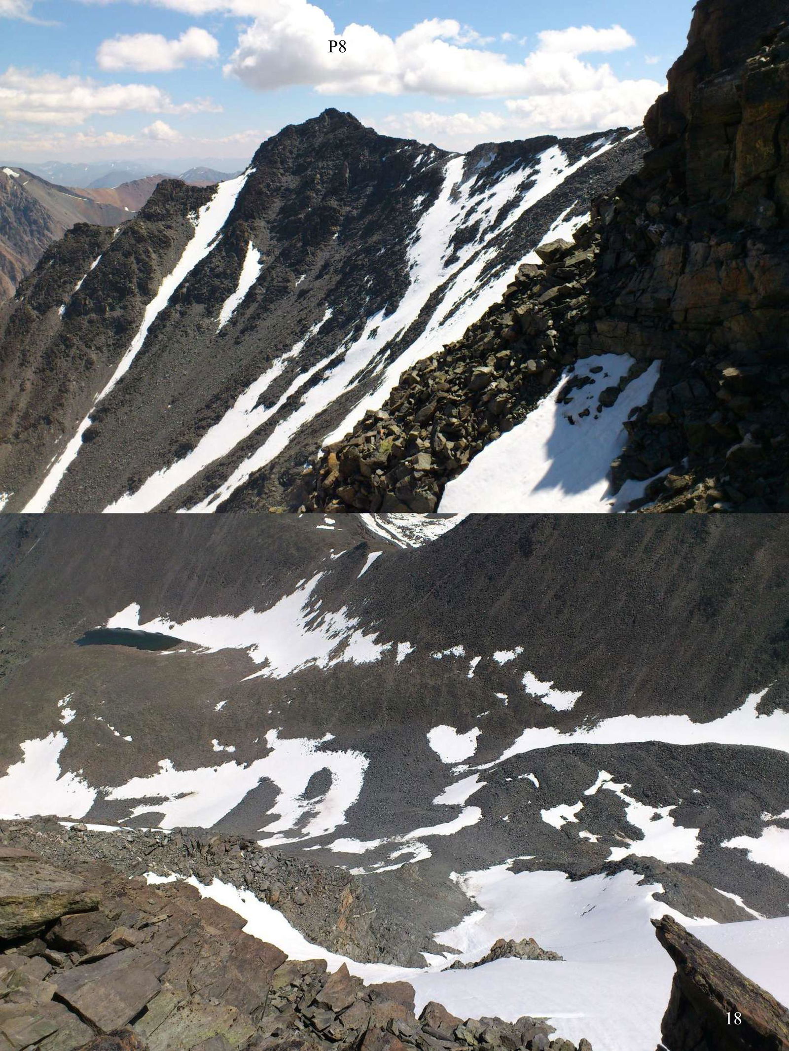
R8, 150–170 m, 4. The fifth gendarme is ahead; it is recommended to pass it directly via climbing with alternate insurance (short sections up to 4) — one rope. After reaching the top, move along the left slope of the heavily broken ridge (broken rocks up to 3–4, "hanging" slabs on rock heads, insurance is difficult) — two ropes to a convenient platform in a small col on the ridge.
R9, 250–300 m, 2–3. The sixth gendarme is recommended to be bypassed on the left, closer to the summit, overcoming a section of broken rocks 20–25 m up to 3, one rope, then along a simple ridge 1–2 descend to the next gendarme. The seventh gendarme is not clearly defined and is easily bypassed on the right along the talus slope — two ropes simultaneously in ropes to a couloir crossing the slope. It is necessary to cross the couloir, take a left direction towards a simple ridge (one rope, 1–2), and ascend to the ridge.
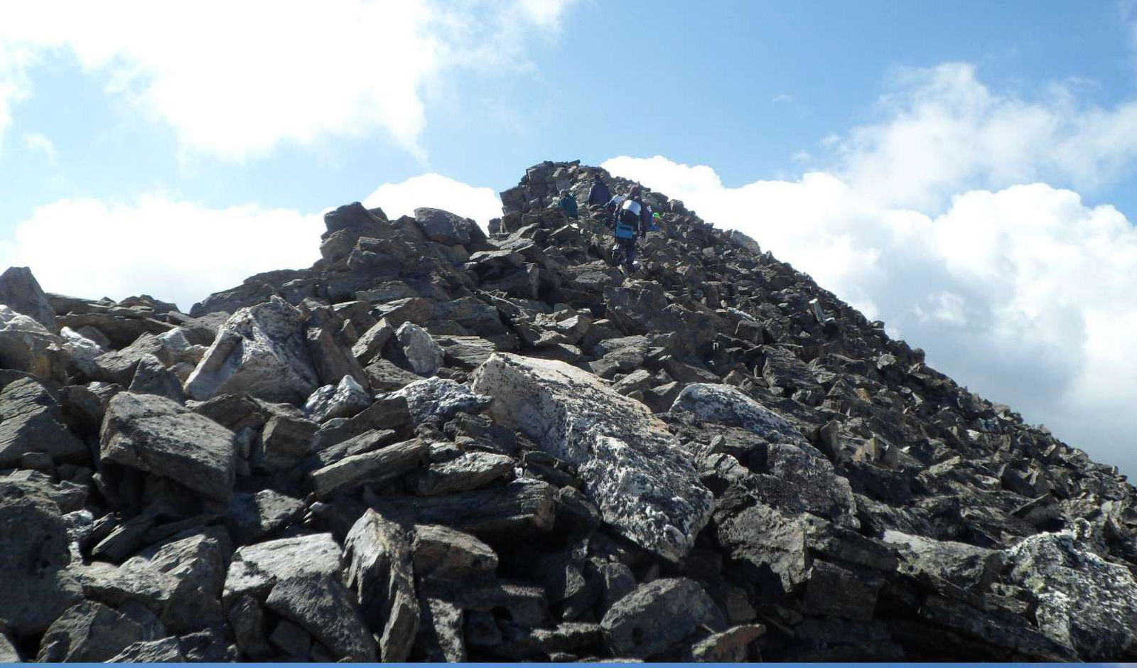
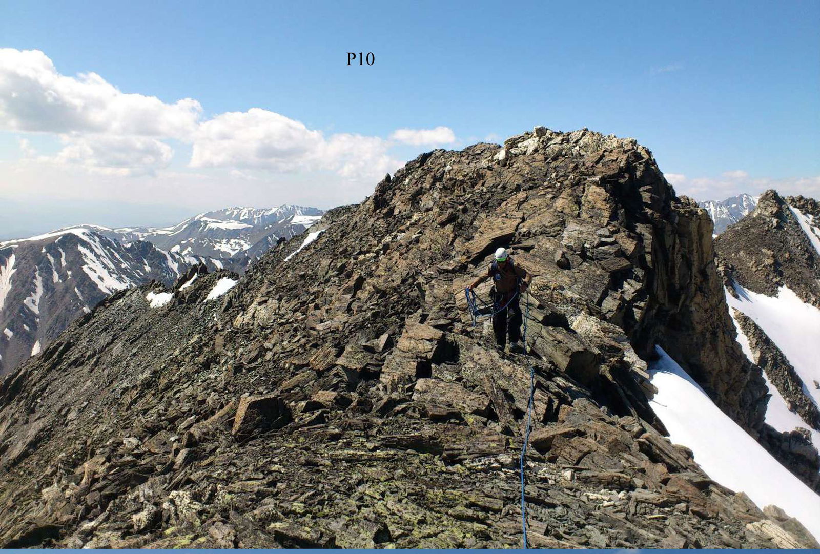
R10, 2100–2300 m, 1–2. Then move simultaneously in ropes along a simple ridge towards the summit for about 30–40 minutes. The summit is located on the left. From the ridge directly to the summit — one rope of broken rocks 2. The summit is an acute rock peak, approximately equal in height to Pik Nikolaya Bondarchuka (visually). The path from Pik Nikolaya Bondarchuka took the group about 4 hours. On the summit, a non-obvious rock cairn was found without any signs of human presence. Since no other traces were found on the route or summit, we claim the right to name the summit Pik Druzhby and request that the route be considered a first ascent.
S1, 160 m, 4. From the summit, move along a sharp rock "knife-edge" for about 10 m with alternate insurance, then rappel down three ropes towards the summit of the ice couloir. The section is heavily broken, large inclined slabs lie unstably. Above the couloir on the ridge is a snowfield; it is necessary to descend onto it.
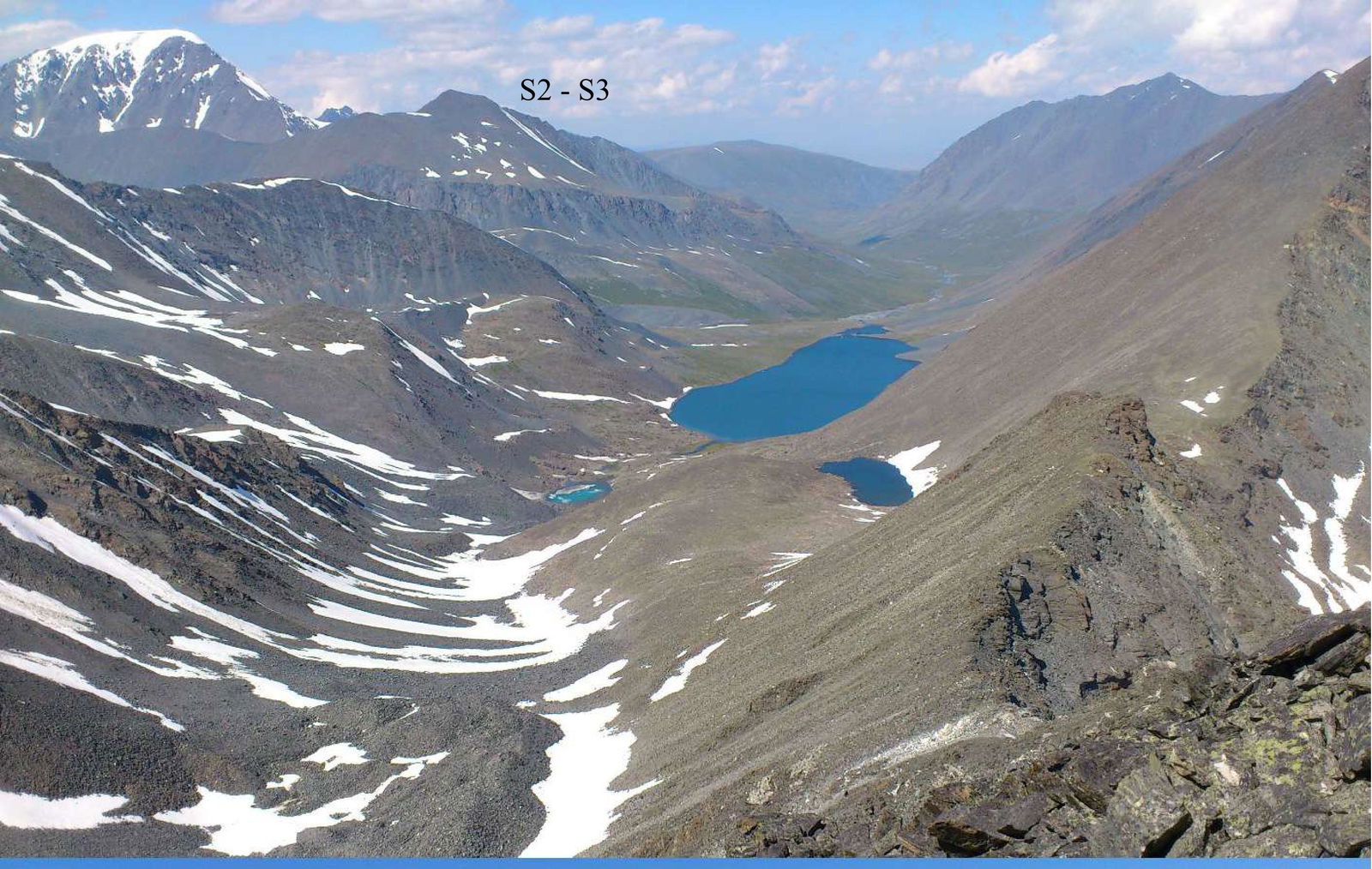
S2, 200 m, 2–4. Cross the snowfield simultaneously in ropes and move to a rock platform on a ridge outcrop — one rope. Then there is a steep section of broken rocks; a rappel down one rope along the ridge direction to a clearly defined outcrop on the ridge is recommended. From the outcrop, it is recommended to rappel down two ropes (broken rocks, large stones lying on inclined smooth "rock heads"; move carefully!!!) onto a simple but sharp rock ridge.
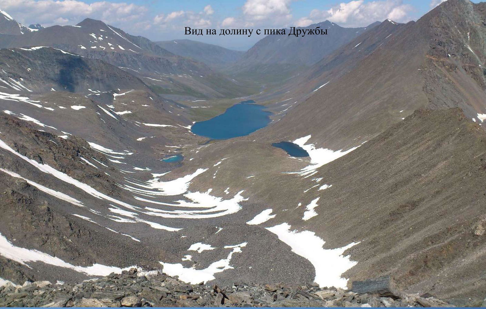
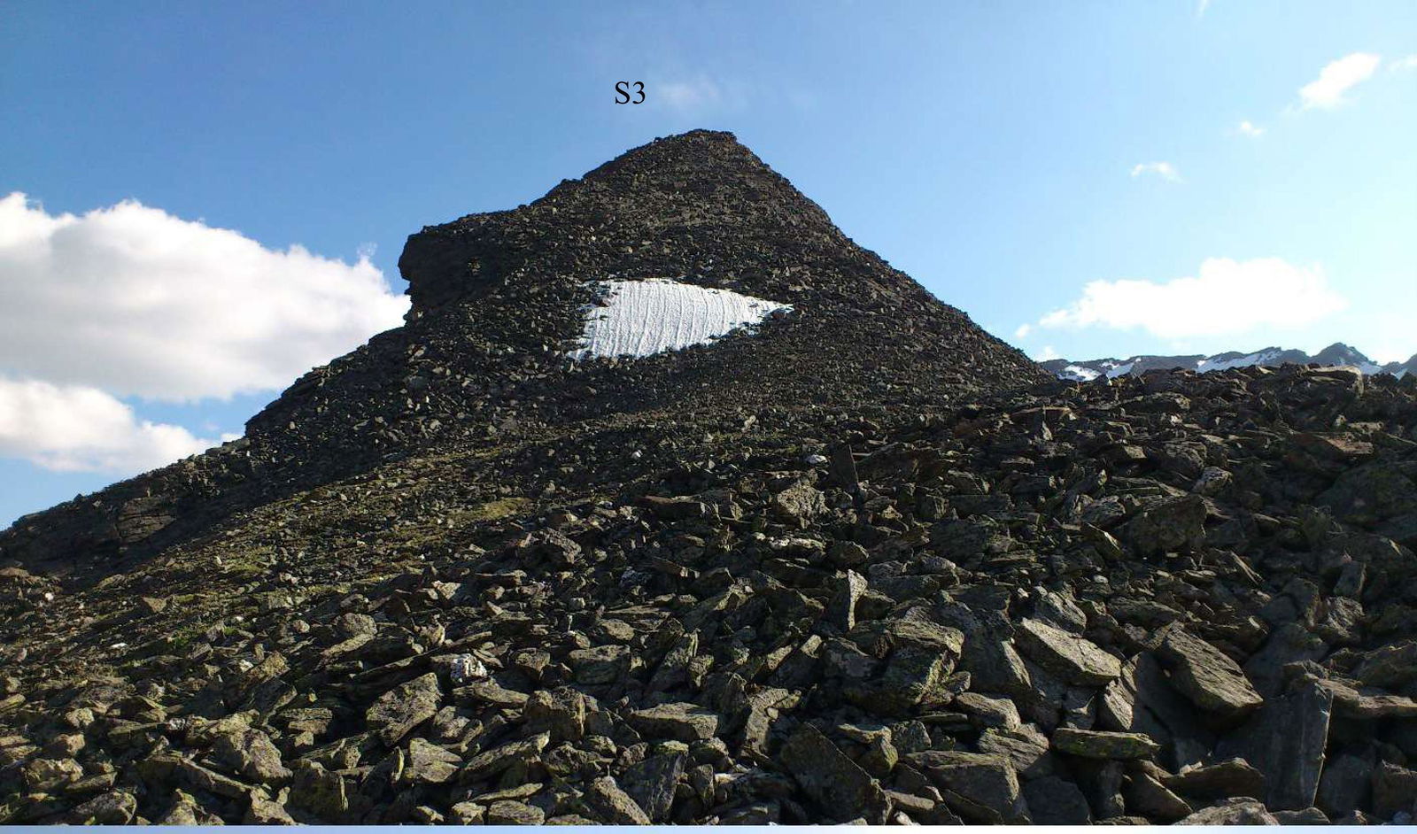
S3, 4000–4500 m, 1–2. Along a simple ridge simultaneously in ropes for about 2 hours to the col of Elangash 3 pass. From the pass, descend left down towards a small lake for about 30–40 minutes. The path from Pik Druzhby to the lake took the group 5–5.5 hours. From the lake, descend down a large talus for 1 hour to the assault camp.
R2

R2–R4
Approaching R3
R3
R3
R4
View of the ridge
R6
R6
R6. Descent to R7
R8 – summit – S3
View of Pik Nikolaya Bondarchuka and the ridge
View of the valley from Pik Druzhby
On the summit of Pik Druzhby
S1
Profile of Pik Nikolaya Bondarchuka