Report
on the first ascent of the route to the summit Yubileynaya from the Container pass, category 1B, by the team of the Sports club of alpinists "Voshozhdenie" (Barnaul) on May 3, 2019
I. Ascent Passport
| № | 1. General Information | |
|---|---|---|
| 1.1 | Full name, sports rank of the leader | Lezhnev Anton Petrovich, CMS |
| 1.2 | Full name, sports rank of the participants | Belov Petr Viktorovich, 3rd sports rank Volkov Anton Leonidovich, 3rd sports rank Zanina Natalia Nikolaevna, 2nd sports rank Korobko Tatyana Vitalievna, 3rd sports rank Malyshkin Vladimir Alexandrovich, 3rd sports rank Pechyonkina Lyudmila Nikolaevna, 3rd sports rank Shubin Alexander Yurievich, 3rd sports rank |
| 1.3 | Full name of the coach | Lezhnev Anton Petrovich |
| 1.4 | Organization | Sports club of alpinists "Voshozhdenie" |
| 2. Characteristics of the object of ascent | ||
| 2.1 | Region | Altai, Severo-Chuysky ridge |
| 2.2 | Valley | Aktru |
| 2.3 | Section number according to the classification table 2013 | 1.2 |
| 2.4 | Name and height of the summit | Yubileynaya, 3403 m |
| 2.5 | Geographic coordinates of the summit (latitude/longitude), GPS coordinates | |
| 3. Characteristics of the route | ||
| 3.1 | Name of the route | from the Container pass |
| 3.2 | Proposed category of difficulty | 1B |
| 3.3 | Degree of route exploration | First ascent |
| 3.4 | Character of the route terrain | Combined |
| 3.5 | Altitude difference of the route (according to altimeter or GPS) | 520 m (from Goluboye lake) |
| 3.6 | Length of the route (in meters) | 2000 m (from Goluboye lake) |
| 3.7 | Technical elements of the route (total length of sections of different categories of difficulty with indication of terrain character (ice-snow, rock)) | 1st cat. diff., combination - 1300 m 2nd cat. diff., combination - 700 m |
| 3.8 | Descent from the summit | To Znachkist pass and further to Goluboye lake |
| 3.9 | Additional characteristics of the route | Lack of water |
| 4. Characteristics of the team's actions | ||
| 4.1 | Time of movement (in hours and days) | 1 day, 11 hours |
| 4.2 | Overnights | - |
| 4.3 | Departure on the route | 7:00, May 3, 2019 |
| 4.4 | Arrival at the summit | 15:00, May 3, 2019 |
| 4.5 | Return to the base camp | 18:15, May 3, 2019 |
| 5. Responsible for the report | ||
| 5.1 | Full name, e-mail | Lezhnev Anton Petrovich, anton.lezhnev@gmail.com |
II. Description of the ascent
1. Characteristics of the object of ascent
1.1. General photo of the summit
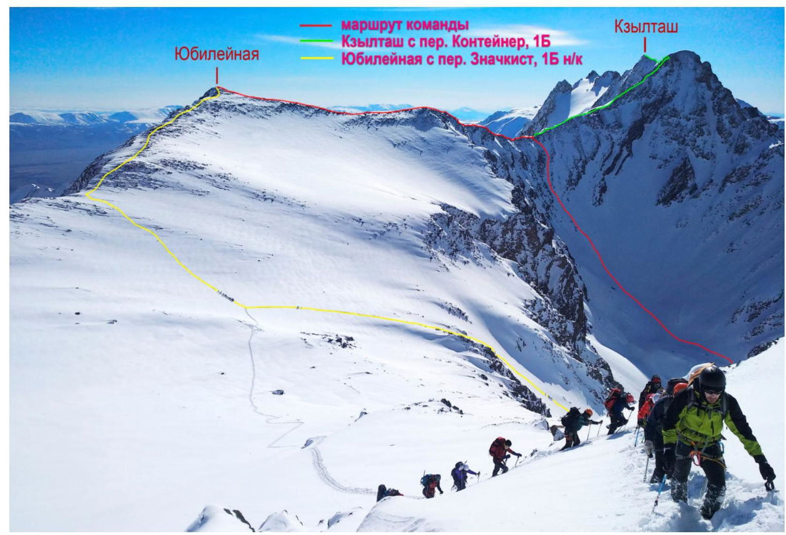
Photo 1. Summit Yubileynaya, shooting point - eastern ridge of v. Stazhёrov, May 8, 2018
1.2. Photo of the route profile
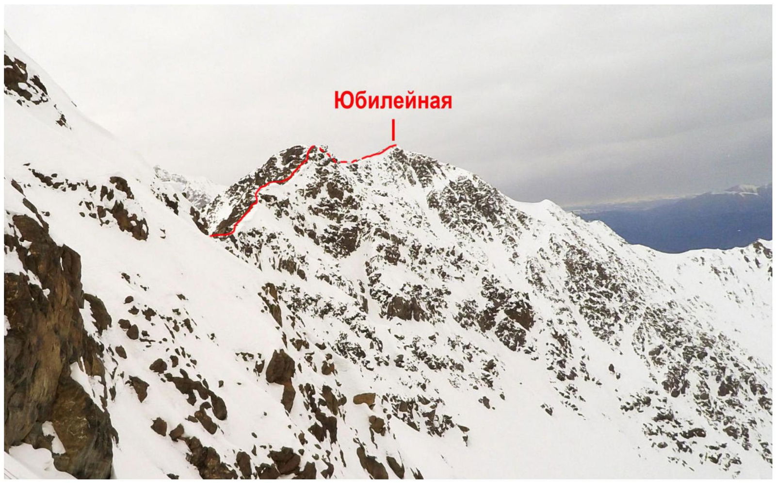
Photo 2. Route profile, shooting point - route 3A cat. diff. on SW ridge of v. Kzyl-Tash, May 5, 2019
1.3. Photopanorama of the area
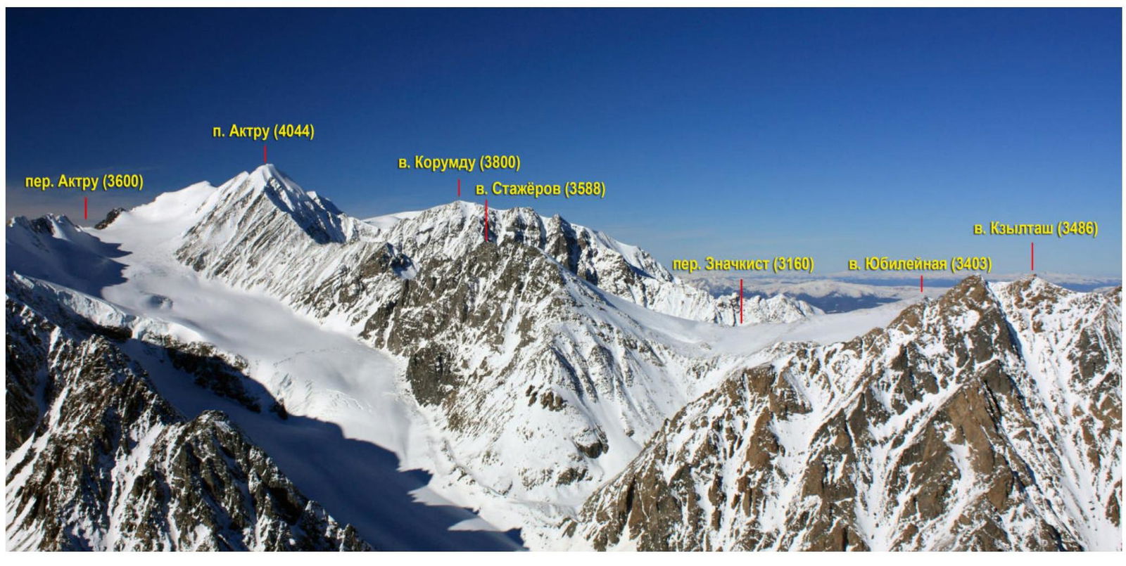
Photo 3. Panorama of the area, shooting point - summit Karatash, November 2014
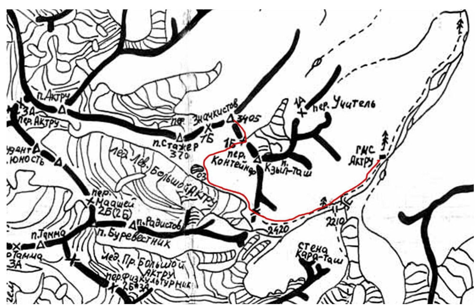
1.4. Map of the area
2. Characteristics of the route
2.1. Technical photographs of the route
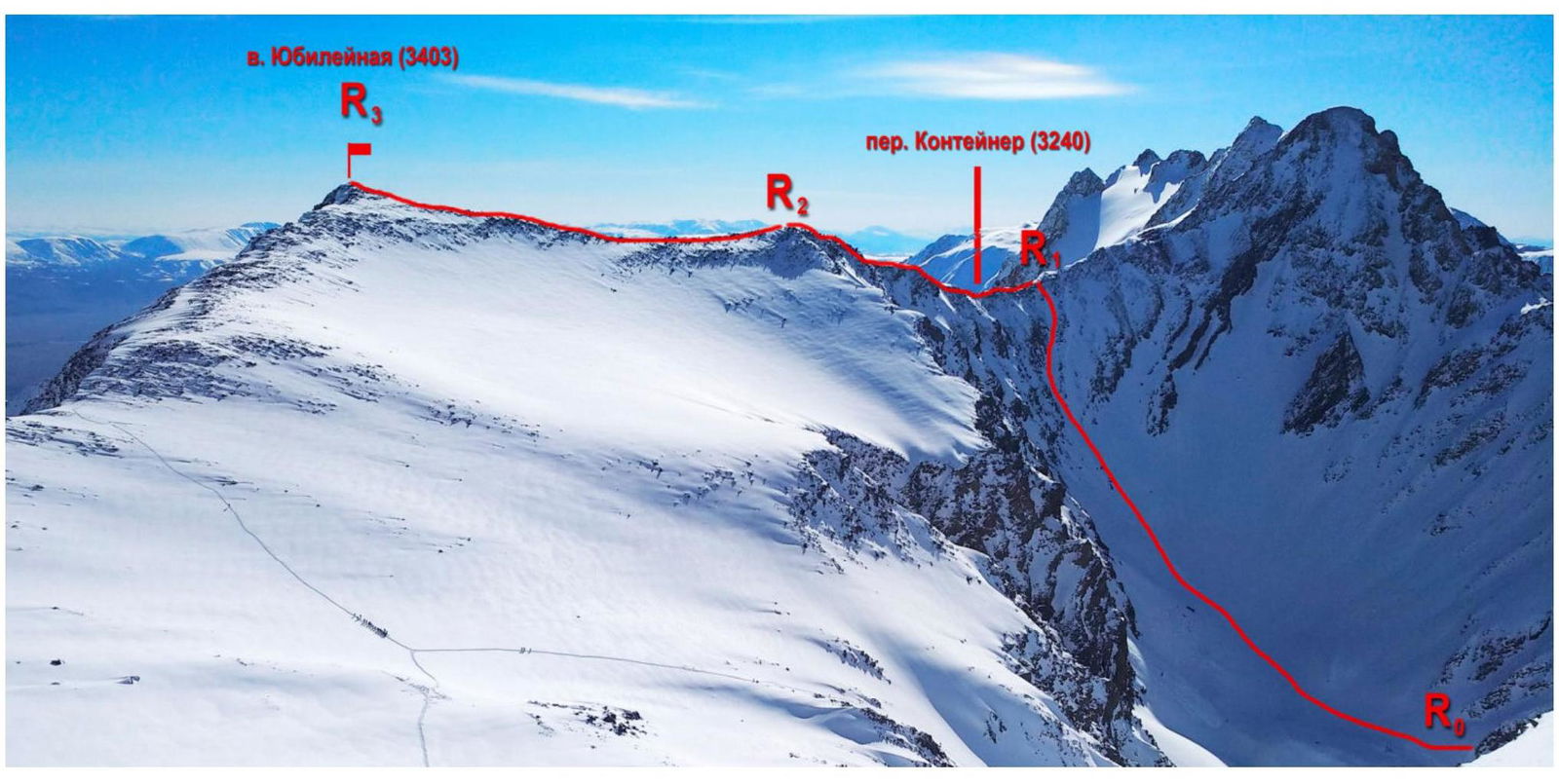
Photo 4. General photo of the route
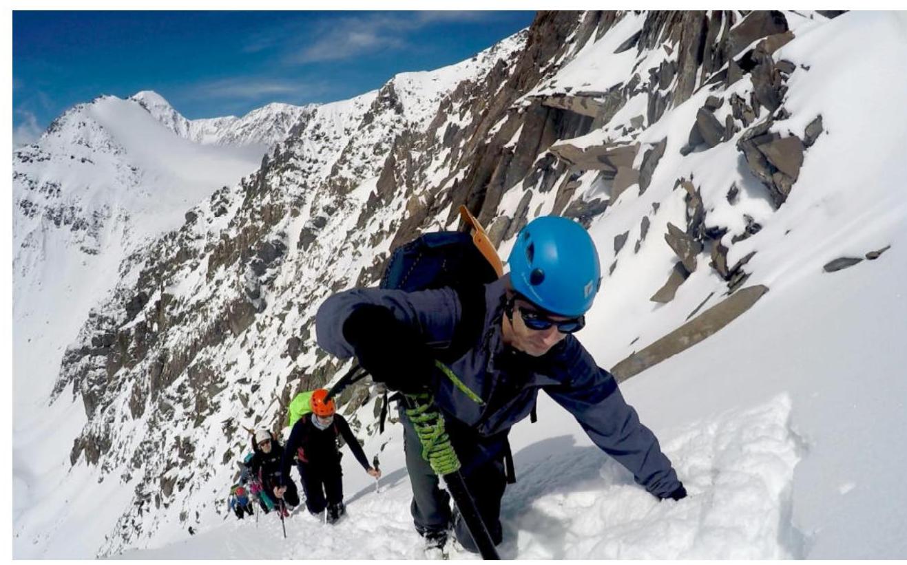
Photo 5. Ascent to Container pass
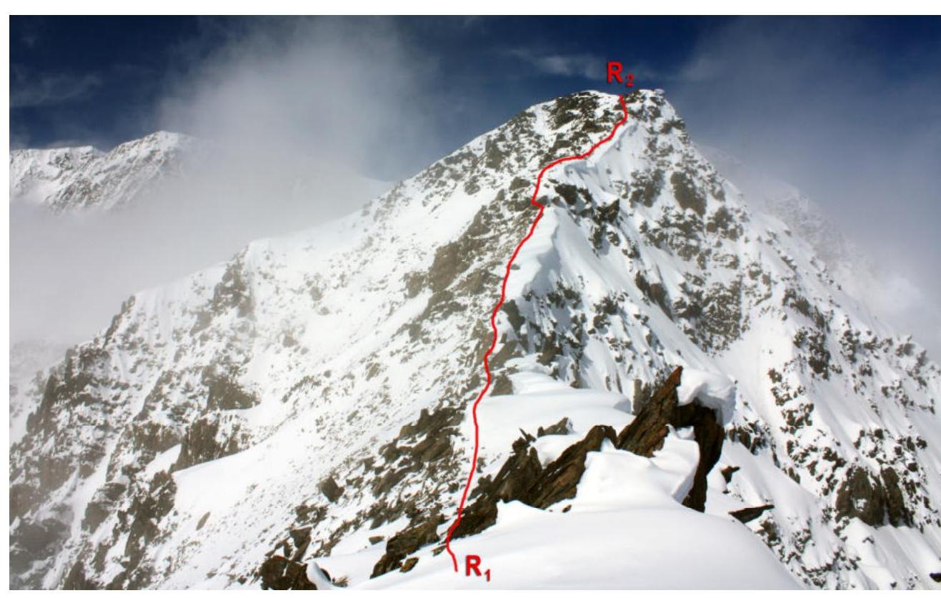
Photo 6. Section R1–R2. Ridge ascent from Container pass
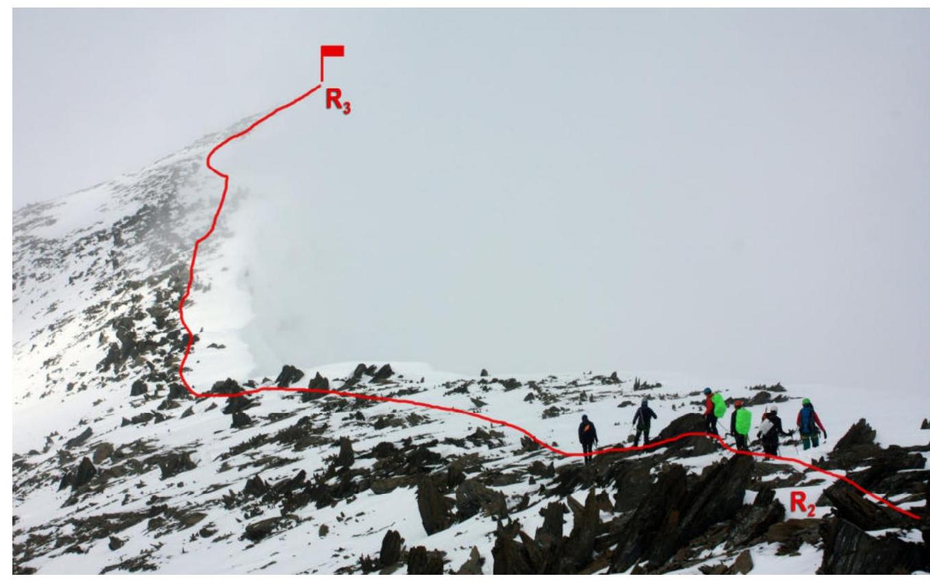
Photo 7. Section R2–R3. Ridge to the summit
2.2. Technical characteristics of the route sections
| Section № | Terrain character | Category of difficulty | Length, m | Type and number of hooks |
|---|---|---|---|---|
| R0–R1 | combined | 1–2 | 1350 | - |
| R1–R2 | combined | 2 | 250 | - |
| R2–R3 | combined | 1 | 400 | - |
3. Characteristics of the team's actions
3.1. Brief description of the route passage
Departure from Akturu tourist camp at 7:00. The approach to Goluboye lake (2880 m) takes about 3 hours. The trail goes along the Aktru river under the slopes of v. Kzyl-Tash.
| Section № | Description | Photo № |
|---|---|---|
| R0–R1 | Approach from Goluboye lake (2880 m) to Container pass. The landmark for turning towards the pass is the turn of the slopes of v. Kzyl-Tash. At the fork between the turns to Znachkist pass and Container pass, there is a large rock. The ascent to the pass is gentle, to the top of the pass - a snowy ascent with a steepness of up to 45°. During the team's ascent - snow up to the knee and deeper, the trek to the top of the pass took almost 3 hours. | 8 |
| R1–R2 | Ridge ascent from Container pass. On the right side of the ridge, there are cornices with deep drops, we stick to the edge of the talus. The talus is from medium to large-block. For training purposes, we work in rope teams. 15–20 minutes. | 9,10,11,12 |
| R2–R3 | The ridge flattens. We move in conditions of limited visibility. On the right side of the ridge, there are cornices until the very summit. 30 minutes. | 7 |

Photo 8. Container pass ahead
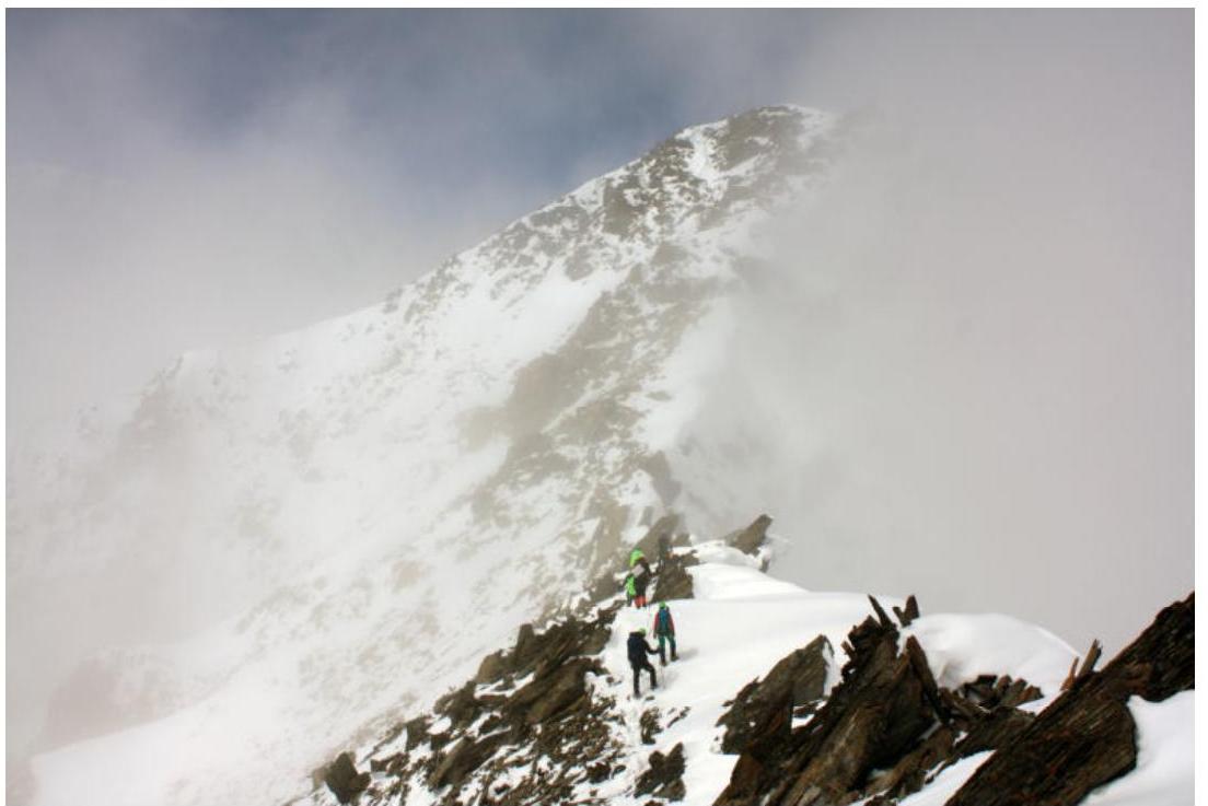
Photo 9. Beginning of section R1–R2
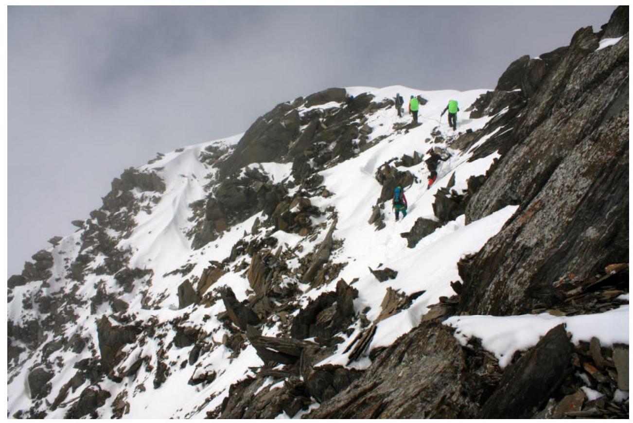
Photo 10. On the ridge. R1–R2
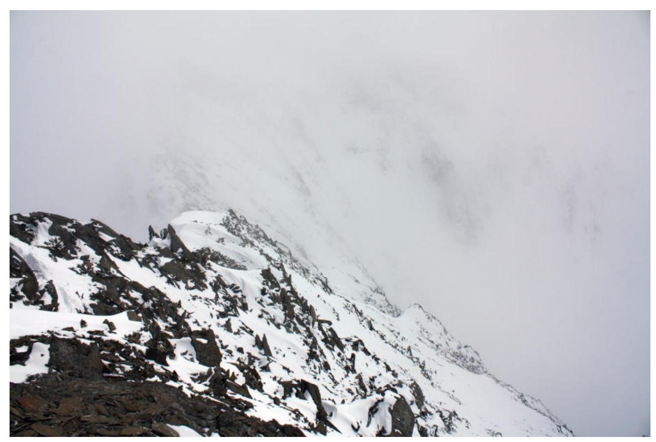
Photo 11. Ridge, view towards Container pass, to the left - cornices and deep drops
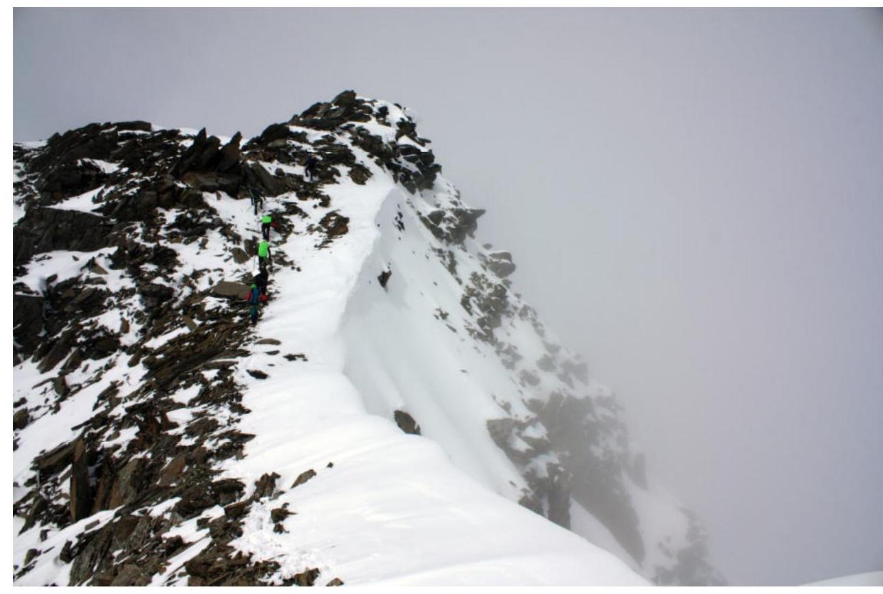
Photo 12. On the ridge. R1–R2
3.2. Photo of the team at the summit with the control tour
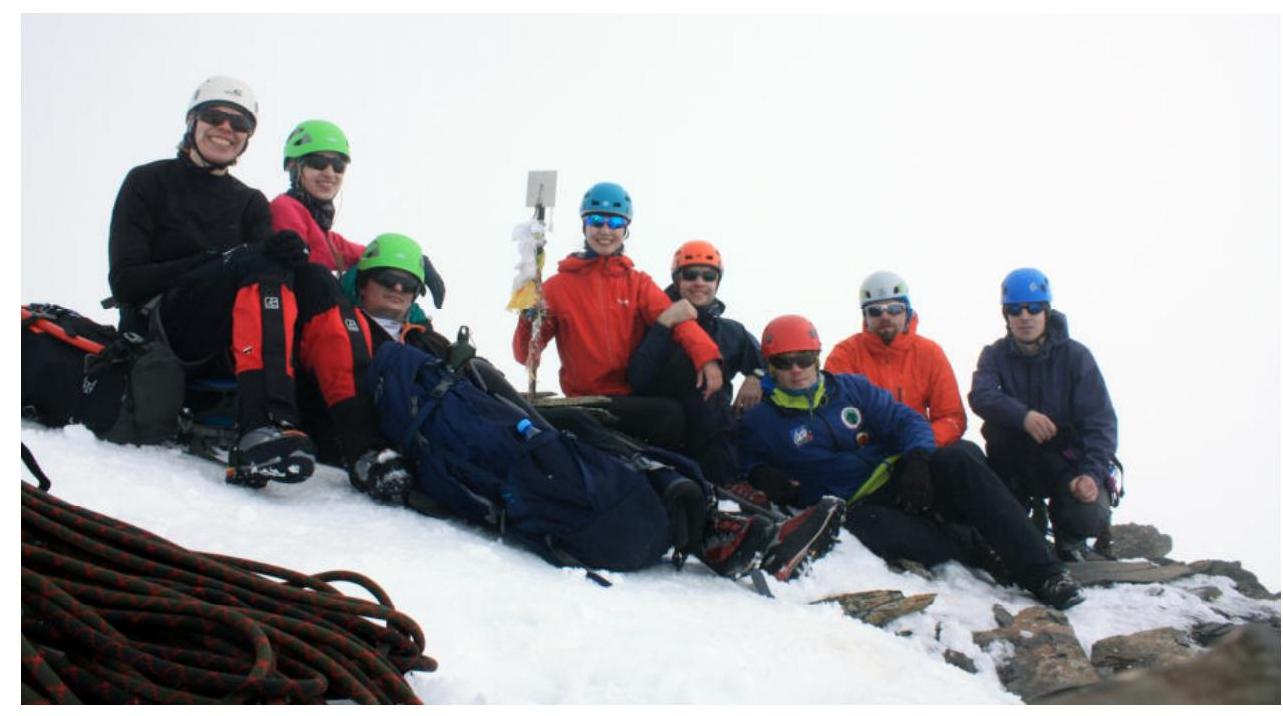
Photo 13. Team at the summit Yubileynaya (3403 m), May 3, 2019
3.3. Safety assessment of the route
An interesting and logical route. A full set of technical difficulties for a category 1B route - snowy and talus slopes with a steepness of up to 45°, medium and large-block talus on the ridge, snowy cornices. When moving along the ridge, it is necessary to stick to the edge of the rocks; the right side of the ridge breaks off with a steep slope. Almost along the entire length of the ridge, there are large cornices. In conditions of limited visibility, it is necessary to be extremely careful.
Descent from the summit in good weather - along a gentle slope towards Znachkist pass (landmark on the right - v. Stazhёrov), then to Goluboye lake. In conditions of no visibility and no tracks, we recommend descending along the ascent path, strictly sticking to the edge of the rocks on the ridge.
The route is slightly easier than the neighboring classified route to v. Kzyl-Tash from Container pass, category 1B. Technically, it is not simpler than 1B on v. Uchitel in Ala-Archa. In the team's opinion, it deserves a category 1B classification.


