V. Snezhnaya 3. North ridge couloir Drakin A.V. Altai. May 4, 1992
Passport
- Class: snow-ice.
- Altai: Severo-Chuysky ridge, Akturu gorge.
- V. Snezhnaya via the western couloir of the north ridge.
- Proposed category 2B first ascent.
- Height difference 1700 m, length 12 km (from the base camp at IMS Akturu).
- Travel hours: 11.
- Leader: Drakin A.V., CMS.
Participants:
- Ruzin D.D. — 2nd sports category
- Mokhova V.N. — 1st sports category
- Okhtimenko I.I. — 2nd sports category
- Conducting organization: "Sibvest" club, Barnaul.
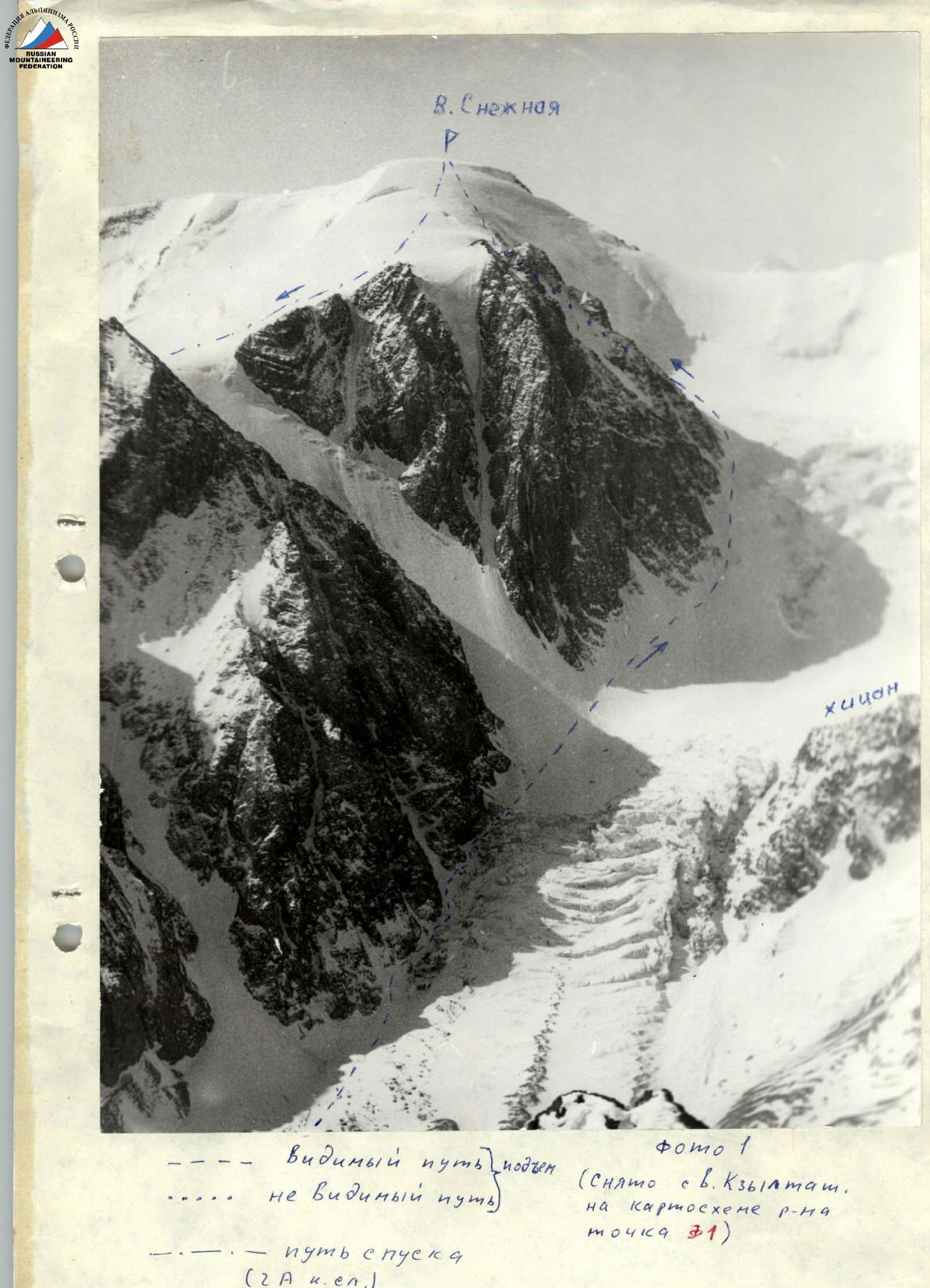
Photo 1. Visible ascent path (taken from V. Kzyltait), invisible path on the district map, point 31. Descent path (category 2A).

Photo 2 (taken from point 2 on the district map). Ascent path. Descent path.
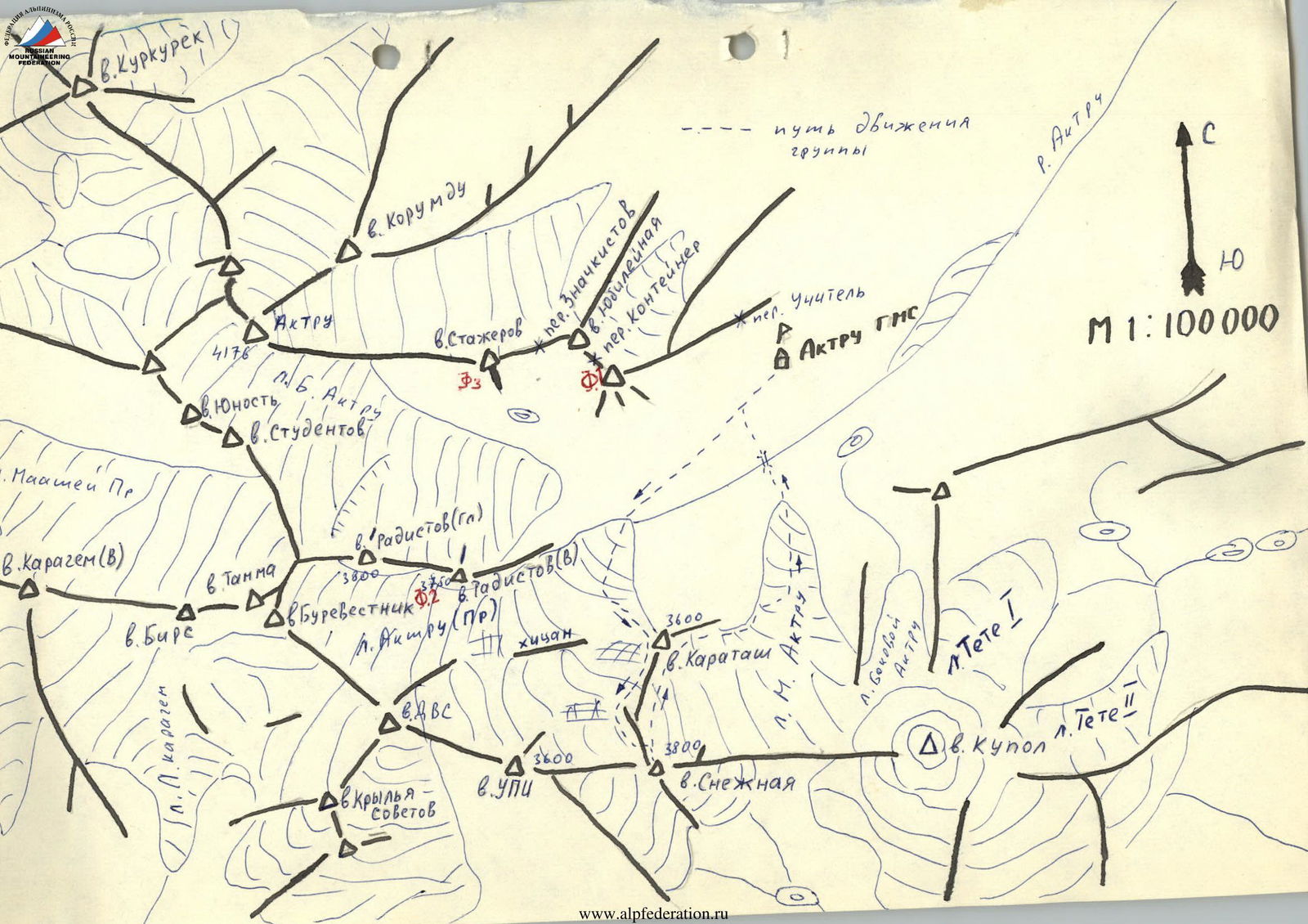
Photo (taken from point 2 on the district map). V. Snezhnaya 3, north ridge couloir, category 2B (approximately). V. UPI route from north, category 2B.
Route diagram
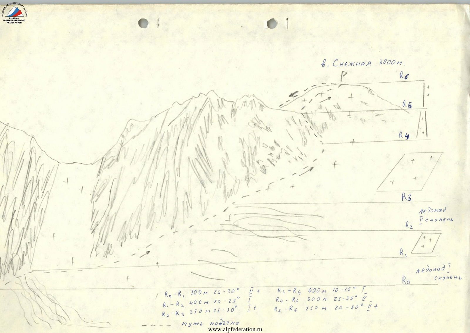
V. Snezhnaya 3800 m.
- R0–R1: 300 m, 25–30°, II+
- R1–R2: 400 m, 20–25°, I
- R2–R3: 250 m, 25–30°, I+
- R3–R4: 400 m, 10–15°, I
- R4–R5: 300 m, 25–35°, II
- R5–R6: 250 m, 20–30°, II+
Ascent path.
Route description
From the base camp located at IMS Akturu, move along the Akturu river and then along the Pr. Akturu glacier moraine to the icefall between v. Karatash and the hicane. Travel time 1–1.5 hours. Tie in under the icefall.
The icefall is overcome either under the slopes of v. Karatash or through the center with careful piton belay. Movement to the right under the hicane slopes is objectively dangerous. Time to pass the icefall 1–2 hours.
The second stage of the icefall is overcome to the left under the slopes of the north ridge of V. Snezhnaya. Time — 2 hours.
Then move along the north ridge of V. Snezhnaya along the upper glacier field almost to the ice slopes descending from the summit. In this part of the ridge, there is a couloir, wide at the bottom and narrowing at the top. Travel time to the couloir — 2 hours.
The ascent to the north ridge goes through this couloir. In the narrow part of the couloir, movement is on ice with piton belay. Time — 2 hours.
The north ridge turns into the snow-ice dome of the summit. In the upper part, before reaching the summit, one has to overcome an ice slope 80–100 m, steep in the lower part, and flattening out at the top. Movement with piton belay. Time to reach the summit — 1–1.5 hours.
Descent via category 2A route through l. M. Akturu. Descent time — 2–3 hours.