Ascent Passport
- Altai, Shavlo gorge, section 1.2.
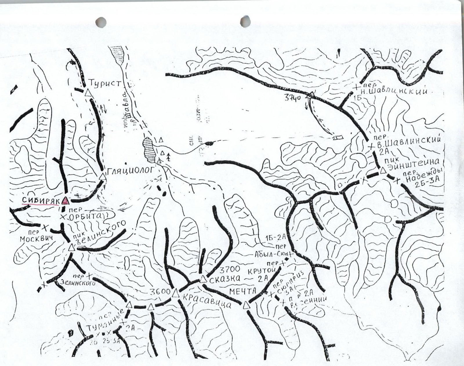
- Sibiryak peak, via the South ridge from the Orbita pass (3400).
- Category 1B difficulty is proposed.
- The nature of the route is combined.
- Height difference 500 m, length 1000 m, average slope of the route 30°.
- Driven pitons: rock and wired 2.
- Team's travel time 5 hours.
- Leader: Afanasieva G.N. 1st sports category. Participants: Afanasiev A.E. Master of Sports, Bormotov A.A. badge holder, Kobec Yu.M. 1st sports category, Kukovinets D. badge holder, Naumov K. badge holder, Sergeev O. badge holder, Solodovnikov Yu.A. 1st sports category.
- Coach: Afanasiev A.E.
- Departure to the route and return: June 24, 1992.
SIBIRYAK peak is located in the SHAVLO gorge, western part of the Severo-Chuysky ridge, ALTAI. Administratively, it is on the territory of the ALTAI republic. Travel by train to the city of BIYSK, and then by bus along the Chuysky highway to the village of CHIBIT, approximately 400 km. Then there is a mountain dirt road along the Chuya river, a bridge across it, and an ascent to the plateau. It is advisable to hire a high-clearance vehicle for this section - the road is narrow and steep. There will be an ascent to the Eshtyk-Kol plateau to a height of about 800 m. Along the Shaboraga river bank down to the confluence with the Shavlo river and up to the Big Shavlo lake - 2 days of travel. It is possible to hire pack horses from the local population.
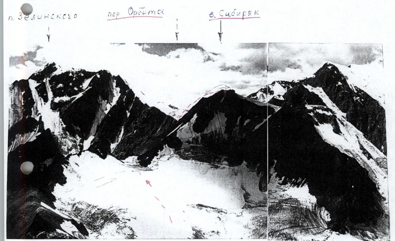
Description of the ascent route to Sibiryak peak 3400 m via the South ridge from the Orbita pass, category 1B difficulty.
Sibiryak peak is located in the northern spur of the Severo-Chuyskie Belki ridge between the Leвое and Praвое Shavlo gorges. The approach to the Orbita pass from the camp at the Upper Shavlo lake takes 3 hours. The route begins with an ascent to the Orbita pass, category 1B difficulty (cairn) 3000 m above sea level.
R0–R1 300 m, 35° 1 — Scree slope. R1–R2 200 m, 40° 1 — Snow couloir. R2–R3 40 m, 45° 2 — Broken rocks. Rope railing. R3–R4 300 m, 30° 1 — Snowy rocks and scree to the left of the ridge. R4–R5 30 m, 55° 2 — Large-block rocks. Alternating movement. R5–R6 300 m, 35° 1 — Snow ridge with several ascents. Cornices to the right. Simultaneous movement in rope teams. Ascent to the summit.