Ascent Record.
-
Climbing area: ALTAI REPUBLIC, Severo-Chuyskiy ridge.
-
Summit: SIBIRYAK 3400 m.
-
Route: SIBIRYAK summit — East ridge.
-
Difficulty category: 1B
-
Route characteristics:
- elevation gain 1000 m
- length of 1B difficulty sections 300 m
- average slope 30°
-
Piton usage on the route: no
-
Moving time: 8 hours
-
Number of nights spent on route: none
-
Participants and their qualifications:
-
Kazakov Alexander Dmitrievich CMS
-
Dolgovykh Stepan Gennadievich RS 2
-
Kuzmina Ekaterina Anatolyevna RS 2
-
Popov Ivan Alexandrovich RS 2
-
Team coach: Suvorkina Lyudmila Davydovna CMS
-
Route start date: July 18, 2002
-
Return date: July 18, 2002
 The SIBIRYAK summit is located in the SHAVLO gorge, western part of the Severo-Chuyskiy ridge, ALTAI. Administratively — on the territory of the ALTAI REPUBLIC.
Travel by train to BIYSK city, and then by bus along the Chuy tract to CHIBIT village — approximately 400 km. Then a mountain dirt road along the Chuya river, a bridge across it, and an ascent to the plateau. It is advisable to hire a high-clearance vehicle for this section — the road is narrow and steep.
The journey involves:
- Ascent to the Eshtyk-Kol plateau to a height of about 800 m.
- Moving along the Shaborga river bank downstream to its confluence with the Shavlo river.
- Ascent up the Shavlo river to the Big Shavlo lake — 2 days of travel.
It is possible to hire pack horses from the local population.
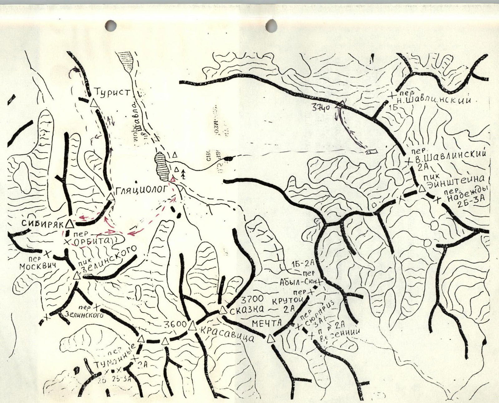
Route description — ascent to SIBIRYAK summit 1B category, 3400 m
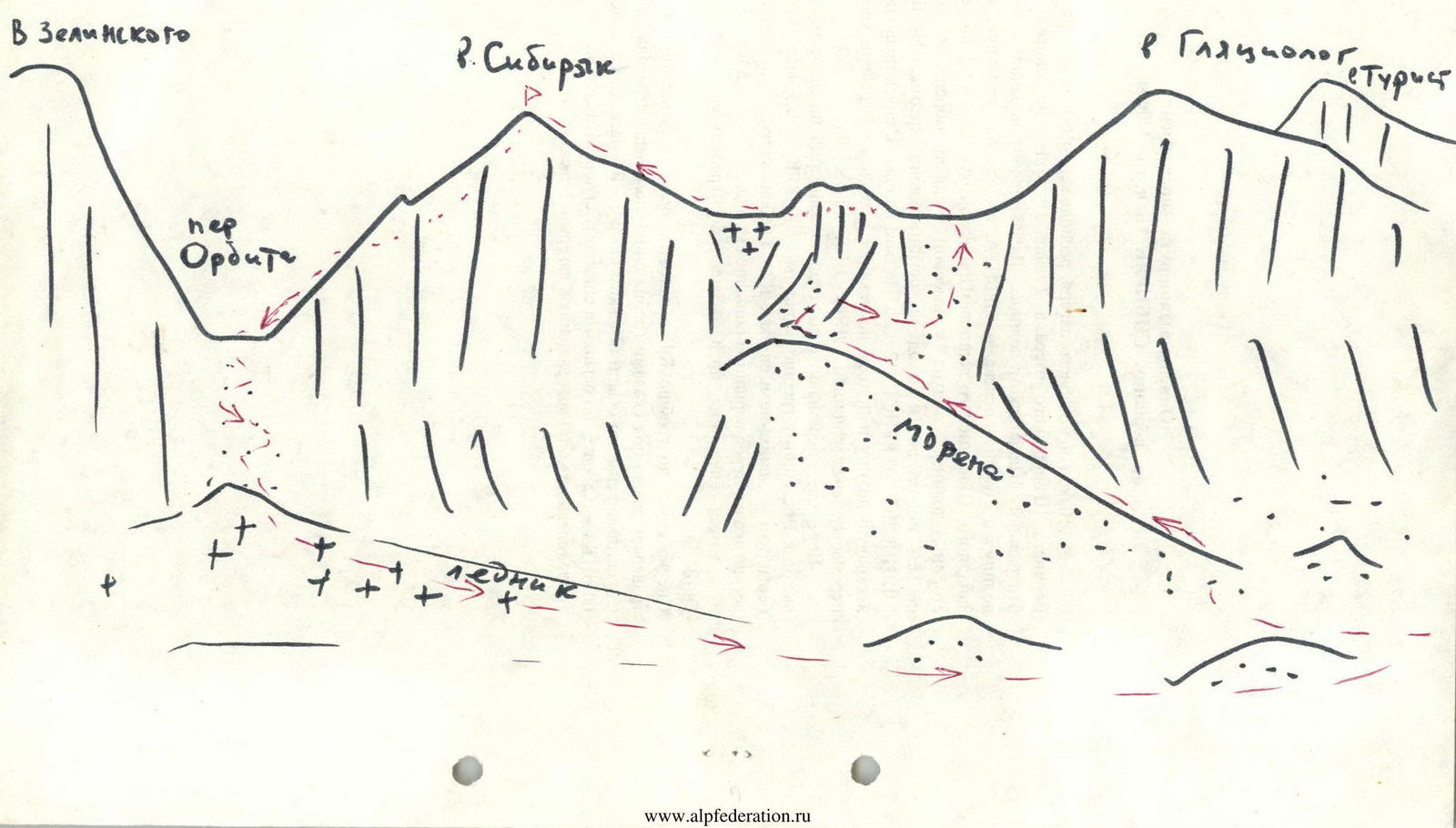
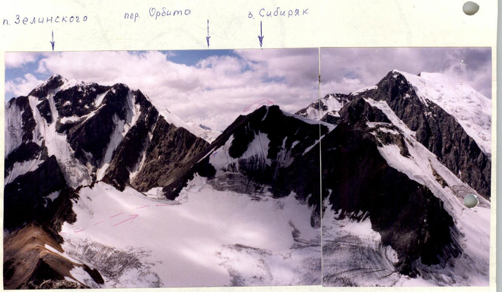
Departure from the base camp, located in the forest zone above the Upper Shavlo lake, at 7:00. Approach — along the lateral moraine of the central Shavlo glacier. Then turn west into a lateral valley towards the ORBITA pass, exit to the terminal moraine of the Western Shavlo glacier. Staying on the right (in the direction of travel) side of the valley, approach to a high lateral moraine, ascent along the ridge, and exit to the talus slopes of the SIBIRYAK — GLYATSIOGLOG — TOURIST ridge — 2 hours. Ascent along the talus, descent to the right along the way into a cirque valley and ascent along the talus with an exit to the ridge on a col before the GLYATSIOGLOG summit — 1 hour — R1.
Cross the col and move under the rock pinnacle along a snowy slope to the East ridge of the SIBIRYAK summit — 0.5 hours. Possible bergschrund — movement in rope teams R2.
The ridge:
- at the bottom — snowy,
- then — easy rocks,
- before the summit — large rock blocks.
Duration: 1.5 hours, R3.
Descent from the summit along the Southwest ridge towards the ORBITA pass. First, descent along the ridge R4, and then along the talus of the western slope, with a traverse to the left under the ridge rocks with an exit above the ORBITA pass. Descent to the pass along talus and easy rocks — 0.5 hours. Descent from the ORBITA pass – 0.5 hours along talus and a snowy slope. Along the glacier, moraines, and trail (to the left in the direction of travel) return to the camp — 2 hours.