
1.2 III
Passport
- Category: classification application.
- Altai, Severo-Chuysky ridge, Karakabak river gorge.
- Peak Neizvestnykh Solat via SW ridge.
- Proposed category: 2A.
- Height 3300 m, elevation gain 800 m, length 1600 m.
- 6 pitons used.
- Moving time: 7 hours from camp to camp; 6 hours from the start of the ascent to the summit to the start of the descent.
- Leader: Semenov E. B., Candidate Master of Sports
Participants:
- Avdienko I. N., 3rd sports category
- Kuznetsov A. V., 3rd sports category
- Coach Drakin A. V., 1st sports category, №68
- Date of ascent July 24, 2003.
- Organization: Akturu branch in the Karakabak river gorge.
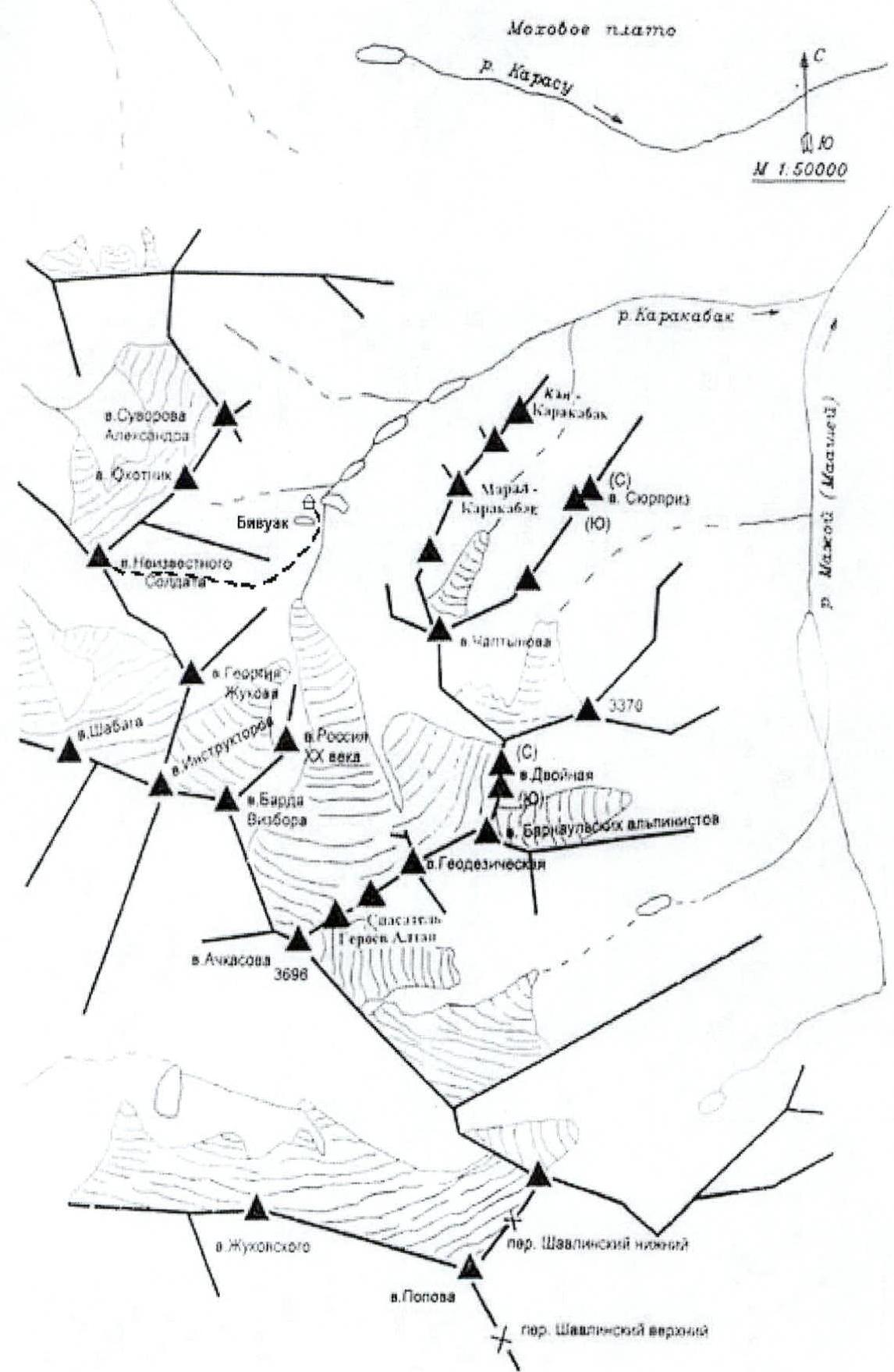
Fig. 4. Map – scheme of the area indicating the route from the base camp
Peak Neizvestnykh Solat via SW ridge
From the base camp, located near the third lake, move initially along the stream flowing into the lake, then along the moraine ramparts.
The ascent to the route starts from the beginning of the scree (R0–R1), about 100 m long and with a slope of 15°–20°. Further movement goes along a heavily destroyed rocky ridge, quite sharply standing out against the general background and, as it were, bypassed on both sides by rockfalls. These rocks are the safest and most stable place, leading almost to the top of the ridge (R2–R3). It is not advisable to deviate from the rocks to the left, especially in the lower part of the route, as the overhanging rocks are quite loose. The ridge itself is a fairly monolithic rock with a large number of cracks, convenient for piton placement. 6 pitons were hammered in on this segment. The length of the ridge is about 300 m. The path along the ridge leads to a clearly defined scree pass into the Shabagi glacier valley. From point R2 in Fig. 2 to the pass, there are about 20 m left. In photo 2, the pass itself is hidden by protruding rocks, and in photo 1, it remains behind the lower part of the frame. The pass is a narrow (1 m wide) depression in the ridge, from which a yellow strip of fine scree goes towards the Shabagi glacier valley. In the other direction, visible in the photograph, the pass descends into a narrow, winding canyon, ending in rock faces. From the pass begins a gentle (30°) ascent, 200 m long, along a medium scree ridge with simultaneous movement in a rope team. With further ascent, a series of pronounced walls (35°–45°, section R3–R4, 200 m) begins, leading to the summit of the first pillar (marked A on the diagram). Further, the path goes along a narrow (in some places, the width of a foot) and about 350 m long ridge (R5) to the second pillar (marked B on the diagram), which is bypassed on the left along a clearly defined scree ledge, ending literally 60 m from the summit. Protection on this section is alternating, carried out through ledges. The ascent slope is about 35°.
The descent from the summit was made along the southeastern ridge through the yellow pillar (R6) to the key section R7–R8 (a seven-meter wall with a slope of 70°, top-rope protection, carried out through a ledge, the last one descends with free climbing with bottom rope protection) and further along the ridge to the pillar of Peak Silantiev (R10) and the yellow scree line behind it (this is the most clearly visible landmark for the start of the descent along the scree, R9). Movement is in a rope team, protection is simultaneous. From the yellow line, the path is another 100 m along the ridge, and the descent into the valley begins.
The route has been previously climbed. A note from a group of climbers from the EMERCOM training camp in Barnaul, dated July 19, 2001, was found on the summit.
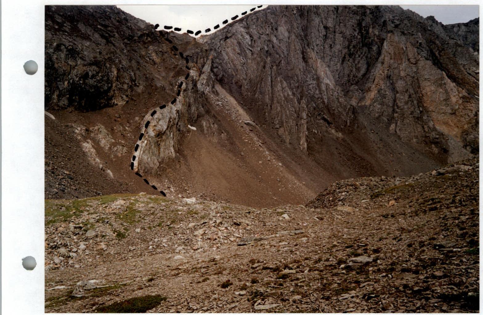
Photo 2. Lower part of the ascent to Peak Neizvestnykh Solat with a diagram of the route. Taken from the moraine scree 200 m before the ascent.
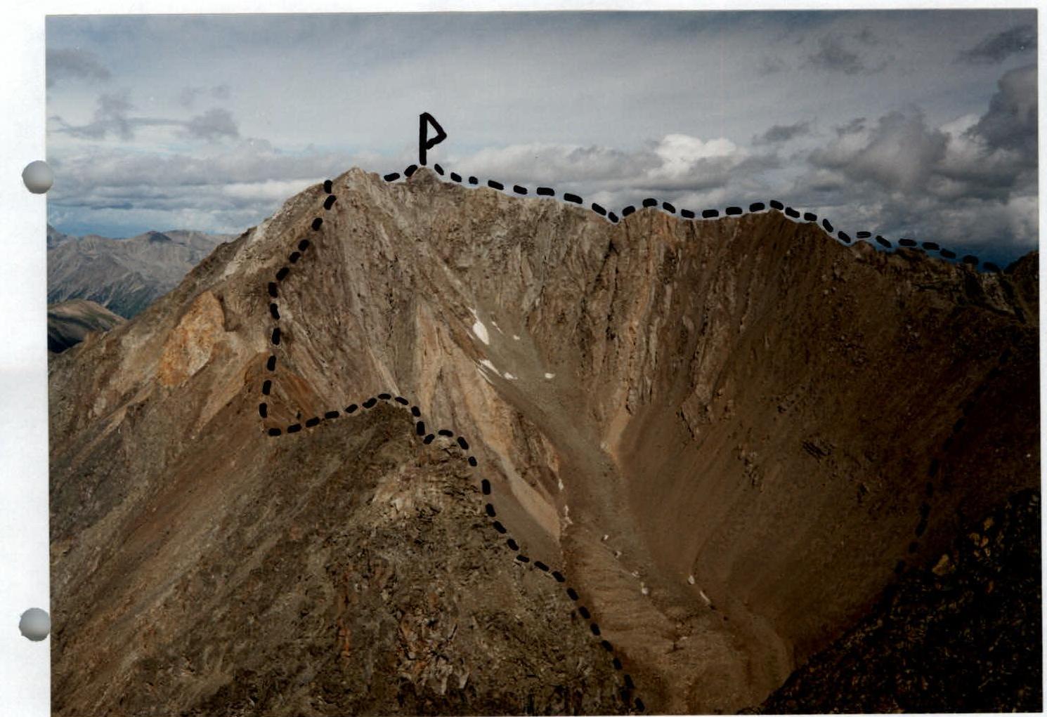
Photo 1. Peak Neizvestnykh Solat with a diagram of the route. View from Peak Marshala Zhukova.

Photo 3. Lower part of the descent from Peak Neizvestnykh Solat.

Photo 6. Memorial plaque on the summit of Peak Neizvestnykh Solat.
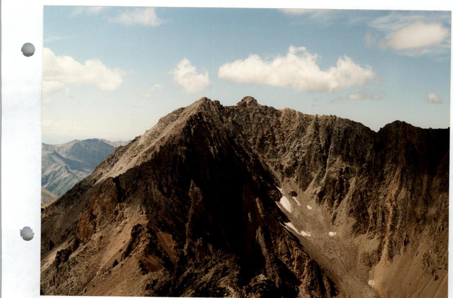
Photo 7. General view of Peak Neizvestnykh Solat. Taken from the summit of Peak Marshala Zhukova.