115
Ascent Passport
- Gorny Altai, Severo-Chuysky Ridge.
- peak Nadezhda, from Maashey cirque via col Nadezhda
- proposed route 3A cat. diff., presumably first ascent.
- Route type: combined.
- Route elevation gain — 633 m.
Route length — 2040 m. Section lengths:
| II cat. diff. | — 1300 m. | |
| III cat. diff. | — 740 m, |
Average slope:
- main part of the route — 38°
- whole route — 22°
- Pitons left on the route:
- total — 0; including bolted — 0 pcs.
Pitons used on the route:
- stationary bolted — 0 pcs., including for artificial support — 0 pcs.;
- removable bolted — 0 pcs, including for artificial support — 0 pcs.;
- rock — 0 pcs., including for artificial support — 0 pcs.;
- chocks — 10, including for artificial support — 0 pcs.;
- ice screws — 10, including for artificial support — 0 pcs.
Total artificial support points used — 0 pcs.
- Team's climbing hours: 8 h, 1 day
- Participants:
- Parshin Anton Vladimirovich — Candidate for Master of Sports
- Temerev Ivan Mikhailovich — Candidate for Master of Sports
- Nikolaychik Alexander Alexandrovich — 2nd sports category
-
Coach: Novoselova G.V.
-
Route start: 08:00, February 17, 2006.
Reached summit: 16:00, February 17, 2006. Returned to base camp: 17:30, February 17, 2006.
- Organization: Tomsk Alpine Federation.
Photo of the route profile
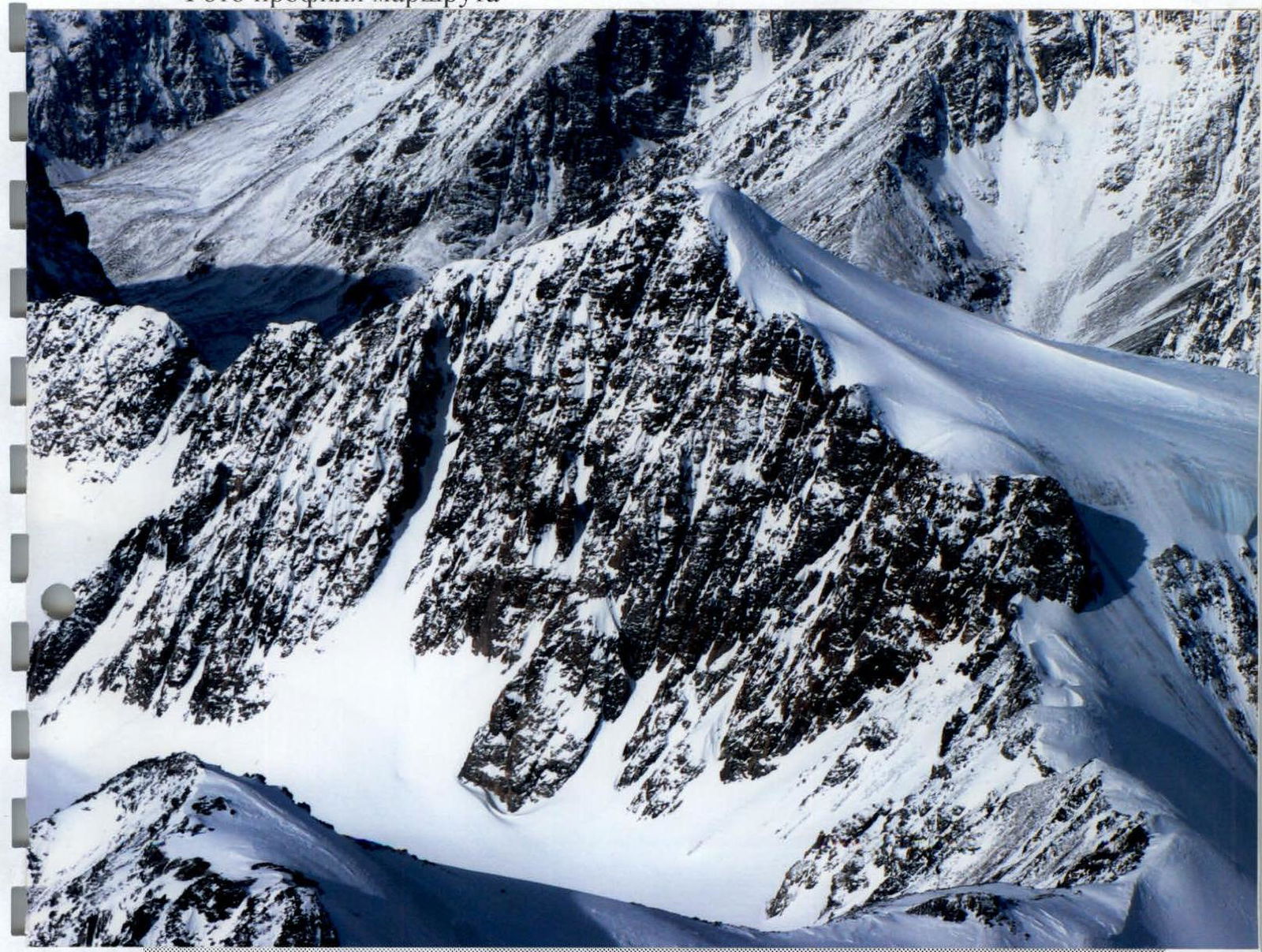
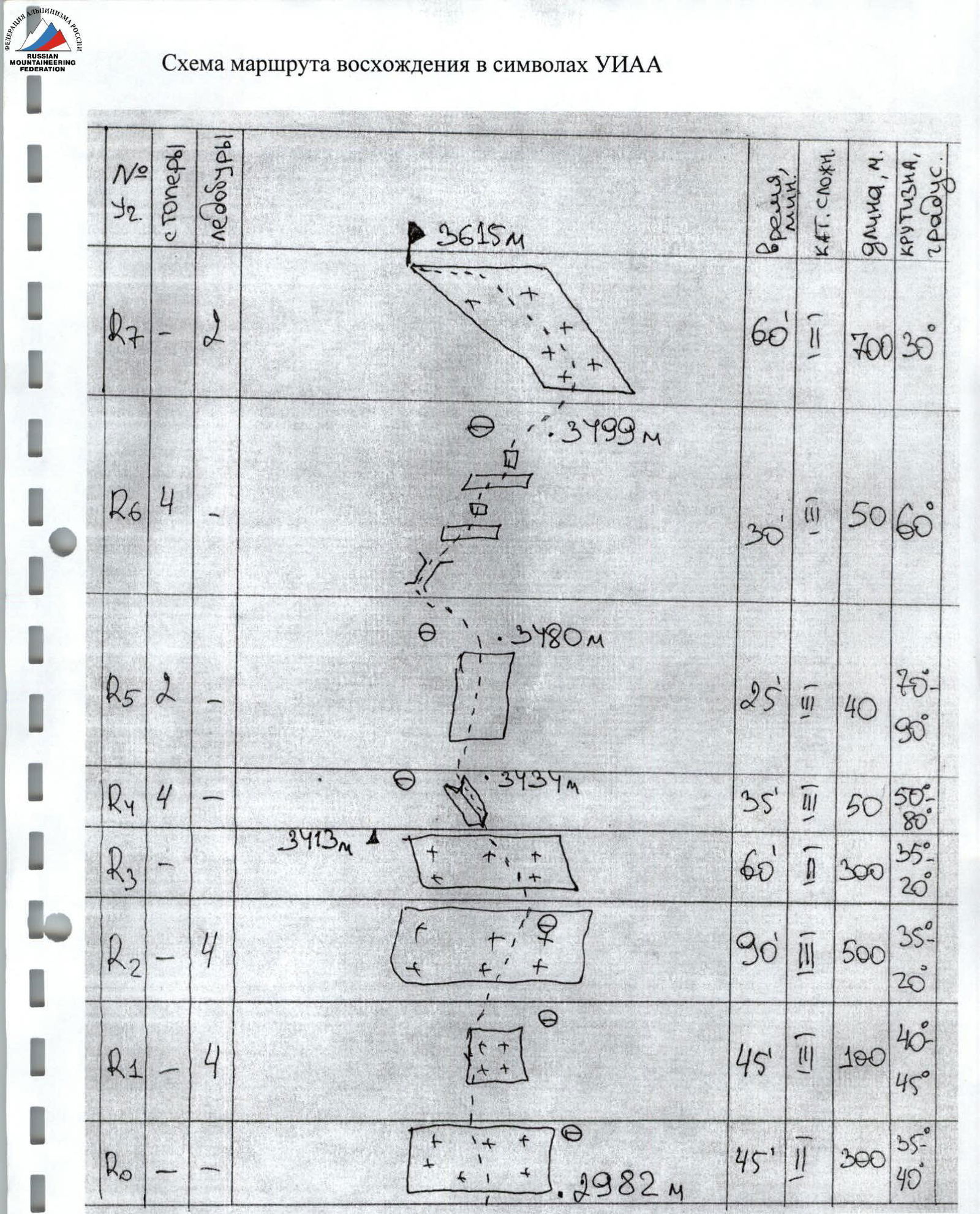
Photo #4 (technical photo of the route) General view and route thread from peak Maashey ridge.
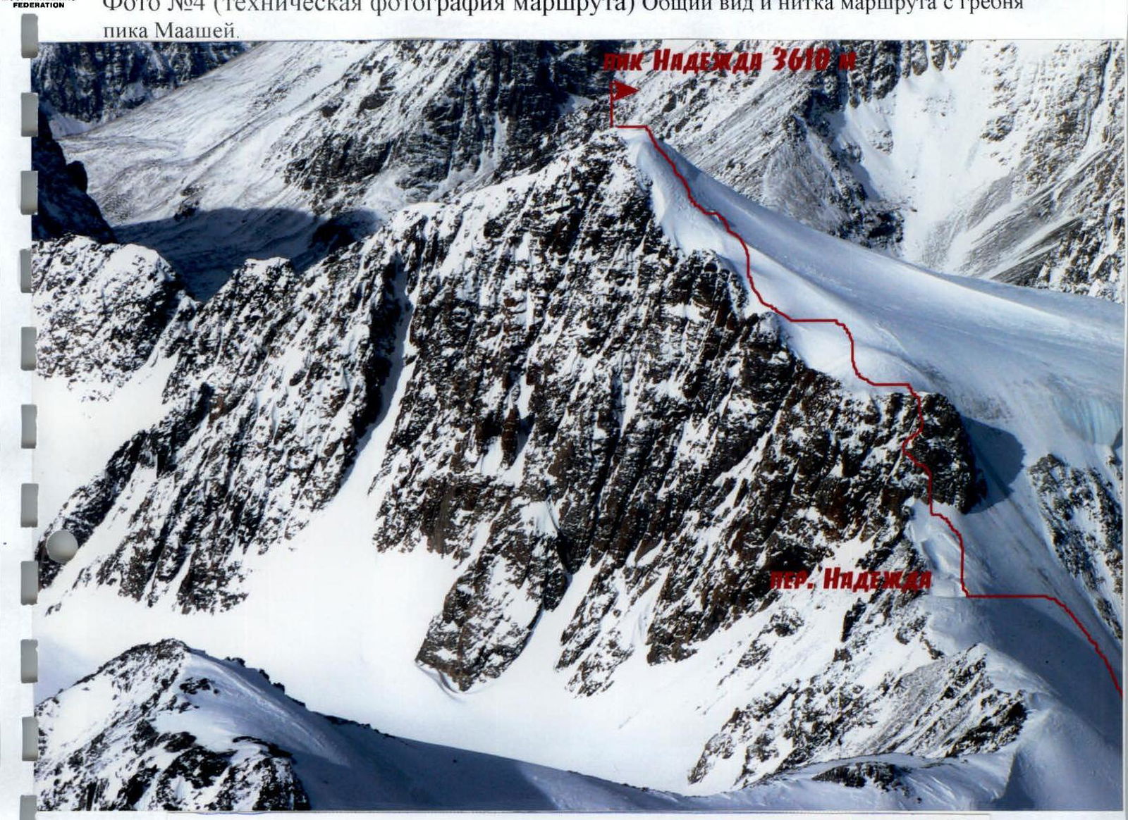 3615 m PIK NADEZHDA
Route Description by Sections
Time Breakdown
8:00 Departure from tents below the pass (base camp). 9:00 At the start of the ascent, put on gear, crampons, and rope up. 13:00 Reached col Nadezhda. Short snack. 13:30 Start ascending the rocks. 15:00 Reached above the rocks onto the snow-ice slope. 16:00 Reached the summit. 17:30 Descended to the overnight stay location at col Nadezhda.
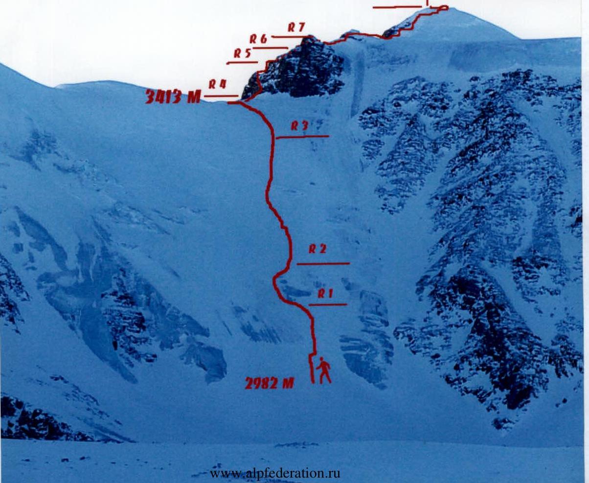
- R0 300 m, II, 35–40°, (2982 m). Start of the ascent to the pass. Moving in crampons, roped, simultaneous movement.
- R1 100 m, III, 40–45°. Ice face. Alternate belay through ice screws. Bypassed from the left side (by route direction).
- R2 500 m, III, 40°. Simultaneous movement. Belay through ice screws.
- R3 300 m, II, 35–20°, (3413 m). Simultaneous movement. Reach col Nadezhda and approach the rocks.
- R4 50 m, III, 50–80°, (3434 m). Hang a rope on the rocks. Move left-up through a snow-covered inside corner. Belay through stoppers.
- R5 40 m, III, 70–90°, (3480 m) From the base, right-up the rock.
- R6 50 m, III, 60°, (3499 m). A small chimney and a series of ledges and walls lead left-up to the ice.
- R7 700 m, II, 30°. Put on crampons and move simultaneously roped along the ice ridge. Belay as needed through ice screws. Reach the summit via the snow ridge.
Descent via the ascent route. The last person on descent pulls the rope through rock outcrops.
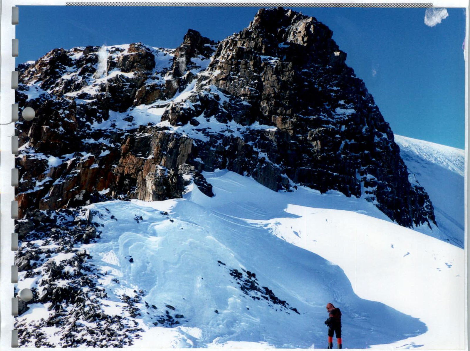
Photo #7 At col Nadezhda
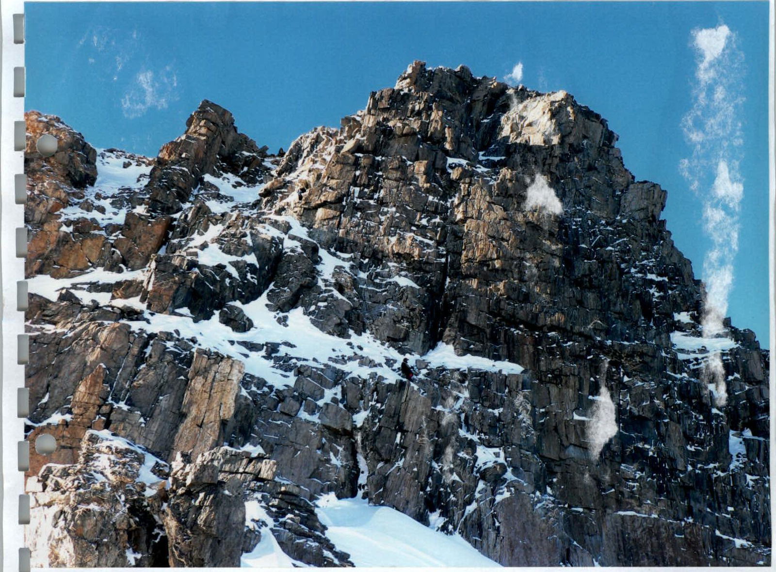
Photo #8 View from the start of the rock bastion. First rope on the rocks.
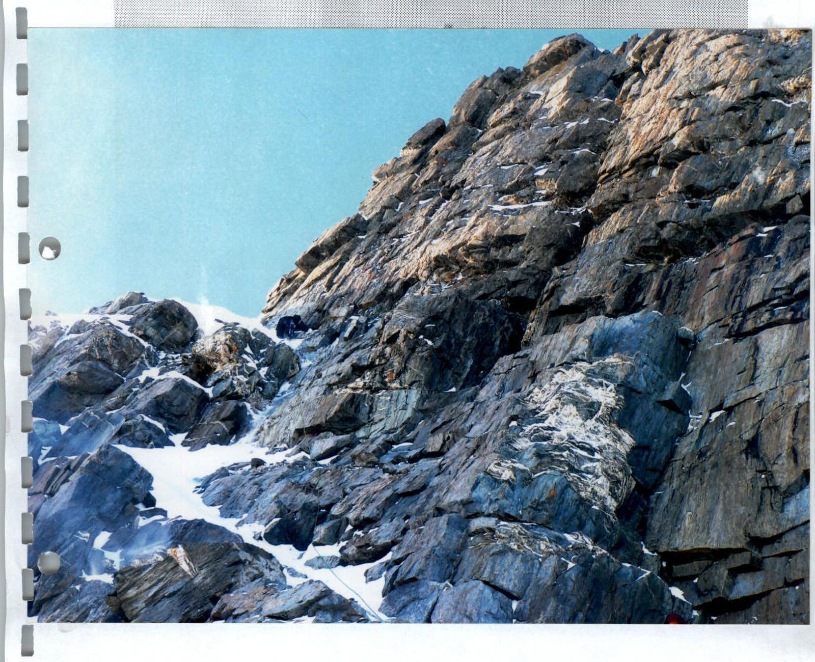
Photo #9 View of the bastion