v. Karatash
3510 m
Report
Teams from Tomsk Region (TFA)
on the first ascent of the route on v. Karatash via the north-eastern counterfort of the north-eastern ridge "4A" (rocky)
Participants:
Temerev I.M.
Karpitskiy E.V.
Tomsk — 2004
| NOMENCLATURE | Page № |
|---|---|
| Postal address and surname of the person who will be notified of the classification results | 3 |
| Ascent Passport | 4 |
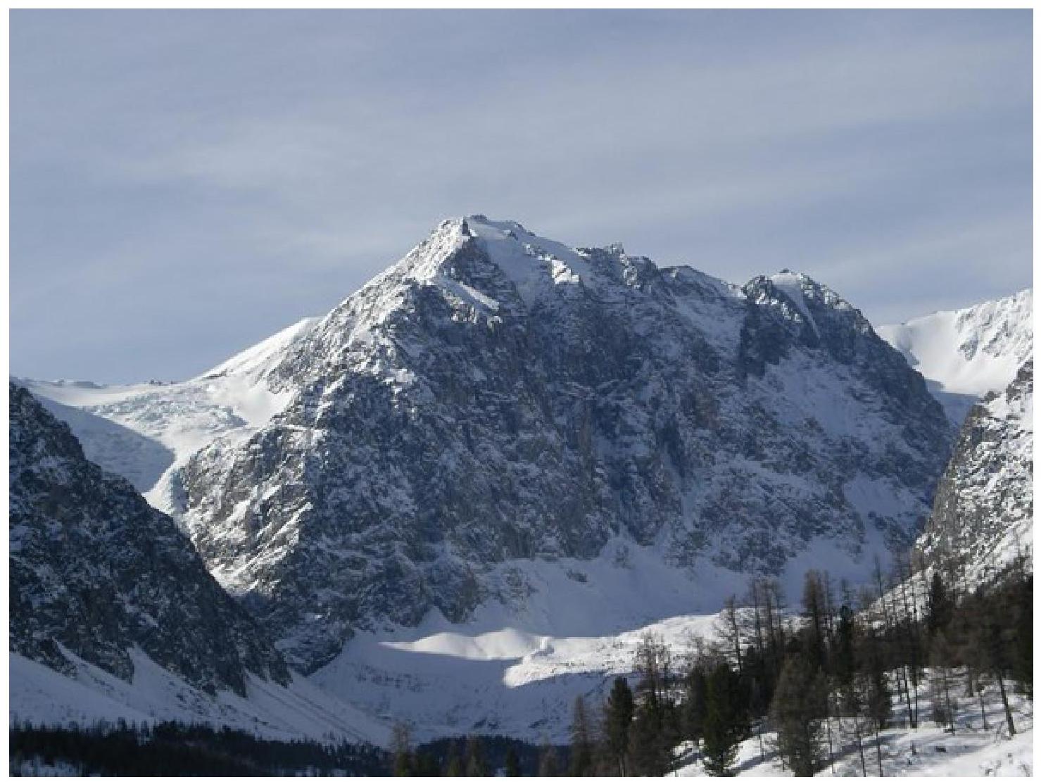
| General view photo of the summit | 5 |
| Route profile photo | 6 |
| Ascent route diagram in UIAA symbols | 7-8 |
| Route description by sections | 9-10 |
| Photo №4 (technical photograph of the route with a thread) | 11 |
| Photo №5 (technical photograph of the route) | 12 |
| 13 | |
| Photo №6 | |
| :-- | :-- |
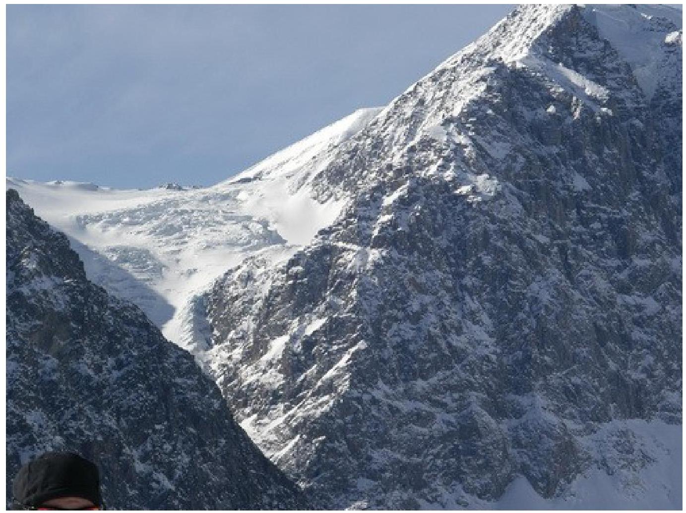
| Photo №7 | 14 |
| Photo №8 | 15 |
| Notes | 16 |
Postal address and surname of the person who will be notified of the classification results (preferably an email address)
Temerev Ivan Mikhailovich, 634058, Tomsk, Kuzovlevo settlement, Teplichnaya str., 1, apt. 2. Email address — ivantern@ngs.ru. Mob. phone (8–903) 953–46–34
Ascent Passport
- Gorny Altai, Severo-Chuysky ridge.
- v. Karatash, north-eastern counterfort of the north-eastern ridge
- proposed route category 4A, first ascent.
- Route type: rocky.
- Route height difference — 1010 m.
Route length — 2085 m. Section lengths:
| • | I category | — 435 m. |
|---|---|---|
| • | II category | — 675 m. |
| • | III category | — 825 m. |
| • | IV category | — 150 m. |
Average steepness:
- main part of the route — 50° (degrees)
- entire route — 42° (degrees)
- Hooks left on the route:
- total — 0; including bolted — 0 pcs
- rappel loop — 1 pc.
Hooks used on the route:
- bolted stationary — 0 pcs., including ITO — 0 pcs.
- bolted removable — 0 pcs., including ITO — 0 pcs.
- rock hooks — 10 pcs., including ITO — 0 pcs.
- chocks — 30, including ITO — 0 pcs.
Total artificial support points (ITO) used — 0 pcs.
- Team's walking hours: 10 hours, 1 day
- Participants:
— Temerev Ivan Mikhailovich — CMS
- Karpitskiy Evgeniy Vladimirovich — 1st sports category
-
Coach: Novosyolova G.V.
-
Route start: 8:00, August 15, 2004. Summit reach: 19:30, August 15, 2004. Return to BL: 21:30, August 15, 2004.
-
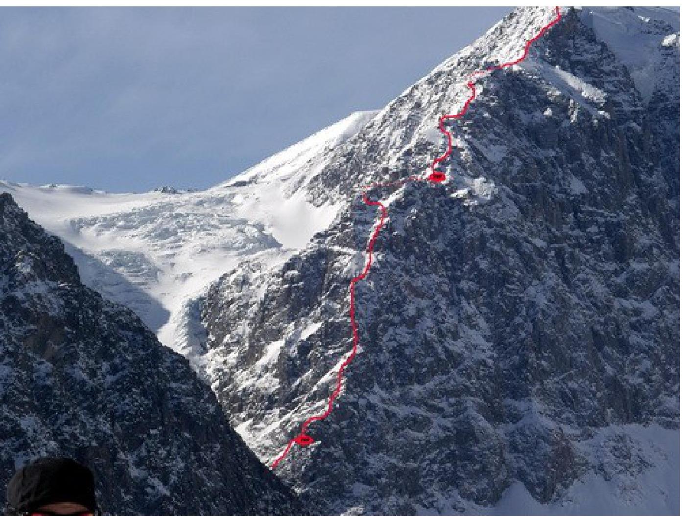
Organization: State Institution "Tomsk Regional Search and Rescue Service". General view photo of the summit
 Route
profile photo
Route
profile photo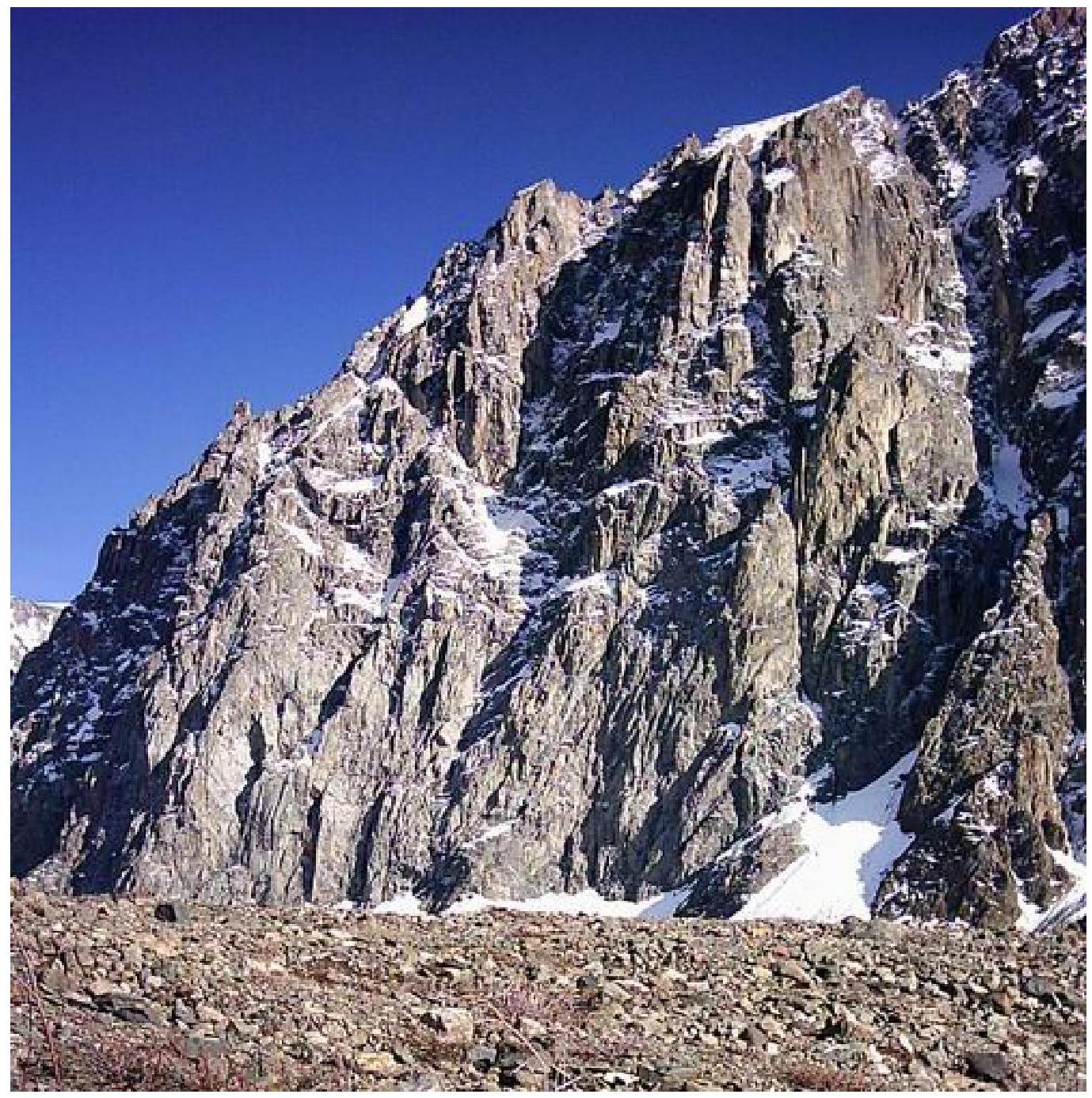 Ascent route diagram in UIAA symbols
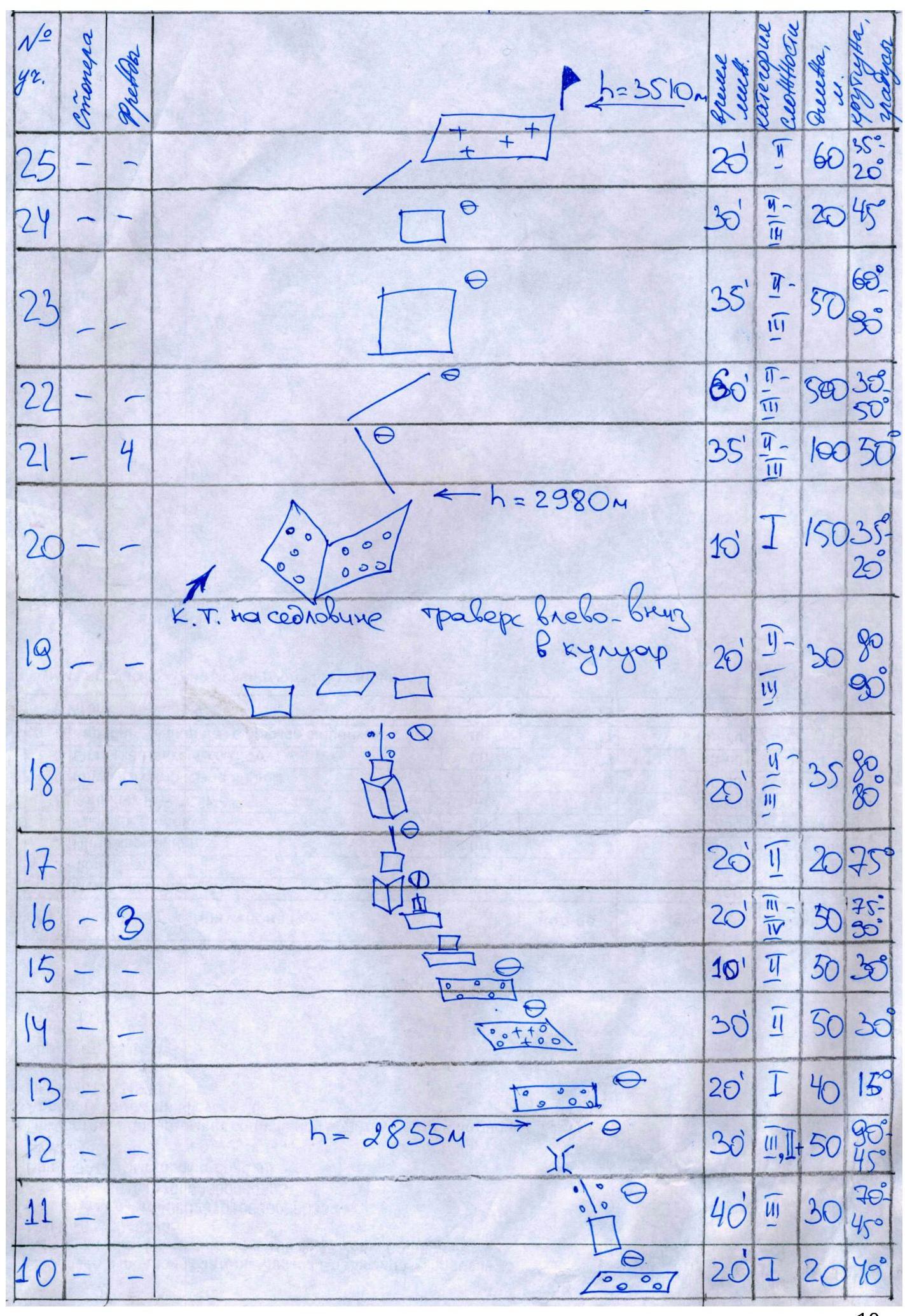
Route description by sections. Time breakdown. 8:00 — exit from "Aktru" camp. 9:30 — transition from glacier to rocks (height 2500 m). 10:00 — exit to the counterfort via the ledge. 11:00 — R5. 14:00 — R11. 17:00 — R20 — exit to the saddle near the gendarme. Start of route 3A (height 2980 m). 17:30 — ascent along the ridge to the 1st gendarme. 18:30 — ascent to the pre-summit gendarme. 19:30 — reach the summit (height 3510 m). 21:30 — descent to "Aktru" camp (height 2130 m). 8:00 — exited the camp. Took the path from Aktru camp up to the Maly Aktru Glacier. Put on crampons and ascended up to the turn of the glacier to the right. Caution: in our variant, rocks were falling down the glacier (all the way to the bottom) from the walls of Karatash.
As an orientation point for the start of the route, a wide couloir on the left (as viewed from below) between the rocky masses of Kupol can be used. Opposite to it, a not very pronounced rocky ledge (slightly green when without snow) goes back to the right. From it, 150–200 m upwards, there is:
- a very steep,
- narrow,
- very loose couloir.
During our ascent, remnants of winter snow were melting at the top, and water streams were dislodging numerous rocks. When transitioning from the glacier to rocks and on the first ropes, the rockfall danger was high.
So, 9:30. Started from a height of 2500 m (at the glacier turn). Observed "trains" of falling rocks on the glacier, away from the rocks. Waited for a window and ran under the rocks. R1 Removed crampons and, without tying in, ascended simple rocks (10 m, II–III, 70°–80°) up to a ledge. Ran right along it (25 m) to the shelter of rocks, where it was still hit but less. Psychologically difficult — "trains" were buzzing every 2–5 minutes on both sides and above. R2 35 m, II, 50°, 1 protection point. Moved upwards to the right with protection. R3 50 m, II–IV, 40°–90°, 2 protection points. Line of movement still to the right and upwards, without entering the couloir. Rockfall danger was lower, but it was better to move while sheltering behind rock outcrops. R4 150 m, I, 40°–30°. Moved simultaneously upwards. Exit to a saddle. Set up a control cairn. 11:00. R5 25 m, II–III, 45°, 1 protection point. Followed the counterfort. Movement was logical. On the left — steep loose couloirs, on the right — the northern wall. R6 25 m, III, 90°, 2 protection points. Inner corner. R7 75 m, I, 40°. Moved left and upwards to the right across scree rocks. 11:50. R8 50 m; including 15 m, IV, 80°–85°, 4 protection points — chimney and 25 m, III–IV, 90°, 2 protection points — large inner corner. R9 25 m, II, 40°–45°, 1 protection point. Moved upwards to the left. Ended on loose scree. It is worth noting that for many difficult sections, there is a shelf above with fresh loose scree. Therefore, to avoid dislodging rocks onto the teammate below, it was often necessary to make practically a forced ascent on the rocks. R10 20 m, I, 40°. Moved right and upwards across scree. 14:00. R11 30 m, III, 70°–45°. Moved left and upwards — 3 m wall, 70°. Further — along a freshly destroyed ridge. Exit under a rusty rock with a large crack. R12 50 m; including — 10 m up the crack in speleo gear, III, 90°; 40 m, II+, 45°–75° — exit under a large black "tooth" with dirty-yellow quartz stripes. H = 2855 m. R13 40 m, I, 15°. Traversed left along a scree ledge. R14 50 m, II, 30°. Traversed left across a streamlet. We had snow there, so we had to put on crampons. R15 50 m, II, 30°. Traversed left along a scree ledge. R16 50 m, III–IV, 75°–90°. On the traverse, not reaching 20 m to a steep couloir, moved upwards from the ledge via an inclined slit — 15 m, 75°, IV, 2 protection points.
10 m along ledges and small walls up to 90°, III–IV, 1 protection point. 25 m along an inner corner 80°–90°, IV. Setting up a belay station was difficult but possible. However, it turned out to be "soppy". R17 25 m, II, 75°. 16:00 H = 2920 m. Moved upwards-left 5 m and traversed upwards-left 15 m. Exit to a ridge. R18 35 m, II–III, up to 80°. Moved upwards-right 25 m along a couloir. Traversed left along a rocky wall 10 m. There were "live" rock blocks. Exit to a destroyed ridge. R19 30 m, II–III, up to 90°. Traversed left-down along ledges to scree. Belay was difficult. For the rappel of the last climber on a small "tooth", a loop-anchor was left. R20 150 m, I. 17:00 H = 2980 m. Moved simultaneously right-upwards along scree adjacent to rocks. Exit to a saddle (start of 3A). Set up a control cairn on the pass. Further movement followed route 3A. R21 100 m, II–III, 50°. Moved upwards along the ridge two rope lengths of moderate difficulty with the use of chocks to a small gendarme, which was bypassed on the left. 4 protection points. R22 500 m, II–III. Further 500 m along the ridge, movement was simultaneous, sticking to the left slope, two gendarmes along the way were bypassed on the left. R23 50 m, II–III, 60°–90°. The third gendarme (before "Trovony shtany" glacier) was taken head-on with the use of protection for outcrops. R24 20 m, II–III, 45°. Descent to a saddle via free climbing, then ascent along simple rocks, partly on natté ice. R25 60 m, II, 35°–20°. Exit to a wide firn ridge leading to the summit. Descent from the summit followed route 2A category.
Photo №4 (technical photograph of the route)
General view and route thread from Aktru valley.
16 Photo №5 (technical photograph of the route)
18
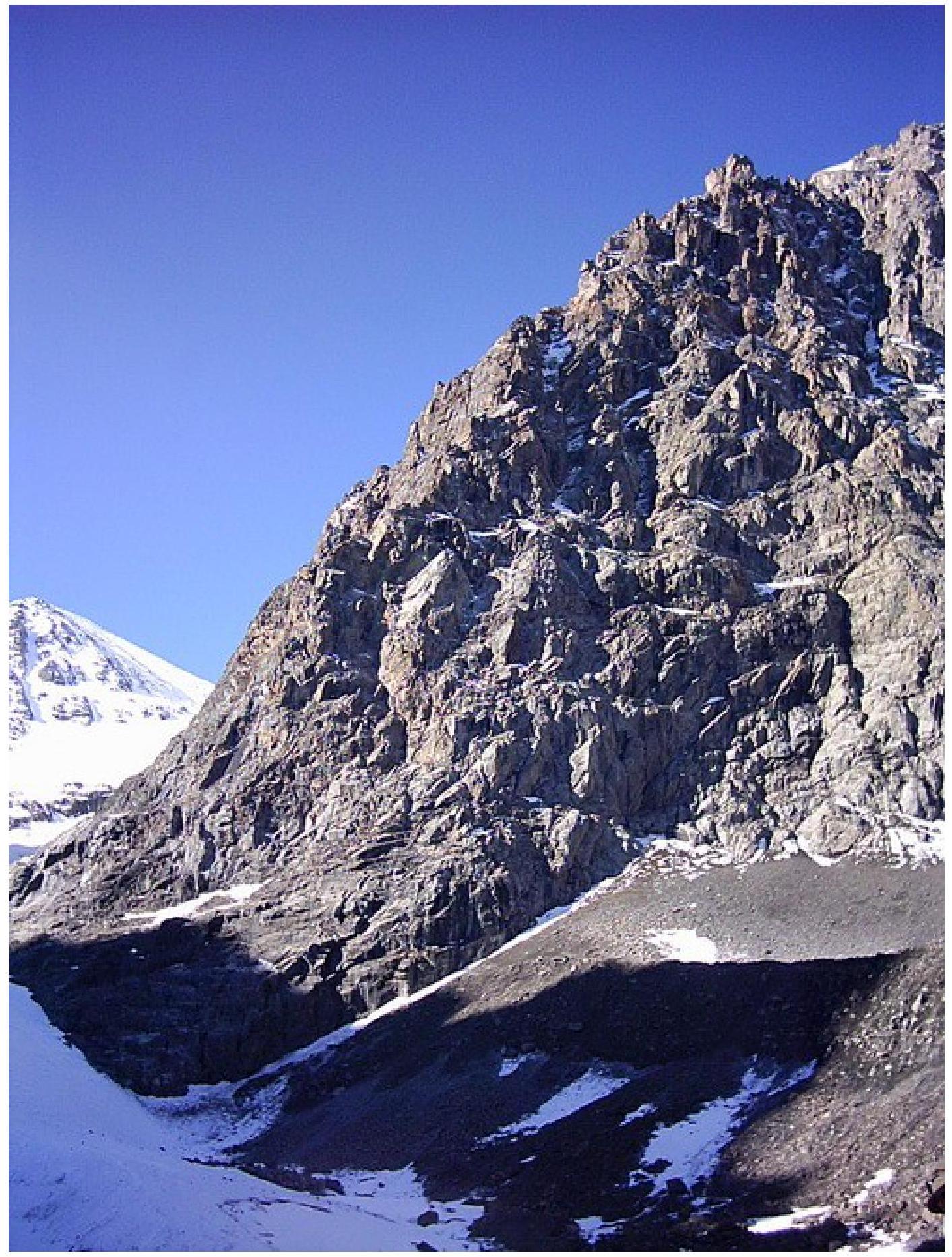
View slightly from the side. Taken from Maly Aktru glacier. Photos of route sections
Photo №6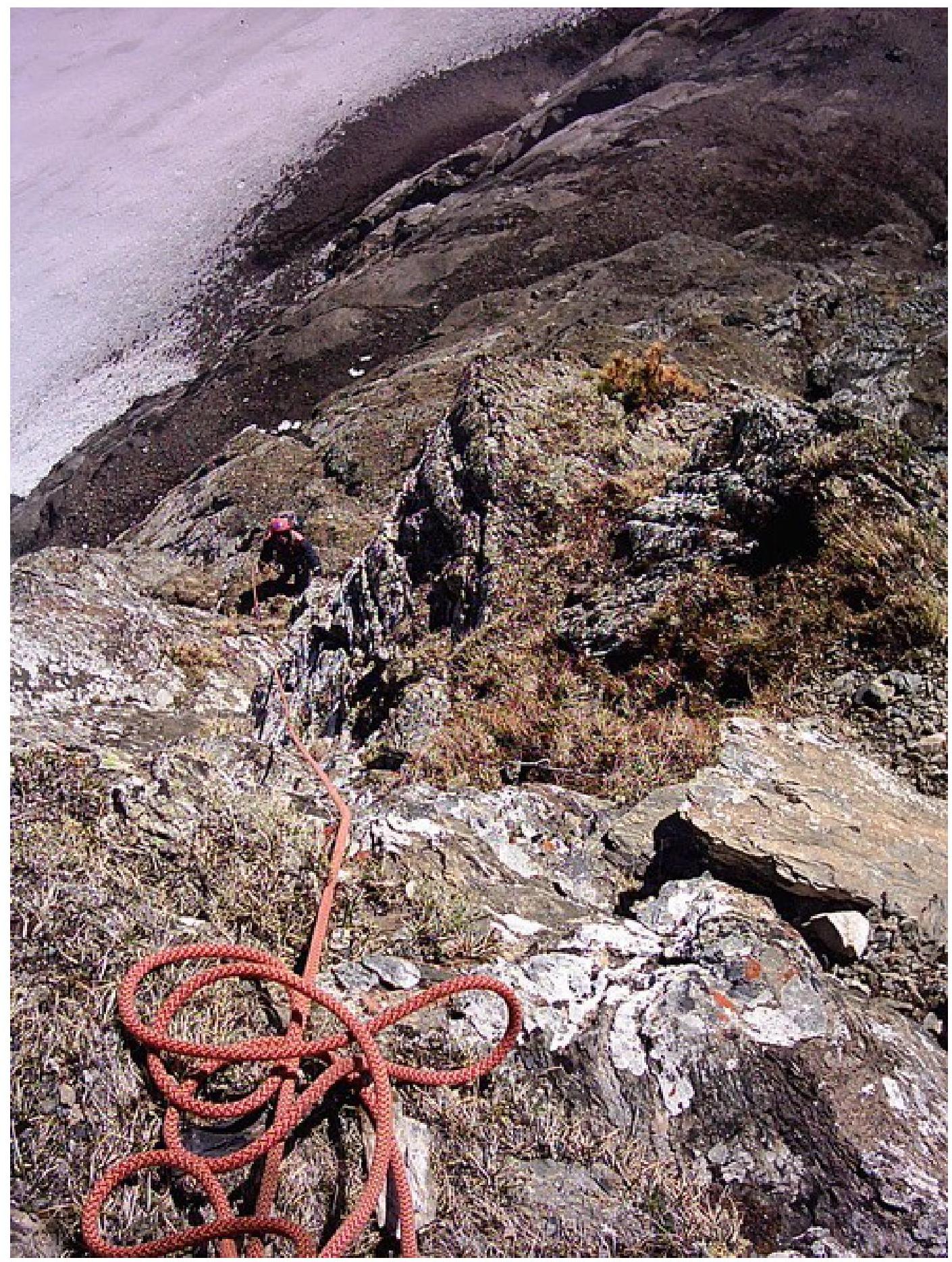
21
R3–R4. The starting point on the glacier is visible. Photo №7
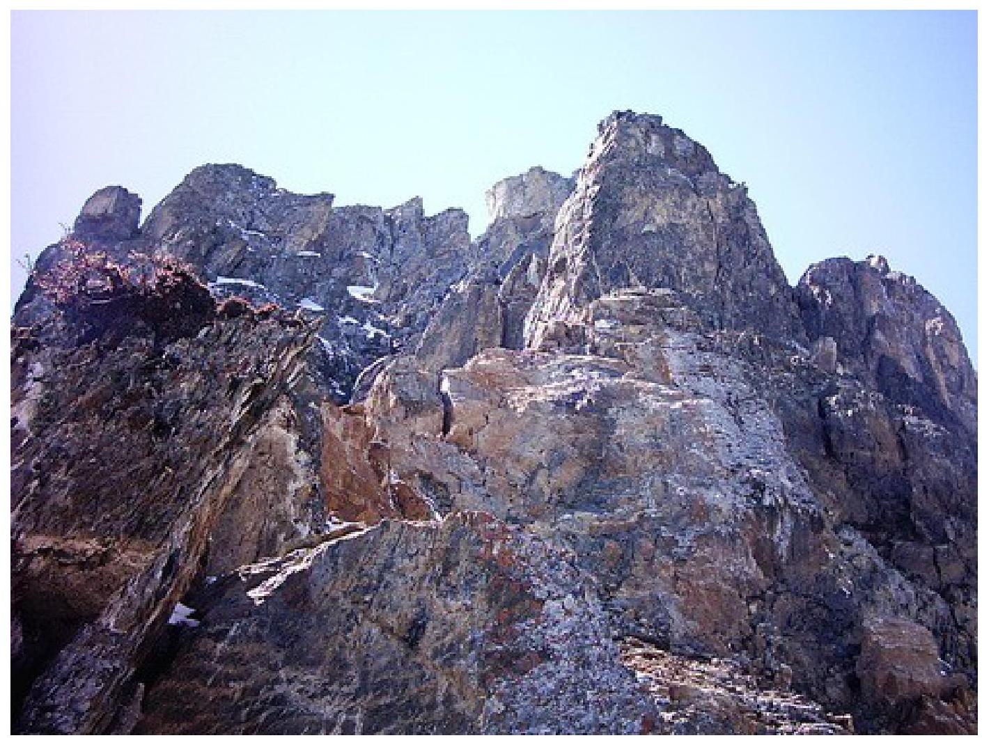 Sections R5–R7 are visible. Photo №8
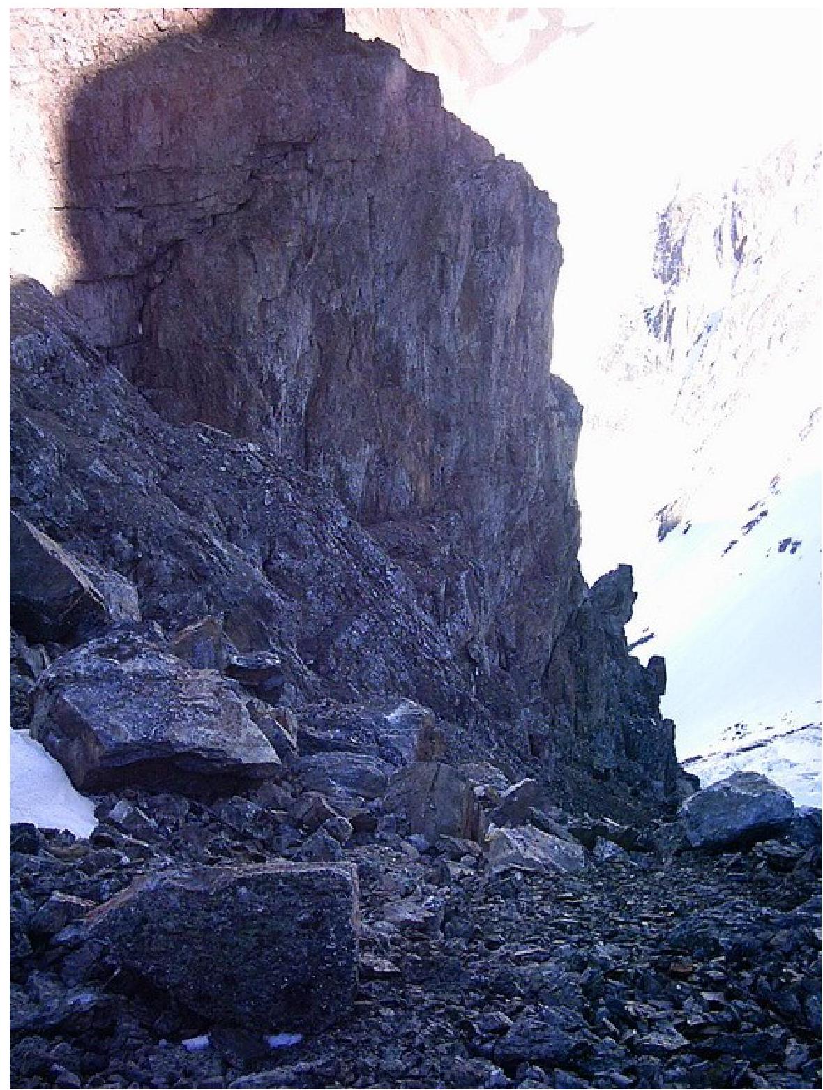 View from the saddle (start of 3A) at the end of R19 and R20.
Notes
Two control cairns were set up.
- 250 m from the glacier. At the end of R4.
- At the end of R20 on the saddle (at the start of the NE ridge with route 3A).
Batteries in the camera and GPS died after section R20, so further GPS observations were not conducted and a summit photo could not be taken.
No record was found in the summit cairn.