Passport
- Region — Altai, Shavlo gorge, KMGV section number — 1.2.
- Summit — Pik Kapitsy P.L. (3720 m), category 3B.
- Proposed category — 3A, first ascent.
- Route type — combined.
- Height difference 700 m (by altimeter). Route length m. Length of sections with V category of difficulty m, VI category of difficulty m. Average slope: main part of the route — degrees, whole route — degrees.
- Approach to the key point in crampons, belay through rock formations, 1 rock anchor hammered.
- Team's travel time: 6 hours, 1 day.
- Leader: Onishchenko V.P. — MSMK, participants: Muravyov E.A. — MS, Bastrikov V.P. — CMS, Lapshina M.A. — MS.
- Departure to the route: 7:00, July 23, 2002. Summit ascent — 13:00. Return to base camp — 17:00.
- Organizing body —
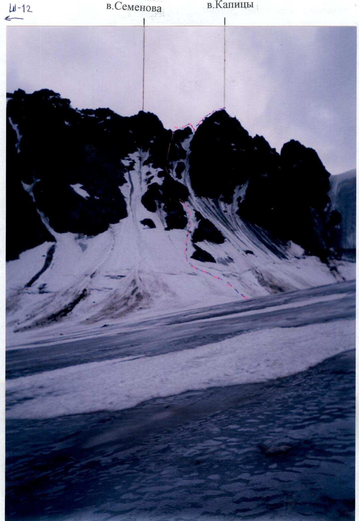
Altai. Photo of Pik Kapitsy
Route Description
From the base camp by Bolshoe Shavlo lake, the approach to the moraine of Shavlinsky glacier took 8 hours. On the next day from the bivouac on the moraine, the approach to Krutoy pass via the glacier towards the summit took 1 hour. Towards the counterfort (ridge), ascent up the snowy slope in crampons, bypass the lower rock outcrop from the left (photo 1). Further movement goes either to the right or to the left of the rock outcrops with alternating belay and exit to the gendarme between Semenova peak (left) and Pik Kapitsy (right). When descending from the gendarme towards the summit, 20 m of rope railing are set up. From the saddle, ascent up the rocks (piton belay), then along the right rock ledge, further exit to the left side of the pre-summit ridge and along it to the summit. Descent follows the ascent route.
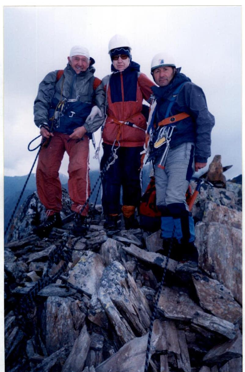
On the summit of Pik Kapitsy P.L.