Passport
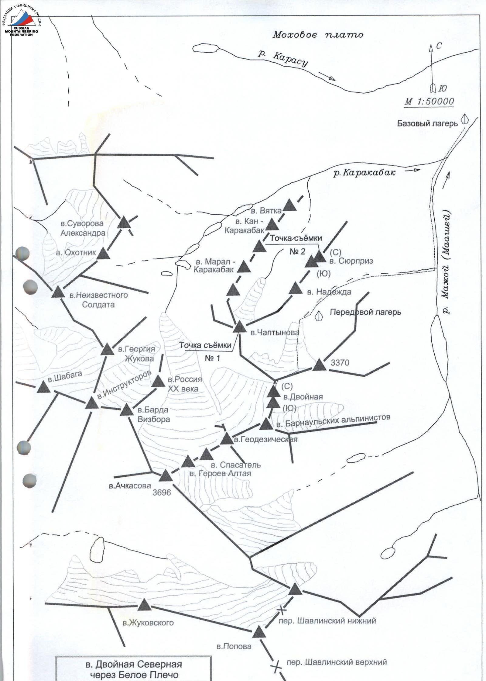
- Altai, Severo-Chuysky Ridge, Karakabak gorge, 1.2
- Peak Dvoynaya Severная via Beloe Plecho, height 3600 m (marked on the map M 1:50 000).
- Proposed - 3B category of difficulty, first ascent.
- Route type - ice and snow.
- Elevation gain: 600 m; length - 1800 m.
Average slope of the route - 20-25°. Average slope of the main part of the route (up to Beloe Plecho) - 25-35°, length - 1200 m.
- Number of pitons used on the route: ice screws - 25.
- Team's travel time:
- 6 h 20 min from the glacier to the summit;
- 9 h 00 min from the glacier to the glacier;
- 13 h 00 min from the advanced base camp to the advanced base camp.
- Overnight stays - none.
- Climbing pair: Barnov Sergey Ivanovich, 1st sports category; Komissarov Dmitry Alexandrovich, 3rd sports category.
- Coach: Drakin Andrey Valentinovich, 1st category (№68).
- Departure from the advanced base camp: 8:00, July 16, 2001.
Departure to the glacier: 9:15, July 16, 2001, fog. Start of the route: 11:00, July 16, 2001. Reaching the ridge: 14:45, July 16, 2001. Reaching Beloe Plecho: 16:40, July 16, 2001. Reaching the summit: 17:20, July 16, 2001. Descent to the glacier: 20:00, July 16, 2001. Return to the advanced base camp: 21:00, July 16, 2001.
- Organization:
joint training sessions of the Tomsk Alpine Federation and ZS TPSS.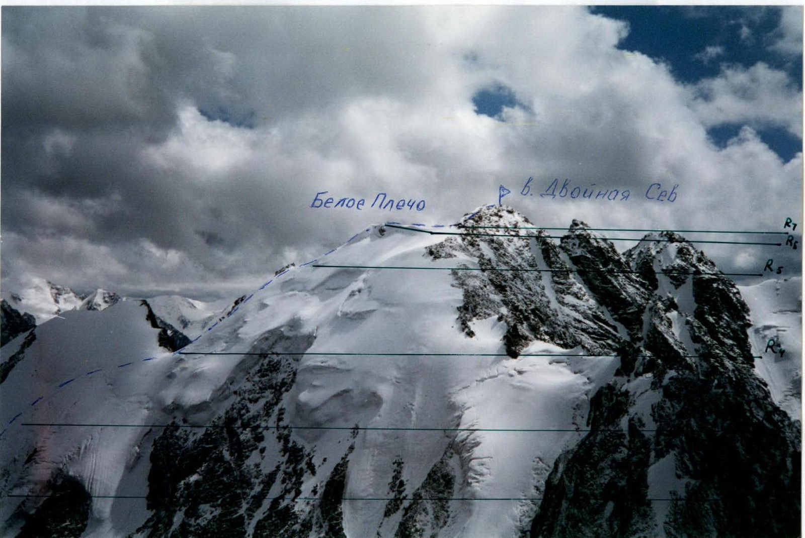
Peak Dvoynaya Severная via Beloe Plecho, shooting point №1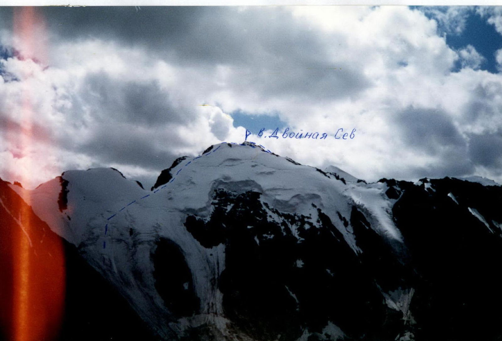
Peak Dvoynaya Severная via Beloe Plecho, shooting point №2
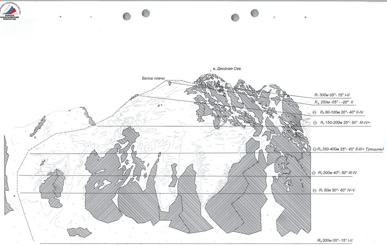
p. Dvoynaya Sev. Beloe plecho R7: 300 m, 05°–15°, 1–2 R6: 250 m, 05°–20°, 2 R5: 80–100 m, 20°–40°, 2–4 R4: 150–200 m, 25°–50°, 3–4 R3: 350–400 m, 25°–45°, 2–3, Crevasses! R2: 200 m, 40°–50°, 3–4 R1: 50 m, 50°–60°, 4–5 R0: 300 m, 05°–15°, 1–2
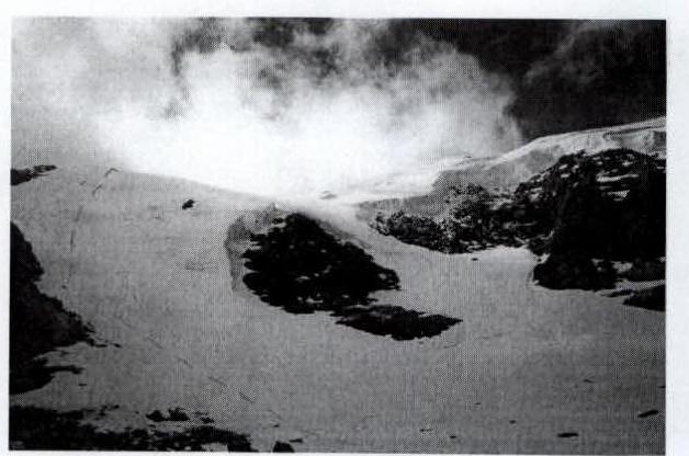
Start of the route
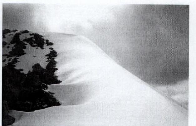
The final ascent of Beloe Plecho
From the advanced base camp, located between p. Geodezist (3370) and p. Surpriz, move towards the glacier, located in the valley between p. Geodezist (3370), Beloe Plecho, p. Chaptyнова and p. Surpriz, through the sheep's foreheads and moraine ridges blocking the river valley. Approach the northern slope of Beloe Plecho via the glacier. The approach from the advanced base camp, located between p. Geodezist (3370) and p. Surpriz, takes 1-1.5 hours.
Move on ice. Reach the ridge at the saddle between 1 and 2 prelminary summits of Beloe Plecho. 300 m (slope: 5°–15°) towards the rock under the steep ice slope. Simultaneous movement, protection via ice screws (6). Ice slope with cracks 5 ropes of 50 m, slope: 50°–60° (up to 70°), alternating movement, protection via ice screws (7). Then towards the saddle 350–400 m, slope: 25°–45°. Crevasses. Simultaneous movement with protection via ice screws (6) or alternating via ice axes. From the saddle along the ridge to a steep ascent (150–200 m, 25°–50°), initially alternating movement with protection via ice axes, then simultaneous with protection via ice screws (2), and at the top of the ascent - alternating with protection via ice screws (2). The next ascent is more gentle (80–100 m, 20°–40°), movement is initially alternating with protection via ice axes, then simultaneous with protection via ice screws (2). On Beloe Plecho - control point. From it, move along the ridge towards the gap between Beloe Plecho and p. Dvoynaya (S). 250 m. Then along the ridge - to p. Dvoynaya (S) 300 m, 5°–15°, simultaneous movement.
Descent via the same route.
Route safety assessment
The route is not prone to rockfall and avalanches (although there was a lot of snow in 2001). Be cautious when crossing crevasses in the fractures and on the glacier bends.
The route to the summit Dvoynaya Severная via Beloe Plecho is ice and snow. Approximately 3B category of difficulty.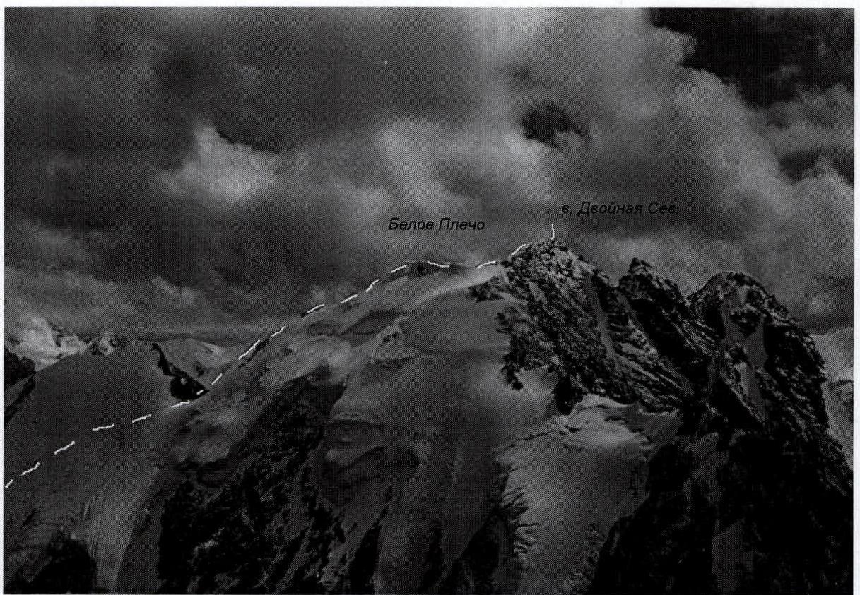
View from p. Chaptyнова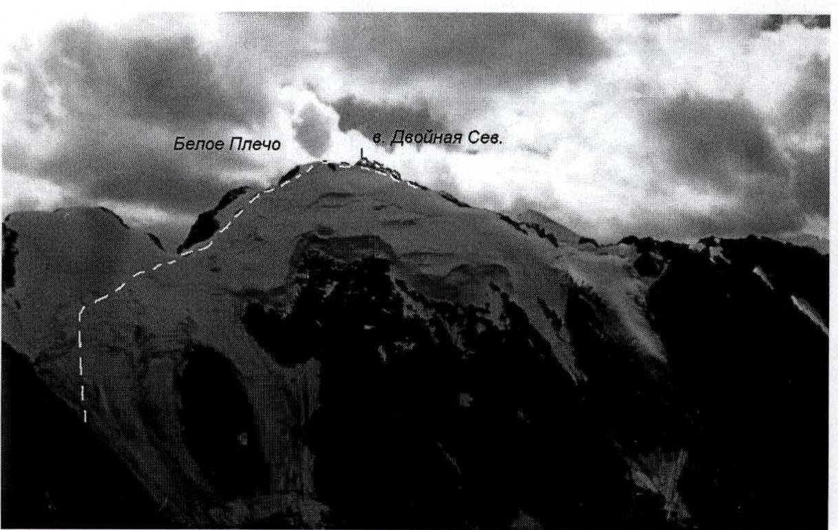
View from p. Surpriz


