Ascent Record
- Altai, Aktru gorge, section 1.
- Aktru peak, 4044 m, via the South slope.
- Proposed category: 2B, first ascent.
- Route type: combined.
- Elevation gain: 500 m, distance: 700 m, average steepness of the main part: 45°.
- Pitons used: 2 rock, 2 ice.
- Team's total climbing hours: 5 hours.
- Leader: Afanasiev A.E., Candidate Master of Sports. Team members: Shakleev V.I., Candidate Master of Sports, Morozov V.V., Candidate Master of Sports.
- Coach: Sobolev N.M., Candidate Master of Sports.
- Departure: October 23, 1981, summit: October 23, 1981, return: October 24, 1981.
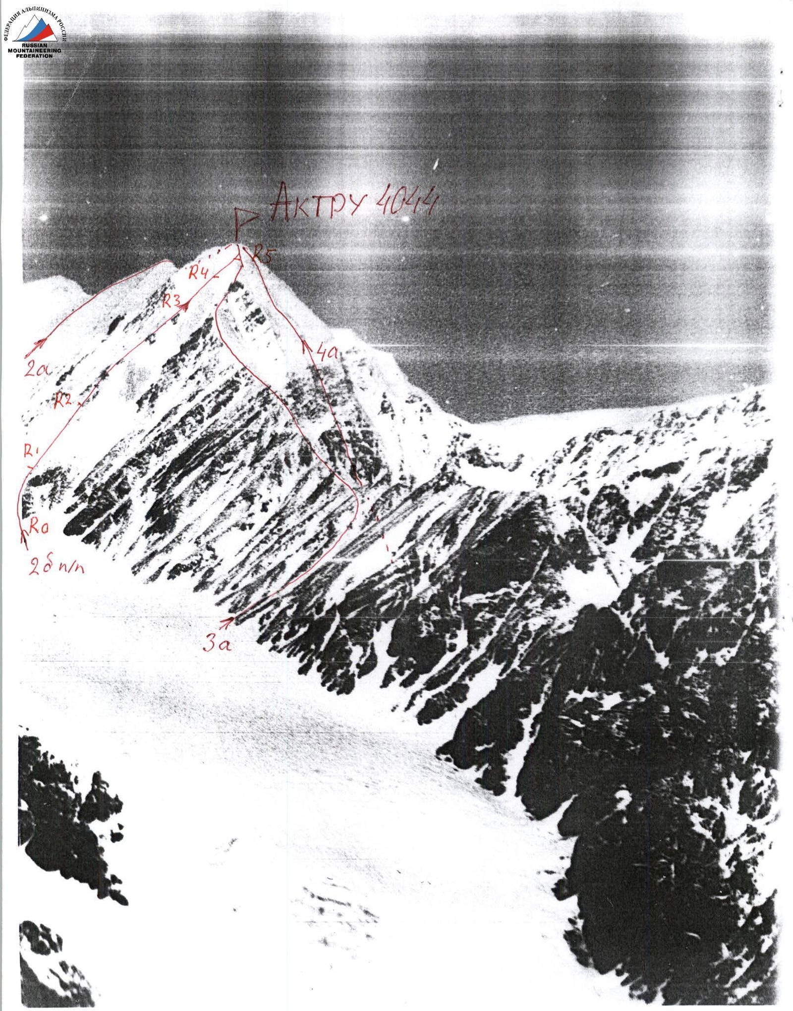
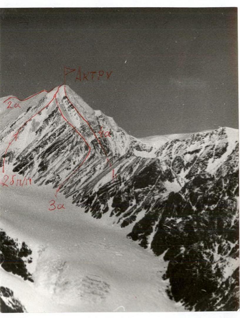
Description of the ascent route to Aktru peak via the South slope, category 2B.
The route starts from the Levyy Aktru glacier at an altitude of 3500 m, i.e., above the upper (third) bend of the glacier, almost opposite the Studenov peak, along the middle rocky-debris ridge of the South slope of Aktru peak.
Route sections:
- R0: 120 m, 40°, category 1, debris slope, schist slabs.
- R1: 140 m, 50°, category 2, schist live rocks, protection via outcrops, rock pitons, alternating movement.
- R2: 200 m, 45°, category 2, rocky ridge traversed on the left side, simultaneous movement, protection via outcrops.
- R3: 120 m, 43°, category 1, debris ridge.
- R4: 80 m, 47°, category 3, section starts with a separate rocky outcrop in ice, protection via a rock piton; followed by an ice slope, protection via ice screws; in the upper part of the section, a possible snow "board" — avalanche danger!
- R5: 40 m, category 2, snowy upper ridge of the route, category 3A. Cornices to the right!
Descent via the ascent route or route 2A.
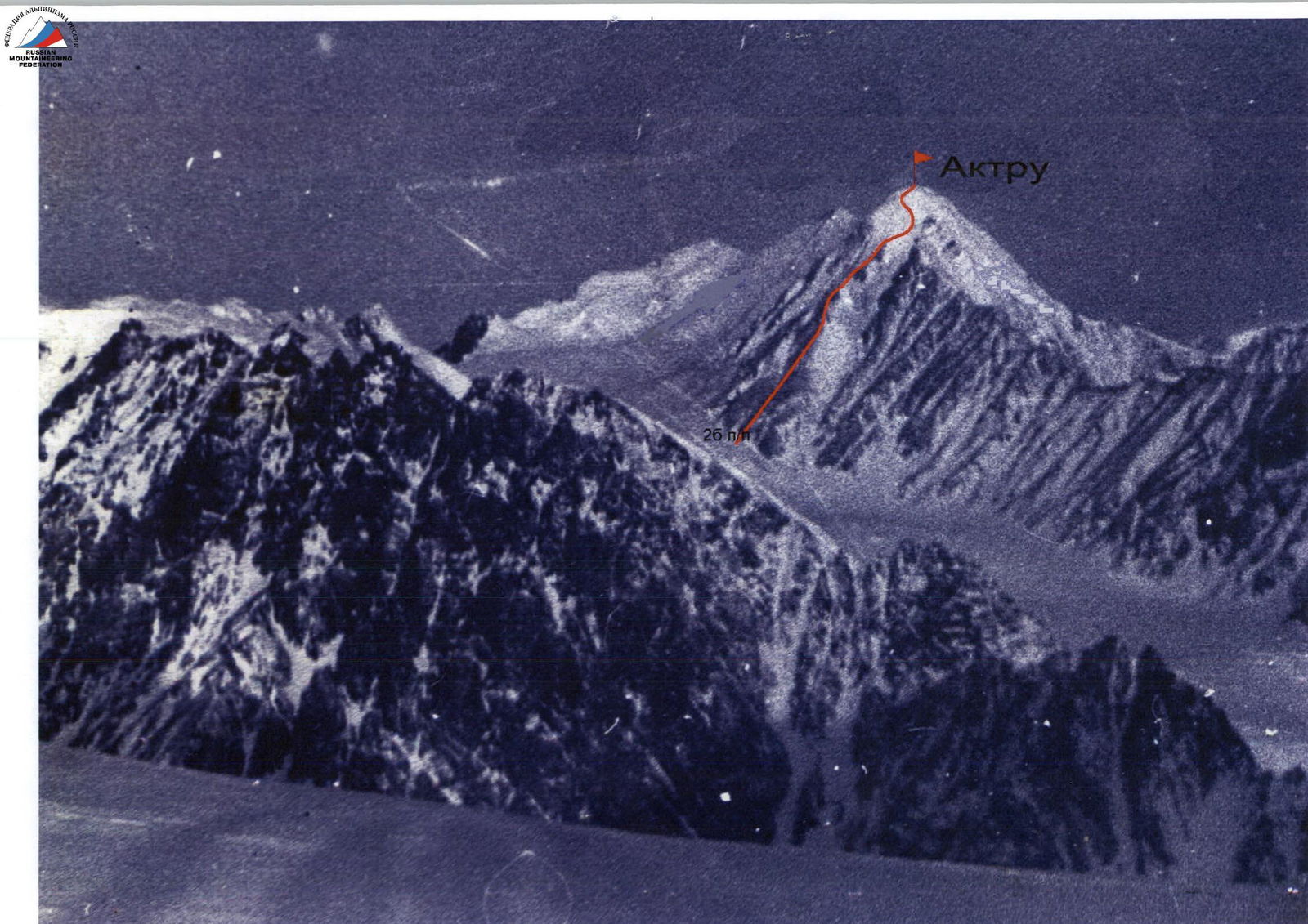
Aktru peak, South slope, category 2B.
UIAA Scheme
| Rock | Chocks | Ice | UIAA Symbols | Section characteristics |
|---|---|---|---|---|
| (graphical symbol) | R5: 40 m, category 2 | |||
| 1 | 3 | (graphical symbol) | R4: 80 m, 47°, category 3 | |
| (graphical symbol) | R3: 120 m, 43°, category 1 | |||
| (graphical symbol) | R2: 200 m, 45°, category 2 | |||
| (graphical symbol) | R1: 140 m, 50°, category 2 | |||
| (graphical symbol) | R0: 120 m, 40°, category 1 |
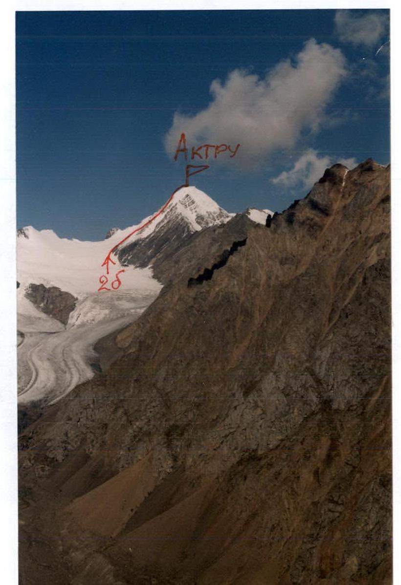
Aktru, 4044 m, category 2B route.