Report
on the first ascent route to the summit 3548 m a.s.l. It is proposed to be named after Tomsk climber Krylov Stanislav.
Altai Republic, Ust-Koksinsky district, Katunsky ridge via the glacier from the north
2B cat. difficulty (approximately) (ice climbing) by the team of Tomsk Alpine Federation March 20, 2022
Participants: Temerev I.M. Khasanov N.A. Vorontsov A.V.
I. Ascent Passport
| № | 1. General Information | |
|---|---|---|
| 1.1 | Full name, sports rank of the leader | Temerev Ivan Mikhailovich, Master of Sports |
| 1.2 | Full name, sports rank of participants | Khasanov Nail Albertovich, 3rd rank, Vorontsov Andrey Vladimirovich, no rank |
| 1.3 | Full name of the coach | Temerev Ivan Mikhailovich, Master of Sports |
| 1.4 | Organization | Tomsk Alpine Federation |
| 2. Characteristics of the ascent object | ||
| 2.1 | Region | Altai Republic, Ust-Koksinsky district |
| 2.2 | Ridge | Katunsky |
| 2.3 | Section number according to the 2020 classification table | 1. ALTAI |
| 2.4 | Name and height of the summit | 3548 m – unnamed. It is proposed to be named after Tomsk climber Krylov Stanislav |
| 2.5 | Geographical coordinates of the summit (latitude/longitude), GPS coordinates | N 49°53′27.72″ E 86°35′28.09″ |
| 3. Characteristics of the route | ||
| 3.1 | Route name | via the glacier from the north |
| 3.2 | Proposed category of difficulty | 2B (rather weak ice 3A). Not recommended as the first ice 2B! |
| 3.3 | Degree of route development | Probably a first ascent, date of first ascent unknown – no cairn or note found |
| 3.4 | Relief characteristics of the route | Ice slope to the ridge, then rocky |
| 3.5 | Height difference of the route (according to GPS data) | 600 m |
| 3.6 | Route length (in meters) | 950 m, including 650 m of technical part; not including the approach |
| 3.7 | Technical elements of the route (total length of sections of various difficulty categories with indication of relief character (ice-snow, rocky)) | I cat. diff. – 200 m snow-firn slope up to 30°. II cat. diff. – 350 m, – ice slope up to 35° – 50 m, – including rocks with slope up to 30°, местами obledenevshe – 300 m, III cat. diff. – 400 m ice slope 40–55° |
| 3.8 | Descent from the summit | Along the south-west slope to Lake Gornykh Dukhov, along a snowy trail to the stream rapids, then along ice cascades in crampons to the Akkem River, along the frozen Akkem River to the base camp |
| 3.9 | Additional route characteristics | Recommended for winter ascent! In summer, it is necessary to observe the state of the ice slope and possible rockfalls from the slopes during the hottest time of day. Average slope 45°, maximum slope 62°. |
| 4. Characteristics of team actions | ||
| 3.10 | Equipment used | Ice tools – 3 pairs, ropes – 2 x 70 m, ice screws – 14 pcs., local loops with carabiners – 2 pcs., short quickdraws with carabiners – 10 pcs. |
| 4.1 | Time of movement (team's walking hours) | 19 hours, including approach – 6 hours, ascent – 7 hours, descent and return – 6 hours |
| 4.2 | Overnights | - |
| 4.3 | Start of the route | 6:00, March 20, 2022, departure from the weather station on Akkem Lake, 12:00 start working on the route |
| 4.4 | Reaching the summit | 19:00, 19:30 start of descent |
| 4.5 | Return to base camp | 1:00 |
| 5. Responsible for the report | ||
| 5.1 | Full name, e-mail | Vorontsov Andrey |
II. Ascent Description
1. Characteristics of the Ascent Object
1.1. General photo of Krylov Stanislav summit 3548 m a.s.l. is shown in Figure 1.
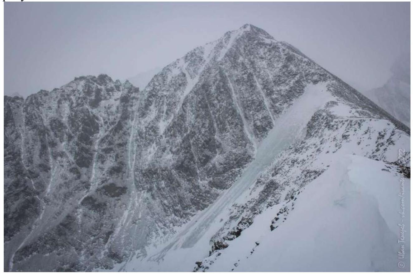
Figure 1. Krylov Stanislav summit 3548 m a.s.l., photo taken on March 18, 2022, from the summit of Yarlu (3370 m) (photo location coordinates 49°53′51.80″ N, 86°34′33.94″ E).
1.2. Route Profile Photo
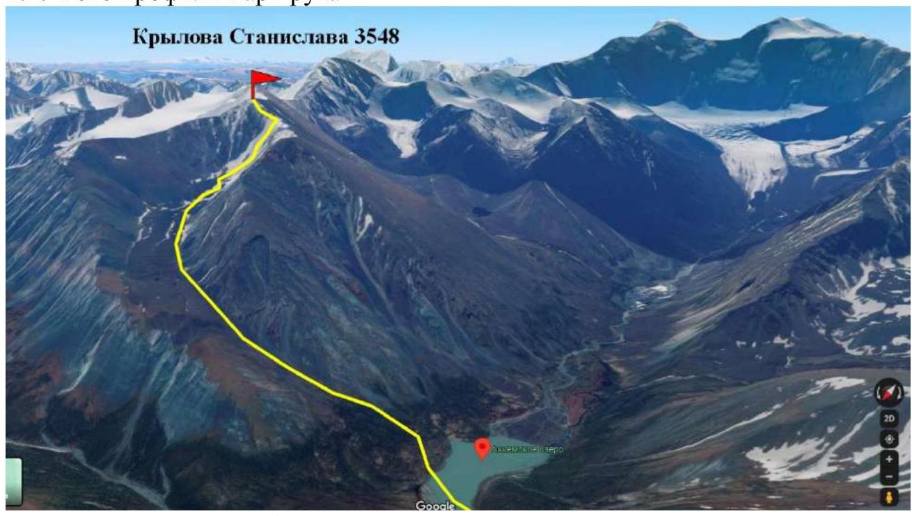
Figure 2. Screenshot of the approach route (4 km) to the climb. Screenshot taken from the site https://www.google.ru/↗. Accessed on May 19, 2022.
Route profile photo from R0 to the summit is shown in Figure 3.
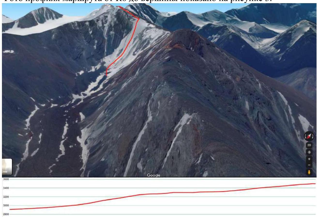
Figure 3. Screenshot of the route under perspective (route path marked with a red line) with route profile. Screenshot taken from the site https://www.google.ru/https://www.google.ru/maps/@49.9048046,86.577104,590a,35y,146.69h,77.63t/data=!3m1!1e3↗. Accessed on May 19, 2022.
1.5. Area Map
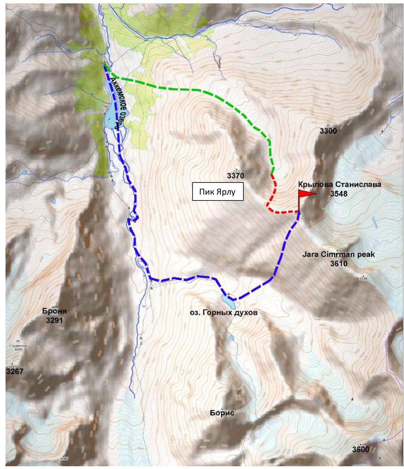
Figure 4. Area map with summits and their heights, as well as the ascent route marked as: green dotted line (approach to the route), red – route from R0 to the summit, blue – descent from the route to the base camp on Akkem Lake. Screenshot taken from the site https://nakarte.me/#m=11/50.00686/86.47614&l=Otm↗. Accessed on May 19, 2022.
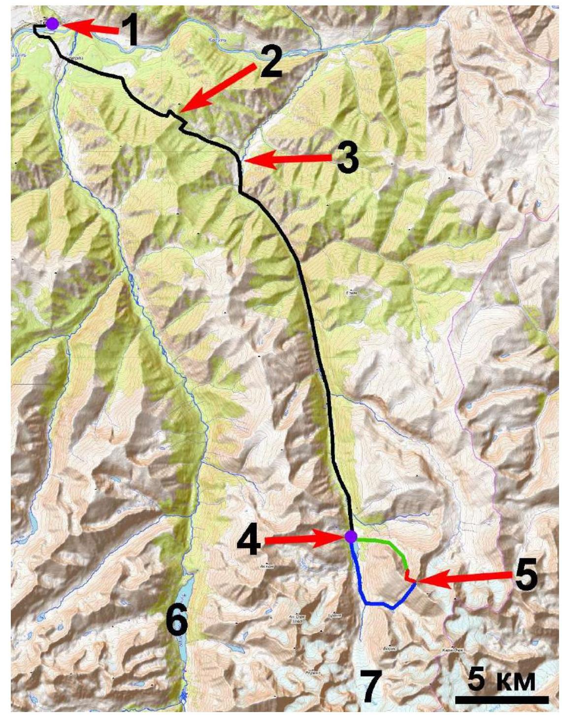
Figure 5. Area map. Numbers on the map indicate:
- 1 – Tyungur village
- black line – ascent path to the base camp through Kuzyak pass (2) to Akkem Lake (4),
- 3 – intersection of the ascent path and start of movement along the Akkem River,
- 5 – Krylov Stanislav summit 3548 m a.s.l.,
- 6 – Kucherlinsky Lake (for reference),
- 7 – Akkem glacier (for reference).
The black line schematically indicates the path from Tyungur village through Kuzyak pass (number 2 on Figure 7), along the Akkem River (number 3 indicates the intersection of the path with the Akkem River) to the base camp located on Akkem Lake (number 4 on Figure 7), the purple marker indicates the base camp (40 km from Tyungur village), number 5 on Figure 7 indicates Krylov Stanislav summit 3548 m a.s.l. The green line – path to the start of the route, the blue line – descent from the route.
Krylov Stanislav summit 3548 m a.s.l. is located southeast of Akkem Lake. It is situated in the northern part of the Katunsky ridge. Among the summits included in the classifier, slightly south of Krylov Stanislav summit 3548 m a.s.l. are Jara Cimrman peak, Boris peak, Belukha peak, and across the Akkem River to the southwest is Bronya peak.
The distance from Tyungur village (in winter) along the dirt road through Kuzyak pass to the Akkem River is 16 km, then along the frozen Akkem River to Akkem Lake is 24 km. The summit is visible from Akkem Lake.
Path to the start of the route:
- from Tyungur village along the dirt road through Kuzyak pass to the Akkem River, along the frozen Akkem River to Akkem Lake – 40 km.
- then 4 km on foot in a southeast direction through the forest zone, exit to the rocky terrain of the gorge to the start of the ascent (R0 (49°53.754′ N, 86°35.149′ E)).
Total approach time from Akkem Lake is 6 hours.
Currently, there are no categorized routes to the summit.
2. Route Characteristics
2.1. Route diagram in UIAA symbols in the form of an outline of the route on the mountain
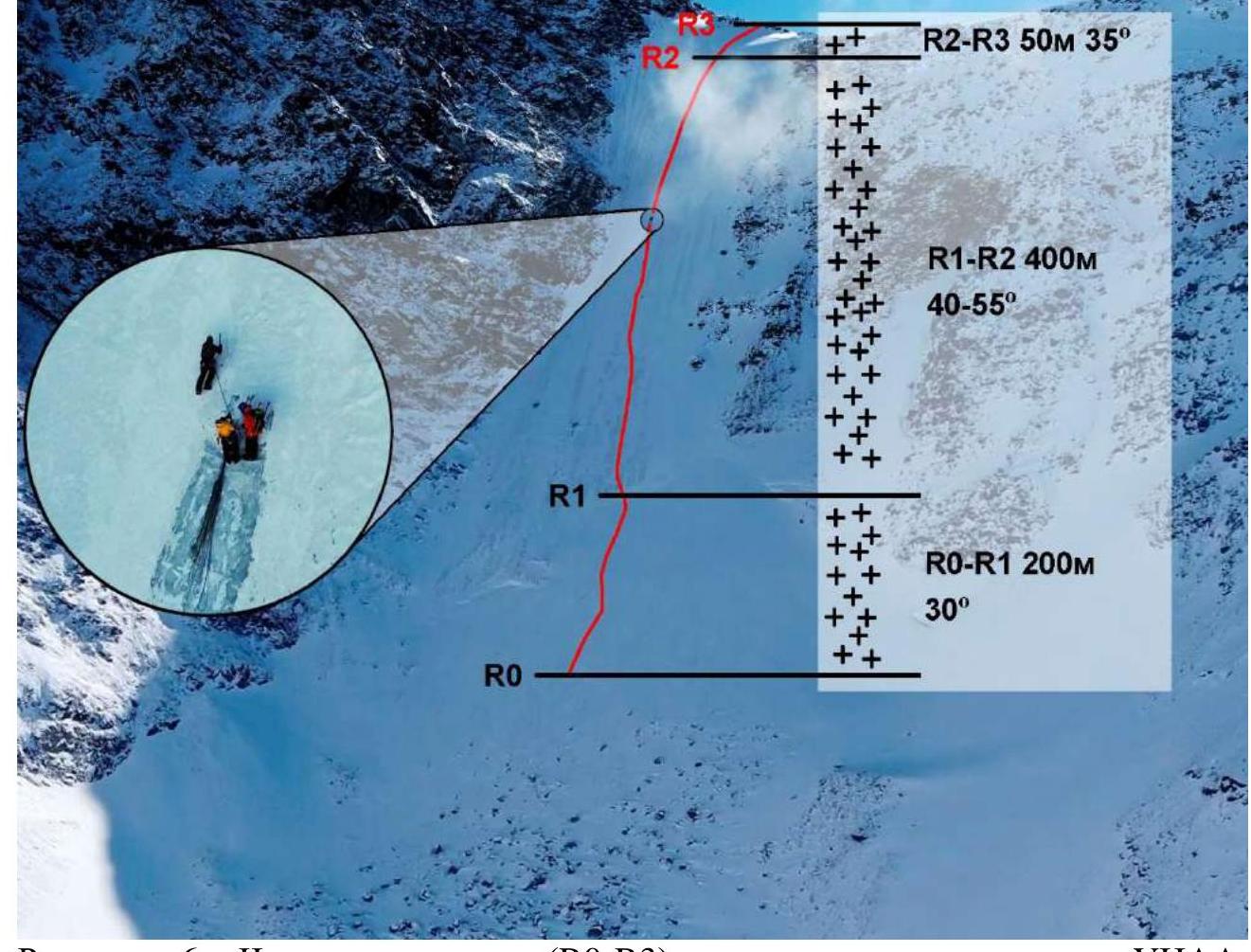
Figure 6. Part of the route (R0–R3), described in UIAA symbols, with section lengths and average slope steepness. Photo taken with a quadcopter on the day of the ascent.
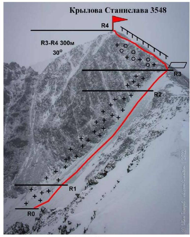
Figure 7. Route thread (R0–R4), described in UIAA symbols, with section R3–R4 length and average slope steepness. Photo taken from the summit of Yarlu (3370 m) (photo location coordinates 49°53′51.80″ N, 86°34′33.94″ E).
2.2. Technical Characteristics of Route Sections
| Section № | Relief Character | Category of Difficulty | Length, m | Type and Number of Ice Screws |
|---|---|---|---|---|
| R0–R1 | Snow-firn slope, angle up to 30° | 0–1 | 200 | 0 |
| R1–R2 | Ice covered with a thin layer of snow, slope 40–55° | 3 | 400 | Key section. Dense ice, convenient for making stations, insurance with ice screws every ~10 m |
| R2–R3 | Ice covered with a thin layer of snow, slope up to 35° | 2 | 50 | Dense ice, convenient for making stations, insurance with ice screws every ~10 m |
| R3–R4 | Rocky scree and simple rocks; slope up to 30° | 2 | 300 | Free climbing. |
2.3. Route Diagram in UIAA Symbols in Table Form.
| Section № | Ice Screw Name and Number | Insurance Points, Characteristics in Symbols | Route Line in UIAA Symbols | Section Difficulty in Symbols | Section Length, m | Steepness, ° |
|---|---|---|---|---|---|---|
| Loops on Relief, Ice Screws | ||||||
| R3–R4 | 0 / 0 | 0 | 2 | 300 | 30° | |
| R2–R3 | 1 / 5 | 0 | 2 | 50 | 35° | |
| R1–R2 | 7 / 49 | 0 | 3 | 400 | 40–55° | |
| R0–R1 | 0 / 0 | 0–1 | 200 | 30° |
3. Characteristics of Team Actions
3.1. Brief Description of Route Passage with Photo Illustrations.
| Section № | Description | Photo Number |
|---|---|---|
| R0–R1 | Snow-firn slope, angle up to 30°. From the start of the section – simultaneous movement in teams and with crampons. | Photo 1–3 |
| R1–R2 | Key section. Ice covered with a thin layer of snow, slope 40–55°. Movement in a team and with crampons, using ice tools, insurance with ice screws. | Photo 4–8 |
| R2–R3 | Ice covered with a thin layer of snow, slope up to 35°. Movement in a team and with crampons, using ice tools, insurance with ice screws. | Photo 9–10 |
| R3–R4 | Rocky scree and simple rocks; slope up to 30°. Snowy rocks with slope up to 30°, местами obledenevshe. Movement by free climbing. | Photo 11 |
Photo 1. Movement on section R0–R1
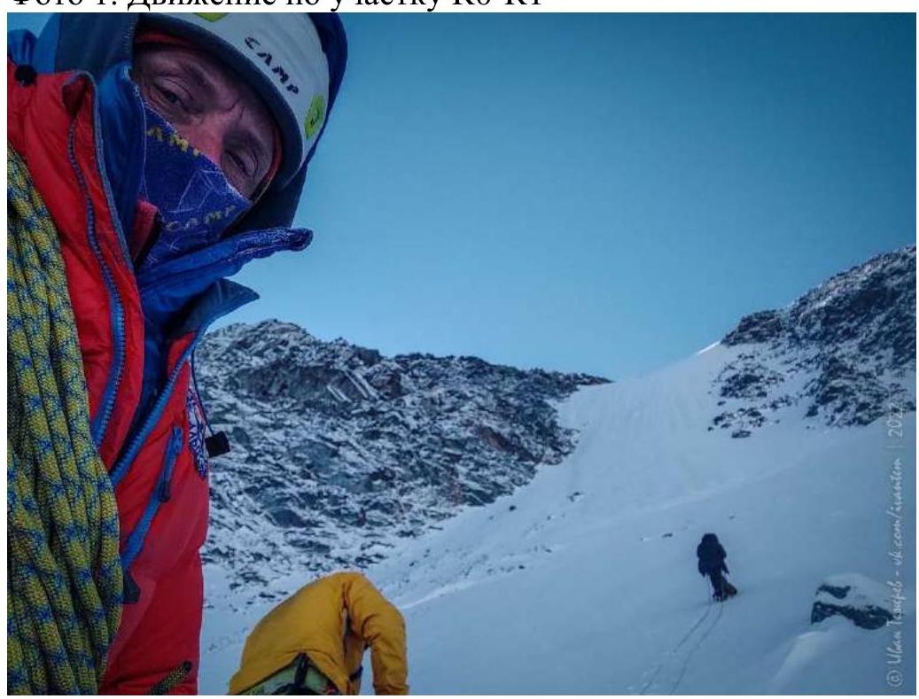
Photo 2. Movement on section R0–R1
 Photo 3. Movement on section R0–R1
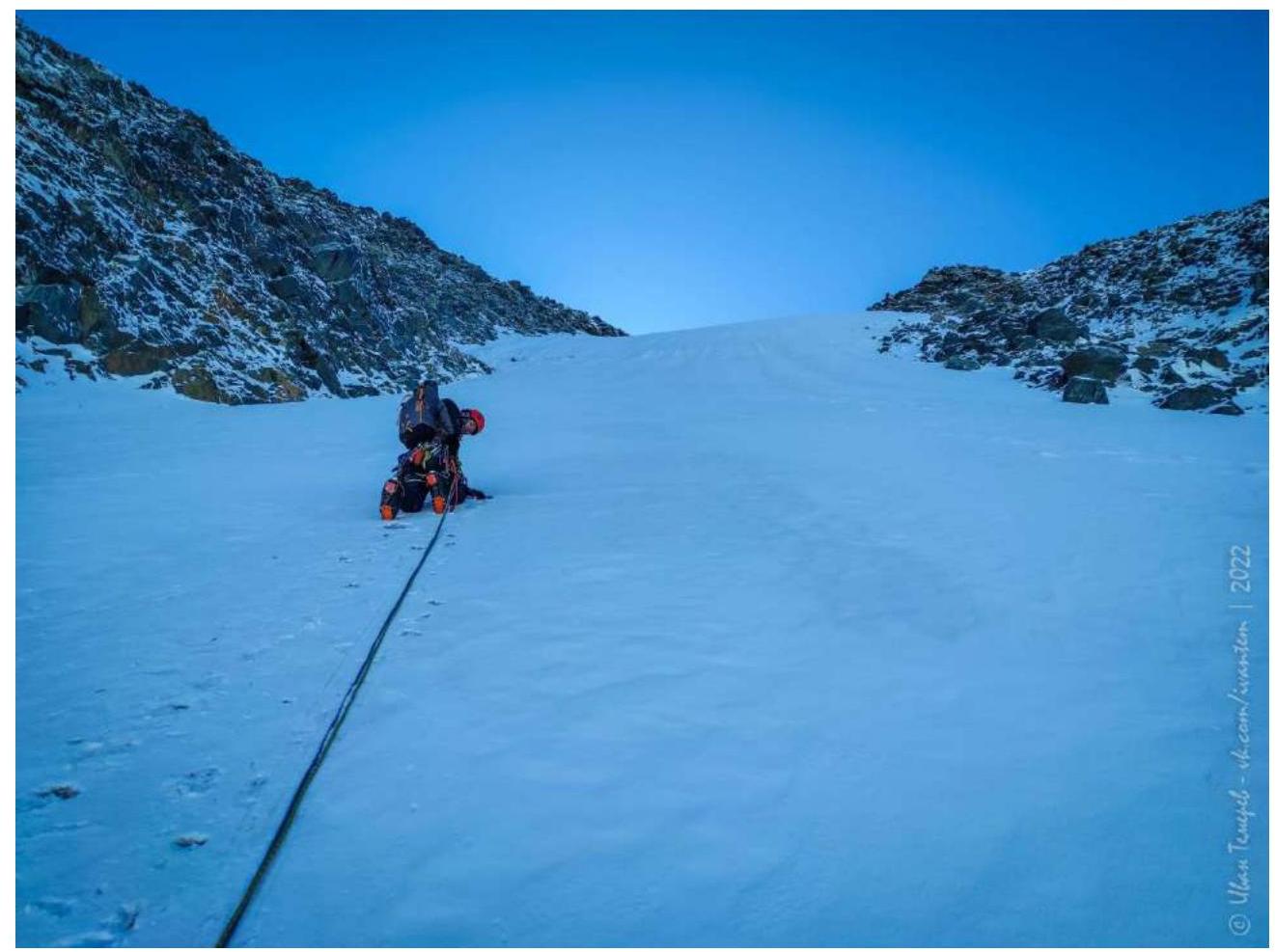 Photo 4. Movement on section R1–R2
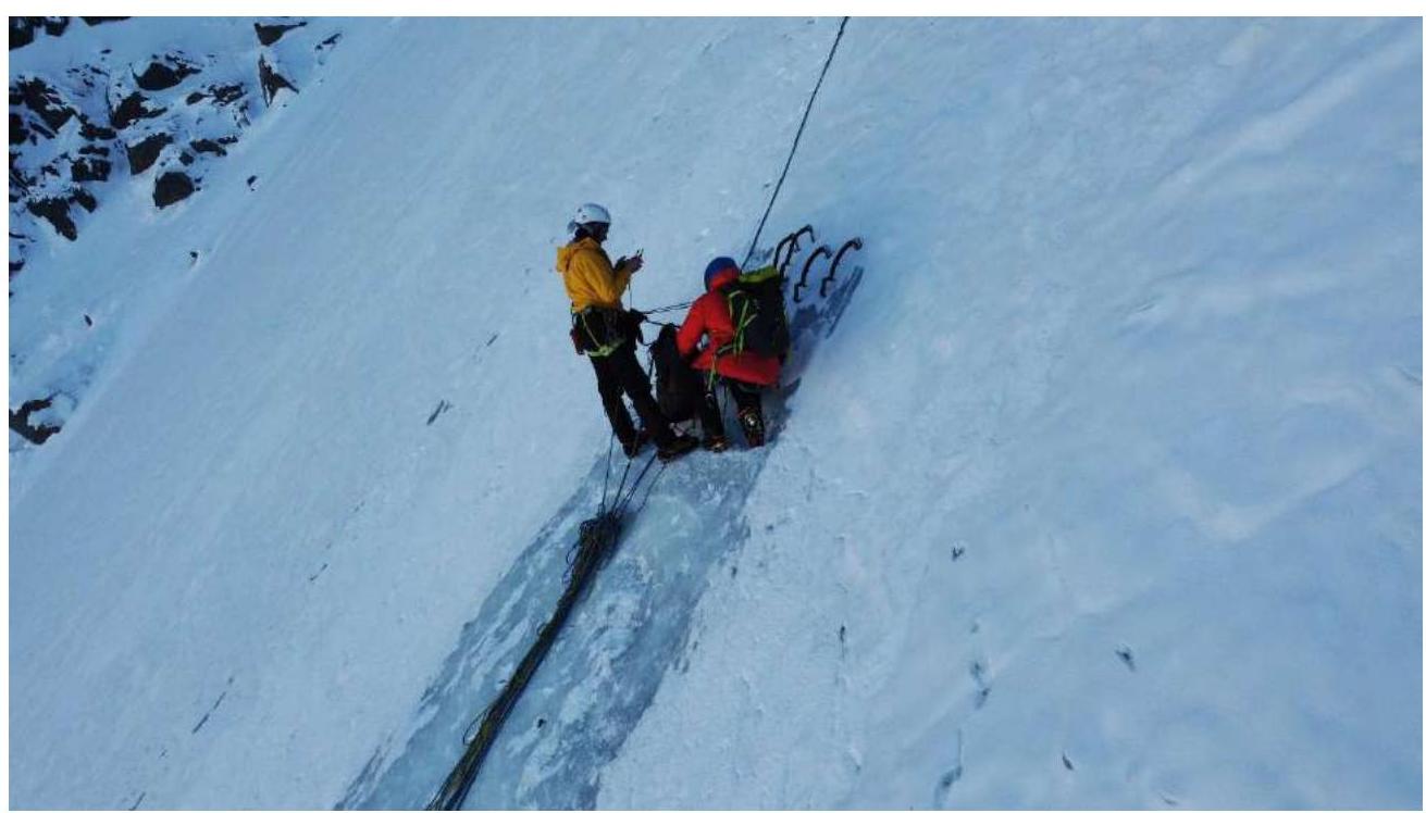
Photo 5. Movement on section R1–R2
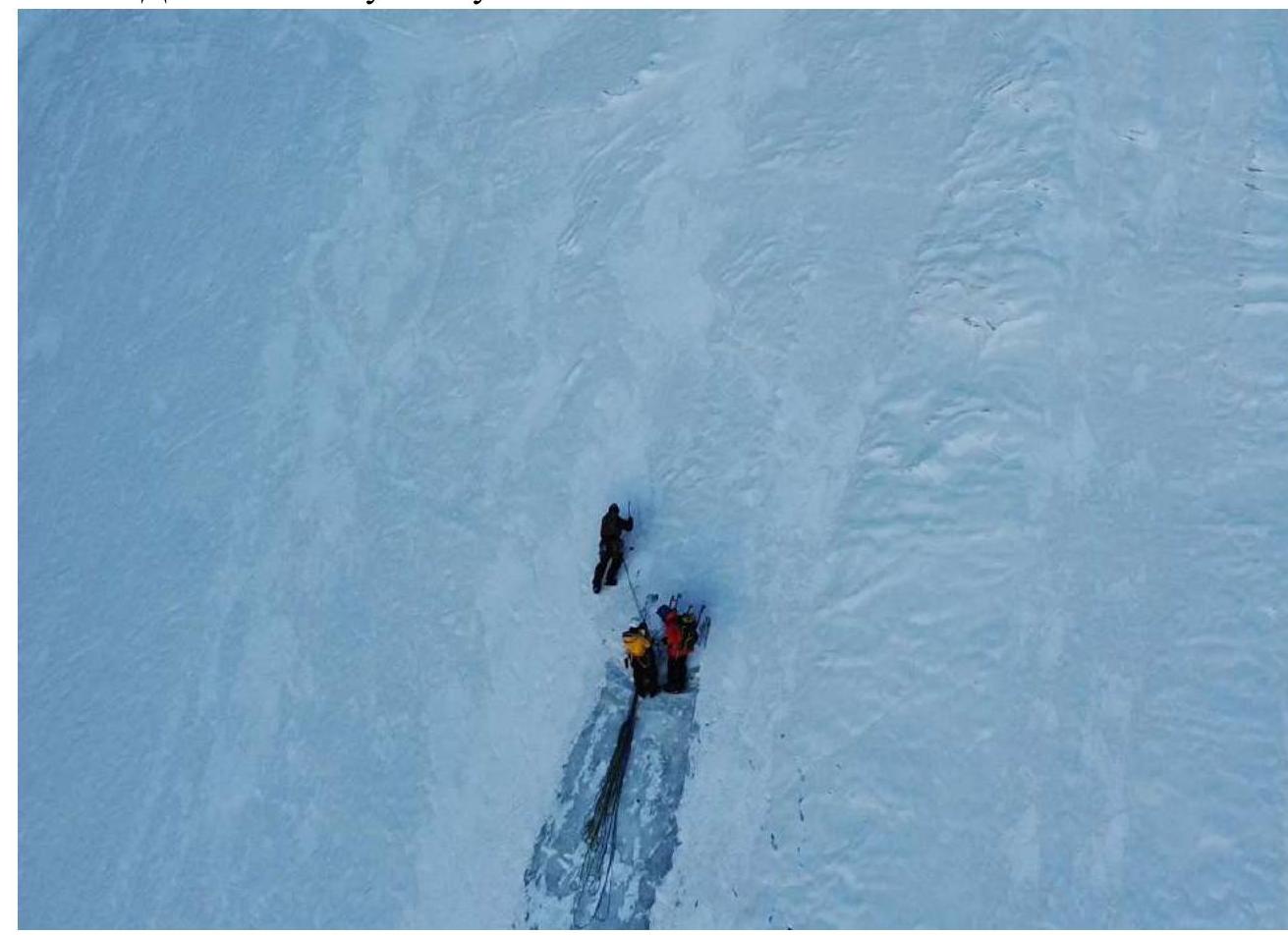 Photo 6. Movement on section R1–R2
 Photo 7. Movement on section R1–R2
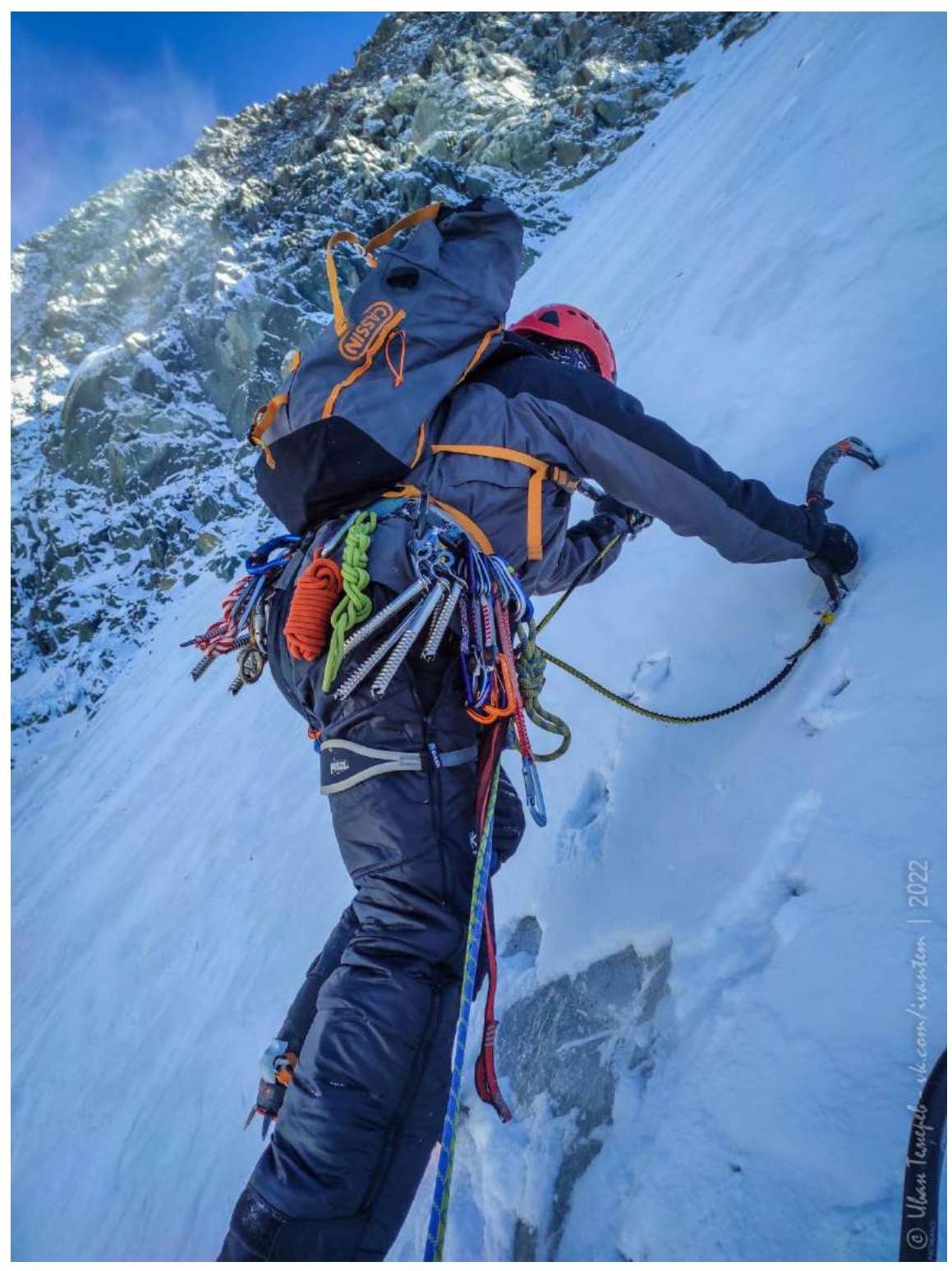 Photo 8. Movement on section R1–R2
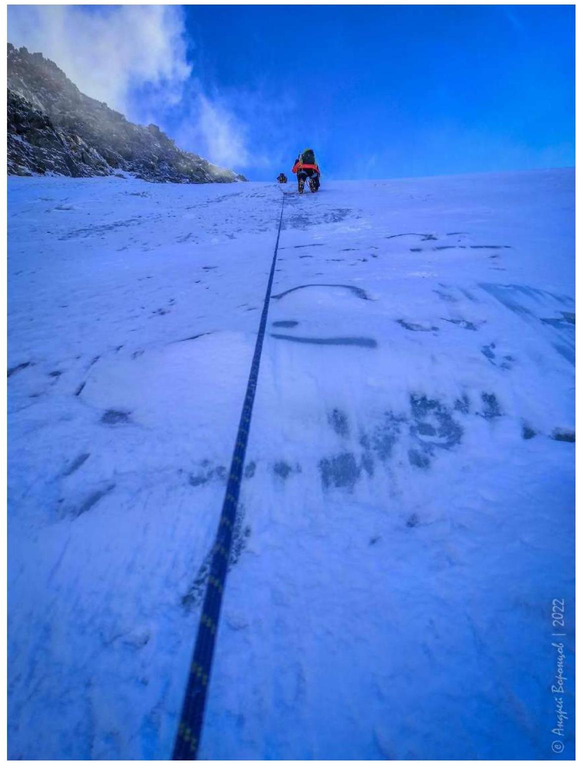 Photo 9. Movement on section R2–R3
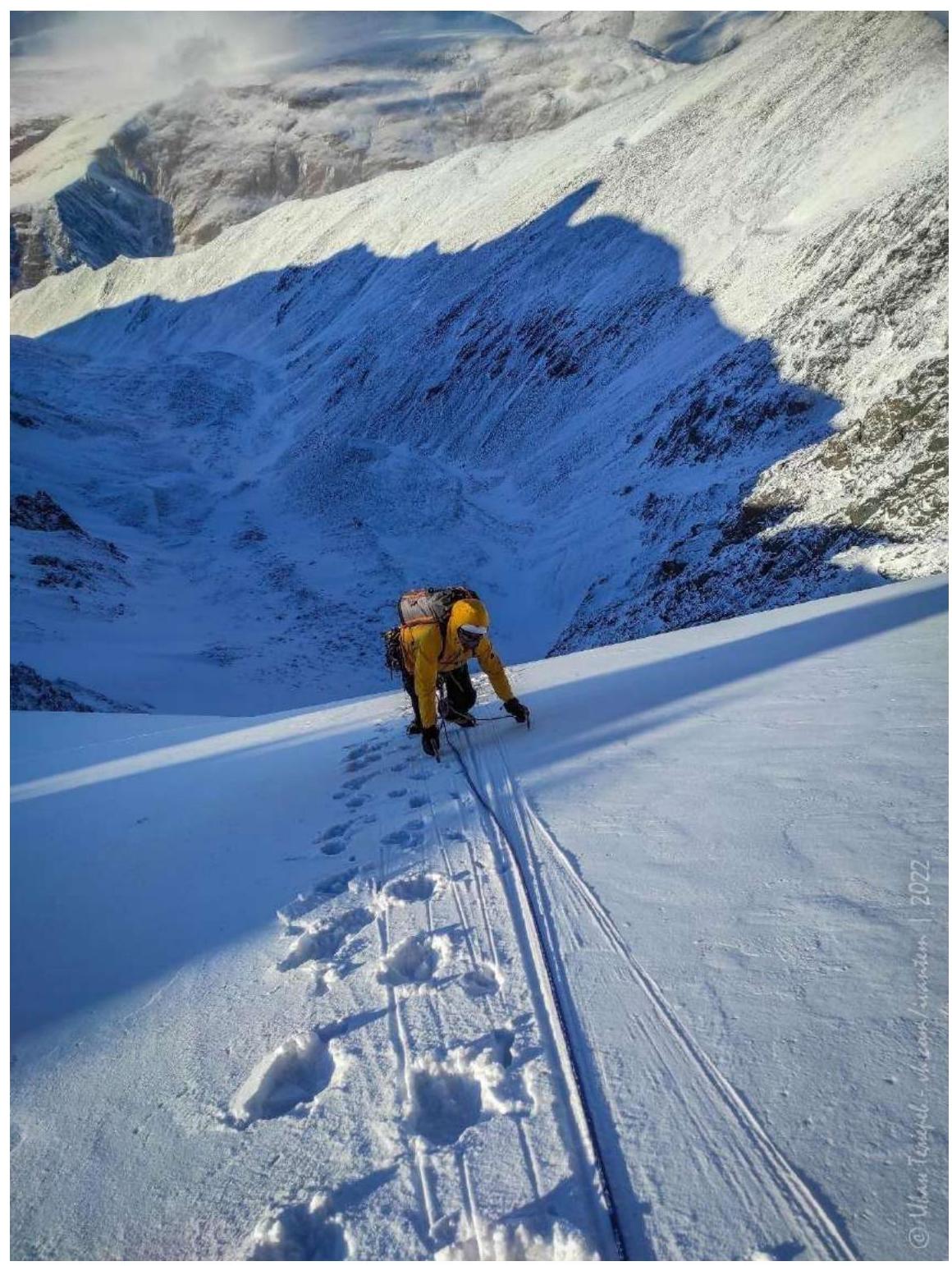 Photo 10. Shelf on the NW ridge at the end of section R2–R3
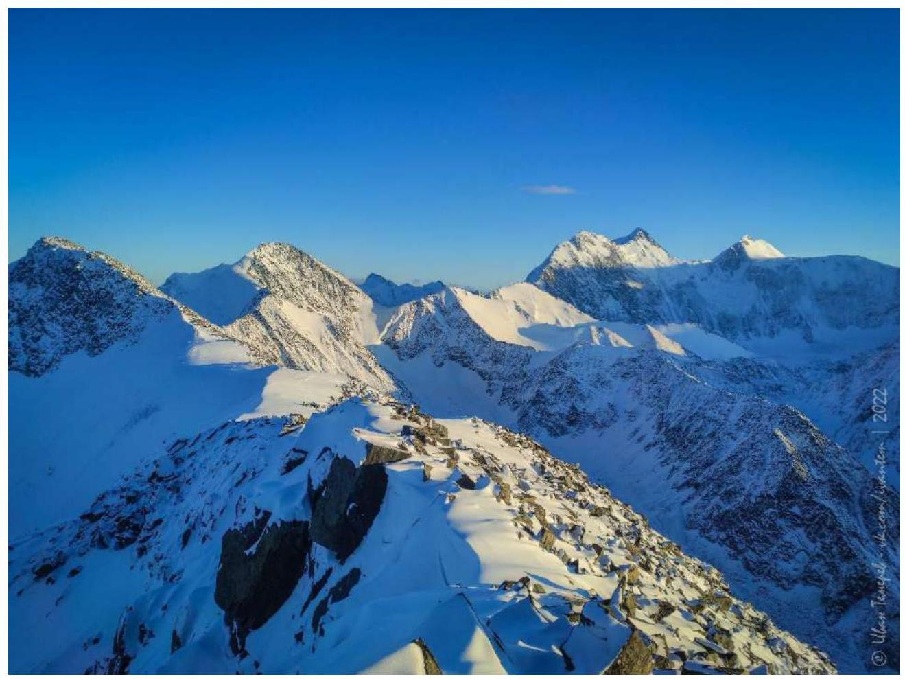
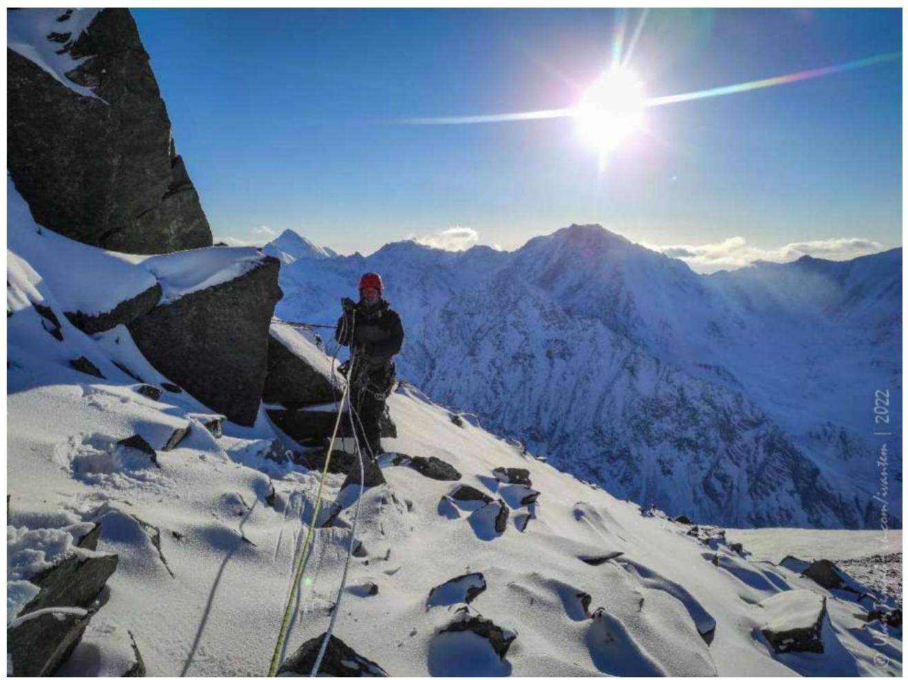 Photo 11. Movement on section R3–R4. View of the S ridge and Yarlu summit
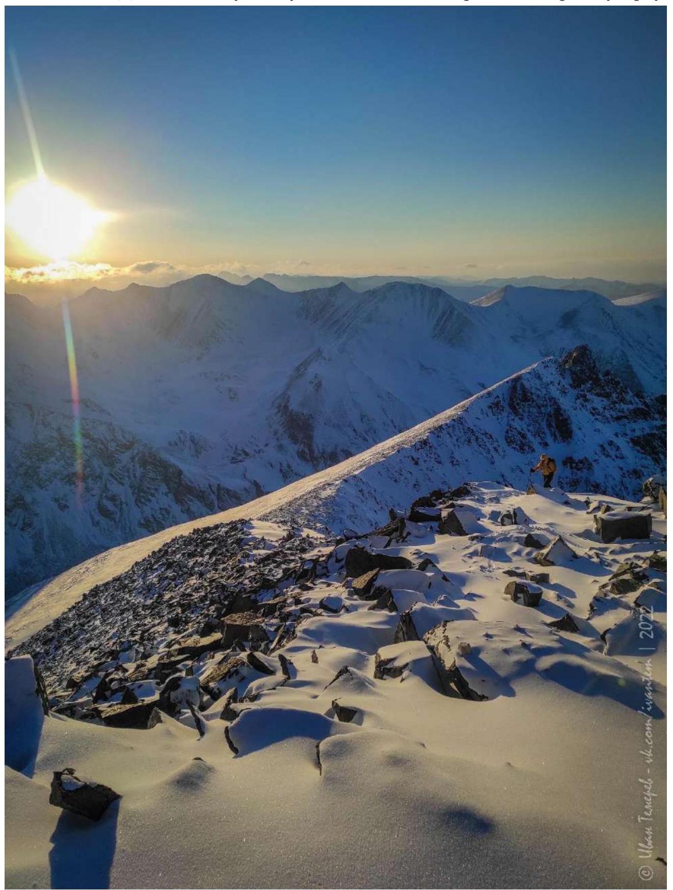 Photo 12. Photo from Krylov Stanislav summit 3548 m a.s.l. From left to right peaks: Jara Cimrman peak, Kara-Ayuk peak, Titov peak, Delone peak, Belukha W and Belukha E
3.2. There is no photo of the team on the summit with a control cairn because due to low temperatures, all photographic equipment completely discharged immediately after the above shot from the summit towards Belukha.
3.3. The route requires close attention to avalanche danger in winter, as well as rockfalls in summer. Cellular communication is absent.
The descent was made towards Lake Gornykh Dukhov, shown in Figure 4, but turned out to be very laborious in winter due to large-block scree to Lake Gornykh Dukhov and the icy trail after the lake. It is recommended to descend via the ascent route in winter.
The proposed category of difficulty is correlated with a similar route in the Altai Republic and is rather characteristic of 3A, but the route, in our opinion, lacks the length of difficult sections for a full-fledged triple.
The route is interesting because in winter it is clear of snow, which is not typical for snow-ice slopes in the Akkem gorge in winter.