Ascent Log
- Rock class.
- Altai, Mensu gorge.
- Belukha East, via the south-eastern slope.
- Proposed — for category complexity, first ascent.
- Height difference: 700 m, length: 1200 m, average steepness: 40 °.
- Climbing hours — 6 hours.
- Overnight stays: 2 on approach, on the route — none.
- Leader — Afanasyev A.E.
Team members:
- Bagaeva L.
- Zakharov N.
- Kuznetsova T.
- Obednin K.
- Hibercer G.
- Mautseh A.
- Sovincky J.
- Mohch U.
- Coach — Zakharov N.N. — Honored Coach of the RSFSR.
- Departure to the route and return: July 16, 1993.
- Gathered by the Krasnoyarsk Regional Sports Committee.
Description of the Approach and Route
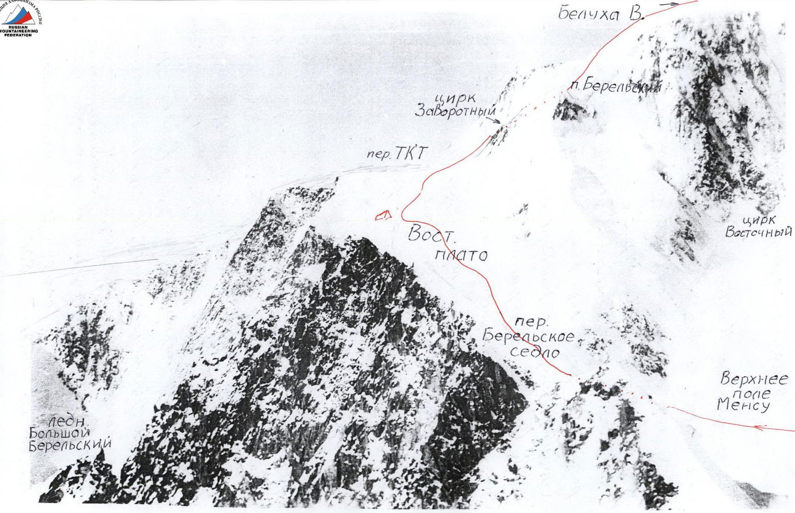
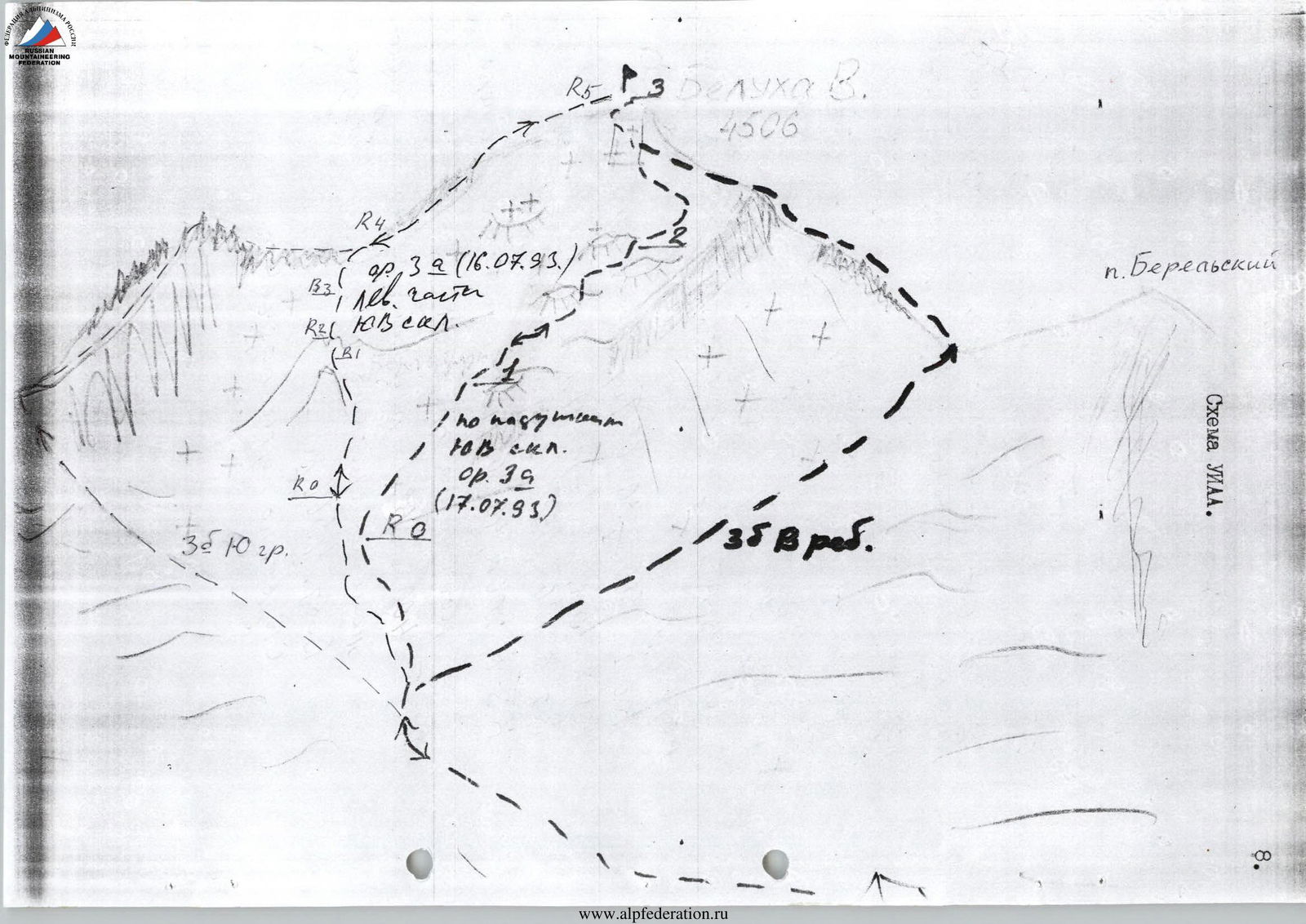
The route up the south-eastern slope, like the route via the cushions of the south-eastern slope, begins from the Zavrotny cirque. The approach to this cirque is described on page 6.
The route can be approached from four different sides: Akkemsky glacier, Mey-su glacier (Nedochet gorge), Bolshoy Berelsky glacier, Katunsky glacier. The Katunsky and Akkemsky glaciers give rise to rivers of the same name. The Belaya Berel river originates from the Bolshoy Berelsky glacier. The Nedochet river originates from the Mey-su glacier. The Zavrotny cirque is the upper accumulation zone of the East plateau's ice masses. It is possible to get here from all four sides by overcoming equivalent obstacles (passes), rated at 3A category complexity according to the tourist classification:
- Katunsky glacier — TKT pass — East plateau;
- Bolshoy Berelsky glacier — Berelskoe Saddle pass — East plateau;
- Mey-su glacier (lower field) — Upper Mey-su field;
- Akkemsky glacier — Delone pass — Upper Mey-su field.
From the Upper Mey-su field to the East plateau — a descent of about 500–350 m. Therefore, before the ascent, a day's mountain hike is required, and an overnight stay on the East plateau at an altitude of 3800 m.
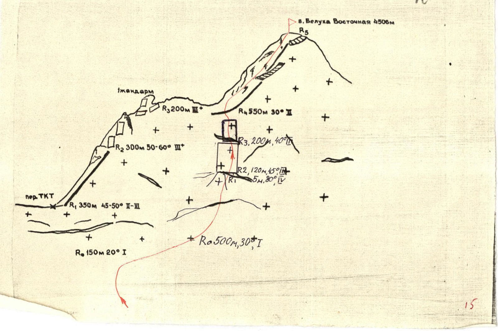
Route Description
After an overnight stay on the East plateau, one needs to walk almost to the TKT pass and then, leaving the pass saddle to the left, move into the Zavrotny cirque. Directly hanging are seracs of ice falls, to the left — an icy slope under the southern subject with a clearly defined bergschrund. In the middle part under the bergschrund, an ice finger sticks out. The path goes through it.
Along the cirque, one needs to walk 300 m to the start of the route.
R0–R1 500 m, 30–40 °. Firn slope. 1.
R1–R2 5 m, 80 °. Bergschrund. 4.
R2–R3 120 m, 45 °. Icy slope. 3.
R3–R4 200 m, 40–30 °. Snow slope, to the re-winding on the shoulder. 3.
R4–R5 550 m, 30 °. Summit rocky snow-covered ridge. Belukha East peak 4506 m.
Descent via the ascent route.
 www.alpfederation.ru↗


