
Siberian Federal District Championship
Report
on the first ascent of the route "Rocket donkey" to Peak Serebryanaya стена 4050 m
Via the south-eastern wall, category 5B complexity, by a team from Krasnoyarsk—Perm over the period July 20, 2023
Participants:
- Oleneva N.A.
- Kozlova A.P.
- Seryupova D.R.
I. Climbing Passport. General Information
| № | Item | Information |
|---|---|---|
| 1.1 | Full name, sports rank of the team leader | Oleneva N.A. |
| 1.2 | Full name, sports rank of the participants | Seryupova D.R. (MS), Kozlova A.P. (MS) |
| 1.3 | Full name of the coach | Prokofiev D.E. (MS), Zakharov N.N. (MSMK), Balezin V.V. (MSMK) |
| 1.4 | Organization | Krasnoyarsk Regional Alpine Federation |
| 2. Characteristics of the Climbing Object | ||
| 2.1 | Region | Kyrgyzstan, Gissar-Alay |
| 2.2 | Valley | Karavshin (Kara-Su river valley) |
| 2.3 | Section number according to the 2013 classification table | 5.4.3 |
| 2.4 | Name and height of the peak | Peak Serebryanaya стена 4050 m |
| 2.5 | Geographical coordinates of the peak (latitude/longitude), GPS coordinates | 39°37′3.86″N 70°14′13.21″E |
| 3. Characteristics of the Route | ||
| 3.1 | Route name | Via the south-eastern wall |
| 3.2 | Proposed category of complexity | 5B |
| 3.3 | Degree of route development | First ascent |
| 3.4 | Relief characteristics of the route | Rock |
| 3.5 | Elevation gain of the route (altimeter or GPS data) | 800 m |
| 3.6 | Route length (in meters) | 1290 m, wall section — 750 m |
| 3.7 | Technical elements of the route (total length of sections with varying complexity, specifying relief characteristics) | 1–2 cat. diff. rocks — 370 m. 3 cat. diff. rocks — 120 m. 4 cat. diff. rocks — 130 m. 5 cat. diff. rocks — 225 m. 6 cat. diff. rocks — 435 m. |
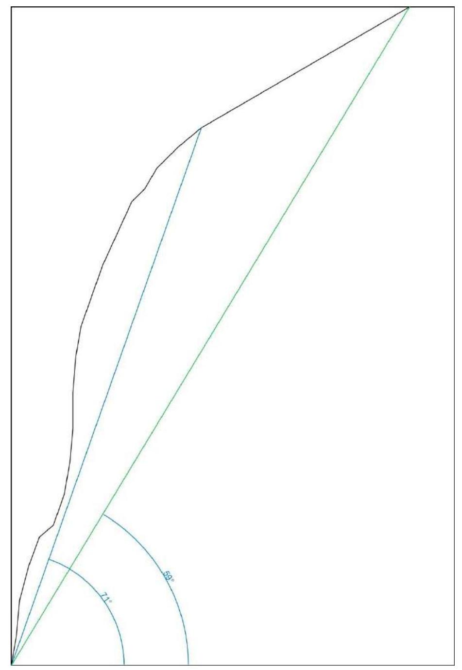
| 3.8 | Average slope of the route, (°) *(2) | 60° |
| 3.9 | Average slope of the main part of the route, (°) *(2) | 75° |
| 3.10 | Descent from the peak | Via category 1B, 3rd slope (valley between peak 5010 and Serebryanaya стена) |
| 3.11 | Additional route characteristics | No water on the route. |
| 4. Characteristics of the Team's Actions | ||
| 4.1 | Movement time (team's walking hours, in hours and days) | 12 h 40 min, 1 day |
| 4.2 | Overnight stays | - |
| 4.3 | Route preparation time *(3) | 0 h, 0 days |
| 4.4 | Exit from camp | 6:00 AM, July 26, 2023 |
| 4.5 | Start of work on the route | 8:20 AM, July 26, 2023 |
| 4.6 | Reach the peak | 9:00 PM, July 26, 2023 |
| 4.7 | Return to base camp | 1:10 AM, July 27, 2023 |
| *5. Weather Conditions (4) | ||
| 5.1 | Temperature, °C | 15–20 |
| 5.2 | Wind speed, m/s | 5 m/s |
| 5.3 | Precipitation | Short-term light rain |
| 5.4 | Visibility, m | Full |
| 6. Person Responsible for the Report | ||
| 6.1 | Full name, e-mail | Seryupova D.R. dashutca9696@mail.ru |
II. Climbing Description
1. Characteristics of the Climbing Object
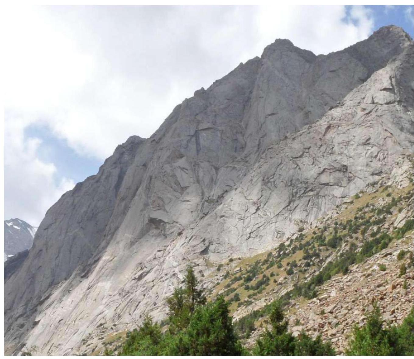
1.1. General Photo of the Peak
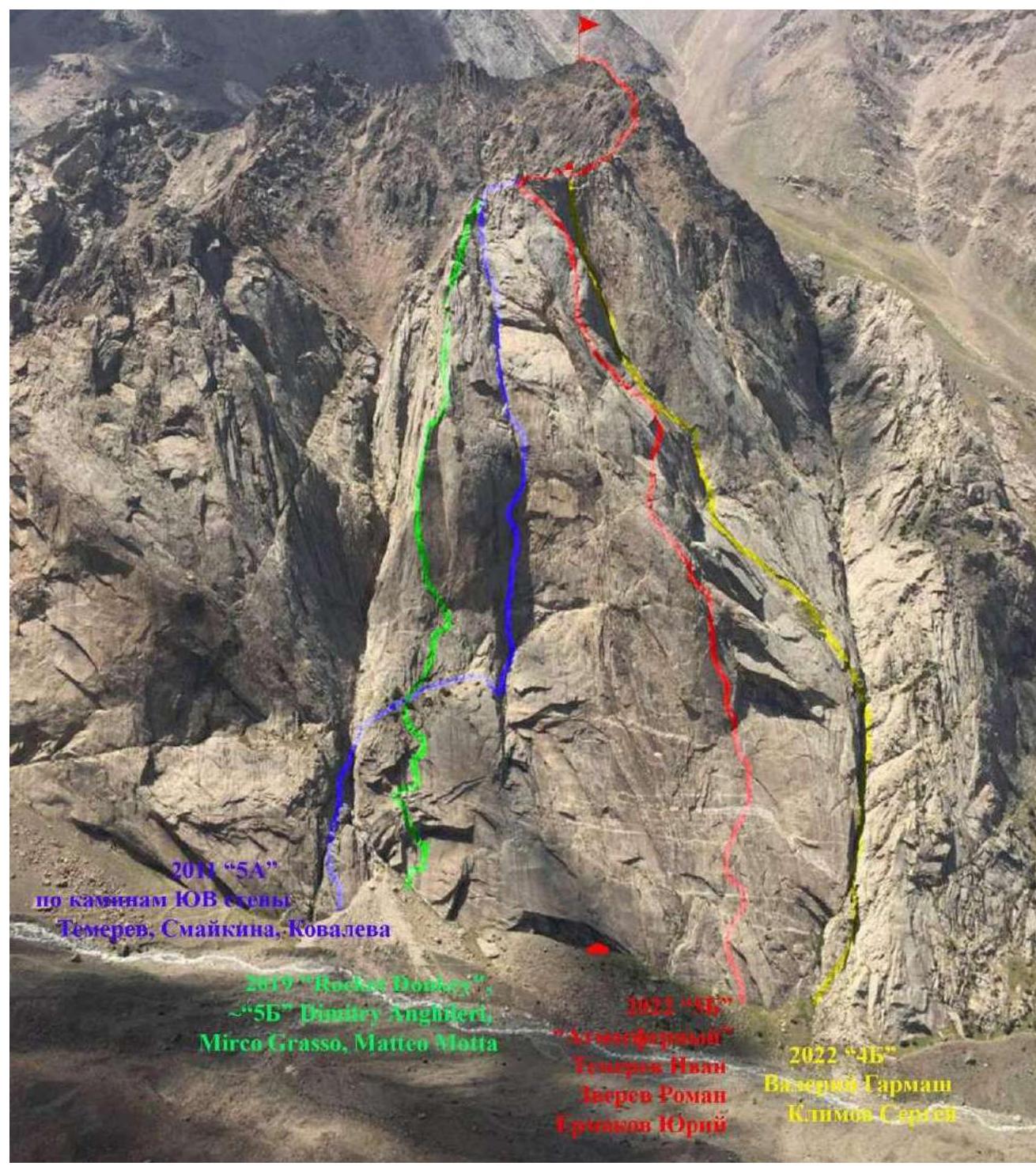
Photo taken from the "Balcony" ledge of Peak Asan on July 26, 2022.
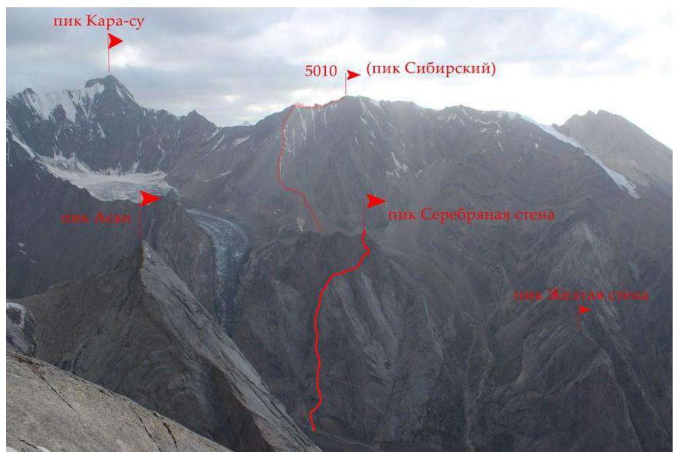
1.2. Route Profile. Taken from under Peak Zholtyaya стена
Taken from under Peak Zholtyaya стена
1.3. Drawn Route Profile
1.4. Photopanorama of the Area
2. Characteristics of the Route
2.1. Photograph with the Route Line
Photo 1 (green line)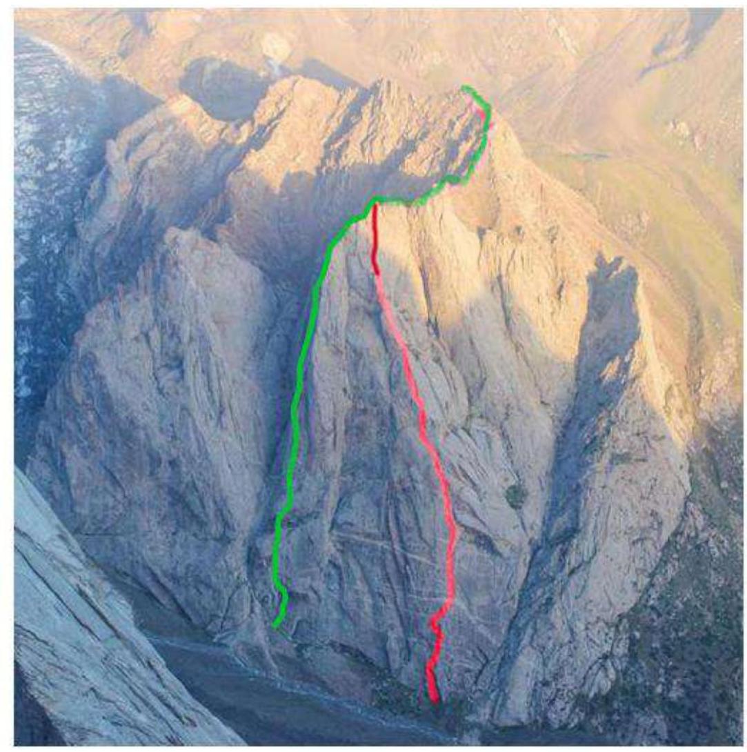 Photo 2 (green line)
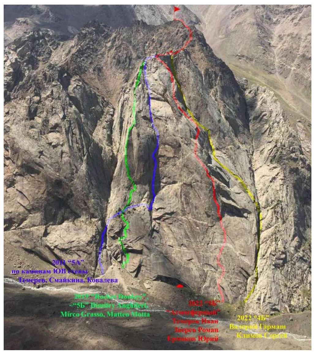 Technical photograph of the route with section numbers.
| № | Length | Angle of inclination | Anchor elements (camalots) | Anchor | Climbing level |
|---|---|---|---|---|---|
| R0–R1 | 50 | 80 | 7 | 5 | 6+ |
| R1–R2 | 60 | 85 | 10 | 7 | 6+ |
| R2–R3 | 60 | 75 | 10 | 10 | 6 |
| R3–R4 | 50 | 70 | 12 | 8 | 6 |
| R4–R5 | 30 | 40 | 10 | 7 | 2 |
| R5–R6 | 55 | 70 | 9 | 5 | 6+ |
| R6–R7 | 55 | 80 | 8 | 8 | 5+ |
| R7–R8 | 55 | 85 | 10 | 7 | 5 |
| R8–R9 | 60 | 90 | 12 | 4 | 6+ |
| R9–R10 | 60 | 85 | 12 | 1 | 6+ |
| R10–R11 | 50 | 80 | 12 | 1 | 6 |
| R11–R12 | 60 | 70 | 12 | 2 | 5+ |
| R12–R13 | 50 | 70 | 7 | 2 | 5+ |
| R13–R14 | 55 | 65 | 7 | 2 | 5 |
| R14–R15 | 60 | 65 | 10 | 2 | 6 |
| R15–R16 | 30 | 45 | 2 | 4 | 3 |
| R16–R17 | 40 | 60 | 4 | 0 | 4 |
| R17–R18 | 50 | 45 | 5 | 0 | 3, 4 |
| R18–R19 | 50 | 40 | 5 | 0 | 3, 4 |
| R19–R20 | 30 | 30 | 0 | 0 | 2 |
2.3. Route Diagram in UIAA Symbols
3. Characteristics of the Team's Actions
The line of this route was found in a foreign guidebook (without description), with an estimated category of 5B. The route was climbed by Spaniards in 2019, with rappel anchors drilled every 55–60 meters. The Spaniards' line ended at rope R14. We decided to climb the route to the summit, adding two more ropes to the ridge, then a couple of ropes along the ridge, and made a rappel of 30 meters and walked to the summit (20 minutes). On this route:
- mostly sixth-grade climbing, 6a–6c+;
- climbing through vertical cracks and over small overhangs;
- a lot of poorly protected climbing near the top.
We climbed half the route using a simultaneous scheme. However, we marked the ropes according to the Europeans' description of the route for easier orientation on the stations (every 55–60 m there is an anchor).
Before this, we climbed Asan 5B (Gorbenko route), and our opinion is that this route is technically more challenging than Gorbenko's.
3.1. Route Climbing Description
On July 26, 2023, we exited the base camp at 6:00 AM. We started working on the route at 8:20 AM. We reached the ridge at 7:00 PM and were on the summit at 9:00 PM. On July 27, 2023, at 1:10 AM, we returned to the base camp.
Climbing Section Descriptions
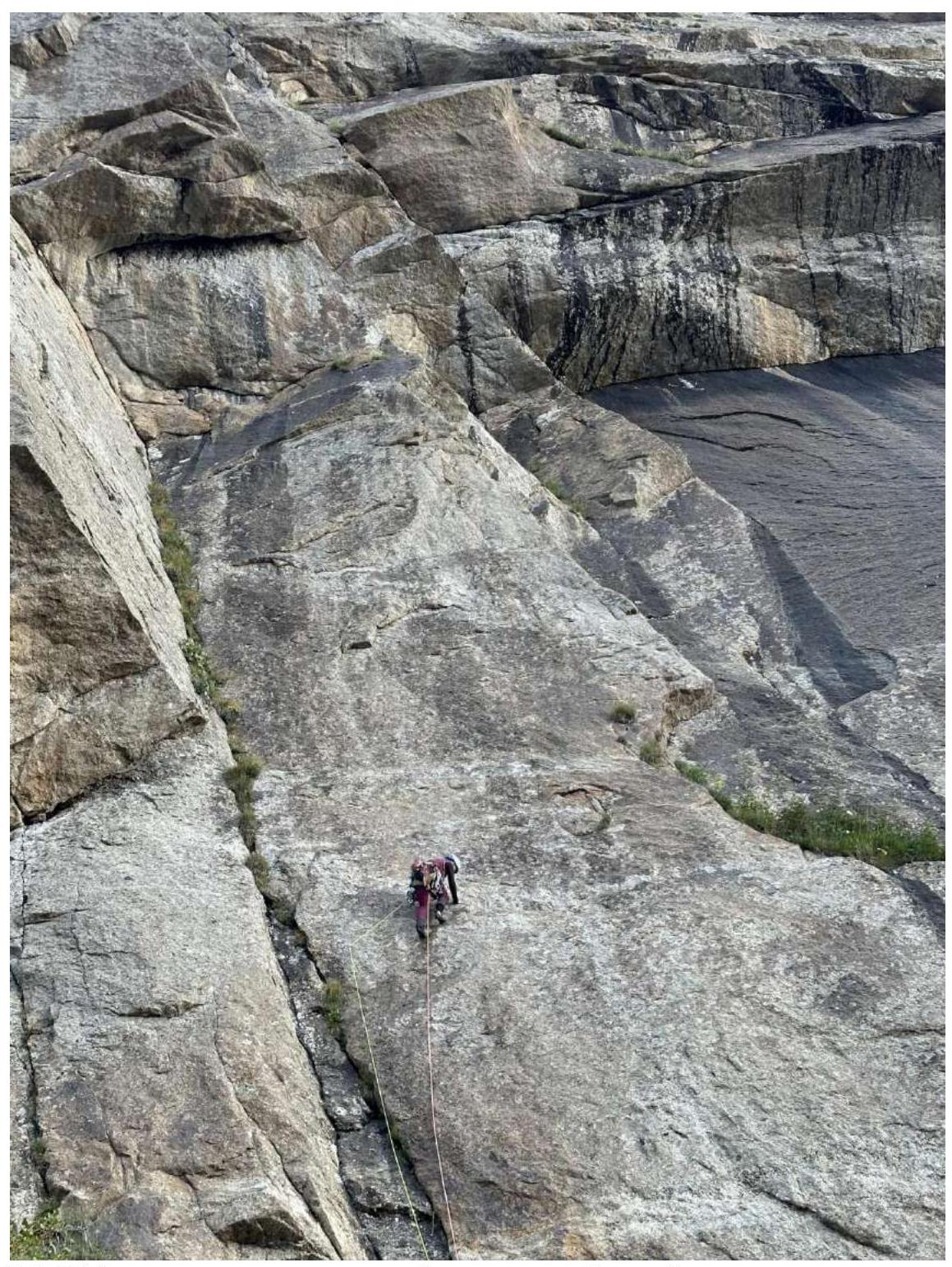
R0–R1. The start of the route is through an internal corner under a large overhanging ledge, followed by a traverse along a coil to the right internal corner, then up the corner to a bolt, with a station in a crack under the ledge. Section length: 50 meters. Climbing category: 6+.
R1–R2. The ledge is bypassed on the left through an internal corner, with tense climbing through a hanging wall. Then move along the crack to the left, with a station on a small ledge. Section length: 60 m. Climbing category: 6+ (15 m), 5+ (45 m).
R2–R3. Climb up through a small wall, then traverse right 10 m along a ledge. Move up through slabs and small cracks, veering slightly to the right. The landmark is large overhangs that are bypassed on the right. Section length: 60 m. Category 3 difficulty: 30 m. Climbing category 6: 30 m.
R3–R4. Climb up through slabs, aiming slightly to the left. Then climb up through scree and grassy ledges to reach a large field. Station on a tree. Section length: 50 m. Climbing: 40 m (6), 10 m (category 3).
R4–R5. Climb up a large ledge, category 2, then walk right to a rock. Station on a tree. Section length: 30 m.
R5–R6. Start through an internal corner with grass and earth, aiming for a small tree on a small ledge. Section length: 55 m. Climbing category: 6+.
R6–R7. Traverse right and up along a sloping, inclined ledge for 15 m. Climb through an internal corner for 10 m, then transfer left to another internal corner. Many loose rocks. Section length: 55 m. Climbing category: 5+.
R7–R8. Climb through cracks with grass to a small chimney, then up. Rope length: 55 m. Climbing category: 5.
R8–R9. Exit to a wall with deep cracks and small footholds and handholds (climbed by climbing, section 6), keeping direction slightly to the left towards a crack under the third and fourth camalot. Section length: 60 m. Climbing category: 6+.
R9–R10. Key to the route: a long, straight, opening crack under a sling (mainly uses 2nd and 3rd camalot, climbing category 6). Climb up the crack, then veer left after 30 meters, overcoming a small overhang, and exit back into the crack. Station on a bolt on a good ledge. Section length: 60 meters. Climbing category: 6+.
R10–R11. From the ledge, a series of vertical cracks follow; climb up any one of them or transfer between cracks to find easier options. Length: 50 meters. Climbing category: 6.
R11–R12. The series of cracks continues; climb up any one of them. Climbing becomes easier. Station on a ledge with a bolt. Section length: 60 meters: climbing 10 m — category 6, 40 m — category 5, 5+.
R12–R13. Move left into a series of cracks, climbing towards huge flakes that are bypassed on the right through an internal corner. Station on a ledge. Section length: 50 meters. Climbing category: 5+.
R13–R14. Climb through fourth-grade rocks to a simple vertical crack with a positive slope. Section length: 55 m. Climbing: 15 m — category 4, 40 m — category 6.
R14–R15. Climb up the crack to a wall (poorly protected climbing), keeping slightly to the right, to reach a ledge. Section length: 60 m. Climbing: 35 m (6), 25 m — category 5.
R15–R16. From the station, traverse right along a diagonal horizontal ledge for 30 meters. Station on personal anchors. Category 3 difficulty.
R16–R17. From the station, move right into a large chimney with blocks. Caution: many loose rocks. Climb up the chimney to reach the ridge, then continue another 20 m until it levels out. Section length: 40 meters. Climbing category: 4.
R17–R18, R18–R19. Climb along the ridge simultaneously, tied together, with occasional protection due to poorly protected climbing sections. Section length: 100 m. Climbing category: 3, with sections of category 4.
Walk along the ridge to a dip; there's a rappel of 25 meters. From there, walk to the summit, 20 minutes.
R19–R20. Category 1–2 difficulty, 20–30–60°. Simultaneous movement without a rope on destroyed slopes and ridges. Several false summits. 400 m.
To access the descent couloir, walk another 100 meters from the summit.
R0–R1 (traverse right into another internal corner)
R1–R2 (through a hanging wall into an internal corner)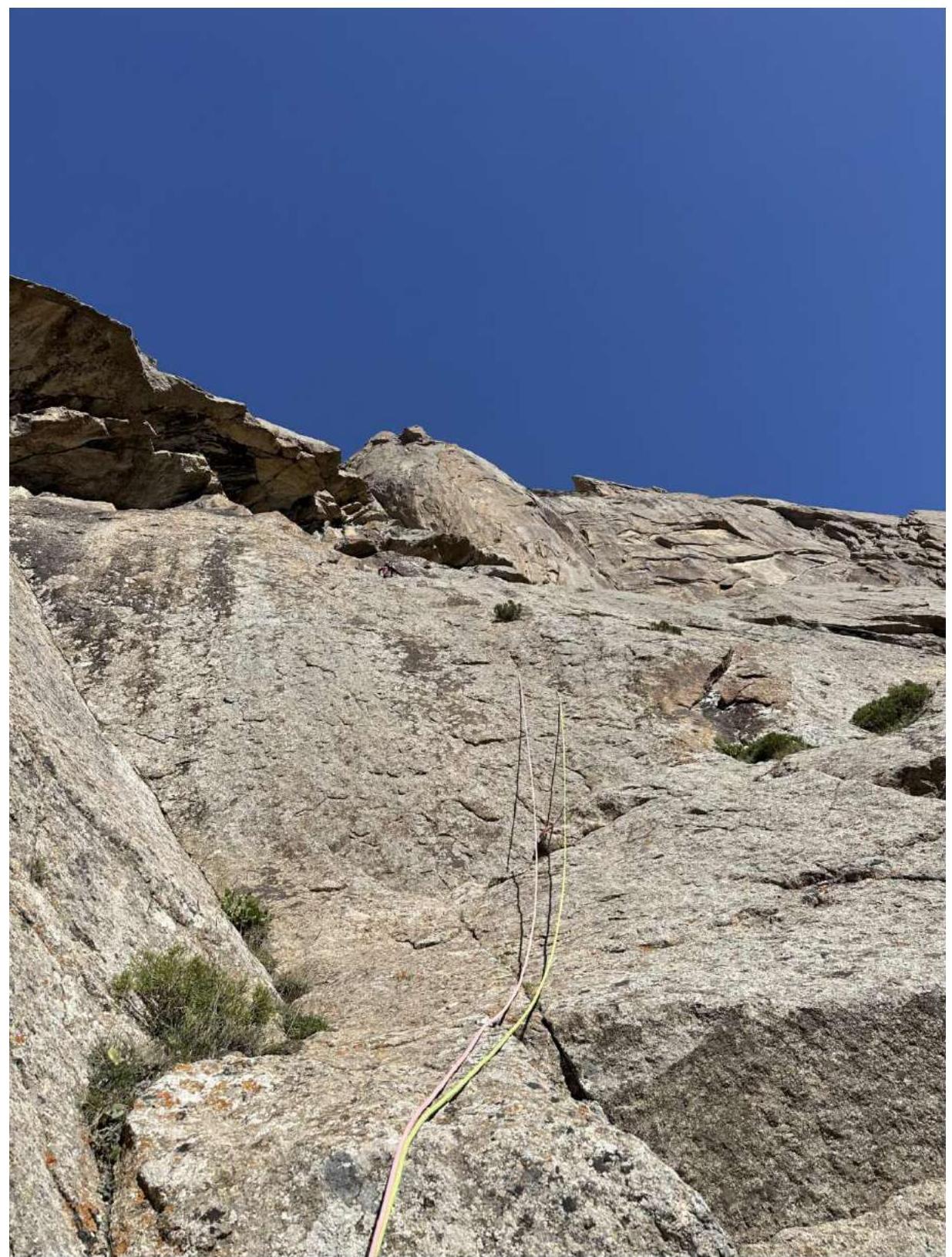
R2–R3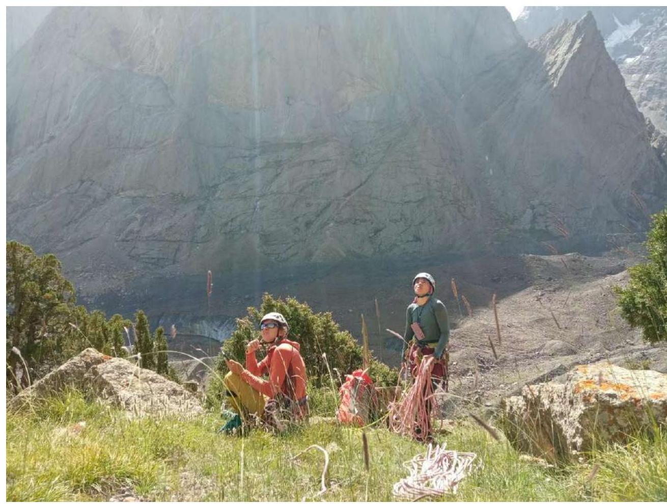
Large clearing on rope R4–R5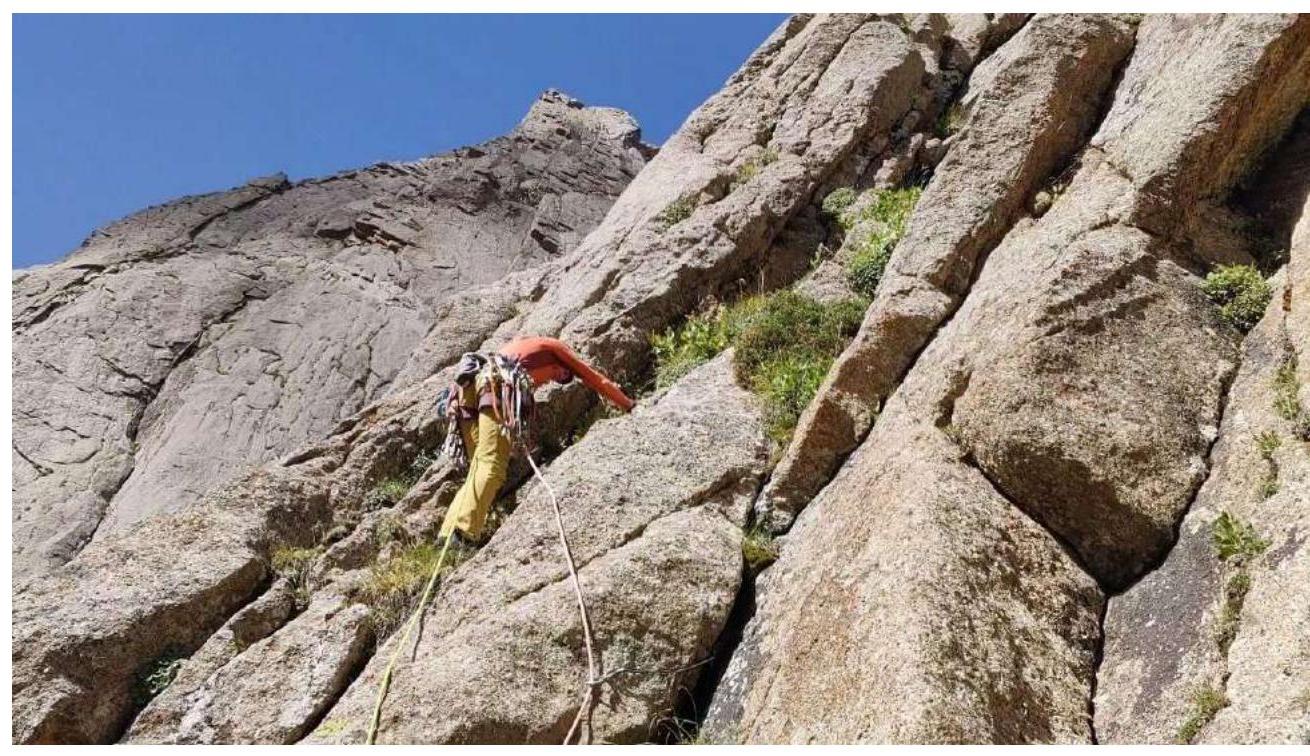
Start of R5–R6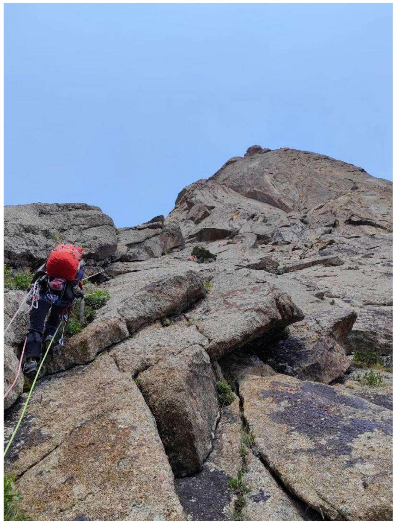
R5–R6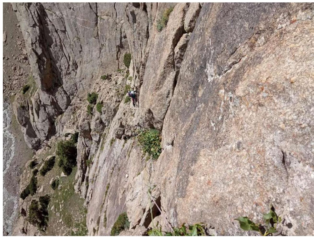
R6–R7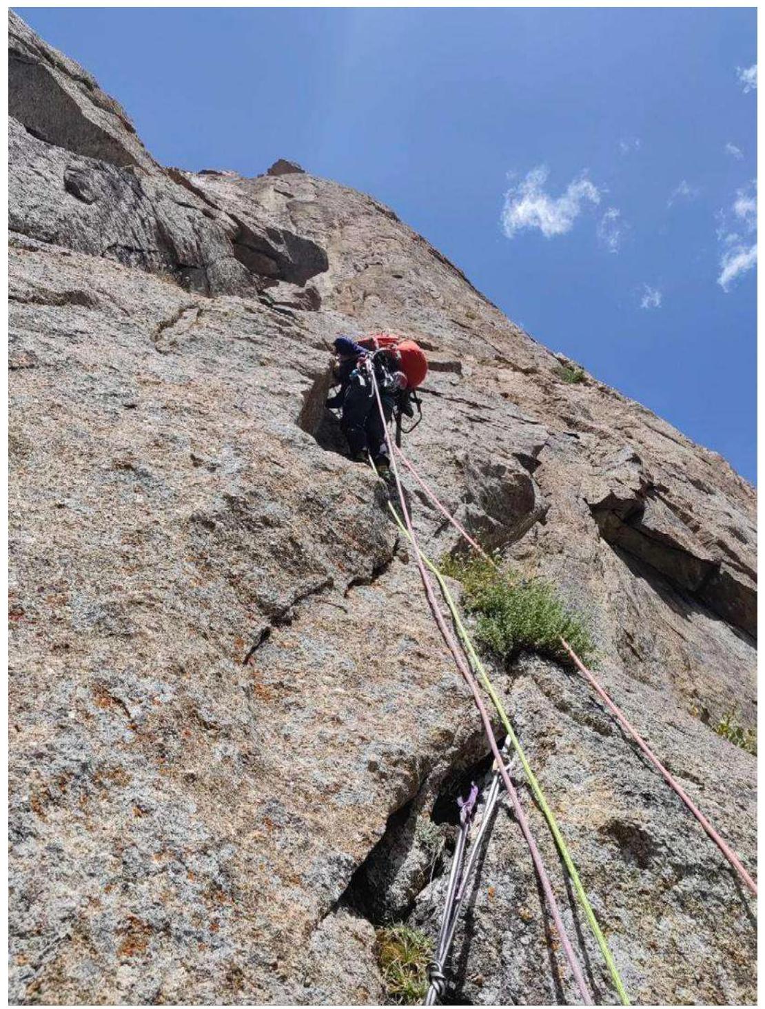
R7–R8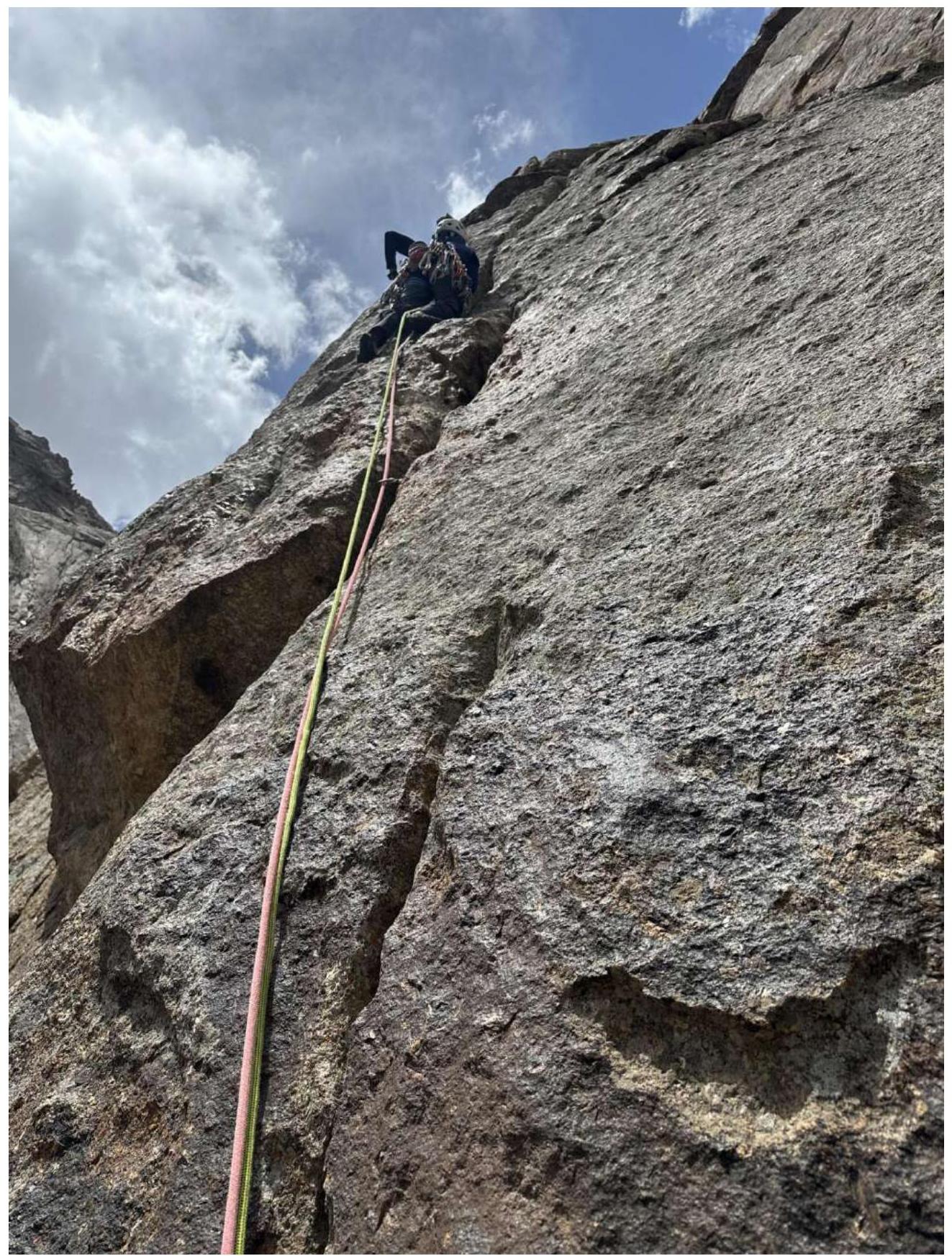
R9–R10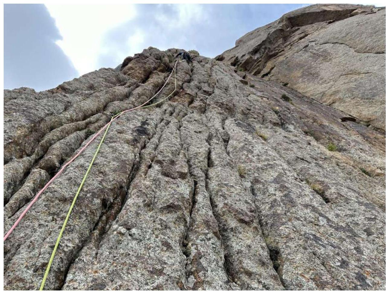
R10–R11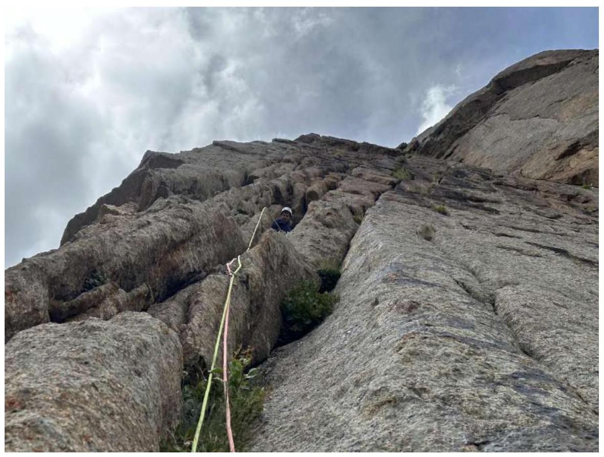
R11–R12
R12–R13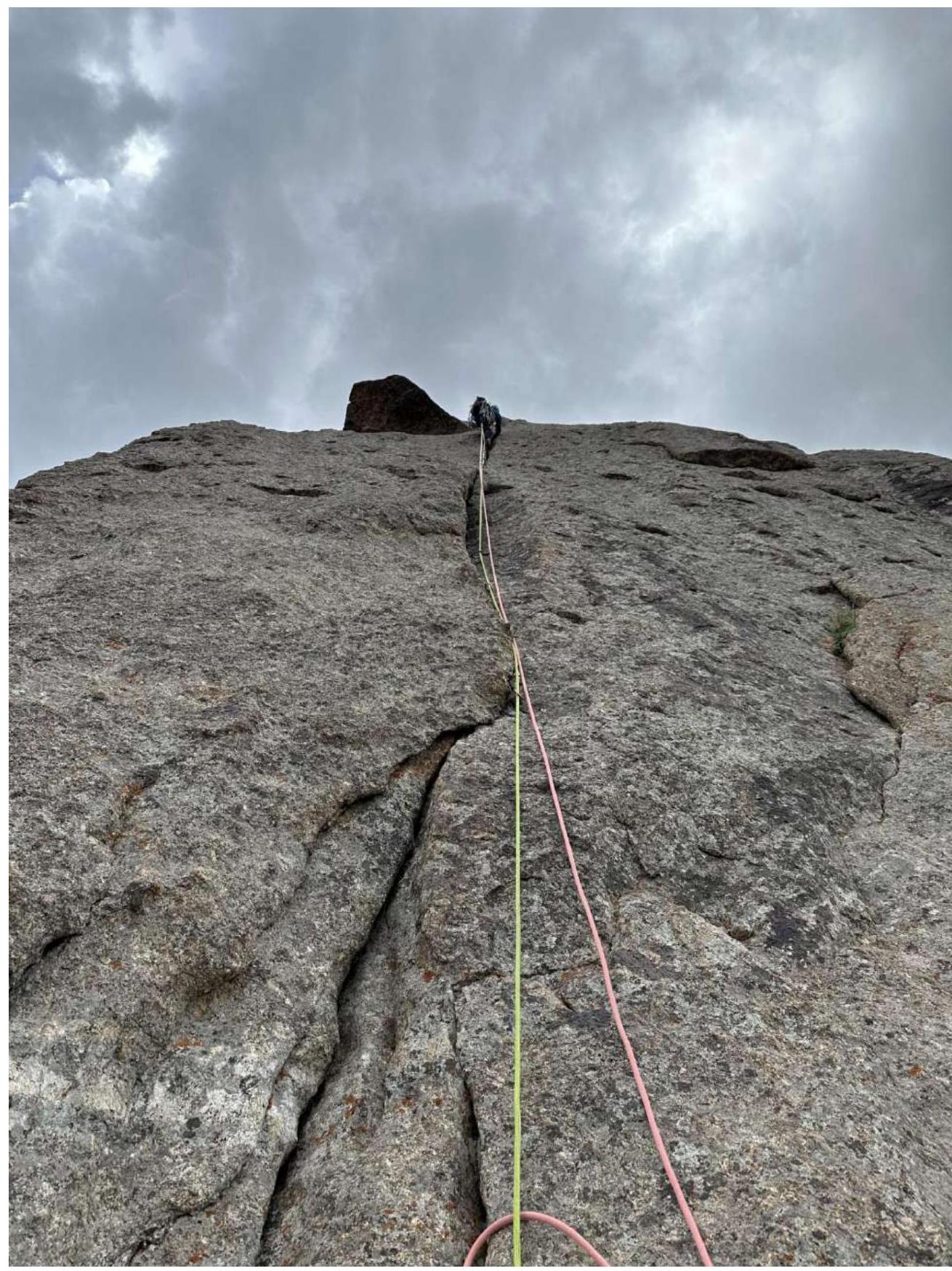
R13–R14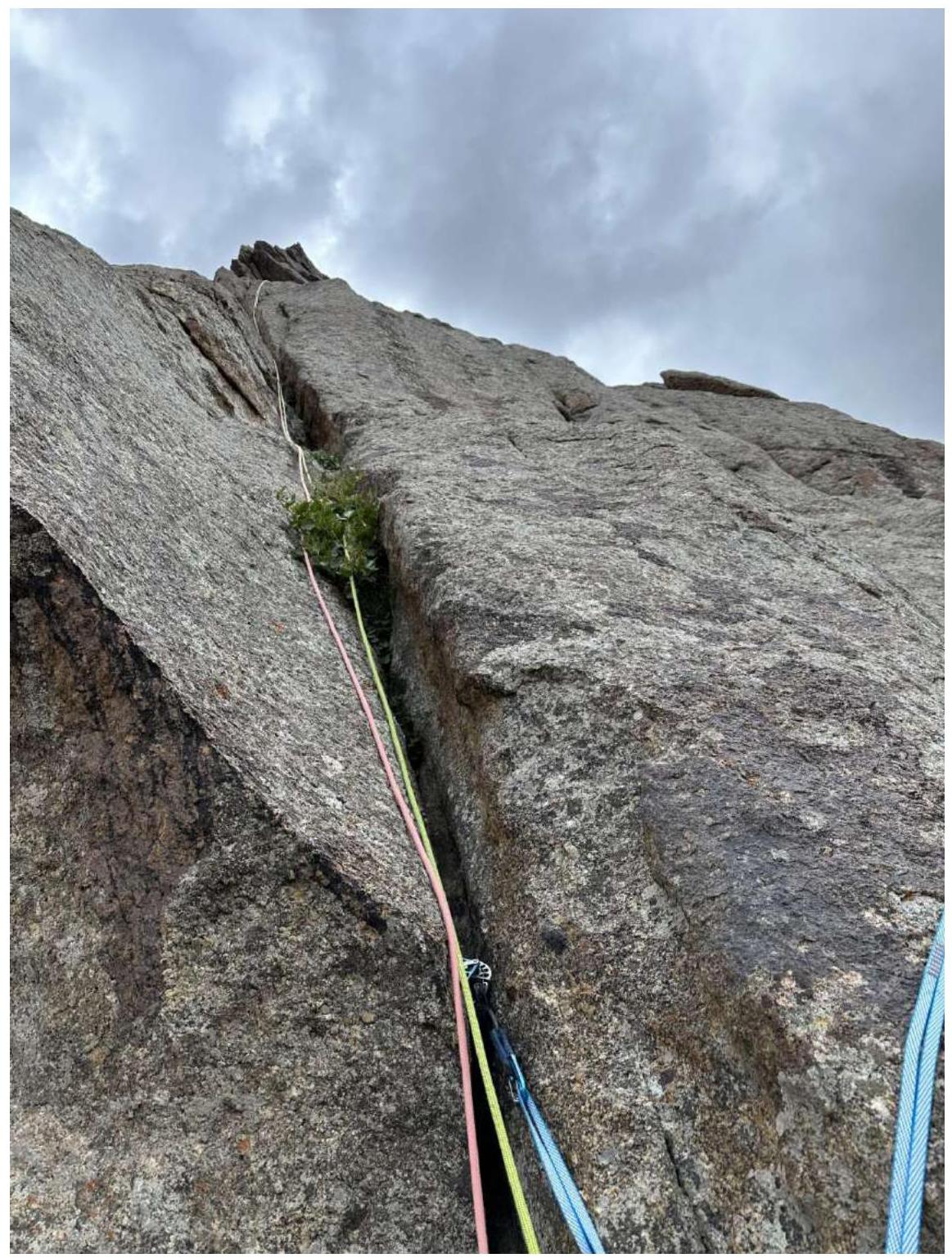
R14–R15
R15–R16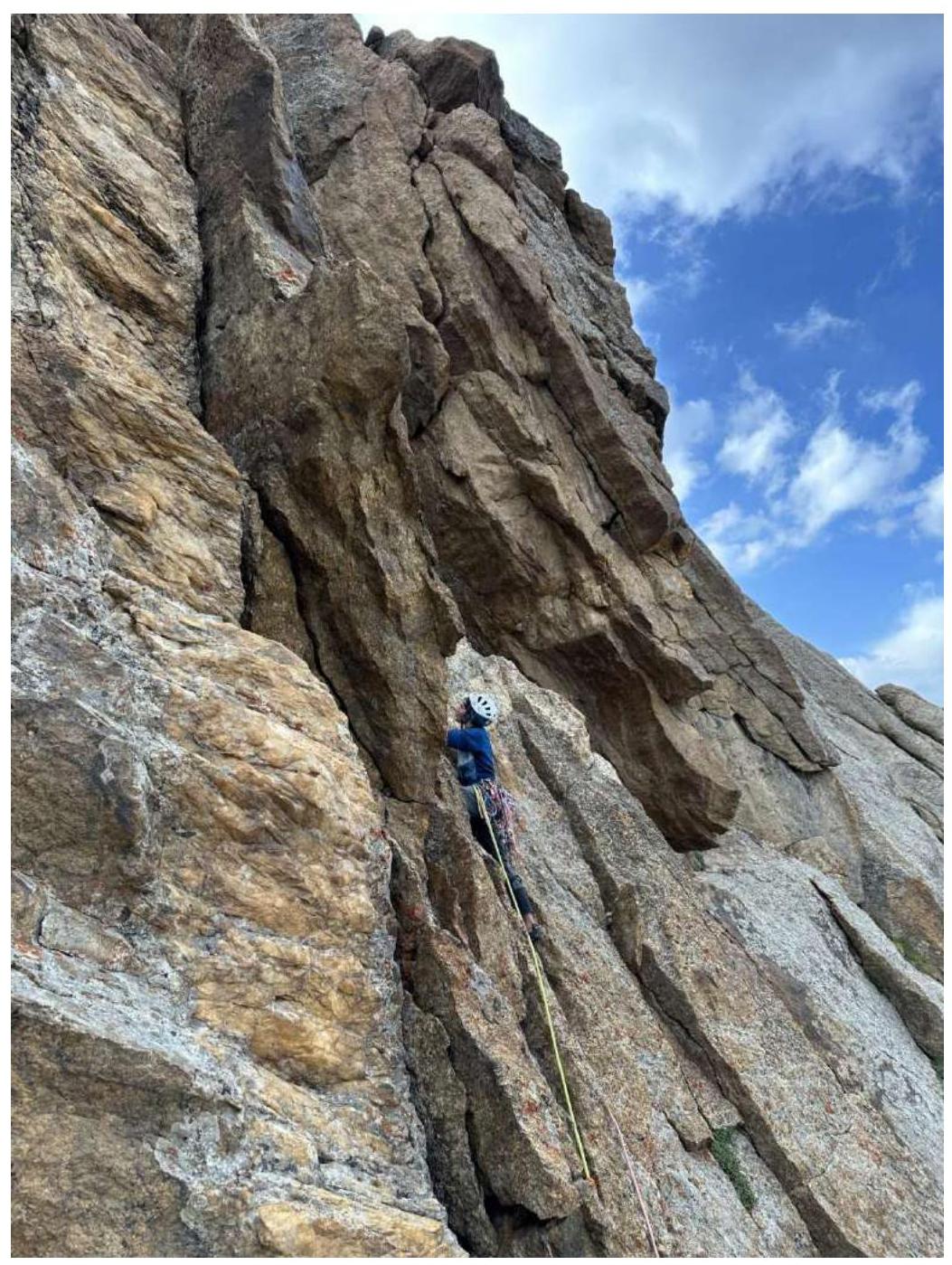
Start of R16–R17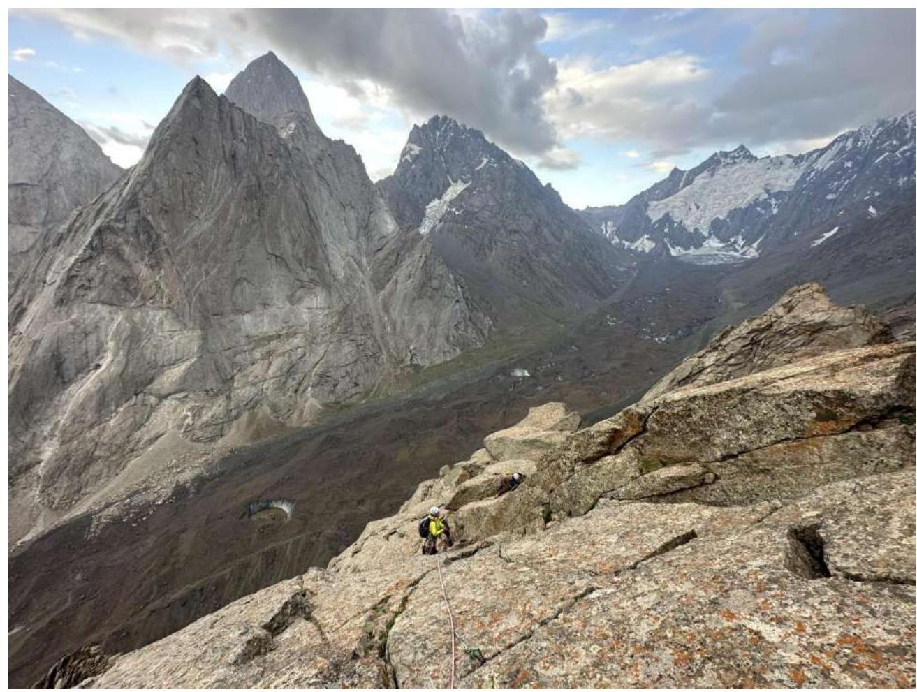
Start of R17–R18 (simultaneous movement along the ridge)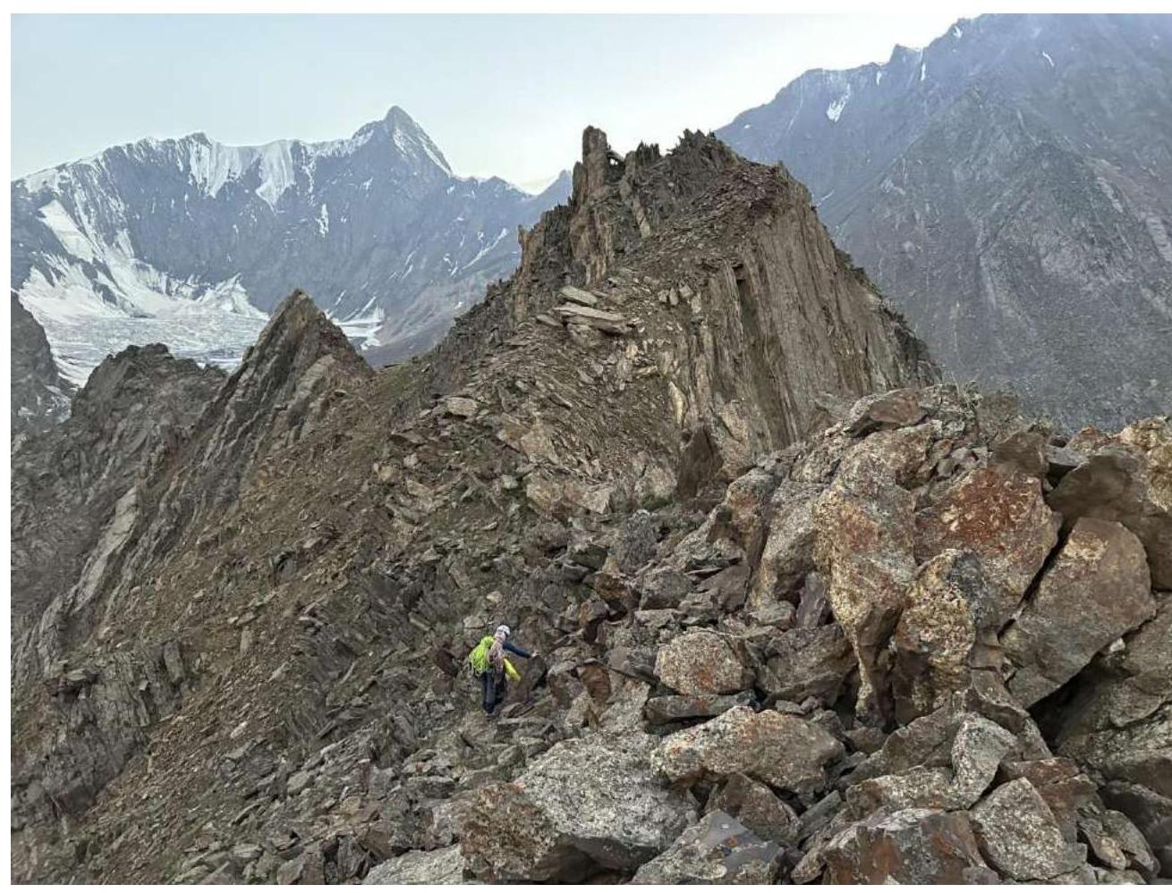
Trail to the summit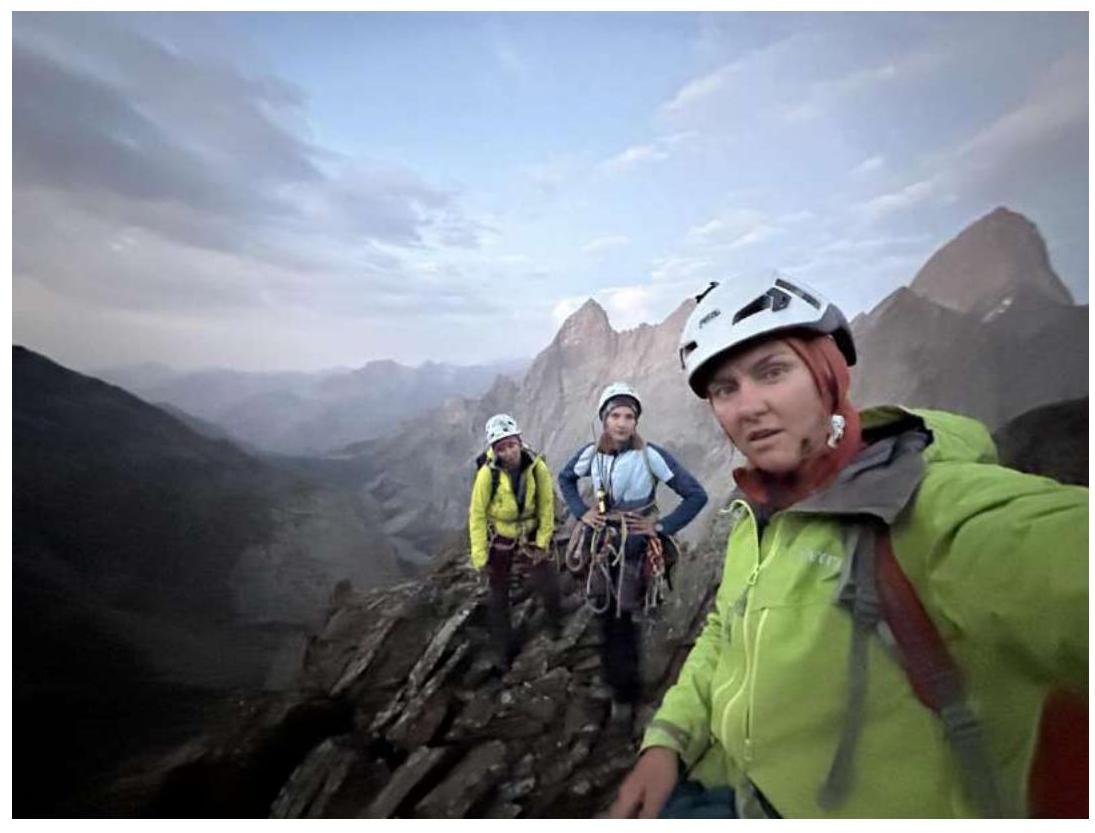
Photo at the summit at 9:00 PM
Comments
Sign in to leave a comment