
Report
on the first ascent of the "Atmospheric" route
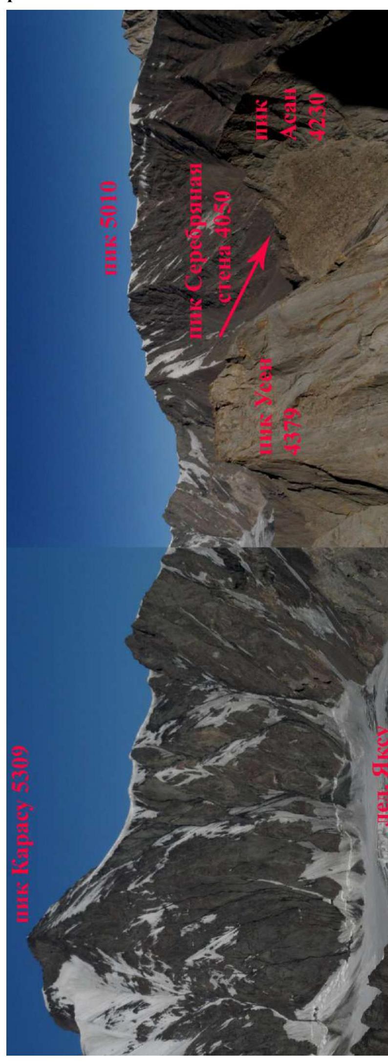
Silver Wall Peak
4050 m
via the buttress of the eastern wall 5B cat. diff. (rock) by the team of MROO Tomsk Alpine Federation and KAiS MPEI from 18:00 July 18, 2022 to 18:00 July 20, 2022.
Participants:
- Temerev Ivan Mikhailovich
- Zverev Roman Nikolaevich
- Ermakov Yuri Nikolaevich
I. Ascent Passport
| 1. General Information | ||
|---|---|---|
| 1.1 | Full name, sports rank of the leader | Temerev Ivan Mikhailovich MS |
| 1.2 | Full name, sports rank of participants | Ermakov Yuri Nikolaevich 1st sports rank, Zverev Roman Nikolaevich 3rd sports rank |
| 1.3 | Full name of the coach | Temerev Ivan Mikhailovich MS |
| 1.4 | Organization | MROO Tomsk Alpine Federation and KAiS MPEI |
| 2. Characteristics of the Ascent Object | ||
| 2.1 | Region | Kyrgyzstan, Gissar-Alai |
| 2.2 | Valley | Karavshin (Kar-Su river valley) |
| 2.3 | Section number according to the 2013 classification table | 5.4.3 |
| 2.4 | Name and height of the peak | Silver Wall Peak 4050 m |
| 2.5 | Geographical coordinates of the peak | 39°37′3.86″N 70°14′13.21″E |
| 3. Characteristics of the Route | ||
| 3.1 | Name of the Route | "Atmospheric" via the buttress of the eastern wall |
| 3.2 | Proposed category of difficulty | 5B |
| 3.3 | Degree of route exploration | First ascent, according to initial information. Actually, possibly third. |
| 3.4 | Relief character of the route | Rock |
| 3.5 | Height difference of the route | 750 m. Wall part 600 m. |
| 3.6 | Route length | 1200 m. Wall part 800 m. |
| 3.7 | Technical elements of the route (total length of sections of various difficulty categories with indication of relief character (ice-snow, rock, combination)) | I cat. diff. ice/rock/combination — 0/0/0 m. II cat. diff. ice/rock/combination — 0/400/0 m. III cat. diff. ice/rock/combination — 0/190/0 m. IV cat. diff. ice/rock/combination — 0/340/0 m. V cat. diff. ice/rock/combination — 0/333/0 m. VI cat. diff. ice/rock/combination — 0/210/0 m. Rock VI, A3 — 0 m. Rock VI, A4 — 0 m |
| 3.8 | Average steepness of the route, (°) | 53 |
| 3.9 | Average steepness of the main part of the route, (°) | 66 |
| 3.10 | Descent from the summit | Via 1B cat. diff. on the 3rd slope (valley between peak 5010 and Silver Wall peak) |
| 3.11 | Additional characteristics of the route | There is no water on the route. |
| 4. Characteristics of the Team's Actions | ||
| 4.1 | Time of movement | 20 hours, 3 days |
| 4.2 | Overnights | 1st overnight on a site in a grotto near the start of the route. 2nd overnight — a small ledge after the technical part of the route on the ridge at 23:00. |
| 4.3 | Time of route processing | 2.5 hours, 1 day. |
| 4.4 | Start on the route | July 18, 2022 start at 18:00 — processing 2.5 ropes, overnight in a grotto under the route. July 19, 2022 start at 07:00. |
| July 20, 2022 start at 08:30. | ||
| :--: | :--: | :--: |
| 4.5 | Arrival at the summit | 10:00 July 20, 2022 |
| 4.6 | Return to the base camp | 16:00 July 20, 2022 |
| 5. Characteristics of Weather Conditions | ||
| 5.1 | Temperature, °C | +25 |
| 5.2 | Wind force, m/s | 3-4 |
| 5.3 | Precipitation | no precip |
| 5.4 | Visibility, m | 30000 |
| 6. Responsible for the Report | ||
| 6.1 | Full name, e-mail | Ermakov Yuri Nikolaevich bobryz@mail.ru |
II. Ascent Description
1. Characteristics of the Ascent Object
1.1. General photo of the peak
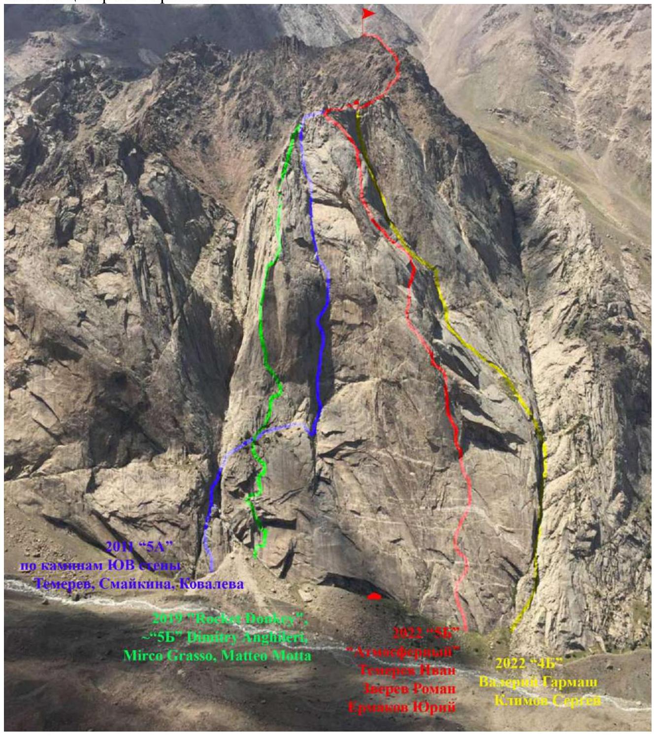
Photo taken from the "Balcony" ledge of Asan peak on August 26, 2022.
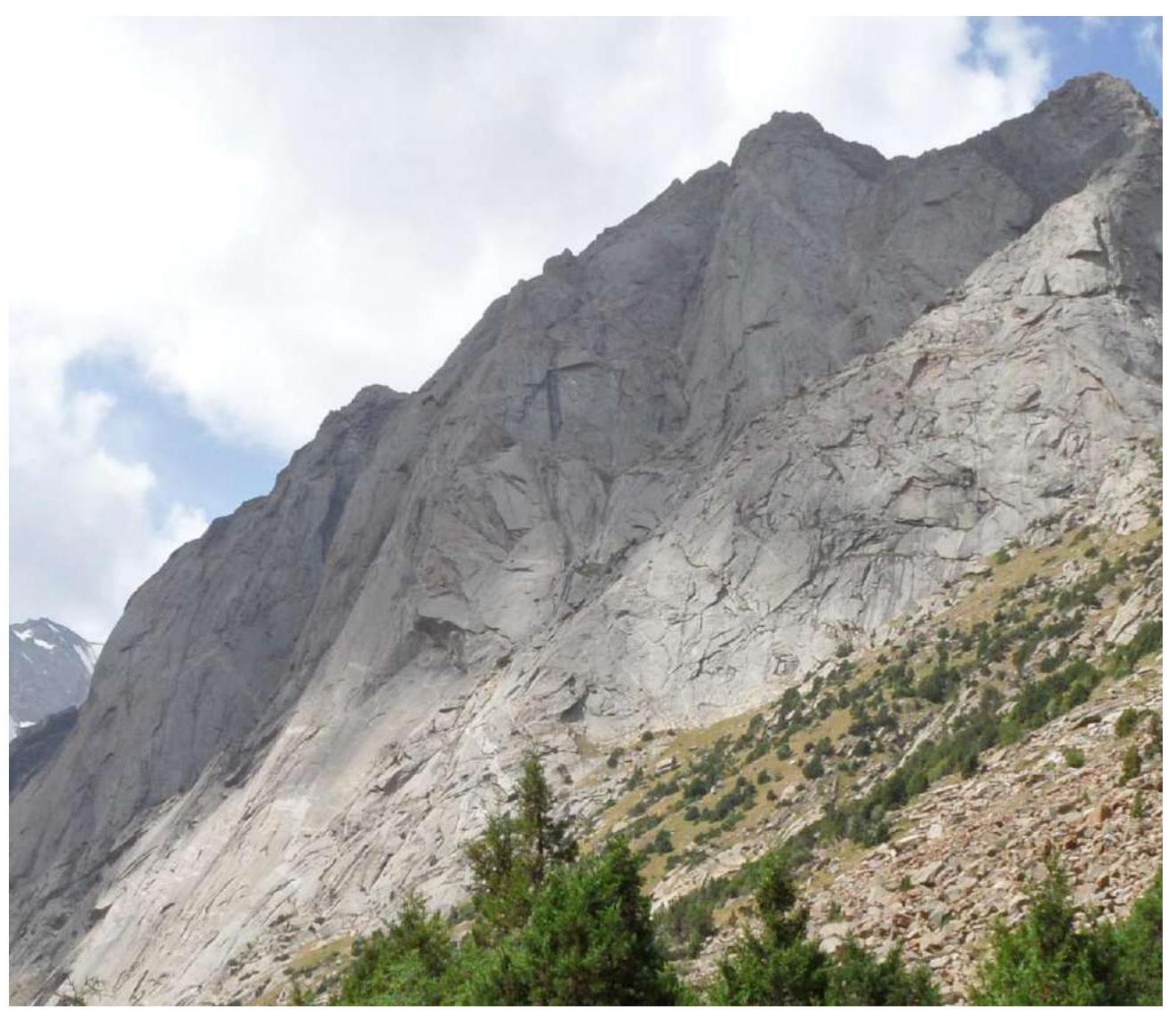
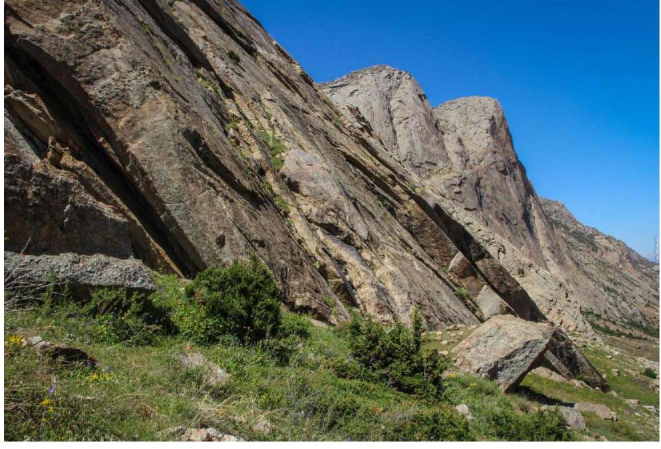
1.2. Profile of the route. Taken from under Zhelty Wall peak
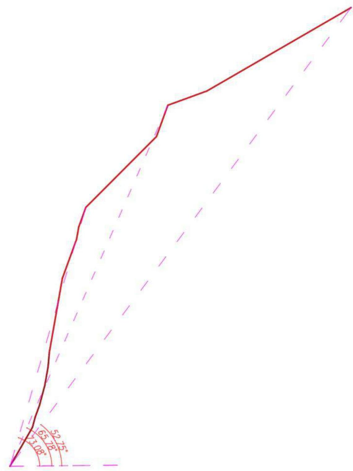
1.3. Drawn profile of the route
1.4. Photo panorama of the area
2. Characteristics of the Route
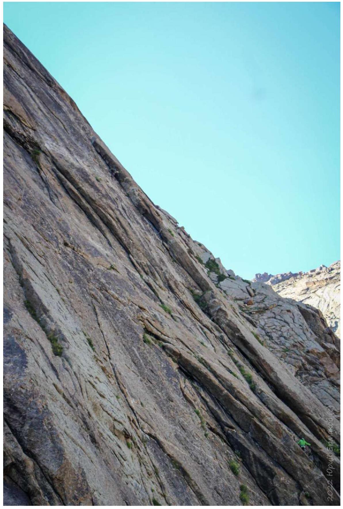
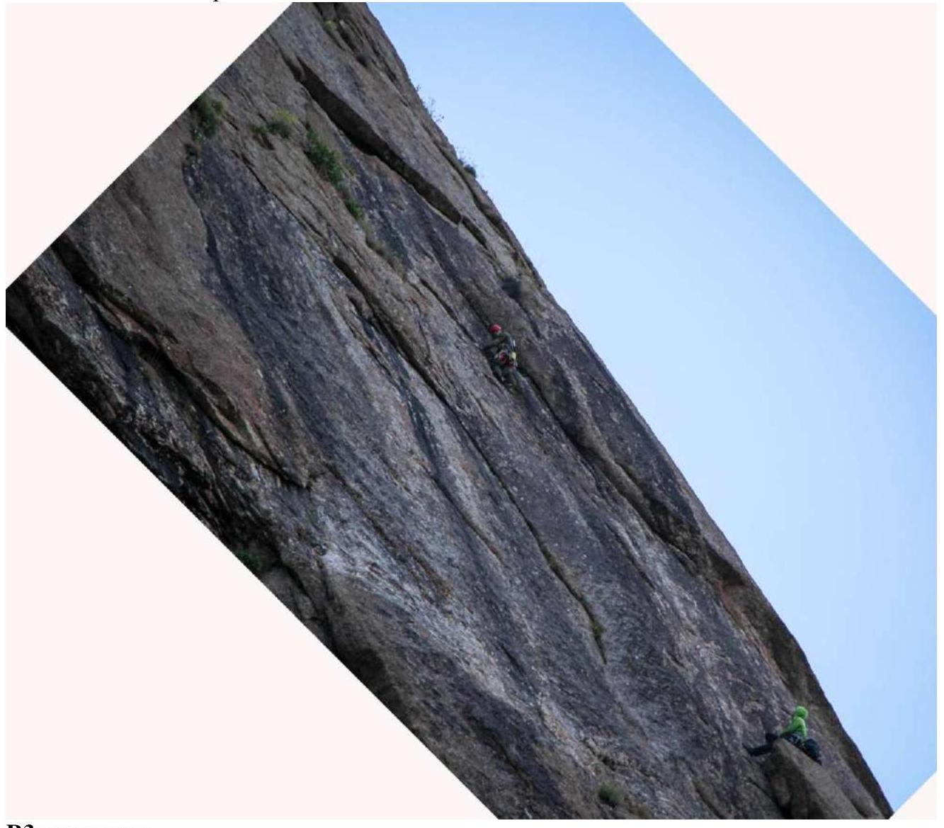
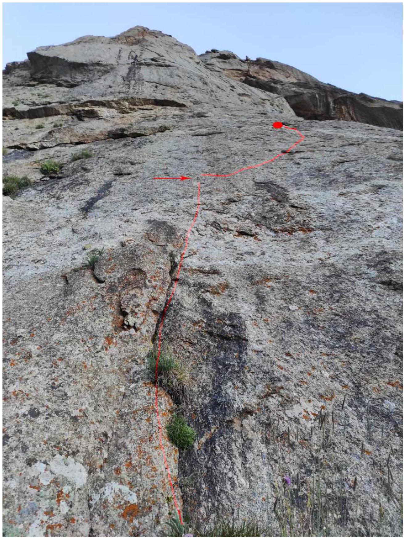
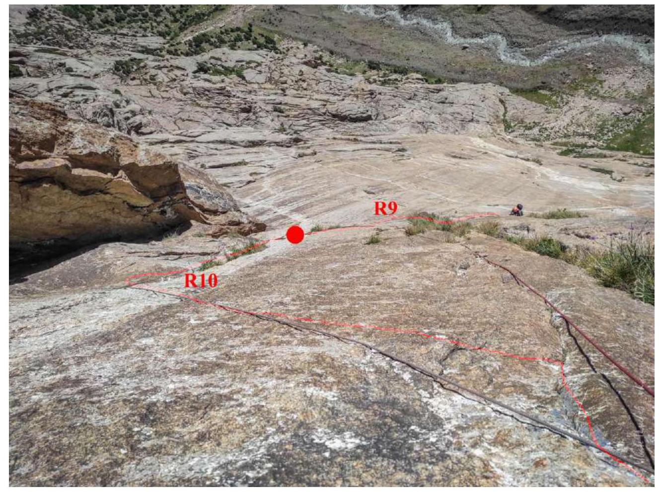
2.1. Photo with the route thread
Photo №1. Left is Serebryannaya Wall southern, right is peak Serebryannaya Wall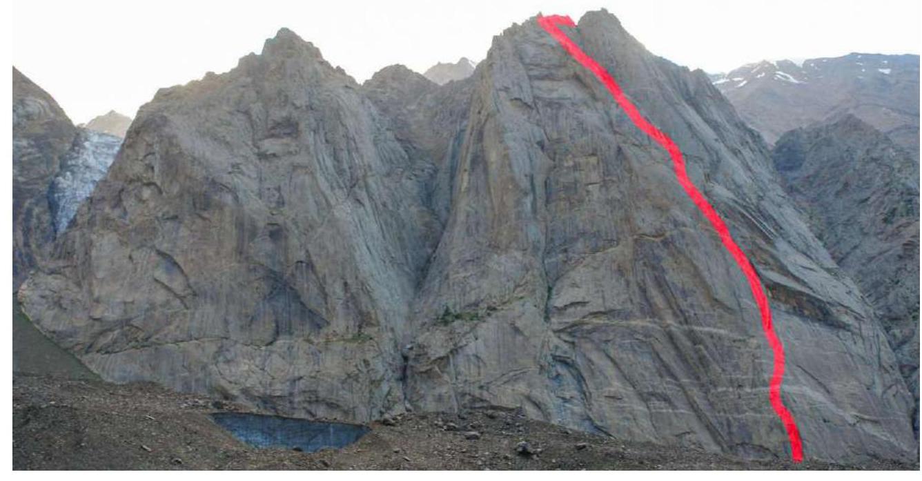
Photo №2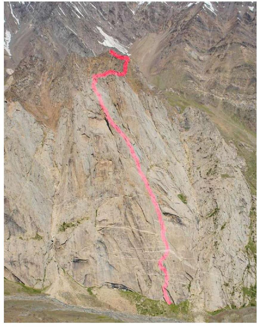
Photo №3. Taken from peak 1000-letie Kreshcheniya Rusi.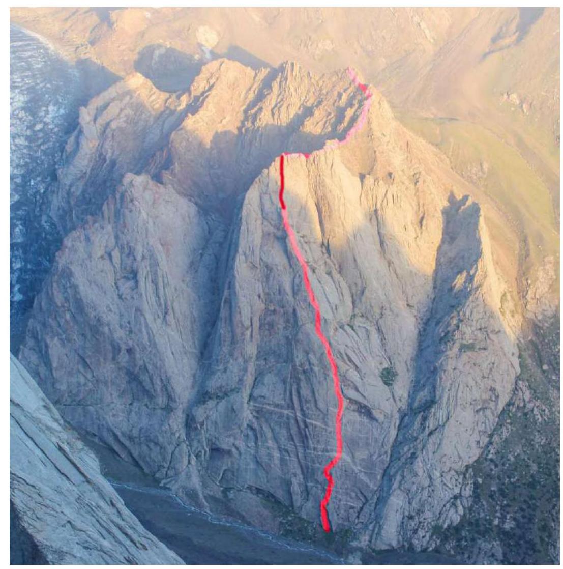
Photo №4. Technical photo of the route with section numbers. Photo taken from the "Balcony" ledge of Asan peak on August 26, 2022.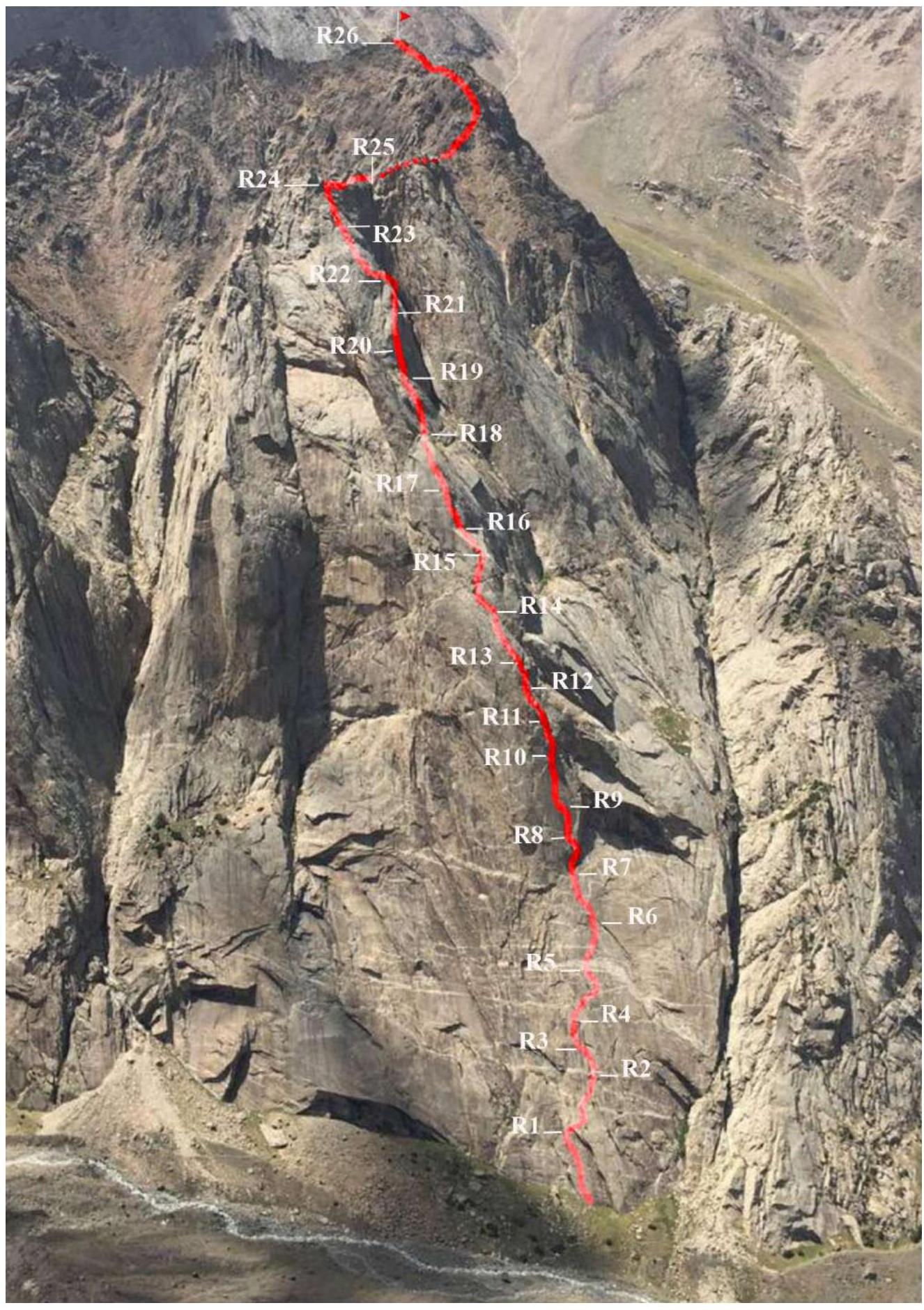
2.3. Route diagram in UIAA symbols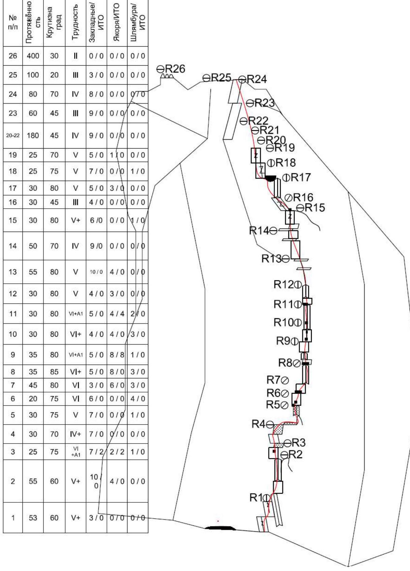
3. Characteristics of the Team's Actions
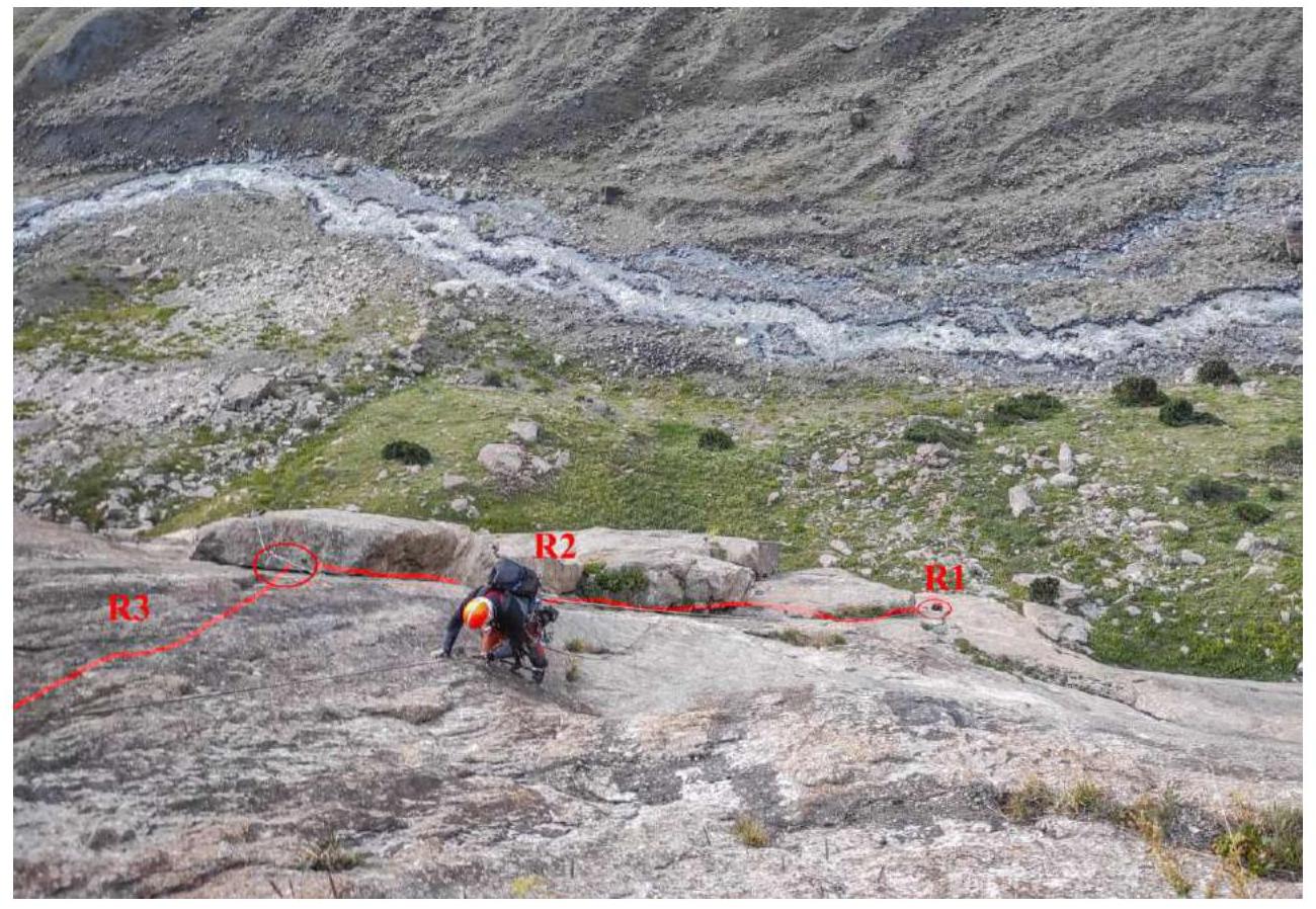
3.1. Description of the route passage.
July 18, 2022 start at 18:00.
At 20:30, hung 2.5 ropes and descended. Overnight in a grotto under the wall on a comfortable site. Water drips from the rock.
R1 53 m
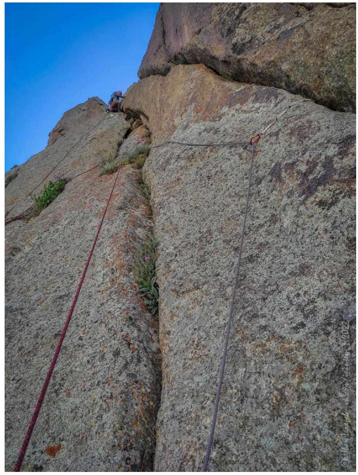
Roman Zverev started. The beginning of the route is along a lying slab (55–60°) with a characteristic gap. To the right of the slab is a large overhanging internal angle. IV+ cat. diff.
25 m along the gap 6 fr.
Further along the shallow relief on the slab without insurance to the right and slightly up to the next gap.
Then up 25 m V+.
Station in the upper part of the overhanging internal angle.
R1 along the gap on the left

R1 R1
Start of the route along the left gap. With a transition to the right.
R1
Start of the route along the left gap. With a transition to the right.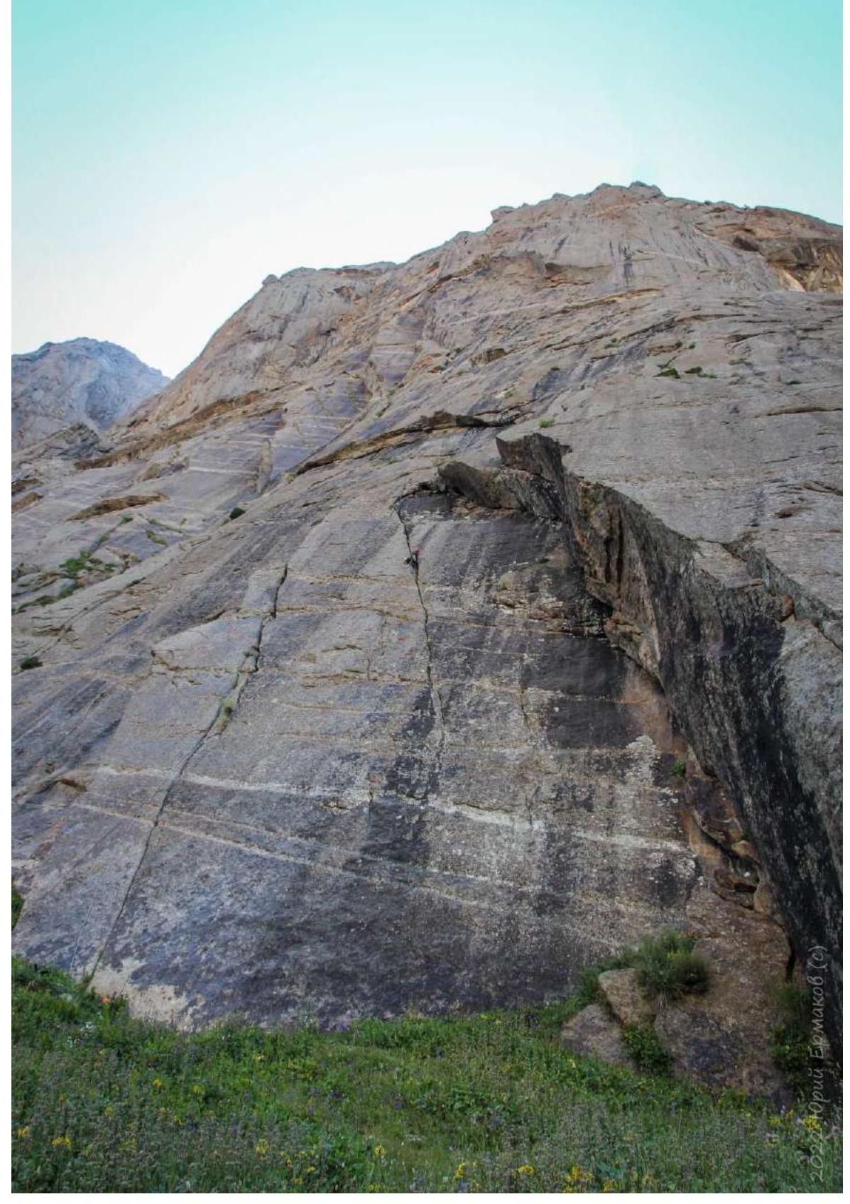 R2
55 m
R2
55 m
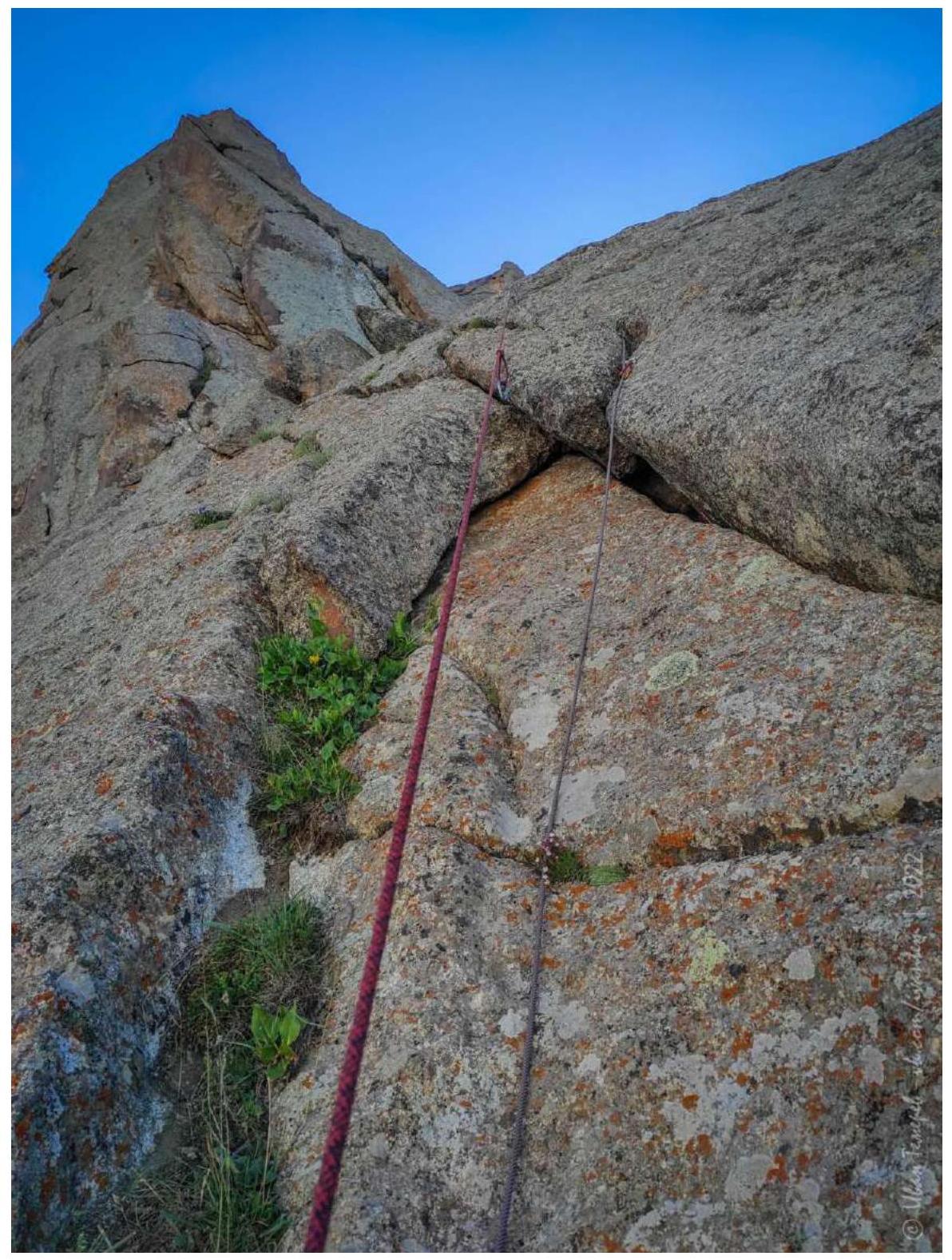
- 20 m up to the right along the slab IV+ cat. diff.
- 35 m along the internal angle formed by the slab on the left and the "naslepka" V cat. diff., to the top of the outcrop. Here is the station. Old loops on the outcrop.
 R2
Photo of the internal angle (taken during the 2019 attempt)
R2
Photo of the internal angle (taken during the 2019 attempt)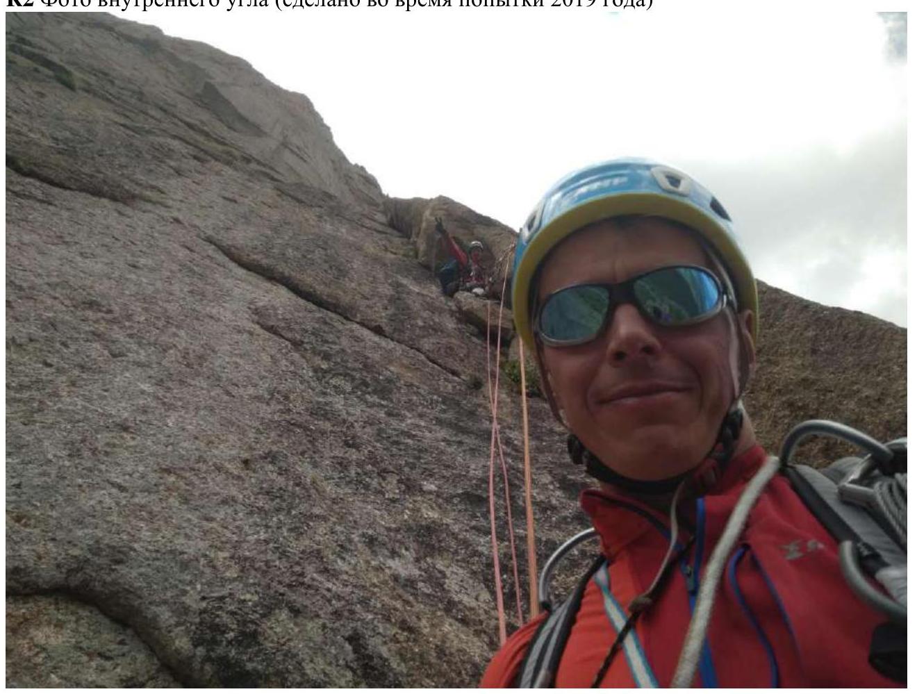
Loops on top of the outcrop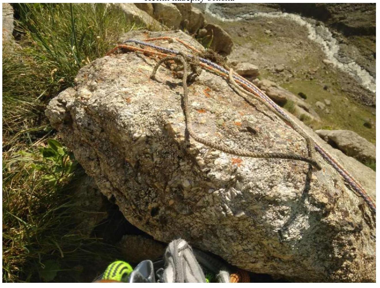
R3 25 m
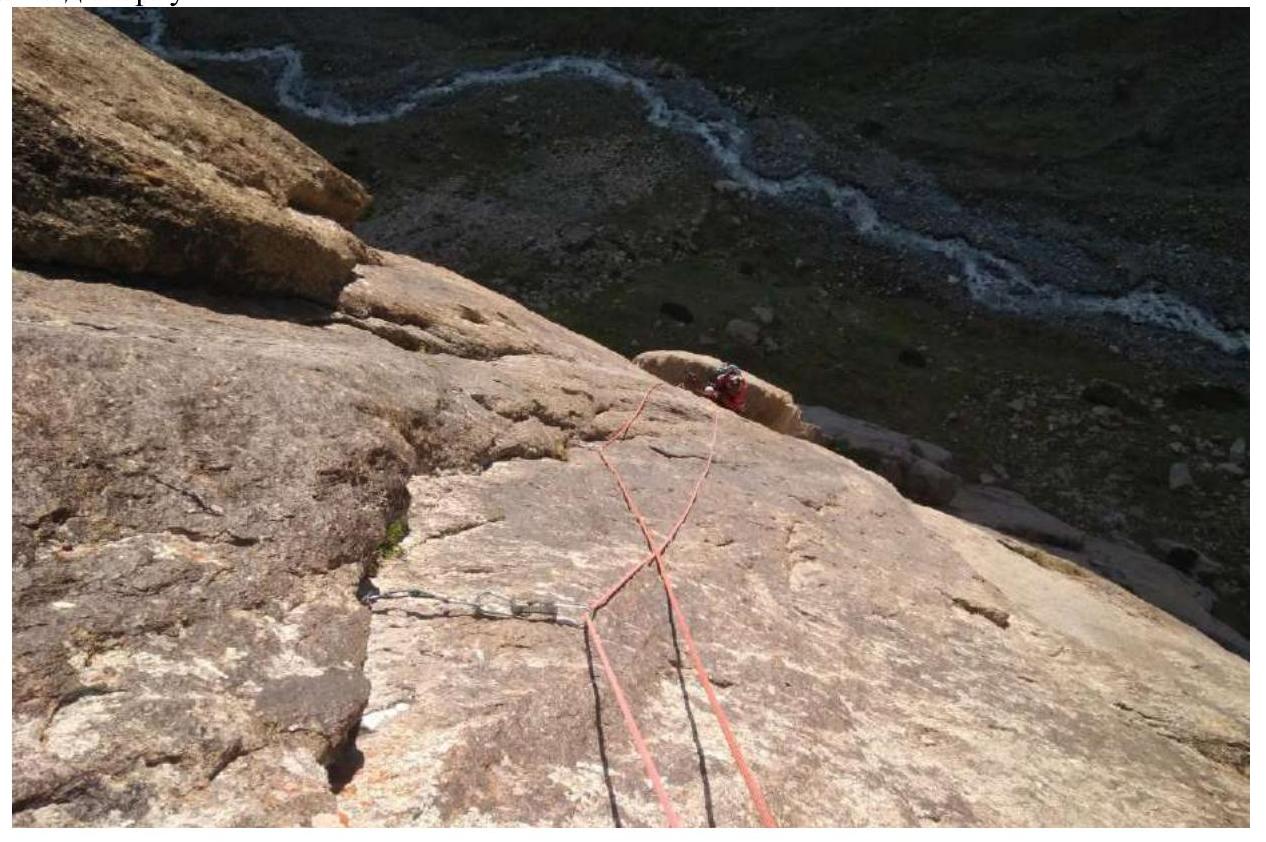
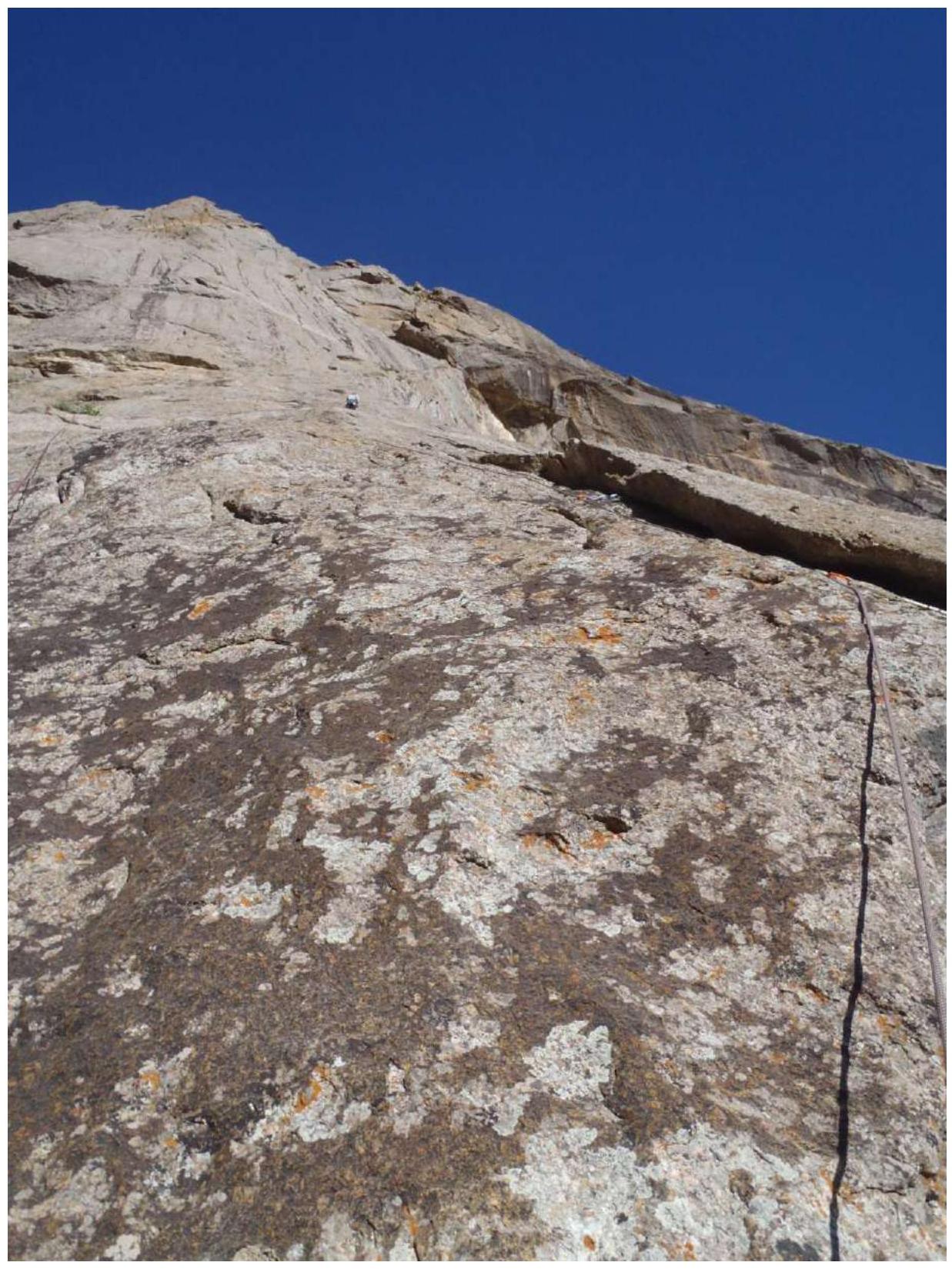
Up and left along the slab VI cat. diff. A2 5 m — 2 holes 8 mm for skyhooks (in principle, you can put a rock anchor or a small fiff in the hole), then a bolt. Further climbing 12 m VI + with poor insurance with anchors. 7 m along the steps with grass 2 cat. diff. Station in the slab-outcrops.
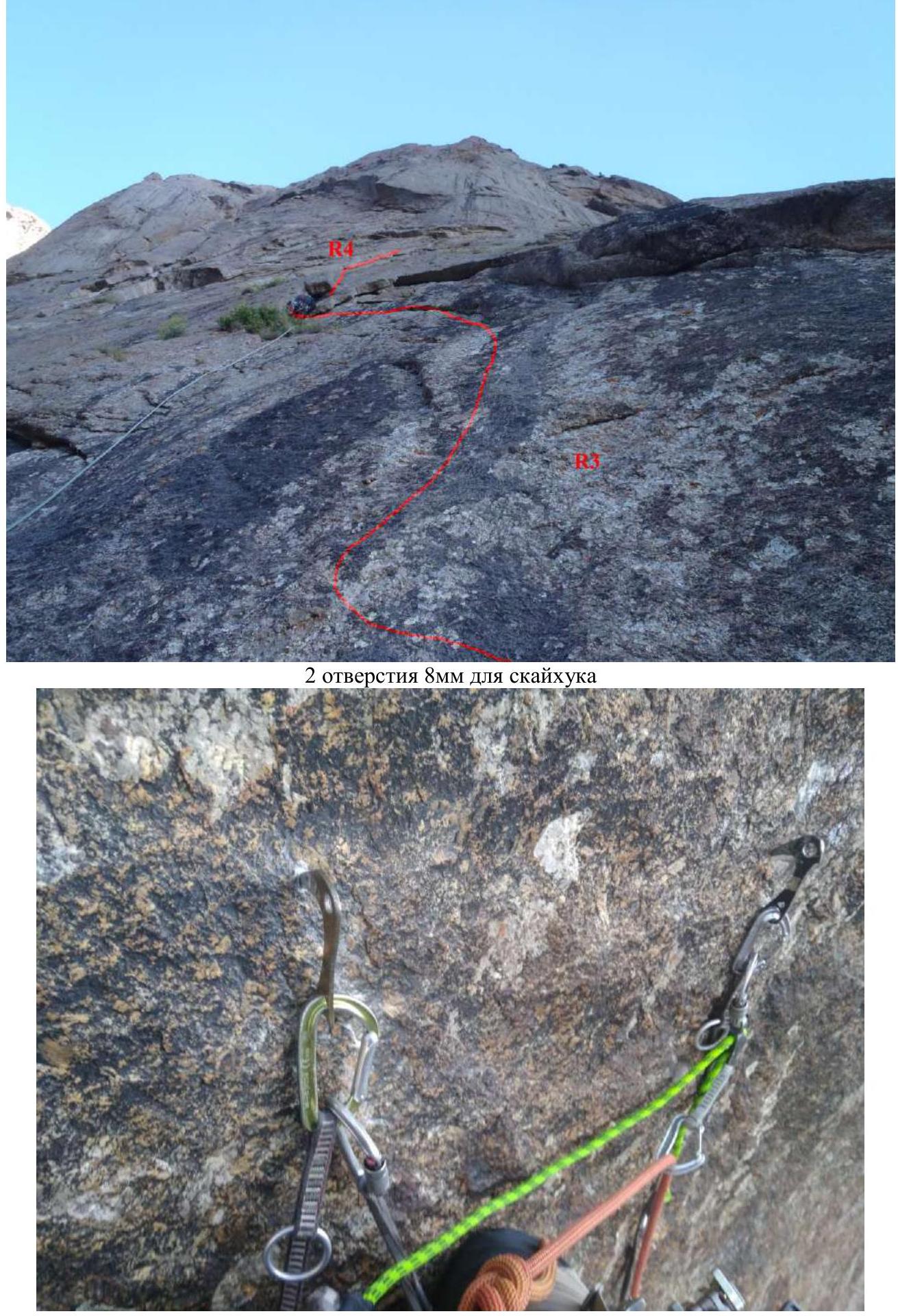
R3 taken from the ground with zoom
R3 view from above
R1–R2–R3 view from the R3 station
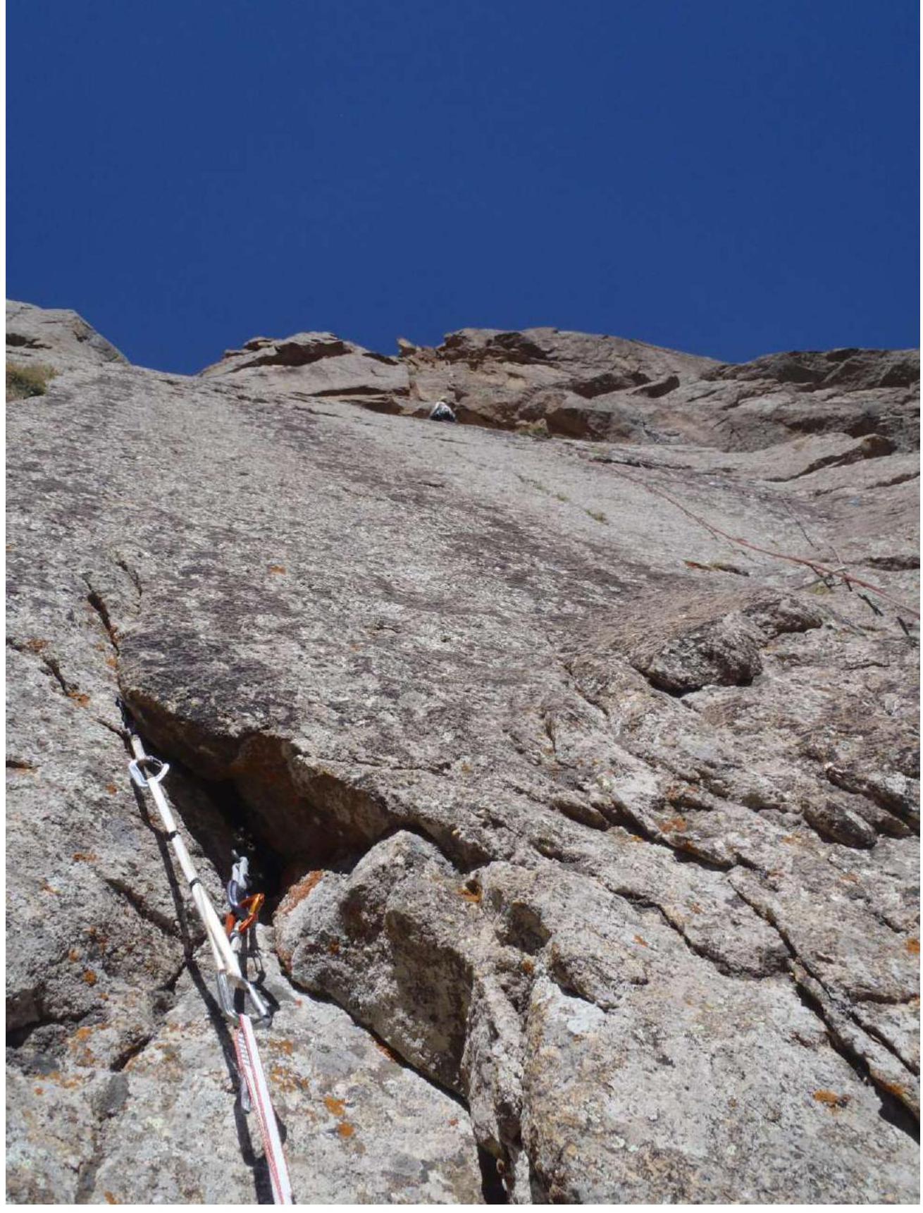
R4 30 m July 19, 2022 Ivan Temerev started working from the point of the end of the pervious rope at 07:00.
Left along the outcrops 15 m IV cat. diff. 70°. Then right up along the green steps II–III cat. diff.
Station on a large outcrop before the slab. View from above R5
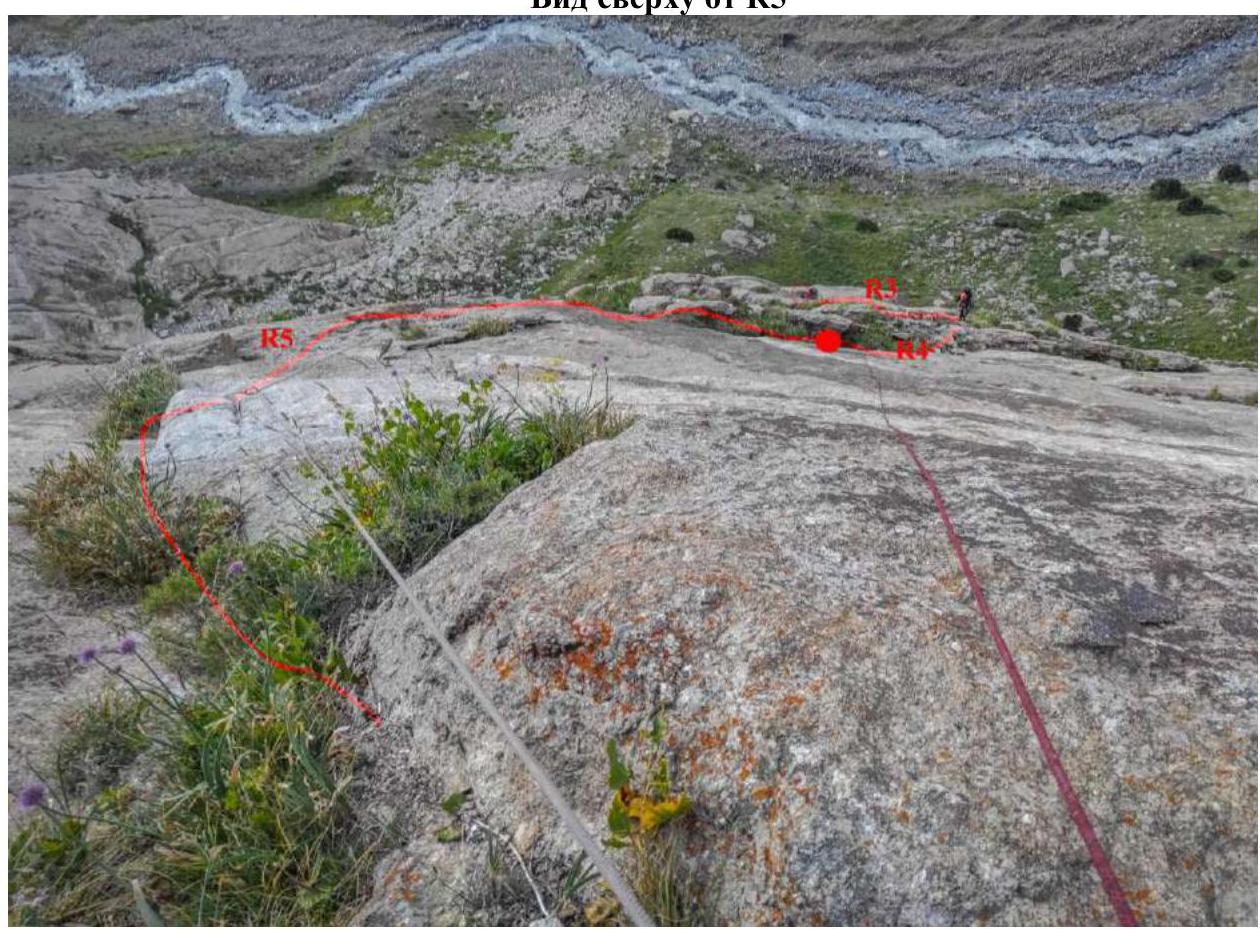
R5 30 m (07:44)
- Along the green ledge to the right until it stops
- Further up along the outcrop 75° 15 m V cat. diff.
- 15 m II–III cat. diff. 50° along the lying internal angle with grass
Station on its own закладке and its own bolt — relief is poor and worn out.
R6 20 m (08:21)
- Up along the slab 8 m VI cat. diff. to the Soviet bolt
- From it to the right 5 m VI cat. diff.
- Further 7 m V cat. diff. 75° up along the slab to three bolts — 1 Petzl 10 mm and 2 Soviet
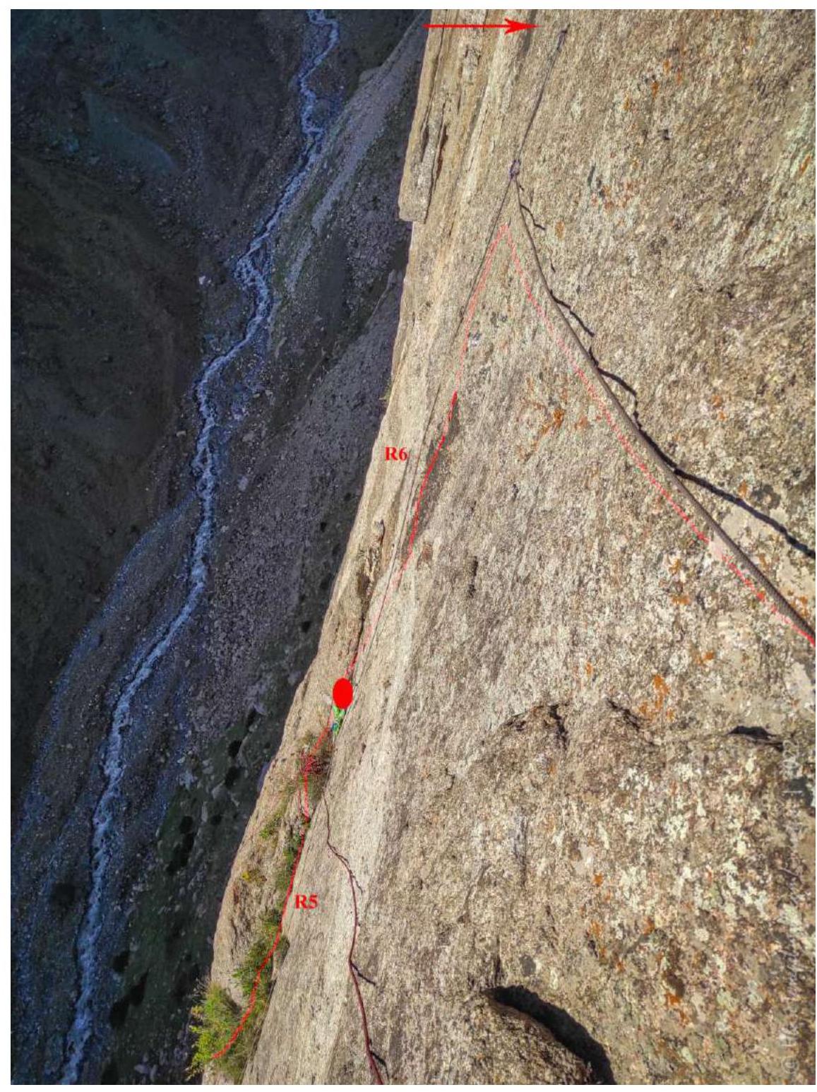
R6–R6 view of the station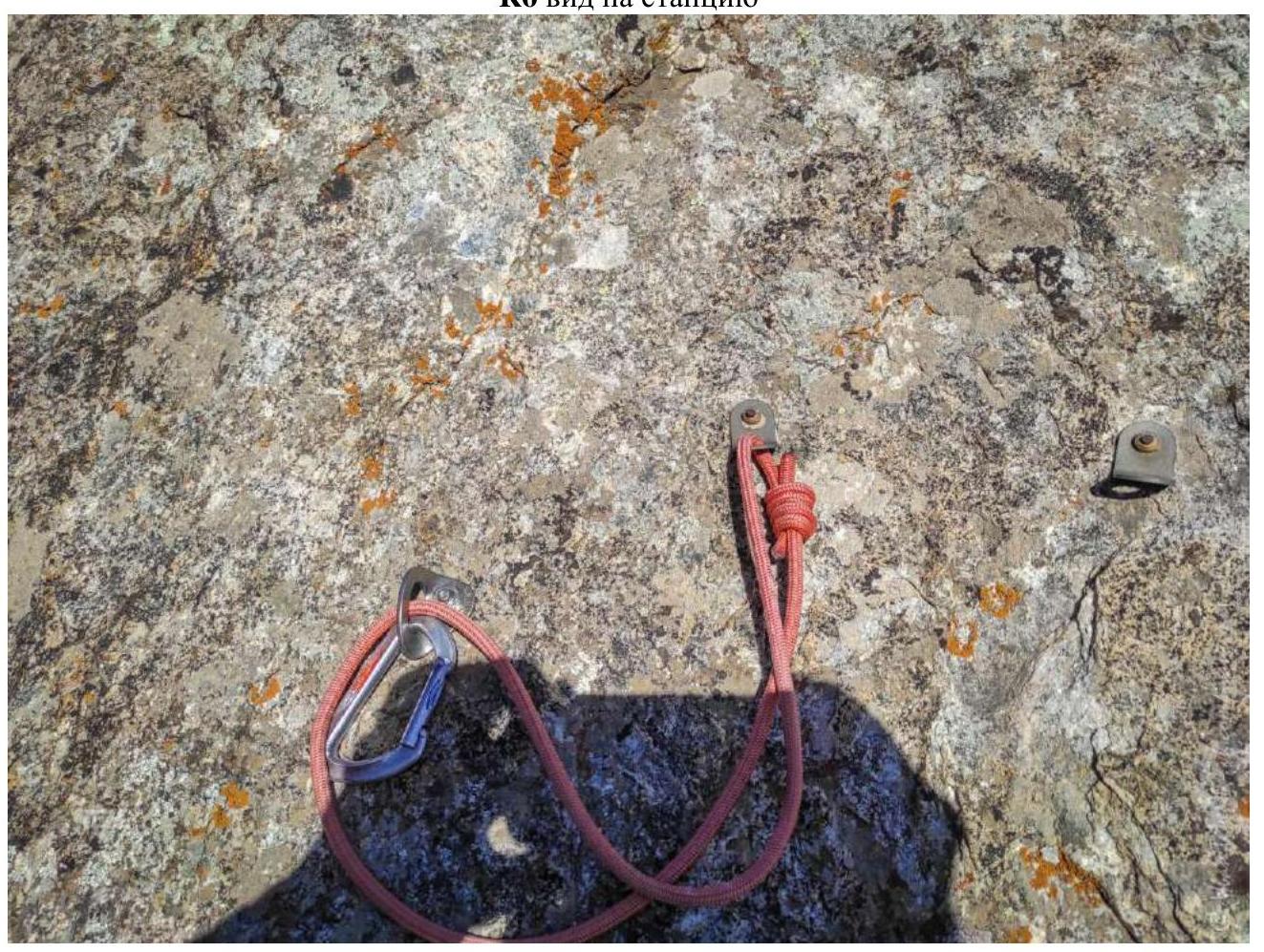
View down from the R6 station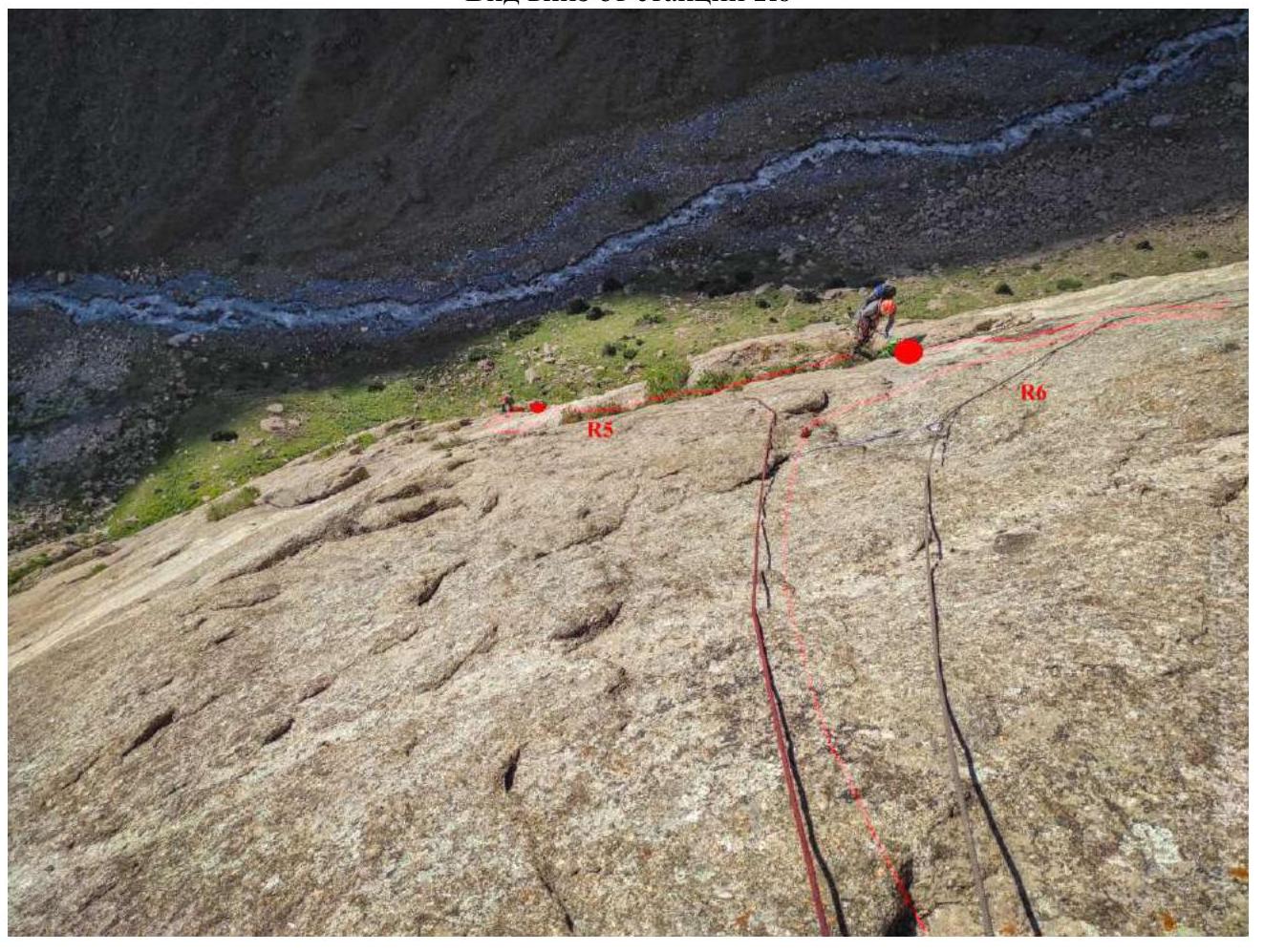 R7
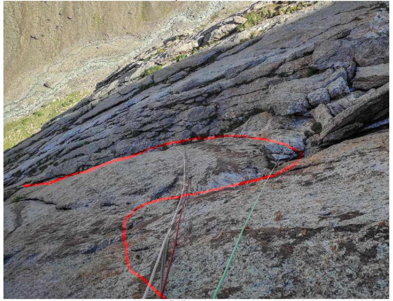
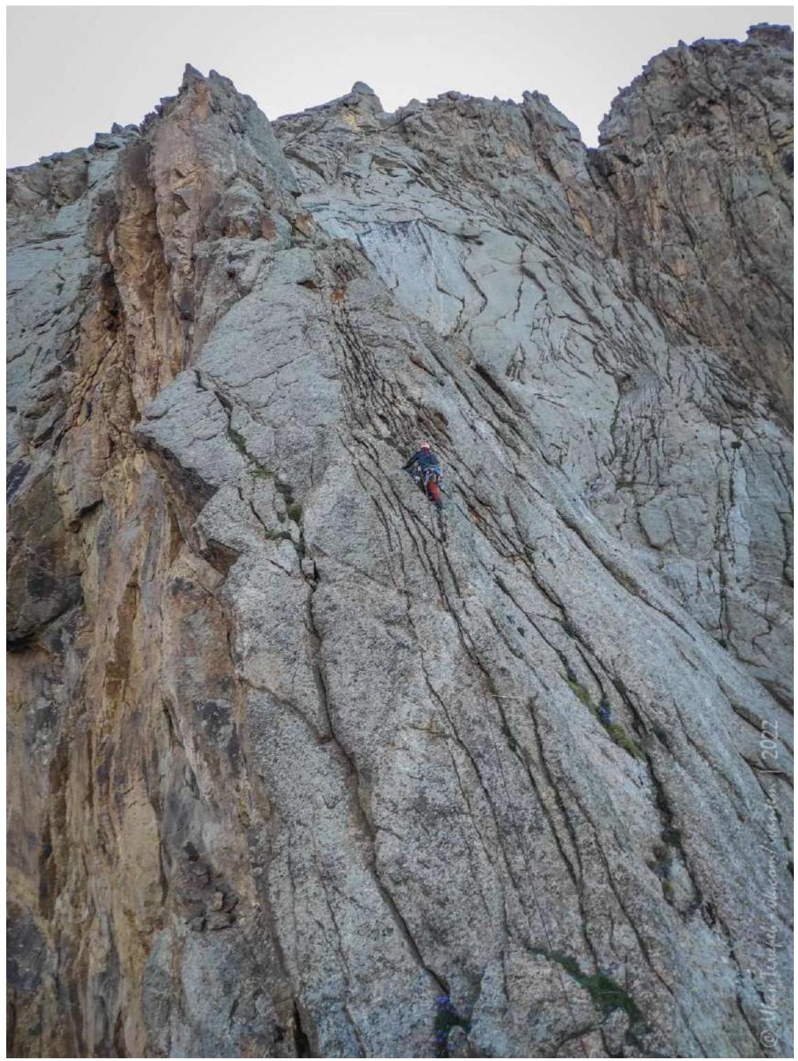
45 m (09:06) Along the slab to the right 15 m complex climbing V+ 65°. Entry into a weakly expressed widely open internal angle. Up along it. VI cat. diff. 75° 30 m. Insurance is mostly anchors. Station on three bolts.
R7
45 m (09:06) Along the slab to the right 15 m complex climbing V+ 65°. Entry into a weakly expressed widely open internal angle. Up along it. VI cat. diff. 75° 30 m. Insurance is mostly anchors. Station on three bolts.
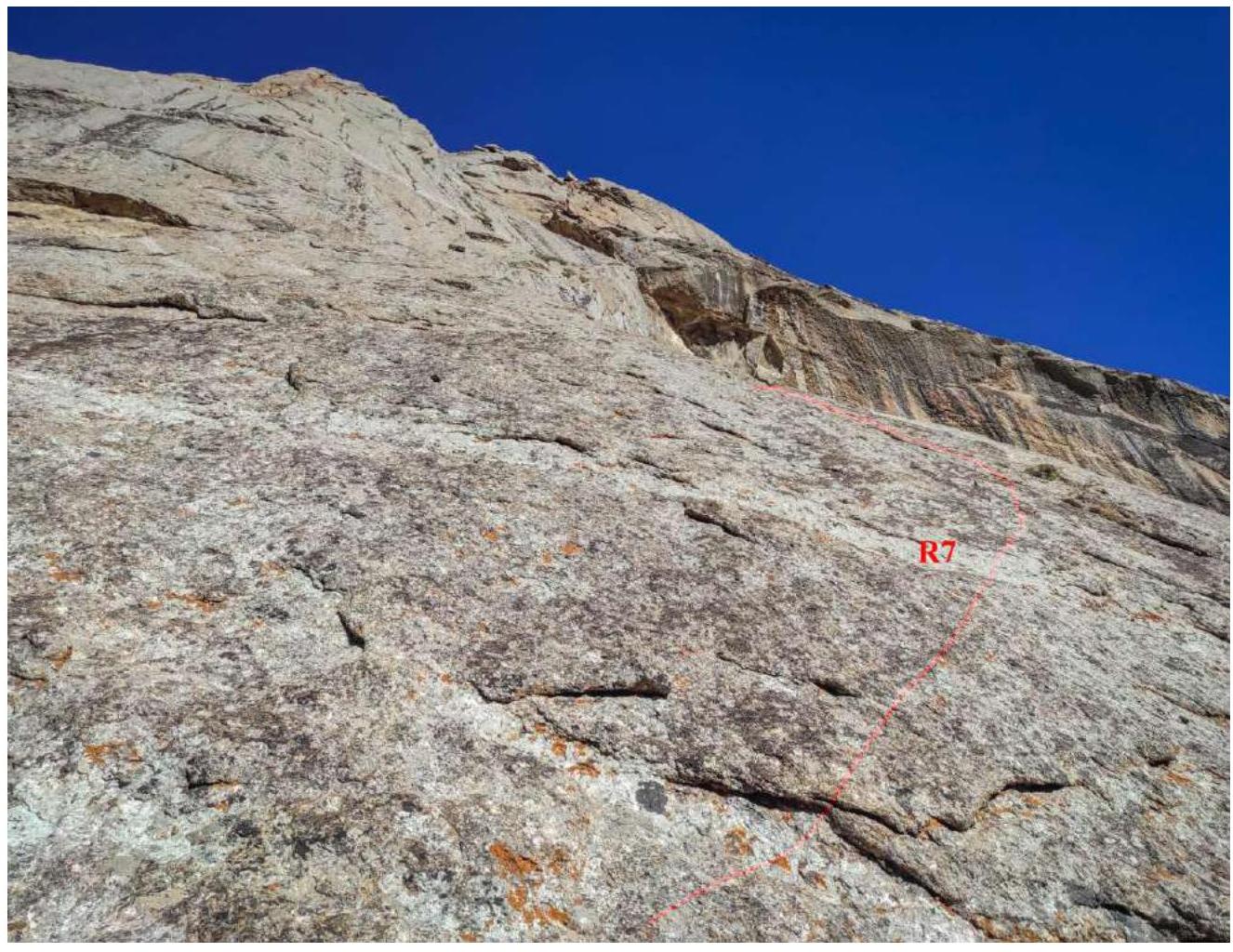 R7
view up to the weakly expressed widely open internal angle
R7
view up to the weakly expressed widely open internal angle R7
view down from the station
R7
view down from the station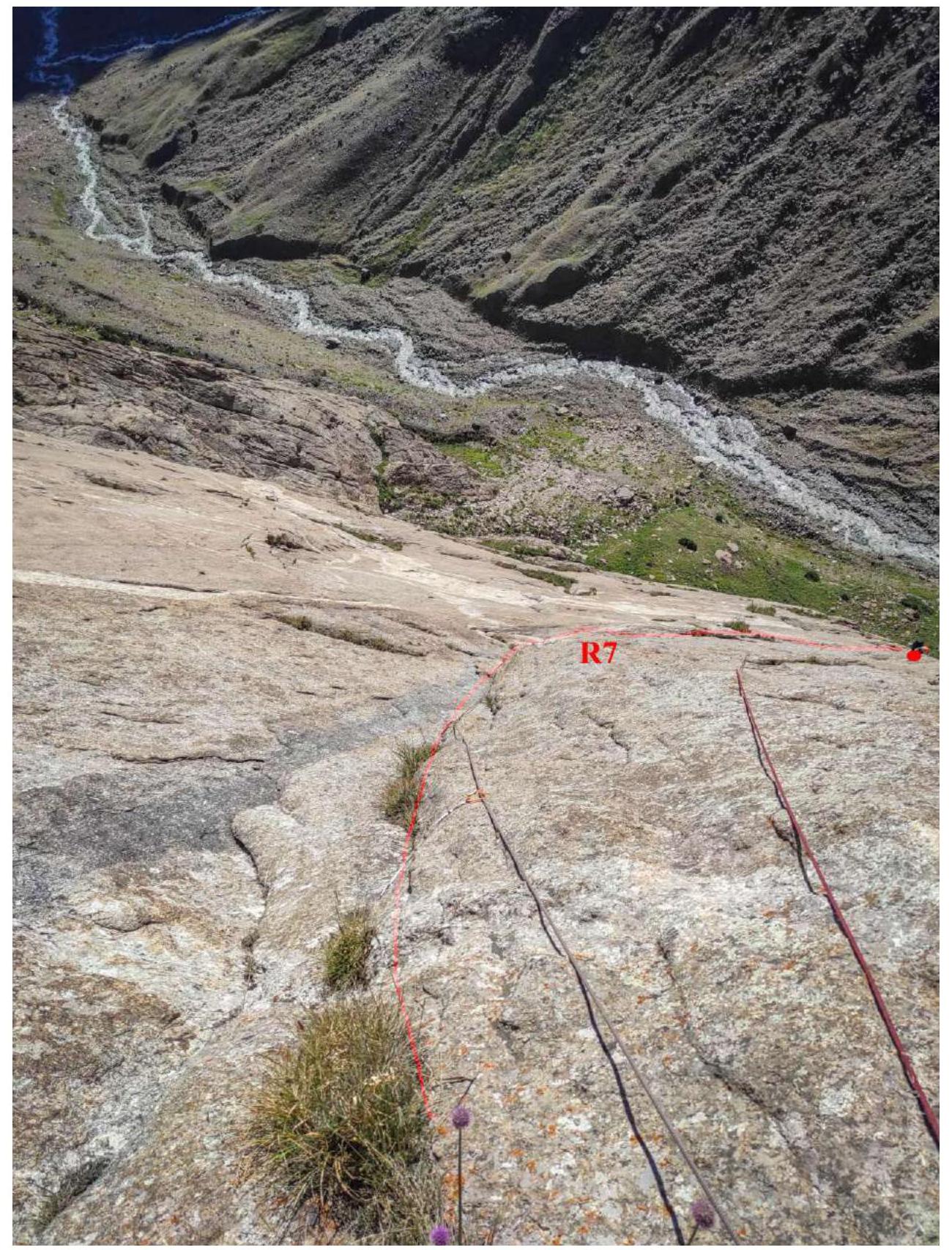 R8
35 m (9:27) Along the slab to the right up 8 m VI, no insurance. 70°. Entry into an internal angle under the wall — slab. Movement under the wall along the internal angle with grass III cat. diff., 10–15 m. 45°. Further up along the wall 90° with gaps, exit to the left into a vaguely expressed internal angle — VI+, anchors.
R8
35 m (9:27) Along the slab to the right up 8 m VI, no insurance. 70°. Entry into an internal angle under the wall — slab. Movement under the wall along the internal angle with grass III cat. diff., 10–15 m. 45°. Further up along the wall 90° with gaps, exit to the left into a vaguely expressed internal angle — VI+, anchors.
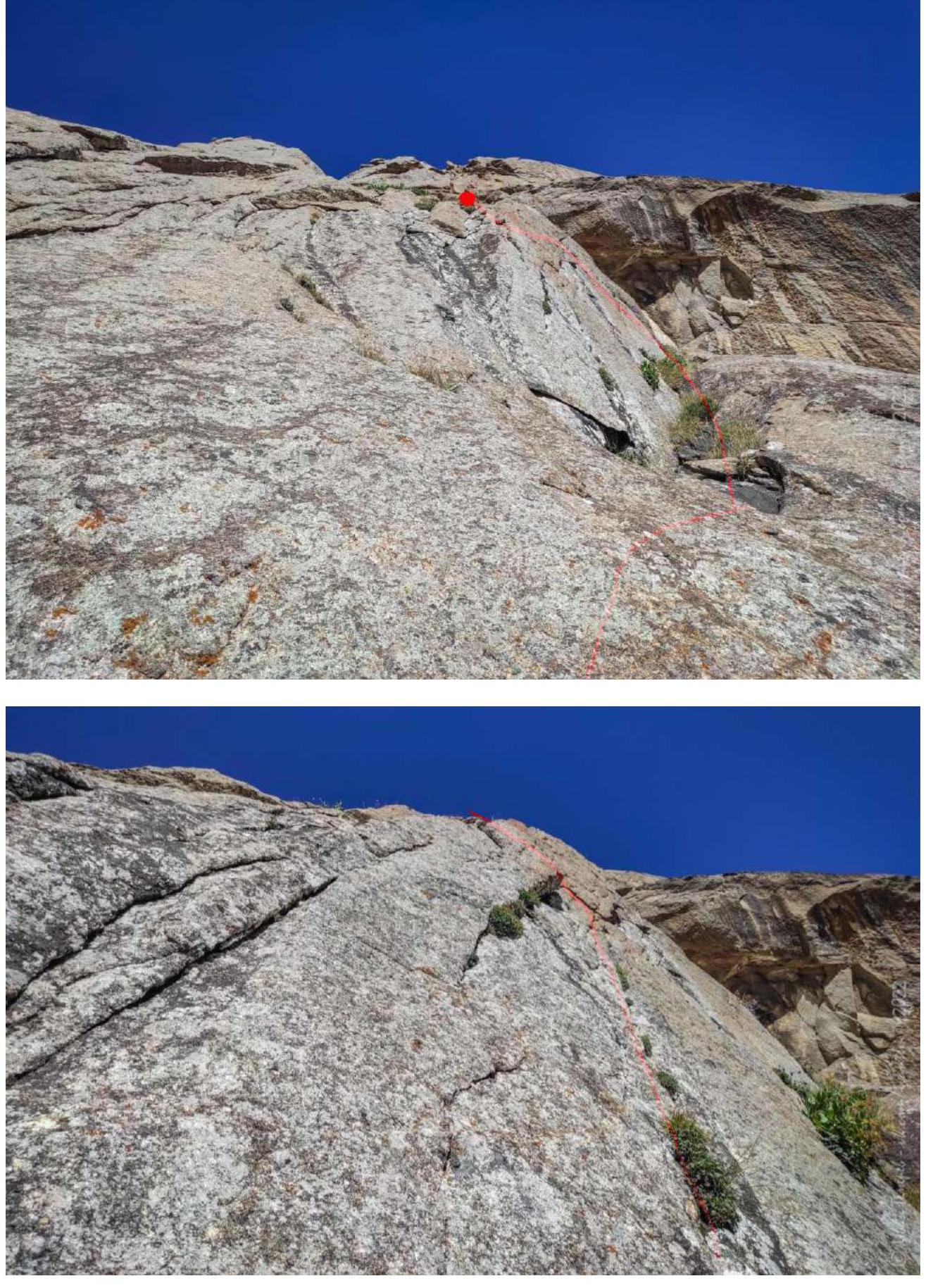 View from the R8 station down
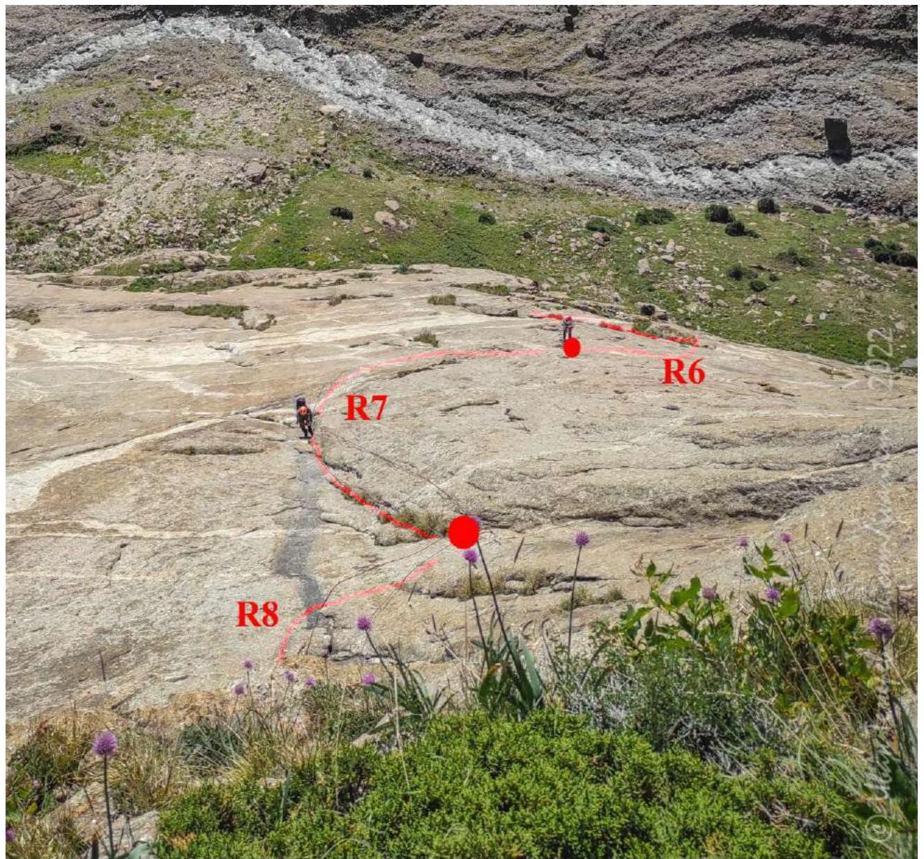 R9
35 m (10:28) Key section of the route. 80°. Along the slab up and slightly to the right towards the old Soviet bolt (a закладка cable enters) almost without insurance VI (6b fr.) — one small anchor. After the bolt, a thin narrow gap starts slightly to the left and up. Approximately 6c+7a fr. We used ITO on anchors and fiffs VI A1 10 m. Old holes for skyhooks are encountered. Then climbing VI+ (6c fr.) up 10 m and along the slab to the right. Entry into an internal angle with "greenery". There are euro-Asian climber's hooks. At the end of the section, an anchor 10 mm with an eye and ring.
R9
35 m (10:28) Key section of the route. 80°. Along the slab up and slightly to the right towards the old Soviet bolt (a закладка cable enters) almost without insurance VI (6b fr.) — one small anchor. After the bolt, a thin narrow gap starts slightly to the left and up. Approximately 6c+7a fr. We used ITO on anchors and fiffs VI A1 10 m. Old holes for skyhooks are encountered. Then climbing VI+ (6c fr.) up 10 m and along the slab to the right. Entry into an internal angle with "greenery". There are euro-Asian climber's hooks. At the end of the section, an anchor 10 mm with an eye and ring.
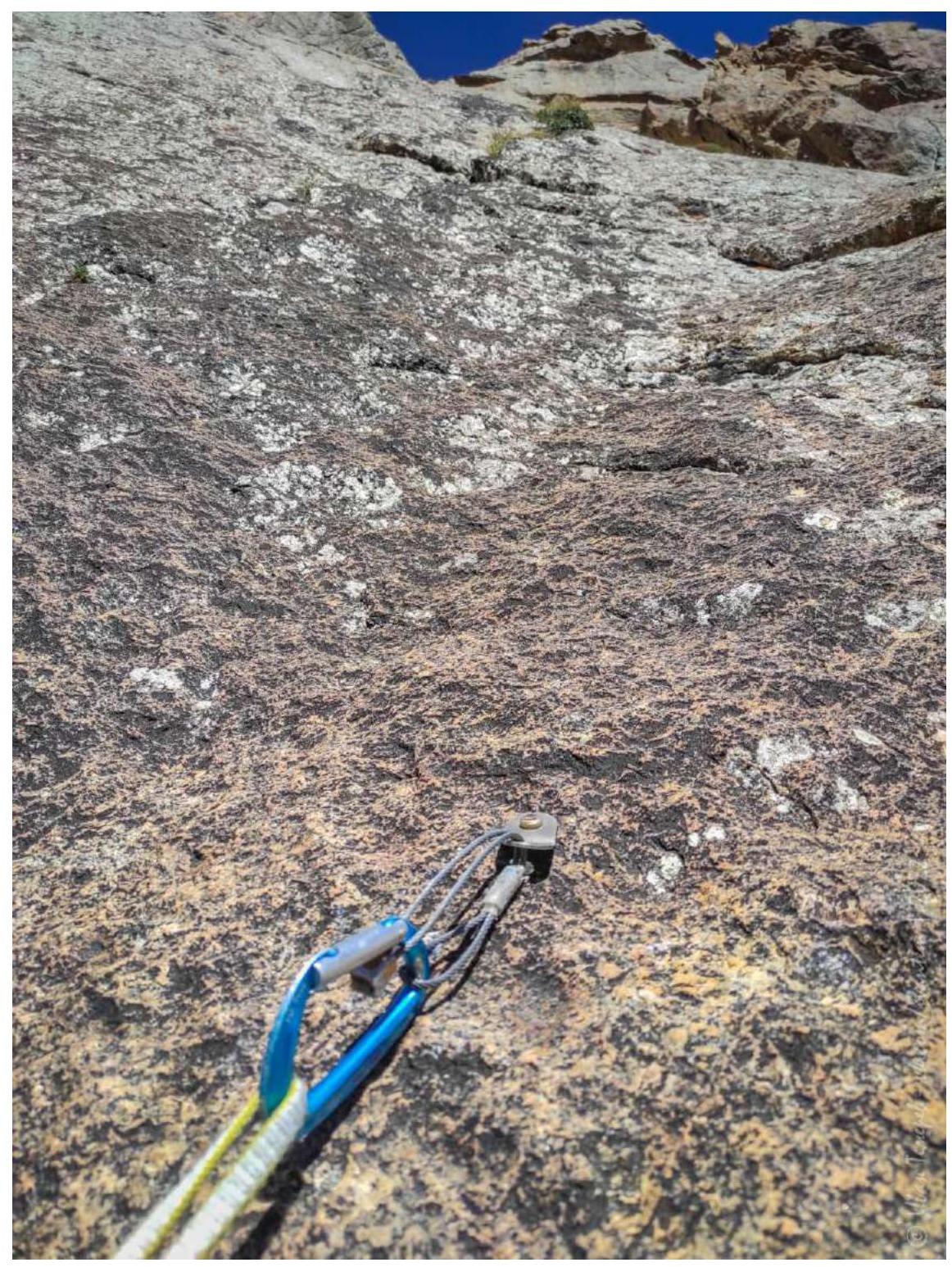
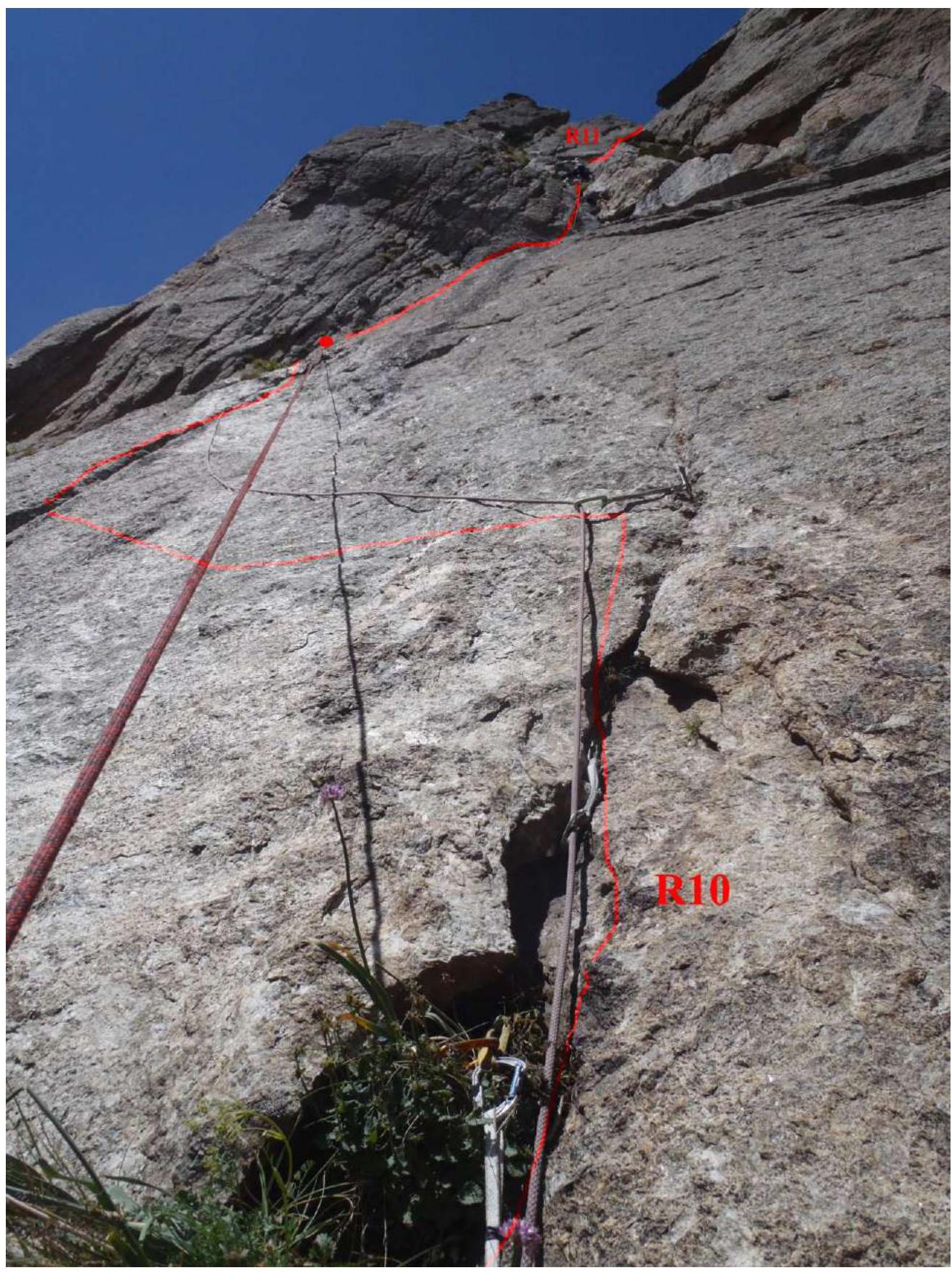
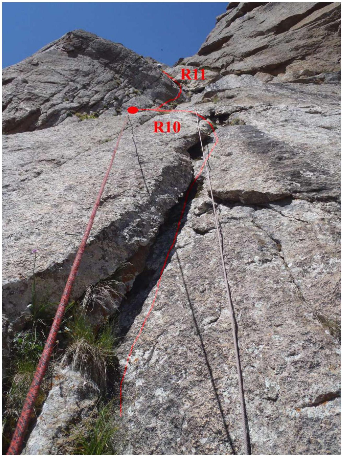
Soviet bolt on R9 R10 30 m (11:10)
- Up VI along the angle, then along the crack.
- As it dies out, a semi-pendulum — semi-climbing 8 m to the left along the wall into the internal angle on a pair of anchors.
- Along the angle VI+ to the wall with gaps. Here we drilled our own bolt — station.
- Further complex wall with gaps.
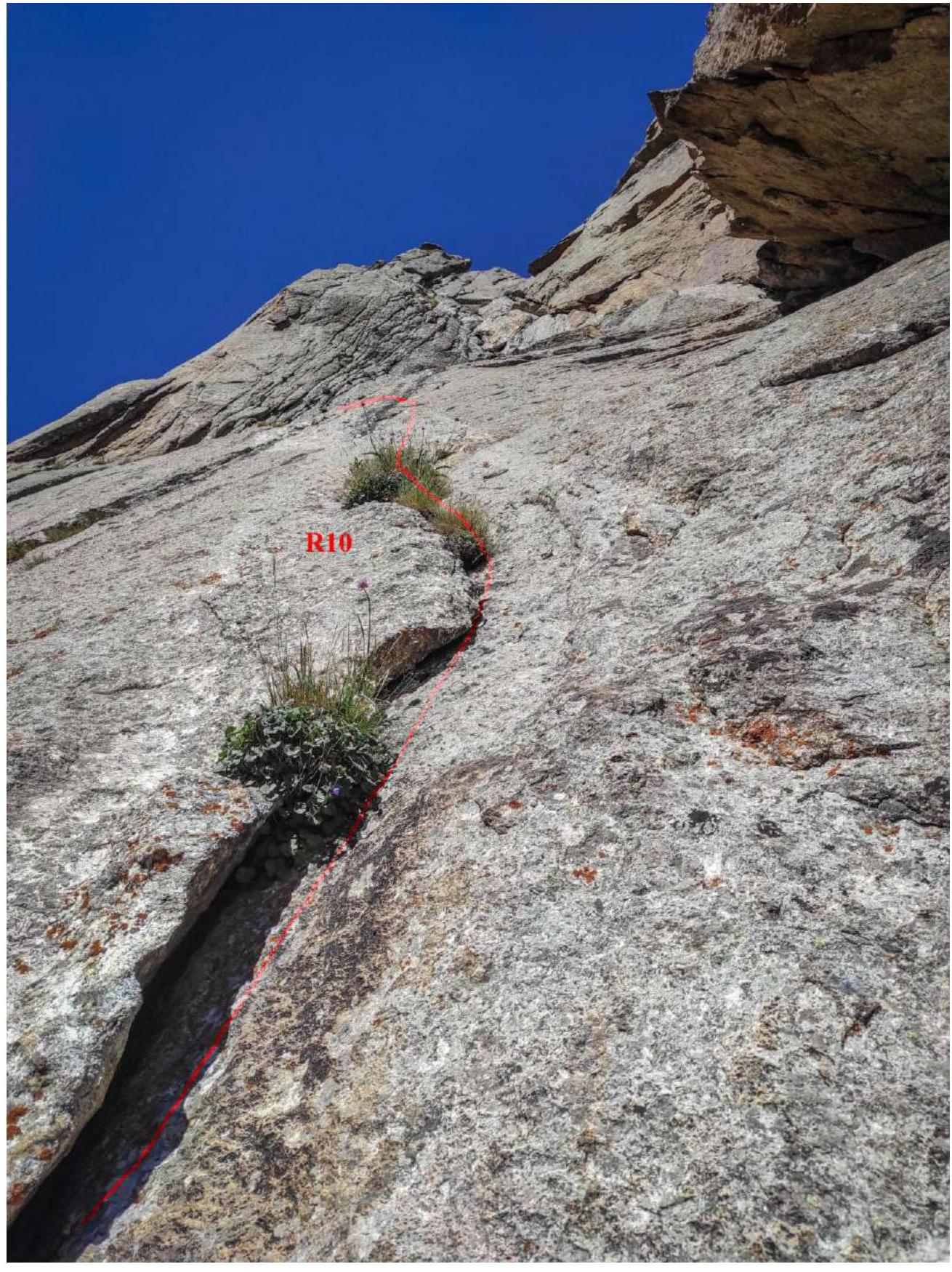 R10
and part of R11
R10
and part of R11
 View from R10 down
 R11
30 m (11:44)
R11
30 m (11:44)
- Start along the internal angle with gaps VI+ 70°.
- Transition to the internal angle 80°. VI.
- At the end, 2 eyes with anchors 10 mm — one of them with a ring.
 View down to R11 from the station.
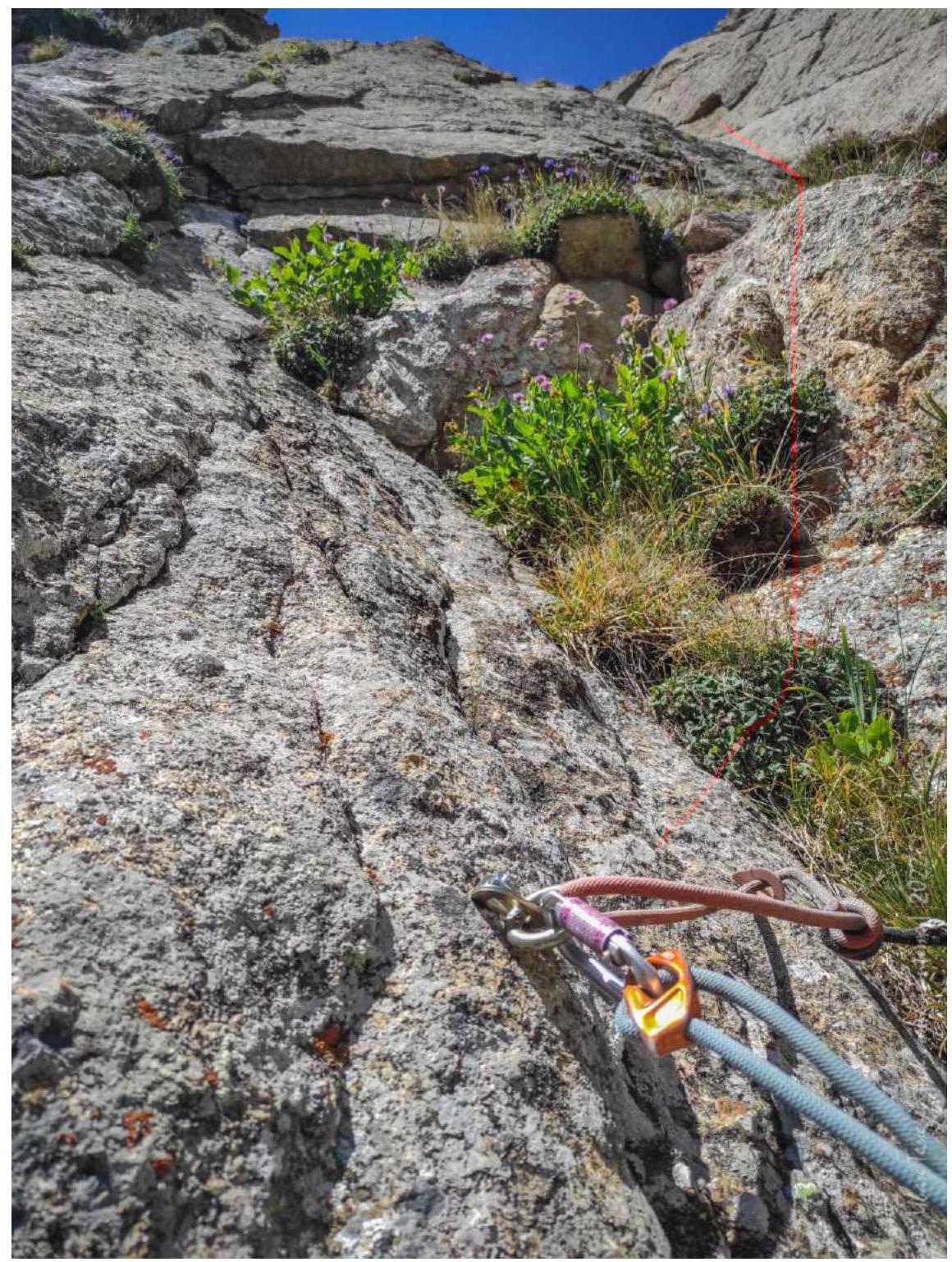
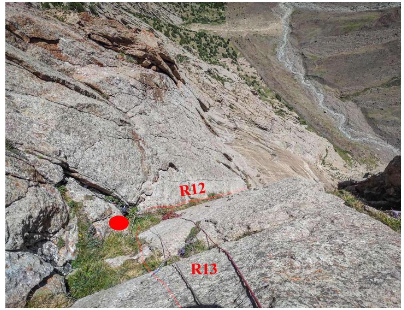
 R12
30 m (12:34)
R12
30 m (12:34)
- 10 m IV cat. along the large-block wall — entry into the internal angle with grass.
- Along it V cat. diff. 20 m.
- Station on its own points in the angle.
 View from R13 down.
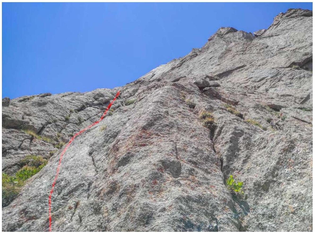
 R14
55 m (12:55)
R14
55 m (12:55)
- 40 m IV+ (5c fr.) 75–80° up and then slightly to the left onto a weakly expressed ridge separating the internal angles overgrown with grass. The ridge is clean. Insurance is rare — anchors.
- Further slightly to the left onto the wall along the gaps.
- Exit onto the ridges and ledges IV cat. diff. 15 m 65–70°
View from R13 down.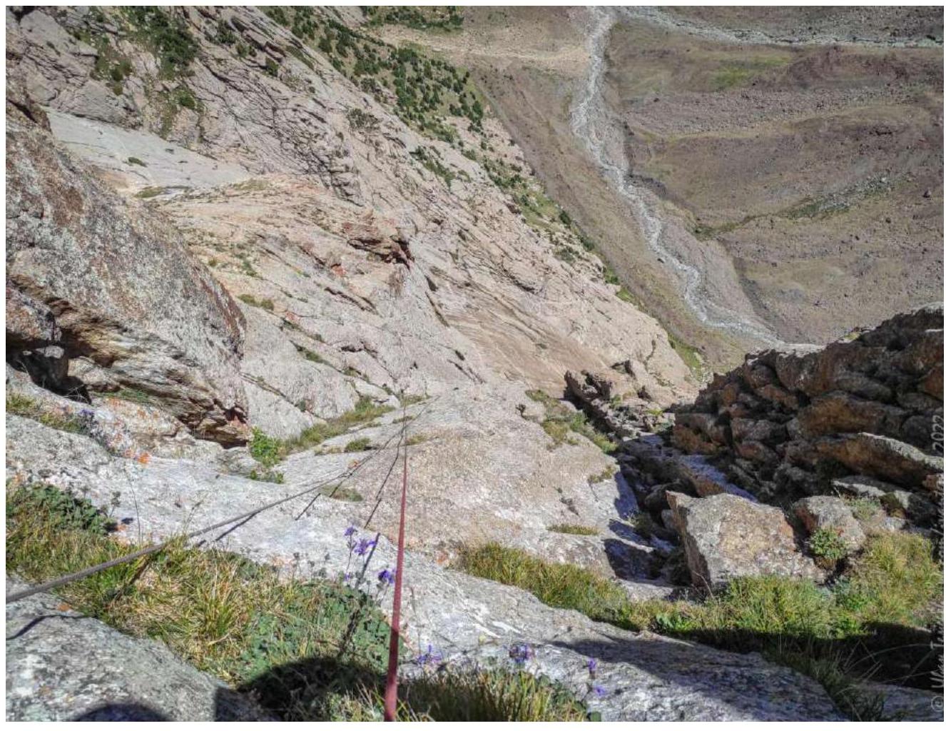
- R14 50 m (13:25) 45°
- III–IV cat. diff. walls-ledges
- R15 58 m (15:15) Leader changed — Yuri Ermakov went first.
- Wide inclined internal angle 55°
- IV cat. diff. 30 m.
- IV cat. diff. 8 m along the inclined slab up and to the right onto the vertical wall.
- 20 m along the gaps 85° V+.
- On the "shoulder" of the rock bastion (need to check from the station to the side of the base camp) a bolt with a ring.
View from R15 down.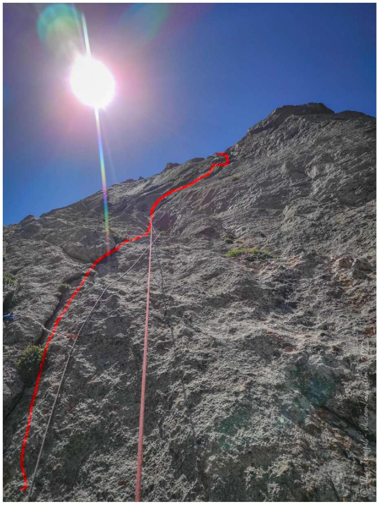
View of R15 at the top of the section.
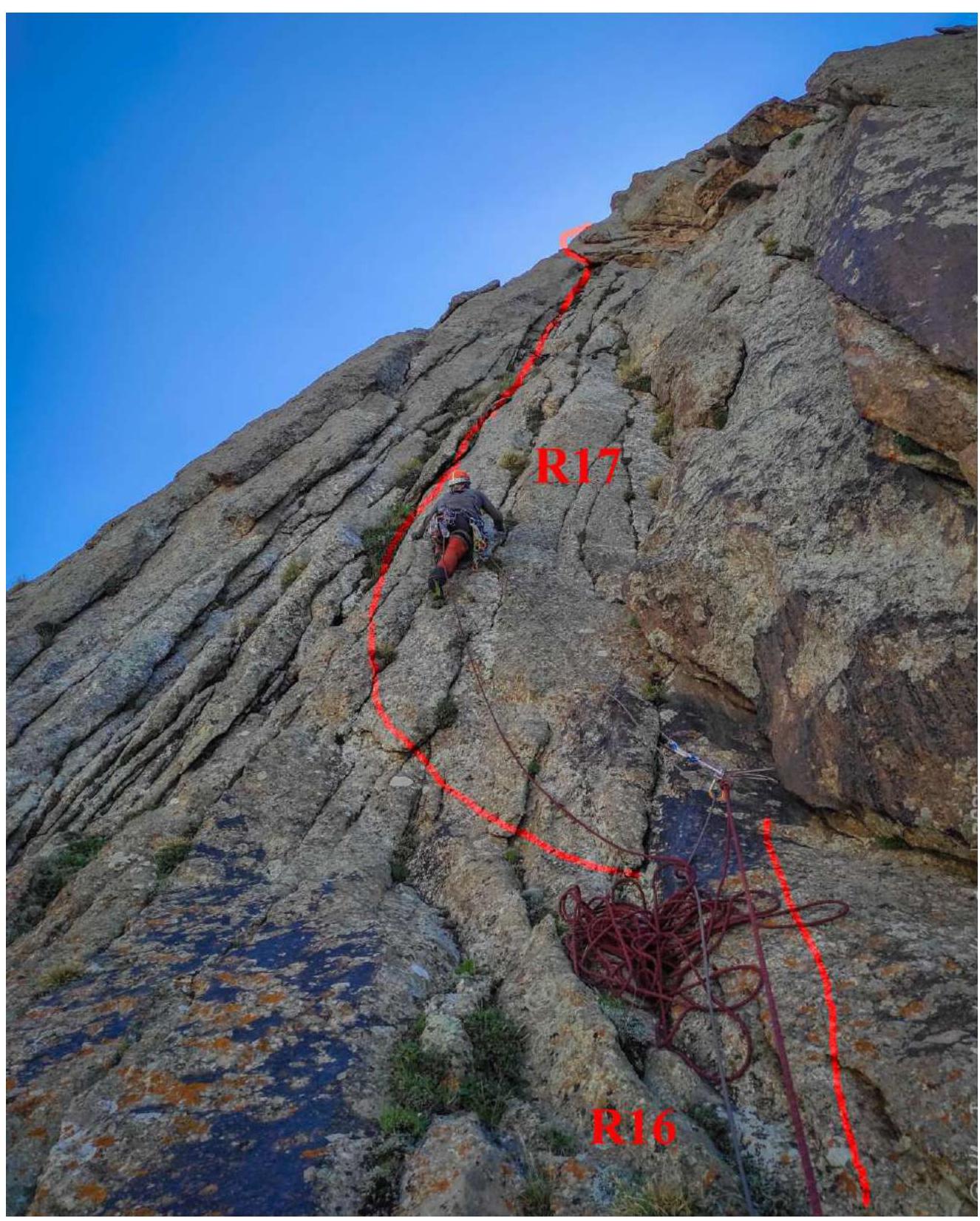
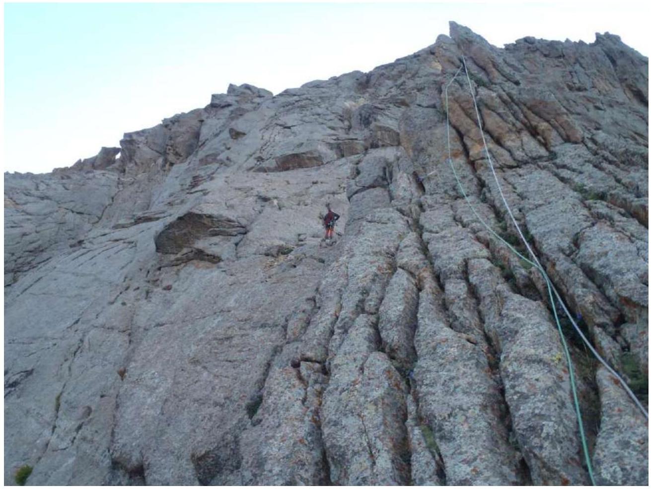
R16 30 m (16:00) Slab 45° with gaps III cat. diff. Station in the angle on the right part before the wide internal angle.
R17 30 m (17:00)
- 70–80° 15 m IV+
- 15 m 5c Under the cornice, departure to the left under the cornice
- Station on friends
- Further around the angle along the large gap
- Above the station at 7 m, a local station on anchors with a ring for dülffer
 Departure under the cornice to the left on R17
R18 25 m (17:50) Inclined gap 75° V cat. diff. местами с травой.
R19 25 m (18:25)
- Along the gaps 15 m V cat. diff.
- 15 m III cat. diff.
- 10 m I cat. diff.
- Station on the ledge
- Exit onto the ridge of the buttress
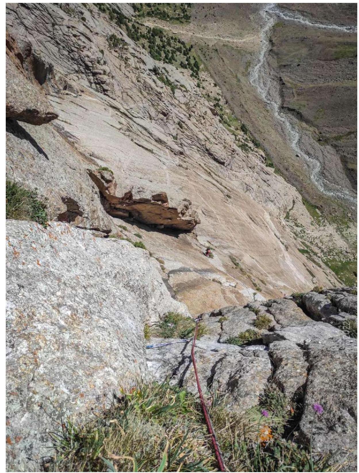
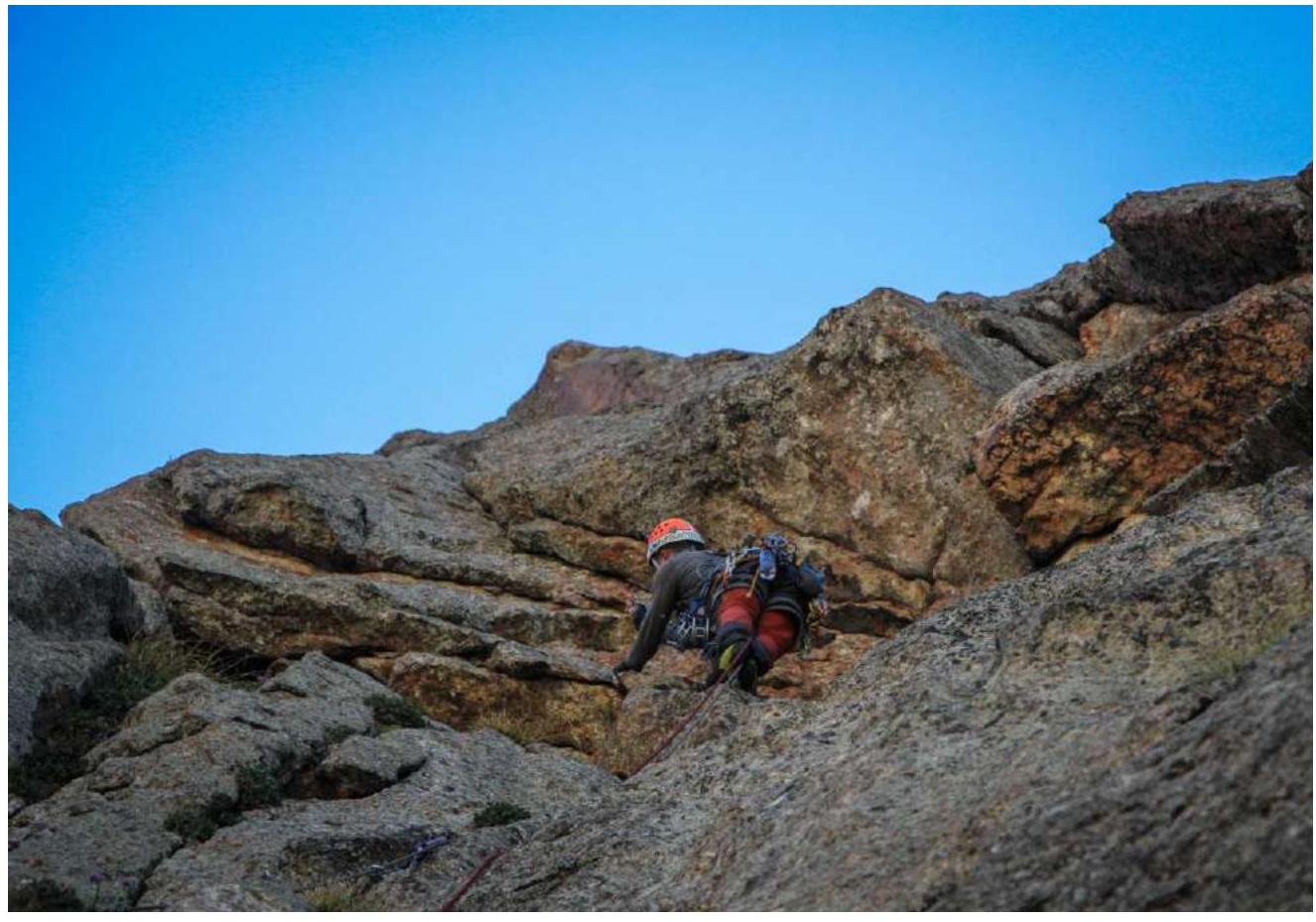
R20–R21–R22 180 m (20:40) III–IV cat. diff. along the ridge. 45–60°. The ridge of the buttress abuts against the slabs of the main ridge of Serebryannaya Wall. It's getting dark.
 Exit from the ridge of the buttress onto the slabs of the main ridge of Serebryannaya Wall.
R23 60 m Slabs III cat. diff. 45–55°. Twilight.
R24 80 m Slabs IV cat. diff. 55–70°. Exit onto the ridge. It's getting dark.
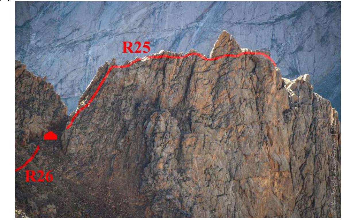
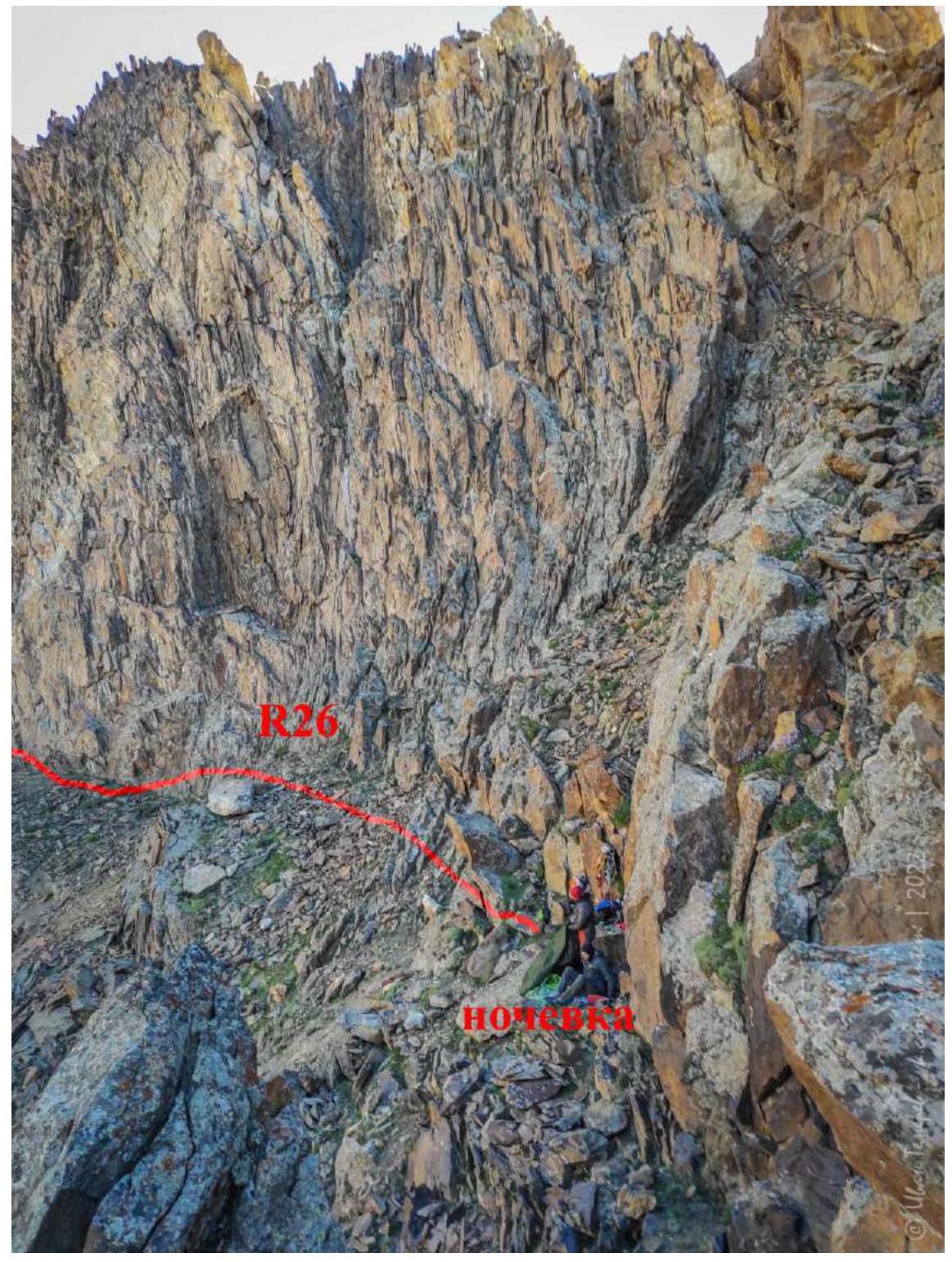
R25 100 m III cat. diff. in a связке simultaneously to the failure. In the dark, it's not very convenient. Against the background of fatigue, you need to be extremely careful, because there is something to break and somewhere to fall. After the failure, on foot. 15 m from the failure on the ridge, there is a small site for 3–4 people without a tent. At 23:00, laid out sleeping bags under themselves and slept until 8:00. Took 1.5 l of water and a jet for emergency. Drank tea in the evening and in the morning.
Overnight site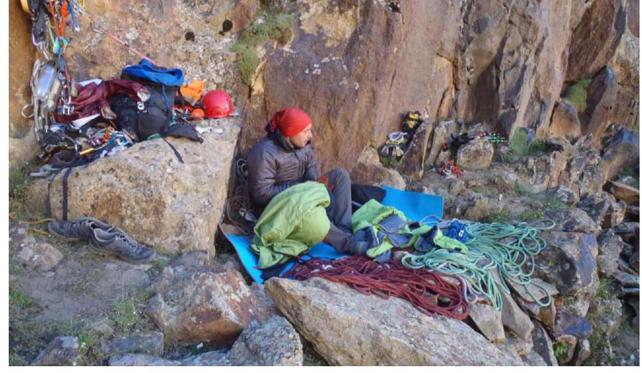
Overnight site
R26 400 m I–II cat. diff., 20–30–60° slope. Simultaneous movement without a rope, destroyed slopes and ridges. Several false summits.
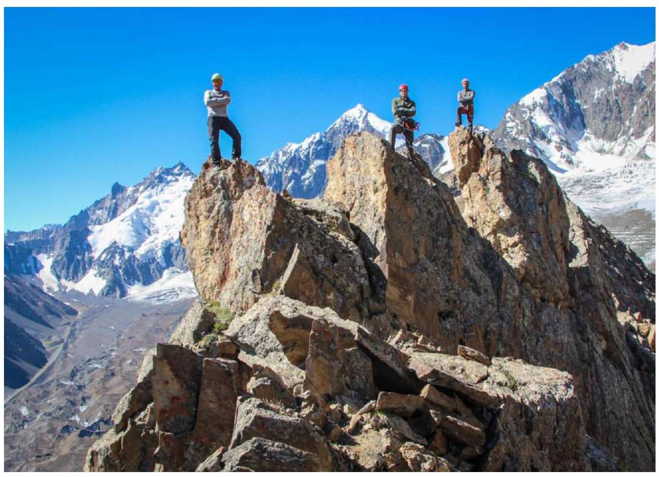
At 10:00 July 20, 2022, were at the summit. Left a note, took photos, observed the surroundings — the weather is ringing, as on the 19th.
R26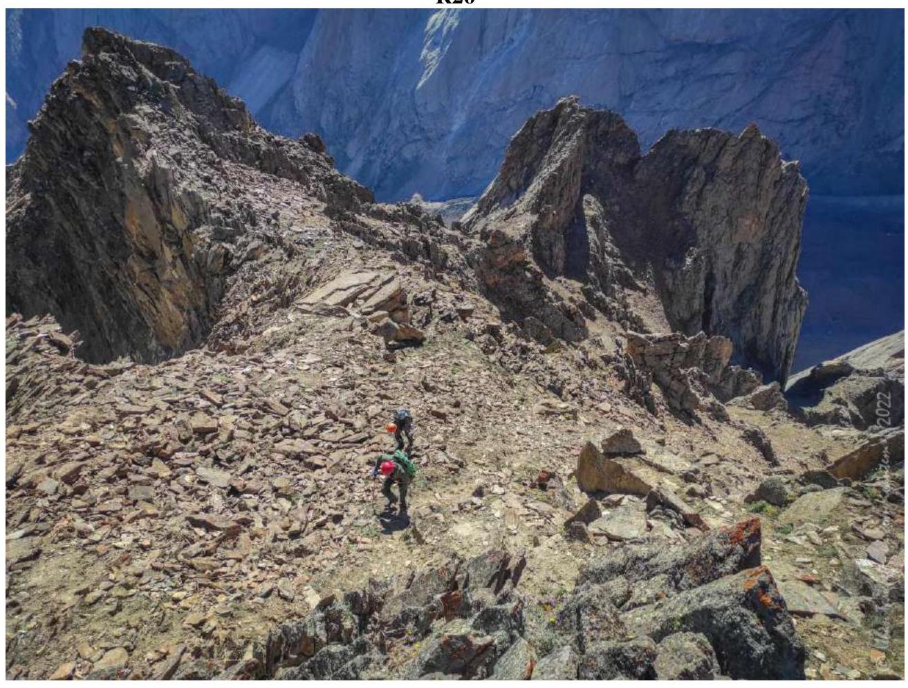
Near the summit tour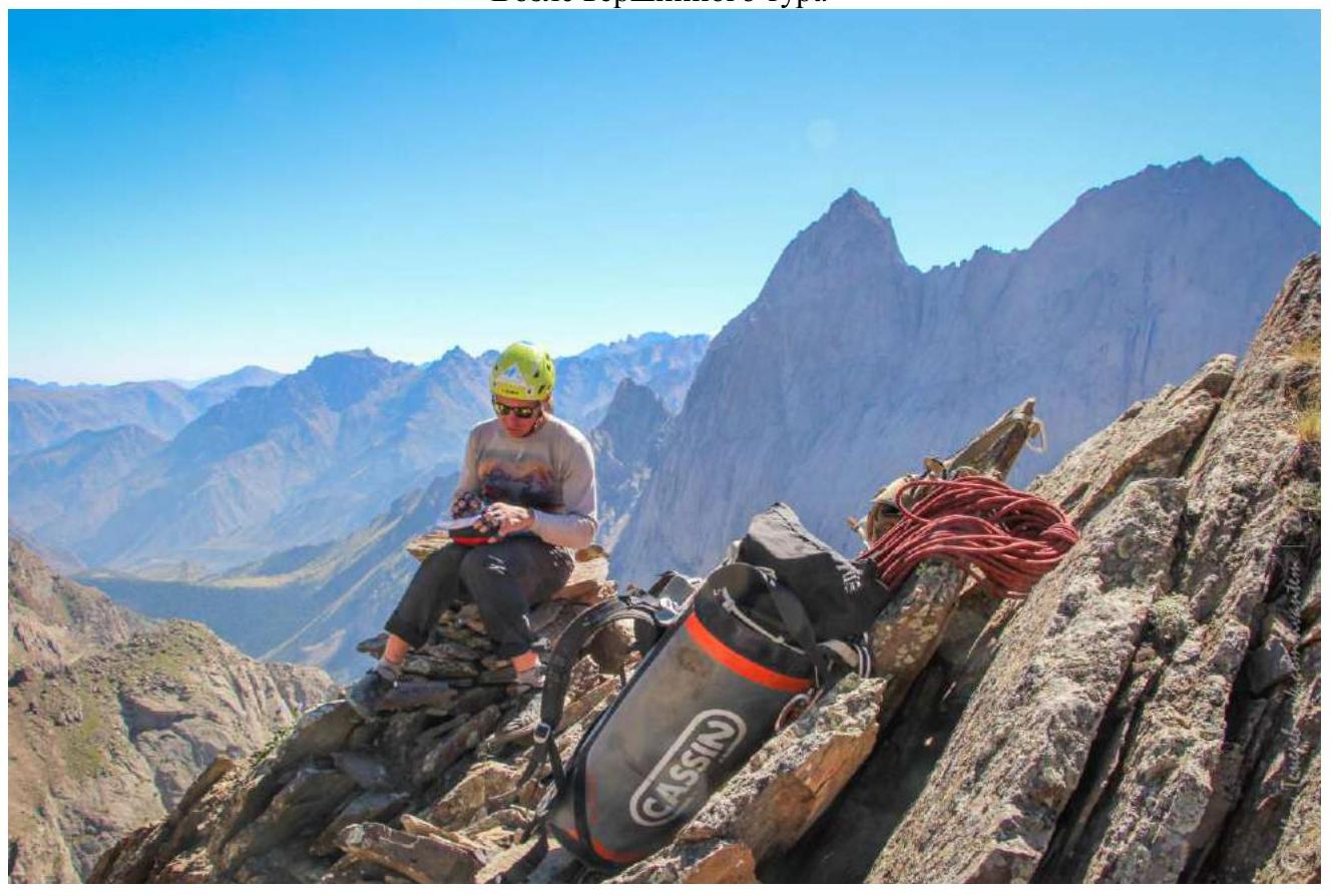
3.2 Photo of the team on the summit
3.3.
3.3.1 Assessment of the route's safety.
The route is safe. There is no snow on top, melting and rockfall are absent. In the lower third, there are destroyed sections of rock, you need to be careful on them. Overall, the route is monolithic and very easy to climb, with an on-sight level of 6c–7a (fr).
3.3.2. Cellular communication on the route is absent, as in the entire valley. With the base camp in Kar-Su — direct visibility, radio communication — excellent.
Recommendations for subsequent ascenders.
3.3.4. Overnight in the grotto under the route. To climb in one day from the base camp, you need to try very hard, and this way you'll have a chance to reach the ridge.
3.3.5. Since there is no water on the route, you should take care of this issue. We worked according to the simultaneous scheme on the 19th, and so that the leader wouldn't "dry out," he carried 0.5 l of drink on his harness.
3.3.6. Descent via 1B on foot:
- From the summit tour straight down along a weakly expressed rocky ridge towards the small valley between peak Serebryannaya Wall and peak Sibiryakov (5010 m);
- Below, destroyed "koshi" — earthworks are visible;
- Descent is simultaneous I–II cat. diff., about 300–350 m;
- Exit onto a grassy slope, movement towards glacier Asan-USen along the trail.
At 13:20, we arrived under the wall at the overnight site before the ascent.
3.3.7. Conclusion on the preliminary assessment of the route compared to classified routes of the same category of difficulty available in the experience of the team members. From the routes climbed by Ivan Temerev, our line on Serebryannaya Wall is comparable in labor costs and complexity of sections with:
- Bodkhona NW buttress (Gulnev) 5B, rock
- Erydag along the left cantilever of the W wall (Pleskachevsky — Polyakov) 5B, rock
- Asan along the buttress of the 3rd wall (Alperin) 5B, rock
- Korona 5th tower, 3rd rib (Ruzhevsky) 5B, rock
- Chanchaikhi left bastion of the NE wall (Martynov) 5B
- Chanchaikhi central bastion of the S wall (Popov) 6A
- Dalar NE wall bastion (Korabin) 6B, rock
From the routes climbed by Ivan Temerev, our line on Serebryannaya Wall is more difficult than these routes:
- Korona (5th) SW wall (Sadovsky) 5B, rock
- Dalar NE wall in the shoulder (Por
Comments
Sign in to leave a comment