
REPORT ON THE FIRST ASCENT TO SEREBRYANAYA STENA PEAK VIA THE ROUTE ALONG THE LARGE ANGLE OF THE NORTH-EASTERN WALL CATEGORY 4B, BY THE TEAM "SAMARA-KHABAROVSK" FROM JULY 25 TO JULY 25, 2022
1. Climbing Passport
| 1. General Information | ||
|---|---|---|
| 1.1 | Full Name, Sports Rank of the Leader | Klimov Sergey Alexandrovich, CMS |
| 1.2 | Full Name, Sports Rank of the Participants | Garmash Valery Vladimirovich, CMS |
| 1.3 | Full Name of the Coach | Erokhov Igor Yuryevich, Knyazeva Marina Alexandrovna |
| 1.4 | Organization | SROO "FASO" |
| 2. Characteristics of the Climbing Object | ||
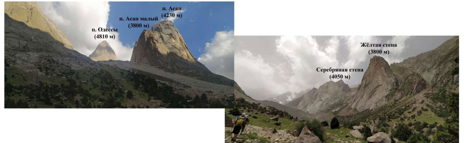
| 2.1 | Region | Karavshin |
| 2.2 | Valley | Karavshin valley (Kara-Su river valley) |
| 2.3 | Number of the Section According to the Classification Table of 2013 | 5. GISSAR-ALAY 5.4.3. Karavshin valley |
| 2.4 | Name and Height of the Peak | Serebryanaya Stena, 4050 m |
| 3. Characteristics of the Route | ||
| 3.1 | Name of the Route | Along the large angle of the NE wall |
| 3.2 | Proposed Category of Difficulty | 4B |
| 3.3 | Degree of Route Exploration | First Ascent |
| 3.4 | Nature of the Route Terrain | Rocky |
| 3.5 | Height Difference of the Route | 870 m |
| 3.6 | Length of the Route (in meters) | 1450 m |
| 3.7 | Technical Elements of the Route | I cat. diff. rocks — 250 m, II cat. diff. rocks — 250 m, III cat. diff. rocks — 125 m, IV cat. diff. rocks — 285 m, V cat. diff. rocks — 400 m |
| 3.8 | Descent from the Summit | Along scree slopes to the west |
| 3.9 | Additional Characteristics of the Route | Water is found in the inner corners in the lower part of the route |
| 4. Characteristics of the Team's Actions | ||
| 4.1 | Time of Movement (in hours from camp to camp) | 15 h 30 min, 1 day |
| 4.2 | Overnights | - |
| 4.3 | Exit to the Route from the Base Camp | 5:30, July 25, 2022 |
| 4.4 | Start of Work on the Route | 7:30, July 25, 2022 |
| 4.5 | Reach the Summit | 18:30, July 25, 2022 |
| 4.6 | Return to the Base Camp | 21:00, July 25, 2022 |
| 5. Person Responsible for the Report | ||
| 5.1 | Full Name, e-mail | Klimov Sergey Alexandrovich, Klimov_SA95@mail.ru |
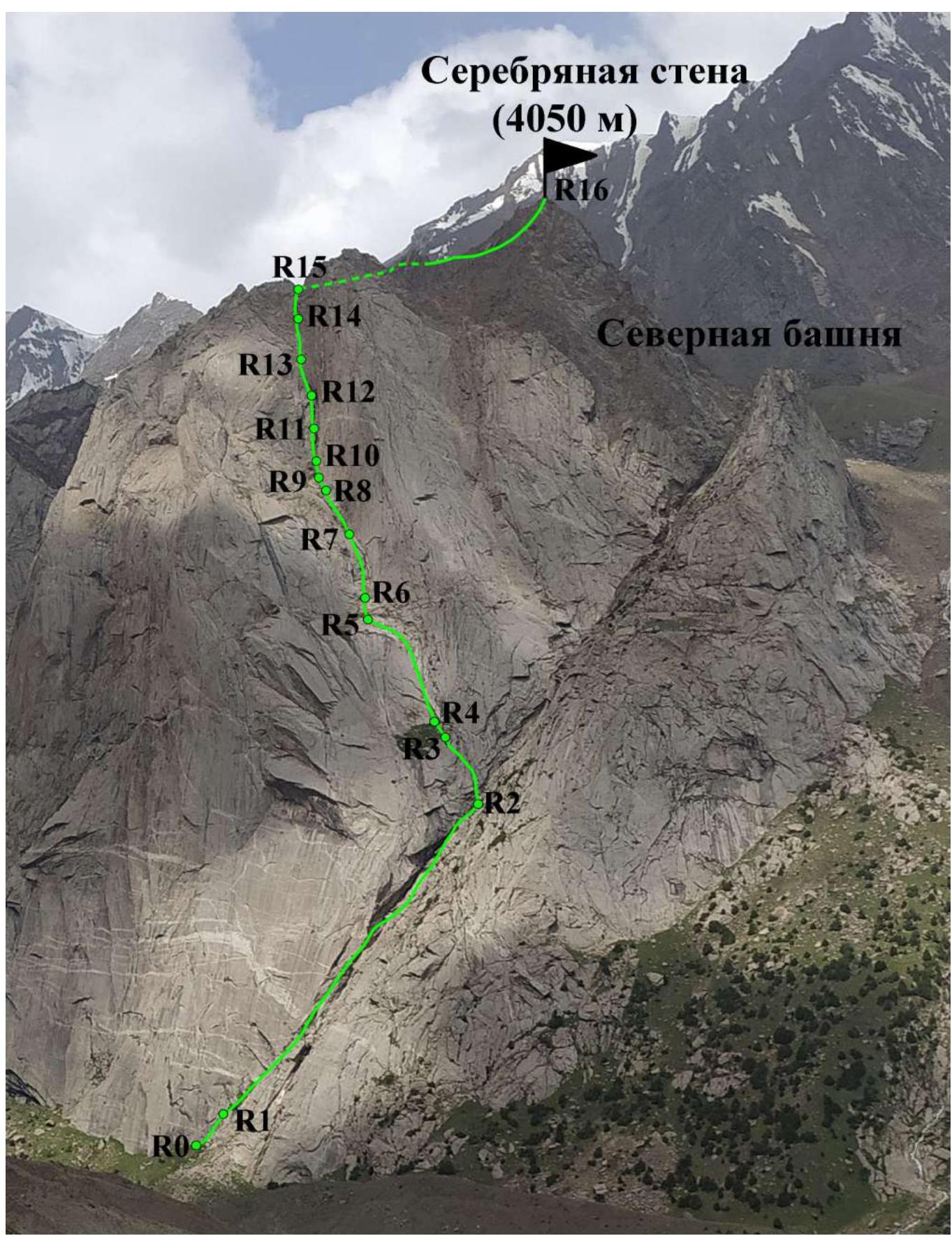
2. Map-Scheme of the Region

3. Panorama of the Region
4. General Photo of the Summit
- Serebryanaya Stena (S) via the E edge, 3B (A. Zhigalov, 2014)
- Serebryanaya Stena via the chimneys of the SE wall, 5A (I. Temerev, 2011)
- Team's Route
- Descent Path

5. Technical Photograph of the Route
6. Scheme of the Route in UIAA Symbols
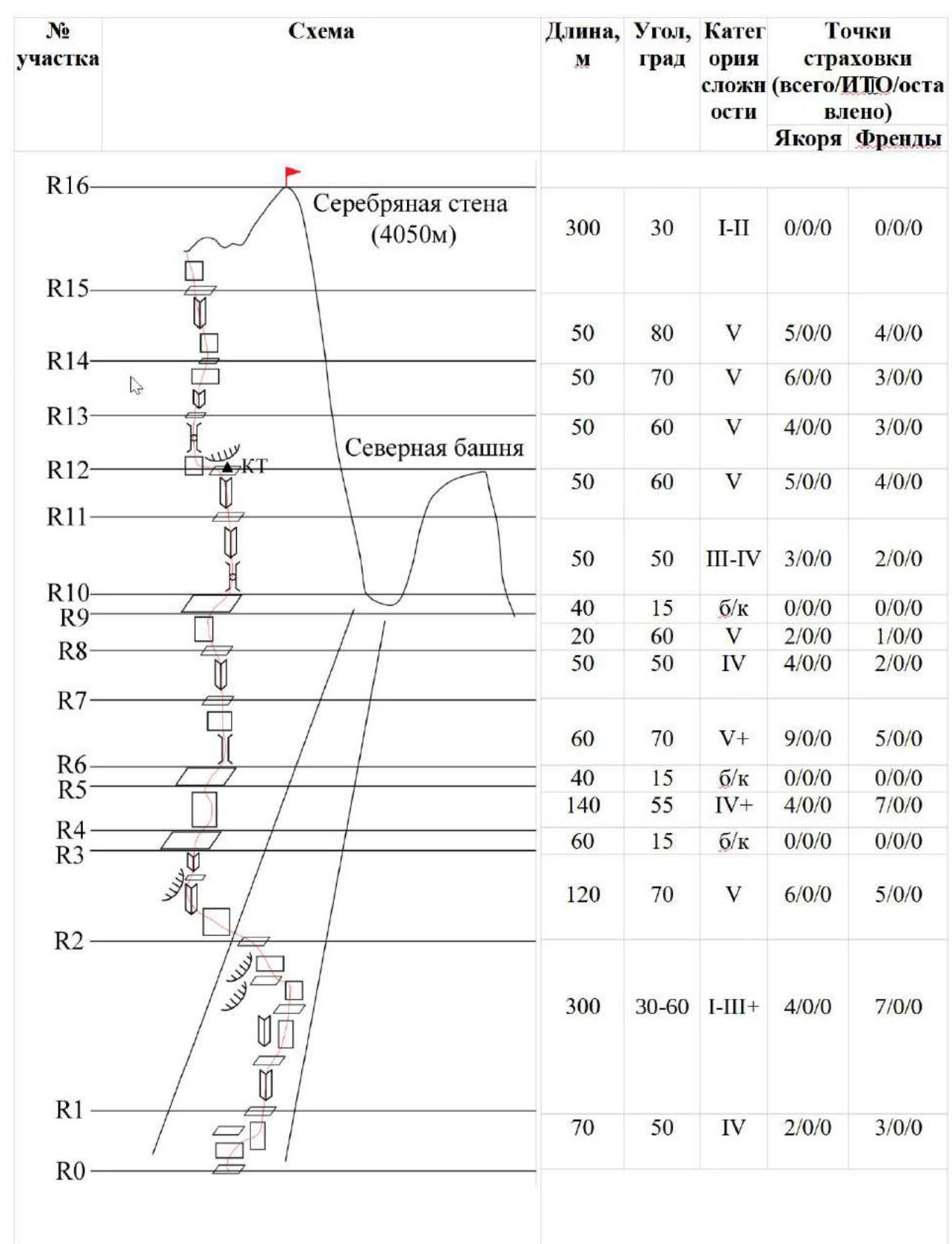
| Section # | Scheme | Length, m | Angle, ° | Cat. Diff. | Belay Points (total/ITO/left) | Anchors, Friends |
|---|---|---|---|---|---|---|
| R16 | (graphical image) | 300 | 30 | I–II | 0/0/0 | 0/0/0 |
| R15 | (graphical image) | 50 | 80 | V | 5/0/0 | 4/0/0 |
| R14 | (graphical image) | 50 | 70 | V | 6/0/0 | 3/0/0 |
| R13 | (graphical image) | 50 | 60 | V | 4/0/0 | 3/0/0 |
| R12 | (graphical image) | 50 | 60 | V | 5/0/0 | 4/0/0 |
| R11 | (graphical image) | 50 | 50 | III–IV | 3/0/0 | 2/0/0 |
| R10 | (graphical image) | 40 | 15 | n/c | 0/0/0 | 0/0/0 |
| R9 | (graphical image) | 20 | 60 | V | 2/0/0 | 1/0/0 |
| R8 | (graphical image) | 50 | 50 | IV | 4/0/0 | 2/0/0 |
| R7 | (graphical image) | 60 | 70 | V+ | 9/0/0 | 5/0/0 |
| R6 | (graphical image) | 40 | 15 | n/c | 0/0/0 | 0/0/0 |
| R5 | (graphical image) | 140 | 55 | IV+ | 4/0/0 | 7/0/0 |
| R4 | (graphical image) | 60 | 15 | n/c | 0/0/0 | 0/0/0 |
| R3 | (graphical image) | 120 | 70 | V | 6/0/0 | 5/0/0 |
| R2 | (graphical image) | 300 | 30–60 | I–III+ | 4/0/0 | 7/0/0 |
| R1 | (graphical image) | 70 | 50 | IV | 2/0/0 | 3/0/0 |
| R0 | (graphical image) |
7. Characteristics of the Route and Description by Sections
The route can be divided into two main parts.
The upper part of the route passes through a huge internal angle, which is clearly visible from almost any point in the valley, including the base camp.
In the lower part, the angle "lies down"; there are three large grassy ledges along the way — characteristic landmarks. The higher you go, the steeper the terrain becomes. This part of the route features a lot of interesting climbing through chimneys and internal corners, with rocks sometimes smoothed by water. During bad weather, water will flow through the chimneys and corners.
The lower part of the route passes through a large angle-couloir located between the main wall and the separate North Tower massif. Climbing in this part of the route is mostly simple, but the angle often contains wet and crumbling sections.
The belay on the route is entirely natural, including stations; the team did not leave any equipment behind except:
- a cordelette for organizing a control tour on station R12.
| Section # | Route Description | Photo # |
|---|---|---|
| Approach | From the base camp in the Kara-Su river valley, cross the river and move along its right side (upstream) along the trail towards Serebryanaya Stena. The landmark for the start of the route is the huge angle-couloir between the main Serebryanaya Stena massif and the separate North Tower. From the trail, approach the triangular wall at the base of the angle-couloir via grassy slopes. There is a cairn. | - |
| R0–R1 | From the ledge with the cairn, climb the wall to a sloping grassy ledge. Then move right to the wall and along its edge into the large internal angle-couloir. | №1 |
| R1–R2 | Climb simple and moderately difficult rocks upwards, sometimes through the angle-couloir, sometimes through rocks to the right, avoiding wet and crumbling sections. Pass a series of black cornices on the left | №2, 3, 4, 5 |
| R2–R3 | From the upper edge of the wedged slab, move to the left wall of the couloir. Climb it upwards and slightly right through an internal corner with an overhanging left part. Reach a huge grassy ledge at the base of the large NE wall angle. | №6 |
| R3–R4 | Walk along the ledge to the right edge of the next rock step. | №7 |
| R4–R5 | Climb the slabs in the right part of the rock step towards the second large green ledge. | №8, 9 |
| R5–R6 | Climb the ledge upwards and right to the base of the angle — a chimney. | - |
| R6–R7 | Key section. Climb the angle-chimney and its left wall to a flattening. Then careful friction climbing on slabs to a small ledge. Station. | №10 |
| R7–R8 | Climb simple rocks upwards towards the third large ledge. | №11 |
| R8–R9 | Climb a short wall to reach the large ledge. | №12 |
| R9–R10 | Climb the ledge upwards and right as far as possible. Approach the chimney with wedged blocks. | №13 |
| R10–R11 | Climb the chimney and then the internal corner. | №14 |
| R11–R12 | Continue climbing the internal corner, which eventually turns into a chimney again. Reach a niche. Control tour. | №15, 16 |
| R12–R13 | From the station, traverse left 3 m to the wall, bypassing the overhang, then climb the wall to enter a chimney with a block. It's easier to bypass the block from inside. Station on a ledge after the chimney. | №17 |
| R13–R14 | Climb the internal corner, bypass the cornice on the left, then move right towards a V-shaped gap in the ridge. Station on a small ledge. | №18 |
| R14–R15 | Through a small overhang, enter the internal corner and climb it to a ledge before the ridge gap. | №19 |
| R15–R16 | Through a short wall, cross to the other side of the ridge and climb simple rocks on its left side towards the summit. | №20, 21, 22 |
| Descent | From the summit, descend to the eastern side, bypass the summit tower, and reach its shoulder. From the shoulder, descend west through a series of scree couloirs into the cirque. Then, bypassing Serebryanaya Stena and its North Tower, reach the slope between Serebryanaya and Zhelтая Stena. From here, descend into the valley (there is a trail in the lower part of the slope) to the main trail. | №23 |
8. Characteristics of the Team's Actions
The team arrived in the region on July 5. They completed a warm-up ascent of Zhelтая Stena via the center of the E wall (V. Solonnikov's route, 4B) and an ascent of peak Odessa via the "mirror" of the 3rd wall (A. Rusyaev's route, 6B), which was the main goal of their trip.
Since they still had time before departure and the participants already had good acclimatization and were in good shape, they decided to undertake another first ascent. The choice fell on a beautiful internal corner that runs through almost the entire NE wall of Serebryanaya Stena and is clearly visible from the base camp.
On the day of the ascent, July 25, at 5:30, the team started from the base camp in the Kara-Su river valley. In addition to their equipment, they took:
- a tent,
- down jackets,
- a stove,
- some food,
- 5 liters of water, as they were unsure if they could complete the route in one day.
They approached the route at 7:00 and began work at 7:30. By 10:00, they had completed the lower part of the route and reached the large green ledge at the base of the large NE wall angle — R3. By 17:00, they had climbed the angle — the main part of the route — and reached the ridge. They were on the summit at 18:30. They began their descent at 18:45 and returned to the base camp by 21:00.
9. Photo Report from the Route
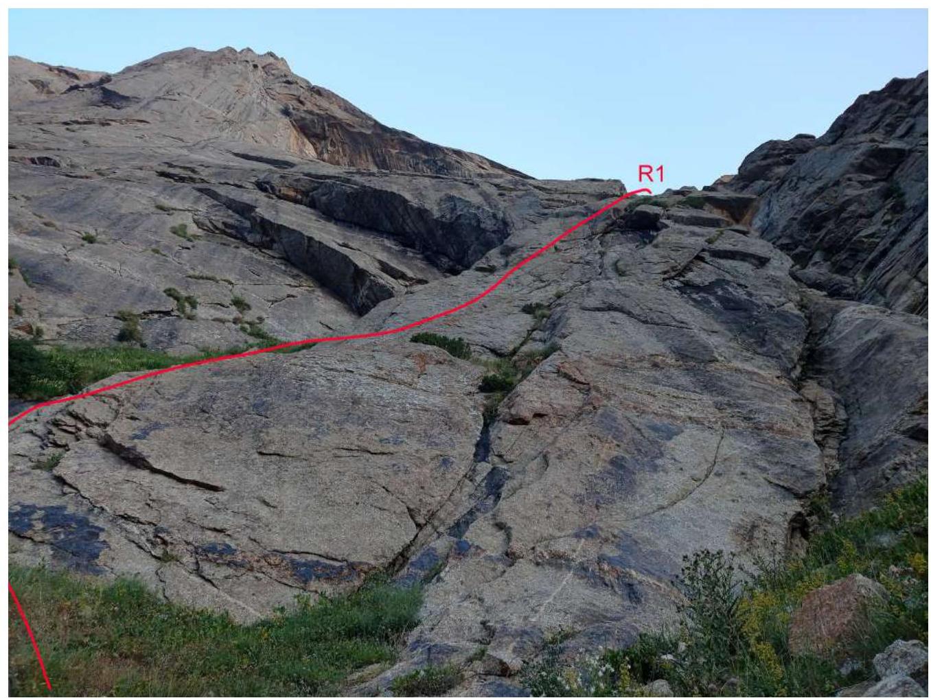
Photo №1 — Start of the Route
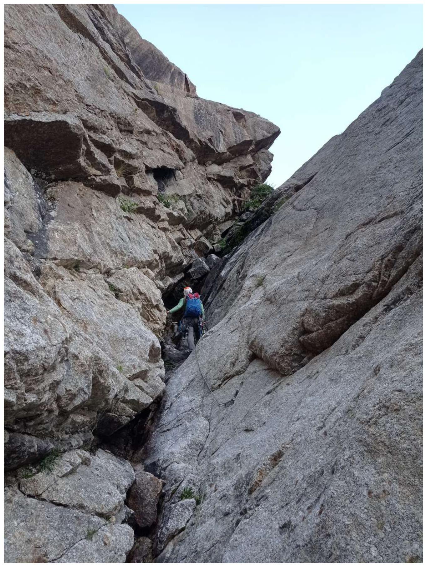
Photo №2 — On section R1–R2
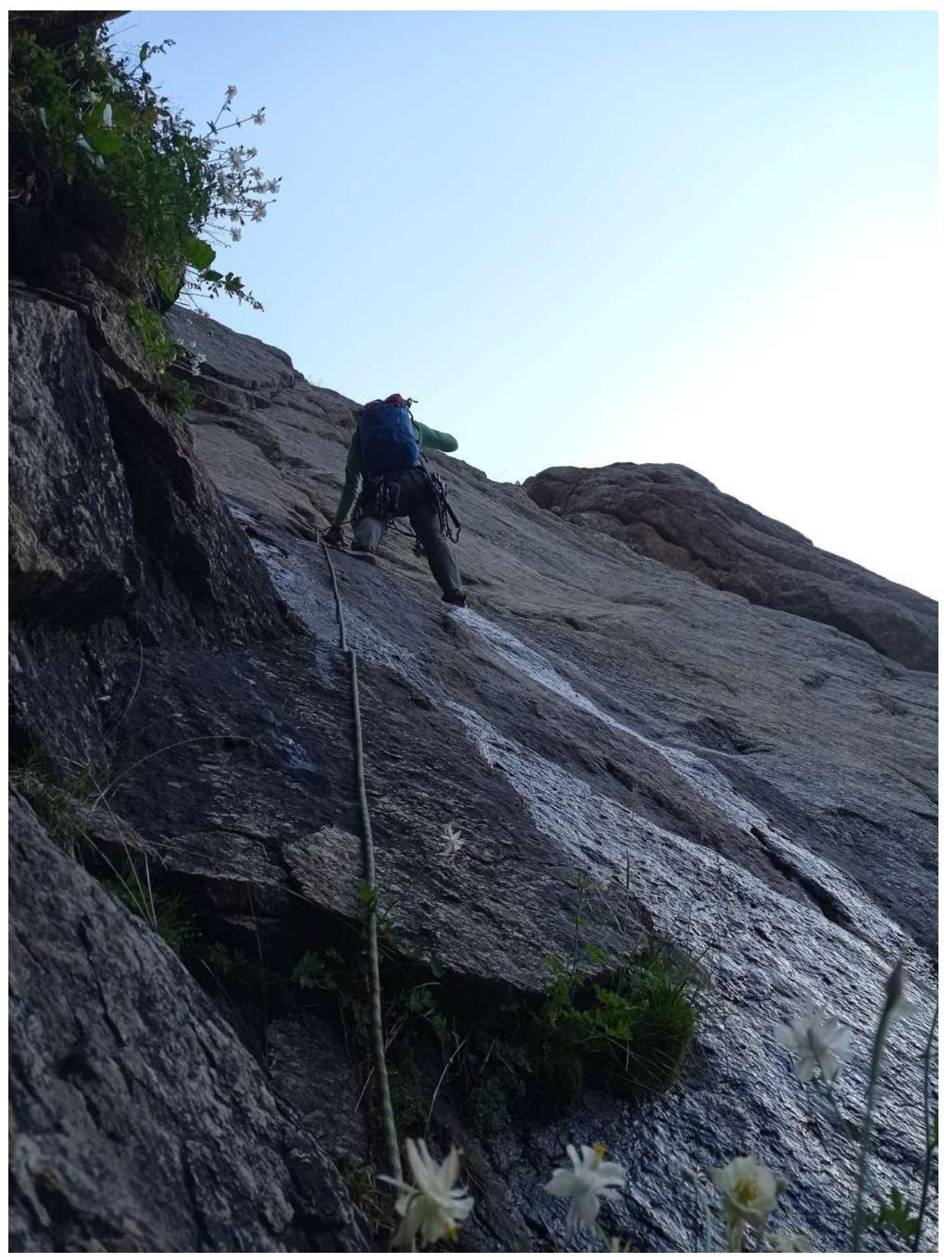
Photo №3 — On section R1–R2
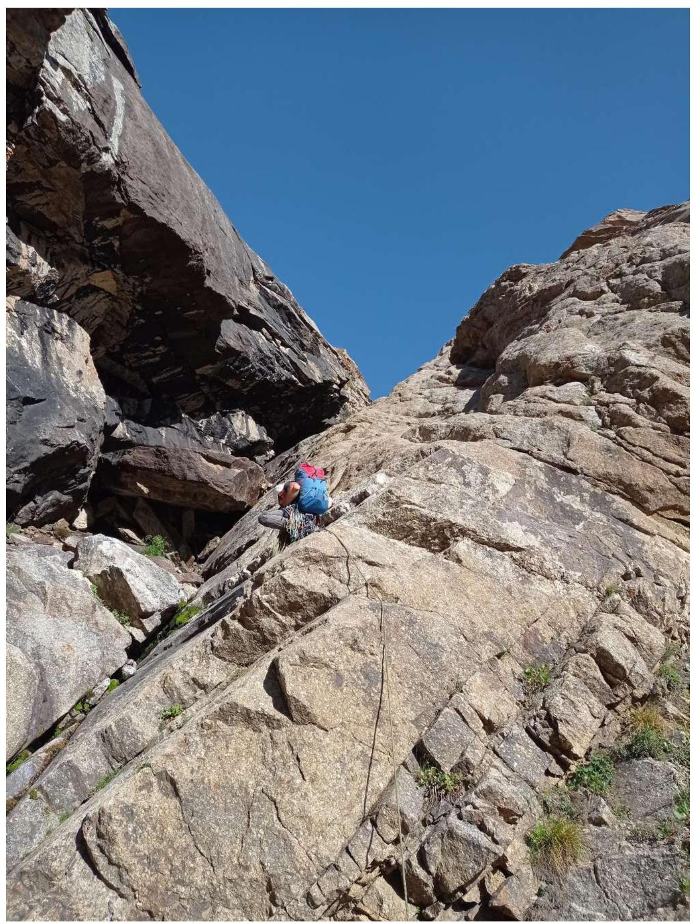
Photo №4 — On section R1–R2
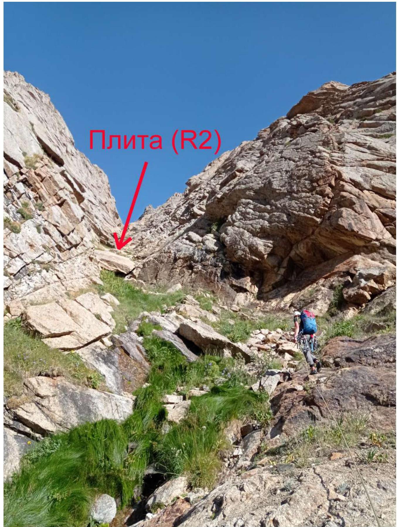
Photo №5 — End of section R1–R2
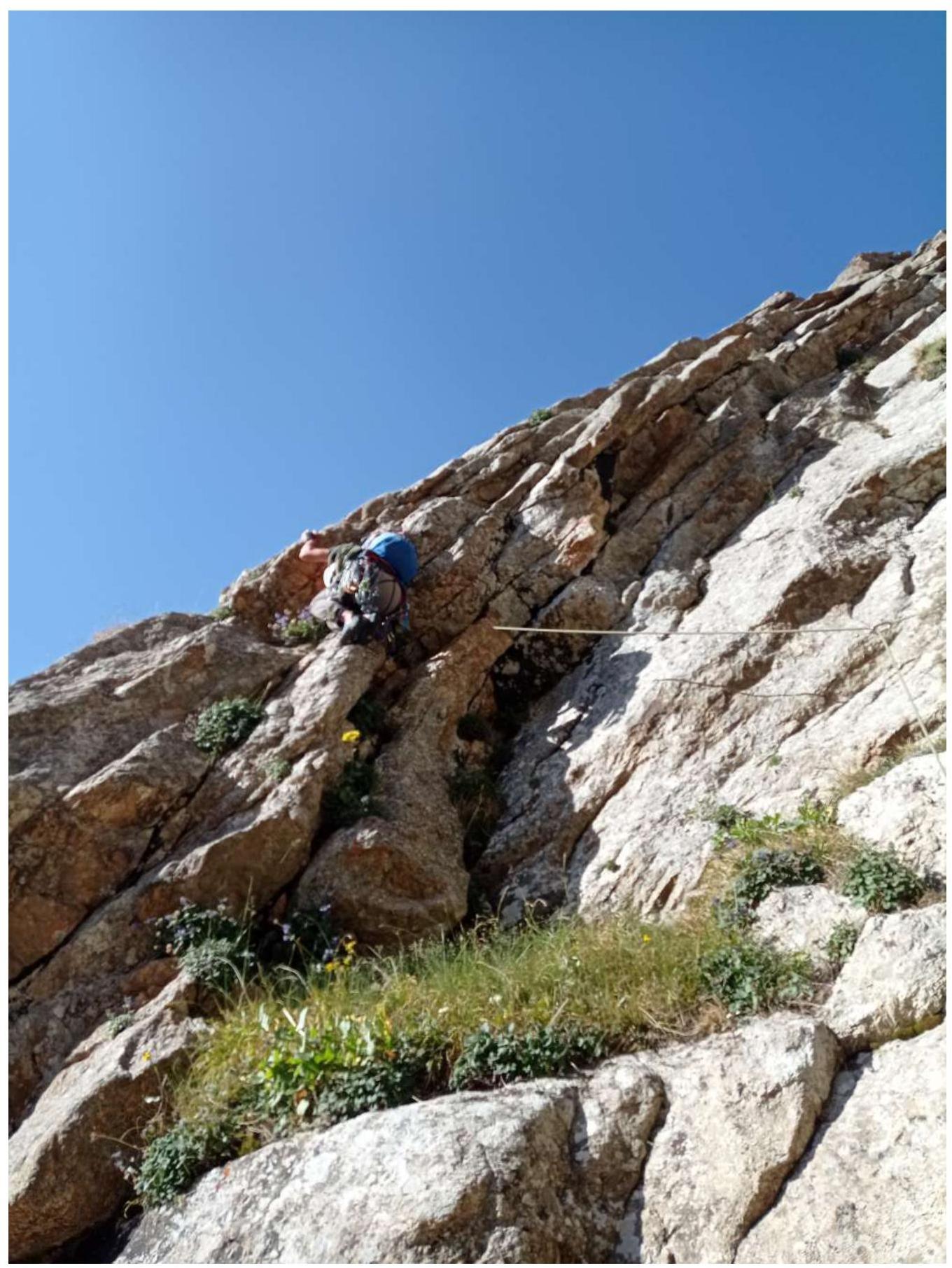
Photo №6 — Start of section R2–R3

Photo №7 — Sections R3–R4 and R4–R5
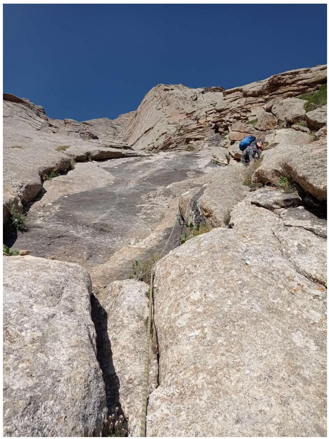
Photo №8 — On section R4–R5
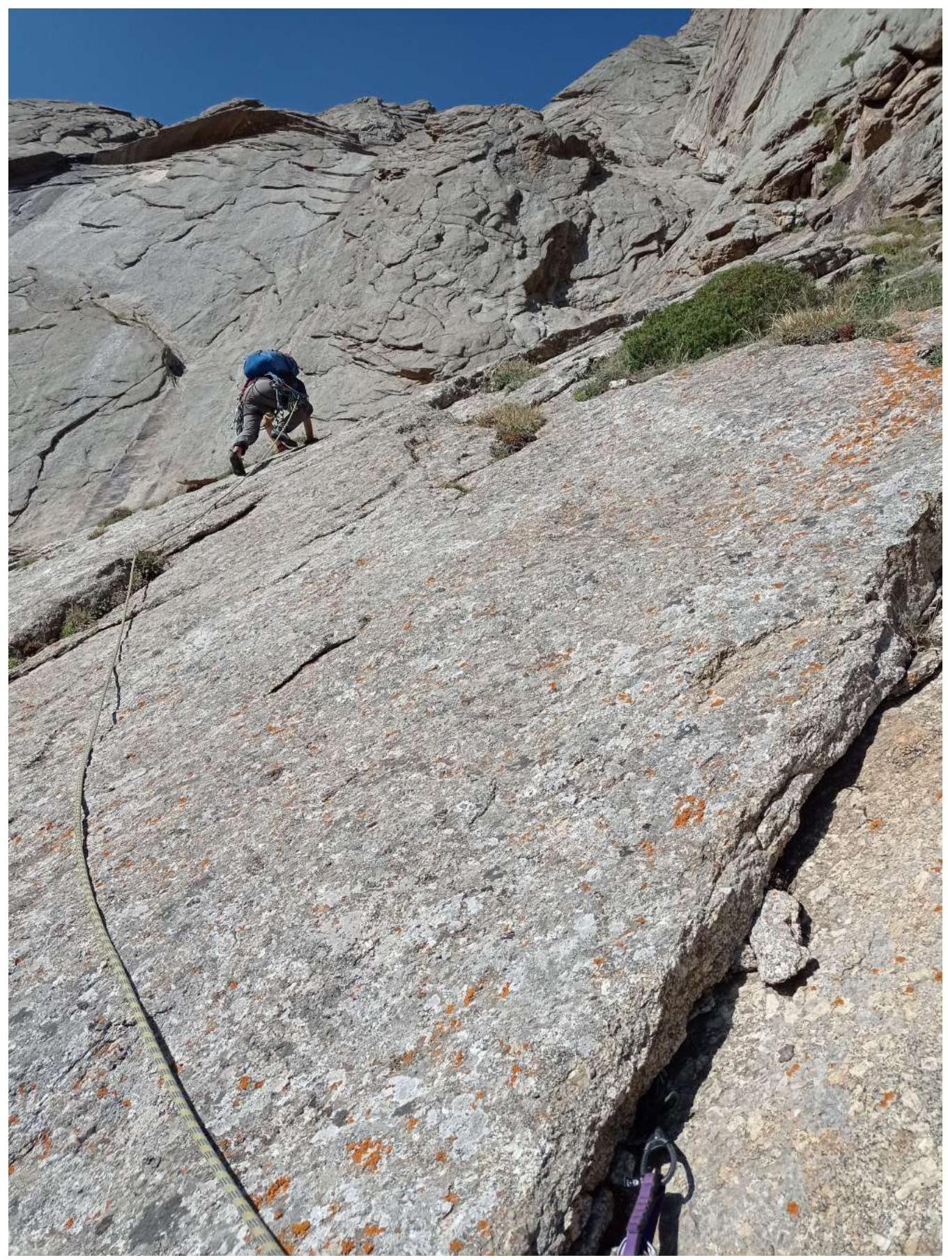
Photo №9 — Upper part of section R4–R5
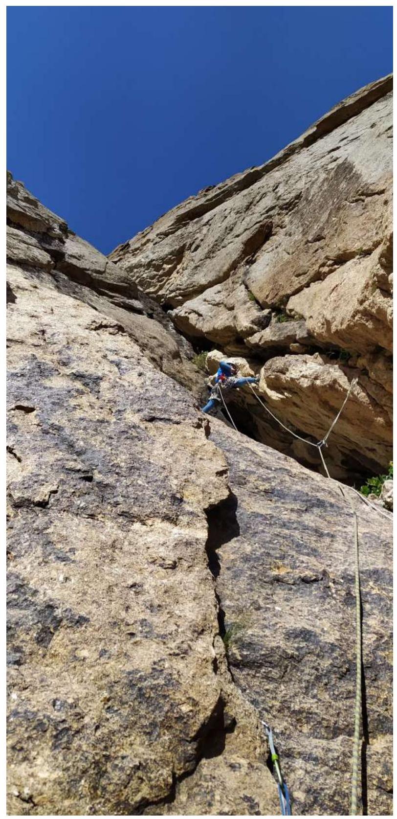
Photo №10 — Section R6–R7. Key section.
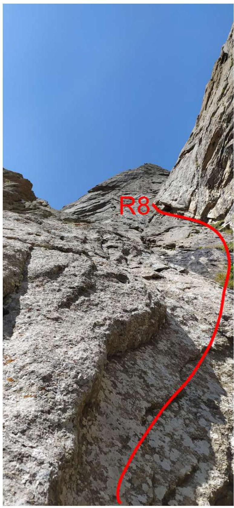
Photo №11 — Section R7–R8
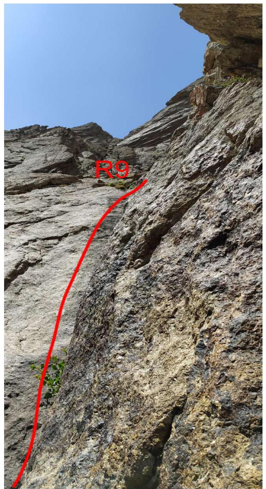
Photo №12 — Section R8–R9
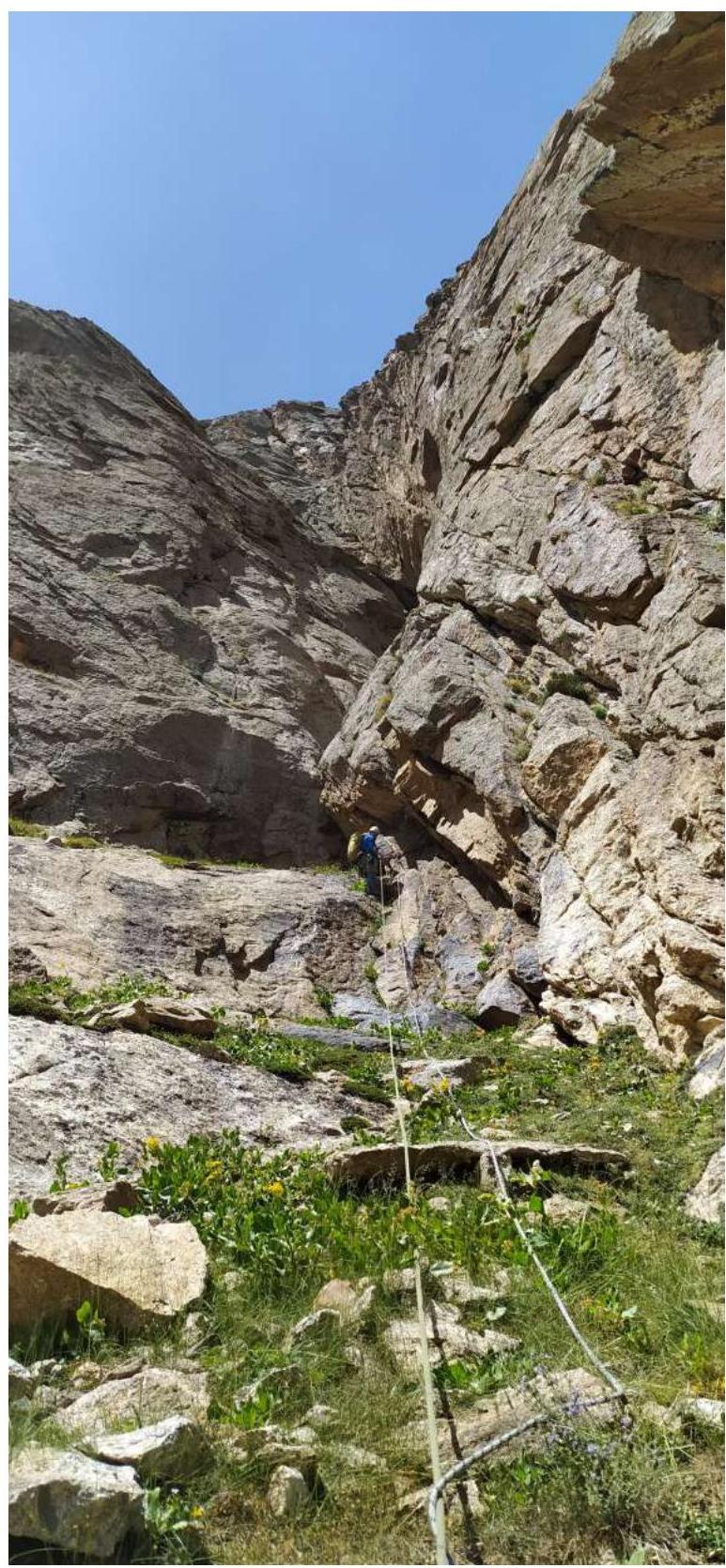
Photo №13 — On section R9–R10
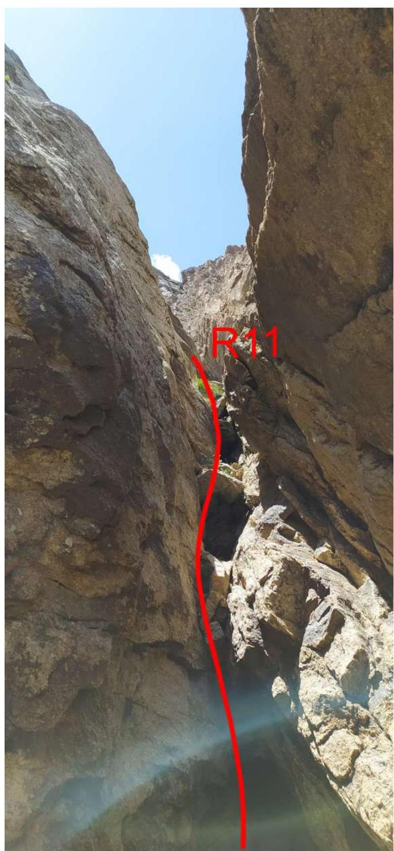
Photo №14 — Section R10–R11
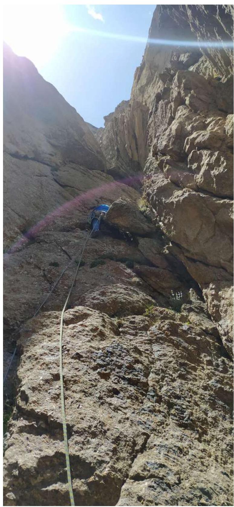
Photo №15 — On section R11–R12
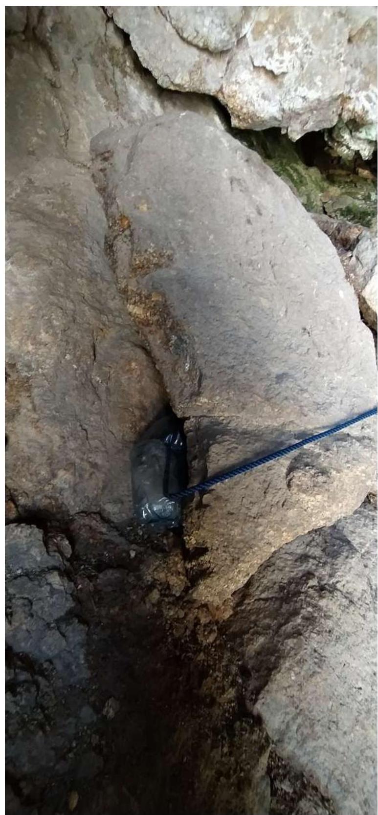
Photo №16 — Control tour on station R12
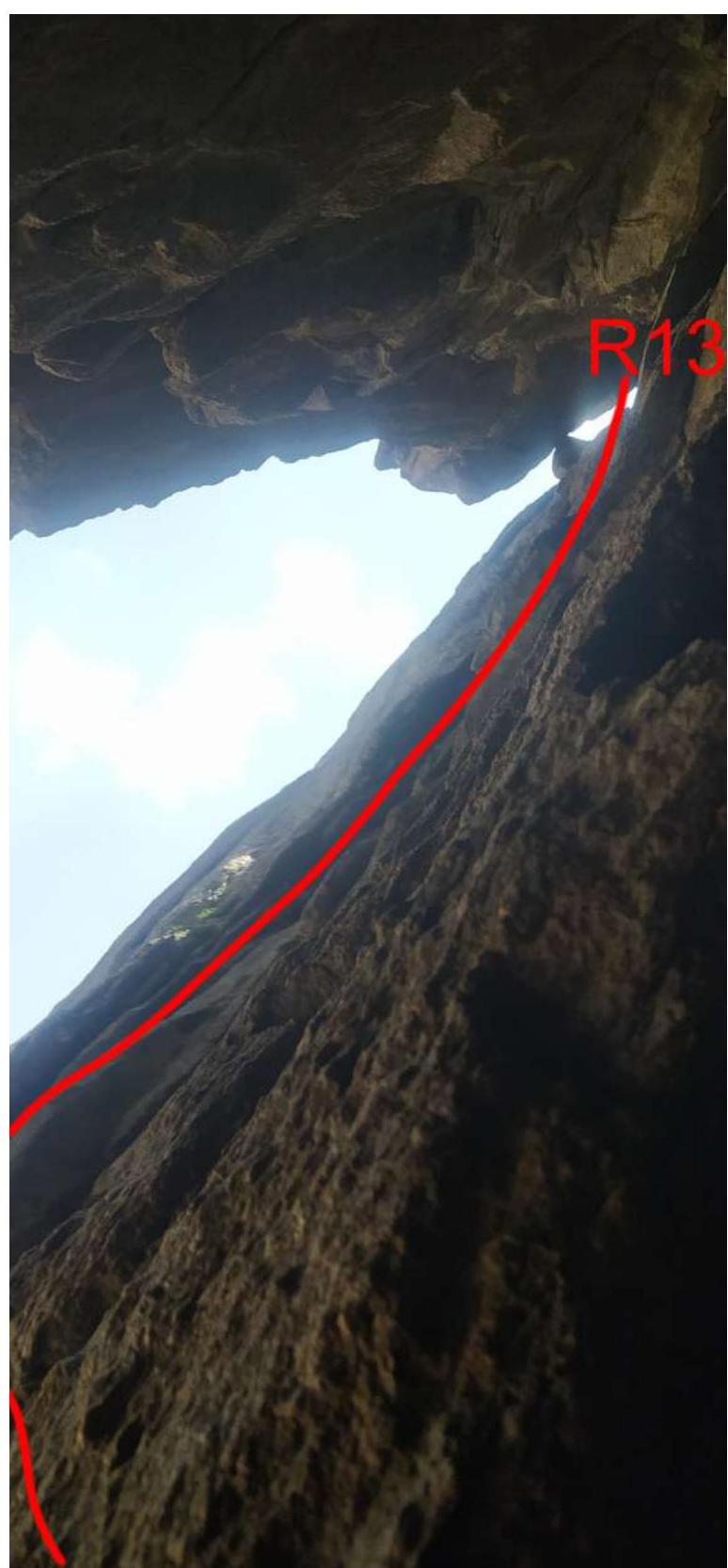
Photo №17 — Section R12–R13
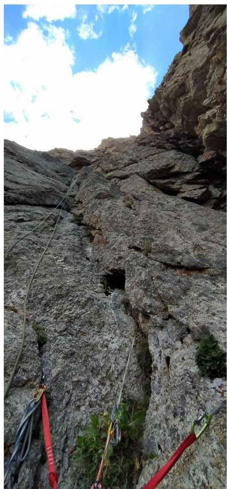
Photo №18 — On section R13–R14
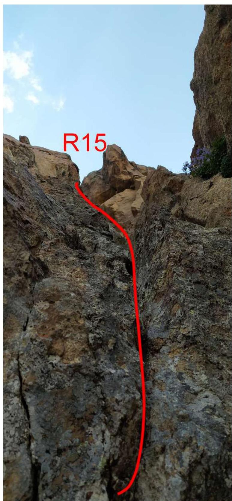
Photo №19 — Section R14–R15
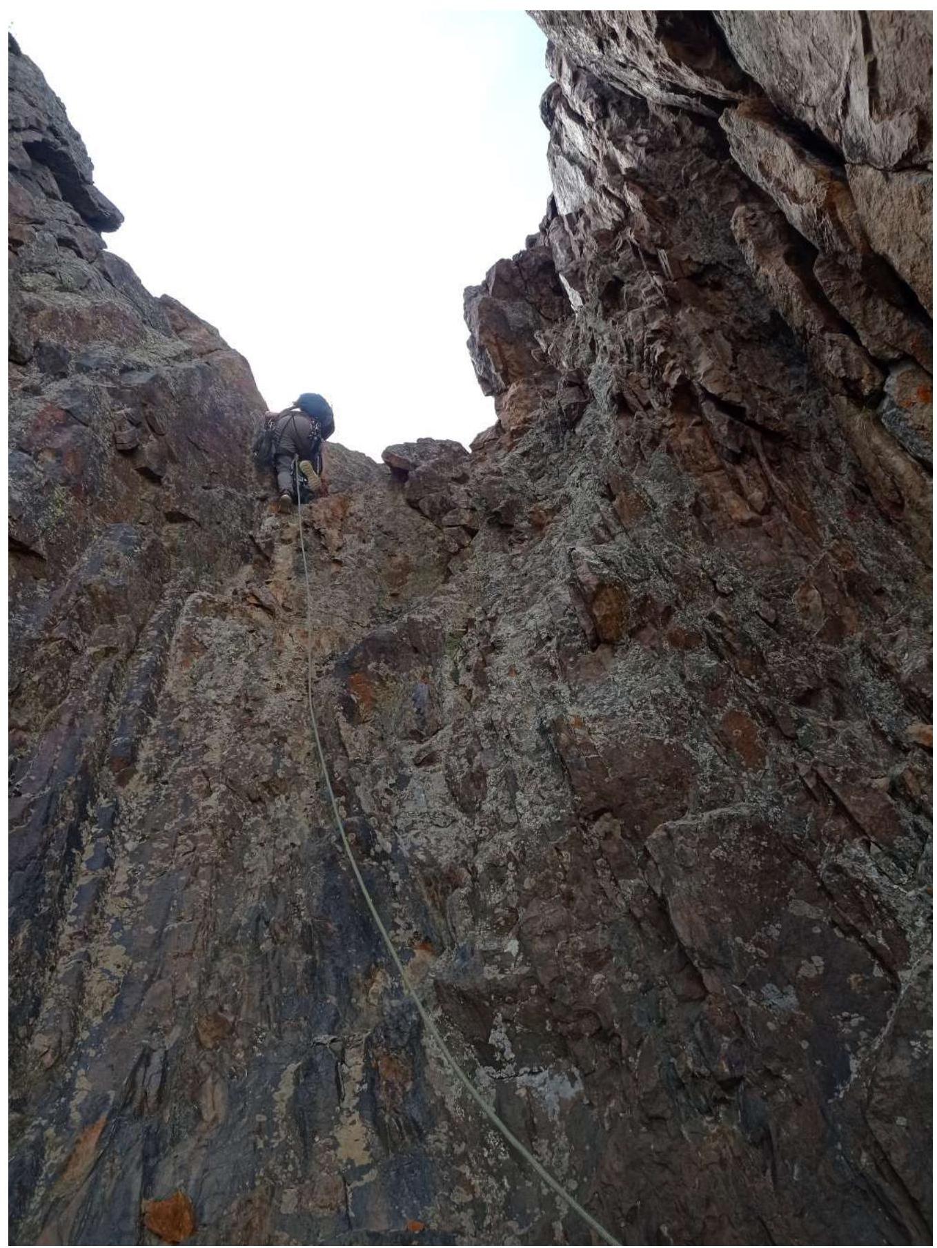
Photo №20 — Wall at the start of section R15–R16
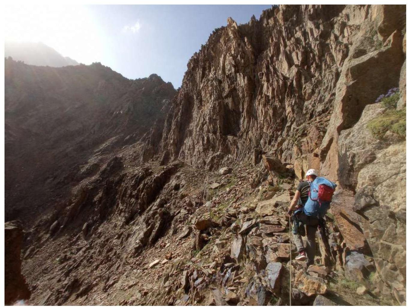
Photo №21 — Ridge, section R15–R16
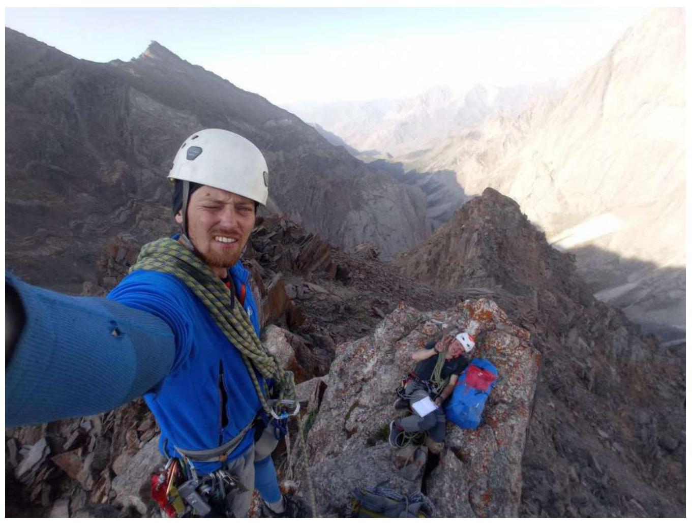
Photo №22 — Team on the Summit
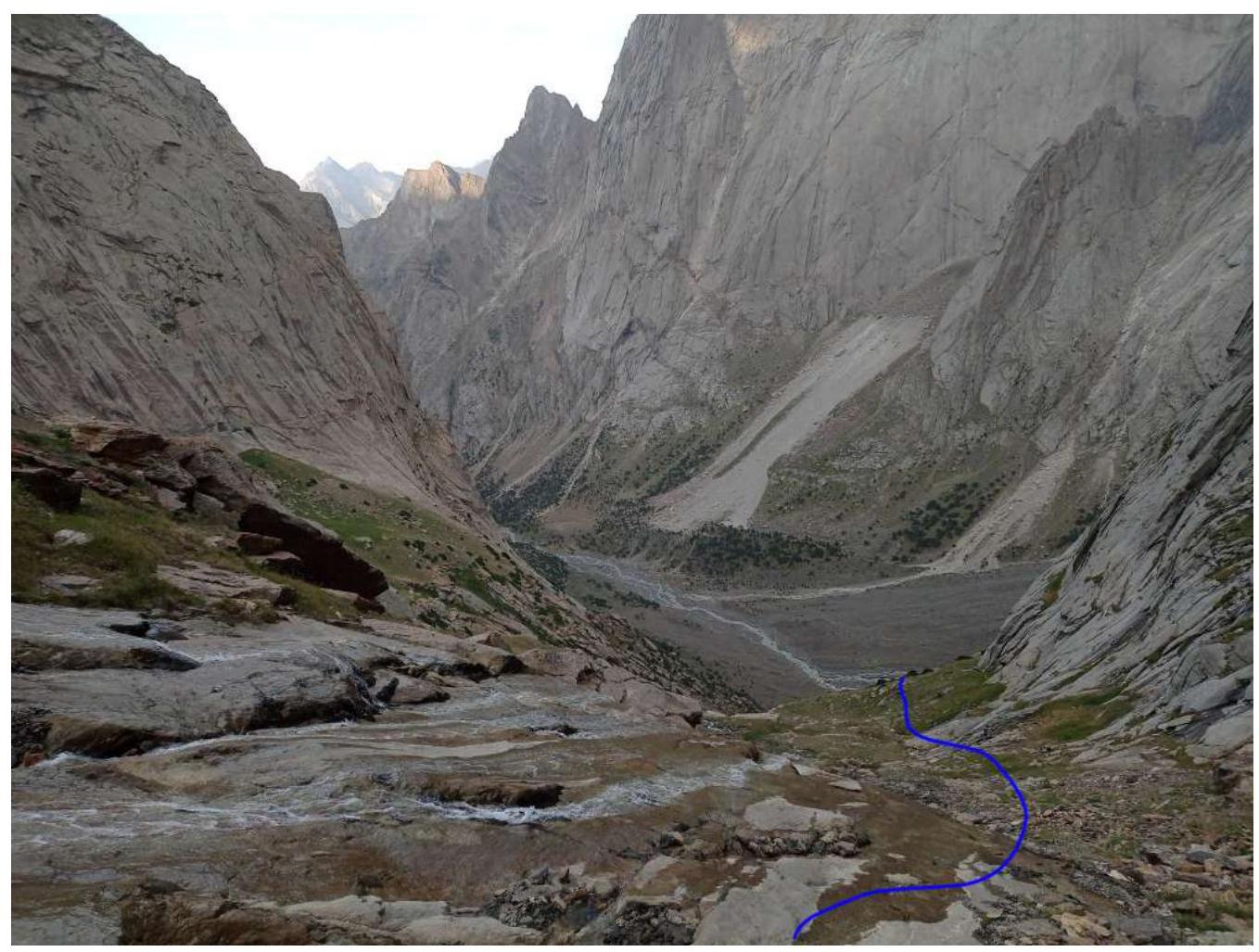
Photo №23 — On Descent
Comments
Sign in to leave a comment