
Report
On the ascent to the summit of Asan via the 5B category route by the team
- Vasily Terekhin
- Oleg Khvostenko (Krasnoyarsk Krai)
July 5–6, 2019
Ascent Passport
| 1. General Information | ||
|---|---|---|
| 1.1 | Full name, sports rank of the leader | Terekhin Vasily Andreevich, MS |
| 1.2 | Full name, sports rank of the participants | Khvostenko Oleg Valeryevich, MS |
| 1.3 | Full name of the coach | Zakharov Nikolai Nikolaevich, HCT; Balezin Valery Viktorovich |
| 1.4 | Organization | Ministry of Sports of Krasnoyarsk Krai |
| 2. Characteristics of the Ascent Object | ||
| 2.1 | Region | Gissar-Alay |
| 2.2 | Valley | Karavshin |
| 2.3 | Section number according to the 2013 classification table | 5.4.3 |
| 2.4 | Name and height of the summit | Asan, 4230 m |
| 3. Route Characteristics | ||
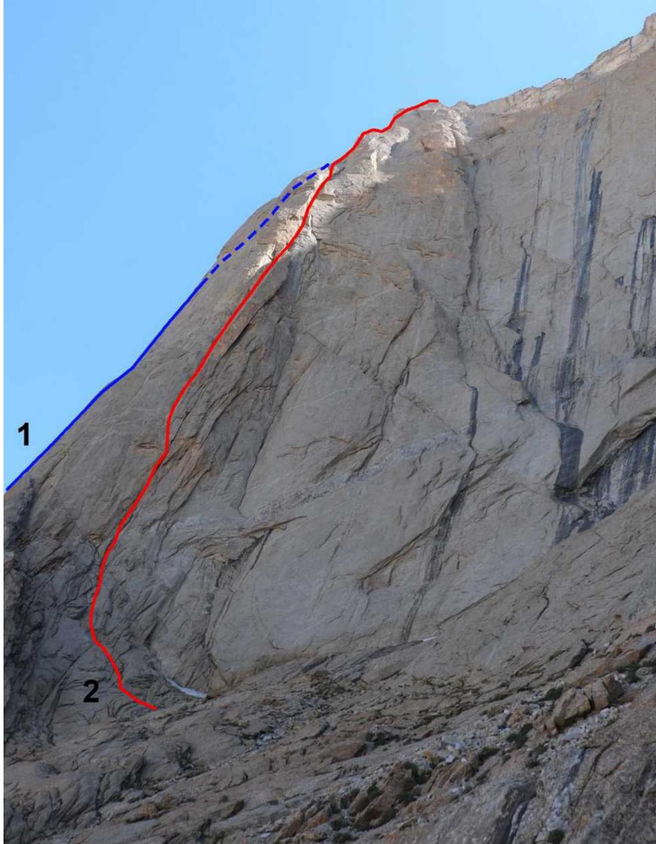
| 3.1 | Route name | Along the left part of the SW wall |
| 3.2 | Category of difficulty | 5B |
| 3.3 | Degree of route exploration | – |
| 3.4 | Nature of the route terrain | Rocky |
| 3.5 | Height difference of the route | 870 m |
| 3.6 | Route length | 1000 m |
| 3.7 | Technical elements of the route (total length of sections of various difficulty categories with indication of the terrain type (ice-snow, rocky)) | 2, 3 cat. rocky – 200 m. 4 cat. rocky – 60 m. 5 cat. diff. rocky – 140 m. 6 cat. diff. rocky – 390 m. Free climbing level up to 7a on the French scale |
| 3.8 | Average steepness of the route, (°) | 65° |
| 3.9 | Average steepness of the main part of the route, (°) | 73° |
| 3.10 | Descent from the summit | Via the 4B route from the east |
| 3.11 | Additional route characteristics | The upper part coincides with Alperin's 5B route on the 3rd wall |
| 4. Characteristics of the Team's Actions | ||
| 4.1 | Travel time | 17 h |
| 4.2 | Overnights | – |
| 4.3 | Route preparation time | – |
| 4.4 | Start of the route | 7:00 July 5, 2019 |
| 4.5 | Summit ascent | 13:00 July 6, 2019 |
| 4.6 | Return to the base camp | 19:00 July 6, 2019 |
| 6. Person Responsible for the Report | ||
| 6.1 | Full name, e-mail | Khvostenko O. V. 79039240941@yandex.ru |
- On the 3rd wall, Alperin, 1987, 5B
- Along the left part of the SW wall, Terekhin–Khvostenko, 2019, 5B orig.
Route profile

Description of the Area
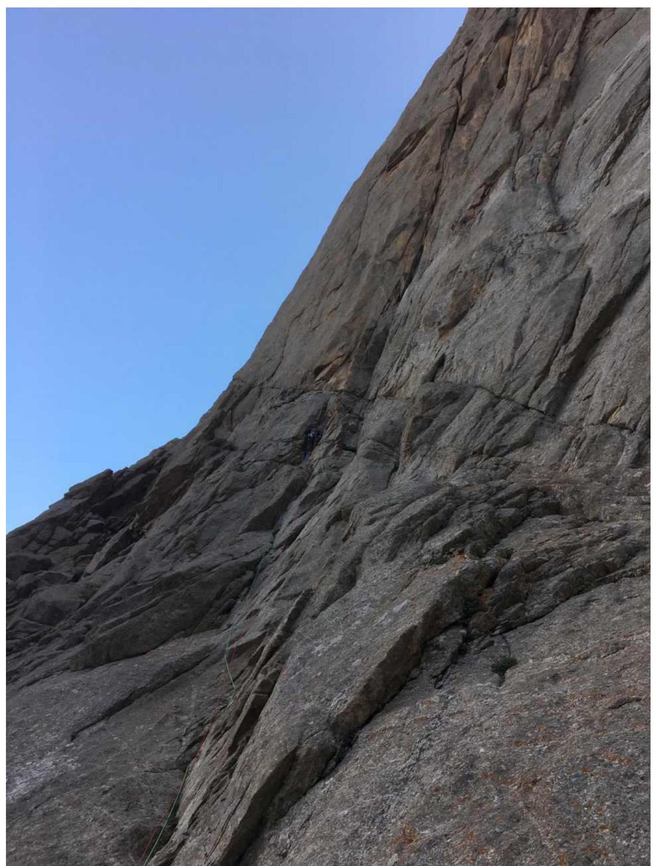
The Karavshin area is well described. Peak Asan is one of the most visited summits in the area. The NW wall of Asan abounds with 6A category routes. Undoubtedly, the most popular route on Asan is Alperin's 5B category route. This route is located on the right part of the wall and follows the counterfort separating the NW wall of Asan from the SW wall, which connects peaks Asan and Usen. The route taken by our team is located:
- On the left part of the SW wall
- In close proximity to Alperin's counterfort
- In the upper part (after the key ropes), it converges with Alperin's route and leads to the saddle between peaks Asan and Usen.
To the right of our line lies an extensive area of the SW wall, free for first ascents.
Tactical Actions of the Team
The route along the left part of the SW wall of peak Asan follows a clearly defined monolithic terrain. The route was climbed as an acclimatization ascent.
On the evening of July 4, we approached the NW wall of Asan, together with the Korulin–Mukhametzyanov team, who planned to ascend via Alperin's route. Overnight stay at the standard location below the Timofeev route.
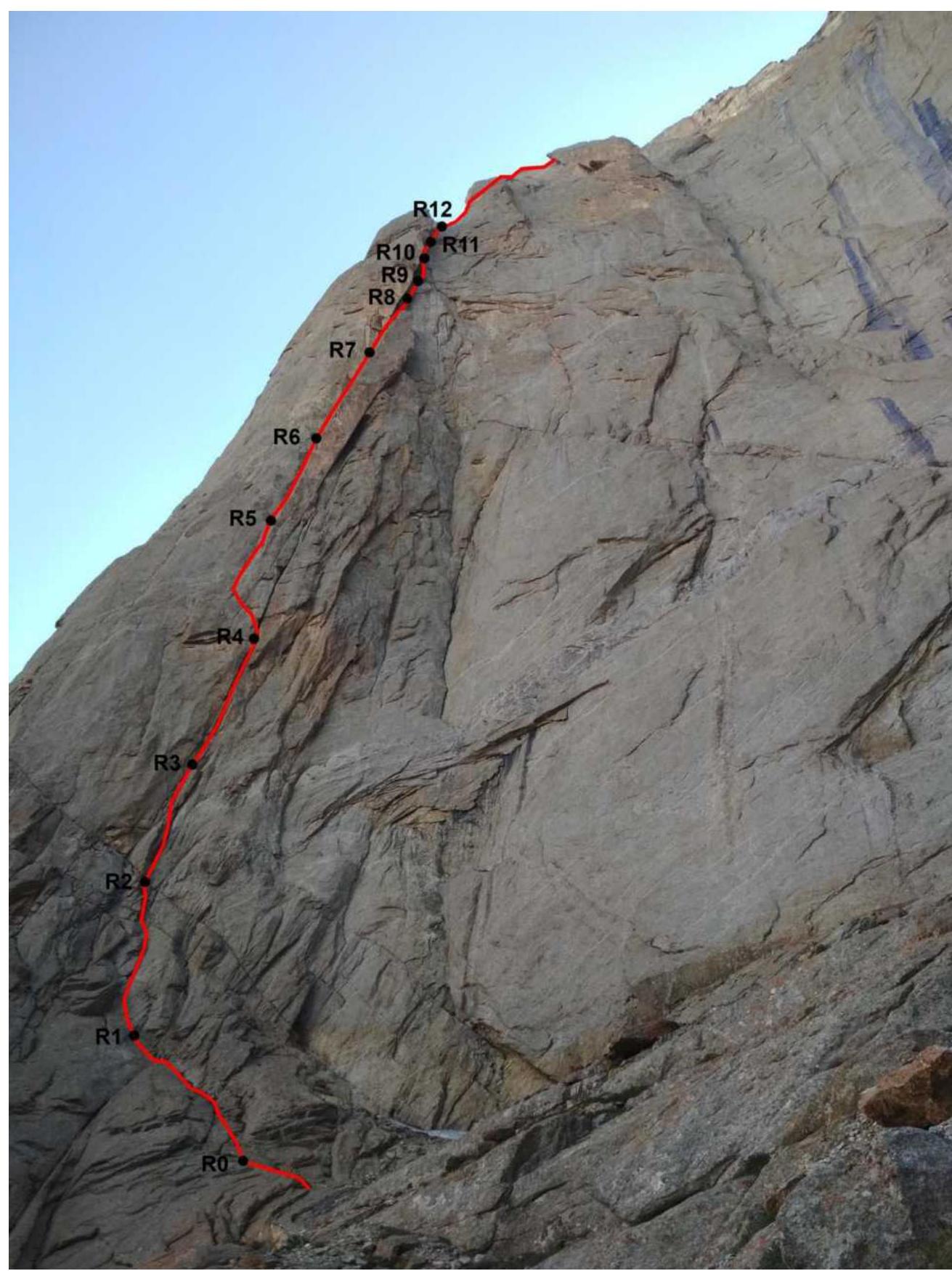
On the morning of July 5, we approached the start of the planned route – 20 minutes. We planned to reach the saddle in one day. During our ascent, we encountered traces of a previous ascent – piton hooks, a stuck friend. Judging by their appearance, they were Soviet-made. It was later discovered that this line had been ascended at least twice in the 1980s. A report of one of these ascents is available on the FAR website: https://alpfederation.ru/api/files/3454 ↗. After lunch, the weather deteriorated, and it started raining. At that moment, we were on the R7–R8 section. Our speed significantly decreased. The key section R8–R9 was climbed using artificial aids with skyhooks.
Around 18:00, we reached the junction with Alperin's route – R12. Here, there is a good anchor station on pitons and a convenient spot for an overnight stay. On the other side of the bastion, the Korulin–Mukhametzyanov team arrived via Alperin's route. The rain had stopped by then. We decided to continue. Before nightfall, we managed to climb three more ropes along Alperin's route together with the second team. Vasily Terekhin led the entire day. Overnight stay on a convenient ledge to the left of the main route line.
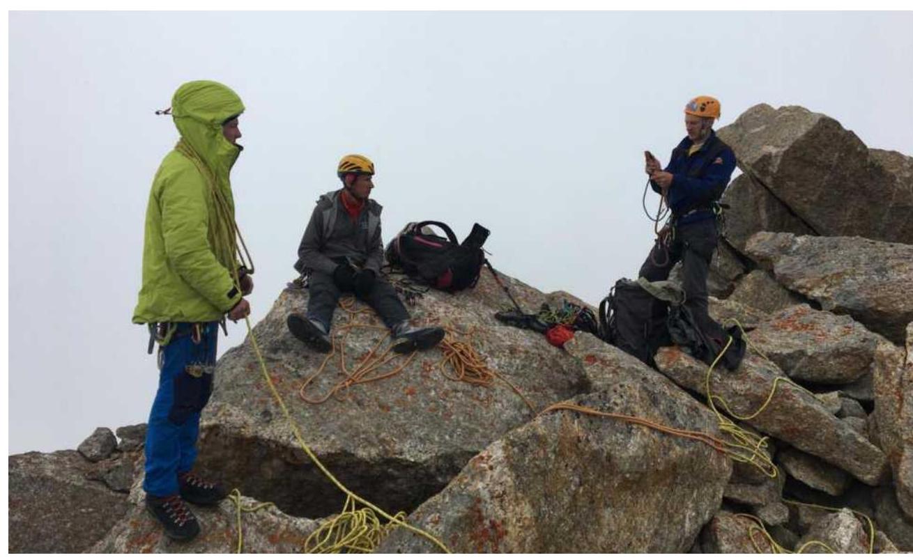
On the morning of July 6, we climbed the remaining three ropes to the saddle between Asan and Usen. We ascended to the summit of Asan. Descent was made via Tugalev's 4B route.
Technical photo of the route
Route scheme in UIAA symbols
| № | Length, m | Angle | Category | |
|---|---|---|---|---|
| R18 | 200 |  | 2 | |
| R15 | 150 | 70° |  Chimney with "feathers" m-t Alperina Chimney with "feathers" m-t Alperina | 5c–6b |
| 155 | 70° | 5c–6b | ||
| R12 | Junction with Alperin's 5B | |||
| R11 | 40 | 70° | 6b | |
| 40 | 70° | 6a | ||
| 40 | 70° | 6c, A2 | ||
| R9 | ||||
| 40 | 70° | 6a | ||
| R8 | ||||
| 45 | 80° | 7a, A2 | ||
| R7 | ||||
| 50 | 75° | 6a | ||
| R6 | ||||
| R5 | 40 | 80° | 6a | |
| 50 | 85° | 7a, 6a | ||
| R4 | ||||
| 30 | 85° | 6c | ||
| R3 | 6b+ | |||
| 30 | 85° | 6b | ||
| R2 | ||||
| 30 | 80° | 6b | ||
| R1 | ||||
| R0 | 60 | 55° | 4 |
Route Description by Sections
Approach from the base camp to the NW wall of Asan – 1.5 hours. Climb to the base of the wall via standard ledges (standard approach to NW wall routes). Traverse to Alperin's counterfort. From the start of Alperin's route, descend slightly, then continue traversing upwards to the base of the SW wall. There is a good campsite at the base of the wall, with snow patches.
R0–R1: Up to the left via easy rocks. 60 m, 3–4.
R1–R4: Climbing an internal corner and cracks – three sections of 30 m. 90 m, 6b–6c.
R4–R5: Traverse left into another internal corner, bypassing a huge overhanging "cucumber". 20 m, 6c–7a. Can set up a belay station after the traverse or continue climbing the crack and corner for another 30 m, 6a.
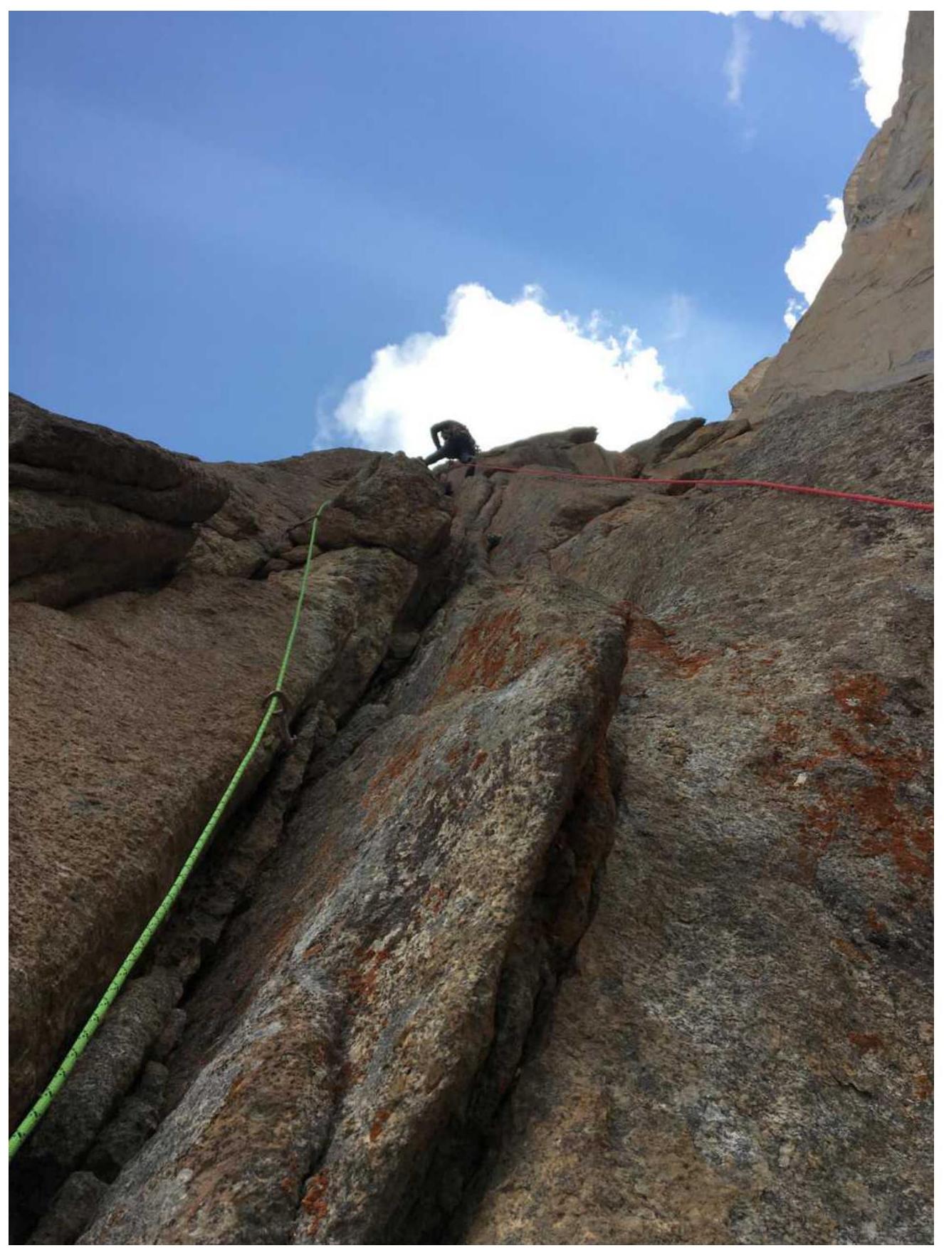
R5–R6: Continue climbing the internal corner to the start of a chimney. 40 m, 6a.
R6–R7: Climbing the chimney. A piton was placed in the middle of the section for safety. Above the piton, there's a 10 m plug. After the plug, exit the chimney to the left into an internal corner. Belay station in the corner, 8 m from the top of the "cucumber". 50 m, 6a.
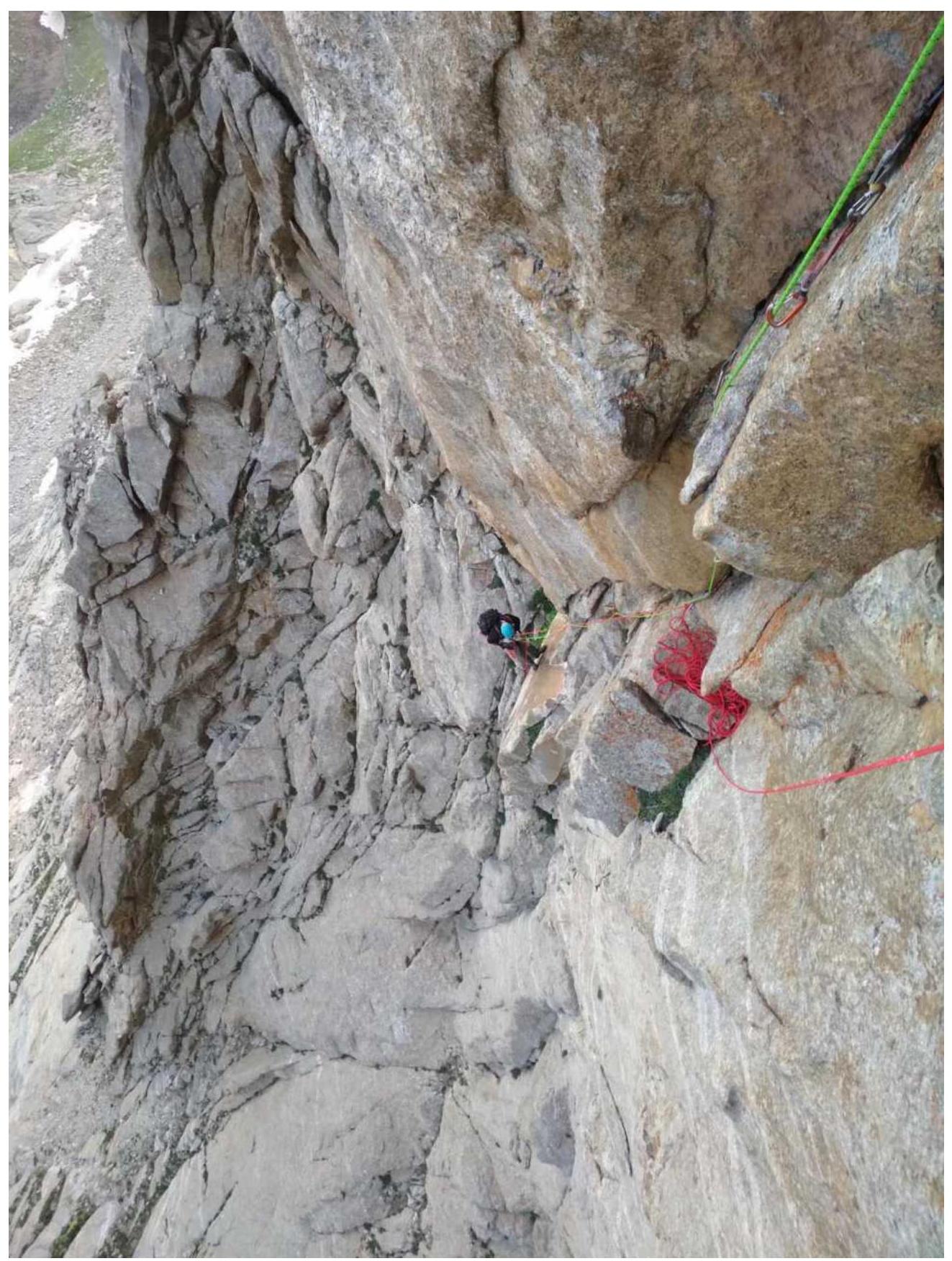
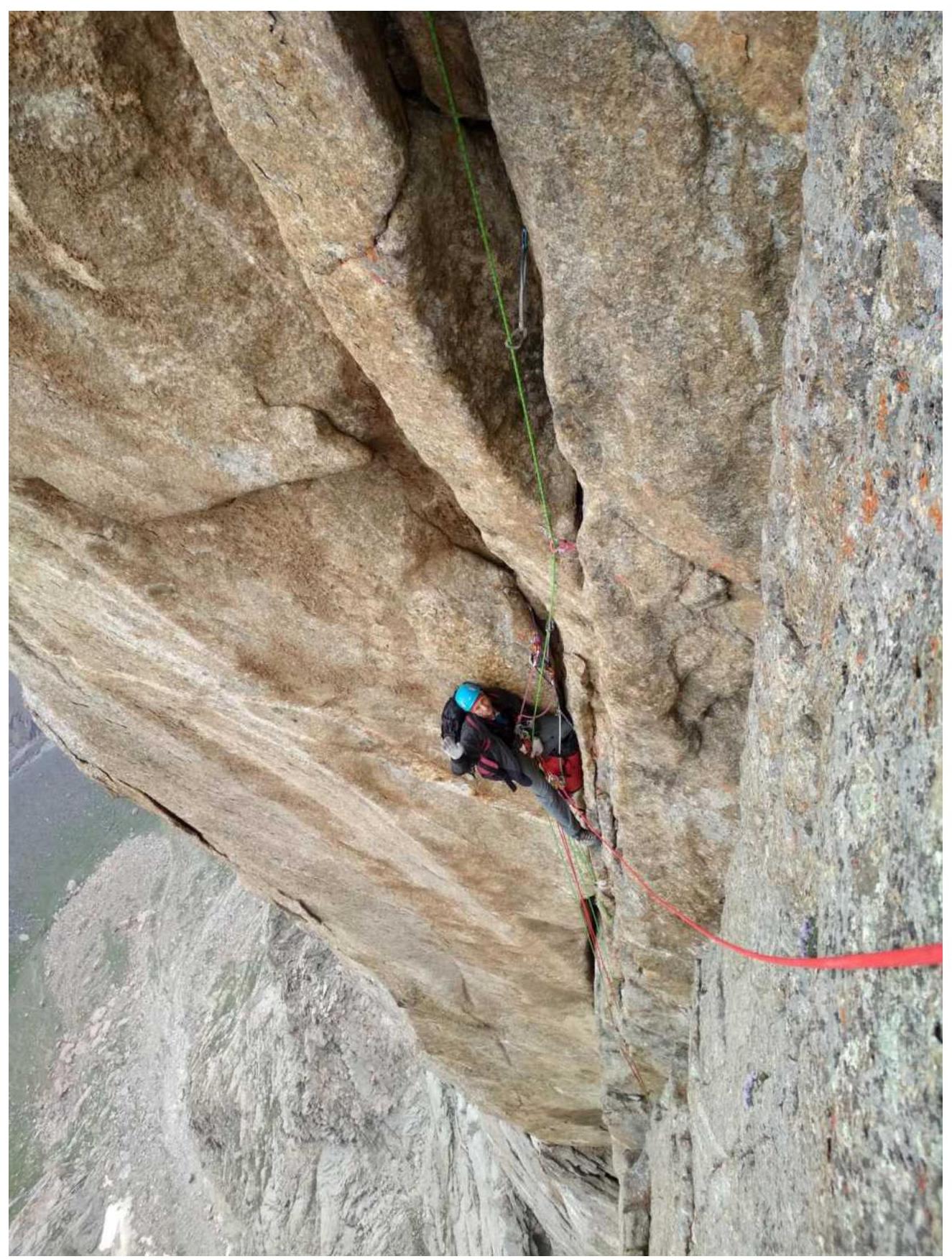
R7–R8: Strenuous climbing through a crack for 8 m. Exit onto the top of the "cucumber". Then, along the left corner, followed by a traverse to the right. Climbing via a thin crack using artificial aids. Exit via climbing over a cornice. Enter a wide crack on the right. 45 m, 7a, A2.
R8–R9: Up through a system of cracks. 40 m, 5c–6a.
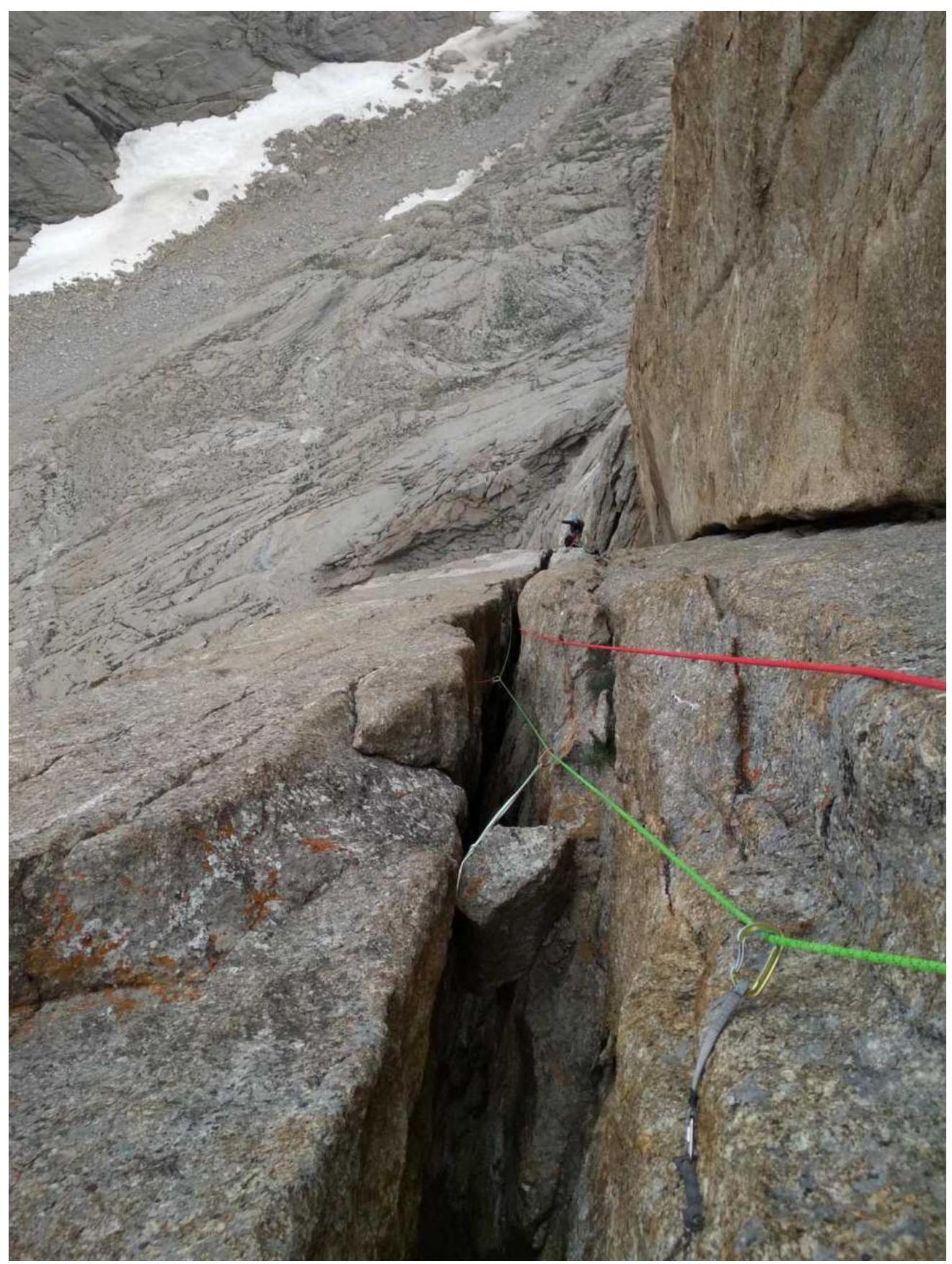
R9–R10: Can attempt to climb a slightly overhanging wide crack (off-width), which widens downwards. Large cams are necessary for protection, #5, 6. Can bypass this area to the right via a monolithic slab. There are 2 old pitons on the slab, with holes for skyhooks in between – A2 artificial aids. After the slab, return left into the corner. 40 m, 6c, A2.
R10–R12: Two sections of 40 m through a large fault – crack, chimney. Exit onto Alperin's bastion. Good ledge for overnight stay. 80 m, 5c–6b.
The route then coincides with Alperin's 5B route. Description can be found on the FAR website. For example: https://alpfederation.ru/api/files/3451 ↗.
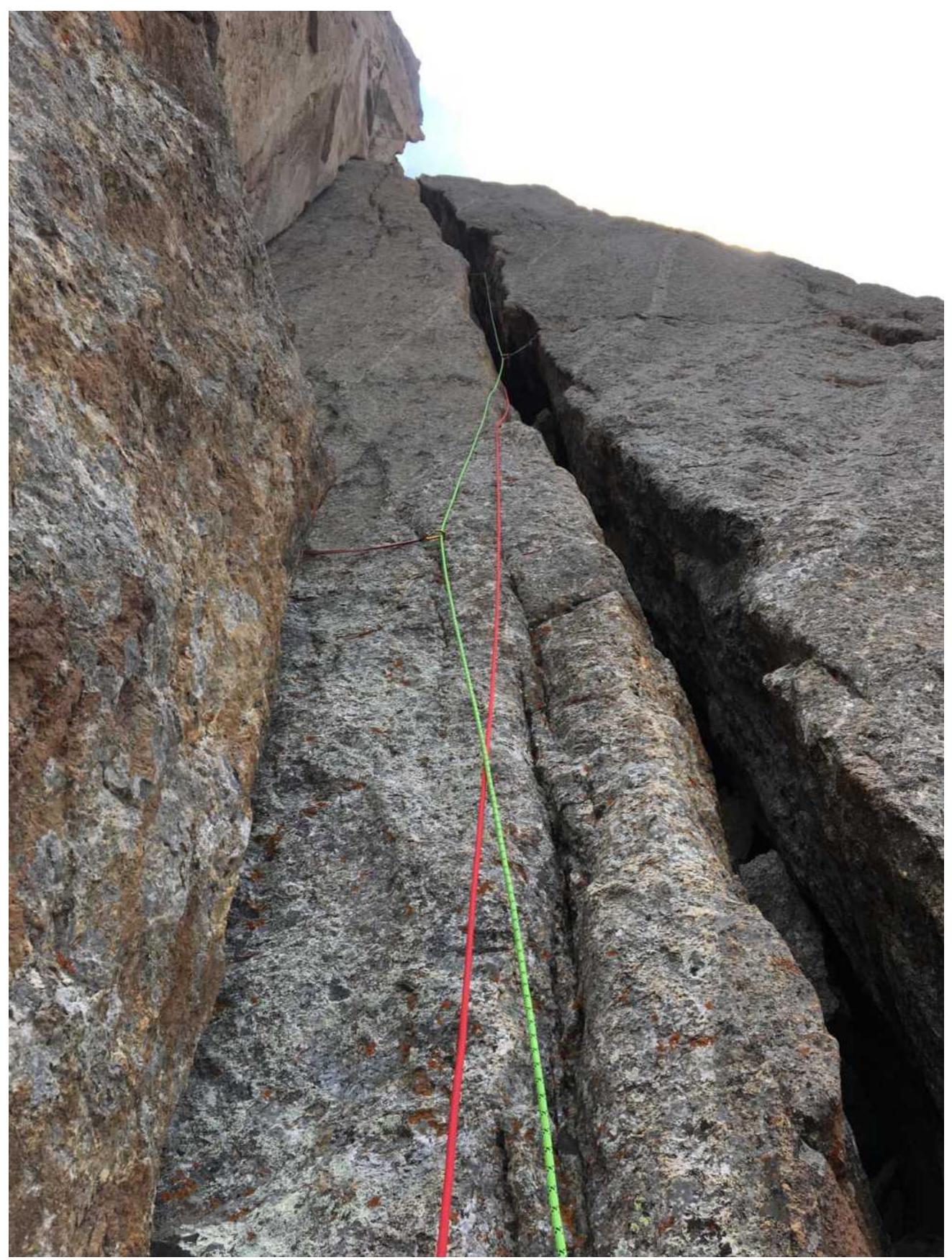
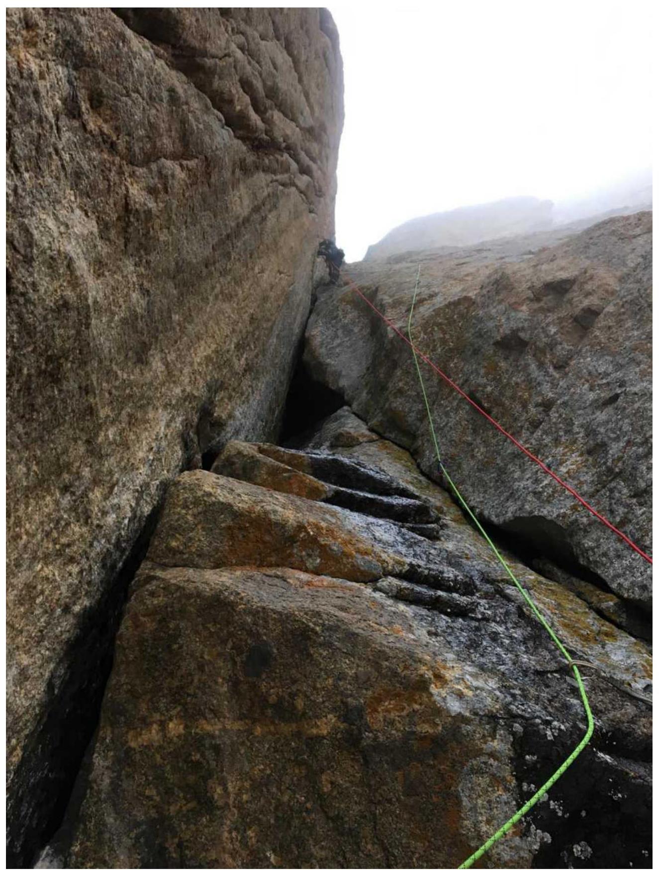
R12–R15: From the ledge, climb up a wide crack (6b) and continue upwards through a system of cracks and ledges. Three ropes. Approach the chimney with "feathers". 155 m, 5c–6b. Did not enter the chimney; traversed left around the corner for 30 m to a good ledge for overnight stay.
R15–R18: From the overnight stay, climbed directly upwards through a system of corners and ledges. Reliable monolithic terrain. Three ropes to the saddle. 150 m, 5c–6b.
Along the ridge to the summit – 200 m – easy rocks.
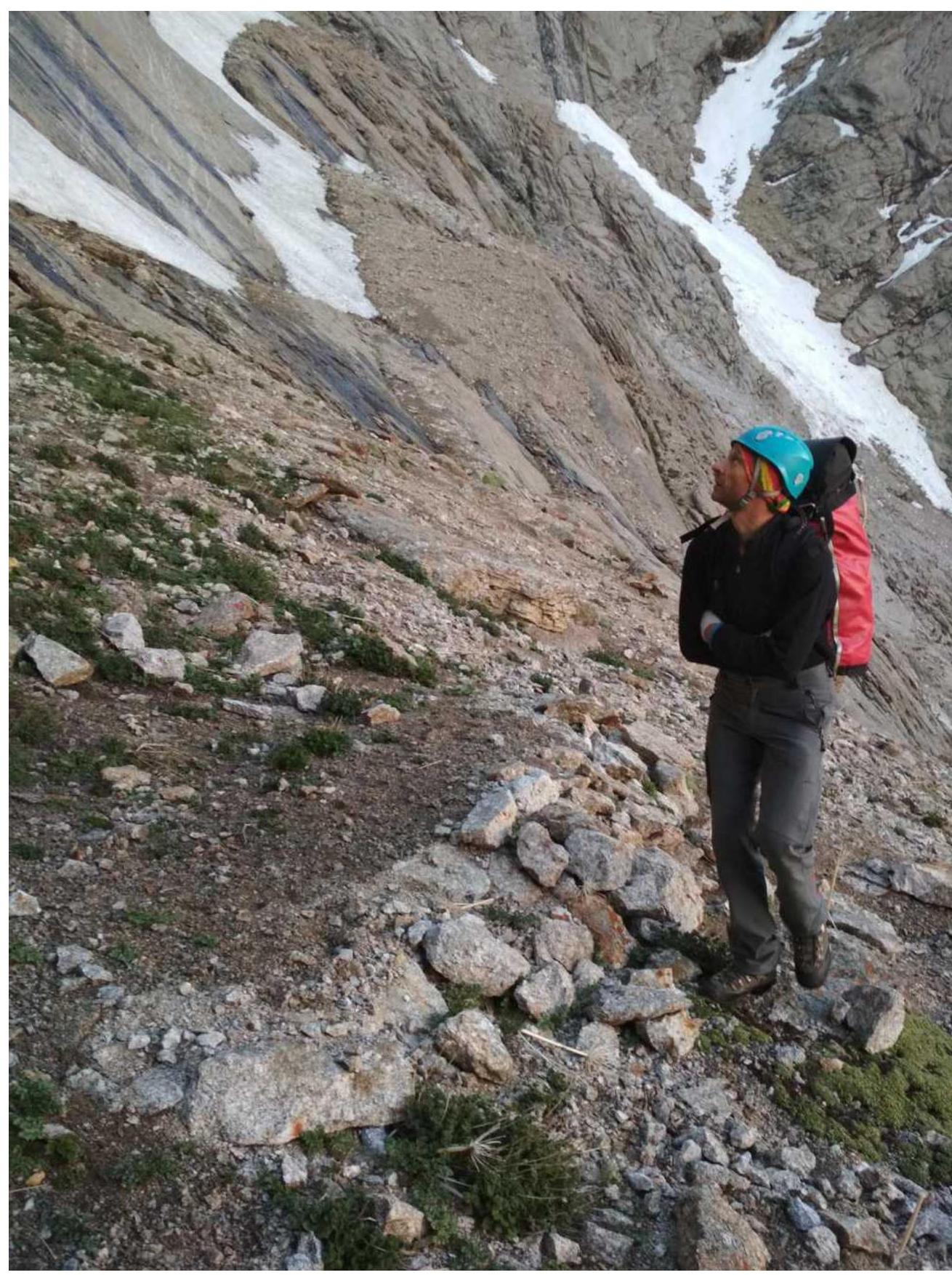
Approach to the route. Campsite at the base of the SW wall
R0–R1 section
R1–R2 section
R2–R3 section

R4–R5 section
R6–R7 section
R6–R7 section, view from above
R7–R8 section, view from above (from the top of the "cucumber")

R7–R8 section
R9–R10 section
On the saddle between Asan and Usen
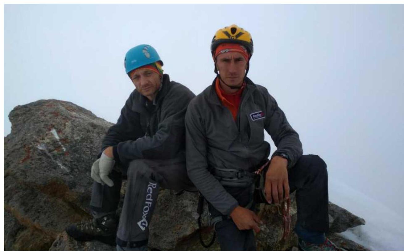
Team on the summit
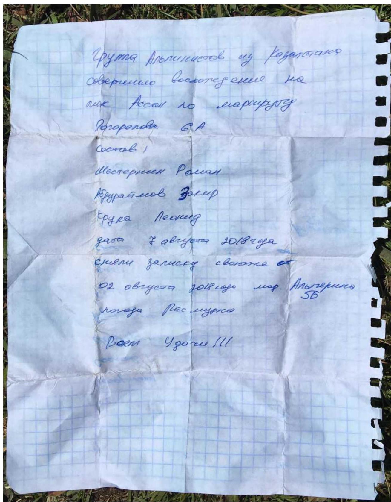
Note from the Kazakhstan team, 2018
Comments
Sign in to leave a comment