Passport
- Category — technical
- Pamir-Alay, Turkestan Range, Karasu gorge, Karavshin valleys.
- Peak 4379 (Usen) via the center of the east face.
- Proposed 5A–5B, first ascent.
- Height difference — 570 m, length — 840 m, length of sections 5B–6 cat. diff. — 270 m, average steepness 65°.
- Pitons driven:
| Type of pitons | Quantity (1) | Quantity (2) |
|---|---|---|
| rock | 74 | 20 |
| bolt | 1 | 1 |
| chocks | 44 | 3 |
- Team's climbing hours — 18, days 2.
- Overnight stay — on a ledge, comfortable.
- Leader:
Sitnik Mikhail Alexandrovich (MS)
Participants:
- Fenov Alexander Alexandrovich (CMS)
- Sipkin Sergey Lukich (CMS)
- Kanarsky Anatoly Ivanovich (1st sports category)
- Boyko Lyubov Alekseevna (1st sports category)
- Coach: Sitnik M.A.
- Approach to the route July 1, 1987. Summit and descent July 2, 1987.
- Organization — Alpcamp "Odessa".
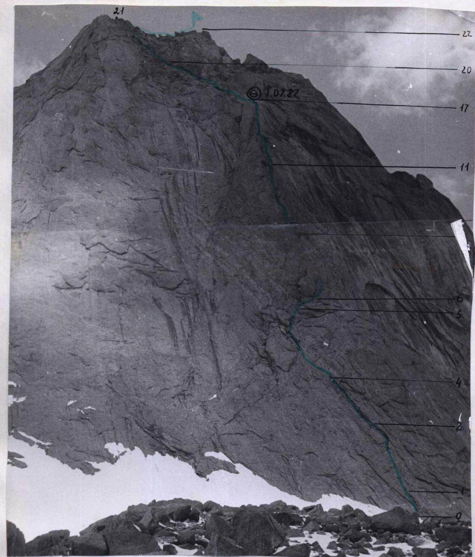
Photo of Peak Usen from the east. Taken on July 30, 1987 at 13:00, distance to the wall about 500–600 m. Camera "Smena-7".
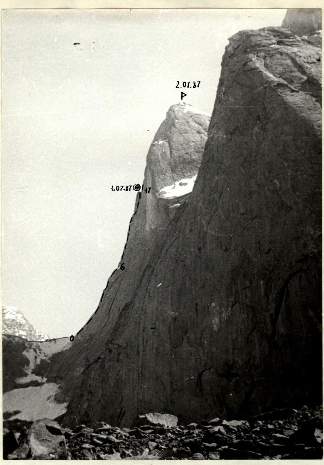
Peak Usen. Route profile on the right. Taken on July 30, 1987 under the east face of Peak Asan.
Brief description of the route
The route follows a steep counterfort in the center of the east face. The structure of the face rocks — slabs, uncomfortable for climbing ("tiles"), many cornices. At the lower part of the counterfort — a huge bulge — "belly", the left and right sides of which formed internal corners with the wall. The route is chosen along the left of the corners (sections R0–R4). The right side of the corner overhangs, in the middle part of the corner a cornice, which is bypassed on the right by difficult climbing. At the top of the bulge — a convenient large ledge. From it to the left into the internal corner, along which there is an exit to the second large ledge.
Bypassing along the ledge the overhang, difficult climbing initially along the center of the counterfort (sections R6–R10), then along its right part, at the junction with the wall (sections R11–R13), through two cornices (aid climbing) on section R16–R17 (flowstone ice!) complex exit to the top of the counterfort. Here is a convenient place to bivouac.
Further along the rocks of medium difficulty under the "barrier", a wall 10–30 m high, passable along a flake-chimney (in the place of transition from the chimney for belay a bolt piton is driven), behind which — slabs filled with flowstone ice. Along them — left-up to the summit ridge.
The route is practically safe, differs in difficult free climbing, according to the set of difficult sections more complicated than any of the paths 5B cat. diff. on the peaks Dzhailyk (routes of Franzuzov, Khatskevich, Inyutkin), V. Spain (Subartovich, Kizel), Shchurovsky through "Surok" and others, but weaker than routes 5B cat. diff. of this area and the area of peak Aksu, so the group estimates the complexity of the route 5A.
Descent from the summit:
- Along the ascent route (equipped with rappel pitons).
- Along the south ridge (route 3B cat. diff.).
- Through Peak Asan to the north (equipped with pitons for descent).
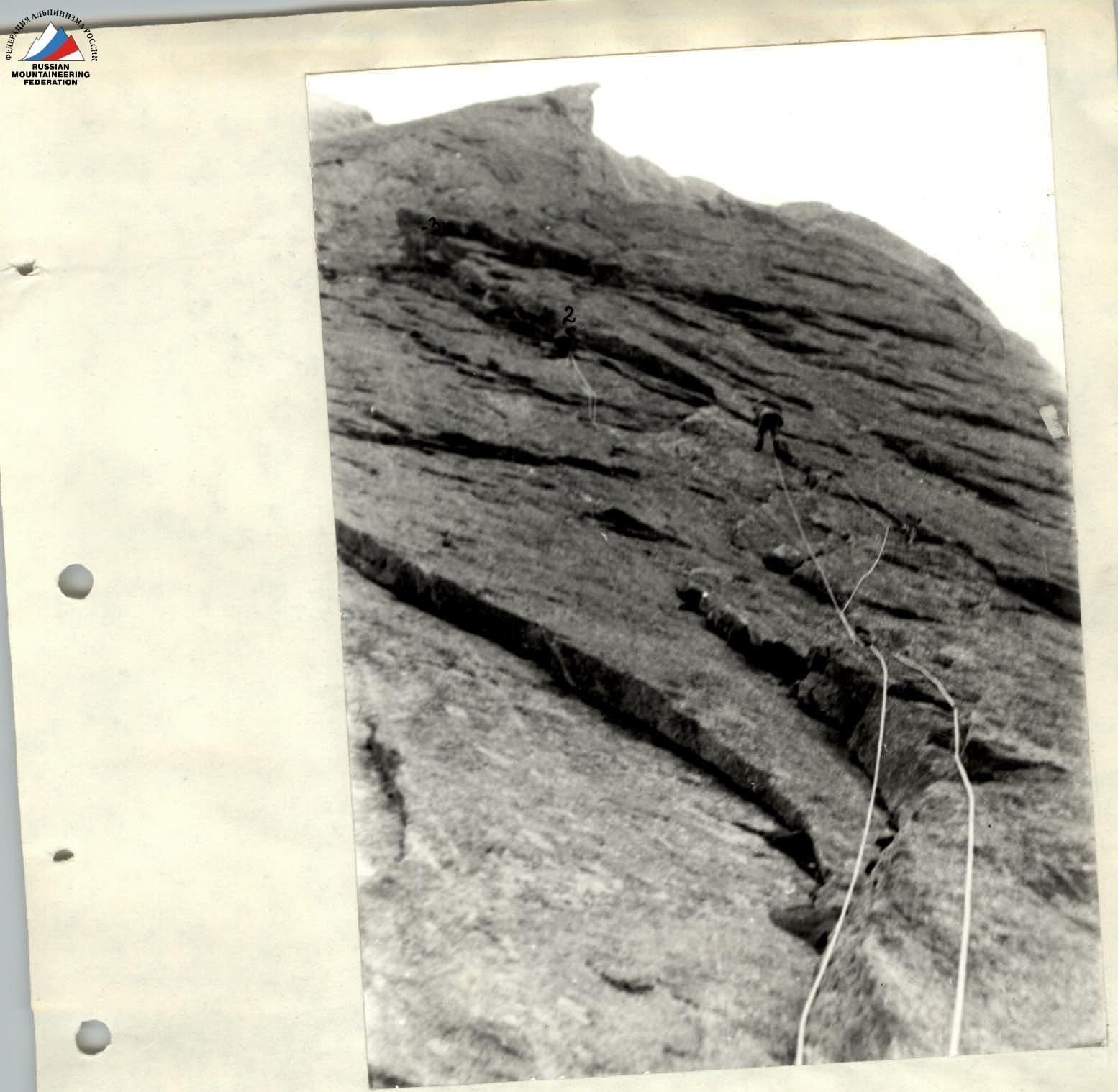
Start of the route. Work on section R0–R2. Section 2–3 is visible.
| rock pitons | chocks | bolt pitons |
|---|---|---|
| 74 | 44 | 1 |
| 20 | 3 | 1 |
| 7 | 6 | 1 |
| 3 | - | - |
| 3 | - | 1/1 |
| 1 | - | - |
| - | 6 | - |
| 12/1 | - | - |
| 5/2 | 1/1 | - |
| - | 1 | - |
| 2 | - | - |
| 5 | 4 | - |
| 9 | 3 | - |
| 5 | 2 | - |
| 6 | 2 | - |
| 7 | 4 | - |
| 4 | 1 | - |
| 2 | 2 | - |
| 3 | - | - |
| 4 | 3 | - |
| 1 | - | - |
| 3 | 3 | - |
| 2 | 9 | - |
| 1 | - | - |
| - | 1 | - |
67 38 20 3


