Peak Serebryanaya стена
4050 m
Report
Tomsk Region (TFA) team ascent report on the route to Peak Serebryanaya стена via the chimneys of the SE wall "5B" (rocky). Tomsk – 2011
Participants
- Temerev I.M.
- Smaikina S.V.
- Kovaleva A.V.
Ascent Passport
-
Kyrgyzstan, Pamir-Alay, Karavshin gorge (Kara-Su river valley), 5.4.3.
-
Peak Serebryanaya стена, via the chimneys of the south-eastern wall.
-
First ascent, proposed 5B category of difficulty.
-
Route type: rocky.
-
Route height difference — 800 m.
Route start at 3250 m (measured using a household altimeter). Route length — 1520 m. Wall section length (before reaching the ridge) — 700 m. Section lengths:
- 4th category of difficulty — 425 m.
- 5th category of difficulty — 150 m.
- 6th category of difficulty — 50 m.
Average slope:
- main part of the route 68°
- entire route 50°
-
Pitons left on the route:
- total — 0.
Pitons used on the route:
- bolted — 0 pcs.
- rock anchors — 12 pcs., including ITO — 0 pcs.
Total artificial support points used — 0 pcs.
-
Team's climbing hours: 13.5 h, 1 day.
-
Leader:
- Temerev Ivan Mikhailovich — CMS
Participants:
- Smaikina S.V. — MS
- Kovaleva A.V. — CMS
-
Coach: Novoselova G.V.
-
Departure to the route: 6:00, August 7, 2011.
Reach the summit: 19:30, August 7, 2011. Return to the assault camp: 21:00, August 7, 2011.
-
Organization: MROO "Tomsk Alpine Federation".
-
Report responsible: Temerev I.M.
E-mail: ivantem@ngs.ru, icq: 204984743, skype: ivantem1979, phone: 9234144634, 9528823151.
Photo of the general view of the peak. Taken from under Peak Асан (distance about 1 km).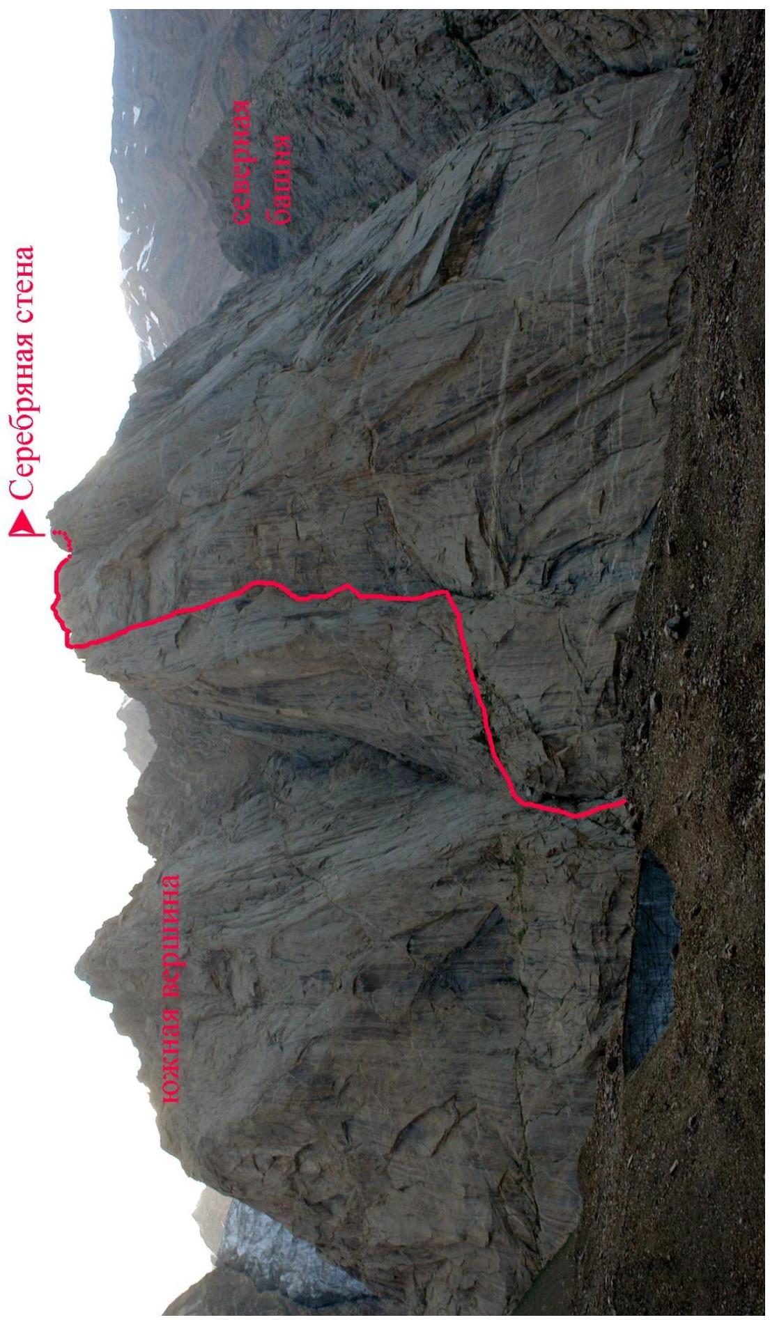
Photo of the general view of the peak. Taken from the wall of p. Асан (on the Pogorelov route).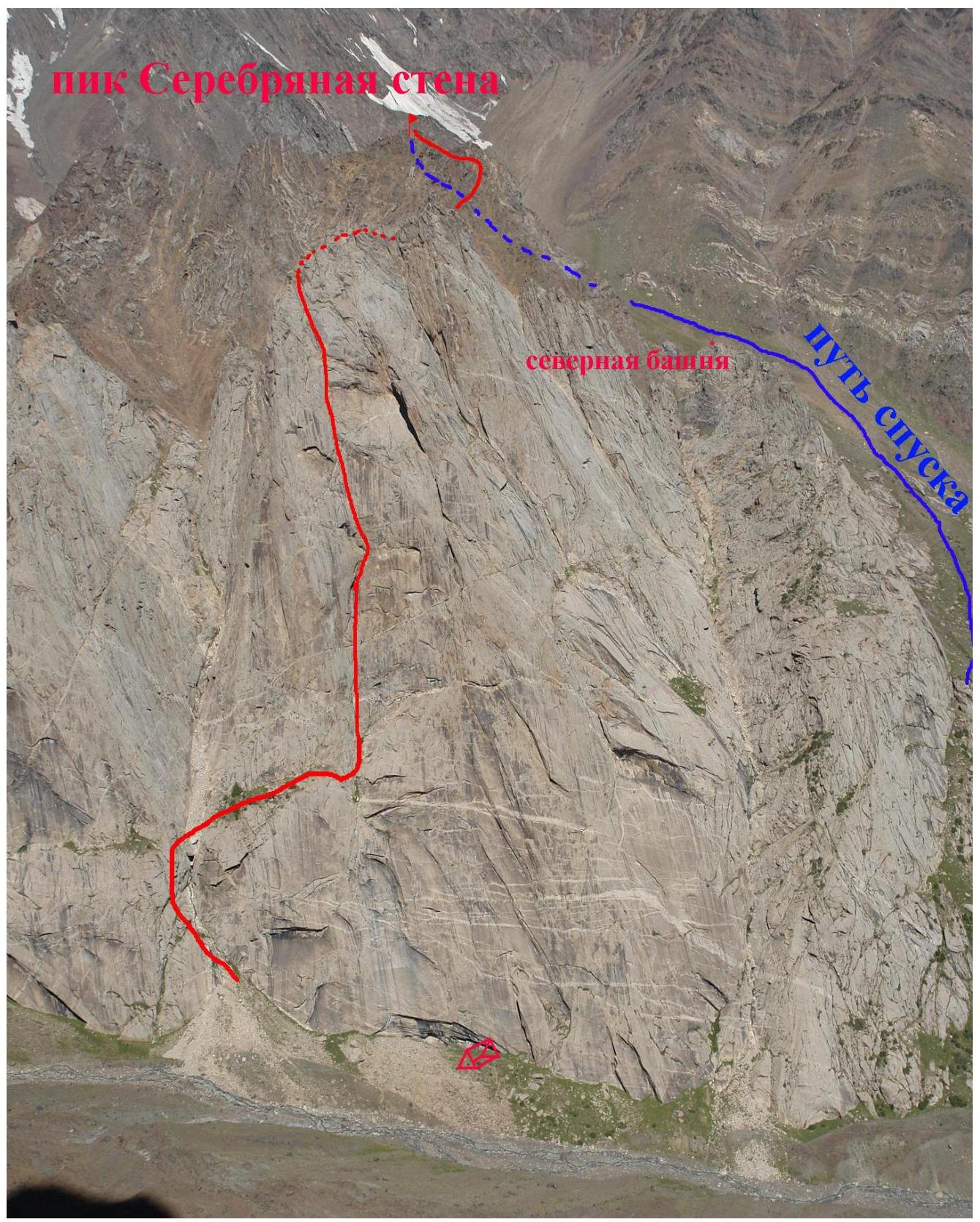
Photo of the route profile. Taken from the base camp. Distance about 3 km.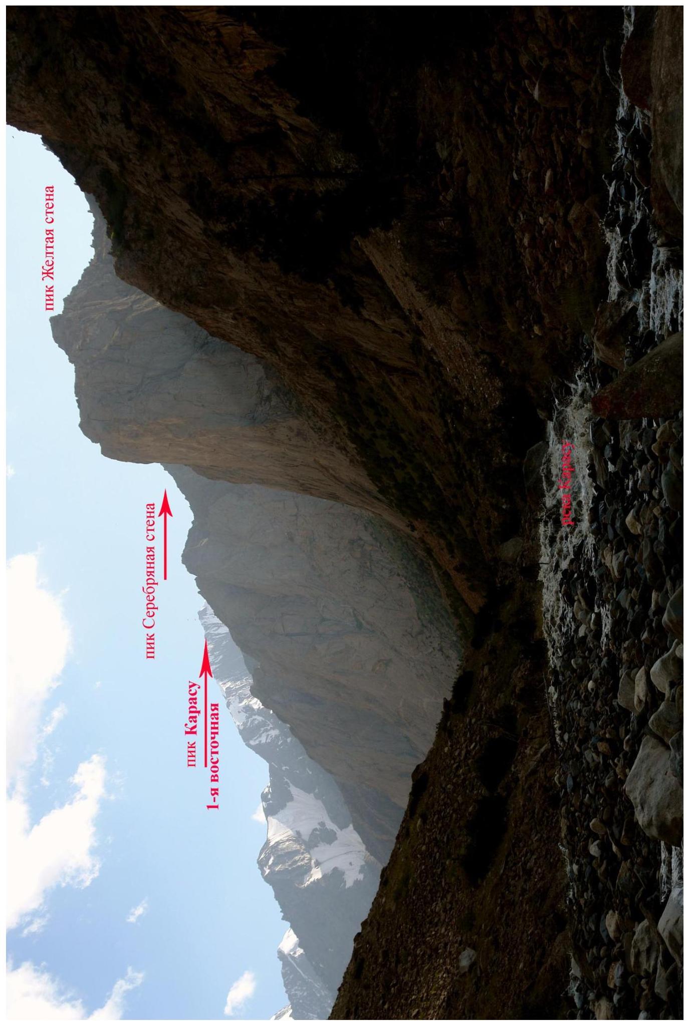
Photo of the route profile. Taken from under Peak Yellow Wall. Distance about 1 km.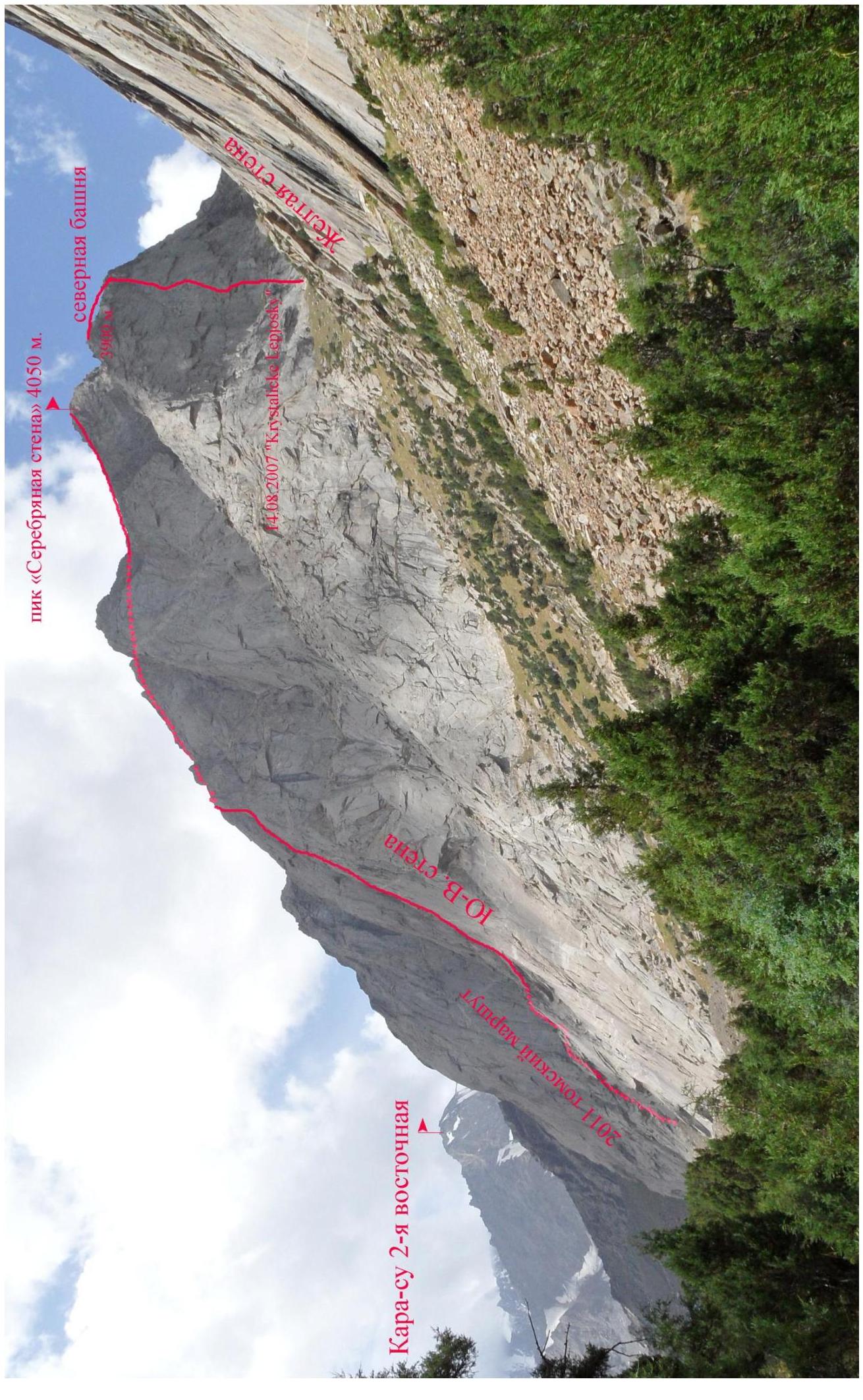
Panorama photo of the area. Taken from the Pogorelov route on Peak Асан.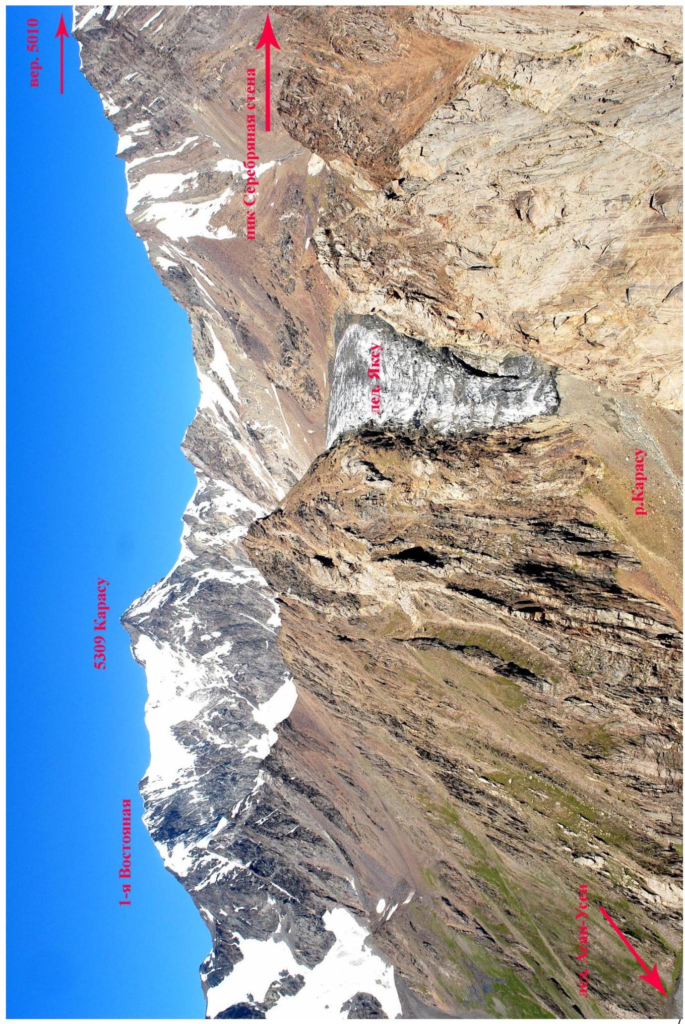
Panorama photo of the area. Taken from the Kricuk route on peak 4810.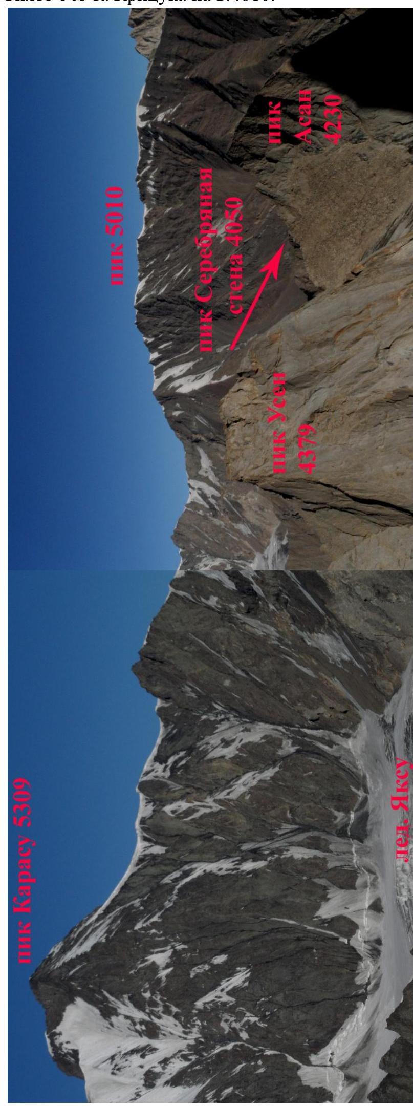
Panorama photo of the area. Taken from the Kricuk route on peak 4810.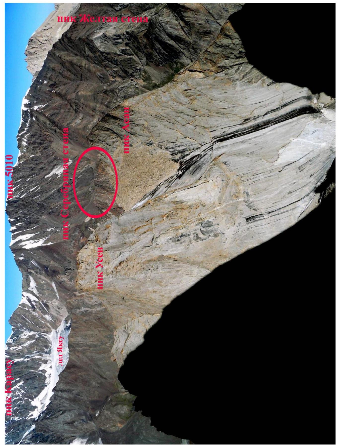
Route diagram in UIAA symbols.
| Section № | Pitons, anchors, stoppers (f.r.) | Section length, m | Category of difficulty | Section slope, deg. | UIAA Symbols | Characteristic |
|---|---|---|---|---|---|---|
| R10 | 3 stop., 1 anchor | 20, 20 | 4+, 6 | 80–90, 70 | Chimney, plug at the top, then a destroyed corner | |
| R9 | 1 anchor, 1 stop. | 15, 15, 30 | 6, 4, 5 | 90–70–90 | From the belay station left upwards to the inner black corner (overgrown with moss at the top). Leads to a chimney. | |
| R8 | 3 anchors, 1 stop. | 10, 20 | 4, 5+ | 70–80 | Along the corner and up to the right onto the wall | |
| R7 | 2 anchors, 1 stop. | 10, 35 | 6, 4 | 90, 70 | Up the inner corner | |
| R6 | 2 stoppers | 10, 30 | 4, 3 | 80, 60 | Traverse along the wall to the bottom of the chimney, up the chimney | |
| R5 | - | 10 | 3 | 50 | Without descending into the chimney, ascend up the small inner corner, belay station behind a fragment | |
| R4 | - | 250 | 3–2 | 45–10 | Walking across the stream to the right-hand edge, along a shelf with a tree to the right (downstream) | |
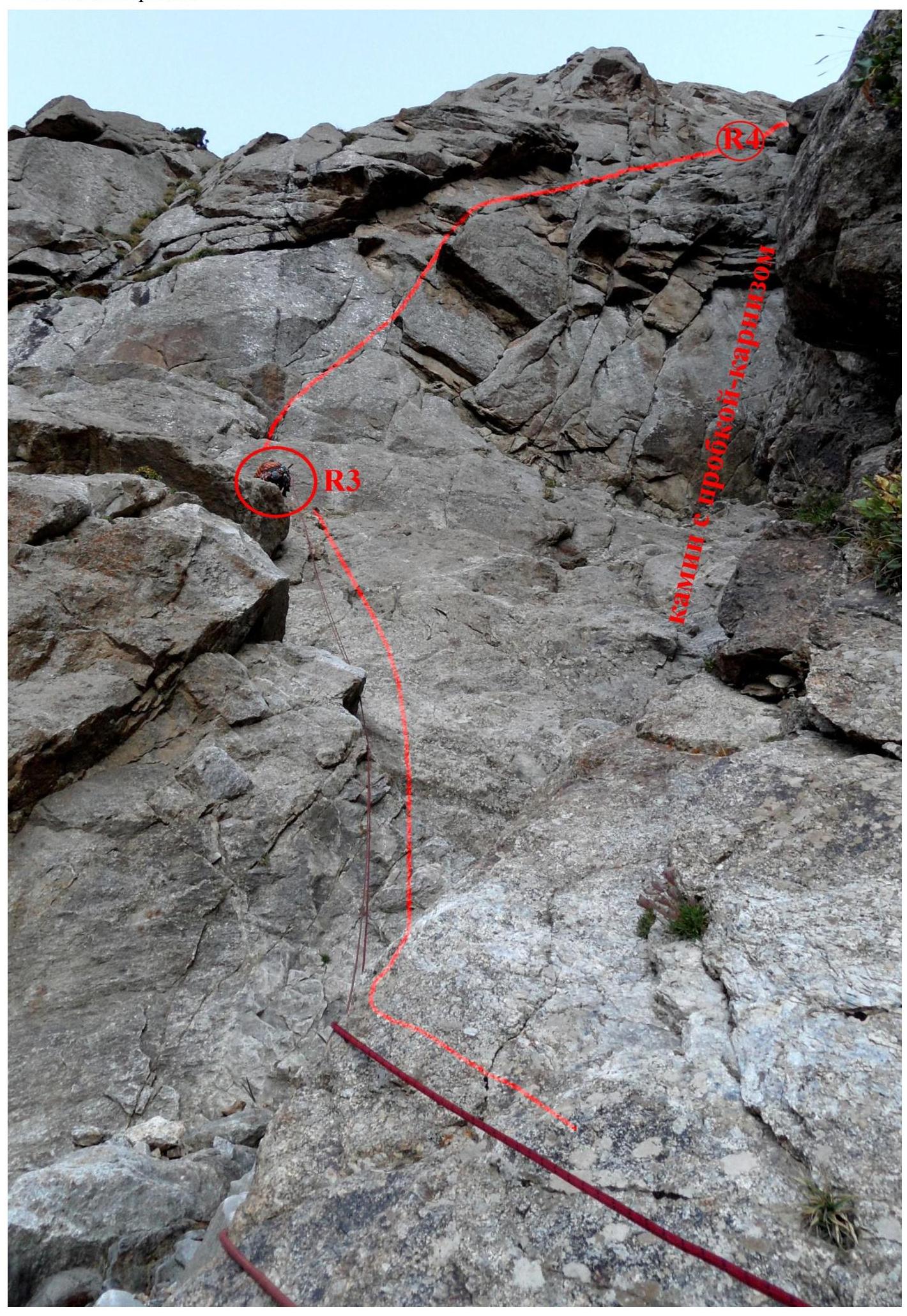
| R3 | 3 stoppers, 3 anchors | 15, 10 | 4, 5 | 70–80 | Bypass the chimney on the left, belay station with an old white loop | |
| R2 | 2 stoppers | 30, 5 | 3, 4 | 80 | Stream, wall | |
| R1 | 1 pit., 1 anchor, 1 stop. | 50 | 2 | 40–60 | Inner corner |
| Section № | Pitons, anchors, stoppers (f.r.) | Section length, m | Category of difficulty | Section slope, deg. | UIAA Symbols | Characteristic |
|---|---|---|---|---|---|---|
| R18 | - | 400 | 1–2 | 20–30–60 | Simultaneous movement without a rope. Several false summits. | |
| R17 | - | 200 | 3–4 | 45–90 | Simultaneous movement along the ridge in a rope team | |
| R16 | 1 anchor, 1 stop. | 30, 20 | 4+, 5 | 80, 90 | Exit to the ridge | |
| R15 | - | 15 | 3 | 60 | Steps | |
| R14 | 2 stoppers | 20, 25 | 5, 4 | 90, 70 | Inner corner | |
| R13 | 1 stop., 1 anchor | 20, 10, 50 | 5+, 5, 2 | 80, 70, 40–30 | Corner, large sloping shelf on the right | |
| R12 | 1 anchor, 1 stop. | 5, 50 | 5, 4 | 80, 70–80 | Exit from the chimney onto the wall | |
| R11 | 3 stoppers | 5, 35, 10 | 6, 5, 4 | 100, 70–90 | The beginning hangs — up and to the left. Then a chimney with a small plug. |
Technical photo of the route.
Technical photo of the route.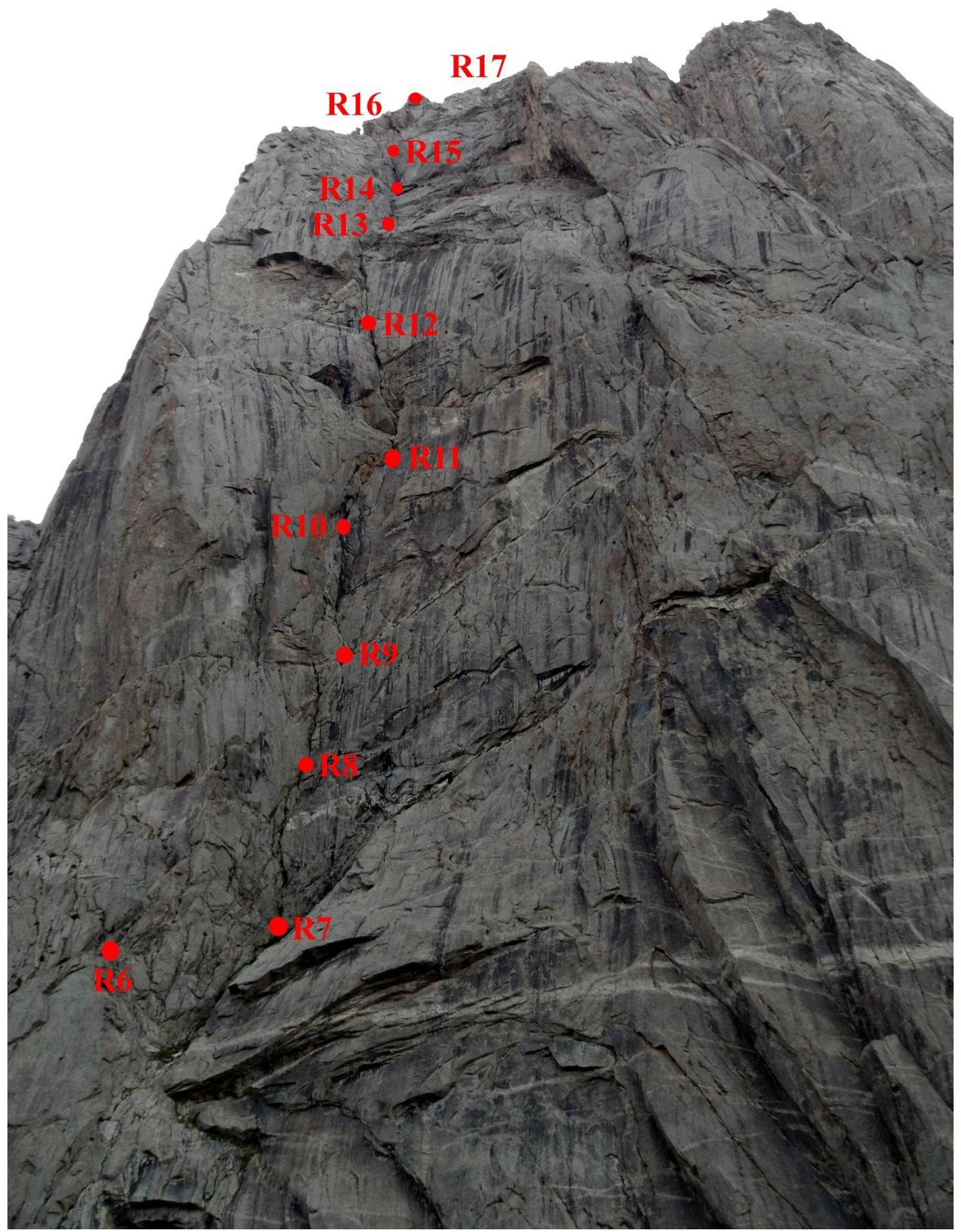
Route description by sections
R1 50 m, 2, 40–60 gr. Inner corner along the gully with a stream (between the wall of the southern tower of Serebryanaya стена and the SE wall). R2 35 m, 3–4, 80 gr. Cross the stream and ascend the right-hand wall of the chimney. R3 25 m, 4–5, 70–80 gr. Bypass the chimney with a plug-cornice on the right, along a small inner corner. At the exit, a belay station with an old white loop. R4 250 m, 3–2, 45–10 gr. Walk across the stream to the right-hand edge, along a shelf with a tree to the right (downstream) to a large chimney. R5 10 m, 3, 50 gr. Without descending into the chimney, ascend up the small inner corner, belay station behind a fragment. R6 40 m, 4–3, 80–60 gr. Traverse along the wall to the bottom of the chimney, up the chimney to the start of a vertical inner corner. R7 10 m, 6, 90 gr., 35 m, 4, 70 gr. Up the inner corner. R8 30 m, 4–5+, 70–80 gr. Along the corner and up to the right onto the wall. R9 15 m, 6, 90 gr., 15 m, 4, 70 gr., 30 m, 5, 90 gr. From the belay station left upwards to the inner black corner (overgrown with moss at the top). Leads to a chimney. R10 20 m, 4+, 80–90 gr., 20 m, 6, 70 gr. Chimney, plug at the top, then a destroyed corner. R11 5 m, 6, 100 gr., 45 m, 5–4, 70–90 gr. The beginning hangs — up and to the left. Then a chimney with a small plug. R12 5 m, 5, 80 gr., 50 m, 4, 70–80 gr. Exit from the chimney onto the wall. R13 20 m, 5+, 80 gr., 10 m, 5, 70 gr., 50 m, 2, 40–30 gr. Corner, large sloping shelf on the right. R14 20 m, 5, 90 gr., 25 m, 4, 70 gr. Inner corner. R15 15 m, 3, 60 gr. Steps. R16 30 m, 4+, 80 gr., 20 m, 5, 90 gr. Inner corner, exit to the ridge, large shelf. R17 200 m, 3–4, 45–90 gr. Simultaneous movement along the ridge in a rope team. R18 400 m, 1–2, 20–30–60 gr. Simultaneous movement without a rope, destroyed slopes and ridges. Several false summits.
Descent from the summit cairn straight down along a weakly expressed rocky ridge towards a small valley between Peak Serebryanaya стена and Peak 5010. At the bottom, destroyed dugouts-earth shelters are visible. Simultaneous descent 1–2, about 300–350 m. Exit to a grassy slope, movement towards the Asan–Usen glacier along a trail.
Photo illustration.